What to expect
Highlights
- Malampuzha Dam & Garden — Reservoir and garden area near Palakkad town.
Reservoir, gardens and family day-trip base near Palakkad.
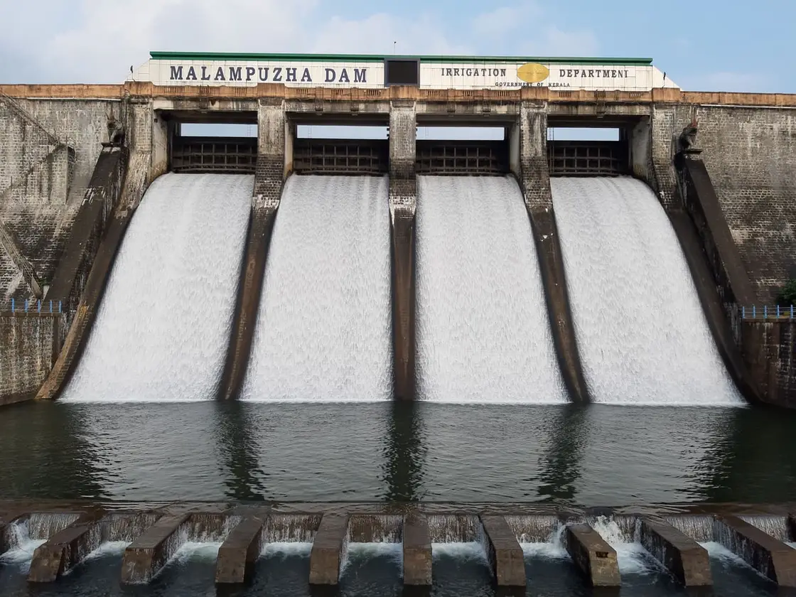
The number everybody repeats about Malampuzha is not a height. Wikipedia's infobox prints 115.06 m, and the Kerala Water Resources Department's own project page gives that same figure as the full reservoir level — an elevation above mean sea level — while putting the dam's maximum height at 38.10 m from its lowest foundation. The structure is a straight gravity masonry dam of 1,626.71 m with an earthen portion of 222.20 m, which together make the 1,849 m often quoted as the masonry length alone. It impounds a tributary of the Bharathapuzha, holds 226 million cubic metres, spreads over 22 square kilometres at full level and irrigates 21,349 hectares. It was inaugurated on 9 October 1955. The department's own page prints both 1955 and 1966 in different places and does not reconcile them, so we record the discrepancy rather than choose.
What makes it a day out rather than an engineering visit is everything below the wall: terraced gardens and water channels, a ropeway strung across the reservoir edge, a rock garden built from broken tiles, bangles and pottery, and the reclining Yakshi that the place is pictured by. Be aware that the published record is thin here — no sculptor, no date and no dimensions are given for the Yakshi, and no creator for the rock garden — so anything you read that states those confidently is going beyond the sources.
After the monsoon, when the reservoir is at its fullest and the Ghats behind it are green — roughly September to February. The level draws down through the hot months as water goes out to the ayacut, so April looks very different from August. That said, until the garden reopens the reason to come is the landscape and the drive, not the attractions.
Live forecast loads in your browser.
Sun and moon are calculated for this location and shown in IST. Photography windows are the hour around sunrise and sunset; the sunset bearing is degrees clockwise from true north. Moon phase is accurate to about half a day.
Malampuzha is a village about ten kilometres from Palakkad town that almost nobody visits as a village. People come for the reservoir, the gardens and the sculpture, and leave without registering that they have been standing on the head of the largest irrigation work in this part of Kerala — a scheme that waters some 21,349 hectares of farmland, supplies drinking water, and carries a fishery on its surface. Malampuzha is the rare Kerala destination with no temple at its centre and no legend attached to its name. What it has instead is water, engineered at scale, in the driest corner of a wet state.
The numbers are worth having, because they are the reason the place exists. The Kerala Irrigation Department's own project page gives a masonry dam of 1,626.71 m with an earthen saddle of 222.20 m — about 1,849 m together — rising to a maximum height of 38.10 m, holding a gross storage of 226 million cubic metres across a water surface of roughly 22 square kilometres at full reservoir level. Work began in 1949 and the scheme was commissioned in 1955. (The same official page also lists a year of completion of 1966, which it does not reconcile with the 1955 commissioning; we record the discrepancy rather than pick a side.)
What those figures do is irrigate. The command area — the ayacut — is about 21,349 hectares, served by two canals, a left bank canal and a right bank canal, each running roughly 32 kilometres. The left bank canal carries water into Palakkad, Chittur and Alathur taluks; the right bank canal serves farmland largely within Palakkad taluk. This is the plumbing behind the district's reputation: Palakkad is Kerala's rice country, and a great deal of that rice is grown on water released from behind this wall.
The reservoir does two further jobs that visitors never see. Water is drawn off, treated and distributed as drinking supply, and the Fisheries Department runs pisciculture on the reservoir itself. A dam that most people experience as a backdrop for a family photograph is, on any working day, simultaneously an irrigation head-works, a municipal water source and a fish farm.
The river it holds back is the Malampuzha, a tributary of the Bharathapuzha — the Nila, the river most bound up with Malayalam literature and memory. That connection is worth stating plainly and then leaving alone: Malampuzha is a headwater of the Nila system, and what is impounded here is water that would otherwise have gone down into a river now widely described as failing.
Geography explains the rest. Malampuzha sits just inside the Palakkad Gap, the broad break in the Western Ghats, and the Gap governs the weather. Where the Ghats elsewhere wring the rain out of the monsoon winds, here hot dry air pushes the other way off the Tamil Nadu plains, which is why Palakkad is routinely the hottest corner of Kerala. A large stored water body in a rain-shadowed, wind-scoured district is not a scenic amenity. It is the difference between a crop and no crop.
The same wind that makes the district dry is now also worked. A few kilometres away at Kanjikode stands the first wind farm built in Kerala, sited exactly where the Gap funnels the air — the Kerala State Electricity Board gives it as nine machines of 225 kW, about 2.025 MW installed, generating in the order of 1.2 million units a year across some 27.5 acres. (Larger figures circulate for Kanjikode, in the region of 22 MW across eleven turbines, which appear to describe later development by other operators rather than the original KSEB installation; we give the KSEB figures for the original and flag the discrepancy.) Taken with the reservoir, it makes this corner of Palakkad an unusually legible piece of country: the same break in the mountains that dries the fields is what fills the canals with stored water and turns the blades.
One consequence of all this is that Malampuzha has a season in a way most reservoirs do not. The level draws down through the hot months as water goes out to the ayacut and the taps, and refills through the monsoon; a visit in April and a visit in August are visits to two different-looking places. In a rain-shadow district the reservoir level is followed the way a coastal town follows the sea, and when the shutters are opened it is news downstream. If you want the sheet of water at its widest, come after the rains rather than before them (levels vary year to year).
As a place to be, Malampuzha is best understood as Palakkad's reservoir suburb: ten kilometres out, an easy auto or bus hop, with Palakkad Junction the practical railhead. It fills at weekends and in the holidays, empties on a weekday morning, and looks completely different depending on the reservoir level — which, in a district this dry, is itself the local news.
Malampuzha is the honest exception in a state where almost every named place carries an inherited story, and the exception is worth stating rather than disguising. There is no origin legend here, no presiding deity, no festival that predates the dam. The Malayalam Wikipedia article on മലമ്പുഴ classes it a village and lists no temple, no festival and no legend at all; the English sources do the same. We searched in both languages before saying so, because an absence found only in English is a statement about search coverage rather than about the world.
That matters, because it makes Malampuzha a genuinely unusual case study in how sacred geography gets made. Most Kerala places acquire their meaning slowly and anonymously — a grove, a stone, a story told about them for long enough that nobody remembers who first told it. Malampuzha acquired its meaning on a known date, from a known person, by public commission. The reclining figure that everyone photographs was installed in 1969. Before that there was a dam, a garden and a view; there was no figure to stand in front of.
The choice made in 1969 was to reach for the yakshi — the female nature-spirit of Malayalam folk belief, whose own traditional character is set out on this town's dam page and not repeated here. What is worth noticing at the level of the town, rather than the statue, is the structure of the act: a modern state, having built a utilitarian waterworks, deliberately borrowed a figure from the oldest layer of local belief and installed her as the spirit of the place. It is mythology by commission — and it worked, which is the surprising part. Ask anyone in Kerala what is at Malampuzha and the answer is not the ayacut, or the 226 million cubic metres, or the two canals. The answer is a name from folklore attached to a piece of 1960s concrete.
It worked partly because it was fought over. A public argument about a sculpture is itself a way of fixing a place in the collective mind, and this one has run for more than half a century. The argument belongs to the statue's own article; the point here is that Malampuzha's fame is a made thing, and comparatively recent, and that it has fully displaced whatever quiet agricultural identity the village had before 1949.
There is one older layer, but it is landscape rather than legend, and it is felt rather than told: the wind. The Palakkadan wind that comes through the Gap is the single fact of life that every generation here has shared, dam or no dam — the hot dry push off the Tamil plains that makes this the warmest district in Kerala, dries the paddy, and turns the reservoir into a sheet of moving light on almost any afternoon. It has no story attached to it that we could verify, and we are not going to invent one. But it is the thing that made a dam necessary in the first place, and it is the oldest continuous presence at Malampuzha — older than the sculpture by an unimaginable margin, and older than the reservoir it now blows across.
Malampuzha's history is essentially the history of one project, and that project belongs to a specific moment: the first Indian Five Year Plan, when large reservoirs were being spoken of as the temples of a modern nation. Work commenced in 1949, before the state of Kerala existed — this was then the Malabar district of Madras State — and the scheme was commissioned in 1955, at a cost commonly given as around Rs 5.3 crore.
It was, at the time, the first large-scale irrigation scheme attempted in old Malabar, which is the claim that actually matters about it and is better supported than the various ‘longest dam’ formulations that circulate. Its purpose was never scenic: it was to put water on the dry farmland of the Palakkad plains and to supply drinking water.
⚠ A caution on the dates, because the primary source is not self-consistent. The Kerala Irrigation Department's project page states that works commenced in 1949 and that the project was completed and commissioned in 1955, and elsewhere on the same page lists a year of completion of 1966. Both figures come from the same official source and it does not reconcile them. The likeliest reading is that 1955 marks the dam and 1966 the completion of the wider canal network, but that is an inference and is offered as one.
The visitor apparatus came afterwards and deliberately. Once the works were finished the government developed the downstream face into landscaped gardens, and over the following decades added the ropeway, aquarium, snake park, boating and the rest — recognising that a large reservoir near a hot inland town was a public amenity as well as a public utility. The sculpture of 1969 belongs to that second phase, not the first.
The result is a place with a very short and very legible history: a river, a wall built between 1949 and 1955, a garden, and then an argument about a statue. There is almost nothing here from before the twentieth century, and that is not a gap in the record — it is the record.
To see the waterworks as a waterworks. Most visitors read Malampuzha as a garden with a dam behind it; it is more interesting the other way round — an irrigation head-works serving 21,349 hectares, with a garden on its downstream face.
For the reservoir under the Gap: a 22 sq km sheet of water set against the break in the Western Ghats, in the hottest, driest corner of Kerala.
Because it is the easiest half-day out from Palakkad town — about ten kilometres, and reachable by bus, auto or taxi without planning.
For a rare thing in Kerala: a celebrated place with no inherited mythology at all, where you can watch exactly how and when a modern one was installed instead.
For the water level itself. Malampuzha looks like a different place full and low, and in a rain-shadow district the level is a genuine local barometer.
Entry: Nothing, because nothing is open to sell you a ticket. The garden complex has been closed since 11 September 2025 and there is no reopening date. For reference, the pre-closure rates were about ₹25 for an adult and ₹10 for a child aged 3–12, with the ropeway, boating, aquarium and snake park each charged separately — treat those as a guide to what may return, not as today’s price.
Dress code: None — this is a waterworks and a leisure landscape, not a place of worship. Dress for heat: Palakkad is routinely the warmest corner of Kerala.
Festivals: Malampuzha has no festival of its own. The district’s calendar belongs to Palakkad town — the Kalpathi Ratholsavam chariot festival in November is the big one, about 12 km away.
Photography: Ordinary personal photography of the reservoir and the hills is unrestricted. The dam structure itself is a controlled irrigation asset and photography on and around the bund can be restricted on security grounds — while the complex is closed the question is academic, because you cannot get onto it.
Parking: The visitor car parks are inside the closed complex. Anyone driving out at the moment parks on the approach road, which is neither marked nor supervised.
Check your return bus or ferry with the operator before setting out. Leave time to reach the stop or jetty after your visit, and arrange a return vehicle in advance for a remote outing.
Ask at the jetty or the stand for the time of the last service back, not the next one. If you miss it, an auto or a taxi is the fallback — agree the fare before you get in.
No accessible toilet, no wheelchair loan and no visitor centre are operating — the whole gated area is closed.The nearest accessible facilities of any kind are in Palakkad town, 10–12 km away.
Checked 21 August 2026 against source 1source 2source 3. Conditions change and surfaces vary with weather — if step-free access is essential, confirm with the site before you travel.
Emergency numbers are verified against official government and state tourism sources. 112 works anywhere in India.
Charge cap and free-transaction limits: Reserve Bank of India, in force since 1 May 2025.
These services are listed within about 1.2 km of Malampuzha. Walking distances follow mapped routes; access and opening hours can change. Other services may be closer but are not included here.
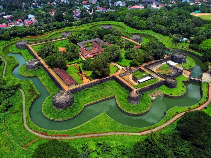 Gateway base
Fort, dam and rail-road gateway through the Palakkad Gap.
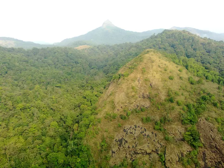 Rainforest base
Permit-based rainforest national park access.
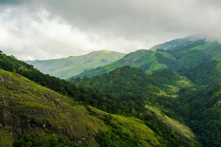 Hill base
Tea, orange estates and forested viewpoints.
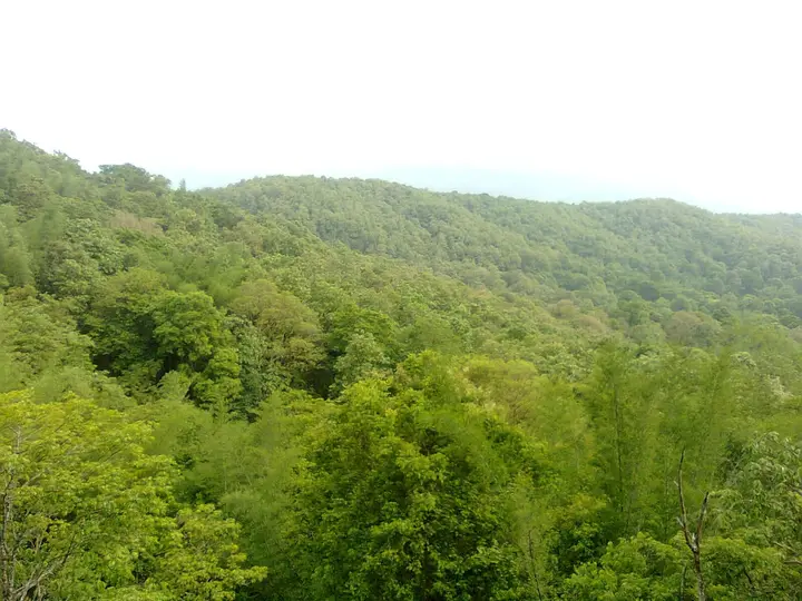 Wildlife base
Tiger reserve accessed with permits via the Anamalai side.
Palakkad district is known for: Palakkad Fort, Silent Valley National Park, Malampuzha, Nelliyampathy and Parambikulam.
Every verified place in Malampuzha — filter by what you’re after.
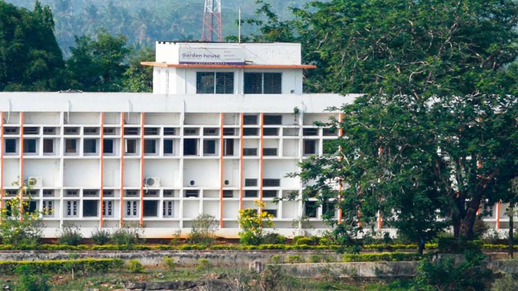
Hotel in Malampuzha. Budget hotel (KTDC) · Malampuzha, KTDC, Garden House.
Kerala Tourism-listed resort on Malampuzha Dam Ring Road for Palakkad/Malampuzha stays. Au, Kerala Tourism-listed resort, malampuzha.
Book with the place itself. India’s cyber-crime coordination centre warned in April 2025 that convincing copies of hotel and pilgrimage booking sites are being pushed through sponsored search and social ads, taking payment for rooms the property never hears about. Every listing here links to the business’s own contact details and its own Google or Bing profile — we take no commission and sit in nobody’s payment path. If a booking page reached you through an ad, check the address bar against the property’s own site before you pay. Fraud can be reported on cybercrime.gov.in or on 1930.
The best tourist places to visit in Malampuzha — temples, viewpoints, lakes, heritage and nature, each with a full guide, how to reach it and what to see nearby.

The garden below the dam is the reason Malampuzha is a family day out rather than an engineering visit — terraces, water channels and a ropeway strung across the reservoir edge. It is busiest at weekends and in the evenings, and it is one of the few places in Palakkad where the Western Ghats wall behind the water does most of the work.
Open guide →
The number everybody repeats about this dam is not a height. Wikipedia's infobox prints 115.06 m; the Kerala Water Resources Department's own project page gives 115.06 m as the full reservoir level — an elevation above sea level — and the dam's maximum height as 38.10 m from its lowest foundation. It is a straight gravity masonry dam of 1,626.71 m with a 222.20 m earthen saddle, impounding a tributary of the Bharathapuzha, and it was inaugurated on 9 October 1955.
Open guide →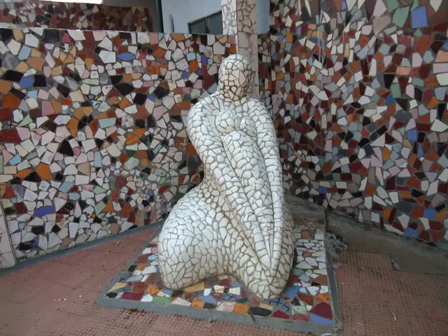
A garden built out of broken things — waste tiles, bangles, cracked pots and shards worked into figures and walls. It belongs to the same family of Indian rock gardens as Chandigarh's, and it sits inside the Malampuzha garden complex rather than apart from it. The published record names no creator and gives no dates, so we name none.
Open guide →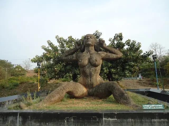
The single most recognisable object at Malampuzha and the most under-documented. The Yakshi is a large reclining nude figure in the garden, and it is what the place is pictured by. Neither Wikipedia nor the department page we could find gives a sculptor, a date or a dimension for it — we would rather tell you that than print a number nobody can source.
Open guide →Roampedia is commission-free. Travellers discover your business, book directly and contact you through official details. Basic listings are free, while Gold and Platinum package upgrades can be requested from the owner dashboard after approval.
Written about Malampuzha itself — its history, its legends and the arguments about them.

One figure is repeated by almost every page written about this dam, and it is not a height at all. Here is where it comes from, what it actually measures, and how to check any dam number yourself in about a minute.

Kerala’s most argued-about piece of public art has a named author, a known date and a size that two reference works cannot agree on. The argument about it has now run longer than most of the people having it have been alive.

India’s second Nek Chand rock garden is 1.5 acres of Kathakali dancers and Theyyam figures made out of rubbish. You cannot currently see any of it, and that is the single most important thing to know before you drive here.
Wider reading from Palakkad. The stories about Malampuzha itself are above.

A grid of tiled houses, a temple on the river and a giant wooden chariot: Kalpathy is a slice of old Tamil-Brahmin Kerala, and the first place in the state to be named a heritage village.
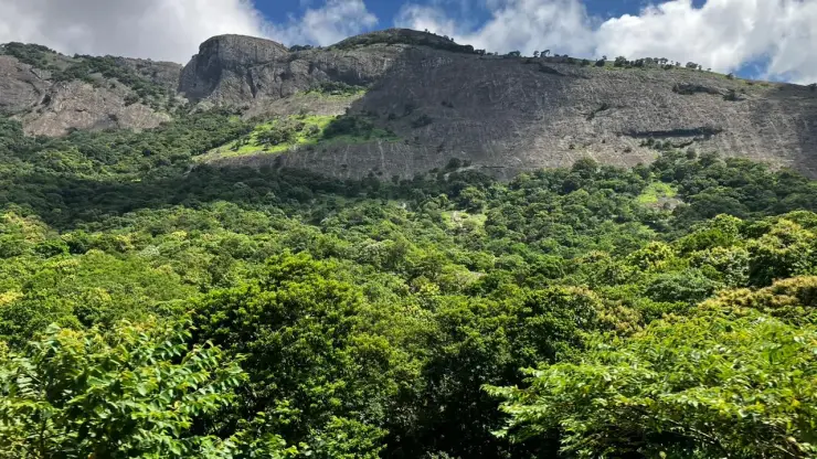
One low gap in a thousand-kilometre wall of mountains explains why Palakkad is hot, windy and green with paddy — and why every road and railway to Tamil Nadu runs through it.
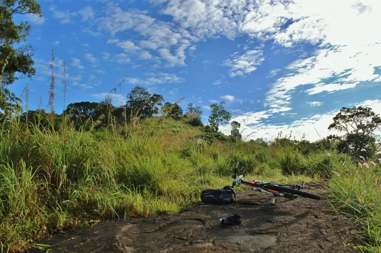
Less famous and less crowded than Munnar, Nelliyampathy is a slow, green plantation hill station a couple of hours above the Palakkad plains. Here’s how to plan it.
The practical half — what is actually here, in what order to see it, and how to arrive.
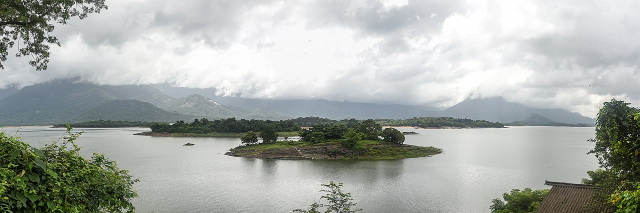
The honest version of this trip has changed, and most published itineraries have not caught up. Here is what the day actually looks like now.
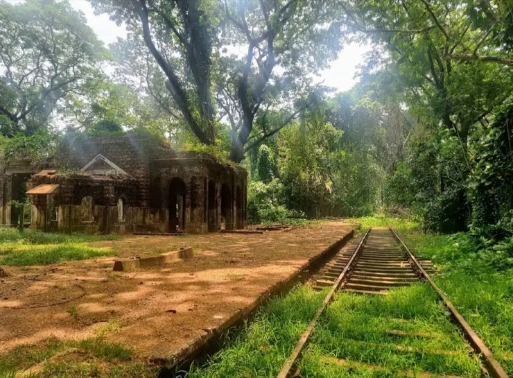
Kerala is long, narrow and easy to travel. Here is how to get in by air or rail, and how to move between the backwaters, hill stations and cities once you arrive.

Kerala is one of India’s easier, calmer states to travel solo. Here’s an honest look at safety, the numbers to save, and how to sidestep the usual hassles.
Route-level itineraries and practical guides for the rest of the state.

A species described in 2025 gives Dhoni’s stream margins and leaf litter a story beyond the waterfall.

Look at the cascade’s shape from the permitted viewing position without treating a pool photograph as swimming permission.

Keep Dhoni’s reporting base, waterfall route and wider hill landscape distinct when planning from Palakkad.
Irrigation, first and foremost. The scheme waters an ayacut of about 21,349 hectares through a left bank canal and a right bank canal, each roughly 32 km long — the left bank serving Palakkad, Chittur and Alathur taluks and the right bank mainly Palakkad taluk. The reservoir also supplies water for treatment and drinking distribution, and the Fisheries Department runs pisciculture on it.
The Kerala Irrigation Department gives a masonry dam of 1,626.71 m plus an earthen saddle of 222.20 m — about 1,849 m together — with a maximum height of 38.10 m, a gross storage of 226 million cubic metres and a water surface of roughly 22 sq km at full reservoir level. Note that this is a little under two kilometres: descriptions of it as ‘well over two kilometres’ or as the longest dam in Kerala overstate the official figures, and this site previously carried that error.
Work commenced in 1949 and the project was commissioned in 1955. ⚠ The same official page also lists a year of completion of 1966 without reconciling the two; the likeliest reading is 1955 for the dam and 1966 for the wider canal network, but that is an inference, not a stated fact.
The Malampuzha, a tributary of the Bharathapuzha — the Nila. Malampuzha is a headwater of the Nila system, which is why the reservoir matters well beyond the immediate district.
No, and unusually for Kerala that is a genuine absence rather than a gap in our research. We checked in English and in Malayalam: the ml.wikipedia article classes Malampuzha a village and lists no temple, no festival and no legend. Its famous figure is a sculpture installed in 1969, not an inherited tradition.
The Palakkad Gap. Elsewhere the Western Ghats wring the rain out of the monsoon winds, but through this roughly 40 km break hot dry air pushes the other way off the Tamil Nadu plains. That rain-shadow effect is precisely why a large stored water body here is an agricultural necessity rather than an amenity.
About ten kilometres — a short auto, taxi or local-bus trip, roughly 20–30 minutes. Palakkad Junction (Olavakkode) is the usual railhead, and Coimbatore is the nearest major airport.
Top places to visit in Malampuzha include Malampuzha Garden, Malampuzha Dam, Rock Garden, Yakshi statue — each has a full guide with how to reach it and what to see nearby on this page.
The nearest airport to Malampuzha is Coimbatore (CJB), ~55–65 km; Cochin (COK), ~110 km. The rail gateway is Palakkad Junction (PGT).
October to March is the driest and most comfortable season to visit Malampuzha and the rest of Kerala. The June–September monsoon is lush and green but wet, and often brings lower low-season prices.
Photographs: Mamichaelraj (CC BY-SA 4.0), Timothy A. Gonsalves (CC BY-SA 4.0), Wikicd24 (CC BY-SA 4.0). Wikimedia Commons.