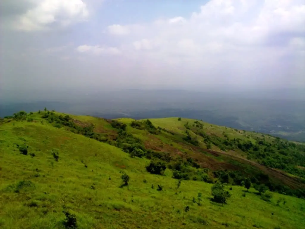
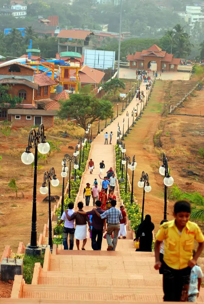
Perinthalmanna is a municipal town of about 49,700 people in the middle of Malappuram district, and it is best understood as a junction. Roads from Kozhikode, Palakkad, Nilambur, Melattur, Cherpulassery, Kunnamkulam, Valanchery, Tirur and Manjeri all come together here, on National Highway 966 between Kozhikode and Palakkad, and the Malayalam Wikipedia article on the town claims it as the place where more roads meet than anywhere else in central Kerala. That crossing is the whole of its history in one fact. It is why the Valluvakonathiri rajas of Valluvanad kept their seat beside it at Angadipuram, and it is the reason usually given for the thing the town is now known for across Malabar — an unusually dense cluster of hospitals for a taluk headquarters, which has earned Perinthalmanna the working nickname of the hospital city. Kodikuthimala, the grassland hill nine to twelve kilometres east, is its high ground and its evening escape.
Start with what the town is on paper, because almost every institution in this part of the district has its office here. Perinthalmanna is the headquarters of Perinthalmanna taluk, of one of the two revenue divisions of Malappuram district — with jurisdiction over the Perinthalmanna, Eranad and Nilambur taluks — of a block panchayat of eight grama panchayats, and of one of the six police sub-divisions of the district. The Revenue Divisional Office, the taluk office, a mini civil station, the office of the Deputy Superintendent of Police and a court complex holding the Munsiff-Magistrate court, a second Judicial First Class Magistrate court and a Fast Track Special Court under the POCSO Act are all inside the municipal limits. The town became a grama panchayat in 1933 under the Malabar District Board and was raised to a municipality on 10 February 1990. The numbers behind that are modest and worth stating plainly: at the 2011 census the municipality held 49,723 people across about 34 square kilometres, with women in a clear majority at 52.7 per cent, and a literacy rate of 95.3 per cent against a state figure of 94.0. Muslims form the largest religious group, followed by Hindus and Christians. A ward delimitation in 2025 took the council from 34 seats to 37; at the election that followed, the United Democratic Front took 21 of them and ended a Left run in the town hall that had held since 1995. That is unusual enough to be worth noting: in a district that is the Muslim League’s strongest ground anywhere, Perinthalmanna has long been one of the places where the Left could win.
The roads are the reason the town exists, and they are easy to trace on the ground. National Highway 966 from Kozhikode to Palakkad runs through the middle of it. State Highway 39 from Perumbilavu to Nilambur passes through the town; State Highway 23 from Shoranur ends here where it meets the national highway; State Highway 53 comes up from Palakkad by way of Cherpulassery; and State Highway 73 from Valanchery to Nilambur joins NH 966 two and a half kilometres away at Angadipuram. The town is served by one KSRTC sub-depot and three separate private bus stands, which tells you more about how people actually travel here than any timetable would.
That crossing is very old. The Malayalam account of Valluvanad describes two ancient overland trade routes meeting at Perinthalmanna: one running from the Mysore country by way of Gudalur, through Nilambur and down to Mathilakam near Kodungallur; the other from Madurai through the Palakkad gap and Mannarkkad and on to Kozhikode. The word used for the meeting is nalkkoottapperuvazhi, the great four-way road. The same account suggests that it was the commercial value of that junction that led the Valluvakonathiri to keep his centre of government at Angadipuram and around it. A dynasty and a hospital economy, eight centuries apart, are sited by the same piece of geography.
The hospitals are what most people in Malabar now associate with the name. The public sector runs a district hospital under the Malappuram District Panchayat, and a government Ayurveda hospital and a government homoeopathic dispensary under the municipality, alongside urban health centres in several wards. Around them has grown a private cluster that is genuinely large for a town of this size: a medical college hospital at Angadipuram run by the Muslim Educational Society, several multi-speciality and super-speciality hospitals, a co-operative hospital and research centre, at least two dedicated eye hospitals, an ENT hospital, a mother-and-child hospital and a children’s hospital. Patients travel in from across Malappuram and from Palakkad, Thrissur and Kozhikode districts. We name none of them as a recommendation; this is a description of an economy, not medical advice, and anyone travelling for treatment should take advice from a doctor rather than from a travel page.
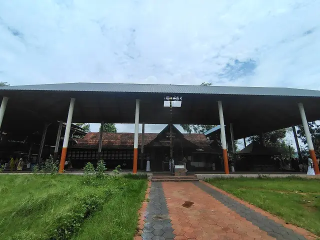
It changes the town for a visitor in practical ways. Hotel and lodging demand here is driven by the families of patients rather than by tourists, so rooms are busiest on weekdays and around clinic hours rather than at weekends; pharmacies, diagnostic labs and small eating places cluster along the approach roads to the larger hospitals; and autorickshaw drivers know the hospitals better than they know any monument. If you are here as a traveller rather than a patient, the town is a base and a junction, not a sight — the things worth seeing are the temples at Angadipuram, the hill at Kodikuthimala, and a scatter of villages in the block that carry more history than the highway does.
One of those villages gives the medical reputation a much older root, though the two are not connected and it would be wrong to pretend they are. Pulamanthol, about eleven and a half kilometres out on the Perinthalmanna–Pattambi road and inside Perinthalmanna block, sits on the bank of the Kunthipuzha and is the home village of the Pulamanthol Mooss, one of the eight Ashtavaidya physician houses of Kerala — the hereditary Nambudiri families trained in the eight branches of classical Ayurveda. The village has a Sree Rudra Dhanwanthari temple with Dhanwanthari, the physician of the gods, as its deity. Kerala’s wider Ayurvedic scholarship is strongly associated with this Bharathappuzha and Nila country, and the Valluvanad region is part of that map. The modern hospital cluster is a twentieth-century commercial phenomenon and did not grow out of the Ashtavaidya tradition; the two simply share a taluk.
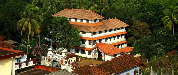
Two and a half kilometres west, effectively a twin town, is Angadipuram — the capital of medieval Valluvanad, the temple town of Malabar, and the place where the railway reaches Perinthalmanna. Angadipuram station is on the Shoranur–Nilambur Road branch, a single line of about 66 kilometres that is one of the shortest broad-gauge lines in India, laid to bring Nilambur teak down to the plains. Trains from here run to Nilambur, Shoranur, Palakkad, Kottayam and Kochuveli, and the service is thin: most people in the town use Shoranur Junction, on the main line, for anything long-distance. Pattikkad and Cherukara are the other small halts nearby. Thiroorkkad, on the same side, has become the district’s cluster of automobile showrooms.
Eight to twelve kilometres north, at Keezhattoor, stands the illam of the bhakti poet Poonthanam Nambudiri (about 1547 to 1640), author of the Jnanappana, the single most widely recited devotional poem in Malayalam. The house still stands and is maintained by the Guruvayur Devaswom, which keeps his birth star — Ashwathi in the month of Kumbham — as Poonthanam Dinam each year. The village has a school, a reading room and an open auditorium raised in his memory, and its Muthukurussikkavu thalappoli is counted among the significant festivals of Valluvanad. The two Malayalam sources we used give the distance from Perinthalmanna differently, at eight kilometres in one and twelve in the other, so allow for either.
A little south, at Elamkulam on the bank of the Thuthapuzha, is the mana where E. M. S. Namboodiripad was born on 13 June 1909 — the man who in 1957 became the first chief minister of Kerala and the first head of any Indian state government not drawn from the Congress, and who pushed through the land reform that dismantled exactly the kind of landlord household he came from. He carried the village’s name for the rest of his life. Valluvanad’s court had traditionally drawn its royal priests from two Nambudiri houses, Pathaikkara and Elamkulam; that the reformer came out of the second of them is the natural reading of the Malayalam sources, though we have not seen it set down in those words anywhere and do not assert it as established.
The last layer is the most recent and the most visible. Between roughly 1980 and 2000 Gulf remittances remade Perinthalmanna, as they remade most of Malappuram: the shophouses along the highway, the hospitals, the private colleges, the bus fleets and the large houses on the ridge roads all belong to that period. What the town looks like today — busy, prosperous, commercial, low on monuments and high on services — is the shape that money left behind.
Legend & myth
The town’s name is its best story, and it is one you will only find in Malayalam. The Malayalam Wikipedia article on Perinthalmanna gives the derivation under the heading padolpathi, word-origin: in the old days an annual display of physical and martial skill was held here, presided over by Kakkooth Nair, the commander of the Valluvakonathiri’s forces, on ground lying to the east of what is now Angadipuram. The Malayalam for such a bout is perum thallu — the great striking, the big fight — and the place where the perum thallu was held became, in time, Perinthalmanna. The office is not invented for the story: Kakkoottu Nair appears in the standard Malayalam account of the Valluvanad constitution as one of the fourteen swaroopis, the council of the state, alongside the chief minister Karuvayur Mooss, the Cherukara and Appamkulam Pisharodis, the Kulathur Variyar, the Pathiramanna Vellodi, the Elumpulakkad Achan, the Parakkad Nair and the Mannarmala Nair. A name for the town that comes out of an annual fighting festival run by the army commander of a state whose whole reputation rests on suicide-warriors is, at the very least, in character.
We should say what that etymology is and is not. It is a folk derivation recorded in a Malayalam reference work, not an inscription and not a dated document, and place-name origins of this shape — an evocative phrase worn down into a modern name — are exactly the ones that get built backwards from the name rather than forwards from the event. We searched the English sources, which offer no derivation at all, and the Malayalam ones, which offer this and nothing competing. So we print it as the tradition the town keeps about itself, we name the source, and we refuse to dress it up as a fact. No date is attached to the contests anywhere we could find, and we are not going to supply one.
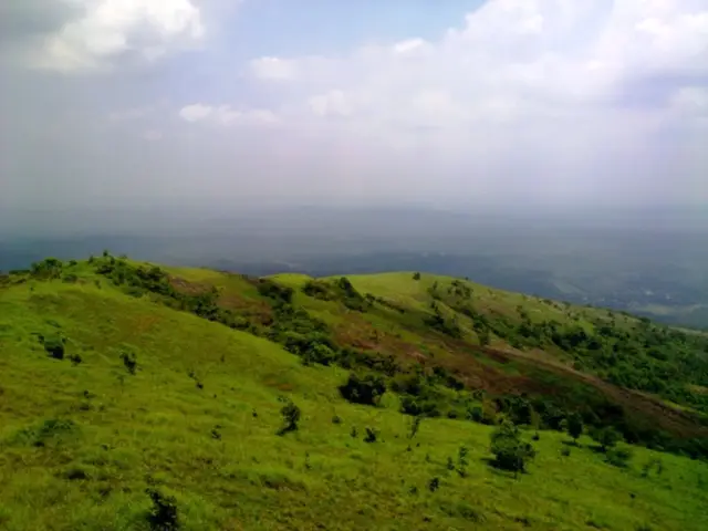
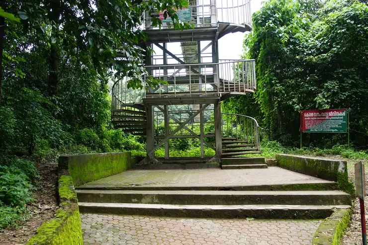
The hill has a name story of the same kind, and it is unusually literal. Kodikuthimala breaks into kodi, a flag, kuthi, to plant or drive in, and mala, a hill: the hill where a flag was planted. Every account agrees on the meaning and on the general answer to whose flag it was — a survey party working under the British, using the summit as a vantage point over the surrounding country and raising a flag on it. Beyond that the versions separate. The English account says only that the British hoisted their flag here during a survey. The Malayalam article is more specific and says the hill was an important signal station in the Malabar survey of 1921. Both cannot be checked against a survey record we could reach, and we print both rather than choose. A watch-tower is said to have been built at or near the point where the flag stood, continuing the same idea; the three-storey tower on the summit today is dated to 1998 in the Malayalam source.
What we will not do is give the hill an older legend. Kerala hills of this kind routinely collect a goddess, a sage or a Pandava, and it would be very easy to attach one here. We searched in Malayalam for a legend of Kodikuthimala — for a kavu, an aithihyam, a Bhagavathy, a serpent grove, a temple origin on the summit — and found none. The name is a survey name and the hill’s recorded history is a survey history: grazing ground, trigonometrical vantage point, and since the 1990s a tourism project on land held partly by the Forest Department and partly earmarked by the tourism department. That is a genuine absence, and it is more interesting than an invented presence, because it means Kodikuthimala is one of the few celebrated hills in this district that the sacred geography simply passed over.
The legend that does belong to this ground is Valluvanad’s own founding story, and it is told from the losing side. As the Malayalam accounts of Angadipuram have it, the last Chera Perumal, before leaving his kingdom to make the pilgrimage to Mecca, gave the whole of this part of southern Malabar to his vassal the Valluvanad raja — and gave him, as well, his own sword and his shield. One version explains the gift of arms bluntly: the Perumal handed over the sword so that the Valluvanad raja might defend himself against another of his vassals, the Zamorin of Kozhikode. From that moment, in the telling, the two houses were hereditary enemies. It is a legend that does a lot of work, because it lets a small state explain both its right to rule and the enmity that eventually destroyed it in a single scene, and it is told here as legend rather than as record.
A second, drier tradition explains where the dynasty itself came from. The Malayalam account of Valluvanad reports a belief that the Valluvakonathiris arrived by sea from central Kerala and established their authority over the Valluvakkanakkanmar, the people already living around the Thirumandhamkunnu goddess at Angadipuram, and that the kingdom took its name from them. Against that sits solid documentary history: a tenth-century inscription at Thiruvottiyur, near Chennai, records Vellan Kumaran, son of Rajasekhara, chieftain of Vallabha Rashtra in Kerala, leading a Kerala contingent north to fight for the Cholas under the prince Rajaditya. Both the sea-borne origin and the Sanskrit name Vallabhakshoni circulate; the inscription is the only part of it that can be dated.
One great story that starts here we are deliberately leaving alone. The quarrel between the Valluvakonathiri and the Zamorin over the presidency of the Mamankam at Thirunavaya, the Valluvanad chaver who went out sworn to die, and the chaver thara from which they set off, are told in full on our pages for Thirumandhamkunnu Temple and for Thirunavaya, and there is no case for telling them a third time on a town page. What belongs here instead is the aftermath, which almost nobody tells: having lost Thirunavaya and then most of the kingdom to the Zamorin by the end of the fourteenth century, the Valluvanad rulers went on governing the country immediately around their seat for another four hundred years, until Mysore’s campaigns finished them and the raja took refuge in Travancore.
Finally, the poet. Poonthanam Nambudiri, born at Keezhattoor in this block around 1547, is the subject of the most-loved devotional legend in Kerala, and it is a Valluvanad story before it is a Guruvayur one. He and his wife were long childless; a son was born after years of prayer, and the child died an hour before his annaprasanam, the rice-giving ceremony, with the guests already invited. Poonthanam went to Guruvayur in his grief, and the tradition holds that the Lord himself consoled him by lying for a moment in his lap as a child. He took Krishna as his son and wrote the line the Jnanappana is remembered for — while the little Krishna is dancing in our hearts, what need have we of children of our own. A companion legend sets him against his contemporary Melpathur Narayana Bhattathiri, the Sanskrit scholar who is said to have refused to read a poem written in mere Malayalam, and has the deity settle it by declaring that he preferred Poonthanam’s bhakti to Melpathur’s vibhakti — a pun on devotion and grammatical case that has kept the story alive for four centuries.
More about Perinthalmanna and Kodikuthimala
History
Valluvanad, known in its own records as the Arangottu Swarupam, appears as a constituent chiefdom of the Chera kingdom by the late tenth century and emerges as a sovereign state after that kingdom dissolved in the early twelfth. It was ruled by a Samanthan Nair house called the Vellodis, whose rulers took the titles Valluvakonathiri and Vellattiri and who were recognised by the East India Company as the kingdom of Vellattiri, the ruler styled Vallabha Raja. The family divided into four thavazhis or branches — Kadannamanna, Ayiranazhi, Mankada and Arippura — with the senior male of the branches holding the title; the original house was the Kadannamanna Kovilakam at Kuruva, near Kulathur at Angadipuram. The court had a chief minister, the Karuvayur Mooss, a council of fourteen, royal priests drawn from the Pathaikkara and Elamkulam manas, and four Panicker houses — Vayankara, Verkkode, Chenthrathil and Puthumana — as its war-captains.
The state’s long decline is measured in territory. At its greatest extent it ran from the Bharathapuzha in the south to the Pandalur hills in the north, from the sea at Ponnani to the Attappadi hills in the east, and had absorbed a good part of Nedunganad around Pattambi, Ottapalam and Cherpulassery. Most of that was lost to the Zamorin between the fourteenth and fifteenth centuries. By the time of the Mysore invasions only the Attappadi valley and a portion of what is now Ottapalam taluk remained under it; the raja took refuge in Travancore, and when the British took Malabar the house was given a malikhana pension and stripped of authority. The state was formally disestablished in 1793, when the Company assumed the administration directly.
Under British Malabar the region was reorganised as Walluvanad taluk of Malabar district in the Madras Presidency, and Perinthalmanna was its headquarters — the origin of the town’s continuing role as an administrative centre. After independence the area stayed with Madras State for a time, passed to Palakkad district when Kerala was formed, and was transferred to the newly created Malappuram district in 1969. Because the old British taluk also swept in the southern parts of Valluvanad and the Nedunganad towns of Ottapalam, Pattambi, Shoranur and Cherpulassery, the whole of that country is still called Valluvanad informally today, in a sense the medieval kingdom would not have recognised.
The railway arrived late and did not stay. The South Indian Railway Company was contracted by the Madras Presidency in 1923 to build a line from Shoranur to Nilambur to move teak, and opened it in sections: Shoranur to Angadipuram on 3 February 1927, Angadipuram to Vaniyambalam on 3 August, and the full run to Nilambur on 26 October of the same year. During the Second World War the line was lifted and its rolling stock sent to the Middle East, and it ceased to exist in 1941. Public pressure brought it back on its original alignment after independence: the Shoranur–Angadipuram section reopened in 1953 and the rest in 1954. It was electrified in 2024 and electric locomotives took over from 1 January 2025.
The year 1921 marks this country deeply and the accounts of it do not agree. The English account of the town lists Perinthalmanna, with Malappuram, Manjeri and Tirurangadi, as one of the main centres of the Malabar Rebellion. E. M. S. Namboodiripad, then twelve, was moved to Irinjalakuda because his house at Elamkulam was attacked. Yet the Malayalam history of the Elamkulam panchayat itself records the opposite for the same village: that under the leadership of local Muslim cultivators, all three of the landlord manas — Elamkulam, Muthukurussi and Puthumana — were protected without any encroachment at all, though the protection was given while the caste-distance customs of the day were still observed. Both statements are on the record and we print both. At Pulamanthol, the Malayalam account states that forty-one of the seventy who died in the Wagon Tragedy came from that panchayat, arrested on a charge of trying to break the Pulamanthol bridge in order to free an arrested ustad.
The town’s modern institutions are all twentieth-century: a grama panchayat under the Malabar District Board in 1933, a police station established in 1988, municipal status on 10 February 1990. Its one contribution to the history of science is older and belongs to Angadipuram — the red, iron-rich rock that Francis Buchanan described in his report of 1807 as an indurated clay that could be cut into blocks and hardened on exposure, and which he named after the Latin word for brick. The Geological Survey of India raised a plinth over the outcrop and declared it one of twenty-six National Geological Monuments during the International Conference on Laterization held in 1979, making this the type locality of a rock that covers roughly half of Kerala’s land surface and much of the tropics. The monument, the temples and the Pooram belong to our Angadipuram record and are described there.
Why visit
It is the most useful base in inland Malappuram: a junction town on NH 966 with a KSRTC sub-depot, three private bus stands and roads radiating to Nilambur, Palakkad, Kozhikode, Manjeri, Tirur and Cherpulassery.
Angadipuram, two and a half kilometres away, puts the Thirumandhamkunnu and Thali temples, a dozen smaller shrines and the national laterite monument within a single unhurried morning.
Kodikuthimala gives the district its best open horizon — grassland, a summit tower and an unbroken sunset — about nine to twelve kilometres east of the town.
Keezhattoor holds the illam of Poonthanam Nambudiri, author of the Jnanappana, maintained by the Guruvayur Devaswom and still marked with an annual day in his name.
For anyone interested in how Kerala works, this is the taluk that produced E. M. S. Namboodiripad, that lost a kingdom to the Zamorin, and that now runs on hospitals — three quite different Keralas within twenty kilometres.
The Nilambur–Shoranur branch line, reached at Angadipuram, is one of the shortest broad-gauge lines in India and among the most scenic short rail journeys in the state.