Nadukani is the long walk hidden behind the famous Athirappilly waterfall stop: a guided 9 km route from the visitor entrance through buffer-zone forest and an old teak plantation to a hill that looks back across the valley.
The story of Nadukani trek
The name needs fixing before the boots go on. Kerala has several places called Nadukani, including a hill viewpoint in the Idukki–Kottayam highlands and a pass on the Nilambur road. This programme belongs to Athirappilly in Thrissur. Its official reporting point is the waterfall entrance, and its subject is the forest hill reached from there. A photograph or map result from another Nadukani can send a traveller to the wrong district.
The official Vazhachal Forest Division page calls this a hard trek and gives the distance as 9 km. That immediately separates it from the ordinary visitor route at Athirappilly, where the top and base viewpoints are reached by short public paths. Nadukani is not a longer ticketed stroll around the waterfall. It is a booked, guided forest day with one published morning departure.
The route begins at a place designed for crowds and quickly changes scale. At the entrance there are ticket checks, parking, railings and the constant sound of visitors arriving for the falls. Beyond the reporting process, the trekking party becomes a small managed group. The waterfall ceases to be the whole destination and becomes a landmark seen from another side of its forest.
Kerala Forest Department describes the walk as crossing the Athirappilly Forest Station area from the camp shed towards Nadukani hill. It explicitly says the trail lies in the buffer zone and does not enter the core area. Those words are not a downgrade. They define the authorised space in which a tourism walk can happen without turning the deeper protected forest into an open recreation ground.
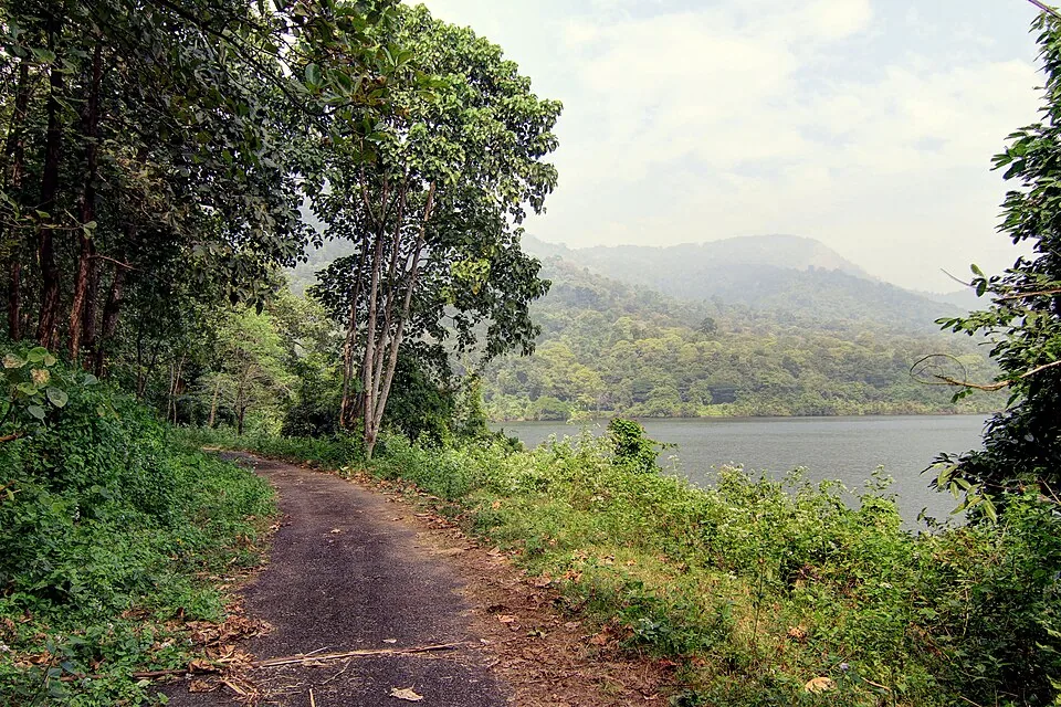
Semi-evergreen forest forms the living background: trunks, climbers, leaf layers, damp ground and brief openings alternate as the trail gains and loses sightlines. The official programme mentions opportunities to see birds, butterflies and odonates, but wildlife moves freely. Come for the forest itself and treat sightings as a bonus.
One of the route’s most specific markers is a teak plantation established in 1976. A plantation can resemble forest in a wide photograph, yet walking makes its structure easier to read. Repeated trunk spacing and a more ordered stand contrast with the irregular layers of semi-evergreen growth. The trek therefore crosses not one timeless wilderness but a landscape with both managed and less regular forest histories.
That contrast is more useful than treating every large tree as interchangeable scenery. Teak was planted for timber under a particular management logic; the surrounding mixed forest follows many more forms and ages. The official itinerary turns the plantation date into a waypoint, allowing walkers to notice how land use produces a visible pattern. It is a history lesson written in spacing rather than a plaque.
The trained staff and experienced local tribal watcher listed in the programme are part of the route, not an optional service attached to it. They decide pace, interpret conditions and keep the group within the authorised line. Their knowledge matters most when the trail looks least dramatic: a change in animal sign, a wet crossing or a silent section can mean more than a visitor’s desire to reach the next photograph.
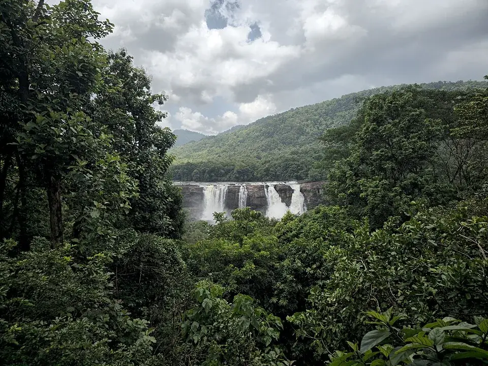
Nadukani culminates in distance rather than proximity. The advertised attraction is a safe view of Athirappilly Falls from the opposite side, after the waterfall has been reframed by the forest crossed to reach it. From afar, the broad white drop sits within a much larger green basin. This is the scale the roadside and base viewpoints cannot provide, even though they bring visitors closer to the water.
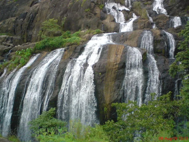
The strongest available hero photograph shows exactly that relationship: Athirappilly’s curtain is small enough to be held by forested slopes and large enough to remain unmistakable. It is a remote view of the falls, not proof of the precise Nadukani summit position. The caption and credit must keep that distinction clear because a view can explain a route without pretending to locate the camera on it.
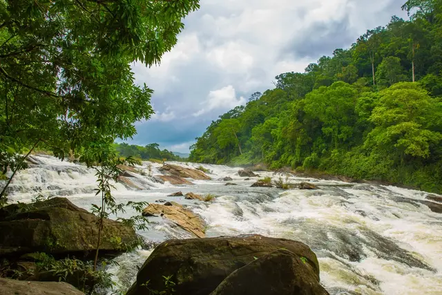
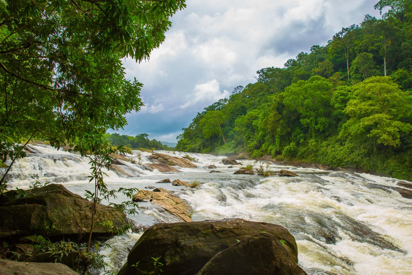
Waterfall conditions transform the reward. In wet months the Chalakudy River can spread into a powerful white wall and lift spray above the trees. In drier weather individual channels and the dark rock face become easier to separate. Neither state changes the length or difficulty of the forest walk, and dramatic monsoon volume can arrive with slippery ground or a suspended departure.
This is why “best time” cannot be reduced to the fullest waterfall. October through February usually offers an easier hard walk, with less saturated ground and more predictable road travel. The southwest monsoon produces the most forceful water and deepest greens, but it also makes roots, leaf litter and slopes harder. The Forest Department’s decision on the day overrides every seasonal recommendation.
The single 07:30 slot shapes the entire visit. It means the trek is not something to add after seeing the waterfall or to begin when a private car happens to arrive. A group must report with enough time for identity and booking checks, meet its staff and leave as scheduled. Starting together is part of how one guided party remains one party across nine kilometres.
The official portal says a minimum of four travellers must book and lists ₹1,500 per Indian visitor, producing a ₹6,000 minimum. Foreign visitors are listed at ₹3,000 each. These figures belong to the trekking programme, not the ordinary Athirappilly sightseeing ticket. Parking and any separate waterfall visit should not be silently folded into the same price.
There is a contradiction worth preserving rather than smoothing away. The booking information displays a maximum of 20 travellers, while the programme description says a maximum of 15 is included in one trip. A travel page cannot decide which number the operator currently enforces. A large party should ask the published contact before paying, and the answer for that date should govern the booking.
Food and drinking water are listed as inclusions. That is useful on a route where leaving the group to buy something is not an option, but it does not remove personal preparation. Essential medicine, rain protection and any dietary requirement still need to be addressed before departure. The inclusion is logistical support, not permission to arrive without knowing what a hard forest day asks of the body.
Valid original identification and the booking confirmation are required by the official portal. This may feel administrative beside photographs of rainforest, yet controlled entry is what distinguishes an authorised trek from casual forest access. The booking can be made up to 60 days ahead, but completion requires the issued confirmation; a payment attempt or enquiry message alone is not the same thing.
The published rules prohibit pets, smoking and alcohol. They also tell walkers to keep a safe distance from animals, never feed or chase them, avoid flash and remain with the guide. These are not decorative conservation slogans. An encounter on a narrow trail has no safe version in which a visitor moves closer for a photograph or separates from the staff to follow an animal.
Photography works best when the route supplies the composition. Ordered teak trunks, irregular canopy, wet leaf surfaces, a staff-led line of walkers and the distant waterfall each explain a different part of Nadukani. A telephoto view can make the falls appear near, so a truthful caption should say it is seen across the valley. Scale is part of the story and should not be edited away.
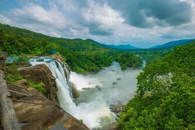
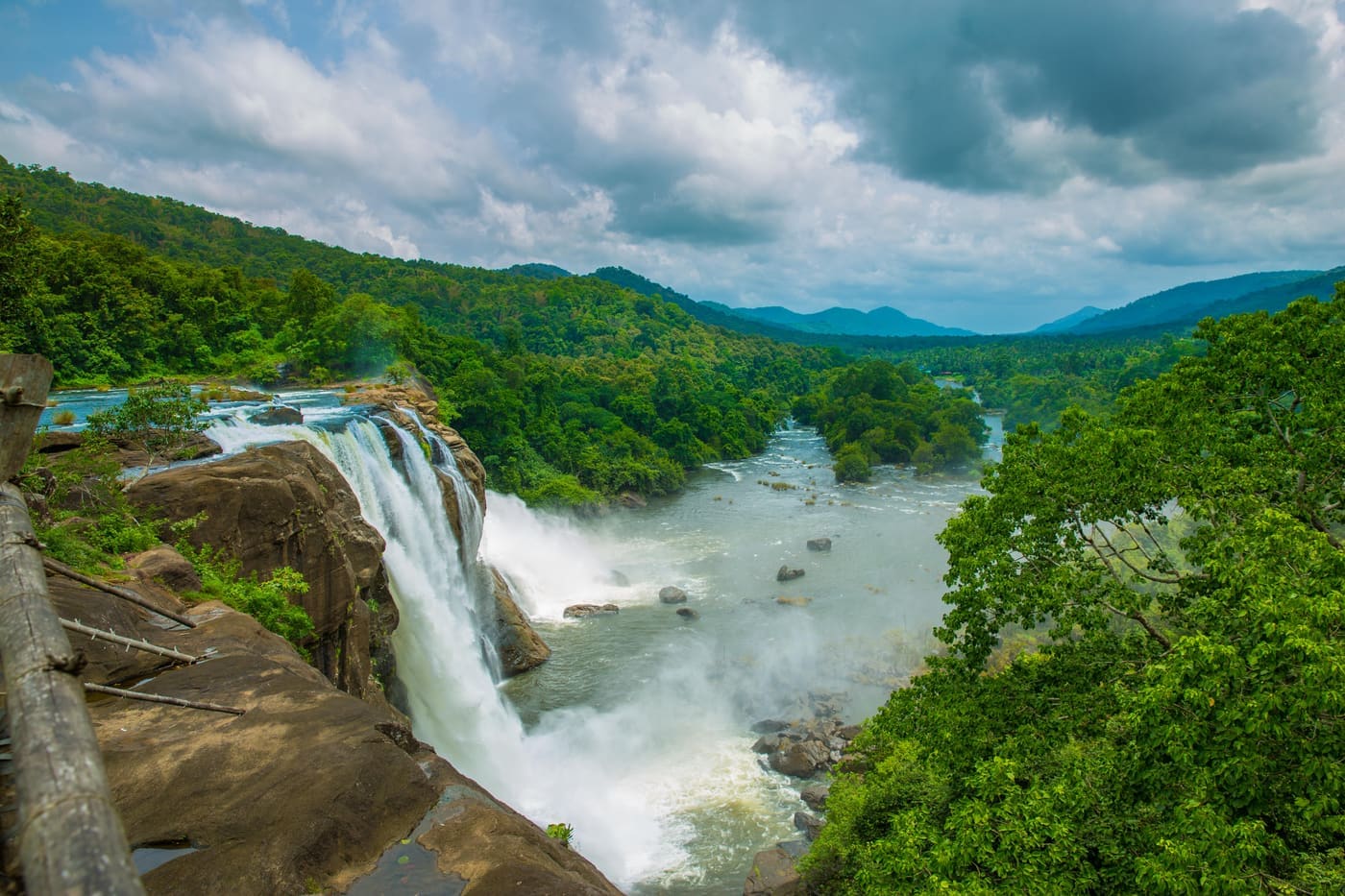
The public waterfall paths deserve their own careful distinction. Images of visitors behind bamboo rails or standing near the top lip show the ordinary Athirappilly experience, not the natural-surface Nadukani trail. They remain useful in the gallery because they explain the crowded landscape from which the trek departs. Captions own the distinction so the pictures do not promise railings throughout the forest.
Likewise, a close photograph from the rocky base can show the force that becomes a distant white band from Nadukani. It does not illustrate the trek’s footing or endpoint. Pairing the two scales is honest when each image is named: one is the waterfall visited by the public, the other is the larger valley the guided walk teaches a traveller to see.
The word “adventure” on the official product should be read through measurable facts rather than promotional mood. Nine kilometres, a hard rating, one early departure, natural ground and a guided buffer-zone line are the substance. There is no need to invent a summit altitude, technical scramble or overnight camp. The day is demanding because it is long and controlled, not because it has been exaggerated.
A sensible pace leaves attention for the return. The waterfall view may feel like the climax, but the same plantation and forest have different light and orientation on the way back. Fatigue also changes footing. Saving energy for the second half is more important than racing the outward leg, especially when the party must remain together and there is no private shortcut to the entrance.
The route can also be read as a sequence of thresholds. The first is administrative: the ticket booth, identification check and meeting with staff. The second is physical, where the infrastructure of the waterfall entrance gives way to a forest surface. The plantation introduces a third threshold because its regular geometry interrupts the mixed growth. The last is visual, when the trees release a view back towards the falls. Remembering those changes gives the walk a structure more precise than a list of kilometres.
Sound records the same transition even when cloud closes the longer views. Voices, vehicles and the waterfall dominate the visitor entrance. Farther along, footsteps and nearby forest sounds replace them; the river may be heard without being visible. At the distant viewpoint the falls return first as a broad noise across the basin and then as a white shape in the trees. The trek therefore approaches its best-known landmark by losing it and finding it again, rather than keeping it continuously in sight.
That pattern explains why an ordinary waterfall ticket and a Nadukani booking serve different travellers. The public paths are built to deliver close viewpoints efficiently, with barriers and a steady turnover of visitors. The trek spends most of its value on the intervening forest and on the time required to cross it. Someone interested only in a close waterfall photograph will find the shorter route more direct; someone choosing Nadukani is choosing the long change of perspective.
The return to the entrance is not an afterthought in that perspective. Familiar trunks now face the walker from the other direction, openings reveal different slices of the valley and the ordered plantation can be compared again with the mixed canopy. A guide may also adjust the pace or line in response to rain and animal movement. Treating the outward viewpoint as the halfway purpose, rather than the finish, keeps the nine-kilometre claim honest in both planning and experience.
Back among the railings and parked vehicles, the forest scale is easy to compress into the final waterfall image. The better memory is relational: an entrance beside the Chalakudy River, a managed buffer-zone route, a dated plantation, a staff-led party and a fall seen across wooded distance. Each element belongs to the same day but none substitutes for another. That is what makes this Nadukani specific, and why borrowing a viewpoint photograph or directions from another district would erase the very journey being described.
Nadukani finally changes the mental map of Athirappilly. The famous falls are no longer an isolated attraction at the end of a road; they are one break in a forested river valley, visible from another hill only after hours on foot. That enlarged geography is the trek’s real reward. It makes the waterfall smaller in the frame and more intelligible in the landscape.