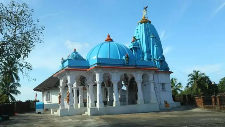
Ranipuram trek

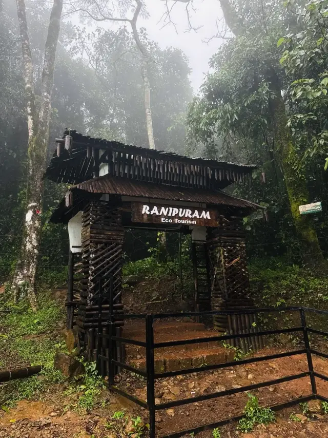
Ranipuram is the hill in these parts that you can drive most of the way up, and everything about the day follows from that. The Panathadi–Ranipuram road is tarred and two lanes for its whole ten kilometres, climbing about six hundred metres out of the plantation country to an eco-tourism counter with a window, a printed tariff and a toilet. The height everyone publishes for this hill — 750 metres, or 780 — is that counter. The summit is 1,049 metres, the highest ground in Kasaragod district, and the walk is what covers the difference.

Ranipuram trek, Ranipuram
Practical guide

Plan Ranipuram trek

Who's going?Tailor Ranipuram trek to your trip
Typetrek
AreaRanipuram
DistrictKasaragod
Best timeNovember to February, when the air is…
Time neededHalf a day
Altitude1,049 m
Places to visit2Listed businesses6

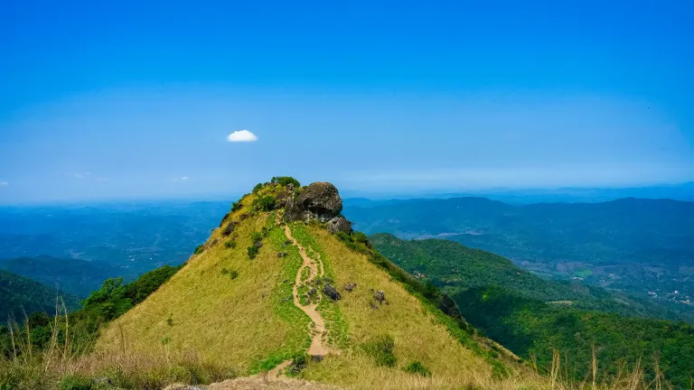
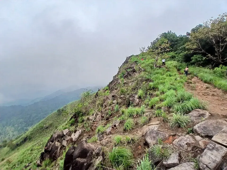
What is left on foot is short. Kerala Tourism calls it two kilometres and about an hour, on a track with stone steps laid into it in places, through evergreen shola and out onto open lemongrass grassland with a bare rock — Manimala Top — at the end of it. The state calls it a soft trek and means it. Come by one in the afternoon at the latest, carry cash for the window, and expect leeches from June into November.

The story

You can be standing on the highest ground in Kasaragod district about an hour after you get out of the car, having paid fifty rupees for it, and in the Western Ghats that combination is rarer than it sounds. No permit, no guide, no minimum party and nothing to book. What buys it is a made road that climbs a very long way up a hill, and a Forest Department gate at the end of it that asks nothing of a visitor except cash and an early start.

The story of Ranipuram trek

The drive is the first surprise. Guidebooks and travel pages describe the last stretch as a rough nine-kilometre jeep track that a low car should not attempt, and advise hiring a jeep at Panathady. The map says otherwise, and it says so unambiguously: the Panathadi–Ranipuram road is a made two-lane road with a tarred surface, classified as a major district road, and it is tarred every metre of the way to the counter. It climbs roughly six hundred metres in about ten kilometres, from plantation country at the bottom to grassland at the top, and it takes an ordinary car about eleven minutes. What slows people down is the bends and the cloud, not the surface.

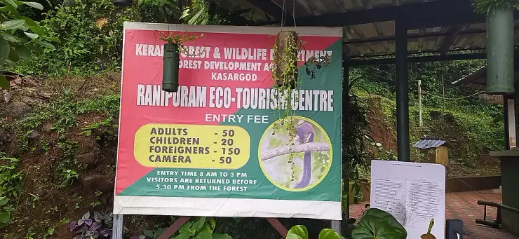
The building at the top of it is small and has a board outside, and the board is worth reading before you buy anything, because it is the plainest statement of what this place is. Fifty rupees for an adult. Twenty for a child. A hundred and fifty for a foreigner. Fifty for a camera. Entry between eight in the morning and three in the afternoon, and — in the department’s own slightly formal English — visitors are returned before half past five from the forest. Two times doing two jobs: three o’clock is the last moment anyone goes in, and half past five is when the hill is empty.

The number that says most about Ranipuram is one you will never see printed at the gate. The department’s booking system allows this centre to issue up to nine hundred and ninety-eight tickets in a day. Set that against the walks it runs elsewhere in the north — ten a day at Aralam, sixty at Vagamon, with a minimum party size at both — and it becomes clear that Ranipuram is not being rationed at all. There is no minimum number, so a couple can do it; there is no booking to make, because online booking for this programme is switched off; and there is effectively no ceiling to bump into. You drive up, you pay in cash at the window, and you walk.

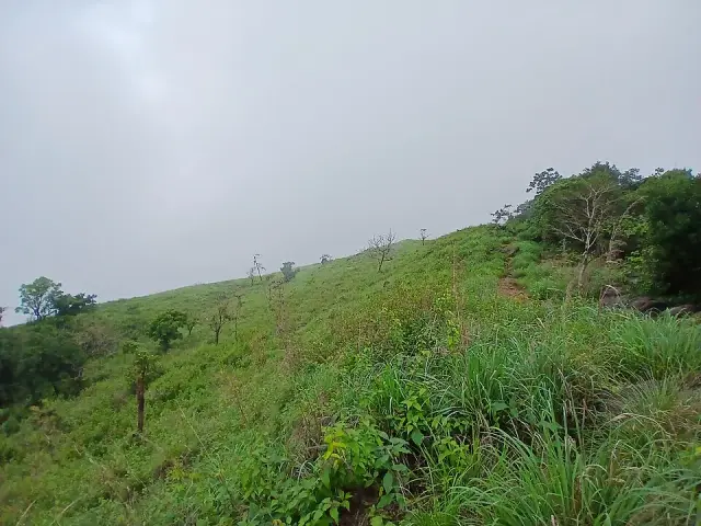
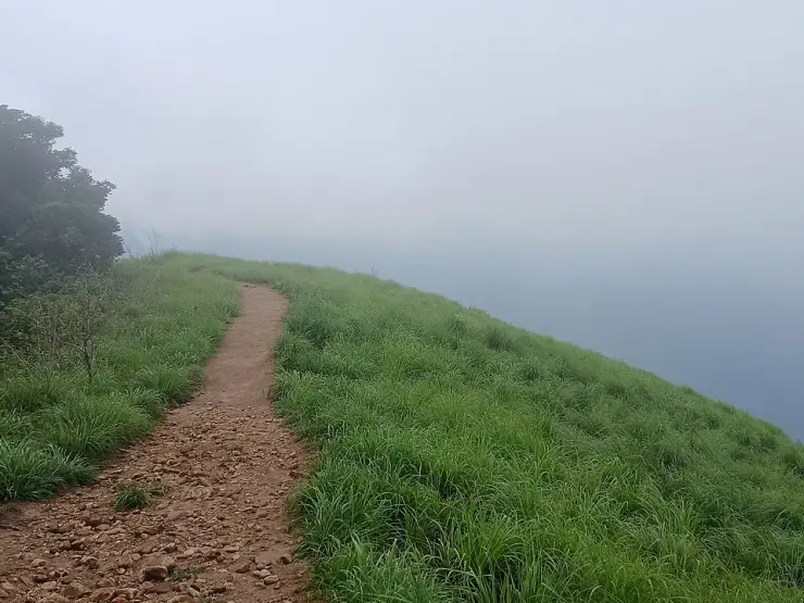
The walk itself is short and the state is honest about it. Kerala Tourism calls it two kilometres and about an hour, and calls it a soft trek — a phrase that is easy to read as marketing and is in fact accurate. Stone steps are laid into the track in places. The gradient is steady. An hour of it brings you out of the trees and onto rolling grass, and that is where the hill changes character entirely.

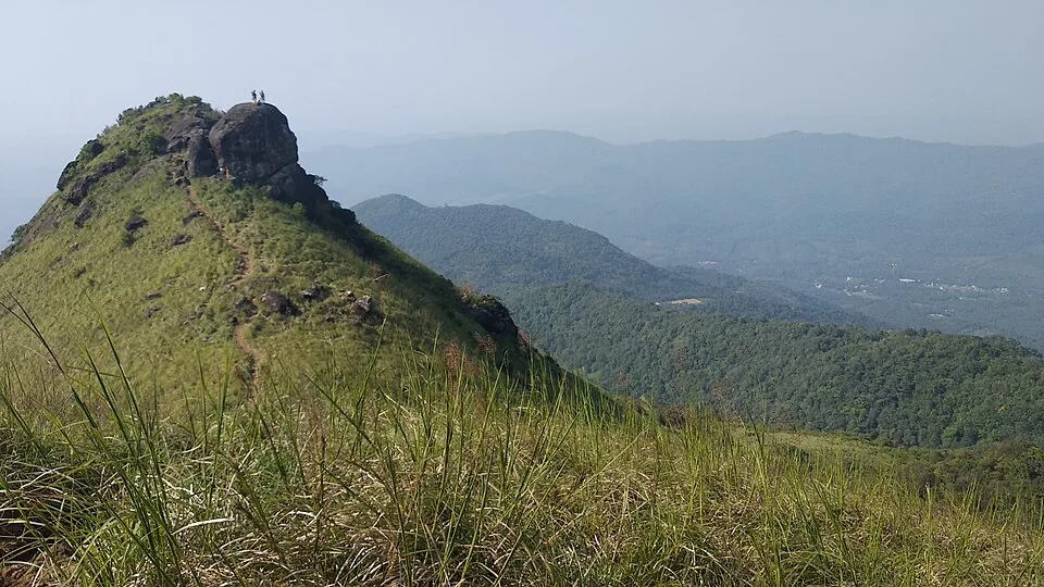
What you are walking through is the thing that makes Ranipuram genuinely unusual rather than merely pleasant. The open ground is grass — much of it lemongrass, which is why people say the air up here smells of it — and set into every fold and hollow of that grass is a rounded island of dark evergreen forest, packed tight, dripping and several degrees colder than the air a stride outside it. Those are sholas: stunted wet woods that survive in the sheltered creases of high south Indian hills, where the cold air pools and fire cannot easily run. Kerala Tourism records this as the only place in Kasaragod district where they are found. The boundary between the two is abrupt enough to step across, and stepping across it is the best thing this walk offers.

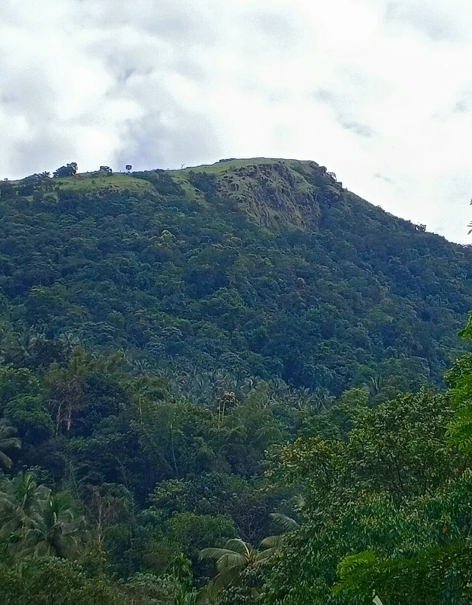
At the end of the grass there is a bare rock, and it has a name of its own. Locally the top is Mani, and the hill under it Manimala, which is why photographs of it are filed under both. It is the thing you can pick out from far down the valley, and it is where the walk stops. There is more than one way up, too: two paths climb through the evergreen forest rather than one, with the rock-cut steps appearing on both at intervals. On a clear morning the Panathady reserve drops away from it in every direction and the Karnataka border runs somewhere out in the green; most days there is cloud sitting below you rather than above. The rock is unrailed and it is slippery in the late afternoon, which is the department’s own stated reason for wanting people up here in the morning. Names have been scratched into it. They are not old and nobody is going to remove them.

The animals are not the attraction and it would be dishonest to sell them as one. This is reserved forest in the Panathady reserve and elephants, leopards, deer, wild boar, jungle cats and Malabar giant squirrels all use it; Kerala Tourism’s own page says elephant herds are commonly seen. King cobra, cobra, krait and Russell’s viper are all recorded on the hill. That is the reason for keeping to the track, going early, and treating a morning here as a walk through somebody else’s house.

And then there are the leeches, which deserve their paragraph because they are what people actually remember. From roughly June into November they are constant, and the state says so itself, in the same breath as the advice: carry good boots and carry salt. They come up the outside of a shoe and go in at the ankle, and the descent is when you find out. It is not a reason to stay away. It is a reason not to arrive in sandals believing you are going to a hill station.

That last word is worth pausing on, because every single source about this place uses it. Ranipuram is the “Ooty of Kerala” — Kerala Tourism says so, the district says so, and so does every travel page that has copied them. It is a useful phrase for selling a hill and a misleading one for planning a day. Ooty is a town: eighty-eight thousand people, a lake, a botanical garden, a mountain railway, hotels, and an altitude of two thousand two hundred and forty metres, which is more than twice the height of the summit here. Ranipuram has a ticket window, a toilet, a bench and a footpath. The nickname is telling you that it is cool and green and high by the standards of its own district, which is true. It is not telling you there is a hill station at the top, because there is not, and a visitor who arrives expecting one will have driven three hours for a disappointment rather than for the thing this place is actually good at.

What it is good at is birds, and there is a hard number for once. In February 2021 the Forest Department ran its first direct bird survey of Ranipuram and recorded ninety-eight species — the first proper study of the place, which is itself the point: the team leading it said plainly that not much work had been done here. The state’s own list names the paradise flycatcher, the green barbet, the trogon, wood pigeon, peacock, the Malabar grey hornbill, the white-bellied treepie and the great Indian hornbill. Two hornbills on one hill is the part a birdwatcher notices; the white-bellied treepie is a Western Ghats endemic and this is comfortably inside its range.

One bird is worth coming for on its own account. The golden-headed cisticola is a grassland warbler of high open country, and Ranipuram is one of a very small number of places in Kerala where it can be seen at all — which is a direct consequence of the thing this hill has and the rest of the district does not, namely open montane grass at a thousand metres. Black eagle, crested serpent eagle and little spider hunter are all ordinary here too. The place to stand is the edge between the grass and the shola, because the birds move between the two and the boundary lets you see into both at once.

The reptiles get the same treatment and deserve the same attention, for the opposite reason. Kerala Tourism names the king cobra, the green whip snake and monitor lizards as things found here, and the department’s wider list for the hill adds the spectacled cobra, the common krait and Russell’s viper. That is three of India’s big four on one small hill. None of it is a reason to stay off the track; all of it is a reason to stay on it, and to look before putting a hand on a rock on the way up to the top.

The hill is not always open, and the reason changes with the season. Through the driest months, roughly April to June, the grass on these tops cures to tinder and the department closes the walk at short notice for fire risk — which is exactly when the weather looks best from the coast. In the monsoon it is the rock and the track that close it. The result is a hill that is most reliably open in the months either side of the rains, and a number worth ringing before a three-hour drive in any month at all.

One last practical thing about the ticket, which nothing else records. The department’s system holds a twenty-day advance window for this programme, the sort of thing that would normally mean you could book three weeks out. You cannot, because online booking for it is switched off, so the window has nothing to open onto. The programme is listed under the plain name “Entry & Trekking”, and that is the whole of it: you are buying entry, and the trekking is what you do with it. There is no guided version to upgrade to and no package to choose between.
Read the full history of Ranipuram trek 480 more words

History

Ranipuram is a new name on an old hill, and the new name is only about fifty years old. Within living memory this was Madathumala — the hill of the madam — and the older name has not gone: Kerala Tourism still records it, the summit is mapped under it, and the village at the counter carries it to this day as its former name. Which of the two you hear depends largely on who you ask and how far up the road they live.

The change happened in the 1970s, when the land was bought from the Kodoth family for settlement through the Catholic diocese of Kottayam, and the settlers renamed the place for the Virgin Mary. That is what the name means: rani is the Malayalam for queen, puram for a town or a settlement, and the queen is the Queen of Heaven. It is one of the very few hills in Kerala whose name is a piece of twentieth-century devotional history rather than geography, and it explains the churches on the way up — there is a St Mary’s a few kilometres below the gate — in country that had none before the settlers came.

The older religion did not leave when the name changed. A Theyyam is still performed here every May to propitiate the goddess of the forest, a custom that predates the settlement by a great deal, and a good part of the population around the hill today is Marathi — descendants of a much earlier migration from the north, and a reminder that the 1970s settlers were not the first people to arrive here from somewhere else.

The ground itself is Panathady reserve forest, and that status — reserved forest, managed by the Kerala Forest and Wildlife Department through its Kasaragod division — is what the ticket, the gate and the timetable all follow from. It is also why the hill can be closed at a few hours’ notice: through the dry months, roughly April to June, fire risk shuts it, and in the monsoon the track and the rock do the same job.

Why visit

It is the rare high Western Ghats walk that a family with an ordinary car and half a day can simply decide to do, at nine o’clock in the morning, without a booking, a permit, a minimum group or a guide.

The shola–grassland boundary is a thing worth seeing once in your life, and this is the only place in the district it exists. You can stand with one foot in each.

Fifty rupees.

The view from Manimala Top is over unbroken reserved forest in every direction, with the Karnataka high ground beyond it, and there is nothing built in any of it.

It is the highest ground in Kasaragod, and unlike almost every other high point in Kerala you can be standing on it an hour after parking.

What to expect

Highlights

  • Manimala Top, the bare rock at the end of the grass ridge, with the whole of the Panathady reserve dropping away from it.
  • The shola–grassland mosaic — rounded islands of dark evergreen wood sitting in open grass — which Kerala Tourism records as the only one in Kasaragod district.
  • The drive itself: six hundred metres of climb in ten kilometres of tarred ghat road, ending where the walking starts.
  • Lemongrass over the open ground, which is why people say the air on this hill smells of it.
  • A bench on the ridge, which is very nearly the only built thing above the counter.
  • Cloud below the path rather than above it, for most of the year.
Getting there

How to visit

  • Drive to Panathady, then take the Panathadi–Ranipuram road to the counter. An ordinary car does it.
  • Buy the ticket at the window. There is no booking to make — online booking for this programme is switched off — and no card to pay with once you are past it.
  • Go in between eight and three. Everyone is returned from the forest before half past five.
  • Give the walk two hours there and back and the day half of itself, allowing for the drive at each end.
  • Boots and salt from June to November. The leeches are routine rather than bad luck.

Distance by road

  • Mangaluru53 km
  • Kozhikode181 km
  • Mysuru226 km
  • Coimbatore356 km
  • Kochi358 km

Road km to Kasaragod; ghat roads and traffic vary — allow extra.

Timing

Best time

November to February, when the air is cool and the ridge is clear often enough to be worth the drive. The months after the monsoon are the greenest and the grass is at its best, and the monsoon itself puts the leeches out and fills the valley with cloud — which some people come for. In the dry months the hill closes at short notice for fire risk, so ring before you set out.

Weather in Ranipuram trekSeasonal guide

Live forecast loads in your browser.

Today at Ranipuram trek
Sunrise6:18 am
Sunset6:27 pm
Golden hour best light5:27 pm–6:27 pm
Blue hour after sunset6:27 pm–6:52 pm
Sun sets toward compass bearingW · 272°
Moon tonight🌓 First quarter · 52%
South-west monsoon. June to September brings heavy rain to Kerala. Trails, falls and ghat roads can be slippery, swollen or closed at short notice, and forest departments sometimes suspend access. Check locally on the day before you travel.

Check the official alert before you travel. Kerala’s beaches, waterfalls and trekking routes close at short notice during heavy rain, and district alert levels change day to day. We do not publish an alert level of our own — read it from the state authority: Kerala State Disaster Management Authority, or the district control room on 1077.

Sun and moon are calculated for this location and shown in IST. Photography windows are the hour around sunrise and sunset; the sunset bearing is degrees clockwise from true north. Moon phase is accurate to about half a day.

Visitor notes

  • This is the opposite of the walk in the Kottancheri hills across the ridge: gated, ticketed, timed and made. The two are five and a half kilometres apart in a straight line and about half an hour apart by road, because there is no road over the top.
  • The ceiling is 998 tickets a day, so being turned away for want of one is not a realistic worry here.
  • The counter is the last of everything — the last toilet, the last person, the last place anything can be bought or arranged.
  • Names have been scratched into the summit rock. They are not old and they are not going anywhere.
Safety

Good to know

  • This is reserved forest in the Panathady reserve, with resident elephants, leopards, wild boar and deer. Elephant herds are seen regularly. Stay on the track and go in the morning.
  • The rocks are slippery at twilight, which is the department’s own reason for starting early rather than late.
  • There is no shade at all on the grassland stretch and no water above the counter.
  • The approach is tarred, but it is a ghat road with cloud sitting on it for much of the year. The hazard is visibility and the bends, not the surface.
Official eco & forest programmes

Experiences around Ranipuram trek

These are official or public-sector eco offerings that match this place, town or forest destination. Confirm availability, permits, tariffs and reporting times with the official operator before travel.

Ranipuram, Ranipuram trek
trekviewpointwildlife

Ranipuram hill trek

One-day hill trek from the Panathady/Ranipuram side through shola, monsoon evergreen forest and grasslands.

Kerala Forest Department / DTPC KasaragodShort day trek
Official source →
Ranipuram, Ranipuram trek
forest staytrek

Ranipuram DTPC forest-base cottages

Hill-station base accommodation near the Ranipuram trek start, useful for early starts and misty grassland walks.

DTPC Kasaragod / local operatorsforest cottageOvernight
Official source →
Stay · eat · do · rent · see · shop

Stays, food & things to do near Ranipuram trek

Verified hotels, homestays, restaurants, experiences, sights, shops and rentals around Ranipuram trek — commission-free, with direct contact. Filter by what you need.

The Palavayal Farmresorts — Farm homestay in Ranipuram
Top pick Verified
Farm homestay · Ranipuram
The Palavayal Farmresorts
38.8 km · 44 min drive ~₹800–930 by taxi

Kerala Tourism-listed riverside farm stay with kayaking, trekking and houseboat-ride context. The Palavayal Farmresorts, Kadalikkattil House, Enichal, Palavayal, Kasaragod, Kerala 670511 · Farm stay, Tejaswini River, Kayaking.

Directions Commission-freeView details
Eden Vibes Home Stay Ranipuram Side — Homestay in Ranipuram
Top pick Verified
Homestay · Ranipuram
Eden Vibes Home Stay Ranipuram Side
18.4 km · 18 min drive ~₹440–510 by taxi

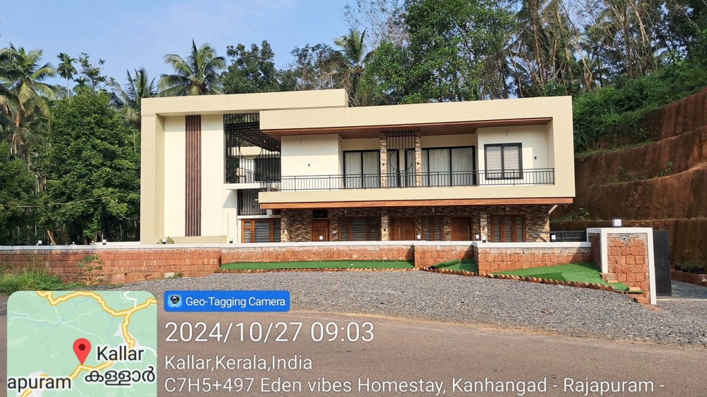
Kerala Tourism-listed Rajapuram homestay positioned between Bekal Fort and Ranipuram. Ranipuram side, Rajapuram, Homestay.

Directions Commission-freeView details
Ranipuram Hills Kerala Tourism — Hill and trek destination in Ranipuram
Verified
Hill and trek destination · Ranipuram
Ranipuram Hills Kerala Tourism
20 m · 1 min walk

Ranipuram Hills is Kasaragod highest hill-and-grassland route, with a short forest-and-shola trek best planned around weather, road condition, forest sensitivity and local transport from Panathady or Kanhangad. Ranipuram, Hill station, Trek.

Directions Commission-freeView details
R
Ranipuram Resorts Restaurant
Where to eat
Top pick Verified
Hill resort restaurant · Ranipuram
Ranipuram Resorts Restaurant

Restaurant at Ranipuram Resorts for hill-station visitors needing food near the trekking base. Ranipuram, eat, Hill resort restaurant.

Directions Commission-freeView details
B
Bekal Holidays Ranipuram Travel Agent
Things to do
Top pick Verified
Kerala Tourism-listed travel agent · Ranipuram
Bekal Holidays Ranipuram Travel Agent

Bekal Holidays Ranipuram Travel Agent is a researched kerala tourism-listed travel agent record for ranipuram, added to improve practical Kerala trip planning without duplicating an existing same-place listing. Ranipuram, Kerala Tourism-listed travel agent, do.

Directions Commission-freeView details
R
Ranipuram Resorts Direct Contact
Place to stay
Top pick Verified
Direct Ranipuram resort · Ranipuram
Ranipuram Resorts Direct Contact

Ranipuram resort contact record for travellers planning overnight stays near the hill-station trailhead.

Directions Commission-freeView details

Book with the place itself. India’s cyber-crime coordination centre warned in April 2025 that convincing copies of hotel and pilgrimage booking sites are being pushed through sponsored search and social ads, taking payment for rooms the property never hears about. Every listing here links to the business’s own contact details and its own Google or Bing profile — we take no commission and sit in nobody’s payment path. If a booking page reached you through an ad, check the address bar against the property’s own site before you pay. Fraud can be reported on cybercrime.gov.in or on 1930.

Ranked

More ways to explore Ranipuram

Find food, accommodation and activities across Ranipuram. Browse the guides for places to eat, stay and explore along your route.

Nearest to Ranipuram trek, on foot

Walking routes start at Ranipuram trek. Check the route and access before setting out, especially where a road, gate or waterway separates the stops.

Across the whole of Ranipuram

Ranked guides

Top experiences around Ranipuram

2 more places around Ranipuram. Open a guide to plan the visit and onward journey.

hill stationRanipuram

1.6 km · 20 min walk

A grassland-and-shola hill topping out at 1,049 m, the “Ooty of Kerala”, with easy treks and montane forest on the Western Ghats edge.

trekKottancheri Hills trek

25.3 km · 30 min drive

Four hills standing in a ring like a fort wall — which is what the name means, from kotta — above the village of Konnakad. A separate range from Ranipuram, not another name for it: five and a half kilometres away across the ridge but half an hour apart by road, with no ticket counter, no gate and no marked path, and rainforest underfoot instead of open grass.

Roampedia is commission-free — own or know a stay, eatery, guide or shop near Ranipuram trek? List it and it appears here once verified.

Add a nearby business
Trek facts

Ranipuram trek — at a glance

DifficultyEasy
Altitude1,049 m
DistanceOfficial pages conflict: one describes a 2 km walk and another describes roughly 2.5 km. Treat both as route guidance rather than a surveyed current distance and ask the counter which turnaround is open that day.
DurationAbout an hour up, less coming down.
TimingsEntry between 8:00 am and 3:00 pm, and every visitor returned from the forest before 5:30 pm. Three o'clock is the last moment you can go in; half past five is when the hill is empty.
Best timeNovember to February for cool air and a clear ridge. The months straight after the monsoon are the greenest; the monsoon itself, June to September, means constant leeches, slick stone and a valley full of cloud. April to June is when the hill is most likely to be shut at short notice for fire risk.

Entry: Published Ranipuram rates are not current enough to promise: official/reference pages have carried ₹30 adult and ₹15 child, while a photographed Forest Department counter board carried ₹50 adult and ₹20 child. These are dated reference figures, not a verified 2026 tariff. Confirm the amount at the counter on the day and carry cash.

Photography: A photographed counter board carried a ₹50 camera charge, but that is a dated reference rather than a verified 2026 tariff. Confirm the current charge at the window.

Permit: None beyond the ticket, and no guide is required. This is the difference between Ranipuram and the reserved forest on the other side of the ridge, where nothing is sold and permission has to be arranged in advance.

Booking: No current advance-booking route was found in the 4 September 2026 source review. Confirm same-day entry, current tariff and any seasonal closure with the counter on 8547602605 before the long drive, then carry cash for whatever the counter currently charges.

Parking: At the road head, where the tar ends. The vehicle is charged for separately: ₹10 for a two-wheeler, ₹30 for a three- or four-wheeler, ₹60 for a medium vehicle, ₹100 for a heavy one.

Wildlife: Elephants, leopards, deer, wild boar, jungle cats and Malabar giant squirrels, with hornbills, the Indian black eagle and a long butterfly list. Kerala Tourism's own account names elephant herds as commonplace here.

Getting here

How to reach Ranipuram trek

  • ✈︎ By air Kannur International Airport is nearer at 105 km and about an hour and three quarters; Mangaluru International is 117 km. Kerala Tourism's trek page names only Mangaluru, at 125 km, which leaves out the closer of the two.
  • 🚆︎ By train Kanhangad is the nearest station at 46 km and about three quarters of an hour, and it is the practical arrival point. Nileshwar is 55 km and Cheruvattur 61 km. Kerala Tourism's own figure of 45 km from Kanhangad station is very close to the measured road.
  • 🚗︎ By road From Kanhangad it is 46 km and about three quarters of an hour inland, then the Panathadi–Ranipuram road up to the counter — tarred, two lanes and classified a major district road for the whole climb, which is not how it is usually described. Kasaragod town is 57 km, Bekal Fort 52 km.
  • 🚌︎ By bus Buses run to Panathady from Kanhangad. Above Panathady the state contradicts itself — its destination page says regular jeep and bus services run up to the hills, its Bekal page says buses reach Panathady only and it is better to hire a jeep. Both are Kerala Tourism's own pages; ring the counter and ask.
Getting back

If you are travelling by bus or ferry, check the return service with the operator before setting out. Leave time to reach the stop or jetty after your visit.

Ask at the bus stand for the time of the last service back, not the next one. If you miss it, an auto or app cab is the fallback — agree the fare before you get in.

Do

Things to do

  • Walk up to Manimala Top and sit on the rock for as long as the cloud allows.
  • Look at the boundary between grass and shola, which is abrupt enough to step across in a stride and drops several degrees when you do.
  • Watch for the Malabar giant squirrel in the shola canopy — the animal on the department's own board at the gate.
  • Come back down slowly and look at the lichen on the summit rock, which is the oldest living thing most visitors will touch all day.
Prepare

What to carry

  • Come by one in the afternoon. The gate shuts to new entries at three and a two-thirty start turns the walk into a march.
  • Cash at the window. Nothing above it takes anything else.
  • Boots and long trousers, and salt in a pocket, from about June into November.
  • Ring 8547602605 in the dry months before driving out — the hill closes at short notice for fire risk.
  • The morning is the department's own advice, and the reason it gives is that the rocks are slippery at twilight.
Facilities

On site

  • A staffed ticket counter, which takes cash and is the last staffed point on the hill.
  • A toilet at the counter — mapped, and the only one.
  • Nothing to buy above the counter, and no water.
  • A bench on the open ridge, which is close to the only built thing above the gate.
Stay safe

Safety

  • Reserved forest with resident elephants, and herds are seen regularly enough that the state says so on its own destination page. Stay on the track.
  • Leopards, wild boar and deer use the same ground, and king cobra, cobra, krait and Russell's viper are all recorded on the hill.
  • No shade at all on the grassland and no water once you are past the gate.
  • The rock at the top is exposed and there is no railing on it.
Getting around Ranipuram trekNot wheelchair accessible
Terrain
Steep
Steps
Stone steps are laid into the track in places — Kerala Tourism mentions them and they are visible in photographs of the climb. The rest is bare earth and rock, then open grass.
From the entrance
A tarred two-lane road all the way to the eco-tourism counter, 9.9 km and about eleven minutes above Panathady, climbing roughly six hundred metres. The counter is the drop-off point and there is parking at it. Everything above the counter is on foot.
Step-free access
The drive is the accessible part of this place and it goes further than at most hills of its kind: a made road to a counter at about 780 m, with a toilet and a view out over the ridges. The walk above it is an unmade track over stone steps and open grass to a summit at 1,049 m, and there is no part of that a wheelchair user can do. There is no shortened version and no alternative route, and we would rather say so than invent an accessible stretch.
Prams
Not above the counter. The track is stepped and unmade and a small child has to be carried.

A staffed ticket counter at the road head, which is the last staffed point on the hill.A bench on the open ridge above, and nothing else built anywhere on the walk.

  • Entry is between 8 am and 3 pm and everyone is returned from the forest before 5.30 pm. A late start is the commonest way this walk goes wrong.
  • No shade at all on the grassland stretch, and no water once you are past the gate.
  • Leeches from about June into November — good boots and salt, which is the state’s own advice.
  • Reserved forest with resident elephants, leopards and venomous snakes. Stay on the track.
  • The rock at the top is exposed and unrailed, and it is slippery at twilight.

Checked 31 August 2026 against source 1source 2source 3. Conditions change and surfaces vary with weather — if step-free access is essential, confirm with the site before you travel.

Nearby

What’s near Ranipuram trek

hill stationRanipuram

A grassland-and-shola hill topping out at 1,049 m, the “Ooty of Kerala”, with easy treks and montane forest on the Western Ghats edge.

1.6 km · 20 min walk · straight line
trekKottancheri Hills trek

Rainforest walking in the Kottancheri hills above Konnakad — four hills standing in a ring like a fort wall, reached on foot from the village and quite separate from the ticketed hill at Ranipuram.

25.3 km · 30 min drive
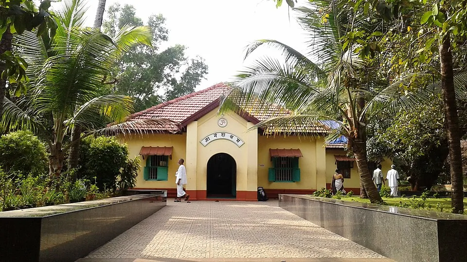
heritageAnandashram

A tranquil spiritual retreat at Kanhangad founded in 1931 by Swami Ramdas (Papa) and Mother Krishnabai, set in quiet wooded grounds; open to visitors of every faith under its motto of “universal love and service”.

28.7 km · ~48 min by cab · straight line
heritageNileshwar

The cultural capital of Kasaragod — a Theyyam and folk-arts town on the Nileshwaram backwaters, with kovilakams, kavus and a lively ritual-arts season.

30.8 km · ~51 min by cab · straight line
heritageHosdurg Fort

The surviving laterite fort at Hosdurg in Kanhangad is associated with the Ikkeri Nayakas and recognised by its rounded bastion and broad ramp; Nithyananda Ashram is a separate neighbouring institution.

31.6 km · ~53 min by cab · straight line
heritageNithyanandashram

The hillside cave complex at Hosdurg where Bhagawan Nityananda cut meditation chambers by hand out of a single mass of laterite — 43 by the ashram’s own account — with the Nithyananda Temple built above them in 1963. Mobile phones are prohibited in the caves.

32.0 km · ~53 min by cab · straight line
beachKanhangad beach

Kanhangad Beach is the Hosdurg coastal frontage of Kanhangad in Kasaragod district, with a broad sandy shore and an established fish-landing setting. It is a beach visit from Kanhangad town, distinct from Hosdurg Fort, the town’s ashrams and the separately named beaches at Ajanur, Ozhinhavalappu and Thaikadappuram. Use the named beach approach rather than a generic Kanhangad map result. The shore’s working character is central to the visit: leave boats, nets and landing passages clear while enjoying the sea-facing sand.

33.4 km · ~56 min by cab · straight line
beachBekal Beach

The beach stretch below Bekal Fort, with a landscaped park — famously the setting of the song “Uyire” from the film Bombay.

35.2 km · ~59 min by cab · straight line
heritageBekal Fort

Kerala’s largest fort (~40 acres), a keyhole-shaped laterite bastion jutting into the Arabian Sea, built around 1650 by the Keladi Nayakas; its observation tower once mounted cannons.

36.1 km · ~60 min by cab · straight line
backwaterValiyaparamba Backwaters

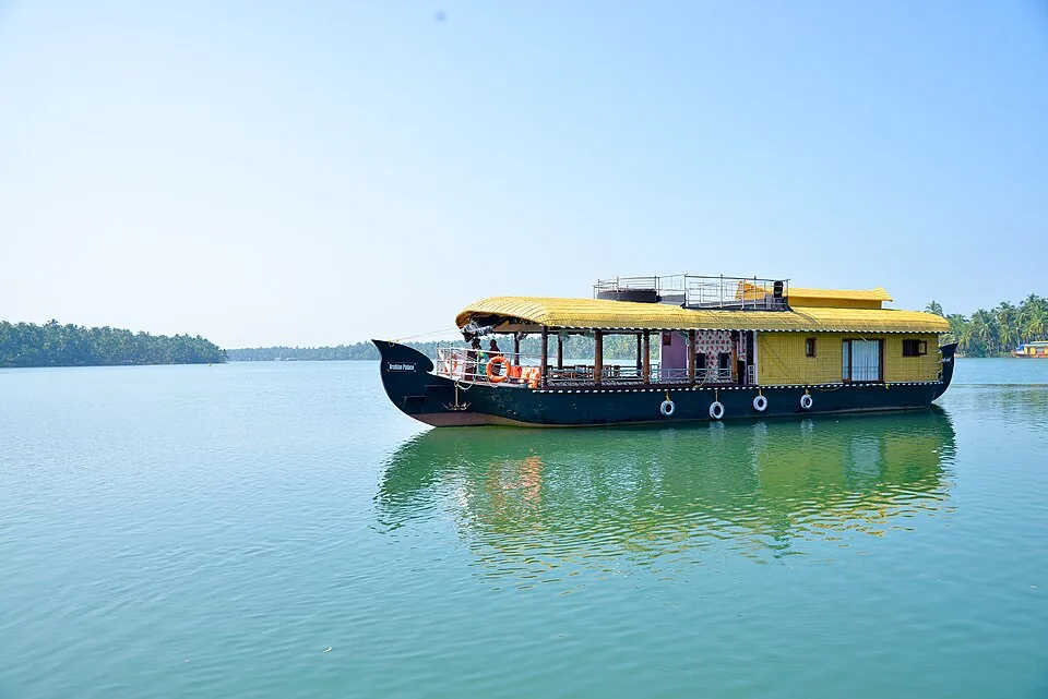
An inhabited coastal backwater landscape in southern Kasaragod, with fishing shores, coconut groves and island settlements. The map uses the Valiyaparamba village jetty as a shoreline orientation base.

38.3 km · ~64 min by cab · straight line
heritageChandragiri Fort

A 17th-century hilltop fort above the Chandragiri river built by the Keladi Nayakas, with sweeping views of the river mouth and the Arabian Sea — good at sunset.

39.7 km · ~66 min by cab · straight line
templeMadhur Temple

The Madhur Sree Madanantheshwara-Siddhivinayaka temple on the Madhuvahini river — a Shiva temple better known for its beloved “Bodajja” Ganapathi and a Tipu Sultan sword-mark on its well.

41.3 km · ~69 min by cab · straight line

All 2 places to visit in Ranipuram →

Walking and driving times are real routed distances, except the few marked “straight line”, which are direct-line estimates and will read short. Fare figures are estimates from Kerala’s notified auto/taxi tariff and exclude waiting and night charges. Routing: © openrouteservice.org by HeiGIT | Map data © OpenStreetMap contributors

On the map

Where Ranipuram trek is

Good to know

Ranipuram trek — frequently asked

How high is Ranipuram, really?

The summit is 1,049 metres, which the Forest Department publishes, and it is the highest ground in Kasaragod district. The 750 or 780 metres quoted almost everywhere is the height of the eco-tourism counter where the road ends and the walk begins.

Do I need to book the Ranipuram trek in advance?

No, and you cannot. Online booking for this programme is switched off, so the ticket is bought in cash at the counter on the day. The department can issue up to 998 tickets a day here, so there is very little chance of being turned away.

Is there a minimum group size?

No. Unlike several of the Forest Department’s other guided walks, Ranipuram sets no minimum party, so two people or one can do it.

Can an ordinary car get up to Ranipuram?

Yes. The Panathadi–Ranipuram road is tarred and two lanes the whole way to the counter, despite being widely described as an unsealed jeep track. It is a winding ghat climb and slow in mist, but the surface is not the problem.

What time should I arrive?

By one in the afternoon at the latest. Entry closes at three and every visitor is returned from the forest before half past five, so a late start turns an hour’s walk into a march.

Are there leeches at Ranipuram?

Yes, and from about June to November they are constant. Kerala Tourism’s own advice is to wear good boots and carry salt.

Is Ranipuram really the “Ooty of Kerala”?

It is what everyone calls it, including Kerala Tourism, but the comparison sets the wrong expectation. Ooty is a town of eighty-eight thousand people at 2,240 metres with a lake, a railway and a botanical garden. Ranipuram is a ticket counter, a footpath and a summit at 1,049 metres. It is cool, green and high for this district, and that is what the nickname is really saying.

What birds can you see at Ranipuram?

Kerala Tourism names the paradise flycatcher, green barbet, trogon, wood pigeon, peacock, Malabar grey hornbill, white-bellied treepie and great Indian hornbill. The edge between the grassland and the shola is the place to stand, because the birds move between the two.

Are there snakes at Ranipuram?

Yes. King cobra, spectacled cobra, common krait, Russell’s viper, the green whip snake and monitor lizards are all recorded on the hill. Staying on the track and watching where you put your hands on the rock is the whole of the precaution.

Is the Ranipuram trek ever closed?

Yes, and at short notice. Through the dry months of roughly April to June the grass cures and the walk is closed for fire risk; heavy monsoon rain closes it for the rock and the track. Ring the counter on 8547602605 before driving out.

How far is Ranipuram from Bekal and Kasaragod?

Bekal Fort is 52 km by road and Kasaragod town 57 km. Kanhangad, at 46 km, is the nearest town of any size and the practical place to arrive from.

What does the name Ranipuram mean?

The queen’s town. The hill was Madathumala until the 1970s, when land here was bought for settlement through the Catholic diocese of Kottayam and the settlers renamed it for the Virgin Mary — rani being the Malayalam for queen. The older name is still used, and is still the name on the map at the summit.

How many bird species are there at Ranipuram?

Ninety-eight, recorded by the Forest Department’s first direct survey of the hill in February 2021. Ranipuram is also one of very few places in Kerala where the golden-headed cisticola, a bird of high open grassland, can be seen.

When is the best time to visit Ranipuram trek?

November to February, when the air is cool and the ridge is clear often enough to be worth the drive. The months after the monsoon are the greenest and the grass is at its best, and the monsoon itself puts the leeches out and fills the valley with cloud — which some people come for. In the dry months the hill closes at short notice for fire risk, so ring before you set out.

What are the entry fee and timings at Ranipuram trek?

Entry: Published Ranipuram rates are not current enough to promise: official/reference pages have carried ₹30 adult and ₹15 child, while a photographed Forest Department counter board carried ₹50 adult and ₹20 child. These are dated reference figures, not a verified 2026 tariff. Confirm the amount at the counter on the day and carry cash. Timings: Entry between 8:00 am and 3:00 pm, and every visitor returned from the forest before 5:30 pm. Three o'clock is the last moment you can go in; half past five is when the hill is empty.

How do I reach Ranipuram trek?

Drive to Panathady, then take the Panathadi–Ranipuram road to the counter. An ordinary car does it. Buy the ticket at the window. There is no booking to make — online booking for this programme is switched off — and no card to pay with once you are past it. Go in between eight and three. Everyone is returned from the forest before half past five. Give the walk two hours there and back and the day half of itself, allowing for the drive at each end. Boots and salt from June to November. The leeches are routine rather than bad luck.

How much time do I need for Ranipuram trek?

Half a day. About an hour up, less down, and the drive at each end — three quarters of an hour from Kanhangad to Panathady and another eleven minutes up to the gate.

What else is near Ranipuram trek?

Nearby you can pair Ranipuram (1.6 km), Kottancheri Hills trek (25.3 km), Anandashram (28.7 km), Nileshwar (30.8 km).

What should I know before visiting Ranipuram trek?

This is reserved forest in the Panathady reserve, with resident elephants, leopards, wild boar and deer. Elephant herds are seen regularly. Stay on the track and go in the morning. The rocks are slippery at twilight, which is the department’s own reason for starting early rather than late. There is no shade at all on the grassland stretch and no water above the counter. The approach is tarred, but it is a ghat road with cloud sitting on it for much of the year. The hazard is visibility and the bends, not the surface.

Image credits

Photographs: Nativeplants garden (CC BY-SA 4.0), Vijayanrajapuram (CC BY-SA 4.0), Rajeshodayanchal (CC BY-SA 4.0), Shem.iz (CC BY 4.0). Wikimedia Commons.