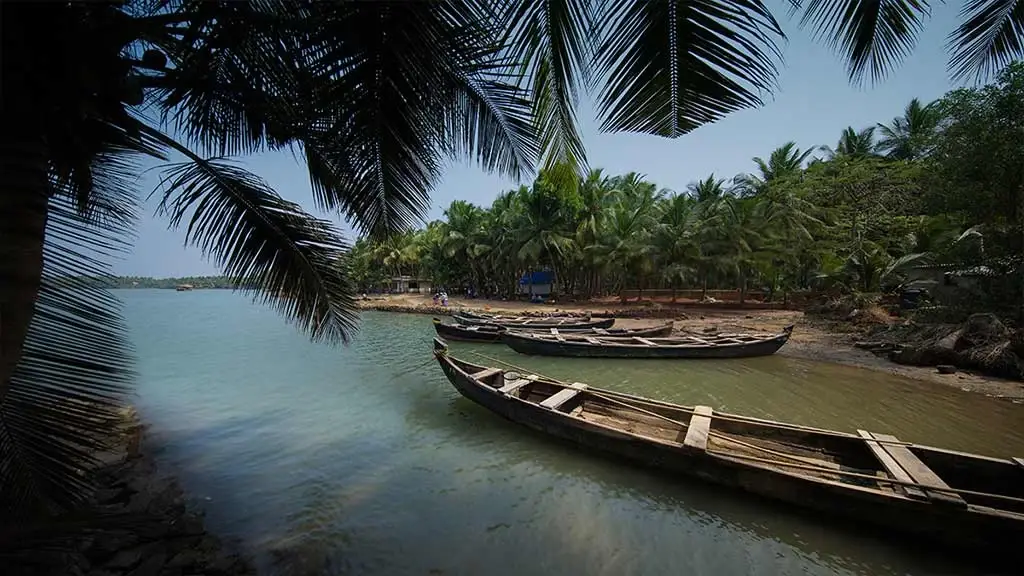
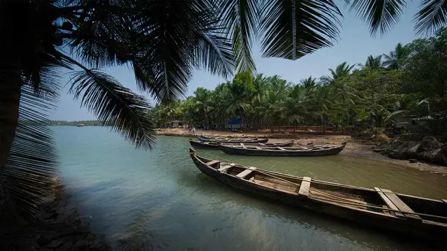
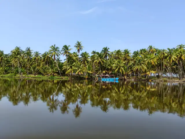
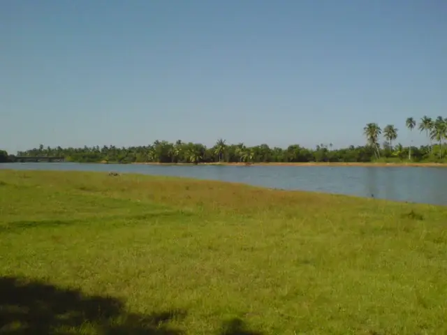
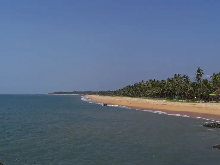
Valiyaparamba is not a town so much as a sandbar with a postcode. It is a coastal island of about 16.14 square kilometres in Hosdurg taluk, Kasaragod district, held apart from the mainland by the Kavvayi backwaters and carrying thirteen panchayat wards along a strip that has the Arabian Sea on one flank and still lagoon water on the other. Cheruvathur, the nearest railway station, is about five kilometres to the north-east across the water. The Kavvayi lagoon it sits in is the third largest backwater in Kerala after Vembanad and Ashtamudi and much the largest in the north, roughly 37 square kilometres of it, running some 21 kilometres parallel to the shore and scattered with islands. Coconut, coir and fishing pay for most of what happens here. The boat, not the road, is still the honest way to arrive.
Start with the shape of the place, because everything else follows from it. Valiyaparamba is a long, narrow barrier island: sea to the west, the Kavvayi backwaters to the east, and in between a ribbon of sand carrying coconut gardens, tiled houses, seven primary schools, a high school and a higher secondary school. The Malayalam Wikipedia article on the panchayat gives the area as 16.14 square kilometres across thirteen wards, with agriculture and fishing as the main income; the English article adds a 1991 population figure of 11,917, and other sources round it to about ten thousand today. The island is commonly described as running 24 kilometres end to end. Whichever figure you take, the point is the same — it is far longer than it is wide, and you are never more than a few hundred metres from water on both sides.
The water is the Kavvayi kayal, and it deserves its own paragraph. At roughly 37 square kilometres it is the third largest backwater system in Kerala, behind only Vembanad and Ashtamudi, and the largest and richest wetland in the northern half of the state. It stretches from Kavvayi near Payyannur in Kannur district up to Nileshwar in Kasaragod, lying parallel to the coast for about 21 kilometres. Valiyaparamba is the biggest of its islands at over 16 square kilometres, but it is one of many: Kavvayi itself, Padannakkadappuram, Vadakkekkadu, Kokkal, Edayilakkad, Madakkal and Kannuveed are all named in the gazetteer of the lagoon, and there are smaller mudbanks and sand tongues that come and go.
How many rivers feed it is a question our sources answer three different ways, and we are not going to pretend otherwise. Kerala Tourism says four, naming the Tejaswini among them. The Malayalam Wikipedia article on Edayilakkad says seven, then lists only six names — Kavvayi, Perumba, Nileshwaram, Kariyangode, Ramapuram and Kuniyan. The English Wikipedia article on the backwaters says the system is fed by the Kavvayi river and its tributary streams Kankol, Vannathichal, Kuppithodu and Kuniyan, which is a different way of counting the same water. Part of the confusion is that the Kariyangode and the Tejaswini are the same river under two names. We have printed all three counts rather than choose one, because a number nobody can reconcile is not a fact.
The most interesting island in the group is not Valiyaparamba but Edayilakkad, which lies in the lagoon off the island’s eastern flank and is administratively part of the same panchayat. It is a sacred grove — a kavu — of the kind north Kerala protects rather than clears, and it is described in Malayalam sources as among the foremost groves in northern Kerala for size and biodiversity, and the one closest to the open sea. The figures for the island’s extent disagree in the same article: 112 acres in the opening paragraph, 312.01 acres by the Revenue Department in the geography section. What is consistent is that only about 16 acres of it is grove. Some 1,305 people live on it in about 250 families.
For a patch of coastal scrub the size of a large farm, Edayilakkad is startlingly full. More than two hundred plant species have been counted in the grove, the commonest tree recorded locally as nayaruppa, alongside kanjiram, ilippa, ilanji and karingotta. Bird-watchers have logged 87 species there — the breakdown given is 34 waterbirds and 57 forest birds, which adds to 91, so one of those numbers is wrong in the source and we cannot say which. It is a nesting ground for the white-bellied sea eagle, and around forty bonnet macaques live in it. There is also a rare medicinal herb, the orila thamara, which sprouts with the rain and withdraws underground by October; specimens were sent to the genetic collection at the Tropical Botanic Garden in Thiruvananthapuram. Less romantically but more usefully, the sandy grove is credited with holding the freshwater lens that keeps the island’s wells from turning salt.
Getting on and off the island is the whole story of the last century here. For decades the only reliable link was the Kotti–Perumbatta boat service, which local accounts say was owned by the Madayanmar of Parassini Madappura, and before the Olavara–Payyannur and Kariyangode road bridges existed it was how people from Trikaripur and Cheruvathur reached Payyannur and Nileshwar at all. The State Water Transport Department still publishes a schedule from Ayitti on the island, with services towards Kotti and other landings around the lagoon; timings change, so check them on swtd.kerala.gov.in rather than trusting any printed list. Road access now comes over the Mavila Kadappuram bridge at the north end and the Valiyaparamba–Edayilakkad bridge at the south, the latter opened on 19 December 2013, together with the Edayilakkad–Vellap bund, which villagers built themselves generations ago to end the daily ferry and which now carries the main road.
One bridge here is famous for the wrong reason. The Madakkal suspension bridge, a footbridge about 320 metres long and a metre and a half wide between Valiyaparamba kadappuram and Madakkal island, was built by the Kerala state undertaking KEL at a cost of around four crore rupees and opened to the public on 29 April 2013 by the then Revenue Minister Adoor Prakash. It was described as the longest suspension bridge in Kerala. On 27 June 2013, less than two months later, it partly collapsed; two people on it at the time escaped. A replacement is on the books rather than on the water: a 317-metre Madakkal bridge sanctioned at 36.46 crore rupees through KIIFB, alongside a 365-metre Thekkekkad bridge from Padanna to Valiyaparamba at 47.40 crore, both reported in March 2026 as still at the land-acquisition stage.
Across the lagoon on the mainland side is Padanna, a separate panchayat but part of the same working landscape, and the reason this corner of Kerala matters to anyone who eats shellfish. Backwater mussel culture in Kerala began in the Padanna and Cheruvathur panchayats, and its local architect was a Gulf-returned businessman, Gul Mohammed, who from 1996 taught villagers to raise spat on coir and later on suspended ropes. Output in Kasaragod district went from about two tonnes in 1996 to a peak of 13,431 tonnes in 2008 before a long decline from 2009 attributed to disease. The work is done overwhelmingly by women, through self-help groups and Kudumbashree units, in a village where beedi-rolling had been the alternative. Green mussels, oysters and clams are farmed and dived for along this shore; the word to listen for is kallummakkaya.
The island’s quieter crisis is salt. At Oriyara, near the northern end, sea and lagoon water push in and kill coconut trees by the hundred and spoil the drinking wells behind them — the panchayat president V. V. Sajeevan put it in exactly those terms when the Inland Navigation Department sanctioned 50 lakh rupees for a protection wall there in late 2022. Unregulated sand extraction from the bed has been named as a contributing cause. It is worth knowing before you go, because the thing a visitor reads as scenery — a low green strip with water on both sides — is, to the people farming it, a margin that is getting narrower.
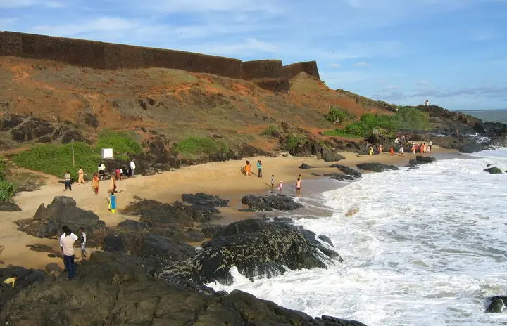
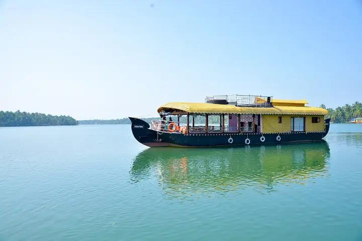
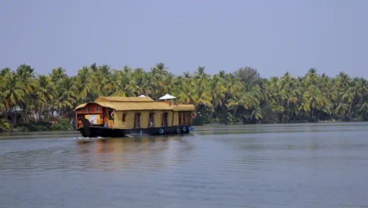
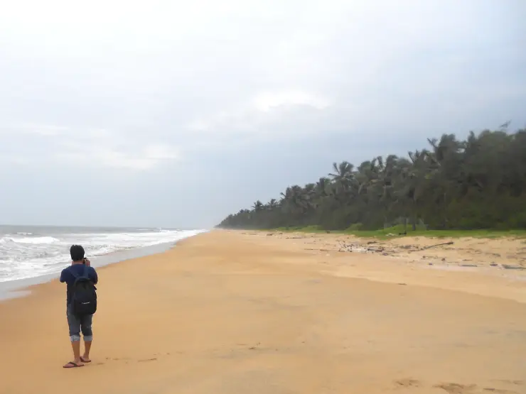
What there is to actually do here is deliberately little. There is no ticketed monument on Valiyaparamba and no attraction with a gate. The experience is a boat: houseboat terminals at Ayitti and Edayilakkad, country boats from the smaller landings, and a lagoon that carries a fraction of the traffic Alappuzha does. Add the grove and its macaques, the breakwater at the island’s western edge, the headland at the southern tip of Edayilakkad, and a beach that runs for kilometres with nobody on it. A tourist information centre was built beside the lagoon on fourteen cents of land for about seven and a half lakh rupees; Malayalam reporting describes it as having been left to the snakes and the street dogs, which is a fair warning against expecting facilities.
Legend & myth
The island’s own name has two explanations and the sourced one is the humbler. The Malayalam account traces Valiyaparamba to a paddy field: beside the old ALP School there stood a long-established Jumaat mosque, and between the school and the mosque ran a wide bund across the middle of the paddy — a valiya varambu, a great ridge. That phrase, the account suggests, wore down into Valiyaparamba. The source is careful to say this is inferred rather than documented, and it is worth repeating precisely because it is so unglamorous. Nothing about a god, nothing about a king: a footpath between a school and a mosque, walked flat by generations of feet, ends up naming an island. Edayilakkad’s name is explained the same plain way — the whole islet is mangrove, and because the trees grow to a middling height rather than tall forest, it became the wood-in-between.
The island’s real legend belongs to the sea and to a grave. At Mavila Kadappuram, the northernmost point of Valiyaparamba village, at the Oriyara river mouth, the body of a waliyy — a holy man in Muslim usage — is said to have come ashore many years ago. It was carried up the beach and buried with the proper rites. Afterwards, the tradition says, wonders of various kinds began to be seen at the spot, and a small mosque was raised over it. This is a coastal story of a very old shape, the saint who arrives by water at a place he never chose, and it belongs to Valiyaparamba specifically rather than to north Malabar in general. It is told as sacred tradition and should be taken as such; there is no date attached to it and no name for the man, which is itself part of the telling.
The grove on Edayilakkad is the island’s other sacred ground, and it is a serpent grove. The Nageshwari Kavu is dense with medicinal plants and cane thickets, and the macaques live in it undisturbed and come out to take fruit from villagers at the edge. The northern part of the grove belongs to the Mukaya community, whose hereditary work is fishing, and they conduct their own worship there. Once a year, on the Ayilyam star — the day across Kerala on which serpents are propitiated — parties come over from the Kshetrapalaka temple at Udinur on the mainland to perform puja and offer nivedyam in the grove for naga prasadam. Udinur’s own tradition holds that Kshetrapalakan is the janmi, the landlord, of that village, which makes the annual crossing to the island something more pointed than a courtesy visit: the landholder’s household coming to the serpents’ address.
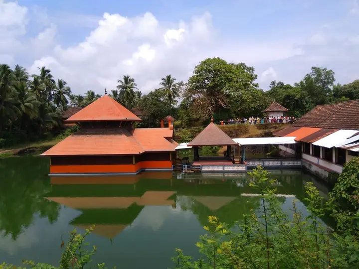
There is one theyyam here that appears to belong to nowhere else nearby. The Venugopala temple on Edayilakkad — long derelict, for years used only as a Krishna bhajana hall, its earlier building taken by the sea in 1964 and rebuilt inland — holds its festival once every two years, and the record of the renovation notes that its principal theyyam kolam is Ghantakarnan, a form not found in any neighbouring shrine on this coast. Ghantakarnan is the bell-eared one, the figure who is said to have hung bells at his ears so as not to hear any name but his chosen god’s; he is a healer-deity elsewhere in Kerala too, but a locally exclusive kolam is a real distinction in a district where the theyyam calendar is otherwise shared out among a hundred kavus. The festival is described as a gathering of the whole panchayat and beyond, with offerings made without regard to caste or religion.
We are deliberately not telling you where theyyam comes from, or the story of Parashurama and the possessed body, or how Muthappan or Pottan Theyyam came to be. Those legends are the property of our Nileshwar page, which is the right place for them, and repeating them here would turn a specific island into a generic north-Malabar article. For the same reason we leave the Tulu frontier, the seven languages and the birth of Yakshagana to Kumbla, where the sources actually place them, and we leave Parashurama’s elephant stables and the Chakrapani lotus-picker story to Trikaripur across the water, whose legend it is. Refusing a good story that belongs to the next village is part of getting this one right.
The strangest thing believed about this place is not a legend at all, and it works like one. On the basis of studies by the Centre for Earth Science Studies in Thiruvananthapuram, the age of Edayilakkad is put at 2,800 years — the island is a piece of the coast’s own memory of where the sea used to be. Old residents date human settlement on it only to about 1918, with real numbers arriving in the migrations of the 1930s. So the ground is nearly three millennia old and the village on it is barely a century. Living on something that much older than yourself is a fair description of what the whole spit is: sand the rivers and the sea agreed to leave in place, temporarily.
The grove keeps one genuinely small miracle. The orila thamara — the one-leaf lotus — comes up with the first rains, then withdraws underground by about October and is simply gone, which is exactly the behaviour a plant would have if it were hiding. It is prized as the raw material of a medicine for kidney disease, and villagers went to some trouble to have it taken into the Tropical Botanic Garden’s genetic collection at Thiruvananthapuram so that it could not be lost. Every tree in the kavu now carries an identification card, hung there by the children of the Balavedi attached to the Navodaya reading room, and a protection committee has run since 1964. It is not folklore, but it is the same instinct that made the grove sacred in the first place, arriving by a different route.
And then there is the sadya for the monkeys. Every year on Avittam, the star immediately after Thiruvonam, the villagers and the children of the Edayilakkad Navodaya reading room lay a long bench with banana leaves and set out a full Onam feast for the macaques of the grove — fruit, vegetables, a tumbler at each place — and treat it explicitly as a vazhipadu, an offering, rather than a stunt. A woman named Chalil Manikyamma is described as having fed the animals every single day for twenty-five years, calling them one by one by name, which they answer to. The same account carries a warning with the charm: visitors’ snacks have made the monkeys ill, there was an episode in which numbers of them died, and the organisers now campaign for anyone who feeds them to bring food with no salt in it.
More about Valiyaparamba
History
The oldest fame on this lagoon is not Valiyaparamba’s, and we will say so plainly. At the southern end, in Kannur district, sits Kavvayi, originally Kavvil Pattanam, which was named by Abu’l-Fida in 1273, by Marco Polo in 1293 and by Ibn Battuta in 1342. It served as the headquarters of a territory of some 125 square miles, with a substantial port and a magistrate’s court, and traded Malabar spices and gems and — the striking item — wootz, the crucible steel sold on as Damascus steel, until the British suppressed the trade. Kavvayi held its position under East India Company rule and then faded as administration moved elsewhere in Malabar. The water Valiyaparamba sits in is the water that port used; the port itself belongs to Payyannur’s story, not to this island’s.
Valiyaparamba’s own recorded history is short and administrative, and reaches back through South Canara rather than through Travancore. Before the formation of Kerala in 1956 this stretch lay in South Canara district of the old Madras state, and the panchayat was assembled out of the northern portions of the Padanna and Udinur villages together with the southern portion of Trikaripur village. Further back, Trikaripur and its neighbours were the southernmost villages of the Nileshwar royal line, and the wider area belonged to Allada Swaroopam within the Kolathunad sphere; Udinur is said to take its name from Udayanan, one of the Kolathiri rulers.
The island’s land history is a landlord’s history until quite recently. Edayilakkad belonged in earlier times to the Udinur Kovilakam Devaswom, and before the land reforms it was in the hands of a janmi named in Malayalam sources as Muhammad Kunhi Byari of Thalangara, Kasaragod, who brought people in from various places and settled them on it to farm, housing dependants in thatched huts around the holding. The land reform legislation turned those tenants into owner-cultivators, which is why the island is farmed in small parcels today. Separately, fishing families moved into the southern part of the panchayat from Trikaripur and Ramanthali and built there.
1964 was a year this place remembers twice over. It is the year the sea took the old Venugopala temple on Edayilakkad, which was afterwards rebuilt on safer ground inland, and it is also the year local residents started the committee that has protected the grove ever since. Erosion and conservation arriving in the same twelve months is a neat summary of the island’s modern predicament.
Padanna, the mainland village opposite, carries its own name-history: Kerala Tourism’s own publication derives Padanna from a Kannada word for salt fields, notes that salt is no longer made there, and states that palm-leaf writings record an old trade route from here to China. That last claim rests on a promotional tourism source and we flag it as such rather than repeat it as established fact. What is solidly documented at Padanna is recent and economic: the mussel and oyster culture that began in 1996 and made this estuary a national centre for farmed green mussel within a decade.
The infrastructure history is compressed into the last dozen years and is not a happy one. The Valiyaparamba–Edayilakkad bridge opened on 19 December 2013; the Madakkal suspension bridge opened on 29 April 2013 and partly fell down on 27 June the same year; the two large replacement crossings, Madakkal and Thekkekkad, were still awaiting land acquisition when they were reported on in March 2026. For most of the twentieth century, and for some journeys still, the answer was a boat.
Why visit
It is the third largest backwater in Kerala and carries a small fraction of the boat traffic of the southern lagoons, so the water is quiet in a way Alappuzha has not been for thirty years.
You can stand on a strip a few hundred metres wide with the open Arabian Sea breaking on one side and flat lagoon water on the other, which is a thing very few inhabited places in India let you do.
Edayilakkad is one of the largest coastal sacred groves in Kerala — 87 recorded bird species, a white-bellied sea eagle nesting ground, a resident troop of macaques and a rare medicinal herb that disappears underground every October.
The Onam feast laid out for the grove’s monkeys on Avittam, and the Ayilyam-day serpent worship brought across from the Udinur Kshetrapalaka temple, are living local observances rather than staged ones.
Padanna across the lagoon is where backwater mussel farming in Kerala began, and the rafts, ropes and diving are visible working practice, not a demonstration.
There is nothing to buy a ticket for, which for the right traveller is the entire recommendation.