Places to Visit in Pala and Erattupetta highlands

Eastern Kottayam base for viewpoints and waterfalls.

Pala and Erattupetta highlands
Practical guide

Plan Pala and Erattupetta highlands

Who's going?Tailor Pala and Erattupetta highlands to your trip
DistrictKottayam
RoleHill gateway
Time neededHalf a day covers both towns at a walk
Places to visit9Listed businesses6
What to expect

Highlights

  • Alapra — A quiet upland picnic and viewpoint area in eastern Kottayam, best treated as a low-facility daylight stop with the final road checked locally.
  • Anjukuzhi Waterfall — A seasonal cascade in the Erumeli side of Kottayam whose pools and rock shelves can change quickly after rain; it is not a guaranteed swimming site.
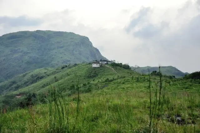
  • Ayyampara Hills — A local hill landscape near Thalanad in the Meenachil highlands, offering valley views without the managed facilities of a ticketed viewpoint.
  • Kottathavalam — A hilltop rock shelter and viewpoint associated with local royal-travel traditions; the uneven ascent and unguarded stone terrain require a dry daylight visit.
  • Muthukora Hills — A lesser-known Kottayam highland walk where the legitimate trailhead, land access and weather-safe return should be confirmed with local guidance.
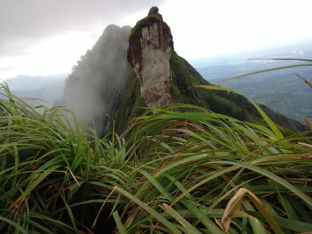
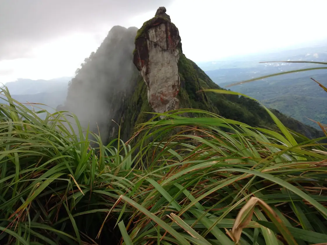
  • Illikkal Kallu — Rocky highland viewpoint popular as a day trip from Kottayam and Pala.
Getting there

How to visit

  • Nearest airport: Cochin (COK), ~75–80 km
  • Rail gateway: Kottayam (KTYM)
Timing

Best time to visit Pala and Erattupetta highlands

October to February for clear air and comfortable temperatures. June to September is the south-west monsoon — around 2,840 mm falls at Pala in an average year — which is green and dramatic but hard on the ghat roads above Erattupetta.

Weather in Pala and Erattupetta highlandsSeasonal guide

Live forecast loads in your browser.

Today at Pala and Erattupetta highlands
Sunrise6:12 am
Sunset6:21 pm
Golden hour best light5:21 pm–6:21 pm
Blue hour after sunset6:21 pm–6:46 pm
Sun sets toward compass bearingW · 272°
Moon tonight🌓 First quarter · 56%
South-west monsoon. June to September is the south-west monsoon in Kerala. Expect heavy showers, mostly in bursts rather than all day — carry rain cover, allow extra time for getting around, and note that ferries and open-air sites are the first things affected.

Sun and moon are calculated for this location and shown in IST. Photography windows are the hour around sunrise and sunset; the sunset bearing is degrees clockwise from true north. Moon phase is accurate to about half a day.

The story

The story of Pala and Erattupetta highlands

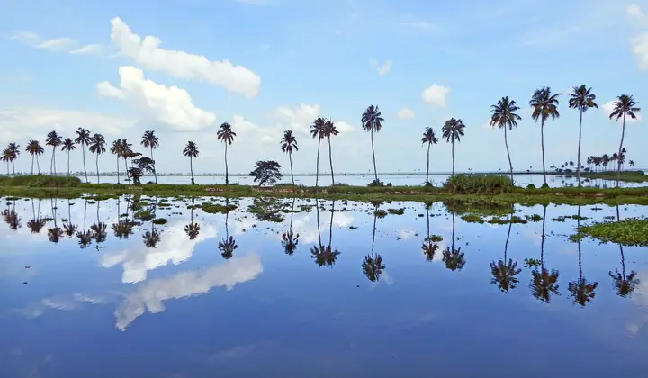
Two towns share this hub and they could hardly be less alike. At Erattupetta the Poonjar Ar and the Theekoy Ar run together in the middle of town and become the Meenachil — the name means, plainly, “the place between two rivers” — and the settlement that grew on the three banks was an inland port, a bullock-cart terminus for goods coming over from Tamil Nadu, and today a Muslim-majority market town of roughly 34,800 people. Thirteen kilometres downstream the same river runs through Pala, the headquarters of Meenachil taluk, seat of a Syro-Malabar diocese since 1950, and the rubber exchange whose prices still set the mood of the whole valley. Between them they are the reason anyone gets up to Illikkal Kallu, Vagamon or Ilaveezhapoonchira at all — but they are worth an afternoon in their own right.

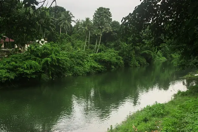
Start with the water, because both towns are arguments about a river. The Meenachil rises on Kudamurutti hill above Vagamon, at around 1,156 m, and runs 78 km west to Vembanad Lake, gathering 38 tributaries, 47 sub-tributaries and 114 named streams on the way and draining a catchment of about 1,208 sq km. Its two head-streams — the Poonjar Ar, known locally as the thekkanar or southern river, and the Theekoy Ar, the vadakkanar or northern one — do not meet somewhere out in the hills. They meet in the middle of Erattupetta, a few steps from the shops.

That confluence is the whole explanation of the town. Before the bridges, the water cut Erattupetta into three separate karas — Thekkekkara, Kizhakkekkara and Vadakkekkara — and in a good monsoon the eastern bank was effectively an island; people swam it if they had to. Two bridges now tie the three together, with three causeways added later to take traffic out of the centre, and a fourth crossing runs off the Pala road past St George’s College. It is an ordinary-looking market town until you notice that its road layout is a river map.

Erattupetta’s older life was commercial and riverine. Kettuvallam cargo boats came up from the west with rice and provisions and went back loaded with malanchakku — the hill produce of pepper, cardamom and areca that came down off the Cardamom Hills — and at night rafts of timber floated west with hurricane lamps burning on them, which was how the highland forests reached the coast. Bullock carts from Tamil Nadu used the town as their terminus until the eighteenth century. When Alappuzha port was developed, that inland-port trade fell away, and Erattupetta became what it is now: a busy retail and produce market rather than a transhipment point.

The other thing the river gave the town was a public square. Once the flow shrank to a summer channel, wide white sandbanks appeared on both sides, and those sandbanks became Erattupetta’s civic space — temporary shops, festivals, fairs and mass meetings. Jawaharlal Nehru, travelling with his daughter Indira during the independence campaign, addressed a gathering on the Erattupetta manappuram. Sand extraction has since taken the banks away almost entirely, and Malayalam Wikipedia’s account of the town says so bluntly; the ground Nehru spoke on is not there any more.

Today Erattupetta is the larger of the two towns — 34,814 people in 7,686 households at the 2011 census, against Pala’s 22,056 — and it is Muslim-majority, a fact with a straightforward historical cause. Christian settlers pushed on into the surrounding hills after farmland, while the trading families stayed put in the town centre. There are now twelve juma masjids and around twenty-five smaller prayer mosques in the municipality, organised around three historic mahallu jamaats: Nainar Palli in the town, Puthanpalli, and the Muhyiddin mosque at Thekkekkara, described in local accounts as one of the largest mosques in Kottayam district. Gulf remittances are a visible part of the economy.

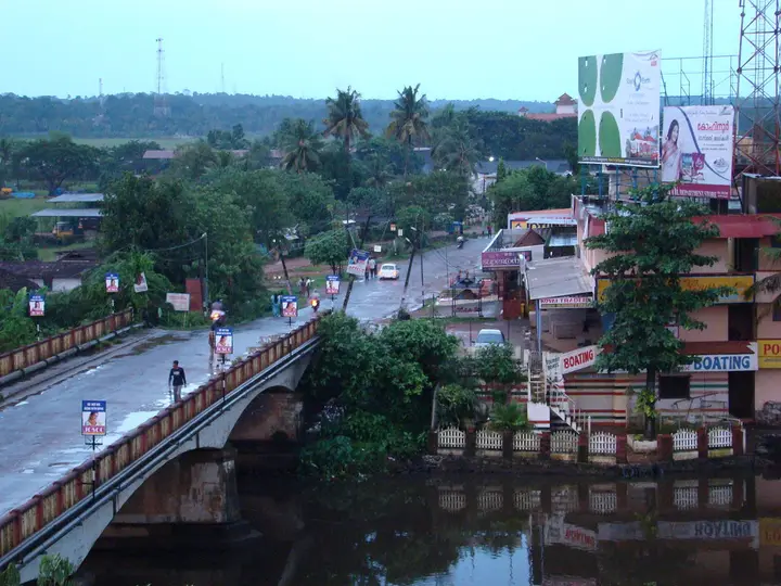
Pala, downstream, reads completely differently. The town centre sits on the north bank; the tall Gothic clock-tower spire of St Thomas Cathedral is the landmark you see from every approach, and the municipality — 16.06 sq km, about 31 m above sea level, roughly 2,840 mm of rain a year — is a compact grid of shops, banks, colleges and church institutions rather than a market strung along a highway. Its bones are commercial: Pala is the principal market for the rubber, pepper and coffee of the whole Meenachil taluk, and Malayalam Wikipedia puts it without softening — living standards here follow the rubber price. Rubber-based small industry sits round the town’s edges.

Pala also has a claim on Malayalam letters that most towns its size would trade a great deal for. Kattakayam Cherian Mappillai, born here on 24 February 1859, spent fifteen years writing Sreeyesuvijayam, generally described as the first Malayalam mahakavya on the life of Christ; he finished it in 1926, and Pope Pius XI sent him a gold medal in 1931. He also founded and edited Vijnana Rathnakaram, one of the earliest literary magazines in the language. The poet known simply as Pala Narayanan Nair carries the town’s name as part of his own. K. K. Aroor, who played the lead in Balan — the first Malayalam film with sound — was from Idayattu in Pala.

And it is a political town. K. M. Mani represented the Pala constituency in the Kerala Assembly continuously from 1965 until his death in 2019, the longest unbroken run any member of that house has managed; the by-election that September went to Mani C. Kappan and was the first time the Left front had ever taken the seat. Sport runs alongside: the volleyball player Jimmy George and the athlete Shiny Abraham both trained at Pala’s colleges, and a former Chief Justice of India, K. G. Balakrishnan, did his intermediate at St Thomas College here. For a municipality of twenty-two thousand people, the honours board is unreasonable.

Legend & myth

The river carries the oldest story, and it is a borrowed shape rather than a local invention. The Meenachil’s older name was Gaunar — also written Kavanar and Kaunar — and the tradition recorded in Kerala temple encyclopaedias explains it exactly as the Kaveri is explained: as Agastya’s water-pot tipped over to make that river, so the kamandalu of a sage called Gauna tipped over here, and the flood that ran out of it became this river. Downstream of Nagampadam in Kottayam the water is still called Kavanar, so the older name never entirely went away — it simply retreated to the lower reaches.

The name it acquired instead is an immigrant’s name. Vellala farmers from Kumbakonam and Vellala traders from Kaveripoompattinam moved up into these hills, and both groups were devotees of Madurai Meenakshi. Where they settled — at Kanjirappally, and at Poonjar just above Erattupetta — they built Meenakshi kovils, and the tract took the goddess’s name. Meenakshiyar, the river of Meenakshi, wore down to Meenachilar. That is as far as this record goes with it: the dynastic migration legend that arrived with the same devotion, the Pandya prince and the crossing of the passes, belongs to the Poonjar Palace record and is told there in full.

Pala’s own name has never been settled, and two rival explanations are still repeated side by side. One holds that the Meenachil was once styled Palazhi — the ocean of milk of the Puranas — and that Pala is what is left of the word. The other, less cosmic and rather more likely on the evidence, is that the town is named for the Palaath Chettiar who founded its market in the seventeenth century. Malayalam Wikipedia records both as beliefs and endorses neither, and older land records call the place Lalam rather than Pala at all. We are not going to pretend one of them has won.

The most vivid legend attached to Pala is startlingly recent, and it comes with a date. Kerala Tourism’s own festival documentation for the Kadappattoor Sree Mahadeva Temple, inside Pala municipality on the Meenachil bank, says the temple’s stone Shiva idol was found on 14 July 1960 by a woodcutter named Madathil Paachu Nair. The day was violently stormy; as the tree he was cutting came down he took fright and jumped into the river, and the idol appeared from inside the trunk. Word of it spread across central Travancore, people came in crowds to look, and a temple grew up around the find. The annual eight-day Thiruvutsavam in March–April draws around six thousand people. Note the tension honestly: the same temple is elsewhere described as ancient and as a stop for Sabarimala pilgrims, so the 1960 story is best read as the discovery of this idol rather than the founding of worship on the site.

In the middle of Pala stands the Lalam Mahadeva Temple, one of the oldest Shiva shrines hereabouts and known locally as Dakshina Kashi, the Kashi of the south — a title several Kerala Shiva temples claim, and one worth hearing as devotional emphasis rather than as a ranking. Its ten-day festival falls in the Malayalam month of Dhanu and ends with the arattu, the ceremonial immersion, in the Meenachil. Both of Pala’s great temple occasions therefore end in the river, which is a neat piece of evidence for how completely the water organises life here.

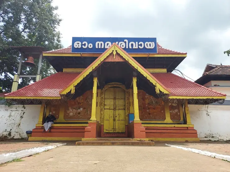
At Erattupetta the first place of worship, by local account, is the Angalamman Kovil standing at the point where the two rivers join, and the second is the Bhagavathy temple at Nadakkal, built by the Poonjar Koyikkal Thampurans and still run in association with the family. The Shivaratri at the Angalamman shrine and the Meena Bharani at the Bhagavathy temple both draw people across caste and religion in a town where that matters. A word of restraint here: Angalamma — Angalaparameswari — is a well-known Tamil village goddess with an elaborate mythology of her own, and it would be easy and wrong to bolt that pan-Tamil cycle onto this shrine. What her name honestly tells you is that Tamil settlers brought her, and planted her at the confluence. We found no local legend text for the shrine itself and are not inventing one.

Erattupetta’s Muslim traditions are unusually specific about people. Islam is said to have reached the town in the first century of the Hijra, carried south from the Kodungallur landing by Malik ibn Habib, nephew of Malik ibn Dinar. Around the 1240s the Chishti saint Sheikh Farid al-Din Ganj-i-Shakar — Baba Farid — is held to have come here, and the Poonjar raja to have granted tax-free land in his honour, on which the Puthanpalli Maqam was raised. Treat that as devotional memory: the historical Baba Farid’s life is documented in Punjab and he died at Pakpattan, and no independent record puts him in Kerala. The second figure is easier to hold. Sheikh Saeed Bava, of a family settled on Androth in Lakshadweep, reached Erattupetta by way of Kochi in Hijri 720 (AD 1320), married into the Methar community, was made khatib of the Nainar mosque, and was buried beside it — and his descendants, the Labbas, have supplied the mosque’s khatib ever since.

One thread we could not pull. Malayalam Wikipedia states that Kottarathil Sankunni’s Aithihyamala — the eight-volume corpus of 126 Kerala legends compiled between 1909 and 1934 — speaks of Erattupetta explicitly. We searched for which of the 126 it is and could not identify it, so we are recording the lead rather than the tale. Similarly, the tradition that St Thomas himself preached here between AD 50 and 72, and that the St George Forane Church at Aruvithura therefore dates to the third century, is flagged as unsourced even on the Malayalam page that reports it. It is what the community believes; it is not what anyone has shown.

More about Pala and Erattupetta highlands

History

Before Travancore, Pala and its hinterland lay under local chieftains called the Meenachil Karthas. Christian settlement in the valley is generally dated from around the ninth century, with families moving in from Palayur and Nilakkal, drawn by chieftains willing to have them, land that suited cash crops, and a river that carried produce down to the trading centres at Athirampuzha and Alappuzha. The church at Pala — Pala Valiyapally, now St Thomas Cathedral — is dated to 1002, founded by four Syrian Christian families; the Lalam Pazhayapally followed in 1683.

The market that made the modern town came later. The Pala angadi was established in the seventeenth century and immediately opened trade towards Tamil Nadu and beyond; Chettiar and Vellalar families settled permanently in the town on the back of it, and pepper and coconut from Pala carried a premium reputation for a long time afterwards. Erattupetta, upstream, was doing the same work from the opposite direction, taking hill produce off the ghats and holding the Poonjar principality’s garrison as well as its market.

The political order changed in 1749, when Marthanda Varma of Travancore took Thekkumkur and absorbed its dependency Meenachil along with it. The Trippadi Danam of 3 January 1750, in which he dedicated his kingdom to Sree Padmanabha, describes the territory as lying west of Thovala fort and east of the Kavanar — that is, the Meenachil under its older name was being used as a boundary marker in the founding document of modern Travancore. The name Meenachil Ar comes into the records after that.

Municipal status arrived at very different moments. Pala’s own sources disagree on the year: the Malayalam account cites an order of the Travancore Maharaja dated 11 December 1947 raising the village union to a municipality, while the English record gives 1 December 1949 — we print both because we cannot reconcile them. Erattupetta was a grama panchayat from 1964 and was upgraded far later, under a state cabinet decision of 13 January 2015, with the municipal council taking office after the following local-body election.

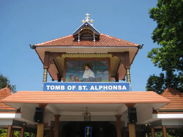
The twentieth century did three things to this country. Rubber replaced pepper and coconut as the crop that mattered, and Pala became its market. Families with too little land to divide any further left, moving up into Idukki and north into Malabar — a migration told in full elsewhere on this site. And the church consolidated: Pope Pius XII created the Eparchy of Palai out of Changanacherry by the bull Quo Ecclesiarum on 25 July 1950, with Sebastian Vayalil appointed the same day and installed in the cathedral on 4 January 1951. Education followed the same curve, from the St Thomas School founded in the Pala presbytery in 1896 to St Thomas College and Alphonsa College; Erattupetta’s first girls’ school, the Muslim Girls’ LP School, opened in 1939.

Why visit

You can stand at the exact point where two rivers become the Meenachil, in the middle of a working market town, without leaving the pavement.

Pala’s cathedral spire, riverfront and church-and-college quarter make a genuine half-day town walk rather than a photo stop.

Erattupetta is the best-stocked place to buy supplies, eat, or hire a jeep before the climb to Illikkal Kallu, Ilaveezhapoonchira or Vagamon.

Two towns thirteen kilometres apart show you Christian-majority and Muslim-majority central Travancore back to back, with the same river running through both.

The Ayyampara rock sheet above Erattupetta gives a long view over the Ghats for the price of a short walk on bare stone.

This is the rubber belt at its most concentrated — tapping panels, sheet-drying sheds and the trade that sets prices, all within a few kilometres of the road.
Before you go

Pala and Erattupetta highlands — at a glance

HoursBoth town centres are busiest from roughly 9 am to 8 pm. Erattupetta market trades early; Pala shops and banks keep standard hours and many close on Sunday, which is the quietest day in a Christian-majority town.

Entry: No entry fee — these are working towns, not ticketed sites. Individual temples, mosques and churches are free to enter where visitors are welcome; the highland viewpoints reached from here may charge their own small fees.

Getting here

How to reach Pala and Erattupetta highlands

Kottayam is the nearest railhead (about 28 km to Pala, 38–40 km to Erattupetta) and Cochin International Airport the nearest airport, on the order of 70–85 km by road. The Ettumanur–Poonjar and Punalur–Muvattupuzha state highways serve both towns; the Erattupetta–Peermade highway is the climb to Vagamon. KSRTC and private buses run frequently between Kottayam, Pala, Erattupetta and Vagamon.

Getting back

Check your return bus or ferry with the operator before setting out. Leave time to reach the stop or jetty after your visit, and arrange a return vehicle in advance for a remote outing.

Ask at the jetty or the stand for the time of the last service back, not the next one. If you miss it, an auto or a taxi is the fallback — agree the fare before you get in.

Plan

Good to know

  • Erattupetta, not Pala, is the practical staging post for the highlands: it is roughly 10 km from the Illikkal Kallu base and about 22–25 km from Vagamon, buses up the ghat start around 5:15 AM, and it is the last place to hire a jeep or buy supplies.
  • The confluence is in the town, not outside it — the Poonjar Ar and Theekoy Ar join beside Erattupetta town centre, which is why the place is spread over three named banks joined by two bridges and three causeways.
  • Time a Pala visit around the arattu if you can: the Lalam Mahadeva temple festival runs ten days in Dhanu (December–January) and ends with the immersion in the Meenachil, and the Kadappattoor temple holds its eight-day utsavam in March–April.
Getting around Pala and Erattupetta highlands

If you need step-free access, contact the site before travelling. Ask about a level entrance, steps along the route, the nearest drop-off point, seating and accessible toilets.

If you need help at Pala and Erattupetta highlands
112All emergencies (police · fire · medical)The single number to call in any emergency (ERSS).

Emergency numbers are verified against official government and state tourism sources. 112 works anywhere in India.

In the district

Where Pala and Erattupetta highlands sits in Kottayam district

Nearest airportCochin (COK), ~75–80 km
Rail gatewayKottayam (KTYM)
District HQKottayam
LandscapeBackwaters & rubber midlands

Kottayam district is known for: Kumarakom on Vembanad Lake — birdlife and lakefront stays.

Kumarakom Bird SanctuaryVembanad LakeBackwater village life
Stay · eat · do · rent · see · shop

Places in Pala and Erattupetta highlands

Every verified place in Pala and Erattupetta highlands — filter by what you’re after.

Sunstar Residency and Food Plaza Pala — Hotel in Pala and Erattupetta highlands
Top pick Verified
Hotel · Pala and Erattupetta highlands
Sunstar Residency and Food Plaza Pala

Kerala Tourism-listed hotel and restaurant in Pala near the KSRTC bus stand. Sunstar Residency and Food Plaza, Pala, Kottayam, Kerala 686575 · Pala, Hotel, Restaurant.

Directions Commission-freeView details
PWD Rest House Erattupetta — Government rest house in Pala and Erattupetta highlands
Top pick Verified
Government rest house · Pala and Erattupetta highlands
PWD Rest House Erattupetta

District-listed PWD rest house in Erattupetta for the highland side of Kottayam. Erattupetta, PWD rest house, District listed.

Directions Commission-freeView details
PWD Rest House Pala — Government rest house in Pala and Erattupetta highlands
Verified
Government rest house · Pala and Erattupetta highlands
PWD Rest House Pala

District-listed PWD rest house in Pala for eastern Kottayam routing. Pala, PWD rest house, District listed.

Directions Commission-freeView details
M
Maharani Restaurant Pala
Where to eat
Top pick Verified
Town restaurant · Pala and Erattupetta highlands
Maharani Restaurant Pala

Maharani Restaurant Pala is better treated as the restaurant inside Hotel Maharani rather than a loose social-only food record. The direct Hotel Maharani source describes Flavours Restaurant as a multi-cuisine restaurant at the Pala city hotel. Pala-and-erattupetta-highlands, eat, Town restaurant.

Directions Commission-freeView details
S
SRTO Pala
Things to do
Top pick Verified
Transport office · Pala and Erattupetta highlands
SRTO Pala

Official Sub Regional Transport Office in Pala municipality. Government service · Pala, Transport, Government office.

Directions Commission-freeView details
H
Hotel Maharani Pala
Place to stay
Top pick Verified
Hotel · Pala and Erattupetta highlands
Hotel Maharani Pala

Hotel in Pala and Erattupetta highlands. Hotel Maharani, Pala Main Road, Pala, Kottayam, Kerala 686575 · Pala, Hotel, Restaurant.

Directions Commission-freeView details

Book with the place itself. India’s cyber-crime coordination centre warned in April 2025 that convincing copies of hotel and pilgrimage booking sites are being pushed through sponsored search and social ads, taking payment for rooms the property never hears about. Every listing here links to the business’s own contact details and its own Google or Bing profile — we take no commission and sit in nobody’s payment path. If a booking page reached you through an ad, check the address bar against the property’s own site before you pay. Fraud can be reported on cybercrime.gov.in or on 1930.

Places to visit

The places themselves, around Pala and Erattupetta highlands

The best tourist places to visit in Pala and Erattupetta highlands — temples, viewpoints, lakes, heritage and nature, each with a full guide, how to reach it and what to see nearby.

Illikkal Kallu, Pala and Erattupetta highlands
PlaceIllikkal Kallu

Rocky highland viewpoint popular as a day trip from Kottayam and Pala.

Open guide →
Marmala Waterfalls, Pala and Erattupetta highlands
PlaceMarmala Waterfalls

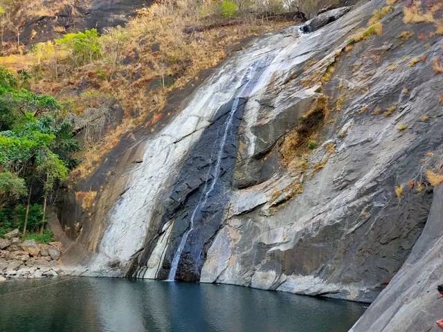
Waterfall reached from the Teekoy/Erattupetta side of the district.

Open guide →
Ilaveezhapoonchira, Pala and Erattupetta highlands
PlaceIlaveezhapoonchira

A high grassland basin ringed by hills in eastern Kottayam, famous for sunrise, sunset and monsoon-green meadows.

Open guide →
Meenachil river valleys, Pala and Erattupetta highlands
PlaceMeenachil river valleys

Meenachil river valleys is a tourist place in Pala and Erattupetta highlands used for route planning, visit timing, and nearby stays, food, transport and local services across Pala and Erattupetta highlands, Kottayam, Kerala, India. Use this guide to plan the route, check access context and find relevant local options as verified listings are added.

Open guide →
A
Alapra
No photograph yet
PlaceAlapra

A quiet upland picnic and viewpoint area in eastern Kottayam, best treated as a low-facility daylight stop with the final road checked locally.

Open guide →
A
Anjukuzhi Waterfall
No photograph yet
PlaceAnjukuzhi Waterfall

A seasonal cascade in the Erumeli side of Kottayam whose pools and rock shelves can change quickly after rain; it is not a guaranteed swimming site.

Open guide →
A
Ayyampara Hills
No photograph yet
PlaceAyyampara Hills

A local hill landscape near Thalanad in the Meenachil highlands, offering valley views without the managed facilities of a ticketed viewpoint.

Open guide →
K
Kottathavalam
No photograph yet
PlaceKottathavalam

A hilltop rock shelter and viewpoint associated with local royal-travel traditions; the uneven ascent and unguarded stone terrain require a dry daylight visit.

Open guide →
M
Muthukora Hills
No photograph yet
PlaceMuthukora Hills

A lesser-known Kottayam highland walk where the legitimate trailhead, land access and weather-safe return should be confirmed with local guidance.

Open guide →
For hotels, homestays and local businesses

Get listed in Pala and Erattupetta highlands for free

Roampedia is commission-free. Travellers discover your business, book directly and contact you through official details. Basic listings are free, while Gold and Platinum package upgrades can be requested from the owner dashboard after approval.

List your business — free
Read before you go

Pala and Erattupetta highlands guides, stories & itineraries

We have not published a story about Pala and Erattupetta highlands itself yet. These cover Kottayam, the district it sits in, and travel in Kerala generally.

Around Pala and Erattupetta highlands

These are written about individual places you can reach from Pala and Erattupetta highlands, rather than about the town as a whole.

Kerala-wide guides & itineraries

Route-level itineraries and practical guides for the rest of the state.

See all 35 Kottayam guides & stories →

Map

Where things are in Pala and Erattupetta highlands

FAQ

Pala and Erattupetta highlands travel FAQs

What does the name Erattupetta mean?

It comes from Eeraattida, “the place between two rivers” — the Poonjar Ar and the Theekoy Ar meet at the town and become the Meenachil. The name passed through the forms Eerapoli, Eerapuzha and Eerattupuzha before settling as Erattupetta; peta or petta means a trading place or market suburb. The change from “puzha” (river) to “petta” (market) records the town’s own shift from village to commercial centre — and the Aruvithura church still proclaims new office-bearers using the older name, Eerattupuzha.

Where does the name Pala come from?

Two explanations circulate and neither is settled. One says the Meenachil was once called Palazhi, the mythic ocean of milk, and that Pala is a contraction of it. The other credits the Palaath Chettiar who founded the town’s market in the seventeenth century. Older land records call the place Lalam. We print both traditions because the sources genuinely disagree.

Which is the better base, Pala or Erattupetta?

Erattupetta, if the hills are the point: it is about 10 km from the Illikkal Kallu base and roughly 22–25 km from Vagamon, with regular buses up (first around 5:15 AM), and it is the last substantial market before the ghat road. Pala, about 13 km downstream, has more hotels, banks and hospitals and better bus links to Kottayam and Kochi, but adds half an hour each way to any highland trip.

How do I reach Pala and Erattupetta?

Kottayam is the nearest railhead — about 28 km to Pala and 38–40 km to Erattupetta — and Cochin International Airport at Nedumbassery is the nearest airport, on the order of 70–85 km depending on route. The Ettumanur–Poonjar and Punalur–Muvattupuzha state highways run through both towns, and the Erattupetta–Peermade highway is the road that climbs to Vagamon. Buses are frequent on all of these.

Is there anything to see in the towns themselves?

Yes. In Pala: St Thomas Cathedral with its clock-tower spire, the Lalam Mahadeva Temple in the town centre, the Kadappattoor Mahadeva Temple on the river, and the riverside walk. At Erattupetta: the confluence itself, the Nainar and Muhyiddin mosques, the Angalamman Kovil at the meeting of the rivers, the St George Forane Church at Aruvithura with its 15-ft Christ figure on a 120-ft tower, and the Ayyampara rock just outside town.

When is the best time to come?

October to February is the most comfortable, with clear air for the highland views above both towns. June to September brings heavy rain — annual rainfall at Pala averages around 2,840 mm — which makes the country spectacularly green but the ghat roads and the waterfall trails slippery and sometimes unsafe. If you want temple festivals, the Lalam arattu falls in Dhanu (December–January) and Kadappattoor’s eight-day utsavam in March–April.

Why is Pala so associated with rubber?

Rubber spread across the Meenachil highlands through the twentieth century, replacing pepper and coconut as the crop that paid, and Pala became the principal market for the taluk’s rubber, pepper and coffee. Local accounts state the connection flatly: living standards in and around the town track the rubber price. Rubber-based small industry clusters on the town’s outskirts, and the plantations you drive through on the way to the viewpoints are the same economy seen from the road.

What are the best places to visit in Pala and Erattupetta highlands?

Top places to visit in Pala and Erattupetta highlands include Illikkal Kallu, Marmala Waterfalls, Ilaveezhapoonchira, Meenachil river valleys, Alapra, Anjukuzhi Waterfall, and more — each has a full guide with how to reach it and what to see nearby on this page.

Photographs: Praveenp (Public domain), Sajetpa at Malayalam Wikipedia (CC BY-SA 3.0), Sajith Erattupetta (Public domain). Wikimedia Commons.

Image credits