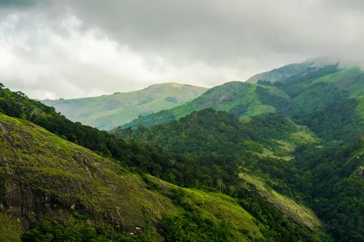
Palakkad town sits in the mouth of the one break in the Western Ghats, and everything about it follows from that. It is the district headquarters of Kerala’s granary, the state’s most densely populated municipality, and one of the five oldest — constituted on 1 November 1866 alongside Kozhikode, Kannur, Thalassery and Fort Kochi. It is also the most Tamil place in Malayalam Kerala: a belt of agraharams runs through the town at Kalpathy, Sekharipuram, Thirunellayi and Noorani, and ml.wikipedia describes the local speech flatly as a mixed language. Add the headquarters of one of India’s oldest railway divisions, the industrial estate at Kanjikode, and two standing water arrangements with Tamil Nadu, and you have a town that has spent two thousand years being a doorway rather than a destination.
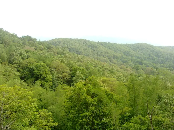
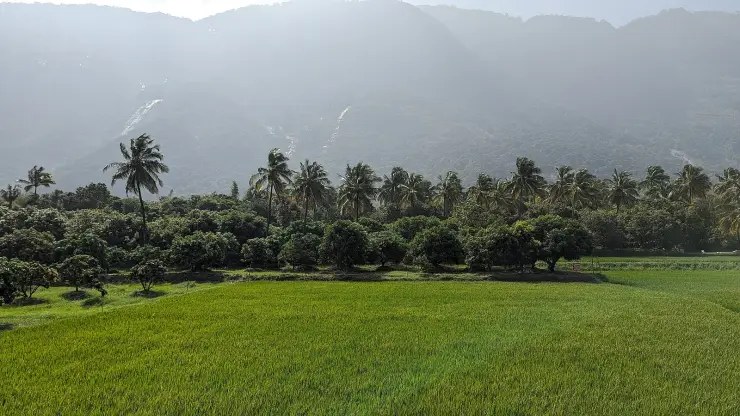
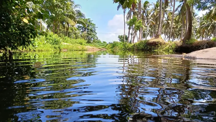
Start with the water, because the town’s shape depends on it. Palakkad stands on the northern side of the Bharathapuzha system, and two of that river’s main tributaries — the Kalpathipuzha and the Kannadipuzha — run through the city itself. This is the flattest, hottest and driest corner of Kerala, a plain rather than a coast, and the paddy that gives the district its “granary of Kerala” nickname grows on the alluvium these rivers lay down. In the dry months the Kalpathipuzha runs shallow and braided, grass islands standing above the water; in the southwest monsoon it fills bank to bank. The district as a whole covers 4,480 sq km, the second largest in Kerala after Idukki, and about 1,360 sq km of that is forest.
The town’s most distinctive feature is not a building but a demographic one. Palakkad has the deepest Tamil layer of any place in Kerala, and it is not confined to Kalpathy. The agraharam — two rows of tile-roofed houses sharing walls and facing each other across a single street, with no private courtyard — is the standard settlement form across a whole belt of the municipality. Kalpathy alone is five hamlets (Old Kalpathy, New Kalpathy, Chathapuram, Govindarajapuram and Manthakkara), and beyond them lie Sekharipuram, Thirunellayi, Noorani, Vadakkanthara and Moothanthara. Sekharipuram runs a chariot festival of its own. Walk any of these streets at dawn and the sound is Sanskrit recital and Tamil conversation, with rice-flour kolams drawn fresh on every doorstep.
That layering shows up hardest in how people speak. The Malayalam Wikipedia article on Palakkad does not call the local dialect a variety of Malayalam at all — it calls it a സങ്കര ഭാഷ, a mixed or composite language, and then breaks it down: near-pure Tamil in the border tracts, what it calls Mylapore Tamil inside the agraharams, clean Malayalam in the Valluvanad villages, and a less-pure Malayalam across the Palakkad, Mannarkkad, Alathur and Chittur taluks. It adds two more layers most visitors never hear about — Telugu-speaking weavers settled around Chittur, and the tribal languages of Attappady and Parambikulam. The Palakkad Iyers themselves are usually described as speaking Tamil at home and Malayalam outside it, in the same day, without comment.
The town’s largest cultural export is Carnatic music, and specifically percussion. Palghat T. S. Mani Iyer (1912–1981) was the first mridangist to receive the Sangeetha Kalanidhi, in 1966, having taken the Sangeet Natak Akademi award in 1956 and the Padma Bhushan in 1971; he is counted with Palani Subramaniam Pillai and Ramanathapuram C. S. Murugabhoopathy as the “holy trinity of mridangam”. His contribution was to stop the drum keeping time and make it answer the singer phrase by phrase. Be careful with the honesty of that “Palghat”, though: he was born at Pazhayannur, which sources place variously in Cochin State and in the old Palghat district, and which is in Thrissur district today. The prefix marks a musical lineage, not a birth certificate — and his centenary was duly marked at Kalpathy.
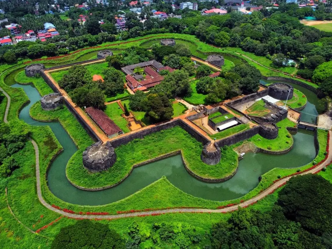
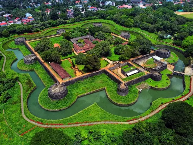
Around the fort, the street names are still the garrison’s. Sultanpet, Pirangi Theruvu (cannon street), Pattani Theruvu and Pattanipadam, Pallitheruvu, Kottachantha, Karnakiyamman Kovil and Diara Street are all listed on the Malayalam Wikipedia page for the fort as places tied to the Mysore period, and they read as a map of an eighteenth-century military town: the sultan’s quarter, the gun line, the Pathan cavalry lines, the mosque street, the fort market. None of this is signposted and none of it is a monument. It is simply the town plan, and it is the single easiest thing to walk in Palakkad if you want the frontier to feel real rather than commemorated.
Palakkad is a railway town in a way few Kerala towns are. The Palakkad Railway Division of Southern Railway was formed on 4 August 1956, making it one of the oldest divisions in India, and it is headquartered here; it manages 588 route kilometres of track across Kerala, Tamil Nadu, Karnataka and Mahé in Puducherry. The town has two stations — Palakkad Junction, which is actually at Olavakkode about 4 km from the municipal bus stand, and Palakkad Town in the centre. At Kallekulangara sits the Hemambika Nagar railway colony, which houses the division’s staff and contains the only school in Kerala run by Southern Railway, along with the division’s training institute for Group C and D employees.
Thirteen kilometres east, where NH544 runs on toward the border, is Kanjikode — the second largest industrial area in Kerala after Kochi. The estate carries Instrumentation Limited, Indian Telephone Industries, the Fluid Control Research Institute, Saint-Gobain (formerly SEPR Refractories), BEML, Patspin, Rubfila, Marico, United Breweries and Empee Distilleries, among others. The Indian Institute of Technology Palakkad — the first and, at the time of writing, only IIT in Kerala — was established here, and the Walayar checkpost on the state border is a few kilometres further on. It is an unglamorous stretch of dual carriageway, hoardings and factory gates, and it is the most economically consequential thing in the district.
Two long-running water arrangements with Tamil Nadu run through this town’s administration, and both are worth understanding before anyone tells you Palakkad is simply Kerala’s rice bowl. The Siruvani dam, about 46 km from the town, stands in Palakkad district but was built to supply drinking water to the city of Coimbatore: an agreement was executed in August 1973 between the two state governments, and the works were carried out by the Kerala Public Works Department using funds provided by Tamil Nadu. The second is the Parambikulam–Aliyar Project. The Parambikulam dam is in Palakkad district and its ownership rests with Kerala, but it is operated and maintained by Tamil Nadu.
Under that agreement Kerala was to receive 7.25 tmcft a year out of an effective storage of 13.41 tmcft. In 2004 no water came after 10 February and paddy dried across thousands of acres in Chittur taluk; by July 2006 the state’s water resources minister was calling for the agreement to be reviewed, and an accord between the two states was finally reached on 17 October 2012. The Palakkad Gap is usually described as a corridor for armies, trains and lorries. It is also a corridor for water, and the water runs the other way.
For all that, the town keeps an ordinary civic life. Government Victoria College counts E. M. S. Namboodiripad, V. R. Krishna Iyer, M. T. Vasudevan Nair, O. V. Vijayan, T. N. Seshan and E. Sreedharan among its alumni; NSS College of Engineering, opened in 1960, was the fourth engineering college in Kerala; Mercy College, founded in 1964, was the district’s first women’s college. And the town has a festival of its own that owes nothing to the agraharams: the Manappullikavu Vela, held between the last week of February and the first week of March, opens with a kodiyettam on a bamboo pole, runs a week of poojas and evening programmes, and ends with a Vela day whose fireworks go up around nine at night and again around four in the morning. Smaller velas from West Yakkara, Vadakkanthara, Vennakkara and Koppam converge on it, and the day is declared a local holiday.
Legend & myth
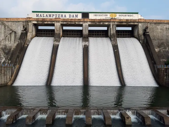
Nobody agrees on what this town is called. The commonest reading makes Palakkad a fusion of pāla, the Malayalam name for the blackboard tree, Alstonia scholaris, and kāṭŭ, forest — the forest of pala trees. A second reading takes it from the Sangam classification of landscapes and puts the region in the palai thinai, the arid tract; the Malayalam Wikipedia article prints this one and then rejects it itself, on the sensible ground that a place with this many rivers is not a desert. A third, credited there to the historian V. V. K. Valath, is the most interesting: in early Dravidian belief the pala was a deity-tree, held to be the dwelling of the yakshan and the yakshi, so the name would mark a grove of the goddess’s tree rather than merely a stand of timber. A fourth derives it from Pali, the language of the Buddhists, by way of Palighat; a fifth, credited to K. V. Krishna Ayyar, reads it as pāra-kāṭu, rock-forest. We cannot settle it and neither can anyone else. The yakshi in that third reading is worth being precise about, though, because there is a famous Yakshi at Palakkad and it is not this one. The concrete sculpture people photograph is a modern work at Malampuzha, and it belongs to that record and to its own argument. The yakshi of the etymology is older and stranger — a tree-spirit of pre-temple Kerala, worshipped alongside the ficus and the marutu, and if Valath is right she is the reason the town has the name it does.
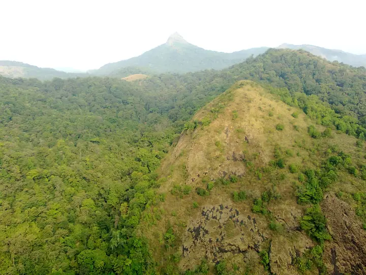
The town’s oldest surviving legend belongs to Kallekulangara, five kilometres out, and it explains both a temple and a place name. The story is set in the time of Adi Shankara. A Durga shrine stood on a hilltop in dense forest some fifteen kilometres away, on the far side of what is now the Malampuzha reservoir, and two Namboothiris — Kuroor and Kaimukku — walked there and back every single day for years. One day, worn out by age and the road, they stopped to rest under a tree, and an old woman appeared and gave them fruit. The next morning, passing the same tree, they saw an elephant standing there, and beside it Jagadambika in a blaze of gold. After that they went no further than the tree.
Age caught them anyway. One night the goddess came to Kuroor in a dream and told him she would take up residence in the pond nearby. The two men went down to bathe the next morning and saw two hands rising out of the water. Knowing whose they were, they swam out — old as they were — and reached for them, and in that instant both hands turned to stone. That is what Kallekulangara means, the stone in the pond. The two of them filled in that part of the water, built a shrine over the spot, and spent the rest of their lives serving it.
The deity at Kallekulangara is still, uniquely, a pair of palms — the two hands of Adiparasakti held in the gesture of blessing — which is why the Hemambika temple is also called the Kaipathi Kshetram, the temple of the hand. Tradition counts it as one of four Ambika shrines installed for the protection of ancient Kerala, with Kollur Mookambika, Lokanarkavu Lokambika at Kozhikode and Balambika at Kanyakumari; a separate tradition holds that the shrine was consecrated by Parasurama. Both are claims of tradition rather than record, and they sit alongside each other without being reconciled. The goddess is worshipped in three aspects — Mahasaraswati, Mahalakshmi and Mahakali — with a different payasam offered at each of the three times of day. Navaratri is the only festival; there is no kodiyettam here at all. Childless couples who receive a child return after six months to lay the baby before her and offer a cradle, a vazhipadu known as kutti-um-thottilum.
Then there is the story about the hand on the ballot paper. Indira Gandhi visited this temple with K. Karunakaran, and photographs of the visit are still kept there; what visitors are told is that the Congress party’s hand symbol was chosen because of the blessing palms at Kallekulangara. It is the best-loved thing anyone in Palakkad will tell a stranger, and the dates do not support it. The Malayalam Wikipedia article dates the visit to 1982, while the faction that carries the hand — Congress (I) — was created in the 1979 split and recognised as the Congress by the Election Commission in 1981. Unless the visit was earlier than the temple’s own account of it, the symbol was already in use before Indira Gandhi ever stood in front of those hands. We print it because it is a genuine local tradition, not because it is true.
The second great legend arrives from outside, on foot, and it is the frontier story in its purest form. After Kannaki burned Madurai — the Silappadikaram’s ending, and she is held here to be an aspect of Bhadrakali — she is said to have travelled towards Kodungallur, and to have stopped on the way at Melamuri near Palakkad. There she gave darshan to the Palakkad ruler Sekharivarma and settled, self-manifested; he built her the temple known as Naduppathimandam. Two sisters are said to have travelled with her, one settling at Pirayiri and one at Thirunellayi, where they are worshipped as Kannukkottu Bhagavathy and Kannadathu Bhagavathy. Both those temples still stand.
The people who walked with them are the point. A community that fled Madurai is said to have followed the goddesses south — the Moothans, a Vaishya caste, whose first settlement here is Moothanthara, still a neighbourhood of the town. Of Tamil descent, they took Malayalam as their mother tongue, which is exactly what marks them off from the district’s other Tamil-origin communities. The Naduppathimandam temple was destroyed, along with most of Palakkad’s temples, during Tipu Sultan’s campaigns, and the idol was carried to Vadakkanthara — first into the Tharavath Nair tharavadu, later to the foot of an atthi tree beside the Ramapuram Vishnu temple, where a sreekovil was eventually built around the standing tree. Because the form worshipped is Vanadurga, the sanctum has no roof to this day, and the west-facing image is barely a foot high and unfinished. The reason given is that the Moothans carried a part of Kannaki away with them to Moothanthara, and she has been incomplete ever since.
Smaller etymologies fill in the rest of the map. Manappullikavu is said to take its name from the madappalli, the kitchen in which a Brahmin perfected his worship of the goddess; the surrounding Yakkara is read as Yagakkara, the ground where agnihotra sacrifices were performed. At Kalpathy the tradition is that a Tamil Brahmin woman from Mayavaram carried the jyotirlinga back from Kashi, which is where the proverb Kashiyil paathi Kalpathy — half of Kashi is Kalpathy — comes from. The Kalpathy record carries that one properly; it belongs there, not here. And two famous stories that Palakkad often gets credited with are not this town’s at all, which is worth saying plainly. The Konganpada, in which the Chittur Bhagavathy destroys a Kongu army that attacked in 918 CE, and in which a rock called Valuvechapara is still shown as the stone where she washed her sword afterwards, belongs to Chittur, some way east of here, and is enacted there each Kumbham by four named families. The great vela of the district is the Nenmara Vallanghy Vela, and that belongs to Nenmara. Palakkad town has enough of its own without borrowing either.
More about Palakkad town
History
Palakkad enters the record as a pass rather than a place. The Sangam works — Akananuru, Purananuru, the Silappadikaram and the Manimekalai — carry references to the Palakkad gap, which was then the way into Kerala from the east. Roman coins found at Padiyur, beyond the gap near Coimbatore, strengthened the conclusion that the main trade road between Kodungallur and the Coimbatore country ran through it. What the town owes to that is not romance but position: for two millennia the traffic came this way because there was no other way for it to come.
The early political history is a sequence of people who used the pass. The Cheraman Perumals are recorded as ruling here from around the first century CE, after which their subordinates split the territory into small chieftaincies. When the Pallavas of Kanchi pushed into Malabar, Palakkad was their main staging post — the place names Pallavur, Pallassena and Pallavanchathannur are read as the residue of that occupation, and William Logan noted the point in the Malabar Manual. At the end of the ninth century the ruler of Nedumpurayur beat back an invading Kongu army at Chittur with help from Eranad, Valluvanad and Perumpadappu; the Nedumpurayur family later became known as the Tarur Swaroopam and as the Palakkad Rajasvaroopam. Their original seat, curiously, was at Athavanad in what is now Tirur taluk in Malappuram; those lands went to the Azhvanchery Thamprakkal and the Palakkad–Chittur country was acquired in their place.
In 1757 the Zamorin of Kozhikode attacked and subdued Palakkad, and the Palakkad Raja sent to Hyder Ali of Mysore for help. What that appeal set in motion — Mysore’s arrival in Malabar, the fort of 1766, the Anglo-Mysore wars and the town changing hands four times — is the fort’s story and is told in full on the fort’s own page. The consequence for the town was that Tipu Sultan ceded Malabar to the East India Company in the 1790s under the Treaty of Seringapatam; Malabar was annexed to the Bombay Presidency in 1792 and transferred to the Madras Presidency in 1800, and Palakkad spent the next century and a half as a district town of British Madras.
It became a municipality on 1 November 1866, under Madras Act 10 of 1865, in the same batch as Kozhikode, Kannur, Thalassery and Fort Kochi — the oldest modern municipalities anywhere in present-day Kerala. Government Victoria College belongs to the same civic moment, though the sources disagree about when: the college’s own Wikipedia article says it was started in 1866, while the article on the town says it opened in 1888. We print both, because we could not reconcile them. By the 1951 census Palakkad was the second largest city in Malabar District after Kozhikode, and one of only two settlements in Malabar then treated as cities at all.
The town’s hardest twentieth-century episode happened at Kalpathy in 1924, and it is a matter of civic history rather than festival colour. The road through the agraharam was a government-funded and government-maintained public road, and it was closed to the so-called avarna castes. Ezhavas in Palakkad organised and walked it. The Madras Presidency issued an order permitting them to enter Kalpathy, and the village’s conservative Brahmins resisted the order anyway; men were beaten for attempting it. A group of Ezhavas converted to the Arya Samaj in response. One young man who was badly beaten converted to Christianity, took the name John Kittu, and was later elected an independent MLA in the first elections to the Kerala assembly. The heritage-village designation is real, and so is this.
The modern district was assembled twice over. Kerala was formed in 1956 and the old Palakkad taluk was divided into three — Palakkad, Alathur and Chittur — and on 1 January 1957 Palakkad district was carved out of the south-eastern part of the former Malabar District of Madras State, taking in Chittur and parts of Alathur that had belonged to the Cochin kingdom. The Palakkad Railway Division was constituted a few months earlier, on 4 August 1956. One further change reshaped the town’s society rather than its map: the Kerala Land Reforms Act of 1963, which ended the tenancy system, is described as having affected the Palakkad Iyers more severely than almost any other community in the state.
Why visit
It is the only town in Kerala where you can walk a genuine agraharam street — two rows of wall-sharing, tile-roofed houses facing across a single lane — and then find four or five more of them within the municipal limits.
The Hemambika temple at Kallekulangara has a deity found nowhere else in Kerala: two stone palms raised in blessing, with a founding legend that explains the name of the place they stand in.
Palakkad is a working railway town, headquarters of a Southern Railway division formed in 1956 that runs track across four states, with two stations and a railway colony of its own.
It is the practical base for the district: the fort is in the centre of town, Kalpathy is about 3 km out, Malampuzha around 10 km and the Kanjikode belt 13 km east on NH544.
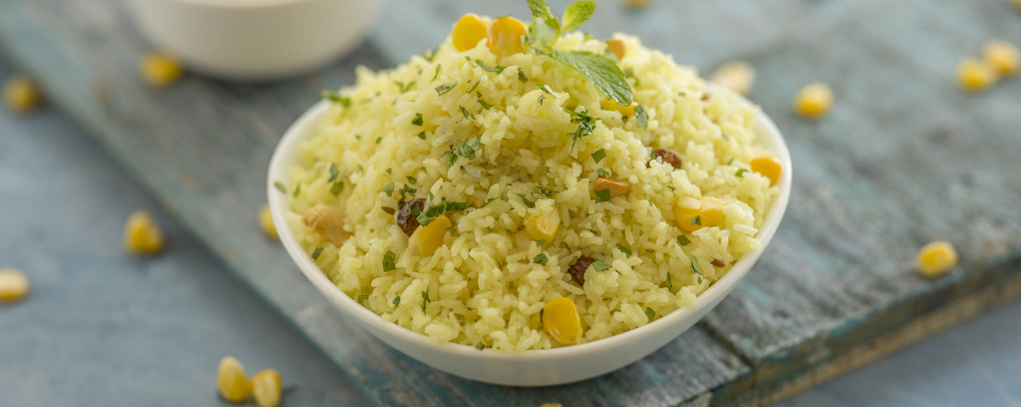
The food and the language are genuinely different from coastal Kerala — a Tamil-Brahmin vegetarian tradition sitting beside Malabar cooking, and a dialect that Malayalam sources themselves call a mixed language.
Manappullikavu Vela, in late February or early March, is the town’s own festival rather than a borrowed one, and Vela day is a declared local holiday.