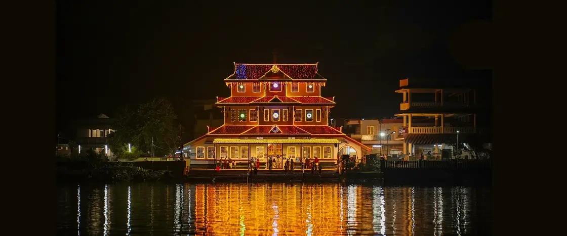
Parassinikadavu is a village on the west bank of the Valapattanam river in Taliparamba taluk, about eighteen kilometres north of Kannur town and six south of Taliparamba, and since 2015 it has been ward 14 of Anthoor municipality. Its name ends in kadavu — a river crossing — and the crossing is the point of the place: this is where the road met the water, and where the water was until recently the road. The river here is Kannur’s longest and widest, and the village sits in the crook of it, its shops and lodges stacked up the slope, its famous madappura facing east onto water it cannot be entered from. Around that shrine has grown a pilgrim economy of free meals, free sleeping halls and small hotels; a kilometre away are a snake park run by a snakebite-treatment society and a co-operatively owned water park. Underneath all of it runs an argument about sand.
Begin with the word. A kadavu, in Malayalam, is the place where you get to the water and across it — the landing where a ferry put in, the steps where the village bathed, the point where a road ran out and a boat took over. Kerala is stitched with them, and dozens of settlements carry the word in their names. At Parassinikadavu the crossing has been superseded: a road bridge now carries traffic straight over the Valapattanam, and the deck runs out from the village towards a laterite bluff of houses and coconut on the far bank. What the bridge did to the ferry it did quietly, but the name did not change, and neither did the shape of the village, which still turns its face to the river.
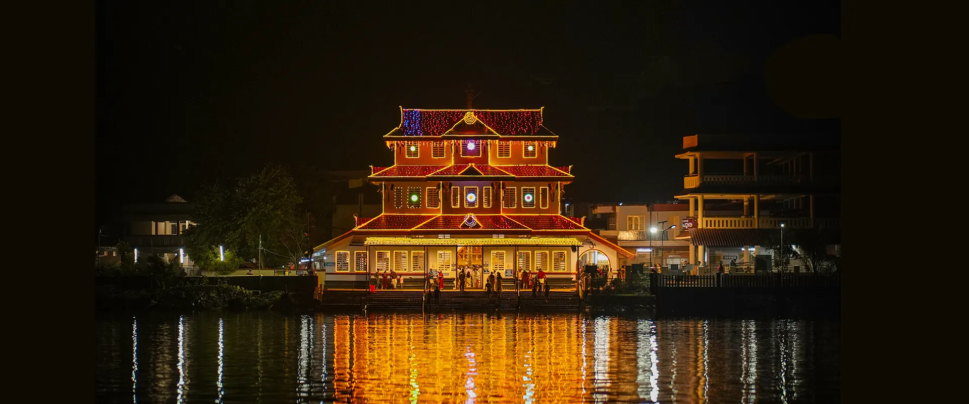
The geography of the settlement is unusual and worth knowing before you arrive. The madappura stands at the middle of the village on the west bank and faces east, towards the water — but because the river is directly in front of it, there is no entrance on that side. Everything else is behind: the devaswom office in the southern row, the hall built for choroonu, the first rice-feeding, in the northern row, and beyond them the hotels, lodges and shops. Coming down from the main road you take a set of hairpin bends and then a flight of steps to reach the shrine. It is a short walk that catches people out, and anyone with limited mobility should plan for it.
The institution at the centre of the village is administered, not merely worshipped at. The temple is a Thiyya ooraima shrine, and like many temples in the Malabar Devaswom Board’s territory it is run by trustees rather than by a state board directly; the chief trustee is the eldest karanavar of the Parassini Madappura tharavad, who is known as the Madayan. Offerings are made to the Madayan as well as to the deity — vecheringattu, a steamed mixture of plantain, pepper, turmeric and salt, and neerkari, of rice flour, salt, turmeric and pepper — and the pattern of a hereditary household holding a public trust is the most durable fact about this place. The shrine gates are open from about five in the morning to eight in the evening, and are not closed through the middle of the day as most Kerala temples are.
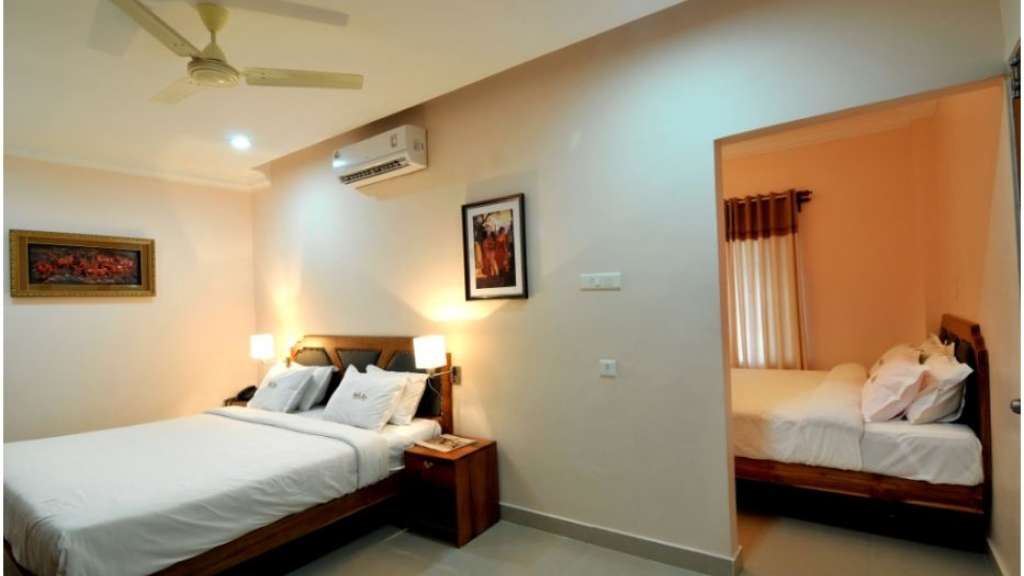
The hospitality is on an institutional scale and is genuinely free. The madappura’s own listing gives tea, steamed rice-and-coconut prasadam through the day from about half past seven in the morning to eight at night, lunch from half past twelve to half past two, and dinner from half past eight to half past nine. Free accommodation is provided, with separate halls for men and women and sleeping mats laid out; members of the Madappura family also run lodges in the village on a commercial footing. Nobody books the free halls. The result is a village whose population swells and shrinks daily, and a small-business economy — tea shops, sweet stalls, a bakery, a couple of general stores and half a dozen lodges — sized for a congregation rather than for its 28,000-strong municipality.
That congregation has a calendar, and the calendar is not what most visitors assume. The temple year’s first Thiruvappana is Puthari Thiruvappana on Vrischikam 16, which usually falls on 1 or 2 December and is tied to the first cut of the harvest; the last Thiruvappana of the year falls on Kanni 30, around the middle of October. Between Thulam 1 and Vrischikam 15 — roughly mid-October to the end of November — Thiruvappana is not performed at all, and it is also suspended on the amavasi days of Karkidakam and Makaram, on the temple’s nira day, and on any day a death occurs in the Madappura family. English-language sources additionally describe a three-day Thiruvappana Mahotsavam on Kumbham 19, 20 and 21, corresponding to about 3–5 March. Anyone travelling specifically for the ritual should telephone the madappura first rather than trust a general guide.
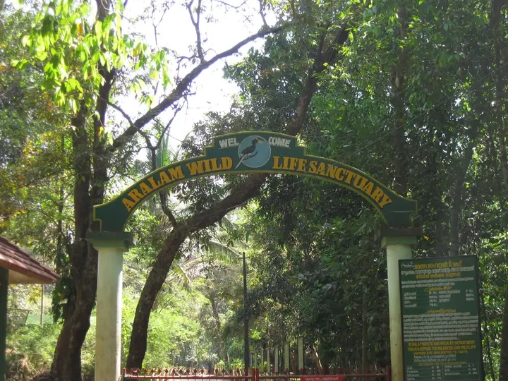
A short walk from the shrine is the Parassinikadavu Snake Park, and its own gate board settles a question the guidebooks fudge: it reads, in Malayalam and English, “Parassinikkadavu Snake Park — a unit of Pappinissery Vishachikitsa Society”, with a society registration number and a Parassinikkadavu post-office address. The Pappinisseri Visha Chikitsa Kendram, eight kilometres downriver, was started in 1964 in memory of C. P. Kumaran Vaidyar as a centre for snakebite treatment and for clinical and literary work in agada tantra, the toxicology branch of ayurveda, and it has documented an enormous number of envenomation cases since. The park is therefore not a roadside attraction that happens to keep snakes; it is the public-facing arm of a treatment institution.
What the park actually holds is worth stating plainly rather than romantically. Malayalam and English accounts agree on around 150 kinds of snake, including the spectacled cobra, king cobra, Russell’s viper, krait and pit vipers, a large collection of non-venomous species and several pythons, with air-conditioned enclosures built for the king cobras. Monkeys, jungle cat, monitor lizard and crocodile are kept alongside, and owls, guinea fowl, kites and peafowl. Demonstration classes run at roughly hourly intervals, and the stated purpose of the handling shows is to dismantle fear and superstition about snakes rather than to thrill. Malayalam Wikipedia also records a long-standing plan for a venom-extraction research laboratory on site; treat that as an intention rather than a fact until you see it.
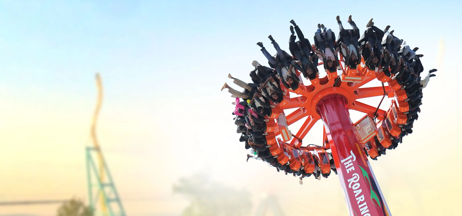
The third institution here is a co-operative, and it explains more about modern Kannur than either of the others. Vismaya, the amusement and water park a couple of kilometres away, is developed and run by the Malabar Tourism Development Co-operative Ltd, registered on 15 February 2000 and functioning from 9 March that year. The reason it exists is set out in its own account: employment in Malabar, and especially in Kannur, had been concentrated in cloth — handloom above all — and in khadi, beedi and pottery, and all of those trades were in trouble. The co-operative was formed to move some of that labour into tourism. The park opened formally in August 2008, occupies about two acres and runs entirely on rainwater collected in a reservoir holding some fifty million litres.
The co-operative habit runs through the village square too. The building at the Parassinikadavu junction carries the board of the Morazha–Kalliasseri Service Co-operative Bank, Parassinikadavu branch, with a hotel, a bakery and a general store under it — the ordinary furniture of a Kerala village, in which the bank is as likely to be a co-operative society as a nationalised branch. Kannur’s largest experiment of this kind was Kerala Dinesh Beedi, launched in 1969 after private beedi firms moved out of the state rather than implement the Beedi and Cigar Workers Act, throwing thousands of rollers out of work; the E. M. S. Namboodiripad ministry put in ₹13.5 lakh of share capital and a ₹7 lakh working-capital loan, and by the mid-1990s the society was producing billions of beedis a year. Beedi rolling and weaving were the trades of this river bank long before pilgrims were.
Downstream, the same river carries the district’s heavy industry. At Valapattanam, seven kilometres north of Kannur city and the smallest panchayat in Kerala at just 2.04 sq km, stands The Western India Plywoods Ltd — incorporated in 1945, grown out of a sawmill and tea-chest works, and long described as the country’s biggest wood-based integrated complex and once the largest plywood factory in South-East Asia. It employs around 1,200 people, installed a hardboard plant of 12.5 tonnes a day between 1956 and 1958, and a synthetic resin unit in 1959. Timber came down this river for a very long time, and the industry that grew at its mouth is the reason Valapattanam’s Malayalam name is glossed as valiya pattanam, the big town.
Legend & myth
The village’s own piece of lore is its name, and it is a modest one. Malayalam Wikipedia records what the old people of the place say: that a grove beside the crossing was called Parachikkadu, and that Parachikkadu-kadavu wore down over time into Parassinikadavu. That is folk etymology, offered as such and not as documented derivation, and it should be held loosely. But it is the right kind of story for this coast, where kadu means a wood and where the wooded patch by a landing is exactly the sort of ground that acquires a name, a spirit and eventually a shrine. The place is named for trees and a river crossing, in that order, and the god comes third.
It is worth pausing on the word kadavu itself, because it is doing more work here than a tourist would guess. A kadavu is the landing: the ferry point, the bathing steps, the place where a village meets its river. In North Malabar it is also a common suffix — Manikkadavu upstream, Poithumkadavu down towards Valapattanam, Uchathukayam where the Payyavur river comes in. And in modern Kerala it has a second, bureaucratic life: under the state’s river-sand regulation the licensed extraction points are themselves called kadavus, so that in a 2015 environmental clearance the government was granting permission at fifty-eight kadavus out of eighty-one. A word for a place of arrival became a word for a place of removal. Parassinikadavu sits at the head of the most contested stretch of it.
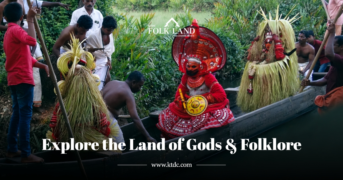
The living custom of the shrine that belongs to the village rather than to the god concerns a family. By tradition the annual festival does not begin at the temple at all: a man of the Thayyil tharavad sets out in procession from the family house at Thayyil, an old coastal hamlet now swallowed by Kannur town, walks to the shrine, and makes the offerings that open the festival. The custom is still kept. It is a reminder that a madappura is not a temple in the Brahminical sense but the house-shrine of a lineage that has widened until it takes in half of North Malabar, and that the right to begin the year is a property held by a named household.
One large temptation has to be refused here explicitly, because it is the most famous thing about this address. The Muthappan cycle — the childless couple at Ayyankara Illam, the boy found by Padikutty, the hunting and the toddy, the drained pots and the palm-tapper turned to stone, the arrow that fell at a bend in the Valapattanam, the poykannu the mother asked her son to wear — belongs to the deity, and this encyclopaedia tells it on the temple’s own page. It is not repeated here. Nor is the daily ritual, nor the offerings, nor the dogs. Two things about that cycle are worth flagging as unsettled even so: the Malayalam and English accounts disagree about where the child was found, one placing it at the Thiruvanchira tank at Kottiyur and the other in the river by the illam, and the illam is placed at Eruvessi rather than at Parassinikadavu in every version. The god arrived here. He did not begin here.
The hill immediately behind the village has lore of its own that survives only in song. Anthoor’s name is glossed as “large village”, and the settlement was split into Anthoor and Morazha because it had grown too big for one; the hill of Anthoor is named in a number of theyyam folk songs and in thottam pattu, the sung invocations that summon a kolam before the dance begins. Nobody has written those verses down for a general reader in English. If you want the lore of this ground rather than of its shrine, that is where it is: in the thottam, sung at village kavus a few kilometres inland, and in Malayalam.
Snakes bring their own belief-world, and the park has an unusual relationship to it. North Malabar keeps sarpakkavus — serpent groves left uncleared in the corner of a compound, with stone nagas at the foot of a tree — and the fear of snakes here is religious as much as practical. The institution that runs the park was built to treat the bite, and its published account of the live demonstrations says the trained handlers work with cobras and vipers in order to quell mythical fears and superstitions about snakes. That is a rare thing to find at a pilgrimage village: an institution whose stated purpose is to take a body of belief apart, standing a few hundred metres from one whose purpose is to keep another alive.
An absence should be recorded honestly, because absences are claims too. We searched in Malayalam — പറശ്ശിനിക്കടവ്, ആന്തൂർ, മൊറാഴ, വളപട്ടണം, ക്ഷേത്രം, ഐതിഹ്യം, ഉത്സവം, തെയ്യം, സർപ്പക്കാവ് — and read the Malayalam articles on the village, on the snake park, on Anthoor municipality, on Valapattanam and on the Valapattanam river, as well as the English ones. Beyond the Parachikkadu name story and the Thayyil family custom, the village carries no separate origin legend of its own that we could find in either language: the lore of this ground has been absorbed by the deity who settled on it. The snake park, the water park and the plywood works are modern built institutions and have no folklore, and we do not invent any for them.
More about Parassinikadavu
History
The river came first, and it is the reason there is a village here at all. The Valapattanam rises in the Brahmagiri hills of Kodagu in Karnataka, runs east through the Malnad villages of Mathyani, Birunani, Poradu, Badagarakeri and Kikkod, then bends sharply west into a narrow, deep valley and drops into the hill country of Kannur. It passes Manikkadavu, Vayathur and Madampam into the Malabar plain, then Srikandapuram, Koyyam — where the Bavali joins — Kandakkai, Parassinikadavu, Kolacheri, Kambil, Narath, Pappinisseri and Azhikode, meeting the Kuppam river and the Arabian Sea at Azhikkal. It is 110.5 km long, the longest and widest river in Kannur district, the tenth longest in Kerala and the fourth largest by volume, and it carries three named islands — Therlayi, Korlayi and Pamburuthi.
For centuries that water was the trade route, and the town at its mouth was the capital. Valapattanam is named for Vallabha II of the Mooshika line, the house that succeeded Ezhimala, and was known as Vallabha-pattanam; Ibn Battuta in the fourteenth century describes the ruler of Ezhimala as residing at Baliapatanam, which suggests political authority had already shifted from the headland to the river mouth, and the Portuguese official Duarte Barbosa in the sixteenth century records Baliapatam as the residence of the king of Cannanore. By 1792 the estuary was being surveyed for the British: John David Spaeth’s Plan of Billiapattam River, published by Dalrymple on 1 November 1792, marks the fort, the bar soundings taken at ebb tide, and Mount Dilly — Ezhimala — to the north. Parassinikadavu is upstream of all of that, one of the crossings on the way in.
Administratively this ground has changed hands repeatedly. Anthoor lay under the Kolathiri, was absorbed into Mysore under Tipu Sultan, and under the British formed part of Chirakkal taluk in Malabar District of the Madras Presidency. After the formation of Kerala it became a grama panchayat of two villages, Anthoor and Morazha. In 1990 the reorganisation of local bodies merged it with Taliparamba to make a single municipality, and in 2015 Taliparamba was bifurcated and Anthoor became a municipality in its own right, with its offices at Dharmashala, an area of 24.12 sq km and a 2011 census population of 28,218. Parassinikadavu is ward 14 of that council.
Morazha, the other half of the municipality, holds the district’s hardest political memory. On 15 September 1940 the KPCC called on the people of Malabar to observe Anti-Imperialist Day; the Congress high command disapproved, but demonstrations were held across North Malabar and Morazha was the centre of the agitation. A clash between a crowd and a police party left Sub-Inspector K. M. Kuttikrishna Menon and Constable Raman dead. The Communist leader K. P. R. Gopalan was sentenced to death for the killings; the sentence was never carried out, after pressure that included Gandhi’s. Anthoor has been a CPI(M) municipality for most of its existence, and at one recent election fourteen of its twenty-eight councillors were returned unopposed.
The industrial history of the lower river is short and heavy. The Western India Plywoods Ltd was incorporated at Baliapatam in 1945, growing from a sawmill and tea-chest works, and added a hardboard plant of 12.5 tonnes a day in 1956–58 and a synthetic resin unit in 1959, later expanded from 200 to 2,400 tonnes a year. Valapattanam also carries a tile works and a cotton mill of similar vintage, and Pappinisseri’s listed trades still read cotton, tile, handloom, plywood and hand weaving. The co-operative answer to the decline of those trades arrived in stages: Kerala Dinesh Beedi in 1969, and the Malabar Tourism Development Co-operative in 2000, whose Vismaya park opened at Parassinikadavu in August 2008.
The most recent chapter is about the riverbed. A 2014 sand audit put deposits along this reach at roughly 315,360 cubic metres, with 22 per cent of it placed off limits. In May 2015 the State Level Environment Impact Assessment Authority cleared sand mining at fifty-eight of eighty-one kadavus in the district, and on 10 May 2016 the National Green Tribunal’s southern bench upheld clearance for the 34.8 km stretch from Parassinikadavu bridge down to Valapattanam bridge, restricting extraction to manual methods and to a depth of three metres or the groundwater level, whichever came first, while keeping bans in place at twelve locations including kadavus in three panchayats around Pamburuthi island. The islanders had objected in numbers: Pamburuthi, home to about 3,000 people, was reported to have shrunk from 125 acres to 90, with salinity appearing in the groundwater. Kerala suspended river sand mining statewide for about a decade before moving to resume it in 2025.
Why visit
To see what a kadavu is: a river crossing that gave a village its name, now spanned by a plain concrete bridge with one of the widest views of the Valapattanam anywhere along it.
To visit one of Kerala’s largest pilgrimage centres as a working settlement — the devaswom office, the choroonu hall, the free sleeping halls and the lodge strip up the slope — rather than only as a ritual.
To spend an hour at the snake park, whose gate board declares it a unit of the Pappinisseri Vishachikitsa Society, and to understand a snakebite-treatment tradition that has been documenting cases here since 1964.
To stand on the bridge and watch the sand economy at work, on a reach that the National Green Tribunal restricted to manual extraction and three metres of depth in 2016.
To take in Vismaya, an amusement and water park built by a tourism co-operative in 2000 precisely because handloom, khadi, beedi and pottery were failing, and run entirely on harvested rainwater.
To use the village as the base for the lower Valapattanam — Pappinisseri’s mangrove park downstream, Valapattanam’s plywood town, and the Kannur University and Mangattuparamba institutions inland.