Places to Visit in Kannur city

Sea fort, beaches and Theyyam-season access.

Kannur city
Practical guide

Plan Kannur city

Who's going?Tailor Kannur city to your trip
DistrictKannur
RoleFort and beach base
Time neededA full day for the city itself
Places to visit4Listed businesses40
What to expect

Highlights

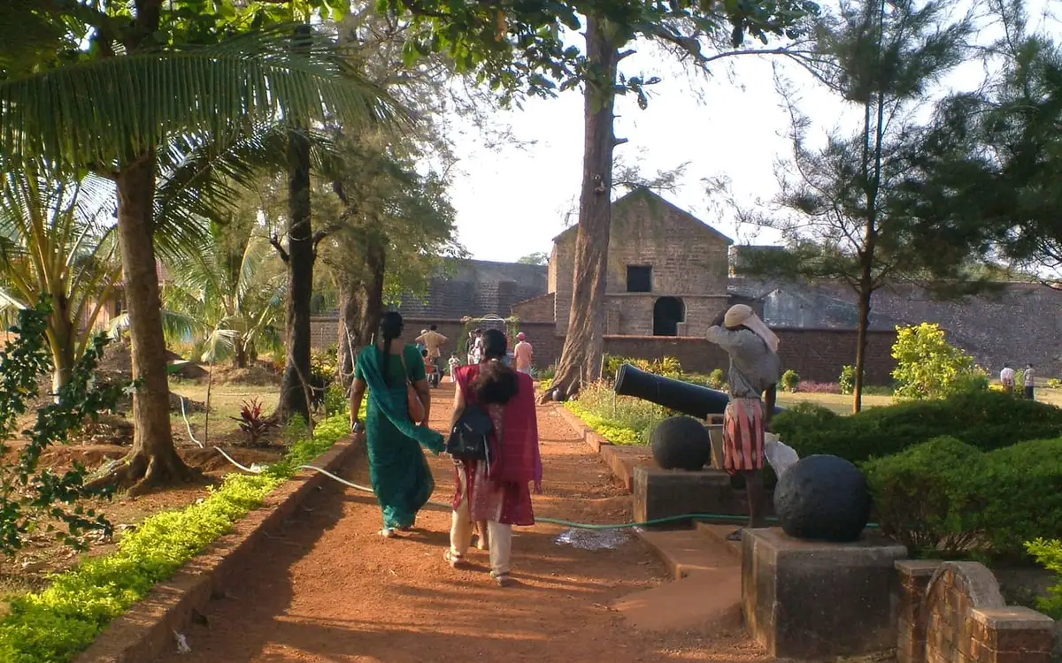
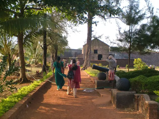
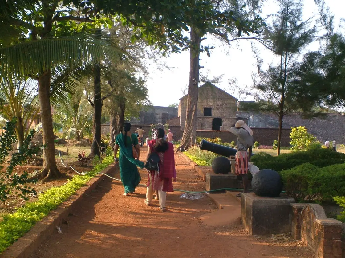
  • St. Angelo Fort — Sea-facing laterite fort built by the Portuguese in 1505, later held by the Dutch, the Arakkal royal house and the British — Kannur city’s great coastal landmark overlooking Mappila Bay.
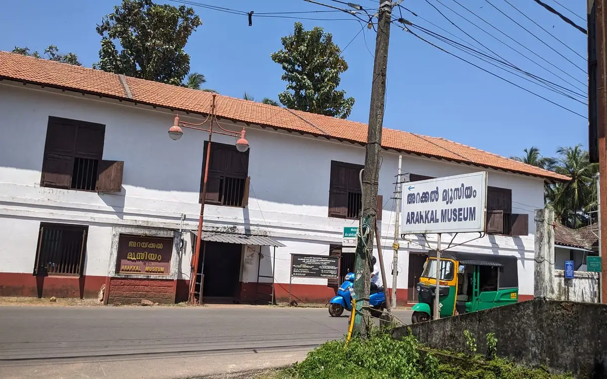
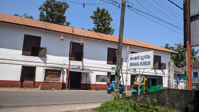
  • Arakkal Museum — The Arakkal Kettu (palace museum) of the Arakkal Ali Rajas — Kerala’s only Muslim royal house, matrilineal so ruled at times by a Beevi (queen).
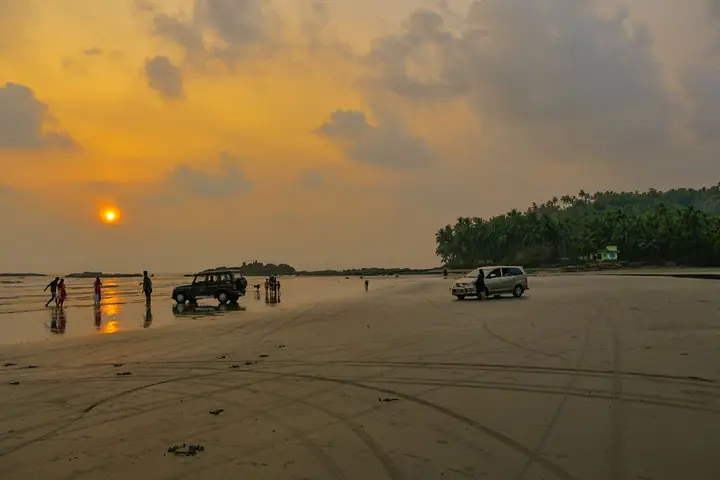
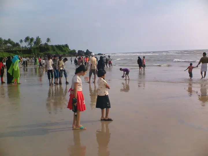
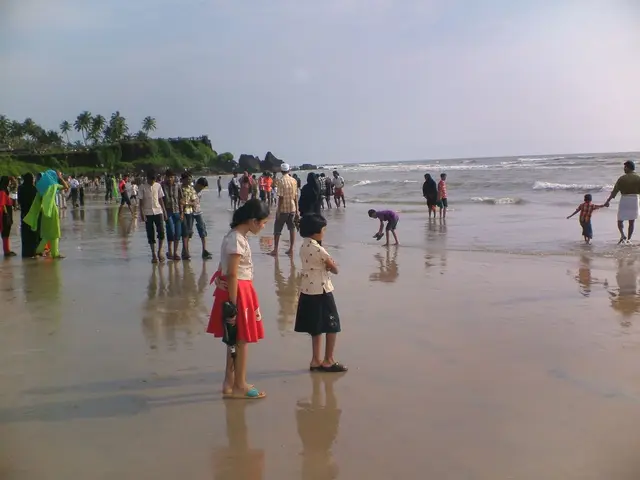
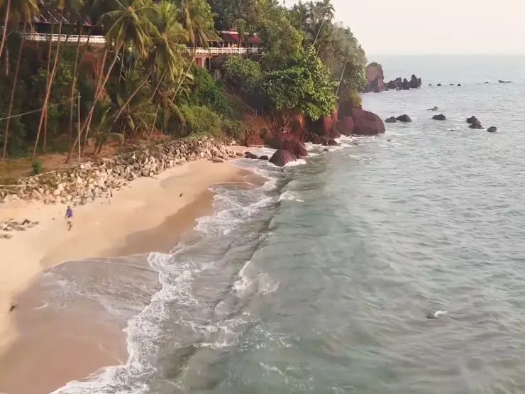
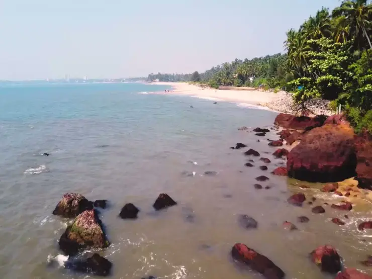
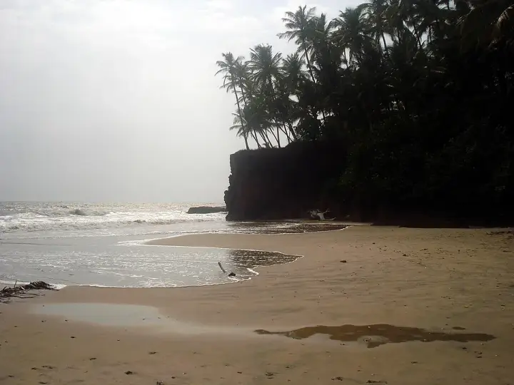
  • Payyambalam Beach — Kannur city’s main beach, with a landscaped garden, the mother-and-child sculpture and long sunset walkways.
  • Rajarajeswara Temple, Taliparamba — An ancient Shiva temple at Taliparamba, one of the 108 Shiva temples and the Dwadasha Shivalayams of old Kerala; men remove their shirt to enter and photography is restricted.
  • Kalarivathukkal Temple — A Bhagavathy temple near Valapattanam regarded as the mother shrine of Kalaripayattu — Kerala’s martial art — where Theyyam is performed; the goddess is guardian of the kalari.
  • Kottiyoor Temple — A remote forest Shiva shrine on the Bavali river, site of the ancient 28-day Kottiyoor Vaisakha Mahotsavam pilgrimage; the Akkare shrine has no permanent roof and is open only during the festival.
Getting there

How to visit

  • Nearest airport: Kannur (CNN), in-district
  • Rail gateway: Kannur (CAN) or Thalassery (TLY)

Distance by road

  • Kozhikode92 km
  • Mangaluru142 km
  • Mysuru178 km
  • Coimbatore267 km
  • Kochi278 km
  • Bengaluru316 km

Road distances measured on real routed roads to Kannur city itself, not to the district headquarters, on 22 August 2026. Driving time is deliberately not published: free-flow routing badly understates a Kerala ghat road, so allow more than the distance suggests.

Timing

Best time to visit Kannur city

October to March, when the coast is dry and comfortable and the theyyam season is running in the surrounding villages. April and May are hot, averaging around 35°C. The southwest monsoon is heavy here: Kannur averages about 3,438 mm of rain a year, roughly 68 per cent of it in the monsoon months.

Weather in Kannur citySeasonal guide

Live forecast loads in your browser.

Today at Kannur city
Sunrise6:18 am
Sunset6:27 pm
Golden hour best light5:27 pm–6:27 pm
Blue hour after sunset6:27 pm–6:52 pm
Sun sets toward compass bearingW · 272°
Moon tonight🌓 First quarter · 51%
South-west monsoon. June to September is the south-west monsoon in Kerala. Expect heavy showers, mostly in bursts rather than all day — carry rain cover, allow extra time for getting around, and note that ferries and open-air sites are the first things affected.

Sun and moon are calculated for this location and shown in IST. Photography windows are the hour around sunrise and sunset; the sunset bearing is degrees clockwise from true north. Moon phase is accurate to about half a day.

Visitor notes

  • Carry cash. The bazaar around Thavakkara and the harbour front at Ayikkara run on it, whatever a card machine on the counter suggests.
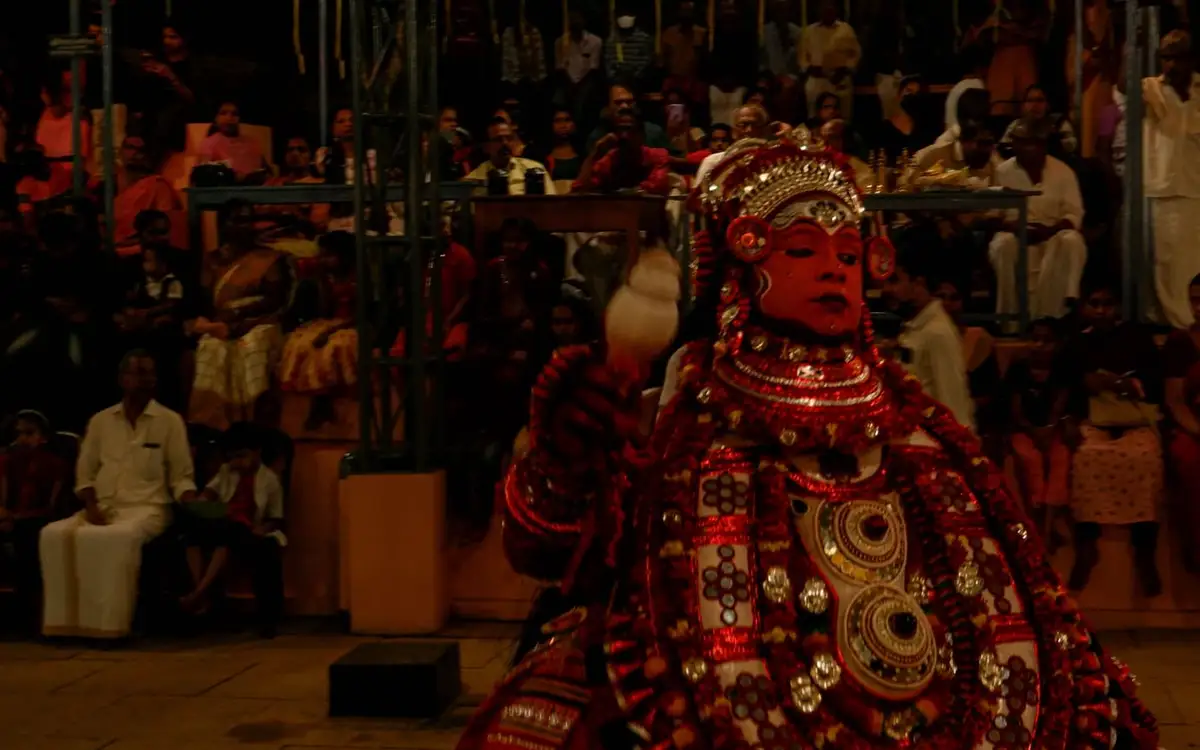
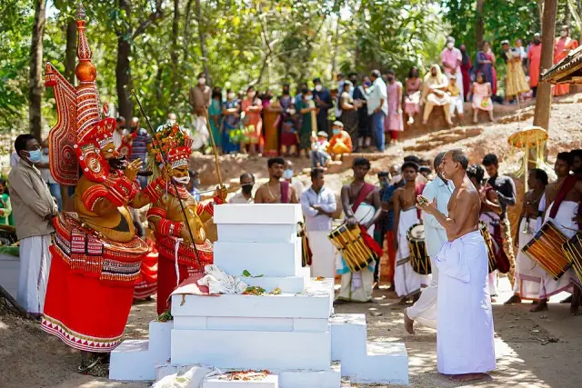
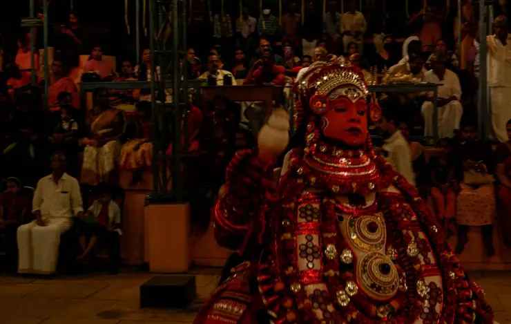
  • Theyyam is a ritual, not a scheduled performance. Its season runs roughly mid-October to mid-May and it happens in the kavus around the city rather than in it — ask permission before photographing, and do not plan a day around a fixed start time.
  • Payyambalam is worth the last hour of light rather than the middle of the day — the sun goes down into open sea from there.
The story

The story of Kannur city

Kannur — Cannanore on the older maps — is the fifth-largest city in Kerala and the least resort-like of its coastal towns. It has eight kilometres of shoreline and sits barely a metre above the sea, but its character was set by soldiers and by looms. This was the seat of Kolathunadu, and of the Arakkal house, the only Muslim royal family Kerala ever had, whose writ ran out to the Laccadive islands until 1905. The British made it their military headquarters on the west coast until 1887 and laid out a cantonment at Burnacherry that is still, today, the only cantonment board in Kerala. Around that garrison grew a working town of weavers and beedi-rollers, both trades later rebuilt as worker cooperatives. The fort and the beach are the postcard; the city behind them is the story.

Kannur city is long rather than deep. The Municipal Corporation covers about 78.35 square kilometres in six zones — Kannur town, Pallikunnu, Puzhathi, Edakkad, Elayavoor and Chelora — divided into fifty-five electoral divisions, and at the 2011 census it held 232,486 people with a literacy rate of 96.23 per cent. The coast runs for roughly eight kilometres, the ground stands only about a metre above sea level, and the one real indentation in it is Mappila Bay at Ayikkara, a natural harbour full of wooden boats where the fishing fleet works. Kannur became a municipality on 1 November 1866 and a corporation only in 2015, the fifth in the state, with E. P. Latha as its first mayor.

The word most likely to puzzle a visitor is “city”. In Kannur it does not mean the centre of town. The quarter that was held by the Arakkal house is still called City, and it lies out towards Ayikkara; the commercial heart, with the bus stand, the railway station and the shops around Thavakkara and Fort Road, is called Town. Between the two sits a third thing again — the Cantonment, at Burnacherry, which the British spelled Burnassery. Locals use all three names in the same sentence and expect you to keep up.

The cantonment is the piece of Kannur that most travellers walk through without registering what it is. India has sixty-two cantonment boards; exactly one of them is in Kerala, and this is it, classified Class III. The Kannur Cantonment Board came into existence in 1938 and has twelve members, six of them elected by the civilian residents, with the Officer-in-Command as chairman. At the 2011 census the cantonment held 4,798 people. The streets are wider than the town’s, the plots are larger, the trees are older, and building is controlled in a way that has kept the area low and green while the rest of the city went vertical.

The garrison is not ceremonial. The Defence Security Corps — the sixth-largest corps of the Indian Army, whose job is guarding defence installations of all three services — has its Centre, its Records office and its Pay Accounts Office here, on the road out to Payyambalam, and the Kannur centre is the mother depot for every DSC platoon in the country. The corps was approved by the Government of India on 25 February 1947 and raised as the Defence Department Constabulary that April, renamed the Ministry of Defence Security Corps in 1948, and brought under Army Headquarters as the Defence Security Corps in 1958. It is manned largely by superannuated soldiers who re-enrol, which is why Kannur has an unusual number of second-career servicemen in it, and its motto is Raksha Tatha Suraksha — defence and security.

Around the cantonment lives Kannur’s Anglo-Indian community, concentrated at Burnacherry and in the neighbouring pockets of Thillery, No. 3 Bazaar and Camp Bazaar. Its institutions are older than the cantonment board by a long way: St Michael’s School was established for boys in 1807 and St Teresa’s for girls in 1871, both by the Apostolic Carmelites, and both still run as Anglo-Indian higher secondary schools. The Holy Trinity Cathedral stands, by the diocese’s own account, on the ground where Franciscan missionaries were permitted to build a chapel in the first years of Portuguese contact; the Diocese of Kannur itself is recent, created by Pope John Paul II on 9 December 1998 out of the Diocese of Calicut.

One more thing happened inside the cantonment that is worth knowing before you fly into Kannur today. There was an airstrip at Fort Maidan, within the cantonment boundary, and from 29 October 1935 Tata Airlines used it on a weekly Bombay–Thiruvananthapuram service that also called at Goa. The service did not last. The airport Kannur uses now is a very different proposition and sits inland at Mattannur, and it has its own page here.

The looms are the other half of the city’s identity, and Kerala Tourism’s phrase for the district — the land of looms and lore — is not marketing invention. The Malayalam Wikipedia article on the district names handloom, beedi and laterite as its three traditional trades in a single sentence, and then adds, without softening it, that the first two have reached a state of dying out. That is the honest position. Weaving in and around Kannur is still real, but it is a shrinking industry sustained by cooperatives, by export orders for furnishings rather than by the local sari trade, and by state institutions. One of the ten Indian Institutes of Handloom Technology is here: IIHT Kannur was registered under the Societies Registration Act in 1987 and is an autonomous institute under the Kerala Industries Department.

If you want to see the craft rather than take it on trust, the Handloom Museum at Payyambalam is the place. Its displays are unusually plain-spoken — an entire panel is given to the loom itself, labelling every part in Malayalam and English, from paavu (warp) and oodu (weft) to the odam (shuttle) and the chavittu kaal (treadle) — and another wall traces the Basel Mission’s weaving establishments in Malabar in old photographs. It is worth saying what Kannur is not: Kerala’s geographical-indication handloom fabrics are Balaramapuram, Chendamangalam, Kuthampully and Kasaragod, and Kannur is not among them. Its reputation was built on volume and on export furnishings, not on a protected sari.

The beedi story is the one that changed the town’s politics. Agitation from the 1940s produced the Beedi and Cigar Workers (Conditions of Employment) Act in 1966, and Kerala was the first state to implement it. The private manufacturers responded by moving production to Karnataka, throwing thousands of Kannur rollers out of work. When negotiations failed the unions proposed a cooperative instead, and the Kerala Dinesh Beedi society was inaugurated in 1969, capitalised by the state with ₹13.5 lakh in share capital and a ₹7,00,000 working-capital loan, with G. K. Panicker, then Joint Commissioner in the Industries Department, doing much of the institutional work. It went from a ₹50,000 profit in its first year to ₹44 crore in 1994–95, and at its peak in the nineties it was making some 6.85 billion beedis a year. It is now among the most studied worker cooperatives in India, with a Cornell University Press book to its name. What survives is a good deal smaller and no longer really a beedi business: the society’s own website today claims full-time employment for about 6,000 people and lists curry powders, squashes, jams, pickles, coconut products, tea, garments, umbrellas and software among its lines. A city that once rolled beedis by the billion now sells you curry powder made by the same cooperative — which is either a decline or an adaptation, depending on the day you ask.

As a place to spend time, Kannur rewards low expectations and a good appetite. The city is a major stop on the coastal railway, so trains are frequent and cheap; the KSRTC stand and the shops around it are the busiest ground in town. Eat what the coast eats: Malabar biriyani, kuzhi mandi with its Yemeni ancestry, mussels (kallummakkaya), pathiri, irachi puttu, and the sweets Europeans once called sweet meat and everyone here calls halwa, alongside banana chips fried wafer-thin. Then walk the cantonment roads in the late afternoon, when the light is long and the traffic is somewhere else.

Legend & myth

Kannur cannot agree with itself about its own name, and both explanations are worth having. The first reads it as Kannan-ur, the town of Kannan — Krishna — and points to the Kadalayi Sree Krishna temple, which once stood inside the Kolathiri rajas’ Kadalayi fort within what is now the city. The second is drier and possibly better: that the name comes from Kanathur, an old village whose name still survives inside the corporation’s own boundaries. Neither has been settled. What is documented is that in the Thalassery records from 1796 the place is written Kannanur, which fits the first reading and does not prove it.

The Kadalayi story is the town’s real legend, and unusually for a legend it has dates attached. The temple stood at Kararinakam Kadalayi, about six kilometres south-east of the town centre, established by Valabhan — reckoned among the foremost of the Kolathiri line — as the guardian shrine of the Kadalayi fort. In the Kollam year 964, which falls in 1788–89, when Tipu Sultan’s forces were plundering temples across Malabar, the melsanthi of Kadalayi is said to have prised the Krishna idol out of its pedestal, hidden it in the well of his own illam, and got word to the Kolathiri. The raja then built a temple south-east of the Chirakkal palace, and in Kollam 1023 — 1847–48 — the Kadalayi Krishna was consecrated there.

The old site was never recovered. The fort and the temple decayed, the temple tank silted up, and the ground passed out of the community’s hands. What is left is a map made of names: the spot is still called Kottammal, the fort’s rubble is still visible there, and the surrounding house-names and place-names — Chirakkadavath, Molothu, Illathil, Manayullathil, Ambalathil, Kadalayi Nada — read like a plan of a settlement that no longer exists. Local memory adds one detail that is pure folklore and none the worse for it: that in the deep hours of the night at the place where the idol had been carried, people used to hear a flute, and the sound of cattle hooves.

That listening is what eventually rebuilt the shrine. A devotee held a puja on the spot on Ashtami Rohini in the Chingam of Kollam 1140, which is 1965; the following year a handful of people began marking Krishna Jayanti there with offerings and harikatha; by 1970 the neighbourhood decided the celebration needed a proper seat and commissioned an astrological prasnam. The idol they had made for it — Gopalakrishnan, cattle-goad in the right hand, the tip of the flute held at the waist in the left, smiling — was carved from krishnasila at Kanyakumari and kept at the Thalap Sree Sundareswara temple until it was carried out to Adikadalayi and installed on 15 March 1981, in the muhurtham between 11:45 and noon, by Brahmasri Paravur Sreedharan Thanthri.

That holding temple has a story of its own. The Thalap Sree Sundareswara temple, about three kilometres from the centre of Kannur, was consecrated by Sree Narayana Guru himself, who installed the Shiva idol here on 14 April 1916 — the reform movement arriving in Kannur in the most concrete form it takes. Its eight-day festival begins on the Pooyam asterism in Meenam, in March or April, and it ends where nearly everything in this city ends, with the aarattu procession going down to the sea at Payyambalam.

The ritual season the old city really belonged to was the pooram, and this is where an honest record has to record a loss. Poorakkali is the nine-day observance of the Mushika country — Kannur and Kasaragod — held at Bhagavathi kavus from the Karthika asterism to Pooram in the month of Meenam, danced traditionally by the Thiyya and Maniyani communities. Its footwork is openly borrowed from the kalari: scholars read the steps as kalari steps, the panicker’s silk and headcloth answer the kachi and chura of the training ground, and before the great sequences the dancers are given oil to work into their bodies exactly as a kalari student is oiled. And the territory it is danced in runs from the Chandragiri river down to the Valapattanam river — no further. South of the Valapattanam, which is to say in Kannur city itself and below it, poorakkali has disappeared completely.

The origin stories the poorakkali songs carry are worth hearing even where the dance has gone. One is Kamadahanam: Kamadeva looses his flower-arrow at Shiva to unsettle his mind and is burned to ash for it, and only the unrelenting prayers of Rati and the young women soften Shiva into telling Rati to go to Shambara’s fort and worship an image of him — an image the goddesses then make and adore until Kama is remade. Another says the observance remembers the birth of Pradyumna, Kamadeva reborn as Rukmini’s son. A third is gentler: that Poora was a naga maiden and a celebrated dancer of Brahmaloka, and Krishna brought her down to earth to dance at Vrindavan and himself began the pooravela. The vasanthapuja verses recited before the poorakkali garland simply say the vow and the worship of Kama began in the season of spring, and that the figure of Madana should be traced in flowers on the day of Pooram.

One legend this record deliberately refuses. The romantic accounts of how the Arakkal house began — the Kolathiri princess pulled from the water by a Muslim man who covered her with his own cloth, the minister named Arayankulangara Nair who took the name Mammad Ali — are the best-known stories in Kannur, and they belong to the Arakkal palace, which is a separate page on this site and tells them properly. The same goes for the Cheraman Perumal legend, which is Kodungallur’s before it is anyone’s. Taking them here would only mean telling them twice and worse.

More about Kannur city

History

The site is old. The Taliparamba–Kannur–Thalassery stretch is thick with rock-cut caves, dolmens, burial circles and menhirs, and the Sangam-era kingdom based at Ezhimala held this coast in the first five centuries CE. The port of Naura, named in the Periplus of the Erythraean Sea as lying somewhere north of Muziris, is generally identified with Kannur. Later the Mushika dynasty succeeded Ezhimala, and the Kolathiri or Chirakkal rajas succeeded the Mushikas; Kolathunadu was one of the four great powers of the Malabar coast alongside the Zamorin of Calicut, Cochin and Quilon, and Kannur was its seat. In the medieval spice trade it was a commercially important secondary port, ranking behind Kozhikode but ahead of most.

The Arakkal house rises against that background, its list of rulers beginning with Adi Raja Ali in 1545. It was a vassal of the Kolathiris, from whom it received the Laccadive islands as a jagir in the sixteenth century, and its power was maritime rather than territorial: historians describe Kannur under the Ali Rajas as a Muslim thalassocracy, with a fleet, a horse trade out of West Asia and enough reach that European charts called the nine-degree channel separating Minicoy from the Laccadive group Mammali’s Channel. Succession followed marumakkathayam, the matrilineal rule of much of old Malabar — the eldest member of the family, man or woman, became its head. Four of the reigning names on the list are women, among them Bibi Harrabichi Kadavube (1728–1732), Bibi Junumabe I (1732–1745) and Bibi Junumabe II, who ruled for forty-two years from 1777 to 1819.

The unwinding of that kingdom is precise and worth setting out, because it is usually compressed into a sentence. After the treaties of Srirangapatam the Beevi signed an agreement in 1796 that guaranteed her continued possession of Cannanore town and the Laccadives but stripped her of any claim to sovereignty. Rank outlasted power: as late as 1864 the Bibi of Cannanore still appeared on the official list of native sovereigns and chiefs entitled to a seven-gun salute. The British took over administration of the islands from 1854 to 1861, and again from 1875, that time for good. In 1905, in exchange for the remission of overdue tribute, a pension for the head of the family and the title of Sultan, the Ali Raja gave up all rights to the Laccadives including Minicoy. By 1909 the family had lost Kannur and the cantonment, the last of it going under the Beevi Imbichi Adi-Raja Bibi; by 1911 the sceptre and sword had gone too.

The town’s modern institutions are almost all colonial in date. Kannur served as the East India Company’s military headquarters on the west coast of India until 1887. Government Brennen College, the first college in the district, opened in 1862. Kannur municipality was constituted on 1 November 1866 under Madras Act 10 of 1865, in the same batch as Thalassery, Kozhikode, Palakkad and Fort Kochi — the first modern municipalities anywhere in what is now Kerala. Before the state was formed Kannur was the headquarters of the Chirakkal taluk of Malabar District in the Madras Presidency, and it kept the name when the district was created around its offices.

The twentieth century pulled the town in two directions at once. It became a centre of the organised left — the socialist and communist politics that grew out of Malabar’s tenancy struggles and reform movements are inseparable from the beedi and weaving workforces here — and at the same time it stayed a garrison town, the cantonment board formed in 1938 and the DSC depot arriving after Independence. The educational build-out came late: Kannur University was created by Act 22 of 1996, having first appeared as Malabar University by an ordinance of 9 November 1995, and was inaugurated on 2 March 1996 by Chief Minister A. K. Antony. The thirteenth NIFT campus opened at Dharmashala, sixteen kilometres north of the city. The corporation followed in 2015, and the lighthouse out at the Payyambalam end — whose present tower dates from 1975–76, replacing a light that in its oil-lamp era was only shown in the fair season from September to May — still marks the seaward edge of it all.

Why visit

It is the only place in Kerala with a cantonment: wide, quiet, tree-shaded roads and low colonial-era buildings a ten-minute walk from a busy Indian city centre.

The Handloom Museum at Payyambalam explains the loom part by part in Malayalam and English, which makes every weaving shed in the district readable afterwards.

Kannur is the home of the Kerala Dinesh Beedi cooperative, founded in 1969 after a lockout and now one of the most studied worker cooperatives in India.

The Thalap Sree Sundareswara temple was consecrated by Sree Narayana Guru in person on 14 April 1916, and its eight-day Meenam festival ends with an aarattu at the sea.

Ayikkara and Mappila Bay give you a working fishing harbour rather than a scenic one — boats, ice, nets and an early-morning auction.

It is the easiest base in north Malabar: a major coastal railway station, the NH 66 running through, and the whole district within a short drive.
Before you go

Kannur city — at a glance

HoursThe city is open at all hours. Shops and offices around Thavakkara and the bus stand generally run from mid-morning to about 8pm, with many closing for a midday break; the fish landing at Ayikkara is busiest very early. Cantonment roads are public but individual defence establishments are not — do not attempt to enter them.

Entry: Free — Kannur city is an open town with no entry ticket. Individual sites inside it charge separately: the Arakkal Museum is ticketed by the Arakkal Trust, and the Handloom Museum at Payyambalam has its own nominal charge. Confirm current rates on site.

Getting here

How to reach Kannur city

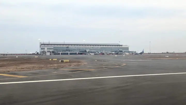
  • ✈︎ By air Kannur International Airport (CNN) at Mattannur is 24 km east of the city, about 28 minutes on a clear routed run — the closest airport to any city in north Kerala. Calicut International (CCJ) is 118 km south, roughly two hours. Cochin International (COK) is 263 km away and only worth it for a much cheaper fare. We have not verified current airport bus timings or taxi rates; check them on the day rather than trusting a figure on a page.
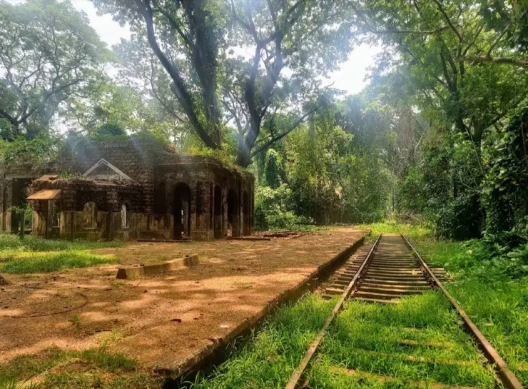
  • 🚆︎ By train Kannur (station code CAN) is 1.7 km from the centre — a two-minute drive — and is a major stop on the coastal main line under Southern Railway's Palakkad division, with frequent services from Kozhikode, Kochi and Mangaluru. Kannur South (CS) at 4.3 km, Valapattanam (VAPM) at 7.3 km and Pappinisseri (PPNS) at 8.8 km are minor halts that take passenger trains only — do not book a long-distance ticket to one of them by mistake.
  • 🚗︎ By road NH 66 runs through the city along the coast: Kozhikode is 92 km south and Mangaluru 142 km north, both measured on real routed roads. The inland route to Karnataka is the Thalassery–Coorg–Mysore road through Iritty, Makutta and Virajpet — Mysuru 179 km, Bengaluru 316 km that way. It is a state highway through reserve forest at the Makutta ghat, not a national highway, whatever a mapping app calls it, and it drives like one.
  • 🚌︎ By bus The KSRTC stand is 200 m from the centre, effectively in it, and the long-distance state services for Karnataka and the rest of Kerala leave from there. The private buses use the Old Bus Stand about 1 km away and the Thavakkara New Bus Stand at 1.6 km. They are three separate places, and a driver told only “the bus stand” will ask which one you mean.
  • ⛴︎ By boat There is no scheduled passenger ferry to Kannur city, and we would rather say so than dress up a fishing harbour as a jetty. Mappila Bay at Ayikkara, 3.6 km from the centre, is a working landing where the boats, the ice and the auction are done by mid-morning. The district's passenger crossings are north of the city — the Azhikkal jetty is 13 km out at the mouth of the Valapattanam river and is how Mattool is reached from this side. We publish no ferry timings: there is no official feed we are permitted to republish and a wrong last-boat time strands people. Ask at the jetty for the time of the last service back, not the next one.
Getting around

Getting around Kannur city

Autos are the workhorse — metered, and easy to find at the stands, the railway station and the beach road. The sights are spread out, so for a Muzhappilangad-and-fort kind of day a pre-booked local taxi beats hailing rides one at a time; KSRTC and private buses cover the coast towns.

  • 🚕︎ Online taxis Not dependable here — plan around them. Uber and Ola coverage in Kannur is thin and app bookings often go unanswered; Kerala travel forums put Kannur among the places where the apps are scarce outside the big cities. A pre-booked intercity app car can still drop you here from Kozhikode or Kochi. For getting around, use the auto stands and local taxis. Where an app does respond, the price is set in-app; we print no fares.
Getting back

Check your return bus or ferry with the operator before setting out. Leave time to reach the stop or jetty after your visit, and arrange a return vehicle in advance for a remote outing.

Ask at the jetty or the stand for the time of the last service back, not the next one. If you miss it, an auto or a taxi is the fallback — agree the fare before you get in.

Do

Things to do in Kannur city

  • Stand under St Angelo Fort's seaward bastions at Ayikkara — they were built to be read from the water, and Mappila Bay is directly below them.
  • Go inside the Arakkal Kettu, the palace of Kerala's only Muslim royal house, matrilineal and so ruled at times by a Beevi rather than a Raja.
  • Walk the eight kilometres of shoreline in pieces: Payyambalam for the sunset, Ayikkara for the harbour, Thavakkara and Fort Road for the town.
  • Follow the older street grid at Burnacherry — wider roads, larger plots, taller trees, and the only cantonment board in Kerala.
  • Eat what this coast eats: Malabar biriyani, kuzhi mandi, mussels (kallummakkaya), pathiri and irachi puttu, and the halwa Europeans once called sweet meat.
  • Ride one stop up the coastal line to Valapattanam, at the mouth of the river that gives the town its name.
  • Drive the sand at Muzhappilangad, 15 km south — four kilometres of hard beach, the longest drive-in beach in India, and only at low tide.
  • Look across from Muzhappilangad to Dharmadam Island, which you can walk to over the sand at low water; landing on it is restricted, so it is a view rather than a destination.
  • Go up to Parassinikadavu at dawn or dusk for the Muthappan thira — a theyyam performed most of the year rather than only in season, and open to everyone.
  • Stand on the beach below Ezhimala for the 286 m headland; the hill is the Naval Academy and closed, and the view from underneath is the point.
  • Give an evening to the Payyambalam sculpture and the sea walk, which is where the city goes when it stops working.
Plan

Good to know

  • Go to Ayikkara early. Mappila Bay is a working fishing harbour rather than a viewpoint, and the boats, ice and auction are all finished with by mid-morning.
  • Do the Handloom Museum at Payyambalam before you visit any weaving society. Its bilingual panel labelling every part of the loom — paavu, oodu, odam, chavittu kaal — turns an unintelligible machine into something you can follow being worked.
  • Poorakkali, the nine-day Meenam ritual dance of the Bhagavathi kavus, is not performed in Kannur city: its surviving territory runs from the Chandragiri river only as far south as the Valapattanam. To see it you must go north of that river, in March or April.
  • If theyyam is why you are coming and your dates are wrong for the season — roughly mid-October to mid-May — go to the Muthappan temple at Parassinikadavu, 20 km north on the Valapattanam river. The Muthappan thira is performed there at dawn and dusk most of the year and is unusually open to all. It is the one place near the city where you do not need the calendar to be on your side.
  • Take the train, not the bus, for Kozhikode and Mangaluru. Kannur is a major stop on the coastal main line, the services are frequent and cheap, and the station is 1.7 km from the centre. The buses are for the inland routes the railway does not go.
  • Check the tide before Muzhappilangad, not the clock. It is about four kilometres of hard sand 15 km south and the longest drive-in beach in India, but you can only drive it at low water — at high tide you have made the trip for a look.
  • Do not plan to climb Ezhimala. The 286 m headland is the Indian Naval Academy and the hill itself is closed; the beach and the views from below are open, and that is the whole of the visit.
  • Buy cloth from the weaving societies, not from the chain stores on the highway. The national menswear outlets in Kannur sell nothing made here, and the co-operatives are where the town's own trade actually reaches a counter.
  • Know what Kannur handloom is not. Kerala's protected geographical-indication handloom names are Balaramapuram, Chendamangalam, Kuthampully and Kasaragod — Kannur is not among them. Its reputation was built on volume and on export furnishings, not on a protected sari, so a shopkeeper's “Kannur handloom” is a description of origin rather than a certification.
  • Do not go looking for a beedi factory. The Kerala Dinesh Beedi society still exists and still employs thousands, but its own product list now runs to curry powders, squashes, jams, pickles, coconut products, tea, garments, umbrellas and software. The city that once rolled beedis by the billion will sell you curry powder made by the same cooperative.
  • Give the cantonment the late afternoon. The streets at Burnacherry are wider, the plots larger and the trees older than anywhere else in the city, and the light is long and the traffic somewhere else by about four.
  • Eat what the coast eats rather than what a menu calls Kerala food: Malabar biriyani, kuzhi mandi with its Yemeni ancestry, mussels (kallummakkaya), pathiri and irachi puttu, the halwa Europeans called sweet meat, and banana chips fried wafer-thin.
Facilities

On site

  • Kannur city is a working corporation, not a site with a gate. Payyambalam, the Ayikkara harbour front, the cantonment's public roads and the Thavakkara commercial centre are all open ground with no ticket and no closing time.
  • The practical-things list further down this page is drawn from OpenStreetMap and routed on foot from the city centre. It is what is mapped, not a survey — absence there means nobody has mapped it, not that it is not there.
  • Deliberately not guessed, because we have not checked it: the condition and opening hours of the public toilets at Payyambalam, whether the beach has any lifeguard cover, parking charges anywhere in the city, and current auto and taxi fares. We would rather publish the gap than a number that turns out to be wrong at your expense.
  • We have not re-surveyed step-free access anywhere in Kannur. Where a step-free distance appears below it is routed over OpenStreetMap's mapped network, which is thin in Kerala, and it is not a statement that the route is usable in a wheelchair.
Stay safe

Safety

  • The cantonment is not a neighbourhood you wander. Its public roads may be walked, but the defence establishments on them, including the Defence Security Corps Centre, are working military property: no photography, no entry, and expect to be stopped if you drift off the public road.
  • Mappila Bay is a working harbour with ice, wet concrete, moving boats and an auction floor. Watch your footing, stay out of the way of a landing, and ask before photographing people at work.
  • Payyambalam is an open Arabian Sea beach on a surf coast. We hold no verified information about lifeguard cover, so treat it as unpatrolled: stay in the shallows, keep children close, and do not swim at dusk.
  • Kannur city, Kannur Town and Kannur Cantonment are three different addresses and a driver will ask which you mean. Confirm it before you book a room or get into an auto.
  • The south-west monsoon here is heavy — the city averages about 3,438 mm a year, roughly 68 per cent of it in the monsoon months — and it arrives in short, hard bursts that flood the low coastal roads for an hour at a time.
Getting around Kannur city

If you need step-free access, contact the site before travelling. Ask about a level entrance, steps along the route, the nearest drop-off point, seating and accessible toilets.

Practical things near Kannur city
ToiletsPublic toilet 559 m · 7 min walkMapped Mar 2023DirectionsBus stopsCaltex Bus Stop Bus stop122 m · 1 min walkMapped Mar 2022DirectionsTaxi & auto standsSouth Bazar Auto Stand 210 m · 3 min walkMapped Oct 2017DirectionsScooter & bike hireSafco Rent scooter Scooter & motorcycle hire162 m · 2 min walkMapped Dec 2025DirectionsParkingParking 884 m · 11 min walkCharges a feeMapped Feb 2022DirectionsFuelBharat Petroleum Pump Fuel station130 m · 2 min walkMapped Mar 2022DirectionsPharmacyLakshmi Medical Supplies 217 m · 3 min walkMapped Apr 2020DirectionsHospitalMother and Child Hospital 320 m · 4 min walkMapped Sept 2020DirectionsClinicKurumathur Arya Vaidya Sala and Nursing Home Clinic1.1 km · 13 min walkMapped Apr 2020DirectionsPolice stationPolice Station, Kannur Town 453 m · 5 min walkMapped Jun 2022DirectionsATMFederal Bank 172 m · 2 min walkMapped Mar 2022DirectionsBankState Bank of India 48 m · 1 min walkMapped Feb 2022DirectionsWater & snacksDream Orange Hypermarket Supermarket638 m · 8 min walkMapped Oct 2017DirectionsGroceries & bakerySheen Bakery 76 m · 1 min walkMapped May 2020DirectionsBarber & salonKing's Gents Beaury Parlour Hairdresser456 m · 5 min walkMapped Mar 2022DirectionsBookshopDeshabhimani Book House Bookshop879 m · 11 min walkMapped Oct 2017DirectionsPost officeTalap Sub-Post Office 873 m · 10 min walkMapped Oct 2017DirectionsSomewhere to prayMosque 470 m · 6 min walkMapped Oct 2017DirectionsPark or gardenAnakkulam park 974 m · 12 min walkMapped Mar 2023DirectionsPublic art & memorialsA.K.G Statue Public artwork83 m · 1 min walkMapped Jul 2024Directions
What the cash actually costs
  • Withdrawing from a bank that is not your own is free for a set number of times a month, then costs up to ₹23 plus GST — about ₹27 a withdrawal. This is not one of the RBI’s six metro centres, so the allowance here is the higher one: at least five free other-bank withdrawals a month, and at least five at your own bank.
  • That free allowance belongs to Indian bank accounts. On a card issued abroad your own bank’s international withdrawal and exchange charges apply instead. If the machine offers to bill you in your home currency, choose rupees — the conversion rate on that offer is set by the machine, not by your bank.
  • Choose a well-lit ATM, preferably at a bank branch. Shield your PIN, avoid help from strangers and use your bank’s support number if a withdrawal fails or the machine retains your card.

Charge cap and free-transaction limits: Reserve Bank of India, in force since 1 May 2025.

These services are listed within about 1.2 km of Kannur city. Walking distances follow mapped routes; access and opening hours can change. Other services may be closer but are not included here.

Nearby bases

Where to go from Kannur city

Thottada, ThottadaBeach homestay base
Town / base

Thottada

Quiet homestay-and-Ayurveda belt about 8 km south of Kannur city, where three laterite-walled coves — Thottada, Kizhunna and Ezhara — run in a row and almost every business is somewhere to sleep.

Thottada BeachAdikadalayi BeachKizhunna Beach
Open Thottada guide →
Muzhappilangad and Thalassery, Muzhappilangad and ThalasseryBeach and food base
Town / base

Muzhappilangad and Thalassery

Drive-in beach, colonial fort and biryani town.

Muzhappilangad Drive-in BeachThalassery FortOverbury’s FollyDharmadam Island
Open Muzhappilangad and Thalassery guide →
Payyambalam, PayyambalamCity beach base
Town / base

Payyambalam

Easy beach area close to Kannur town.

Payyambalam BeachBaby BeachKannur lighthouse views
Open Payyambalam guide →
Parassinikadavu, ParassinikadavuTemple and family base
Town / base

Parassinikadavu

Muthappan temple, Vismaya and Kannur University side stays north of Kannur city.

Parassinikadavu Muthappan TempleVismaya Amusement ParkKannur University side stays
Open Parassinikadavu guide →
Madayipara, MadayiparaLaterite plateau base
Town / base

Madayipara

Biodiversity plateau and heritage landscape near Pazhayangadi.

Madayi KavuVadukunnu Siva Temple
Open Madayipara guide →
Mattannur and Airport, Mattannur and AirportAirport transfer base
Town / base

Mattannur and Airport

Kannur International Airport, Mattannur hotels and arrival/departure transport planning.

Kannur International AirportMattannur hotelsAirport prepaid taxi
Open Mattannur and Airport guide →
Paithalmala, PaithalmalaHill trek base
Town / base

Paithalmala

Highland trek and viewpoint near the Karnataka border.

Paithalmala trekKappimalaKudiyanmala routes
Open Paithalmala guide →
Aralam, AralamWildlife base
Town / base

Aralam

Eastern forest sanctuary and highland village belt.

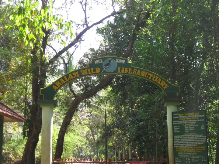
Aralam Wildlife SanctuaryMeenmutty-style forest streamsIritty river side
Open Aralam guide →
In the district

Where Kannur city sits in Kannur district

District HQKannur
LandscapeNorth Malabar coast, forts, beaches and eastern highlands

Kannur district is known for: Theyyam ritual arts, St. Angelo Fort, Muzhappilangad drive-in beach and Aralam forests.

St. Angelo FortMuzhappilangad Drive-in BeachTheyyam season
Stay · eat · do · rent · see · shop

Places in Kannur city

Every verified place in Kannur city — filter by what you’re after.

Arakkal Museum — Museum in Kannur city
Museum · Kannur city
Arakkal Museum

The Arakkal Kettu — the palace museum of the Arakkal Ali Rajas, the only Muslim royal house in Kerala and a matrilineal one, so it was ruled at times by a Beevi rather than a Raja. Ticketed by the Arakkal Trust; confirm the current rate on site.

DirectionsView guide
A
A.K.G Statue
Sight
Public art · Kannur city
A.K.G Statue

Statue of A. K. Gopalan, born in this district and the first Leader of the Opposition in the Lok Sabha. It is a street landmark on the way past rather than a visit in itself.

DirectionsView guide
St. Angelo Fort — Fort in Kannur city
Historic
Fort · Kannur city
St. Angelo Fort

Sea-facing laterite fort begun by the Portuguese in 1505 and later held by the Dutch, the Arakkal royal house and the British. It stands over Mappila Bay and the working fishing harbour at Ayikkara, and the seaward bastions are the part worth the walk.

DirectionsView guide
C
Chovva Thodu
Nature
Waterfront · Kannur city
Chovva Thodu

A thodu, or tidal creek, at Chovva on the eastern side of the town. It runs through a residential area rather than past a viewpoint, and there is no formal access path along it.

DirectionsView guide
Magnet Hotel Kannur — 4-Star hotel in Kannur city
Verified
4-Star hotel · Kannur city
Magnet Hotel Kannur
4-star

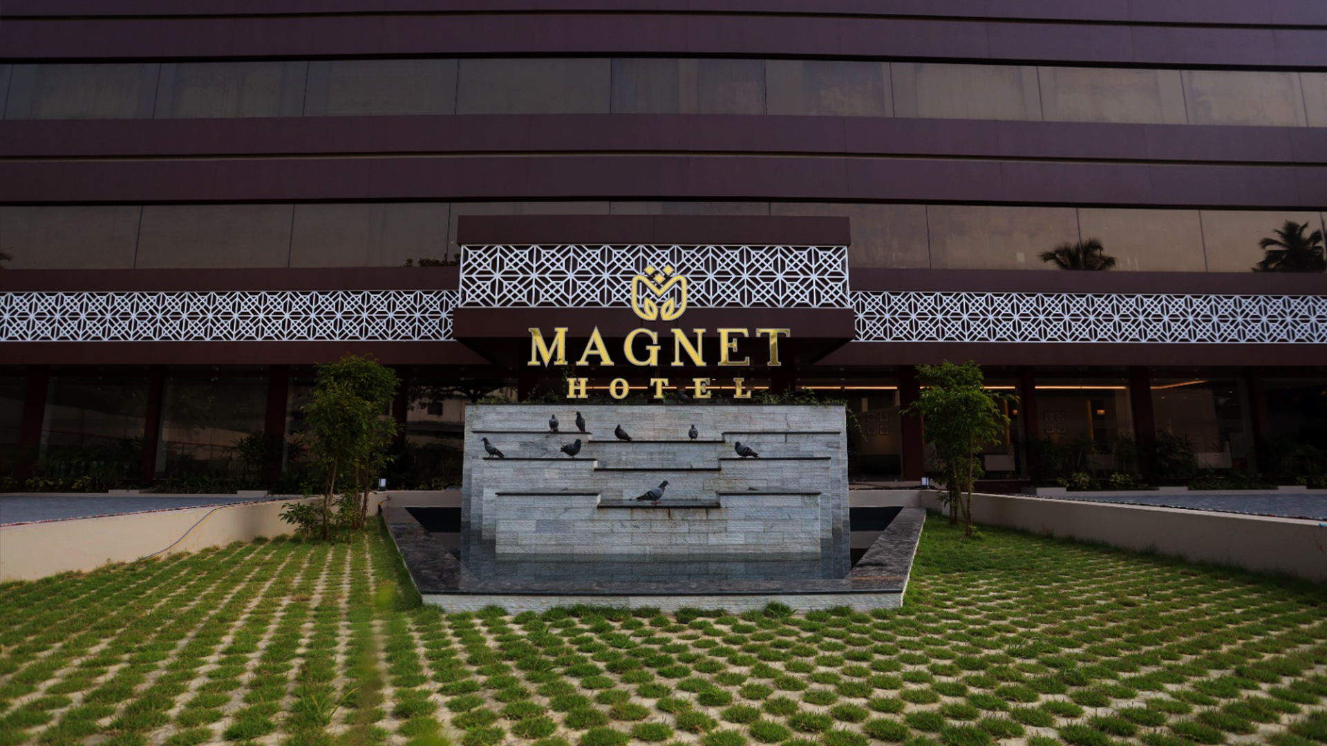
Four-star facility hotel at Chirakkal, Puthiyatheru, on the northern edge of Kannur city. It offers luxury air-conditioned rooms, multi-cuisine dining and banquet and event spaces as one of the city’s newer upmarket hotels.

Directions Commission-freeView details
The Hotel Elegance Kannur — 4-Star hotel in Kannur city
Verified
4-Star hotel · Kannur city
The Hotel Elegance Kannur
4-star

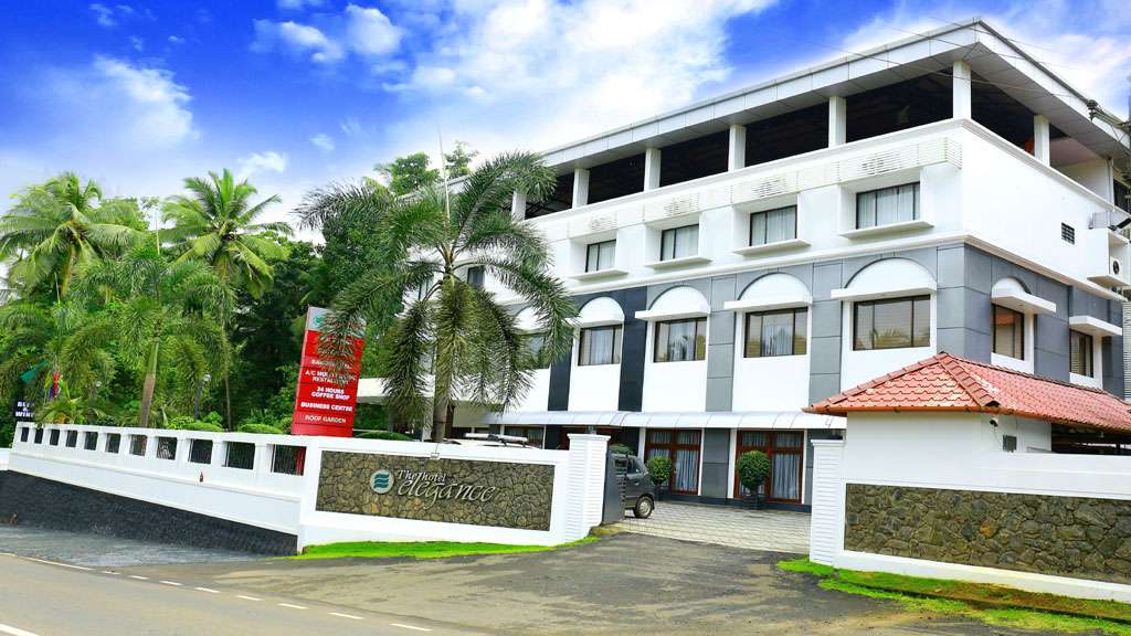
Kerala Tourism-classified 4-star hotel on the banks of the Tejaswini river at Karuvanchal, Alakode, in the eastern highlands of Kannur district. It offers luxury air-conditioned rooms and suites, a coffee shop, business centre and roof garden as an upmarket riverside base.

Directions Commission-freeView details
Kesavatheeram Ayurveda Hospital Ezhilode — Ayurveda and panchakarma hospital in Kannur city
Verified
Ayurveda and panchakarma hospital · Kannur city
Kesavatheeram Ayurveda Hospital Ezhilode

Registered Ayurveda and panchakarma hospital at Puracheri, Ezhilode, north of Kannur city. It provides physician-led classical Ayurvedic treatment, panchakarma therapy and rejuvenation programmes in a dedicated treatment facility rather than a hotel spa.

Directions Commission-freeView details
Malabar Beach Resort Ayurvedic Spa Thottada — Beach-resort Ayurvedic spa and wellness centre in Kannur city
Verified
Beach-resort Ayurvedic spa and wellness centre · Kannur city
Malabar Beach Resort Ayurvedic Spa Thottada

Ayurvedic spa and wellness centre at the Malabar Beach Resort on Thottada Beach south of Kannur city. It offers Ayurveda massage, therapy and rejuvenation packages in a palm-fringed seafront garden setting, aimed at travellers combining coast and wellness.

Directions Commission-freeView details
Itoozhi Namboothiri's Ayurveda Nursing Home — Kerala Tourism-classified Ayurveda nursing home in Kannur city
Verified
Kerala Tourism-classified Ayurveda nursing home · Kannur city
Itoozhi Namboothiri's Ayurveda Nursing Home

Kerala Tourism Ayur-Silver classified Ayurveda nursing home at Mayyil in Kannur district, run by the traditional Itoozhi Namboothiri Ayurveda family. It offers physician-led panchakarma, classical treatments and residential Ayurveda care rooted in a long Namboothiri lineage.

Directions Commission-freeView details
Hotel Sky Palace Kannur — Affordable business hotel in Kannur city
Verified
Affordable business hotel · Kannur city
Hotel Sky Palace Kannur

Affordable business hotel at Metro Tower, Thavakkara Road, in central Kannur, positioned by Kerala Tourism as meeting travellers’ needs at surprisingly affordable rates. It provides value air-conditioned rooms, a restaurant and city-centre access close to the railway station and bus stand.

Directions Commission-freeView details
Green Park Residency Kannur — Budget 2-star hotel in Kannur city
Verified
Budget 2-star hotel · Kannur city
Green Park Residency Kannur
2-star

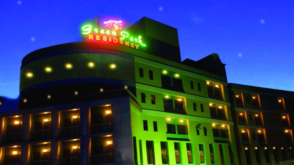
Kerala Tourism-classified 2-star deluxe hotel opposite the Railway Muthappan Temple at Thavakkara in central Kannur, within walking distance of Kannur Railway Station. It offers affordable air-conditioned rooms, a restaurant and banquet facilities as one of the city’s most economical KT-classified hotels.

Directions Commission-freeView details
Malabar Residency Kannur — 3-Star business hotel in Kannur city
Verified
3-Star business hotel · Kannur city
Malabar Residency Kannur
3-star

Kerala Tourism-classified three-star business hotel at Thavakkara in the heart of Kannur city, about a three-minute walk from Kannur Railway Station. It offers 42 air-conditioned rooms and suites, the multi-cuisine Barka Restaurant and a banquet hall, and is billed as the first three-star hotel in Kannur.

Directions Commission-freeView details
MVK Heritage Foods Kannur — Restaurant in Kannur city
Verified
Restaurant · Kannur city
MVK Heritage Foods Kannur

Restaurant in Kannur city. Pamban Madhavan Road, Talap, opposite AKG Hospital, Kannur, Kerala 670002 · MVK Heritage Foods, Talap, Malabar food.

Directions Commission-freeView details
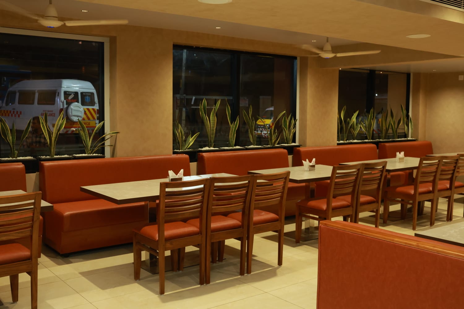
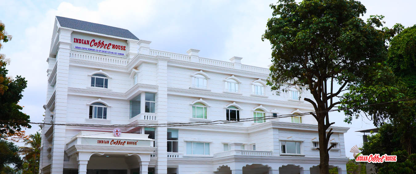
Indian Coffee House Kannur — Restaurant in Kannur city
Verified
Restaurant · Kannur city
Indian Coffee House Kannur
South Indian / Coffee house

Kannur branch of the historic worker-run Indian Coffee House cooperative. Serves classic South Indian snacks, filter coffee and traditional set meals.

Directions Commission-freeView details
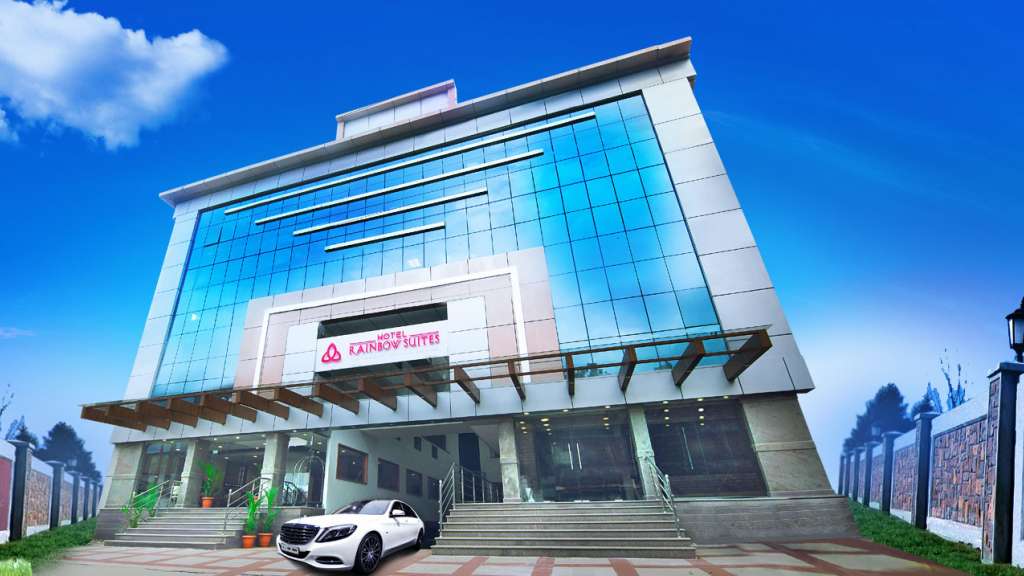
Hotel Rainbow Suites Kannur — Hotel in Kannur city
Verified
Hotel · Kannur city
Hotel Rainbow Suites Kannur

Kerala Tourism-listed hotel opposite Kannur railway station. Kannur railway station, Business hotel, City stay.

Directions Commission-freeView details
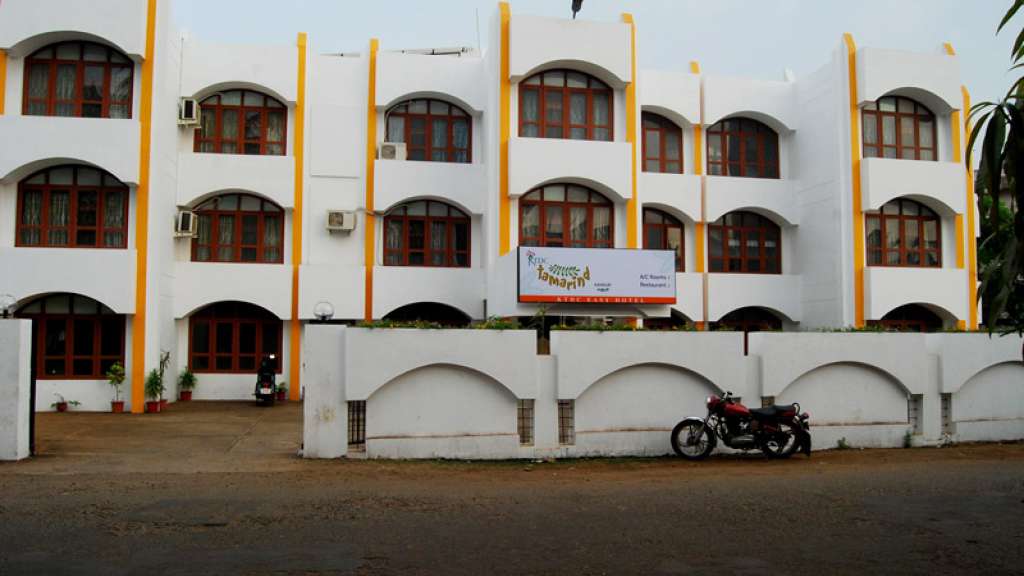
Tamarind KTDC Easy Hotel Kannur — Hotel in Kannur city
Verified
Hotel · Kannur city
Tamarind KTDC Easy Hotel Kannur

KTDC city stay near Police Club and Kannur railway-side logistics. Budget hotel (KTDC Easy Hotel) · KTDC, Kannur city hotel, Railway side stay.

Directions Commission-freeView details
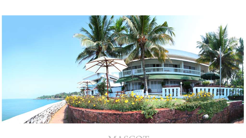
Mascot Beach Resort Kannur — Beach resort in Kannur city
Verified
Beach resort · Kannur city
Mascot Beach Resort Kannur

Kerala Tourism-listed cliff-facing beach resort near Kannur city. Mascot Beach Resort, Kannur resort, Sea view.

Directions Commission-freeView details
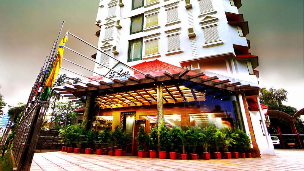
Hotel Blue Nile Kannur — Hotel in Kannur city
Verified
Hotel · Kannur city
Hotel Blue Nile Kannur

Kerala Tourism-listed four-star hotel on S.N. Park Road, Kannur. Kannur hotel, S N Park Road, City stay.

Directions Commission-freeView details
Central Avenue Kannur — Hotel in Kannur city
Verified
Hotel · Kannur city
Central Avenue Kannur

Kerala Tourism-listed four-star hotel near Thavakkara, Kannur. Kannur hotel, Thavakkara, City base.

Directions Commission-freeView details
Theyyam Calendar DTPC Kannur — Cultural calendar in Kannur city
Verified
Cultural calendar · Kannur city
Theyyam Calendar DTPC Kannur

DTPC Kannur Theyyam Calendar is the responsible first check for seasonal Theyyam venues, dates and local timing before planning a ritual-arts itinerary. Kannur district, Kerala · Public calendar; confirm locally · Theyyam, Kannur culture, DTPC calendar.

Directions Commission-freeView details
St Angelo Fort Kerala Tourism — Fort in Kannur city
Verified
Fort · Kannur city
St Angelo Fort Kerala Tourism

St. Angelo Fort is Kannur city sea-fort anchor, best planned with current entry, timing, heat and nearby Payyambalam or Arakkal context checked before travel. St Angelo Fort, Kannur Fort, Heritage.

Directions Commission-freeView details
J
Juishop
Where to eat
Top pick
Café · Kannur city
Juishop
Open · till 10:00 pm burger, ice cream, indian, local, tea

Café (burger, ice cream, indian, local, tea) on Thana Kakkad Road in Kannur City.

Directions Commission-freeView details
K
kairali hotel
Where to eat
Top pick
Restaurant · Kannur city
kairali hotel
Open · till 10:00 pm regional

Restaurant (regional) on Kannur-Calicut-Valanchery Highway in Kannur City.

Directions Commission-freeView details
M
Mascot Beach Resort
Place to stay
Top pick
Hotel · Kannur city
Mascot Beach Resort

Cliff-top resort overlooking the Arabian Sea near Baby Beach. Over 30 rooms with a pool, Malabar restaurant and an in-house Ayurveda centre.

Directions Commission-freeView details

Book with the place itself. India’s cyber-crime coordination centre warned in April 2025 that convincing copies of hotel and pilgrimage booking sites are being pushed through sponsored search and social ads, taking payment for rooms the property never hears about. Every listing here links to the business’s own contact details and its own Google or Bing profile — we take no commission and sit in nobody’s payment path. If a booking page reached you through an ad, check the address bar against the property’s own site before you pay. Fraud can be reported on cybercrime.gov.in or on 1930.

Ranked

The best of Kannur city, ranked

Nearest to the centre of Kannur city, on foot

Ordered by a real routed walk from the town centre — a different question, and the one that decides what you can do before lunch. Straight-line distance understates a real walk by about half again, so these are walking-network figures, not lines on a map.

Everything around Kannur city, by distance

Every place we hold for Kannur city, ordered by a real routed drive from the town centre. Times are free-flow and a real road rarely is, so read them as the floor rather than the estimate — anything that routed over ninety minutes is left out rather than published as a number we do not trust.

For hotels, homestays and local businesses

Get listed in Kannur city for free

Roampedia is commission-free. Travellers discover your business, book directly and contact you through official details. Basic listings are free, while Gold and Platinum package upgrades can be requested from the owner dashboard after approval.

List your business — free
Read before you go

Kannur city guides, stories & itineraries

Stories & history of Kannur city

Written about Kannur city itself — its history, its legends and the arguments about them.

Around Kannur city

These are written about individual places you can reach from Kannur city, rather than about the town as a whole.

Planning a trip to Kannur city

The practical half — what is actually here, in what order to see it, and how to arrive.
Kerala-wide guides & itineraries

Route-level itineraries and practical guides for the rest of the state.

See all 30 Kannur guides & stories →

Map

Where things are in Kannur city

FAQ

Kannur city travel FAQs

Why is part of Kannur called City and another part called Town?

Because they are different places. City is the old quarter towards Ayikkara that belonged to the Arakkal royal house and still carries the name; Town is the commercial centre around the bus stand, railway station and Thavakkara. Between them lies a third district again, the Cantonment at Burnacherry. All three names are in daily use.
Is the Kannur Cantonment the only one in Kerala?

Yes. India has sixty-two cantonment boards and Kannur’s is the only one in the state, classified Class III. The board was constituted in 1938 and has twelve members, six elected by civilian residents, with the Officer-in-Command as chairman. At the 2011 census the cantonment’s population was 4,798.

What is the Defence Security Corps doing in Kannur?

The DSC Centre, DSC Records and the DSC Pay Accounts Office are all here, on the road towards Payyambalam, and the Kannur centre is the mother depot for every DSC platoon in India. The corps guards defence installations of all three services and is the sixth-largest corps of the Indian Army; it was raised in 1947 and took its present name in 1958.

Did the Arakkal rulers really govern Lakshadweep?

Yes. The islands came to them as a jagir from the Kolathiris in the sixteenth century, and the family held them for centuries. The 1796 agreement with the British left them possession without sovereignty; the British took over the islands’ administration from 1854 to 1861 and permanently from 1875; and in 1905 the Ali Raja formally ceded all remaining rights, including to Minicoy, in return for the remission of tribute, a pension and the title of Sultan.

Could a woman rule the Arakkal kingdom?

Yes, and several did. The house followed marumakkathayam, so the eldest member of the family became its head regardless of sex — a male ruler took the title Ali Raja or Adi Raja, a female ruler the title Arakkal Beevi. Bibi Junumabe II ruled for forty-two years, from 1777 to 1819.

What happened to Kannur’s beedi industry?

Kerala was the first state to implement the Beedi and Cigar Workers (Conditions of Employment) Act of 1966, and private manufacturers moved production to Karnataka rather than comply, leaving thousands unemployed. The Kerala Dinesh Beedi cooperative was inaugurated in 1969 in response, grew to some 6.85 billion beedis a year in the nineties, and has since diversified — its own website now lists food products, garments, umbrellas and software, and employment of about 6,000 people.

Where is Kannur’s airport, and is there anything left of the old airstrip?

Kannur International Airport is at Mattannur, well inland from the city, and has its own page here. The old airstrip was inside the cantonment at Fort Maidan, and from 29 October 1935 Tata Airlines called there on a weekly Bombay–Thiruvananthapuram service that also stopped at Goa. The service was short-lived.

What are the best places to visit in Kannur city?

Top places to visit in Kannur city include St. Angelo Fort, Payyambalam Beach, Arakkal Museum, Theyyam performances — each has a full guide with how to reach it and what to see nearby on this page.

How do I reach Kannur city?

The nearest airport to Kannur city is Kannur (CNN), in-district. The rail gateway is Kannur (CAN) or Thalassery (TLY).

What is the best time to visit Kannur city?

October to March is the driest and most comfortable season to visit Kannur city and the rest of Kerala. The June–September monsoon is lush and green but wet, and often brings lower low-season prices.

Photographs: Kidu (Public domain), Akshayanil919 (CC BY-SA 4.0), Vinayaraj (CC BY-SA 4.0). Wikimedia Commons.

Image credits