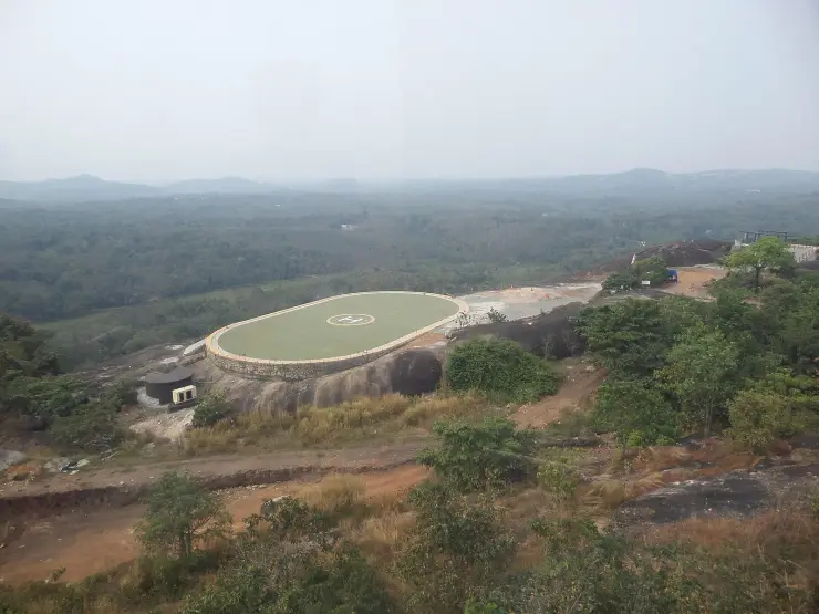
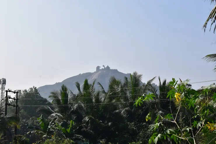
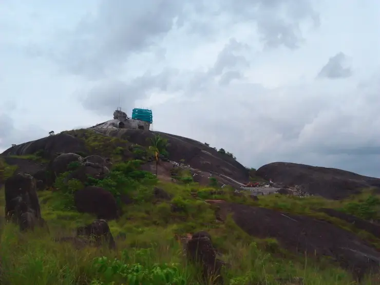
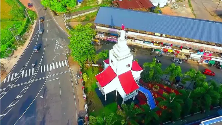
Almost everything written about Chadayamangalam is about a rock on its southern edge. The village underneath is a working administrative town of 22,473 people on the MC Road between Ayoor and Nilamel, and it carries an unusual amount of government for its size: the grama panchayat office, the block panchayat office for eight panchayats, a sub-registrar, a sub-treasury, a Regional Transport office, a KSRTC sub-depot, a KSEB section office, a Rubber Board field station and a police station, all inside about a kilometre of one junction. It is the seat of the 122nd assembly constituency, whose electorate has grown by more than half since 1996. It holds a state-level training institute for watershed management that no travel writing mentions. Its own pilgrimage centre is not the Rama temple on the rock but a Sastha temple 450 m west of the junction. This page is about that town.
Take the geography first, because the town is easy to misread from a car window. Chadayamangalam grama panchayat covers 19.04 square kilometres on both sides of the MC Road, between the towns of Ayoor to the north and Nilamel to the south, and it is bounded by six other panchayats — Edamulakkal, Ittiva, Kadakkal, Nilamel, Pallickal and Elamad. It is divided into fifteen wards, and the ward names are the real map of the place: Theruvinbhagam, Vellooppara, Idaykkodu, Madannada, Poonkodu, Akkonam, Mannamparambu, Kannamkodu, Chadayamangalam, Kuriyodu, Vettuvazhi, Kalayam, Kallikkadu, Moolamkodu and Poredam. Poredam is the ward that contains the river shelf we describe elsewhere; Kuriyodu and Poonkodu are where the schools and the fuel stations are. The junction everybody calls Chadayamangalam is one ward out of fifteen.
The second thing to understand is how much administration sits here. Chadayamangalam is the headquarters of a block panchayat that covers eight grama panchayats — Chithara, Kadakkal, Chadayamangalam, Ittiva, Velinalloor, Elamad, Nilamel and Kummil — with its block office about 1.5 km north of the junction. It is also the seat of the Chadayamangalam assembly constituency, numbered 122, which is part of the Kollam Lok Sabha constituency and the Punalur revenue division. English Wikipedia describes the constituency as drawing from both Kottarakkara and Punalur taluks and from both the Chadayamangalam and Anchal block panchayats; Malayalam Wikipedia lists it as the eight panchayats of Kottarakkara taluk plus Alayamon in Pathanapuram taluk. The two accounts do not match, and we have not found a primary Election Commission notification to settle which is current, so we print both.
The list of government offices in the town is longer than the tourist literature would suggest, and Malayalam Wikipedia sets it out: a police station, a sub-registrar office, a post office, a sub-treasury, a Regional Transport office, a KSRTC sub-depot, a KSEB section office, a Kerala State Beverages Corporation outlet, a Rubber Board field station, a government hospital and a government homoeopathy dispensary, alongside the grama and block panchayat offices. OpenStreetMap adds a government Ayurveda dispensary about 350 m north of the junction, and a PWD office and village office about 670 m north. Five banks are listed, including a district co-operative bank branch and a service co-operative bank. This is what a Kerala taluk-adjacent service town looks like from the inside: not a market, a filing cabinet.
The institution worth going out of your way to know about is the Institute for Watershed Development and Management, Kerala. It sits on the MC Road about 360 m north of the junction, on rather more than an acre of hillside, and it is the state-level training and extension centre of the Department of Soil Survey and Soil Conservation. It runs a one-year Diploma in Watershed Management as a Programme Study Centre of IGNOU, in collaboration with the Government of India’s Department of Land Resources, at a fee of ₹10,000 with a fifty per cent concession for BPL and rural students. It is an outreach centre of MANAGE and the Extension Education Institute at Hyderabad, and an outreach study centre for Indian Institute of Remote Sensing courses in remote sensing, GIS and GPS. The department’s own site states that the institute trained about 12,000 participants within four years of opening. It has a hostel, two training halls, an air-conditioned conference room, a library, and a watershed museum with 3D exhibits. We have not been able to establish the year it was founded, and we have not found any statement about whether the museum admits casual visitors — it is a working training campus, so assume it does not without asking first.
Chadayamangalam is not a one-hill town, which is the impression the sculpture leaves. English Wikipedia names six further hills in the village besides the famous one: Vayanam Mala, Pavoor Mala, Alathara Mala, Elambrakodu Mala, Arkannur Madappara Mala and Thevannur Mala. Arkkannoor, in the west of the panchayat, has a Durga Devi temple, a government lower primary school and a government vocational higher secondary school of its own, about 2.9 km from the junction. This is uplands country of small rounded rises and red weathered ground, and the settlement pattern follows the low saddles between them rather than any single high point.
The village’s own pilgrimage centre is the Sree Kunjayyappa temple at Pattupurakkal, about 450 m west-south-west of the junction and a kilometre from the tourist rock in the opposite direction. Malayalam Wikipedia says it is administered by the Travancore Devaswom Board, that its construction and observances follow Sabarimala including a patinettampadi, that devotees arrive with the irumudi from across the country, and that unlike Sabarimala it is open for worship all year. Its festival is described as the well-known one in the town. Treat those details as reported rather than established: the description comes from Malayalam Wikipedia and the temple’s own Facebook page, without a corroborating Devaswom Board listing or archived news report.
The population figures for this place disagree with each other, and the disagreement is instructive rather than sloppy. The 2011 Census records Chadayamangalam revenue village at 22,473 people in 5,707 households, over an area given as 26.21 square kilometres. English Wikipedia gives 22,213. Malayalam Wikipedia’s panchayat article gives 19,846 over 19.04 square kilometres, with a density of 1,042 per square kilometre and a literacy rate of 89.16 per cent, citing panchayat-level sources that appear to predate the 2011 count. The revenue village and the grama panchayat are not the same polygon and were never meant to be, so two different areas and two different populations for one name is the expected result, not an error. Where a figure matters, we say which unit it belongs to.
One number in that census return is worth stopping on. Chadayamangalam village recorded 10,242 men and 12,231 women in 2011 — a sex ratio of 1,194 women per 1,000 men, against a Kerala state figure of 1,084 and an Indian figure far below both. That is a gap of roughly two thousand people. The child sex ratio, at 983, is close to normal, which means the imbalance is in the adult population rather than at birth. The standard reading of an adult gap of that shape in Kerala is long-term male labour migration to the Gulf, and this is a district with a heavy migration history. We could not find a study or a survey that measures migration for this specific village, so we report the figure and the usual explanation separately, and do not assert the second as the cause of the first. Literacy in 2011 was 93.38 per cent, with 95.80 per cent for men and 91.40 per cent for women.
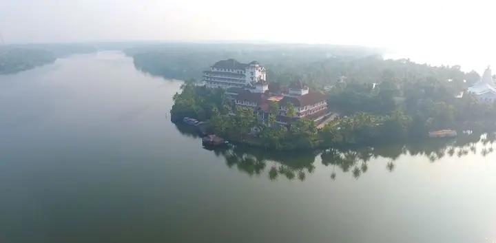
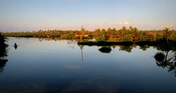
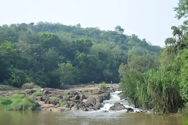
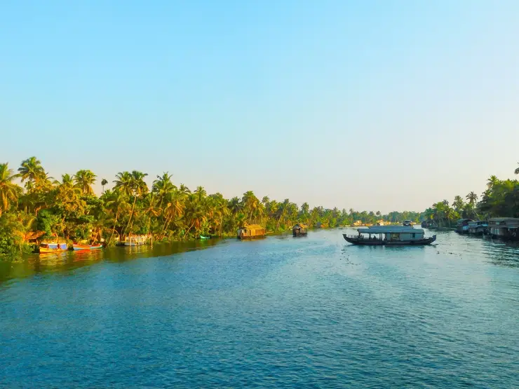
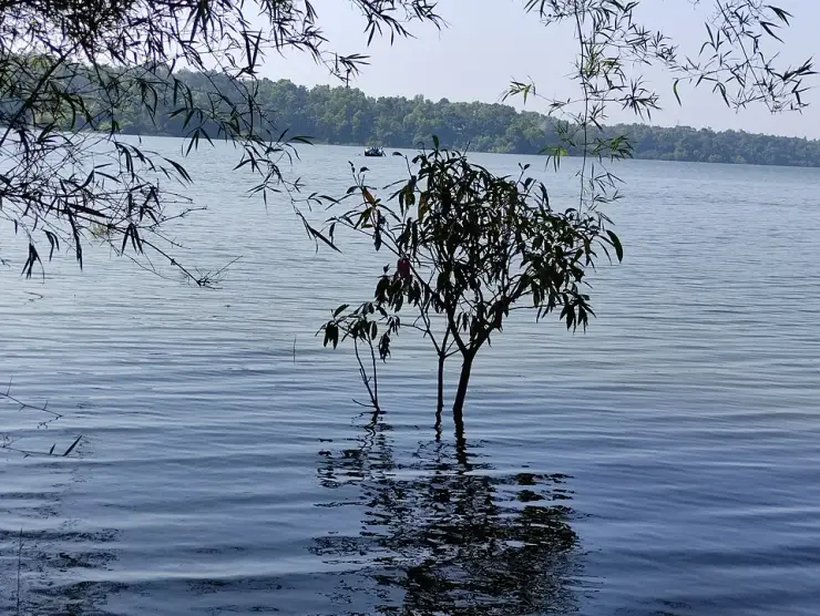
The town sits near a river, though less obviously than English Wikipedia’s phrasing suggests. Its article says Chadayamangalam is located along the Ithikkara, while the river article does not mention the town. Maps show Ithikkara aaru passing about 735 metres north of the central junction. The river is real and close, but the town is arranged around the road rather than the water.
Finally, the road, because the town exists because of it. Chadayamangalam is on the corridor everyone locally calls the MC Road, which through this stretch is also signed as NH-744, the Kollam–Theni highway. English Wikipedia puts the town 37.5 km from Kollam and 43 km from Thiruvananthapuram, 14 km from Kilimanoor and 21 km from Kottarakkara; routing over the mapped road network in August 2026 gave 36.2 km from Kollam town and 51.7 km from Thiruvananthapuram. The Kollam figures agree; the Thiruvananthapuram ones do not, and the gap is almost certainly a question of which point in a large city you measure from. Chadayamangalam has its own KSRTC bus station about a kilometre north of the rock, and a separate highway stop signed Jatayuppara that is the one visitors to the park actually want.
Legend & myth
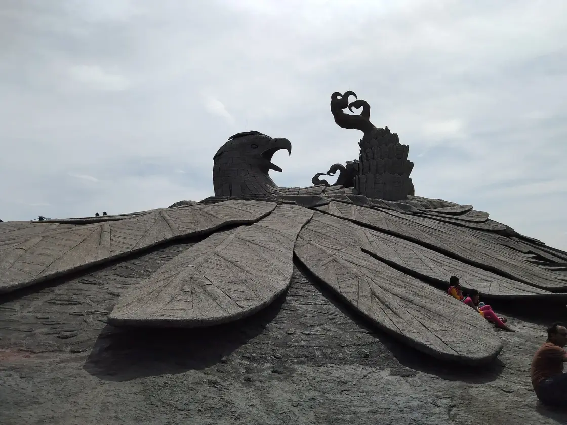
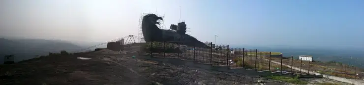
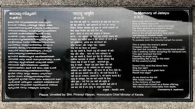
The town’s famous claim is that Jatayu, the vulture of the Ramayana, fell here after Ravana cut off his wing, and that Rama performed the bird’s last rites on this rock. It is a genuine and living local tradition. It is also not the only one, and this is the part that Chadayamangalam’s own publicity never mentions: at least two other places in south India make the same claim, and both of them can point at older stone than anything here.
The first is Lepakshi, a village in the Sri Sathya Sai district of Andhra Pradesh, about 120 km north of Bangalore. Its claim is built into the place-name in exactly the way Chadayamangalam’s is: Telugu folk etymology reads Lepakshi as le, pakshi — “rise, O bird” — the words Rama is said to have spoken when he found the dying Jatayu. The Veerabhadra temple there was built in the sixteenth century under the Vijayanagara empire, carries one of the largest surviving bodies of Vijayanagara mural painting, and is on UNESCO’s tentative list of World Heritage sites. It has a carved Jatayu and a footprint in the rock, which is the same pair of physical proofs offered at Chadayamangalam.
The second is Thiruputkuzhi in Tamil Nadu, a village about eleven kilometres west of Kanchipuram, and its claim is the most tightly argued of the three. The Vijayaraghava Perumal temple there is one of the 108 Divya Desams, sung in the Nalayira Divya Prabandham, and its stone inscriptions date it to the thirteenth century under the Pandyas. The village name is read as pul — a bird of the eagle family — plus kuzhi, a pit: the pit in which Jatayu was buried. There is a tank called the Jatayu theertham where the bird is said to have fallen, and the presiding deity is shown in the posture of performing the funeral rites. We already publish this on our own Tamil Nadu pages, under Kanchipuram, and have done for some time — which means our site has been carrying two rival claims to the same eight verses of the Aranya Kanda without ever saying so.
Set the evidence side by side and the asymmetry is stark. Lepakshi has 1530s sculpture and murals. Thiruputkuzhi has thirteenth-century inscriptions, a place in the Divya Desam canon, and an iconography that depicts the specific episode. Chadayamangalam has a place-name, a hollow in the rock venerated as a footprint, a Rama temple whose founding date we have not been able to source, and a concrete bird finished in 2018. That is not a reason to dismiss the Kerala tradition — the absence of datable stone is the normal condition of a folk tradition, not evidence against it, and the two rival sites are temple institutions with endowments and inscriptions precisely because temples produce documents and villages do not. But it does mean that anyone who tells you Chadayamangalam is where Jatayu fell is telling you about a belief, not a location, and that the belief has competitors with better paperwork. We are not going to adjudicate between three living traditions, and we would be suspicious of anyone who did. What we will say is that the town’s own name almost certainly has nothing to do with the bird — that argument is set out in full on our separate page about the etymology, and it turns on a real, inscribed eighth-century ruler rather than on the epic — and that the Ramayana itself does not name any of the three places.
The second story here is about a phrase, and it is the one most likely to mislead a visitor. The Sree Kunjayyappa temple at Pattupurakkal is described in Malayalam as sthreekalude Sabarimala, the women’s Sabarimala, on the strength of a claim that it follows Sabarimala’s architecture and observances — an eighteen-step patinettampadi, devotees arriving with the irumudi — while remaining open to all worshippers all year round. It is a real and locally meaningful description. It is also not a title, and it is very far from unique.
Search the phrase in Malayalam and it turns up attached to at least half a dozen different Kerala temples, meaning at least three different things. At Attukal in Thiruvananthapuram it refers to the Pongala, the mass women’s offering, and one memoir traces the epithet there to a 1954 instruction to the temple committee. At Chakkulathukavu in Alappuzha it describes a Devi temple in central Travancore. At Thiruvairanikulam in Ernakulam it attaches to the annual few days when the goddess’s sanctum is opened. At Mandaikkadu, just over the border in Kanniyakumari district, it is used because women may enter carrying the irumudi. At the Areeswaram Sastha temple it appears alongside “mini Sabarimala”. And at Chadayamangalam it means a Sastha temple, built and served like Sabarimala, where the restriction that defines Sabarimala does not apply.
So the phrase is a genre rather than a claim to fame, and each temple that carries it is answering a different question about the same famous exclusion. Chadayamangalam’s version is the most literal of them — not a goddess temple offered as an alternative, but an Ayyappan temple described as following Sabarimala traditions without the same barrier. The available account is limited to a paragraph on Malayalam Wikipedia and the temple’s own Facebook page; no accessible Devaswom Board page, dated festival calendar, archived news report or scholarly notice corroborates the detail. This remains a working temple with a festival the town considers its own, but the thin documentation is why the description stops there.
One last piece, which we are recording as a claim rather than a fact because we could not check it. English Wikipedia’s account of the rock mentions a Kokkarani, a water source at the top said to have been made by Jatayu rubbing the stone with his beak, and describes water surfacing there through the year. A perennial source on the summit of a bare crystalline dome is a genuinely odd thing physically, and it is exactly the kind of oddity that attracts a story. We could not source the perennial claim to anything but that article, we have not seen it ourselves, and we are not going to offer a geological explanation we cannot support. The bonnet macaques the same article reports on the hill are, at least, easy enough to believe.
More about Chadayamangalam
History
The origin of the name is dealt with elsewhere on this site and we will not repeat it here beyond the conclusion: historians trace the settlement to the eighth or ninth century and to a ruler named Chadayan in the era of the Ay–Pandya conflict, with -mangalam being the ordinary medieval suffix for a granted or settled village. The Ramayanic reading of the name came later. The nearest town, Ayoor, carries the Ay name in the same way.
The modern town is a creature of three overlapping administrative reorganisations rather than of any single founding. It became the seat of a grama panchayat, of a block panchayat covering eight panchayats, and of an assembly constituency, and it is the coincidence of all three in one small place that explains the density of government offices around the junction. The Punalur revenue division and Kottarakkara taluk are the layers above it.
The constituency is the clearest long record the town has. Registered electors in Chadayamangalam constituency went from 1,31,047 in 1996 to 1,43,376 in 2001, 1,77,610 in 2011, 1,96,733 in 2016, 1,97,285 in 2021 and 2,01,716 for the 2026 election — a rise of about 54 per cent in thirty years, with almost all of it before 2016 and very little since. That flattening is the demographic story of southern Kerala in one column of figures.
The seat has been a CPI stronghold in living memory. Prayar Gopalakrishnan represented it in the mid-2000s and is recorded as having pushed the transfer of the hilltop land from the Revenue Department to Tourism in 2004. Mullakkara Retnakaran of the CPI has represented the constituency since 2006 and served as Kerala’s Minister for Agriculture in the twelfth legislative assembly. Malayalam Wikipedia records J. Chinchu Rani of the CPI as the sitting member for the 2021 assembly. English Wikipedia, checked on 19 August 2026, records M. M. Naseer of the Indian National Congress as the member following the 2026 election, while the Malayalam article had not been updated to match. Treat the 2026 line as the less settled of the two.
There is a small dated document in the village that makes the political history concrete. The gateway of the Government Lower Primary School at Arkkannoor carries a Malayalam plaque recording that it was built from the local development fund of the Minister for Agriculture, Sri Mullakkara Retnakaran, in 2009–2010. The photograph of it on Wikimedia Commons is legible enough to read the year off. Constituency development money, a sitting minister who is also the local member, and a village school gate — that is how public works reach a place like this, and here it is written on the arch.
The land itself has been worked rather than developed for most of that time. The crops of the block are given as paddy, coconut, rubber, tapioca, pepper, cashew, banana and areca nut, and the presence of a Rubber Board field station in the town says which of those has mattered most in the last half-century. The state watershed institute on the MC Road belongs to the same story from the other end: a district of laterite slopes, smallholdings and seasonal rain, where soil and water conservation is an agricultural problem before it is an environmental one.
Why visit
It is the natural stop between Kollam and Thiruvananthapuram on the MC Road, with a KSRTC station, fuel, banks and a hospital in one place.
The Sree Kunjayyappa temple at Pattupurakkal is an Ayyappan temple run on Sabarimala’s own lines and open all year, 450 m from the junction and almost never visited by outsiders.
The town is the base for four separate places we cover — the rock, the open high ground, the temple belt out towards Kottukkal and Kadakkal, and the river shelf at Poredam.
It is uplands country with at least seven named hills, so the drive out to Arkkannoor or Kadakkal is worth an hour on its own.
The state watershed institute here runs a genuine watershed museum with 3D exhibits, on a working government campus that will tell you whether you may see it.
Everything except the ticketed park is free, and there is no tourist infrastructure at all — which is the point.