Places to Visit in Karunagappally

Backwater-and-highway town in Kollam’s northern taluk, on the Alappuzha seam. Four singular places ring it — two shrines with no idol, the Chamayavilakku temple, and the Alumkadavu boatyards on Kayamkulam Kayal.

Karunagappally
Practical guide

Plan Karunagappally

Who's going?Tailor Karunagappally to your trip
DistrictKollam
RoleCoastal north base
Time neededA day, using the town as a base
Places to visit5Listed businesses7

Karunagappally is a base rather than a sight. The town itself is a working coastal junction on NH-66 — coir, cashew and fishing, with its own railway station and KSRTC depot — and what earns it a day is the ring of unusual places around it: two shrines with no idol at all, a Devi temple famous for a night when men process in saris, and a boatyard village on Kayamkulam Kayal where the modern Kerala houseboat was designed in 1991.

Those four places fan out in four directions, so a car or an auto hired for the day is the difference between seeing all of them and seeing one. Nothing here charges an entry fee, and nothing here is set up for visitors: the boatyards at Alumkadavu in particular are private working banks, not a ticketed site.

What to expect

Highlights

  • Cheriazheekal Temple — A coastal temple destination in the Cheriazheekal–Alumkadavu belt, visited as a living place of worship rather than a generic beach-side landmark.
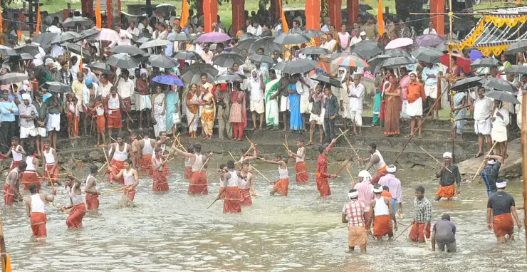
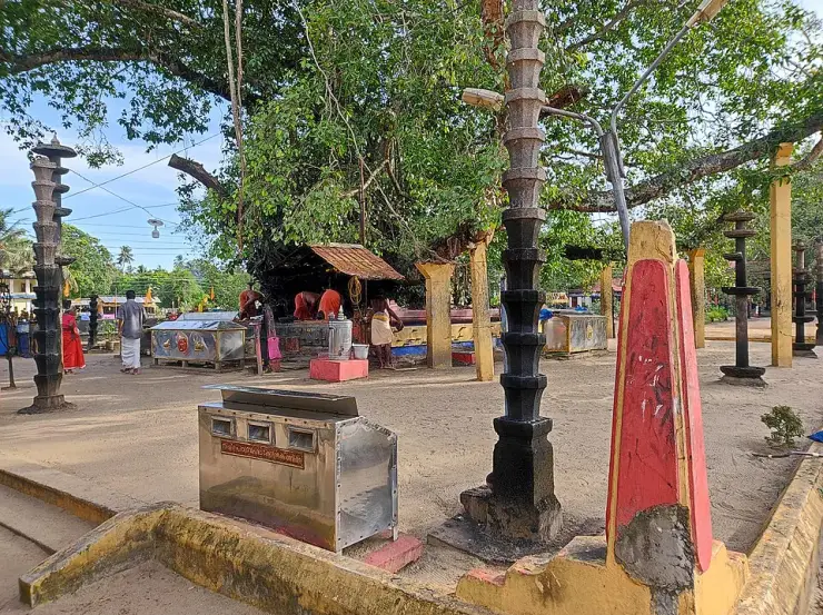
  • Oachira Parabrahma Temple — An unusual temple with no idol or building over the deity, set in an open grove; famous for the Oachira Kali festival.
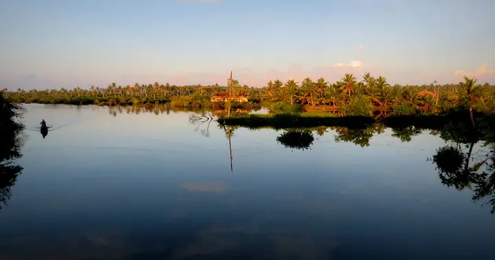
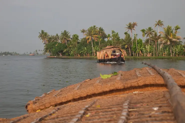
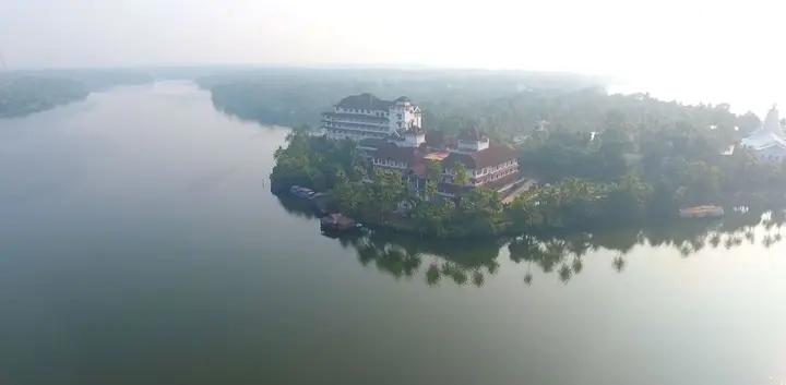
  • Alumkadavu — The boatyard village on Kayamkulam Kayal where the first Kerala houseboat was designed in 1991 — hulls of anjili wood drawn together with coir on an open bank, three kilometres west of Karunagappally. ⚠ Kerala Tourism places it on Ashtamudi Lake and calls it the birthplace of India’s houseboats; it is on Kayamkulam, and Srinagar’s date from the 1880s. These are private working yards, not a ticketed site — ask before you walk in.
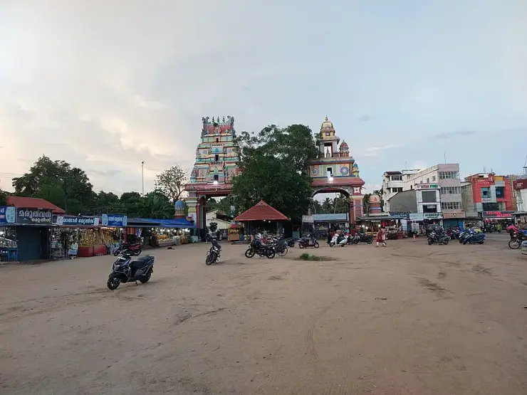
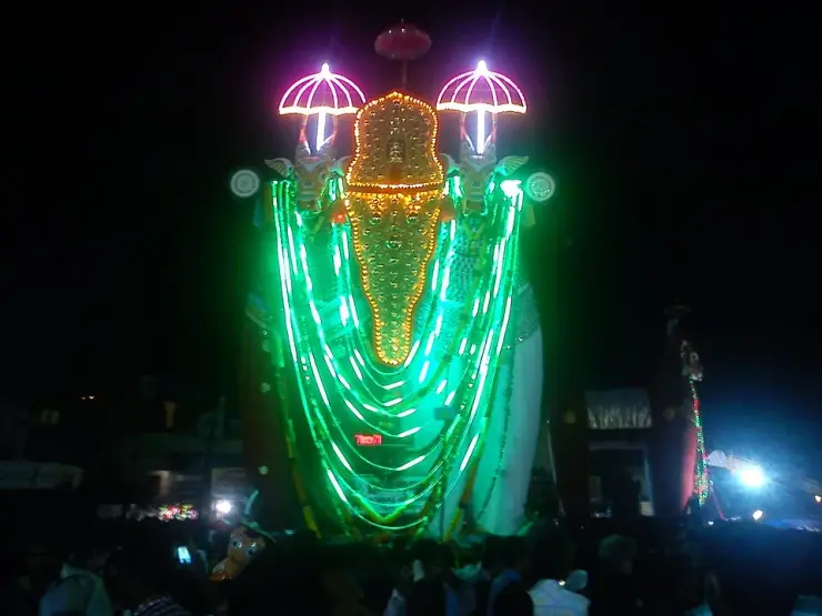
  • Kottankulangara Devi Temple — A Devi temple at Chavara north of Kollam, known across Kerala for Chamayavilakku — the two nights in Meenam when men and boys dress in saris and carry lamps in procession to the goddess, re-enacting the cowherd boys of its founding legend.
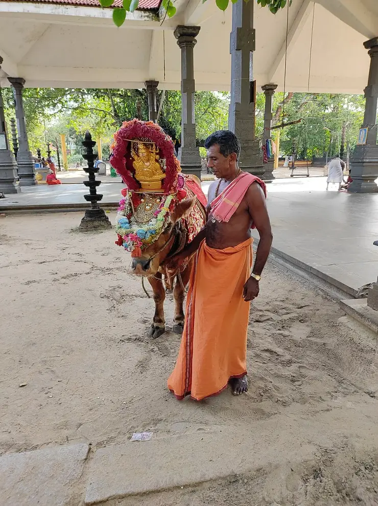
  • Poruvazhy Peruviruthy Malanada — A temple with no idol and no sanctum — an open pillared mandapam over a raised platform, worshipped by sankalpam. The presiding figure is Mala Appooppan, the grandfather of the hill, conceived in the form of Duryodhana; the priest is the Oorali rather than a Brahmin, and toddy is the traditional offering.
Getting there

How to visit

  • Nearest airport: Trivandrum (TRV), ~69 km
  • Rail gateway: Kollam Junction (QLN)
Timing

Best time to visit Karunagappally

October–February on this coast. The Kottankulangara Chamayavilakku festival (March) and the Oachira Kali (June) are the two dates that transform the area.

Weather in KarunagappallySeasonal guide

Live forecast loads in your browser.

Today at Karunagappally
Sunrise6:12 am
Sunset6:16 pm
Golden hour best light5:16 pm–6:16 pm
Blue hour after sunset6:16 pm–6:41 pm
Sun sets toward compass bearingW · 267°
Moon tonight🌖 Waning gibbous · 87%
South-west monsoon. June to September is the south-west monsoon in Kerala. Expect heavy showers, mostly in bursts rather than all day — carry rain cover, allow extra time for getting around, and note that ferries and open-air sites are the first things affected.

Sun and moon are calculated for this location and shown in IST. Photography windows are the hour around sunrise and sunset; the sunset bearing is degrees clockwise from true north. Moon phase is accurate to about half a day.

The story

The story of Karunagappally

A coastal taluk town 27 km north of Kollam, between the Arabian Sea and the Pallikkal river, in the old Onattukara country. It was part of Odanad — a kingdom that ran from the eleventh century until Travancore absorbed it in 1746 — and its name is traditionally traced to a Buddhist monk. Today it lives on coir, cashew and fishing.

Karunagappally sits on the coastal strip of northern Kollam district, 27 kilometres up from Kollam town, with the sea on one side and the Pallikkal river running by. The taluk is bounded by Kayamkulam to the north, Kunnathur to the east, Kollam to the south and the Arabian Sea to the west — a low, sandy, densely settled belt of coconut, backwater and beach.

Its history is the history of a kingdom that most visitors have never heard of. This tract was part of Odanad, a feudal state of late medieval Kerala also known as Onattukara, Kayamkulam, Onad, Kallikoilon and Chirava Svaroopam. It was established in the eleventh century and lasted until 1746, when it was absorbed into Travancore during Marthanda Varma's northward expansion. At its dissolution Odanad covered what are now the taluks of Mavelikkara, Karthikappally and Chengannur in Alappuzha district, together with Karunagappally in Kollam.

That is a substantial polity, and it explains a good deal about this stretch of coast that otherwise looks arbitrary — why the Onattukara identity crosses a modern district boundary, why Kayamkulam and Karunagappally feel related, and why the temple at Kandiyoor far inland is described as the capital shrine of Odanad. The kingdom is gone; its shape is still legible in what people here consider their own region.

The Kayamkulam rajas left a specific mark on the town. Padayanarkulangara, now part of Karunagappally, was once their military station. The name itself carries it — padayani ground, the place of the army — and a garrison town for a kingdom that spent much of the eighteenth century resisting Travancore is a reasonable thing for this place to have been.

The town's own name has a stranger and more interesting derivation. Tradition holds that a Buddhist bhikshu named Karinagan lived here, and that the place takes its name from him together with its position on the bank of the Pallikkal river. Whatever the philology, the association is not out of place: this whole tract carried Buddhist settlement, and the Buddha now enshrined at Mavelikkara, one taluk north in the same old kingdom, is a survivor of it. Karunagappally is one of several Kerala place names in which a Buddhist past is preserved in a syllable and nowhere else.

What the town does today is make things from what grows here. Coir is the traditional industry, as it is all along this coast. Cashew processing is the other major one — Kollam district is the centre of India's cashew trade and Karunagappally is part of that economy. And it is a fishing town, with the sea a few kilometres west and the backwater system behind.

The area around it is unusually dense in unusual places, and we cover them separately: Oachira, the temple with no idol and no building over its deity; Kottankulangara, where men dress as women for the festival; Poruvazhy Peruviruthy Malanada, one of very few temples anywhere dedicated to Duryodhana; and Alumkadavu, where the Kerala houseboat as tourists know it was invented. That is four genuinely singular sites within a short radius of one ordinary-looking taluk town.

Karunagappally itself is the market, the junction and the base for all of that. It is not the attraction; it is the address you use to reach four of them.

Legend & myth

The first thing to hold carefully is the word Onattukara, because it does two different jobs and confusing them will scramble any history you read about this coast. Onattukara is one of the alternative names of Odanad, the medieval kingdom — alongside Kayamkulam, Onad, Kallikoilon and Chirava Svaroopam. It is also the name still used today for the regional tract covering roughly Mavelikkara, Karthikappally, Karunagappally and their surroundings, with its own agricultural identity and its own sesame. So a sentence saying Karunagappally "was previously known as Onattukara" is using the kingdom sense, and a sentence about Onattukara sesame is using the modern regional sense. Both are correct and they are not the same thing.

The second is the kingdom's own tangle of names, which is genuinely difficult and which we would rather flag than smooth over. Odanad, Onattukara, Onad, Kayamkulam, Kallikoilon and Chirava Svaroopam are all used for the same polity in different sources and periods — Kayamkulam being the one most readers will recognise, since the Kayamkulam rajas are the actors in the eighteenth-century wars. If you meet these as though they were separate kingdoms, they are not. The state was established in the eleventh century and ended in 1746, when it passed to Travancore.

The third is the date, and here we want to be careful for a reason specific to this district. 1746 is given for Odanad's absorption into Travancore. Elsewhere on this coast we have found the annexation dates genuinely unsettled — the Karappuram transfer at Cherthala is variously 1753, 1755 and 1762, and the Alappuzha district administration gives no year at all. We have not found comparable disagreement over 1746, but a reader should treat any single year for a Travancore annexation in this period as the date of one step in a process rather than the whole story.

The fourth is the etymology, which is charming and unprovable in equal measure. The tradition is that a Buddhist bhikshu named Karinagan lived here, and that the town's name comes from him plus its situation on the Pallikkal river. Place-name derivations of this kind are folk etymology in the technical sense: they may preserve a real memory or they may be a later explanation fitted to an existing sound. We repeat it because it is the tradition and because the Buddhist context is independently real for this tract — not because it is established linguistics.

The fifth is a caution about that Buddhist context, in both directions. It is true that this part of Kerala held Buddhist settlement, and the enshrined Buddha at Mavelikkara — one taluk north, in the same former kingdom — is physical evidence of it. It is not true that every Kerala place name containing a nasal syllable encodes a Buddhist origin, and a large amateur literature claims exactly that. Treat the Karinagan story as this town's own tradition rather than as a data point in a general theory.

The sixth is scale and expectation. Karunagappally is a working coastal taluk town with a market, a highway and industry. The reasons to come to this part of the coast are almost all just outside it — Oachira, Kottankulangara, Malanada, Alumkadavu, the beaches — and a visitor who arrives expecting the town itself to be the destination has misread the map. That is not a criticism of the place; it is what a taluk headquarters is for.

The seventh is Padayanarkulangara, which is worth naming precisely because it is easy to pass. It is described as having been the military station of the Kayamkulam rajas and is now simply part of the town. There is no fort to see. What there is, is a name that records a garrison, in a kingdom that spent its last decades resisting the power that eventually absorbed it.

More about Karunagappally

History

Karunagappally is a taluk town on the coast of northern Kollam district, about 27 km north of Kollam city, situated on the Pallikkal river between the Arabian Sea and the backwaters. The taluk is bounded by Kayamkulam to the north, Kunnathur to the east, Kollam to the south and the sea to the west.

The area formed part of Odanad, a feudal state of late medieval Kerala also known as Onattukara, Onad, Kayamkulam, Kallikoilon and Chirava Svaroopam. Odanad was established in the eleventh century and was dissolved in 1746, when it became part of the Kingdom of Travancore under Marthanda Varma's northward expansion. At its dissolution the state comprised the present-day taluks of Mavelikkara, Karthikappally and Chengannur in Alappuzha district together with Karunagappally in Kollam district.

Padayanarkulangara, now part of the town, was formerly the military station of the Kayamkulam rajas.

The town's name is traditionally derived from a Buddhist bhikshu named Karinagan said to have lived here, combined with its situation on the bank of the Pallikkal river. The wider tract carried Buddhist settlement in the early medieval period, of which the enshrined Buddha image at Mavelikkara — in the same former kingdom — is a surviving example.

Karunagappally's economy rests on coir, cashew processing and fishing. Kollam district is the principal centre of India's cashew trade, and coir is the traditional manufacture along this coast. Within a short radius of the town lie Oachira, Kottankulangara, Poruvazhy Peruviruthy Malanada and Alumkadavu, where the Kerala tourist houseboat was developed from the traditional kettuvallam.

Why visit

As the base for an unusually concentrated set of singular places: Oachira, whose deity has no idol and no roof; Kottankulangara, where men dress as women for the festival; Malanada, one of very few Duryodhana temples anywhere; and Alumkadavu, where the tourist houseboat was invented.

To stand in what was Odanad — an eleventh-century kingdom that ran until 1746 and whose shape still defines what people here call Onattukara.

For a town whose name is traditionally traced to a Buddhist monk, in a tract where Buddhist Kerala left more traces than almost anywhere else in the state.

For the working coast — coir, cashew processing and fishing — in the heart of India's cashew district.

For Padayanarkulangara, now an ordinary part of town, once the military station of the Kayamkulam rajas.

For the quieter beaches and backwater edges of northern Kollam, away from the Alappuzha houseboat crowds.
Before you go

Karunagappally — at a glance

Getting here

How to reach Karunagappally

  • ✈︎ By air Trivandrum international airport is roughly 100 km south.
  • 🚆︎ By train Karunagappally has its own station on the Thiruvananthapuram–Ernakulam coastal line; Kayamkulam junction is close by.
  • 🚗︎ By road On the NH-66, about 27 km north of Kollam city and just south of Kayamkulam.
  • 🚌︎ By bus Frequent KSRTC and private services along the NH-66.
Getting back

Check your return bus or ferry with the operator before setting out. Leave time to reach the stop or jetty after your visit, and arrange a return vehicle in advance for a remote outing.

Ask at the jetty or the stand for the time of the last service back, not the next one. If you miss it, an auto or a taxi is the fallback — agree the fare before you get in.

Getting around Karunagappally

If you need step-free access, contact the site before travelling. Ask about a level entrance, steps along the route, the nearest drop-off point, seating and accessible toilets.

Practical things near Karunagappally
ToiletsPublic Toilet 671 m · 8 min walkMapped Dec 2019DirectionsBus stopsKarunagapally Bus stop165 m · 2 min walkMapped Jan 2025DirectionsPharmacyAswas medical shop 843 m · 10 min walkMapped Feb 2021DirectionsHospitalSBM Hospital 342 m · 4 min walkMapped Sept 2021DirectionsClinicIdeal hospital 238 m · 3 min walkMapped Nov 2021DirectionsATMState Bank of India 266 m · 3 min walkMapped Jun 2022DirectionsBankIcic Bank 144 m · 2 min walkMapped May 2020DirectionsWater & snacksMargin Free Super Market 138 m · 2 min walkMapped Jun 2022DirectionsGroceries & bakeryGeetha Iceland Bakery215 m · 3 min walkMapped Apr 2020DirectionsBarber & salonBrocode Mens Saloon 828 m · 10 min walkMapped Jan 2021DirectionsPost officeHead Post Office,Karunagappally 350 m · 4 min walkMapped Dec 2019DirectionsSomewhere to prayMahadeva Temple 191 m · 2 min walkMapped Jun 2022Directions
What the cash actually costs
  • Withdrawing from a bank that is not your own is free for a set number of times a month, then costs up to ₹23 plus GST — about ₹27 a withdrawal. This is not one of the RBI’s six metro centres, so the allowance here is the higher one: at least five free other-bank withdrawals a month, and at least five at your own bank.
  • That free allowance belongs to Indian bank accounts. On a card issued abroad your own bank’s international withdrawal and exchange charges apply instead. If the machine offers to bill you in your home currency, choose rupees — the conversion rate on that offer is set by the machine, not by your bank.
  • Choose a well-lit ATM, preferably at a bank branch. Shield your PIN, avoid help from strangers and use your bank’s support number if a withdrawal fails or the machine retains your card.

Charge cap and free-transaction limits: Reserve Bank of India, in force since 1 May 2025.

These services are listed within about 1.2 km of Karunagappally. Walking distances follow mapped routes; access and opening hours can change. Other services may be closer but are not included here.

Nearby bases

Where to go from Karunagappally

In the district

Where Karunagappally sits in Kollam district

District HQKollam
LandscapeCoast, Ashtamudi backwaters and southern ghats

Kollam district is known for: Ashtamudi Lake, Munroe Island, Thenmala eco-tourism and the Kollam coast.

Ashtamudi Lake backwatersMunroe Island canoe tripsThenmala and Palaruvi Waterfalls
Stay · eat · do · rent · see · shop

Places in Karunagappally

Every verified place in Karunagappally — filter by what you’re after.

Ashram & guest accommodation · Karunagappally
Amritapuri Ashram (Mata Amritanandamayi Math)

The Mata Amritanandamayi Math at Amritapuri, which takes visitor bookings for simple ashram rooms.

Directions Commission-freeView details
Restaurant · Karunagappally
Nalla Bhoomi Family Restaurant

Nalla Bhoomi at High School Junction in Karunagappally focuses on Kerala coastal and Kuttanad cooking. Its menu includes banana-leaf kizhi biriyani, duck mappas and karimeen pollichathu. This is an NH66-side meal stop north of Kollam; check dish availability before making a special journey.

Directions Commission-freeView details
Top pick
Hotel · Karunagappally
Hotel Indraprastha Karunagappally

Highway hotel off the NH near Karunagappally town centre, with A/C and non-A/C rooms and the Galaxy restaurant.

Directions Commission-freeView details
Top pick
Temple · Karunagappally
Padanayarkulangara Mahadeva Temple

Karunagappally town’s principal Shiva shrine, on the Pallikkal river. It is administered by the Travancore Devaswom Board.

DirectionsView guide
Top pick
Ashram · Karunagappally
Panmana Ashramam

The samadhi ashram of Chattampi Swamikal at Panmana, open 8.30am to 6pm daily. Panmana Asramam, Panmana P.O., Kollam, Kerala.

DirectionsView guide
Ayurveda & wellness · Karunagappally
Amrita Ayurveda Hospital, Amritapuri

Teaching Ayurveda hospital of the Amrita School of Ayurveda at Vallikavu, with public OP booking.

Directions Commission-freeView details
Bus station · Karunagappally
KSRTC Karunagappally Depot

Karunagappally’s state bus depot on the national highway, run by an Assistant Transport Officer and the practical hub for buses along this coast.

Directions Commission-freeView details
Railway station · Karunagappally
Karunagappalli Railway Station (KPY)

Station KPY at Edakkulangara, the nearest railway station to Amritapuri.

Directions Commission-freeView details
Hotel · Karunagappally
Vijaya Hotel & Bar

Karunagappally hotel with deluxe, executive and step-free rooms, plus a bar and restaurant.

Directions Commission-freeView details
Jewelry · Karunagappally
Malabar Gold & Diamonds, Karunagappally

Malabar Gold & Diamonds showroom opposite the Government Boys High School, Karunagappally.

Directions Commission-freeView details
Shopping mall · Karunagappally
H&J Mall

Ten-storey shopping mall at Lalaji Junction, Karunagappally, with a cinema and 25-plus stores.

Directions Commission-freeView details
Municipal office · Karunagappally
Karunagappally Municipality Office

The municipal office for Karunagappally town, handling certificates, licences and permits. Karunagappally Municipality, Karunagappally P.O., Kollam, Kerala 690518.

Directions Commission-freeView details

Book with the place itself. India’s cyber-crime coordination centre warned in April 2025 that convincing copies of hotel and pilgrimage booking sites are being pushed through sponsored search and social ads, taking payment for rooms the property never hears about. Every listing here links to the business’s own contact details and its own Google or Bing profile — we take no commission and sit in nobody’s payment path. If a booking page reached you through an ad, check the address bar against the property’s own site before you pay. Fraud can be reported on cybercrime.gov.in or on 1930.

Places to visit

The places themselves, around Karunagappally

The best tourist places to visit in Karunagappally — temples, viewpoints, lakes, heritage and nature, each with a full guide, how to reach it and what to see nearby.

Oachira Parabrahma Temple, Karunagappally
PlaceOachira Parabrahma Temple

An unusual temple with no idol or building over the deity, set in an open grove; famous for the Oachira Kali festival.

Open guide →
Poruvazhy Peruviruthy Malanada, Karunagappally
PlacePoruvazhy Peruviruthy Malanada

A temple with no idol and no sanctum — an open pillared mandapam over a raised platform, worshipped by sankalpam. The presiding figure is Mala Appooppan, the grandfather of the hill, conceived in the form of Duryodhana; the priest is the Oorali rather than a Brahmin, and toddy is the traditional offering.

Open guide →
Kottankulangara Devi Temple, Karunagappally
PlaceKottankulangara Devi Temple

A Devi temple at Chavara north of Kollam, known across Kerala for Chamayavilakku — the two nights in Meenam when men and boys dress in saris and carry lamps in procession to the goddess, re-enacting the cowherd boys of its founding legend.

Open guide →
Alumkadavu, Karunagappally
PlaceAlumkadavu

The boatyard village on Kayamkulam Kayal where the first Kerala houseboat was designed in 1991 — hulls of anjili wood drawn together with coir on an open bank, three kilometres west of Karunagappally. ⚠ Kerala Tourism places it on Ashtamudi Lake and calls it the birthplace of India’s houseboats; it is on Kayamkulam, and Srinagar’s date from the 1880s. These are private working yards, not a ticketed site — ask before you walk in.

Open guide →
C
Cheriazheekal Temple
No photograph yet
PlaceCheriazheekal Temple

A coastal temple destination in the Cheriazheekal–Alumkadavu belt, visited as a living place of worship rather than a generic beach-side landmark.

Open guide →
For hotels, homestays and local businesses

Get listed in Karunagappally for free

Roampedia is commission-free. Travellers discover your business, book directly and contact you through official details. Basic listings are free, while Gold and Platinum package upgrades can be requested from the owner dashboard after approval.

List your business — free
Read before you go

Karunagappally guides, stories & itineraries

Stories & history of Karunagappally

Written about Karunagappally itself — its history, its legends and the arguments about them.

Around Karunagappally

These are written about individual places you can reach from Karunagappally, rather than about the town as a whole.

Planning a trip to Karunagappally

The practical half — what is actually here, in what order to see it, and how to arrive.

More from Kollam

Wider guides to Kollam — its coast, its culture and the routes through it.

See all 129 Kollam guides & stories →

Map

Where things are in Karunagappally

FAQ

Karunagappally travel FAQs

What was Odanad?

A feudal state of late medieval Kerala, established in the eleventh century and dissolved in 1746 when it passed to Travancore. It is also known as Onattukara, Onad, Kayamkulam, Kallikoilon and Chirava Svaroopam — all names for the same polity. At its end it covered the present taluks of Mavelikkara, Karthikappally and Chengannur in Alappuzha district and Karunagappally in Kollam district.

Where does the name Karunagappally come from?

Tradition traces it to a Buddhist bhikshu named Karinagan said to have lived here, together with the town's position on the bank of the Pallikkal river. This is a traditional derivation rather than established linguistics, though the Buddhist context of the wider tract is independently real.

Is Onattukara the same as Odanad?

It is one of the kingdom's names, yes — but Onattukara is also used today for the modern regional tract around Mavelikkara, Karthikappally and Karunagappally, known for its sesame and its own agricultural identity. The same word is doing two jobs, and which one is meant depends on the sentence.

What is there to see around Karunagappally?

A remarkable cluster: Oachira Parabrahma Temple, which has no idol and no building over its deity; Kottankulangara Devi Temple, whose festival has men dressing as women; Poruvazhy Peruviruthy Malanada, one of very few temples dedicated to Duryodhana; and Alumkadavu, where the Kerala tourist houseboat was developed from the kettuvallam. Each has its own page.

What is Padayanarkulangara?

A part of present-day Karunagappally that was formerly the military station of the Kayamkulam rajas. There is no fort remaining; the name records the garrison.

How do I reach Karunagappally?

It is on the NH-66 about 27 km north of Kollam, and has its own railway station on the Thiruvananthapuram–Ernakulam coastal line. Trivandrum international airport is the nearest airport.

What are the best places to visit in Karunagappally?

Top places to visit in Karunagappally include Oachira Parabrahma Temple, Poruvazhy Peruviruthy Malanada, Kottankulangara Devi Temple, Alumkadavu, Cheriazheekal Temple — each has a full guide with how to reach it and what to see nearby on this page.

What is the best time to visit Karunagappally?

October to March is the driest and most comfortable season to visit Karunagappally and the rest of Kerala. The June–September monsoon is lush and green but wet, and often brings lower low-season prices.

Photographs: Mahesh Mahajan (CC BY 2.0), arunpnair_787 (CC BY-SA 4.0). Wikimedia Commons.

Image credits