Places to Visit in Kadalundi

Estuary bird sanctuary shared with the Kozhikode coast.

Kadalundi
Practical guide

Plan Kadalundi

Who's going?Tailor Kadalundi to your trip
DistrictMalappuram
RoleBirding coast base
Time neededTwo to three hours for the estuary, the…
Places to visit2Listed businesses6

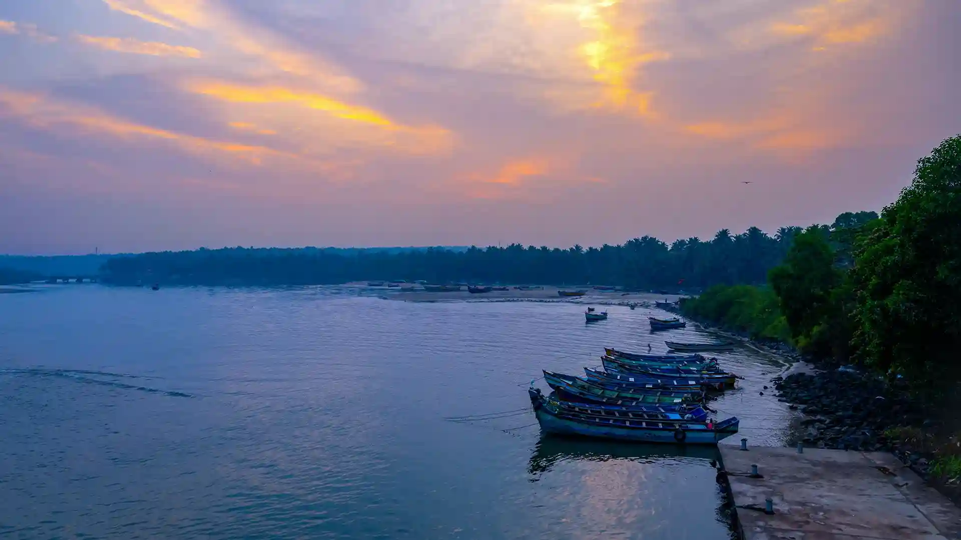
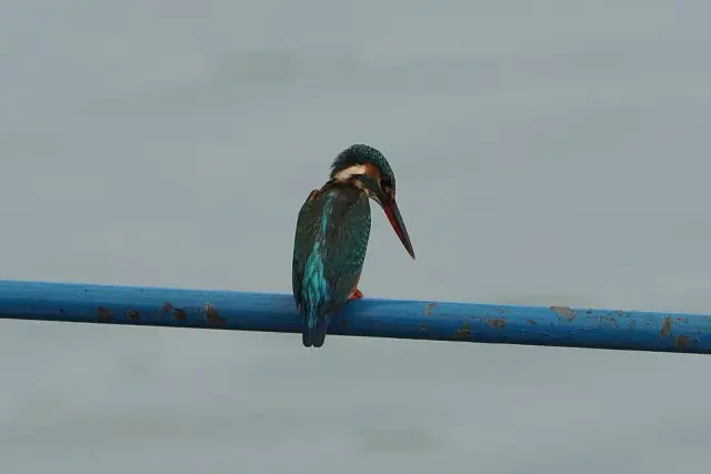
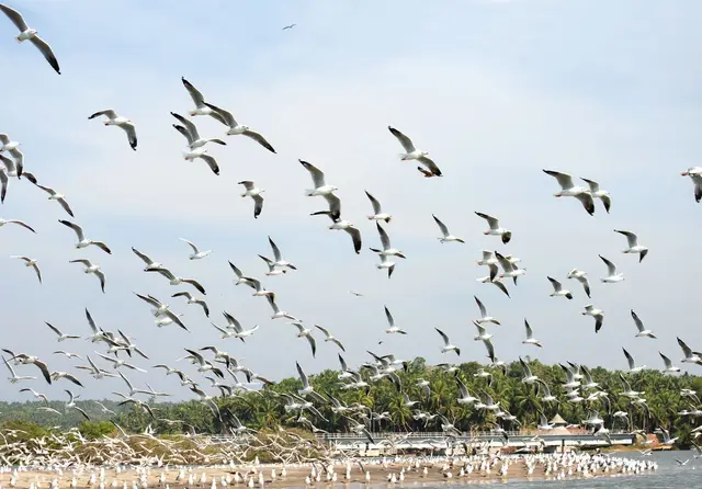
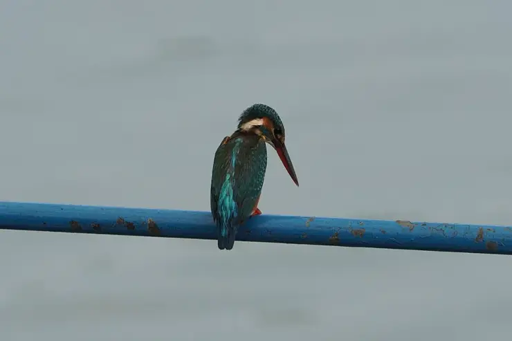
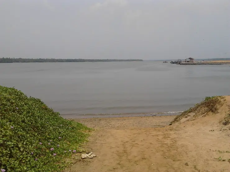
Kadalundi is where its river meets the Arabian Sea, about nineteen kilometres from Kozhikode city, and the estuary spans the Kozhikode and Malappuram district line. Over a hundred native bird species have been recorded here and roughly sixty migratory species come through seasonally — whimbrels and brahminy kites among them — along with a range of fish, mussels and crabs, and the snakes that go with mangrove and scrub. It is a mudflat-and-mangrove place rather than a viewing-platform place, and the tide governs what you see.

The legal shape of it is worth knowing, because it is unusual. The Kadalundi–Vallikkunnu Community Reserve was Kerala's first community reserve, declared in 2007 over 153.84 hectares including 21.22 hectares of reserve forest, and it protects five named islands: Company Thuruthu, Cheru Thuruthu, Cee Pee Thuruthu, Bala Thuruthu and Mannan Thuruthu. A community reserve is not a sanctuary — it is declared over land where people keep their rights and agree to conserve it, which is why the mudflats here are still worked as well as watched. One caution about the published record: Wikipedia's infobox gives the location height as 200 metres above sea level, which cannot be right for a tidal estuary at a river mouth.

What to expect

Highlights

  • Kadalundi Bird Sanctuary — Estuary birding area shared around the Kozhikode/Malappuram coast.
  • Kadalundi Vallikkunnu Community Reserve — Kerala’s first community reserve, declared in 2007 over mangrove, mudflat and five islands at the Kadalundi river mouth.
Getting there

How to visit

  • Nearest airport: Calicut (CCJ), in-district at Karipur
  • Rail gateway: Tirur (TIR), Angadippuram (AAM) or Nilambur Road (NIL)
Timing

Best time to visit Kadalundi

The winter months for the estuary at its most active. Avoid the peak monsoon weeks, when a rain-fed river mouth is a very different and rougher place.

Weather in KadalundiSeasonal guide

Live forecast loads in your browser.

Today at Kadalundi
Sunrise6:16 am
Sunset6:25 pm
Golden hour best light5:25 pm–6:25 pm
Blue hour after sunset6:25 pm–6:50 pm
Sun sets toward compass bearingW · 272°
Moon tonight🌓 First quarter · 52%
South-west monsoon. June to September is the south-west monsoon in Kerala. Expect heavy showers, mostly in bursts rather than all day — carry rain cover, allow extra time for getting around, and note that ferries and open-air sites are the first things affected.

Sun and moon are calculated for this location and shown in IST. Photography windows are the hour around sunrise and sunset; the sunset bearing is degrees clockwise from true north. Moon phase is accurate to about half a day.

The story

The story of Kadalundi

Kadalundi is the place where a river ends. It sits on the estuary where the Kadalundi river meets the Arabian Sea, on the boundary between Malappuram and Kozhikode districts, and it is known to most visitors as a birding coast — which is dealt with on its own page here. What the town itself carries is two quite different stories: an unresolved argument about whether this was one of the great Roman-era trading ports of the Malabar coast, and the memory of the June morning in 2001 when a train came off the bridge over the river.

The geography is the whole of it. The Kadalundi river comes down off the Western Ghats and spreads at its mouth into a shallow, shifting estuary of islands, sandbanks and creeks. That estuary is the reason for everything else: the birds, the fishing, the mussel beds, the old question about a port, and the railway bridge that has to cross it.

Two rivers end here, not one. The Kadalundi and the Chaliyar — both among the longest rivers in Kerala — reach the Arabian Sea at this point, which is why the estuary is as large and as complicated as it is. The Kadalundi itself is the sixth longest river in the state: rain-fed, about 130 kilometres from end to end, rising at Cherakomban Mala at around 1,160 m and running down through Palakkad and Malappuram districts. It is not one stream but two for most of its upper course — the Olipuzha and the Veliyar, which meet near Melattur and only then become the Kadalundi.

That matters for what the estuary is. A rain-fed river drops and swells hugely between seasons, and where two such rivers meet the sea the water is fresh in one month and salt in another. The mixing is the reason for the biodiversity, and it is also the reason for the village's most distinctive industry.

Kadalundi is a green mussel place. Mussel farming here has supported something in the order of fifty families and has accounted for a reported eighty per cent of Kerala's green mussel production, with yields quoted around ₹1,800 a box in the higher-salinity stretches. Alongside it the traditional livelihoods are the ones you would expect of an estuary: fishing, coir made by retting coconut husk in the backwater, and small-scale farming. If you want to understand why people live exactly here, it is not the birds — it is the salinity gradient.

Administratively Kadalundi sits on a seam. The river here forms the boundary between Malappuram and Kozhikode districts, so the place is routinely written about as belonging to both, and the estuary's conservation area is shared between the two coasts. If you find sources placing Kadalundi in different districts, that is why — they are describing opposite banks.

⚠ A note on where Kadalundi actually is, because our own filing and the standard references do not agree. This site files Kadalundi under MALAPPURAM. English Wikipedia describes Kadalundi as a village in KOZHIKODE district, and describes the bird sanctuary as lying across two panchayats — Kadalundi grama panchayat in Kozhikode and Vallikkunnu grama panchayat in Malappuram. Both statements can be true of a place split by a river mouth, and we are flagging the discrepancy here rather than quietly re-filing a live page.

The village is a working one rather than a resort: fishing, mussel-gathering and small coastal trade, with the birding traffic seasonal and mostly early in the morning. There is no developed tourist strip here, which is much of the appeal and is also worth knowing before you arrive expecting one.

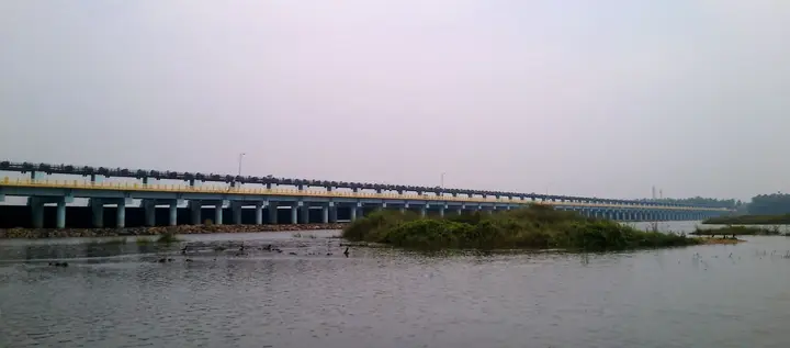
The other permanent presence is the railway. The main west-coast line crosses the estuary here, and the bridge over the Kadalundi is a landmark in its own right — a long, low crossing over tidal water. It is also the site of the worst thing that has happened in this village in living memory, which the history section below sets out.

Legend & myth

The oldest story attached to Kadalundi is not a legend about a god but an argument among historians, and it is one of the better ones on this coast, because the thing being argued about is genuinely lost.

In the first century of the Common Era an anonymous Greek merchant-sailor wrote the Periplus of the Erythraean Sea, a working handbook to the trade routes of the Indian Ocean. Among the ports of Limyrike — the stretch of the Malabar coast the Greeks and Romans traded with — it names Tyndis, describing it, in a phrase that has frustrated everyone since, as ‘a well known village on the coast’. Ptolemy names it too. It lay about 500 stadia — something in the order of ninety kilometres — north of Muziris, and it was a major centre of trade between the Chera rulers and Rome, second only to Muziris itself, probably functioning as a satellite feeding port to it.

So where was it? Kadalundi is one of the answers, and a serious one: it sits at the mouths of the Chaliyar and Kadalundi rivers, roughly the right distance north of Kodungallur, with an estuary that could hold shipping and a natural route inland. The identification usually groups it with Chaliyam and Beypore, the neighbouring river-mouths, as a single port complex rather than a single village.

But it is one of the answers, not the answer, and this page will not pretend otherwise. Ponnani, at the mouth of the Bharathappuzha, is proposed just as seriously. So is Panthalayini Kollam — modern Koyilandy — and so is Tanur. And the reason the argument cannot be settled is stark and worth saying plainly: no archaeological evidence of Tyndis has ever been found. Not at Kadalundi, not anywhere. There is a name in a Greek handbook, a distance in stadia, and a coastline of river mouths that all look plausible.

What makes the puzzle interesting rather than merely unresolved is the hinterland. Whichever river mouth it was, Tyndis worked because it was the sea end of a land route: goods moved from the Malabar coast through the Palghat Gap into the interior Tamil country, and back again. The port was not important for itself but for the road behind it, which is why the argument keeps returning to the estuaries that have a river running back into the hills. Kadalundi has one. So do the others.

There is a further layer in the Tamil material. Sangam poetry speaks of Thondi, a prosperous port under Chera rule, known for fishing, rice and backwater commerce, and Thondi has often been read together with Tyndis. Whether they are the same name in two languages, or two ports that later scholarship fused, is another thing the evidence does not settle.

The honest position, then, is that Kadalundi may be standing on one of the most important ports of the ancient Indian Ocean, and nobody can show you a single stone of it. That is not a satisfying story, but it is the true one, and it is a good deal more interesting than the confident version you will find on signboards.

More about Kadalundi

History

The documented history of Kadalundi as a settlement is thin, which is itself part of the Tyndis problem: a place that was supposedly a major classical emporium has left no excavated trace.

The event that defines the modern village happened on 22 June 2001. The Mangalore–Chennai Mail was crossing Bridge 924 over the Kadalundi river, the crossing that links Malappuram and Kozhikode districts, when six carriages derailed and three of them fell into the river below.

Fifty-nine people were eventually reported dead or missing, among them at least eight women and two children. Reported injury figures vary widely, from around 117 to as many as 300, all taken to hospitals nearby. It was one of the worst Indian rail accidents of that year.

The bridge's age is worth pausing on, because it dates the crossing. If the structure was around 140 years old in 2001, it was built in roughly the 1860s — which places it in the first generation of railway building on this coast, when the line was pushed north from Beypore and the great river mouths of Malabar had to be spanned one after another. The estuary at Kadalundi is wide, tidal and floored with shifting sediment, and a pier standing in that for well over a century is doing a harder job than it looks.

The official inquiry concluded that the derailment was caused by one pillar of the bridge — then about 140 years old — sinking into the riverbed after recent heavy rain. ⚠ That finding has been challenged, and we record it as the official conclusion rather than as the settled cause.

The line was repaired and reopened, and trains cross the estuary today as they always did; there is no memorial that a passing visitor would notice. What the accident left behind locally is a piece of shared memory attached to a very ordinary structure — for anyone who lives here, the bridge is not simply a bridge.

The estuary's later history is one of protection rather than development, and belongs to the sanctuary's own page.

Why visit

For the estuary itself — the river mouth, its islands and sandbanks, and the light on the tidal flats early in the morning. The birds have their own page here.

For one of the more genuinely open questions in Kerala's ancient history: this may be Tyndis, the Roman-era port named in the Periplus, and no one has ever proved it.

Because it is a working fishing and mussel-gathering village rather than a developed coast — quiet, plain, and easy to reach from either Kozhikode or Malappuram.

For the setting on a district boundary, where the same estuary is described from two coasts at once.

For the green mussel beds — an unusual and genuinely local industry that has accounted for a large share of Kerala's production, and the clearest answer to why a settlement sits exactly here.

Because two of Kerala's longest rivers, the Kadalundi and the Chaliyar, finish in the same stretch of water — a confluence-at-the-sea you can stand and look at.

Before you go

Kadalundi — at a glance

HoursNo opening hours — but the estuary is governed by the tide and the light, and early morning is when it is worth being here.

Entry: Free. This is a village and a tidal estuary, not a ticketed attraction; the bird sanctuary has its own page and arrangements.

Photography: The estuary, the mangroves and the rail bridge are the subjects. The birds need a long lens and the tide more than they need luck. People are working here — ask before photographing anyone on the mussel beds or in a boat.

Parking: Roadside parking near the bridge and the reserve approach. There is no car park; this is a village lane, so do not block it.

Getting here

How to reach Kadalundi

  • ✈︎ By air Calicut International at Karipur (CCJ) is the airport, about 23 km away by road — under an hour in ordinary traffic. It is one of the closest airport-to-estuary hops in Kerala.
  • 🚆︎ By train Kadalundi has its own station, code KN, on the Shoranur–Mangalore coast line, and it is a few hundred metres from the estuary — you can walk it. Only passenger and a few local services stop; for an express, use Parappanangadi or Feroke and come the last few kilometres by road. The line crosses the river mouth here on the bridge that is the village’s best-known landmark.
  • 🚗︎ By road About 19 km south of Kozhikode city on the coast road, and a similar short run north from Parappanangadi. The turning down to the estuary is small; the mangroves and the rail bridge are the landmark, not a sign.
  • 🚌︎ By bus Frequent buses run the Kozhikode–Parappanangadi coast road and will drop you at Kadalundi; from the main road it is a short walk or an autorickshaw down to the water.
Getting back

Check your return bus or ferry with the operator before setting out. Leave time to reach the stop or jetty after your visit, and arrange a return vehicle in advance for a remote outing.

Ask at the jetty or the stand for the time of the last service back, not the next one. If you miss it, an auto or a taxi is the fallback — agree the fare before you get in.

Do

Things to do in Kadalundi

  • Understand what the word "community reserve" is doing here. Kadalundi–Vallikkunnu was the first community reserve declared in Kerala, by G.O.(MS) No. 66/2007/F&WL of 17 October 2007. The category came in with the Wildlife (Protection) Amendment Act 2002 — Chapter IV-A — for land that stays in community or private hands, where people keep their rights and agree to conserve. It is not a sanctuary, and the difference is the whole point.
  • Take in the scale: 153.84 hectares in all, including 21.22 hectares of reserve forest, over mangrove, mudflat and five islands.
  • Learn the five islands by name — Company Thuruthu, Cheru Thuruthu, Cee Pee Thuruthu, Bala Thuruthu and Mannan Thuruthu. Most visitors photograph them without knowing there are five, let alone which is which.
  • Time the visit to the tide, not the clock. This is a mudflat system: the birds feed on the exposed flats and the whole place changes character twice a day.
  • Look for whimbrels and brahminy kites among the hundred-odd native species recorded; about sixty migratory species come through seasonally.
  • Walk the mangrove edge and watch the mussel and fishing work, which is what the community in "community reserve" actually does here.
  • Stand on the bridge approach and think about what a sand bar does. There is a published case study on how the estuary’s sand bar reshapes the mangrove system — the one genuinely local subject here that no travel site covers.
Plan

Good to know

  • It is a working village, not a resort — there is no visitor strip, and the estuary is somebody's fishing and mussel ground. Keep off the mussel beds and ask before photographing people at work.
  • Sources place Kadalundi in Malappuram and in Kozhikode district, and both can be right: the river mouth is the boundary and the conservation area spans a panchayat on each side.
  • Tyndis is not established as being here. It is one of several proposed sites and no archaeological evidence of Tyndis has ever been found anywhere.
Facilities

On site

  • Nothing that amounts to visitor infrastructure — no ticket office, no interpretation centre, no toilet block at the water.
  • Tea shops and small provision stores in the village; a couple of homestays.
  • Kadalundi railway station, a few hundred metres away, and autorickshaws on the main road.
  • Banks, pharmacies and hospitals at Parappanangadi and Feroke; Kozhikode city is 19 km north.
  • Local boatmen will take visitors out on the estuary — agree the price and the length of the trip first.
Stay safe

Safety

  • It is a tidal estuary with a river running into the sea. The current at the mouth is strong and the channel is deep in places. Do not swim here.
  • Mudflats look walkable and are not. Stay off them: they are soft, they are the birds’ feeding ground, and they are somebody’s mussel bed.
  • Cobras, vipers and kraits are recorded around the mangroves. Wear shoes and stay on the paths.
  • In the monsoon the river runs hard and the estuary is a rough, different place. Boat trips are not the thing to do that week.
Getting around KadalundiPartly wheelchair accessible
Terrain
Mostly flat
From the entrance
Village lanes at sea level, and Kadalundi railway station is a few hundred metres from the estuary. The water is reached over unmade ground and soft mud.
Step-free access
Getting here is unusually easy — the station is within a few hundred metres and the land is flat. Getting to the water is not: the estuary edge is unmade, tidal and muddy, with no boardwalk, no viewing platform and no railing. There is no accessible boat landing. We have not found any built visitor infrastructure here at all.
Prams
Fine on the lanes and the road; not on the estuary edge.

No ticket office, interpretation centre or toilet block at the water.Tea shops and small stores in the village.

  • Mudflats look walkable and are not — they are soft, they are the birds’ feeding ground and they are somebody’s mussel bed.
  • Strong current at the river mouth; cobras, vipers and kraits are recorded around the mangroves.

Checked 21 August 2026 against source 1source 2. Conditions change and surfaces vary with weather — if step-free access is essential, confirm with the site before you travel.

Practical things near Kadalundi
What the cash actually costs
  • Withdrawing from a bank that is not your own is free for a set number of times a month, then costs up to ₹23 plus GST — about ₹27 a withdrawal. This is not one of the RBI’s six metro centres, so the allowance here is the higher one: at least five free other-bank withdrawals a month, and at least five at your own bank.
  • That free allowance belongs to Indian bank accounts. On a card issued abroad your own bank’s international withdrawal and exchange charges apply instead. If the machine offers to bill you in your home currency, choose rupees — the conversion rate on that offer is set by the machine, not by your bank.
  • Choose a well-lit ATM, preferably at a bank branch. Shield your PIN, avoid help from strangers and use your bank’s support number if a withdrawal fails or the machine retains your card.

Charge cap and free-transaction limits: Reserve Bank of India, in force since 1 May 2025.

These services are listed within about 1.2 km of Kadalundi. Walking distances follow mapped routes; access and opening hours can change. Other services may be closer but are not included here.

In the district

Where Kadalundi sits in Malappuram district

District HQMalappuram
LandscapeNilgiris foothills, rivers, Malabar coast and historic towns

Malappuram district is known for: Malabar culture, Nilambur teak country, Ponnani coast and hill viewpoints.

Nilambur Teak MuseumKottakkunnuPonnani and Padinjarekara Beach
Stay · eat · do · rent · see · shop

Places in Kadalundi

Every verified place in Kadalundi — filter by what you’re after.

3 things to do in Kadalundi

Kadalundi Vallikunnu Boat Experience — Community reserve boat experience in Kadalundi
Top pick Verified
Community reserve boat experience · Kadalundi
Kadalundi Vallikunnu Boat Experience

Guided boating safari through the mangroves and estuary of the Kadalundi-Vallikunnu Community Reserve, the bird sanctuary at the mouth of the Kadalundi river in Malappuram district. Local boatmen run tours across the tidal wetland to watch migratory and resident water birds, best during the winter migration season.

Directions Commission-freeView details
Kadalundi Community Reserve Contact — Visitor information in Kadalundi
Top pick Verified
Visitor information · Kadalundi
Kadalundi Community Reserve Contact

Visitor information in Kadalundi. Kadalundi P.O., Kozhikode 673302 · kadalundi, Official community reserve contact, do.

Directions Commission-freeView details
Kadalundi Bird Sanctuary DTPC Malappuram — Bird sanctuary in Kadalundi
Verified
Bird sanctuary · Kadalundi
Kadalundi Bird Sanctuary DTPC Malappuram

Kadalundi Bird Sanctuary is Malappuram-Kozhikode estuary birding landscape where timing, tide, season and quiet local guidance matter more than a generic sightseeing stop. Kadalundi, Bird sanctuary, Estuary.

Directions Commission-freeView details

Book with the place itself. India’s cyber-crime coordination centre warned in April 2025 that convincing copies of hotel and pilgrimage booking sites are being pushed through sponsored search and social ads, taking payment for rooms the property never hears about. Every listing here links to the business’s own contact details and its own Google or Bing profile — we take no commission and sit in nobody’s payment path. If a booking page reached you through an ad, check the address bar against the property’s own site before you pay. Fraud can be reported on cybercrime.gov.in or on 1930.

Official eco & forest programmes

Forest stays, camping and treks around Kadalundi

Official/public-sector eco offerings mapped to this town base. Always confirm current availability, tariff, permits and reporting time before travelling.

Kadalundi Bird Sanctuary, Kadalundi
birdingwildlife

Kadalundi-Vallikkunnu community reserve birding

Estuary birding and community-reserve landscape shared around the Malappuram/Kozhikode coast.

Kadalundi Bird Sanctuary
Official source →
For hotels, homestays and local businesses

Get listed in Kadalundi for free

Roampedia is commission-free. Travellers discover your business, book directly and contact you through official details. Basic listings are free, while Gold and Platinum package upgrades can be requested from the owner dashboard after approval.

List your business — free
Read before you go

Kadalundi guides, stories & itineraries

Stories & history of Kadalundi

Written about Kadalundi itself — its history, its legends and the arguments about them.

Nearby in Malappuram

Wider reading from Malappuram. The stories about Kadalundi itself are above.

Planning a trip to Kadalundi

The practical half — what is actually here, in what order to see it, and how to arrive.

Kerala-wide guides & itineraries

Route-level itineraries and practical guides for the rest of the state.

See all 36 Malappuram guides & stories →

Map

Where things are in Kadalundi

FAQ

Kadalundi travel FAQs

Is Kadalundi the ancient port of Tyndis?

Unproven, and we will not assert it. Kadalundi — usually grouped with Chaliyam and Beypore — is one of the proposed identifications, but Ponnani, Tanur and Panthalayini Kollam (Koyilandy) are proposed just as seriously, and no source ranks them. Decisively, no archaeological evidence of Tyndis has ever been found anywhere.

What was Tyndis?

A port named in the first-century Periplus of the Erythraean Sea, which calls it 'a well known village on the coast', and again by Ptolemy. It lay about 500 stadia — roughly ninety kilometres — north of Muziris, and was a major centre of trade between the Cheras and Rome, second only to Muziris and probably feeding into it.

Why do sources disagree about which district Kadalundi is in?

Because the river here is the boundary between Malappuram and Kozhikode districts, and the estuary is shared between the two coasts. Sources describing opposite banks will place it differently, and both are right about their own side.

What happened at Kadalundi in 2001?

On 22 June 2001 the Mangalore–Chennai Mail was crossing Bridge 924 over the Kadalundi river when six carriages derailed and three fell into the river. Fifty-nine people were reported dead or missing, including at least eight women and two children, and reported injuries range from about 117 to 300. The official inquiry attributed it to a pillar of the then roughly 140-year-old bridge sinking into the riverbed after heavy rain — a finding that has been challenged.

Which rivers meet the sea at Kadalundi?

Two: the Kadalundi and the Chaliyar, both among Kerala's longest. The Kadalundi is the sixth longest river in the state — rain-fed, about 130 km long, rising at Cherakomban Mala at roughly 1,160 m and formed from two tributaries, the Olipuzha and the Veliyar, which join near Melattur.

What is Kadalundi's main livelihood?

Estuarine work. Green mussel farming is the distinctive one — it has supported around fifty families and is reported to account for some eighty per cent of Kerala's green mussel production — alongside fishing, coir made by retting coconut husk in the backwater, and small-scale farming.

Is this the same place as the bird sanctuary?

Yes — the sanctuary is the estuary at this village, and it has its own page on this site covering the mudflats, the mangroves, the migratory shorebirds and its protected status. This page deliberately does not repeat that.

How old is the railway bridge over the estuary?

The bridge involved in the 2001 accident was described in the inquiry as around 140 years old at the time, which places its construction in roughly the 1860s — the first generation of railway building on the Malabar coast. The line still crosses the estuary today.

When is the best time to come?

Early morning, and in the winter months if you are here for the estuary at its most active. Kadalundi is not a place with opening hours — it is a working village and a tidal river mouth, so the tide and the light matter more than the season.

Is there much to do in the village itself?

Not in the tourist sense, and that is the point. It is a working fishing and mussel-gathering settlement with no developed visitor strip. Most people come early, for the estuary and the birds, and move on.

What are the best places to visit in Kadalundi?

Top places to visit in Kadalundi include Kadalundi Bird Sanctuary, Kadalundi Vallikkunnu Community Reserve — each has a full guide with how to reach it and what to see nearby on this page.

How do I reach Kadalundi?

The nearest airport to Kadalundi is Calicut (CCJ), in-district at Karipur. The rail gateway is Tirur (TIR), Angadippuram (AAM) or Nilambur Road (NIL).

Photographs: Vijayanrajapuram (CC BY-SA 4.0), Vinayaraj (CC BY-SA 4.0), Navaneeth KN (CC BY 2.0), Suresh Babunair (CC BY 3.0), Sunil060902 (CC BY-SA 3.0). Wikimedia Commons.

Image credits