Places to Visit in Nelliyampathy

Tea, orange estates and forested viewpoints.

Nelliyampathy
Practical guide

Plan Nelliyampathy

Who's going?Tailor Nelliyampathy to your trip
DistrictPalakkad
RoleHill base
Time neededA full day trip is possible from…
Places to visit3Listed businesses10

Nelliyampathy is a scatter of estates and settlements about sixty kilometres from Palakkad city, spread over 576 square kilometres of hill and plantation, and the drive up is a large part of what you are coming for. Two things are worth knowing before you commit the day. The first is the weather: the ridge sits in cloud a great deal of the time, and Seetharkundu — traditionally held to be where Rama, Lakshmana and Sita rested during the exile, five kilometres by road above the settlement — is worth very little in mist and a great deal on a clear morning.

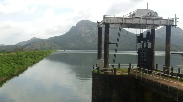
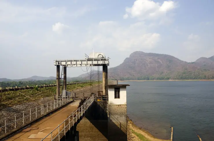
The second is that the most interesting structure is the one everyone drives past. Pothundy Dam, at the foot of the climb, was built in the nineteenth century, and its core wall is packed with a mixture of jaggery and quick lime rather than cement; it stands 32.61 m high and 1,680 m long across the Meenichiladipuzha and Padipuzha, and was later developed into a medium irrigation project completed in 1971. Its own record hedges the claim that it is among India's oldest dams, and so do we. Higher up, Kesavan Para is a bare rock shoulder with a long view, and the place where the 1989 film Mrigaya was shot with Mammootty. Two things you will read elsewhere we leave out: an etymology for the name, and the orange estates — neither is sourced in the records we could check.

What to expect

Highlights

  • Nelliyampathy — Tea and orange-garden hill station reached through forested ghat roads.
  • Nelliyampathy trek — Walking routes off the Nelliyampathy plantation plateau: an evergreen-forest footpath to the bare granite of Kesavan Para, longer forest-division routes to Hill Top, Karassuri and over the ridge to Parambikulam, and a four-wheel-drive climb to Manpara and the ruined Victoria Church.
  • Government Orange and Vegetable Farm — A state farm at Kaikatty growing mandarin oranges, winter vegetables and a fruit forest of fifty varieties on the Nelliyampathy plateau — the Kingdom of Cochin's Poliya estate, a farm since 1943 and an orange and vegetable farm since 1956, with a passion-fruit processing unit and a published ticket.
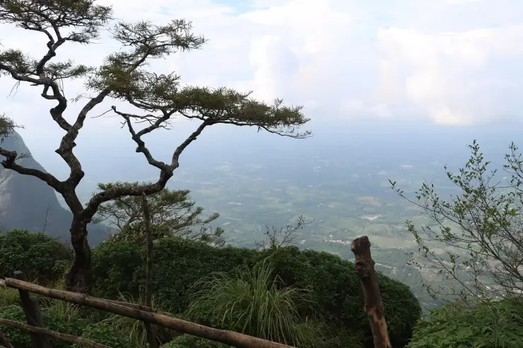
  • Seetharkundu viewpoint — The edge of the Nelliyampathy escarpment, where the plateau stops and the Palakkad plain opens out a thousand metres below — a place you drive to and stand at, with a seasonal waterfall below the lip and a car park full of bold macaques.
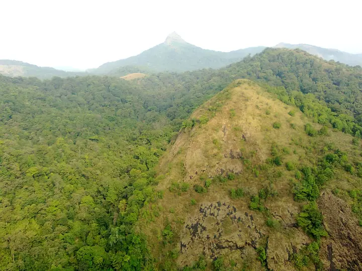
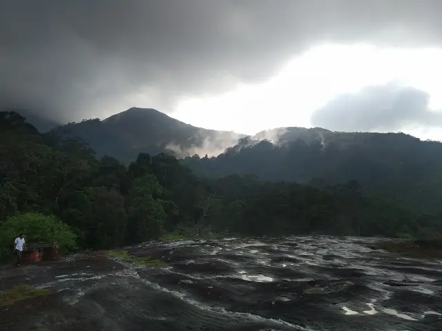
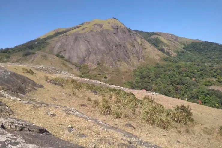
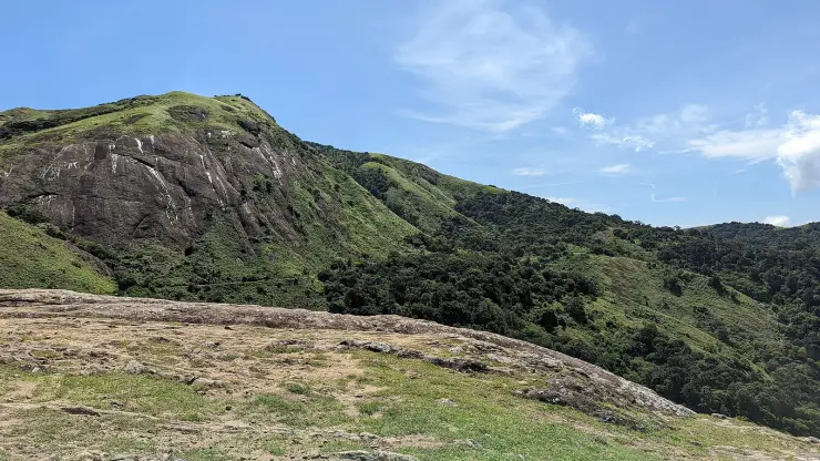
  • Kesavan Para — A great sheet of bare granite tilted out over the valley at the end of a red-earth path through wet evergreen forest — the one walk on the Nelliyampathy plateau that anyone reasonably fit can do without the Forest Division's permission.
  • Karadipara — A rock shoulder on the Kaikatty-Nooradi road looking across an unbroken fold of evergreen forest to a conical peak — the nearest thing on the plateau to a viewpoint you can have to yourself.
Getting there

How to visit

  • Nearest airport: Coimbatore (CJB), ~55–65 km; Cochin (COK), ~110 km
  • Rail gateway: Palakkad Junction (PGT)
Timing

Best time to visit Nelliyampathy

September to March is the most comfortable window, with November to February the cool, clear winter peak for trekking and viewpoints; the June to September monsoon is lush and misty but brings heavy rain, leeches and slippery ghat roads.

Weather in NelliyampathySeasonal guide

Live forecast loads in your browser.

Today at Nelliyampathy
Sunrise6:13 am
Sunset6:22 pm
Golden hour best light5:22 pm–6:22 pm
Blue hour after sunset6:22 pm–6:47 pm
Sun sets toward compass bearingW · 272°
Moon tonight🌓 First quarter · 52%
South-west monsoon. June to September is the south-west monsoon in Kerala. Expect heavy showers, mostly in bursts rather than all day — carry rain cover, allow extra time for getting around, and note that ferries and open-air sites are the first things affected.

Sun and moon are calculated for this location and shown in IST. Photography windows are the hour around sunrise and sunset; the sunset bearing is degrees clockwise from true north. Moon phase is accurate to about half a day.

The story

The story of Nelliyampathy

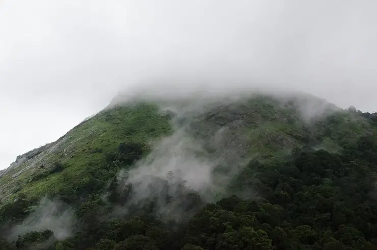
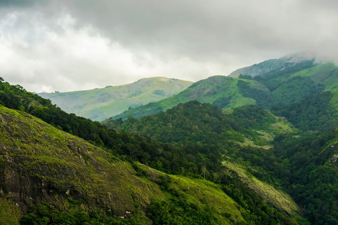
Nelliyampathy is a cluster of mist-wrapped hills and a quiet plantation hill station in Palakkad district, Kerala, reached by a ghat road that doubles back on itself the whole way up from Nenmara past the Pothundy reservoir into cool forests of tea, coffee, cardamom and once-famous orange groves. Long called a poor man’s Ooty and a gentler alternative to Munnar, it rewards travellers with valley viewpoints, plantation walks and Western Ghats air rather than crowds and neon.

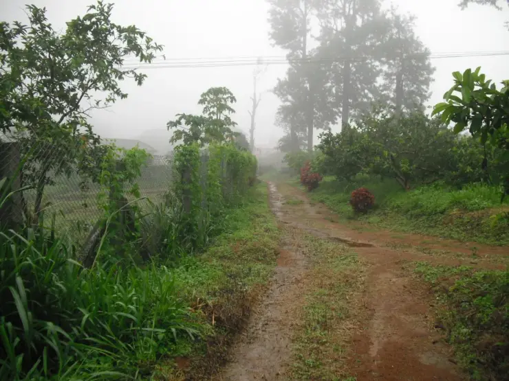
The journey is half the pleasure of Nelliyampathy. From the plains around Nenmara and Kollengode the land is flat, hot and green with paddy, and then the road tilts upward and begins to coil. A forest check post marks the real start of the climb, and beyond it the ghat road twists and doubles back on itself as it gains height — twenty kilometres and about half an hour from the dam to the settlement, through a dozen or so genuine reversals and a great deal more curve than that. With almost every turn the temperature drops a little, the air grows damp, and the Pothundy reservoir shrinks in the valley below until it is a blue-green thumbprint set in forest.

Pothundy Dam sits at the foot of the hills and is often described as the gateway to Nelliyampathy. Built in the nineteenth century, its catchment and the calm sheet of water behind it make a popular stop for a picnic, a boat ride or simply a stretch of the legs before the serious climbing begins. Above it the road enters the Nelliyampathy reserve forests, and the character of the place changes from farmland to true hill country, all tall trees, hanging mist and sudden openings onto plantation slopes.

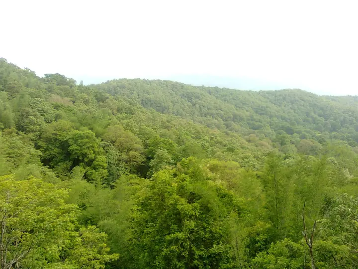
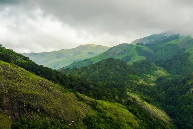
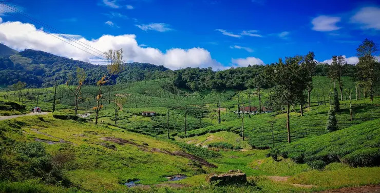
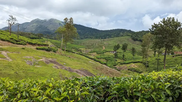
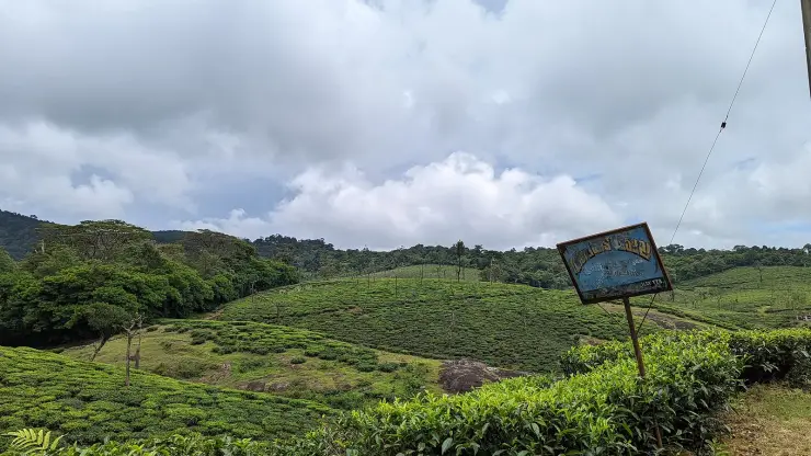
At the top the hills spread out in a patchwork of estates. Tea bushes carpet the cooler shoulders, coffee grows in the shade of taller trees, cardamom scents the damp undergrowth, and pepper vines climb their supports; oranges, for which these hills were once genuinely famous, still ripen in pockets, most visibly at the old government orange and vegetable farm. It is one of the few tracts in India where so many different crops share the same misty range, and walking an estate road here is a lesson in how the Western Ghats reward patient cultivation.

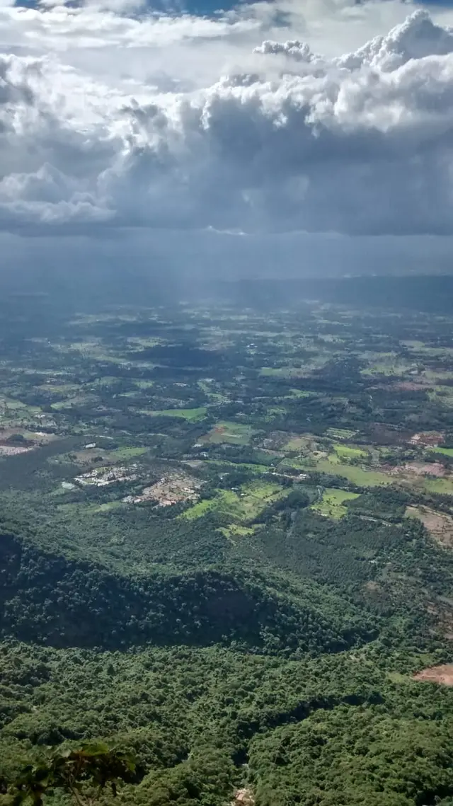
The viewpoints are the reason many people come. Seethargundu (also written Seetharkundu) is the celebrated one, a spur that opens onto a giddy drop toward the Palakkad plains and, on clear mornings, a long view over the Palghat Gap; a tall seasonal waterfall spills nearby after rain. Kesavanpara, a great bald rock reached by a footpath through the forest, is the other name people arrive knowing. Between them are lesser-known ledges where the mist thins for a moment and the whole valley appears, then closes again.

The weather is the constant companion. Cloud drifts up the slopes through much of the year, mornings can be sharp and cool, and afternoons often turn milky with fog that swallows the plantation roads. This is elephant and gaur country too, part of the reserve forests of the Western Ghats, and sightings of elephants, deer, sambar, giant squirrels and abundant birds are part of the appeal for those who trek or stay overnight at an estate bungalow or forest lodge.

What sets Nelliyampathy apart is how little it has been tamed. There are few large hotels, limited nightlife and only modest facilities on top, so the hills stay green and unhurried in a way the busier Kerala hill stations no longer are. Travellers come for plantation air, birdsong, a good trek and the long silence between hairpin bends, and they tend to leave promising themselves a return.

Legend & myth

The best-known story attached to these hills is the one carried by the name of their most famous viewpoint, Seethargundu, which is read as Sita’s rock or Sita’s pool and tied by tradition to the Ramayana. It is a devotional legend rather than documented history, and it gives the escarpment edge a mythic weight for many visitors.

More about Nelliyampathy

History

Nelliyampathy takes its name from the nelli, the Indian gooseberry or amla, which once grew freely on these slopes; the hills are, in effect, the place of the gooseberry trees. Long before roads and estates, the range was forest and hunting country on the edge of the old Kingdom of Cochin, its high ground cool enough to feel a world apart from the hot plains below.

The modern story of the hills is a plantation story, shaped in the colonial and early post-independence decades when the Western Ghats were opened up for tea, coffee, cardamom and pepper. As at Munnar and Wayanad, planters were drawn by the altitude and climate, and estates spread across the cooler shoulders of the range. The scale here stayed smaller and more scattered, which is part of why Nelliyampathy never grew into a large resort town.

Oranges gave the hills a distinct identity, and they still do — the fruit is what most visitors have heard about before they arrive. The orchards are a fixture of the plantation landscape and the crop is a winter one, which is why a summer visit finds the trees bare. The state farm that grows them, and the fruit forest and winter vegetables alongside them, is a subject of its own.

Fortunes here have not always been kind, and that is honest to the character of the place: a working plantation frontier rather than a manicured tourist town, where estates have changed hands, been abandoned and been replanted within living memory.

Today much of the range sits within reserve forest managed by the forest department, with the Kerala Forest Development Corporation running plantations and ecotourism on parts of the hills. The forest check post on the ghat road, the estate bungalows and the network of trekking trails all reflect that dual identity, a place that is at once a cultivated landscape and a protected slice of the Western Ghats.

Why visit

The drive itself is an event, a winding ghat road of hairpin bends that lifts you from the hot Palakkad plains into cool, misty hill country in the space of a single climb.

It is a rare multi-crop plantation landscape where tea, coffee, cardamom, pepper and the hills’ once-famous oranges all grow across the same misty range, ideal for slow estate walks.

The viewpoints deliver, especially Seethargundu with its plunging outlook over the Palakkad plains and the Palghat Gap, and Kesavanpara for a wide, quiet vista off a sheet of bare rock.

Pothundy Dam and reservoir at the foot of the hills make a scenic gateway stop for a picnic or a boat ride before or after the climb.

It is genuine Western Ghats wildlife country, part of the Nelliyampathy reserve forests, where elephants, gaur, deer, giant squirrels and rich birdlife draw trekkers and nature lovers.

It stays refreshingly uncommercialised, a cool, green, unhurried alternative to busier hill stations like Munnar for travellers who want calm over crowds.
Before you go

Nelliyampathy — at a glance

HoursNelliyampathy is a hill region rather than a single ticketed site, so it is open through the day, but access up the ghat road passes a forest check post and vehicle entry may be restricted to daytime hours; individual attractions, farms and KFDC ecotourism activities keep their own timings.

Entry: There is generally no charge to visit the hills themselves, but forest check-post vehicle entry, the government orange and vegetable farm, boating at Pothundy and KFDC ecotourism activities may levy separate fees; carry cash as facilities on top are limited.

Dress code: No formal dress code; wear warm layers as mornings and evenings are cold and misty, plus sturdy shoes for plantation walks and treks and a light raincoat outside the driest months.

Festivals: There is no major temple festival specific to the hilltop; the plantation calendar and orange and coffee harvest seasons shape local life, and Kerala festivals such as Onam and Vishu are observed in the towns at the foot of the hills like Nenmara and Kollengode.

Photography: Photography is welcome across the viewpoints, plantations and reservoir; carry a fully charged battery and covered gear for the mist and rain, and always ask permission before photographing estate workers or private plantation property.

Parking: Informal parking at the viewpoints and the farm; nothing formal on the hills. At Pothundi there is a laid-out area at the dam.

Getting here

How to reach Nelliyampathy

  • ✈︎ By air The nearest airport is Coimbatore International Airport in Tamil Nadu, roughly a two-and-a-half hour drive away via Palakkad and Nenmara; Cochin International Airport is the other option, farther off but well connected.
  • 🚆︎ By train Palakkad Junction is the most convenient railhead, about 55 km away, from where you can hire a taxi or take a bus toward Nenmara and then up to Nelliyampathy, roughly a two-hour drive.
  • 🚗︎ By road By road the approach is via Nenmara and the Pothundy ghat, climbing past the dam and forest check post through a series of hairpin bends to the hilltop; the ghat section is narrow and best driven slowly in daylight.
  • 🚌︎ By bus Kerala state buses and private services run to Nenmara from Palakkad and nearby towns; onward buses up the ghat to Nelliyampathy are limited and infrequent, so many travellers switch to a taxi or jeep at Nenmara.
Getting back

Check your return bus or ferry with the operator before setting out. Leave time to reach the stop or jetty after your visit, and arrange a return vehicle in advance for a remote outing.

Ask at the jetty or the stand for the time of the last service back, not the next one. If you miss it, an auto or a taxi is the fallback — agree the fare before you get in.

Do

Things to do in Nelliyampathy

  • Stop at Pothundi Dam on the way up instead of driving past it. Its core wall is built with a mixture of jaggery and quicklime rather than cement — it is the more interesting structure of the two and almost nobody gets out of the car.
  • Take the dam’s numbers with you: 32.61 m high, 1,680 m long, damming the Meenichiladipuzha and Padipuzha, tributaries of the Aylampuzha. Built in the nineteenth century and considered — the sources hedge, so we hedge — one of the oldest dams in India, later developed into a medium irrigation project completed in 1971.
  • Count the hairpins up the ghat road and watch the Pothundi reservoir shrink in the valley behind you.
  • Stand at Seetharkundu, five kilometres out by road, for the drop to the plains and the Palakkad Gap. The name carries a claim — traditionally believed to be where Rama, Lakshmana and Sita rested in exile — and it is the place name itself that makes it.
  • Walk out onto Kesavan Para. The 1989 Mammootty film Mrigaya was shot on this rock. Whether the name has anything to do with an elephant called Kesavan is a story we have not been able to source, so we are not telling it.
  • Walk in the tea, coffee and cardamom, and look in at the government orange and vegetable farm.
  • Take a forest trail with a local guide and watch for elephant, gaur, Malabar giant squirrel and hill birds.
Plan

Good to know

  • Fuel up and draw cash before you start the climb. There is very little of either on top, and the ghat road is not where you want to discover it.
  • The forest check post governs when vehicles may drive up and down. Read the posted last-descent time on the way in and do not plan a late return.
  • Do not do the ghat road after dark, and do not do it in heavy rain if you can avoid it. It is narrow, steep and continuous hairpins.
  • Carry something warm. It is a hill station and the evenings are cold by Palakkad standards, which catches out day-trippers from the plains.
  • Buses up the ghat exist but are few and slow. A car or a taxi is the practical way.
  • Book a stay before you arrive. There is no walk-up hotel strip up here.
Facilities

On site

  • Estate bungalows, KFDC accommodation and a small number of private stays on the hills — all needing booking ahead.
  • Very limited shops; few or no fuel stations and ATMs above the ghat.
  • KFDC ecotourism activities and guided trails, with their own timings and charges.
  • Boating and a picnic ground at Pothundi at the foot of the climb.
  • Nemmara and Palakkad below are the nearest towns with banks, pharmacies and a hospital.
Stay safe

Safety

  • The road is the danger here. Hairpin bends, narrow carriageway, steep drops and mist — use low gear on the descent, sound the horn on blind bends and do not overtake.
  • Elephant and gaur are present and move on and near the road, particularly at dusk and dawn. If you meet either, stay in the vehicle and back off.
  • Mist can close in within minutes at the viewpoints and visibility drops to a few metres. Do not go near the edge at Seetharkundu or on Kesavan Para in fog.
  • In heavy monsoon the ghat is subject to landslip and can be closed at short notice. Check before you commit to the drive.
  • There is no hospital on the hills. Anything serious is an hour and a half down the ghat.
Getting around NelliyampathyPartly wheelchair accessible
Terrain
Some steps
From the entrance
Everything here is reached by a narrow, continuously hairpinned ghat road. The viewpoints are short walks from the road on uneven ground; Kesavan Para is a bare rock.
Step-free access
The drive itself is accessible from a vehicle. Seetharkundu and Kesavan Para have unmade ground and open rock without railings or ramps, while Pothundi Dam at the foot of the climb offers the most level stop. Estate stays do not publish consistent accessibility details, so ask about rooms, toilets and paths when booking.
Prams
The road is fine; the viewpoints are not, and there is nothing resembling a footpath.

No accessible toilet is advertised anywhere on the hills.Very limited shops, and few or no fuel stations or ATMs above the ghat.

  • A forest check post governs vehicle movement; read the posted last-descent time on the way in.
  • Mist can close the viewpoints within minutes. Elephant and gaur move on and near the road at dusk and dawn.
  • There is no hospital on the hills — anything serious is ninety minutes down the ghat.

Checked 21 August 2026 against source 1source 2. Conditions change and surfaces vary with weather — if step-free access is essential, confirm with the site before you travel.

In the district

Where Nelliyampathy sits in Palakkad district

District HQPalakkad
LandscapePalakkad Gap gateway, plains, dams and rainforest edges

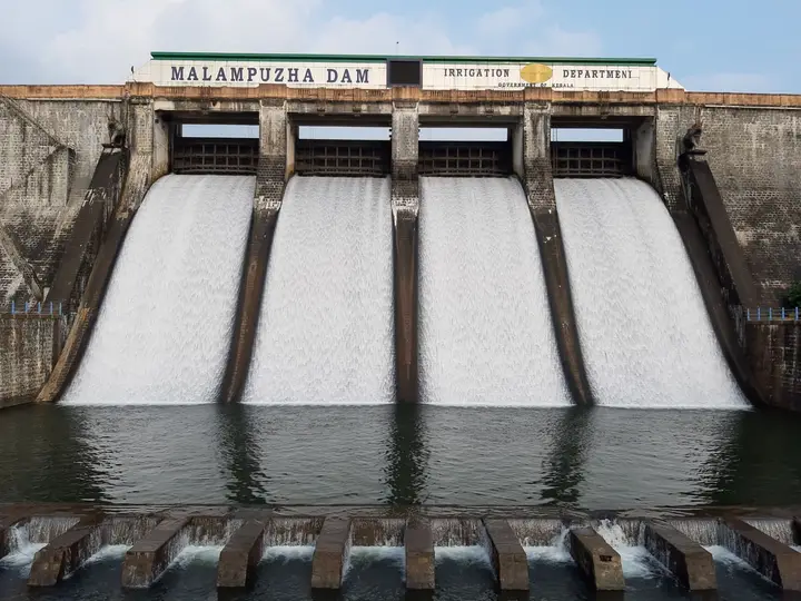
Palakkad district is known for: Palakkad Fort, Silent Valley National Park, Malampuzha, Nelliyampathy and Parambikulam.

Silent Valley National ParkMalampuzha Dam & GardenPalakkad Fort and Kalpathy
Stay · eat · do · rent · see · shop

Places in Nelliyampathy

Every verified place in Nelliyampathy — filter by what you’re after.

1 place to eat in Nelliyampathy

Nelliyampathy Resorts Restaurant Kaikatti — Resort restaurant in Nelliyampathy
Verified
Resort restaurant · Nelliyampathy
Nelliyampathy Resorts Restaurant Kaikatti

The restaurant at Nelliyampathy Resorts on Kaikatti Road, and one of very few places to eat on the plateau. It serves the resort's own cottages first, so telephone before making the drive up for a meal.

Directions Commission-freeView details

Book with the place itself. India’s cyber-crime coordination centre warned in April 2025 that convincing copies of hotel and pilgrimage booking sites are being pushed through sponsored search and social ads, taking payment for rooms the property never hears about. Every listing here links to the business’s own contact details and its own Google or Bing profile — we take no commission and sit in nobody’s payment path. If a booking page reached you through an ad, check the address bar against the property’s own site before you pay. Fraud can be reported on cybercrime.gov.in or on 1930.

Places to visit

The places themselves, around Nelliyampathy

The best tourist places to visit in Nelliyampathy — temples, viewpoints, lakes, heritage and nature, each with a full guide, how to reach it and what to see nearby.

Official eco & forest programmes

Forest stays, camping and treks around Nelliyampathy

Official/public-sector eco offerings mapped to this town base. Always confirm current availability, tariff, permits and reporting time before travelling.

Nelliyampathy, Nelliyampathy
trekviewpointwildlife

Nelliyampathy hills eco visit

Hill, plantation and forest viewpoint landscape above Palakkad, included in Kerala Tourism’s ecotourism inventory.

Nelliyampathy
Official source →
For hotels, homestays and local businesses

Get listed in Nelliyampathy for free

Roampedia is commission-free. Travellers discover your business, book directly and contact you through official details. Basic listings are free, while Gold and Platinum package upgrades can be requested from the owner dashboard after approval.

List your business — free
Read before you go

Nelliyampathy guides, stories & itineraries

Stories & history of Nelliyampathy

Written about Nelliyampathy itself — its history, its legends and the arguments about them.

Around Nelliyampathy

The town itself and the places around it — each written about one subject rather than as a general guide.

Planning a trip to Nelliyampathy

The practical half — what is actually here, in what order to see it, and how to arrive.

Kerala-wide guides & itineraries

Route-level itineraries and practical guides for the rest of the state.

See all 33 Palakkad guides & stories →

Map

Where things are in Nelliyampathy

FAQ

Nelliyampathy travel FAQs

Where is Nelliyampathy and how do you get up there?

Nelliyampathy is a cluster of hills in Palakkad district, Kerala, roughly 55 to 60 km from Palakkad town. You reach it by driving to Nenmara and then up a winding ghat road, passing Pothundy Dam and a forest check post, negotiating a series of hairpin bends to the plantation-clad hilltops.

How many hairpin bends are on the Nelliyampathy ghat road?

It depends what you are prepared to call a hairpin, which is why the published counts run from ten to twenty-three. On the mapped road there are about a dozen genuine reversals between Pothundy dam and the settlement, over twenty kilometres and roughly half an hour of driving, and a great deal more curve besides. It is narrow and steep in places, so drive it slowly and in daylight.

What is Seethargundu and why is it special?

Seethargundu (also spelt Seetharkundu) is Nelliyampathy’s most famous viewpoint, a spur that opens onto a dramatic drop toward the Palakkad plains and the Palghat Gap, with a tall seasonal waterfall nearby after rain. A local Ramayana legend, told as legend rather than history, holds that Rama, Lakshmana and Sita rested here during their exile, which is how it is said to get its name.

Is Nelliyampathy really known for oranges?

Yes. Along with tea, coffee, cardamom and pepper, the hills were long celebrated for their oranges, cultivated notably at the government orange and vegetable farm. Orange harvests have varied greatly over the decades due to crop problems and wildlife raids, but oranges and other fruit remain a signature of the plantation landscape, gathered chiefly in the winter and mid-year seasons.

When is the best time to visit Nelliyampathy?

Roughly September to March is the pleasant season, with the cool winter months of November to February especially popular for trekking, plantation walks and viewpoints. The monsoon brings heavy rain, leeches and slippery roads, though it also makes the hills at their greenest and mistiest.

Are there wild animals, and how safe is it?

Nelliyampathy sits within Western Ghats reserve forest, so elephants, gaur, deer, sambar, giant squirrels and plentiful birds are all present, and elephant movement is common. Keep a safe distance from wildlife, avoid the ghat road after dark, and follow forest-department and check-post guidance. Walking routes are a separate matter with their own permissions and are covered on the trek page.

What are the best places to visit in Nelliyampathy?

Top places to visit in Nelliyampathy include Seetharkundu viewpoint, Pothundy Dam, Kesavan Para — each has a full guide with how to reach it and what to see nearby on this page.

How do I reach Nelliyampathy?

The nearest airport to Nelliyampathy is Coimbatore (CJB), ~55–65 km; Cochin (COK), ~110 km. The rail gateway is Palakkad Junction (PGT).

Photographs: Sanu N (CC BY-SA 4.0), Rajesh_India (CC BY-SA 2.0), Manoj K (CC BY-SA 4.0), Nuveen60 (CC BY-SA 4.0), Noon Plastic (CC BY 4.0). Wikimedia Commons.

Image credits
  • Nelliyampathy:Shagil Kannur · CC BY-SA 4.0
  • Nelliyampathy — photo 1:Sanu N · CC BY-SA 4.0
  • Nelliyampathy — photo 2:Rajesh_India · CC BY-SA 2.0
  • Nelliyampathy — photo 3:Rajesh_India · CC BY-SA 2.0
  • Nelliyampathy — photo 4:Manoj K · CC BY-SA 4.0
  • Nelliyampathy — photo 5:Manoj K · CC BY-SA 4.0
  • Nelliyampathy — photo 6:Nuveen60 · CC BY-SA 4.0
  • Nelliyampathy — photo 7:Noon Plastic · CC BY 4.0
  • Seetharkundu viewpoint:Muzirian · CC BY-SA 4.0
  • Pothundy Dam:Zuhairali · CC BY-SA 3.0
  • Kesavan Para:Jamesnk.nk · CC BY-SA 4.0