Meenmutty Falls trek

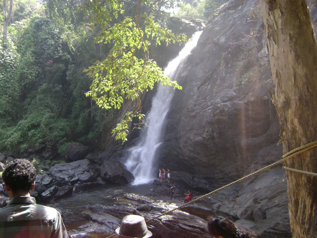
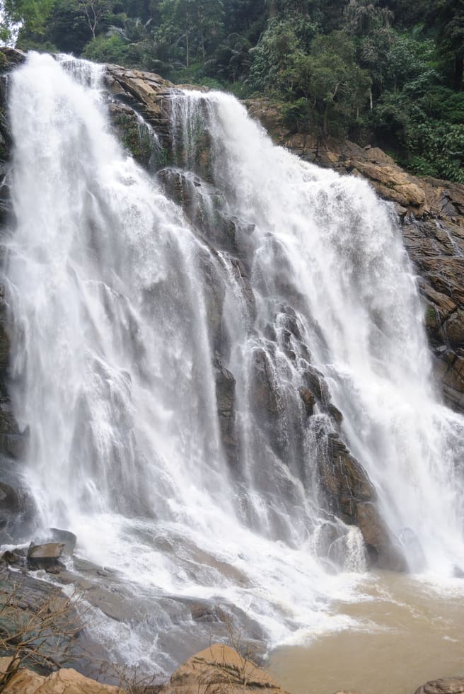
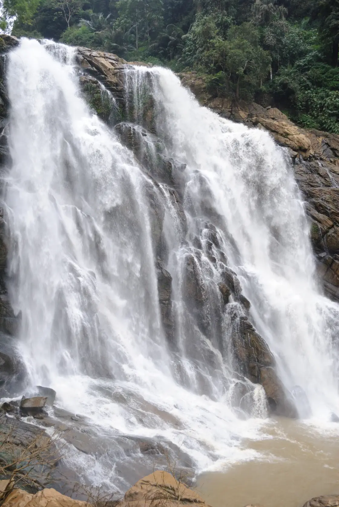
This Meenmutty is the forest waterfall near Vaduvanchal, on the Meppadi–Gudalur side of Wayanad. It descends through steep wooded country away from the main road. Historical photographs show powerful sheets of water spreading over a dark rock face, with forest closely enclosing the fall.

Meenmutty Falls trek, Meppadi and Chembra
Know before you go. This is in the Meppadi/Chooralmala belt, which has seen landslides and access restrictions. Confirm current road access, permits and safety with the Forest Department or DTPC Wayanad before you travel.
Practical guide

Plan Meenmutty Falls trek

Who's going?Tailor Meenmutty Falls trek to your trip
Typetrek
AreaMeppadi and Chembra
DistrictWayanad
Best timeThere is no recommended trekking season…
Time neededNo current trek duration is offered…
Places to visit12Listed businesses23

Do not plan the old forest trek as an open activity. Wayanad DTPC explicitly distinguishes this closed Meppadi-area waterfall from Banasura Meenmutty near Padinjarathara. July 2026 local reporting also describes the Vaduvanchal falls as closed. The map identifies Vaduvanchal bus stand as a town orientation base; it is not a waterfall entrance or an authorised trailhead.

The story

The old close views of Meenmutty are dominated by water and rock. A broad white flow divides around protruding stone, joins again below it, and leaves little room in the frame for the forest rising on either side. The surrounding gorge explains the waterfall as much as the falling water does.

The story of Meenmutty Falls trek

The first detail to establish is the town. Meenmutty is a repeated waterfall name in Kerala, and even Wayanad contains more than one destination carrying it. This page concerns the Vaduvanchal and Meppadi–Gudalur side of the district. Banasura Meenmutty belongs to a different approach near Padinjarathara, while Kallar’s Meenmutty is far away in Thiruvananthapuram. These distinctions change the whole journey, not merely the spelling entered in a map.

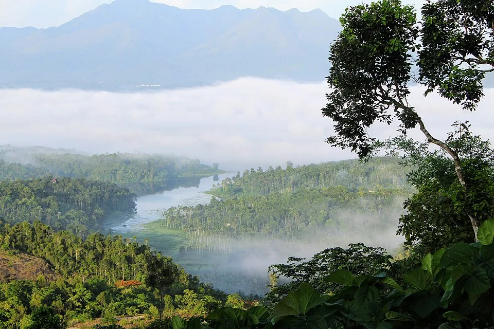
Kerala Tourism places Meppadi and Vaduvanchal along the Kozhikode–Ooty road landscape. Its account describes hills, woods and plantation crops, and associates a forest approach from Vaduvanchal with Meenmutty Falls. That road relationship is useful context: the town is a service and transport point above a much more enclosed landscape. Reaching the road does not place a visitor at the foot of the falls.

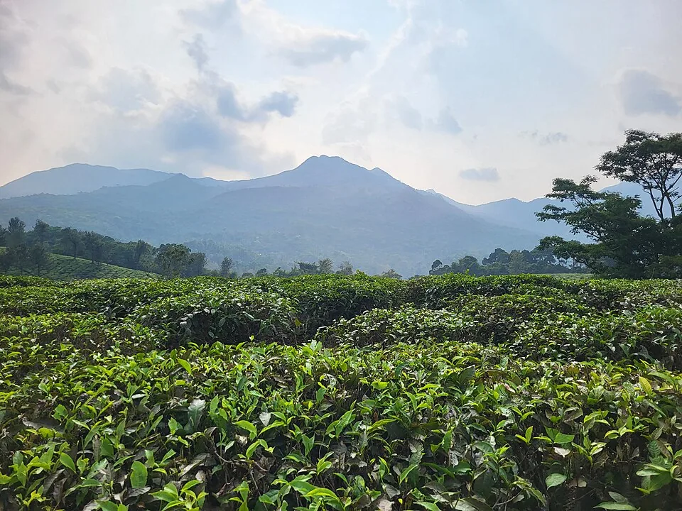
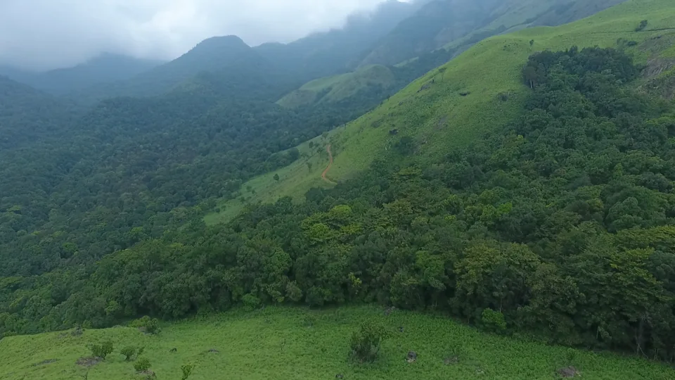
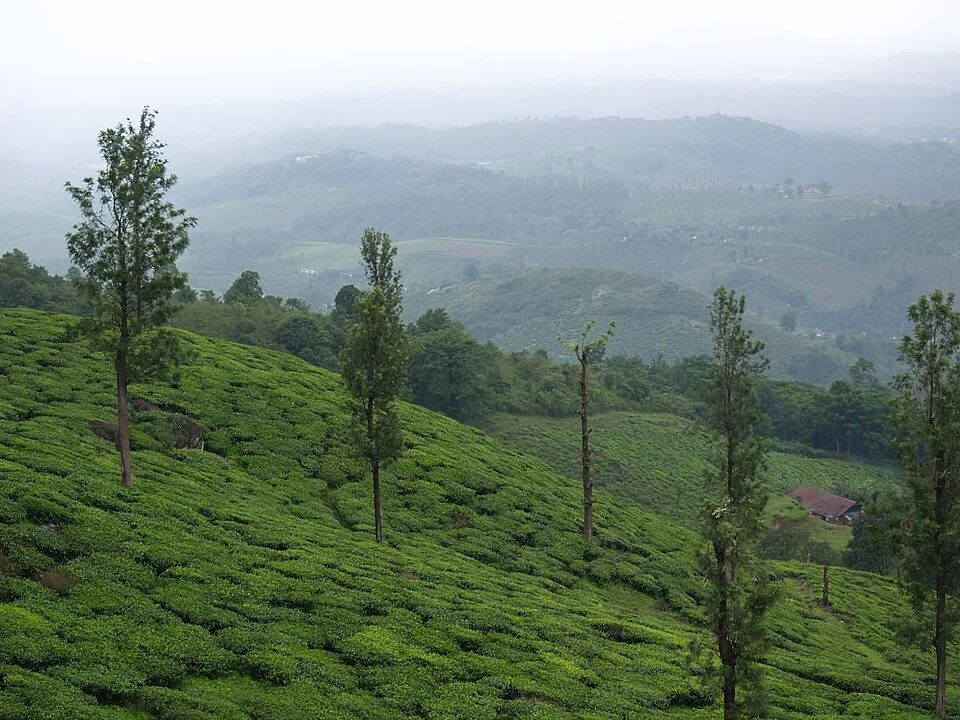
The plantation setting around Meppadi and Vaduvanchal includes tea, coffee, rubber and vanilla in Kerala Tourism’s account. This is a broader agricultural landscape than the tea-only image often associated with a Kerala hill journey. A hosted estate visit can explain the particular crop at that property and how its work fits the surrounding roads and settlements. Arrange such a visit by the estate’s own address and with its permission. It is a separate outing in the Vaduvanchal area, with no implied access through the estate to the closed waterfall.

The 2011 Wayanad District Census Handbook describes one principal waterfall and two smaller falls, reached historically by a forest hike from the Ooty road. This is an account of the landform and its earlier tourism setting. It should not be turned into a present-day walking instruction. The visitor route has a separate history from the waterfall itself.

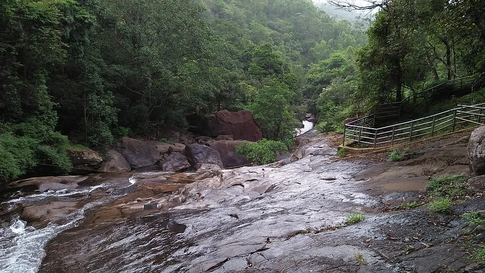
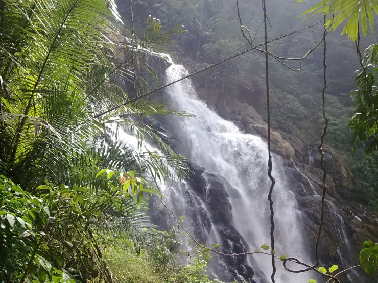
The waterfall’s close photographs show why the word “tiered” can be misleading when used without a view. Even within one section, projecting rock divides the flow into several curtains and channels. Some parts drop almost vertically; others slide across sloping surfaces before falling again. A photograph of one large face does not necessarily show the whole sequence described in an older district account.

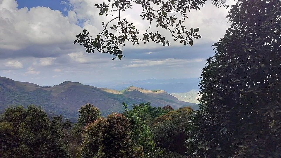
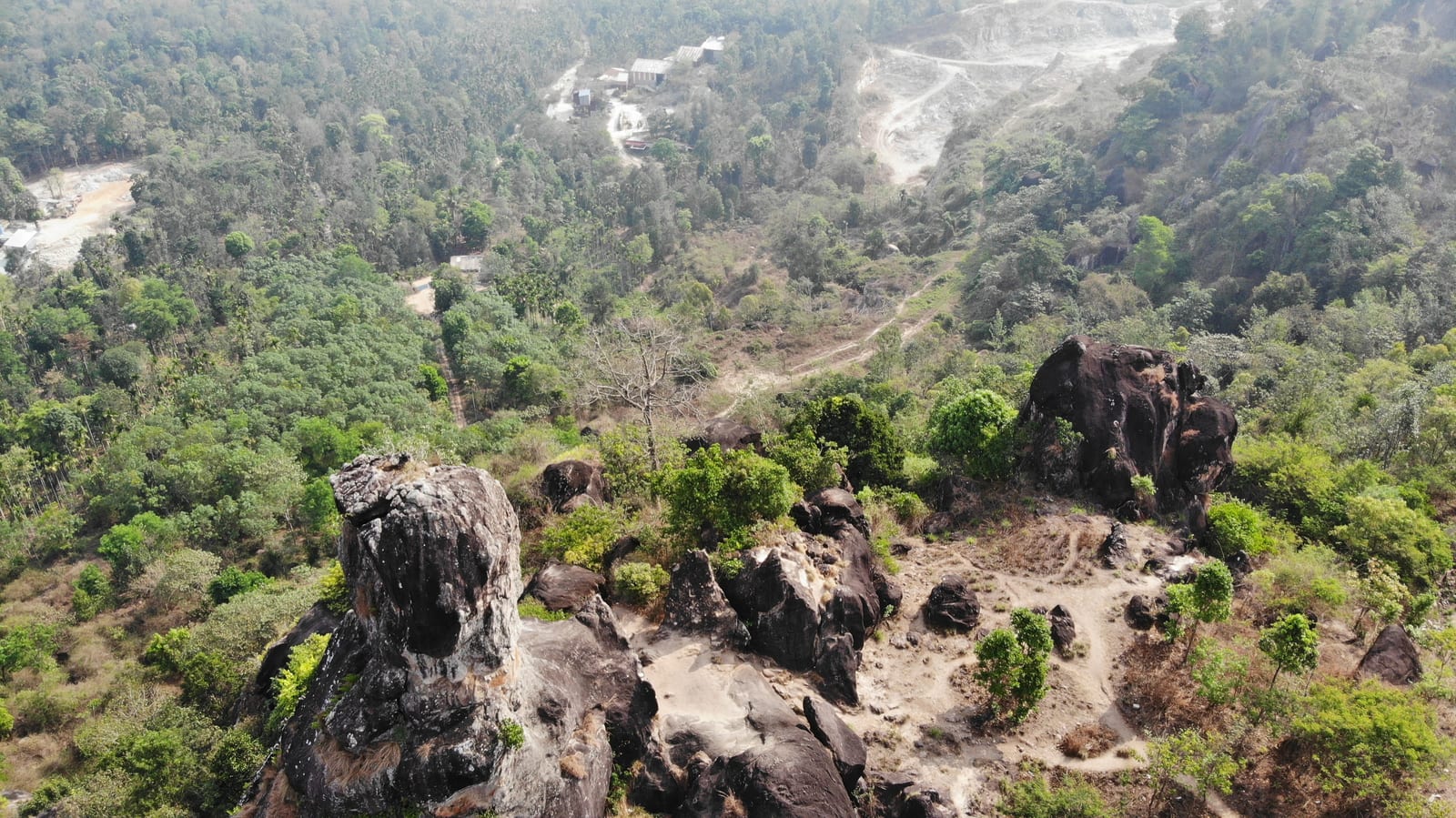
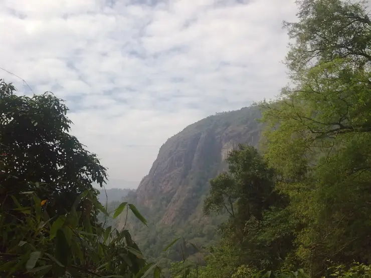
One archived view looks away from the water towards a tall, exposed cliff framed by dense vegetation. It is a useful companion to the familiar white-water image because it reveals the steep-sided setting. The bare rock face rises above the trees rather than forming a gentle walking slope. Reading the surrounding terrain helps explain why a short distance on a map can conceal a difficult descent.

Other images bring the forest into the foreground. Fronds and hanging vines partly screen the cascade; sunlight catches a leaf while the ravine behind stays dark. The waterfall is embedded in this vegetation. It is not an isolated monument with a paved viewing apron around its base, and removing the forest from a cropped image can give a false impression of the space available beside the water.

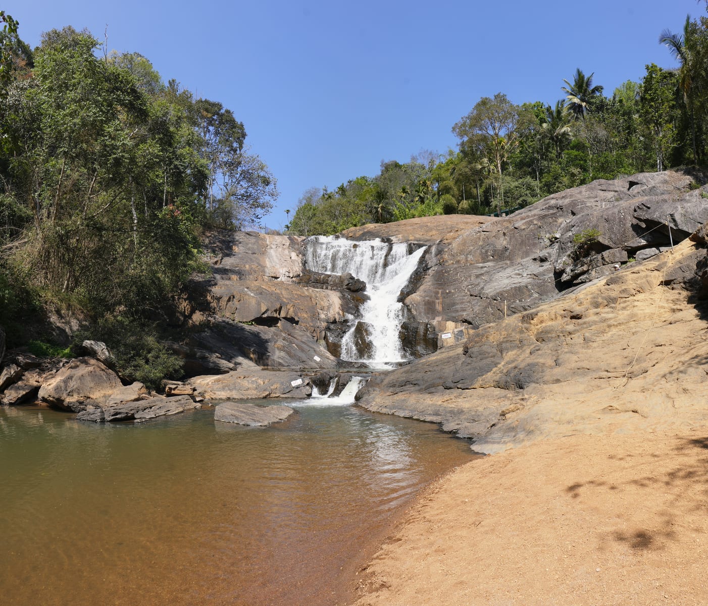
The flow also changes how much rock is visible. In the fuller archival view, white water covers broad portions of the face and breaks into spray above a brownish pool. In a more oblique frame, dark rock and separate streams are easier to follow. These images record particular conditions. Their differences make the landscape interesting without supplying a dependable prediction of flow on a future date.

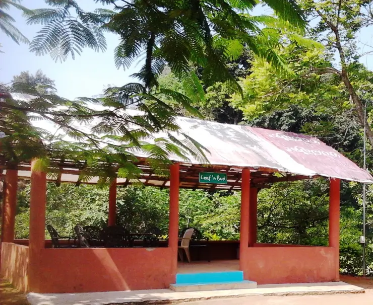
Tourism left its own traces around the earlier approach. A 2014 photograph identified with Vaduvanchal Meenmutty shows an open-sided shelter with red-orange pillars, a metal roof and chairs under leafy shade. It records a visitor-era structure, not a current café listing. The small building gives a human scale to a place otherwise represented almost entirely by a large waterfall.

The present planning question is access. DTPC’s Banasura Meenmutty page specifically warns readers not to confuse it with the closed falls near Meppadi. July 2026 reporting from Vaduvanchal describes renewed local requests to reopen this site. A request for reopening and an old tourism description are different from an operating visitor programme. Until an authorised reopening is confirmed, the sensible use of this guide is to identify the place and avoid a misdirected journey.

Vaduvanchal remains part of a lived-in plantation-road landscape. A stay or a hosted plantation visit can be arranged separately, with its own address and permission. Museum visits around Ambalavayal or another admitted waterfall also require their own travel plan. They can provide a worthwhile day without suggesting that a closed forest path is an obstacle to get around.
Read the full history of Meenmutty Falls trek 143 more words

History

The Wayanad District Census Handbook published for the 2011 Census records the waterfall and its former forest-hike approach from the Ooty road. It is historical destination evidence, not a current access notice.
Dated photographs from 2010 document close views of the cascade and the wooded gorge. A 2014 frame records a shelter associated with the former visitor setting. Their dates should remain visible in the image captions.

The district tourism authority now distinguishes this closed Meppadi-side site from Banasura Meenmutty. The two should never share a ticket price, route pin or claim of current trekking availability.

Why visit

Use the page to identify the correct Meenmutty before making a booking.

Explore the waterfall’s landform and former visitor setting through dated, correctly identified photographs.

Plan the Vaduvanchal road journey with realistic access expectations.

Choose a separate open activity without confusing it with this closed forest approach.

What to expect

Highlights

  • Understand the Vaduvanchal waterfall’s steep forest setting through identified archival images.
  • Distinguish three different Meenmutty destinations before choosing a route or booking: Vaduvanchal, Banasura and Kallar near Ponmudi.
  • Use the Meppadi–Vaduvanchal road context to plan a separate, confirmed outing in southern Wayanad.
Getting there

How to visit

  • If a booking or driver offers “Meenmutty”, establish the district, nearest town and actual entrance first. The Banasura-side ticket and route belong to another waterfall.
  • For this Vaduvanchal site, treat the forest approach as closed unless the responsible authority announces and confirms an authorised reopening. Do not follow an old GPX track or a path through an estate.
  • Use Vaduvanchal only as the named town base shown on the map. Choose an independently confirmed destination for the day rather than driving to the old waterfall approach expecting a ticket counter.
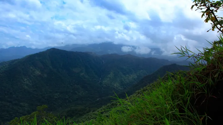
  • If seeking a distant view, ask DTPC for the specific currently admitted viewpoint. Neither a generic road reference nor an old Neelimala photograph establishes a public stopping place.

Distance by road

  • Kozhikode71 km
  • Mysuru138 km
  • Coimbatore210 km
  • Mangaluru254 km
  • Kochi256 km

Road km to Wayanad; ghat roads and traffic vary — allow extra.

Timing

Best time

There is no recommended trekking season while the approach is closed. Seasonal photographs explain how flow and vegetation change, but rain or clear weather does not alter the access rule. Plan travel in the surrounding Vaduvanchal area around the forecast and the opening status of the destination actually being visited.

Weather in Meenmutty Falls trekSeasonal guide

Live forecast loads in your browser.

Today at Meenmutty Falls trek
Sunrise6:14 am
Sunset6:24 pm
Golden hour best light5:24 pm–6:24 pm
Blue hour after sunset6:24 pm–6:49 pm
Sun sets toward compass bearingW · 272°
Moon tonight🌓 First quarter · 52%
South-west monsoon. June to September brings heavy rain to Kerala. Trails, falls and ghat roads can be slippery, swollen or closed at short notice, and forest departments sometimes suspend access. Check locally on the day before you travel.

Check the official alert before you travel. Kerala’s beaches, waterfalls and trekking routes close at short notice during heavy rain, and district alert levels change day to day. We do not publish an alert level of our own — read it from the state authority: Kerala State Disaster Management Authority, or the district control room on 1077.

Sun and moon are calculated for this location and shown in IST. Photography windows are the hour around sunrise and sunset; the sunset bearing is degrees clockwise from true north. Moon phase is accurate to about half a day.

Visitor notes

  • Meppadi and Chembra is the travel-guide grouping. Vaduvanchal is the relevant town orientation for this waterfall; Chembra’s entry arrangements do not apply here.
  • Older descriptions of a forest hike remain online. They explain how the falls were visited, but do not establish a current permit, guide service or opening schedule.
  • The gallery includes dated images taken before the present visit plan. Close waterfall views and an old shelter should not be read as evidence of today’s available facilities.
Safety

Good to know

  • Respect the forest closure and private estate boundaries. A local path or visible opening in vegetation is not an authorised alternate entrance.
  • Do not descend towards a waterfall brink or pool to reproduce an archival photograph. The enclosed gorge limits what can be judged from a distant view.
  • Keep any road stop within a designated, admitted place with space clear of traffic. The Meppadi–Gudalur route is a working road, not a continuous viewpoint promenade.
Official eco & forest programmes

Experiences around Meenmutty Falls trek

These are official or public-sector eco offerings that match this place, town or forest destination. Confirm availability, permits, tariffs and reporting times with the official operator before travel.

Chembra Peak, Meenmutty Falls trek
trekviewpoint

Chembra Peak trek

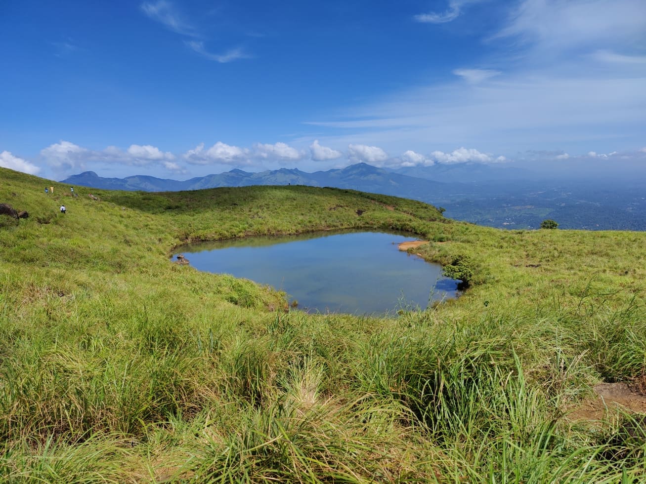
Full-day forest-department trek from Meppadi side to the heart-shaped lake viewpoint area on Chembra Peak.

DFO South WayanadFull day
Official source →
Stay · eat · do · rent · see · shop

Stays, food & things to do near Meenmutty Falls trek

Verified hotels, homestays, restaurants, experiences, sights, shops and rentals around Meenmutty Falls trek — commission-free, with direct contact. Filter by what you need.

900 Woods Trail and Food Experience — Trail and food experience in Meppadi and Chembra
Verified
Trail and food experience · Meppadi and Chembra
900 Woods Trail and Food Experience

900 Woods official trail, campfire and food experience evidence for 900 Kandi/Meppadi. Trekking, Food, 900 Kandi.

Directions Commission-freeView details
After The Rains Farm and Nature Experiences — Farm and nature experiences in Meppadi and Chembra
Verified
Farm and nature experiences · Meppadi and Chembra
After The Rains Farm and Nature Experiences

Rippon/Meppadi farm, plantation, fishing and nature experiences with direct official evidence. Farm experience, Nature walk, Meppadi.

Directions Commission-freeView details
After The Rains Dining Meppadi — Resort dining and local food in Meppadi and Chembra
Verified
Resort dining and local food · Meppadi and Chembra
After The Rains Dining Meppadi

Resort dining and local food in Meppadi and Chembra. After The Rains, Valathoor, Rippon, Wayanad, Kerala · Restaurant, Dining, Meppadi.

Directions Commission-freeView details
LanternStay Camping and Birding Meppadi — Camping and birding experience in Meppadi and Chembra
Verified
Camping and birding experience · Meppadi and Chembra
LanternStay Camping and Birding Meppadi

LanternStay Camping and Birding is a Meppadi-side forest stay experience with direct evidence for camping enquiries, birding, resort facilities and the Meppadi address, useful for Chembra and waterfall-route experience searches. Camping, Birding, Meppadi.

Directions Commission-freeView details
Wayanad Taxi Meppadi Transfers — Taxi service in Meppadi and Chembra
Verified
Taxi service · Meppadi and Chembra
Wayanad Taxi Meppadi Transfers

District-wide Wayanad taxi service for Meppadi/Chembra transfers, sightseeing and airport pickups. Wayanad district, Kerala · Taxi, Meppadi, Chembra.

Directions Commission-freeView details
Rippon Mount Resort Meppadi — Resort in Meppadi and Chembra
Verified
Resort · Meppadi and Chembra
Rippon Mount Resort Meppadi

Kerala Tourism-listed Meppadi-side resort record with image-backed provider evidence. Mid-range resort · Resort, Meppadi, Mid-range stay.

Directions Commission-freeView details
900 Woods Eco Resort Wayanad — Eco resort in Meppadi and Chembra
Verified
Eco resort · Meppadi and Chembra
900 Woods Eco Resort Wayanad

900 Kandi-side eco resort with official contact/travel-context evidence near Meppadi. Mid-range eco resort · Resort, Eco resort, 900 Kandi.

Directions Commission-freeView details
LanternStay Meppadi — Jungle resort in Meppadi and Chembra
Verified
Jungle resort · Meppadi and Chembra
LanternStay Meppadi

LanternStay is a Meppadi jungle resort with suites, tree houses, cottages, villas, camping and birding context, useful for Chembra/Meppadi waterfall and forest-side stay planning. Mid-range jungle resort · Resort, Jungle resort, Meppadi.

Directions Commission-freeView details
Chembra Peak Resort Wayanad — Hotel in Meppadi and Chembra
Verified
Hotel · Meppadi and Chembra
Chembra Peak Resort Wayanad

Kerala Tourism-listed Meppadi hotel/resort record for Chembra-side stay planning. Budget to mid-range hotel · Hotel, Meppadi, Chembra side.

Directions Commission-freeView details
900 Kandi Eco Park Meppadi — Adventure park in Meppadi and Chembra
Verified
Adventure park · Meppadi and Chembra
900 Kandi Eco Park Meppadi

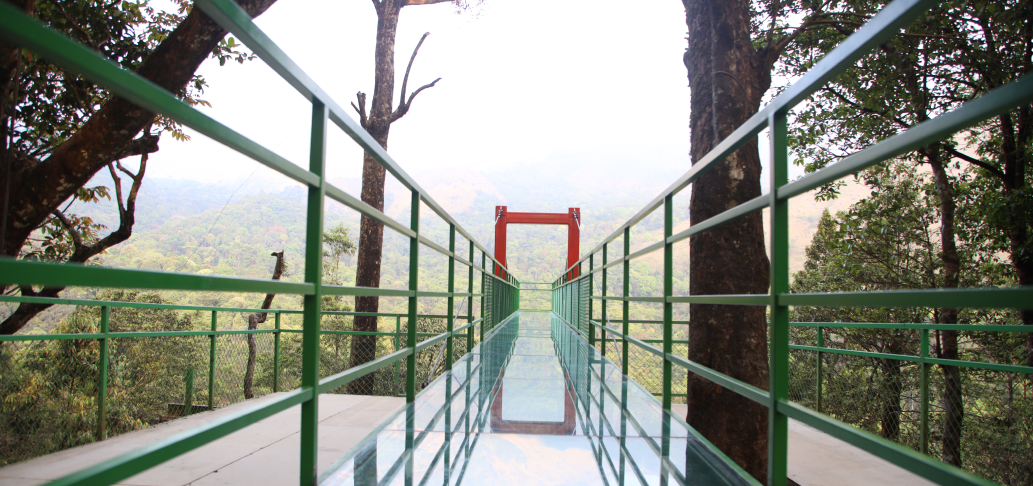
900 Kandi Eco Park, also listed as Thollayiram Kandi Eco Park, is a Meppadi-side adventure and ecotourism park with trekking, camping, zipline, glass bridge and outdoor recreation evidence. 900 Kandi, Meppadi, Eco park.

Directions Commission-freeView details
Skypark 900 Kandi DTPC Wayanad — Adventure park in Meppadi and Chembra
Verified
Adventure park · Meppadi and Chembra
Skypark 900 Kandi DTPC Wayanad

Skypark at 900 Kandi is a DTPC Wayanad-listed adventure and viewpoint park near Meppadi, with glass bridge, zipline, zip cycling, adventure swing, trails and off-road jeep ride context. 900 Kandi, Skypark, Meppadi.

Directions Commission-freeView details
After The Rains Rainforest Lodge Meppadi — Resort in Meppadi and Chembra
Verified
Resort · Meppadi and Chembra
After The Rains Rainforest Lodge Meppadi

Kerala Tourism-listed Meppadi resort with direct reservations evidence. Meppadi, Rainforest lodge, Chembra base.

Directions Commission-freeView details
Chembra Peak Trek Official — Trek in Meppadi and Chembra
Verified
Trek · Meppadi and Chembra
Chembra Peak Trek Official

Chembra Peak trek is Wayanad’s best-known Meppadi-side trek and should be planned around current Forest/DTPC access, group capacity, timing and guide rules. Chembra Peak, Meppadi, Trek.

Directions Commission-freeView details
E
Emarald County 900 Resort
Place to stay
Top pick
Hotel · Meppadi and Chembra
Emarald County 900 Resort

Luxury hillside resort in the 900 Kandi belt above Meppadi. Balconies open to sweeping views over the plantations near the Vellarimala ranges.

Directions Commission-freeView details
N
Namaha Homestay
Place to stay
Top pick
Hotel · Meppadi and Chembra
Namaha Homestay

A Diamond-class homestay on the Rippon tea belt near Meppadi. Four king-bed rooms serve traditional Kerala meals amid Western Ghats hills.

Directions Commission-freeView details
9
900 Woods Eco Resort
Place to stay
Top pick
Hotel · Meppadi and Chembra
900 Woods Eco Resort

Sprawling jungle eco-resort on a forested estate at Kalladi, Meppadi. Soochipara waterfall and the 900 Kandi glass bridge sit a short ride away.

Directions Commission-freeView details
T
Tea Route Homestay
Place to stay
Top pick
Hotel · Meppadi and Chembra
Tea Route Homestay

Family homestay wrapped in tea and coffee plantations at Meppadi. Trailheads to Chembra Peak and Soochipara Falls start close by.

Commission-freeView details
A
After The Rains
Place to stay
Top pick
Hotel · Meppadi and Chembra
After The Rains

Boutique rainforest lodge set in a 16-acre spice garden at Rippon, Meppadi. It overlooks the Nilgiri biosphere and was built without felling a tree.

Directions Commission-freeView details
A
Aramb
Place to stay
Hotel · Meppadi and Chembra
Aramb

Luxury poolside villas on the foothills of Chembra Peak at Kottappadi, Meppadi. Its infinity pool is framed by the Aranamala hills and shola forest.

Directions Commission-freeView details
V
Villa Tesori
Place to stay
Hotel · Meppadi and Chembra
Villa Tesori

Diamond-class hilltop homestay above Meppadi with its own private waterfall. A tea-planted ridge frames a 360-degree view of Chembra Peak.

Commission-freeView details
T
Tea Terrace Restaurant Meppadi
Where to eat
Verified
Plantation restaurant · Meppadi and Chembra
Tea Terrace Restaurant Meppadi

Plantation restaurant in Meppadi and Chembra. Near Meppadi and Chembra route, Wayanad district, Kerala · meppadi-and-chembra, eat, Plantation restaurant.

Directions Commission-freeView details
S
Skyfall Adventures 900 Kandi
Things to do
Verified
Adventure stay and attraction · Meppadi and Chembra
Skyfall Adventures 900 Kandi

Skyfall Adventures is a 900 Kandi adventure stay and attraction near Eco Park, useful for travellers comparing Meppadi-side glass bridge, stay and nature-experience options. 900 Kandi, Skyfall, Meppadi.

Directions Commission-freeView details
S
Sky Swing 900 Kandi Meppadi
Things to do
Verified
Adventure operator · Meppadi and Chembra
Sky Swing 900 Kandi Meppadi

Kerala Tourism-accredited 900 Kandi operator for high ropes, jeep safari, nature walks and zipline. 900 Kandi, Meppadi, Jeep safari.

Directions Commission-freeView details

Book with the place itself. India’s cyber-crime coordination centre warned in April 2025 that convincing copies of hotel and pilgrimage booking sites are being pushed through sponsored search and social ads, taking payment for rooms the property never hears about. Every listing here links to the business’s own contact details and its own Google or Bing profile — we take no commission and sit in nobody’s payment path. If a booking page reached you through an ad, check the address bar against the property’s own site before you pay. Fraud can be reported on cybercrime.gov.in or on 1930.

Ranked guides

Top experiences around Meenmutty Falls trek

13 more places around Meppadi and Chembra. Open a guide to plan the visit and onward journey.

trekChembra Peak trek

Chembra Peak is the Meppadi-side trek landmark of Wayanad. Plan it only with current official permit, weather and reporting-time checks, then keep the rest of the day light for food, transfers or a nearby waterfall.

waterfallSoochipara Waterfalls

Soochipara Waterfalls is a Meppadi-side waterfall reached through controlled access and a short forest walk. Check seasonal opening, crowding and rain conditions before adding it to a Chembra or 900 Kandi day.

waterfallMeenmutty Waterfalls

The closed Meppadi–Vaduvanchal waterfall, also listed as Meenmutty Falls trek. The map marks Vaduvanchal bus stand for town orientation, not an open waterfall entrance. Banasura Meenmutty is a different site.

waterfallBanasura Meenmutty Waterfalls

The Banasura-side Meenmutty at Kappikkalam, five kilometres from Banasura Sagar Dam—not the Meppadi or Makkiyad waterfalls with the same name.

waterfallKanthanpara Waterfalls

Kanthanpara Waterfalls is a smaller Meppadi-side waterfall often used as a lighter alternative to busier falls. Confirm access, weather and local road conditions before pairing it with plantation stays or Chembra-side routes.

viewpointNeelimala View Point

Vaduvanchal/Meppadi-side viewpoint and trek route known for views toward Meenmutty Waterfalls and the Western Ghats.

viewpointSunrise Valley View Point

A weather-dependent sunrise viewpoint name in the Vaduvanchal circuit. The map marks Vaduvanchal as the honest reporting base because no authoritative exact public gate is documented; it is not presented as an alias for Neelimala.

viewpointSkypark 900 Kandi

The distinct Skypark adventure operator at 900 Kandi, with a glass walk, zip activities and a DTPC-published visitor marker separate from the neighbouring Eco Park.

viewpointGlass Bridge 900 Kandi

A comparison guide to the distinct glass-bridge offers at 900 Kandi Eco Park and Skypark; choose the operator before navigating or buying a ticket.

viewpoint900 Kandi Eco Park

The named private Eco Park at 900 Kandi, with its own glass bridge, skywalk and activity ticketing; it is separate from nearby Skypark.

museumAchoor Tea Museum

Harrisons Malayalam’s three-storey tea museum in its 1911 former factory at Achoor, with separately scheduled museum, tasting, working-factory and garden visits.

trekAranamala Peak

Meppadi-side hill and trek landscape around Aranamala, best planned with local route, weather and access checks.

heritageRipon Tea Estate

A working tea-estate landscape rather than a single ticketed attraction. The map marks Rippon 52 village as the honest visitor base; any private walk or factory visit needs its own confirmed property address.

Roampedia is commission-free — own or know a stay, eatery, guide or shop near Meenmutty Falls trek? List it and it appears here once verified.

Add a nearby business
Trek facts

Meenmutty Falls trek — at a glance

Photography: Use the dated gallery to understand the landform. For a new photograph, stay at a specifically admitted viewpoint or public stopping place; do not seek the old close-water positions through the forest.

Parking: Use lawful town parking for a Vaduvanchal stop, without occupying bus bays. No current waterfall visitor parking area is presented for the closed trek.

Getting here

How to reach Meenmutty Falls trek

  • ✈︎ By air Calicut International Airport serves the western approach. The remaining journey is by road into Wayanad; booking accommodation near Vaduvanchal does not include permission to enter the falls.
  • 🚆︎ By train Kozhikode is the western rail-to-road gateway for this part of Wayanad. Continue by road towards the Meppadi–Vaduvanchal area, with the actual day’s destination chosen before leaving the town base.
  • 🚗︎ By road Navigate to Vaduvanchal town on the Meppadi–Gudalur side of Wayanad. Kerala Tourism locates Meenmutty locality via Chellankodu, but that locality reference does not authorise entry to the waterfall approach.
  • 🚌︎ By bus The mapped Vaduvanchal bus stand provides a clear town meeting point. Confirm the current service for your onward town; there is no verified visitor shuttle to this closed waterfall.
Getting back

Use Vaduvanchal for the onward public-road journey. Do not arrange a pickup beyond a closed forest path or assume an old trekking route connects through to another road.

Do

Things to do

  • Establish whether a proposed Meenmutty booking means Vaduvanchal, Banasura or Kallar.
  • Read the historical waterfall views and distinguish the gorge from its town approach.
  • Arrange a hosted plantation visit around Vaduvanchal with its own identified meeting point.
  • Choose a separate confirmed museum or waterfall visit for the day.
Facilities

On site

  • Use Vaduvanchal’s town services when travelling through the area. The old shelter photograph is historical evidence, not confirmation of a functioning café or rest stop.
  • No current waterfall ticket counter, guide departure or maintained visitor toilet is offered as part of this closed-route plan.
Getting around Meenmutty Falls trek
From the entrance
Vaduvanchal bus stand — town orientation base, not a waterfall entrance
Step-free access
Vaduvanchal is the orientation base; this page does not advertise an accessible waterfall route. The earlier forest approach involved steep, uneven terrain, and a current admitted viewpoint with verified step-free access is not established.

Checked 7 September 2026 against source 1source 2. Conditions change and surfaces vary with weather — if step-free access is essential, confirm with the site before you travel.

If you need help at Meenmutty Falls trek
112All emergencies (police · fire · medical)The single number to call in any emergency (ERSS).

Emergency numbers are verified against official government and state tourism sources. 112 works anywhere in India.

Eat nearby

What to eat in Meppadi and Chembra

Meals belong to the Vaduvanchal town or accommodation plan. An old photograph of a shelter near Meenmutty should not send visitors to the closed approach looking for refreshments.

Explore food in Meppadi and Chembra →
01

Vaduvanchal breakfast

A town breakfast suits an onward road journey towards a confirmed destination.

02

Lunch at your stay

Arrange a meal with the property if the day includes a hosted estate visit away from the town road.

03

Tea on the main road

Choose an established town shop with a proper stopping place, keeping the bus stand and carriageway clear.

Nearby

What’s near Meenmutty Falls trek

viewpointSunrise Valley View Point

A weather-dependent sunrise viewpoint name in the Vaduvanchal circuit. The map marks Vaduvanchal as the honest reporting base because no authoritative exact public gate is documented; it is not presented as an alias for Neelimala.

heritageRipon Tea Estate

A working tea-estate landscape rather than a single ticketed attraction. The map marks Rippon 52 village as the honest visitor base; any private walk or factory visit needs its own confirmed property address.

museumWayanad Heritage Museum

Ambalavayal museum focused on Wayanad archaeology, tribal history and heritage artefacts.

waterfallSoochipara Waterfalls

Popular waterfall reached by a short forest walk, access varies by season.

caveEdakkal Caves

Rock shelter with ancient petroglyphs and a steep Ambukuthi hill walk, best planned from Sulthan Bathery or Ambalavayal.

damKarapuzha Dam

Reservoir and garden-side attraction near the Ambalavayal/Kalpetta side of Wayanad.

viewpointPhantom Rock

A natural rock formation near Ambalavayal that resembles a human skull, locally called Cheengeri Mala, reached by a short walk and popular as an eastern-Wayanad viewpoint stop.

waterfallKanthanpara Waterfalls

Meppadi-side waterfall with easier access than some larger Wayanad falls, still weather-sensitive in monsoon.

viewpointNeelimala View Point

Vaduvanchal/Meppadi-side viewpoint and trek route known for views toward Meenmutty Waterfalls and the Western Ghats.

heritageUravu Bamboo Village

Thrikkaipatta bamboo craft and responsible-tourism village experience, useful from the Vythiri/Lakkidi side.

jainJain Temple

Sulthan Bathery Jain temple with old stone architecture and east-Wayanad heritage context.

viewpointGlass Bridge 900 Kandi

A comparison guide to the distinct glass-bridge offers at 900 Kandi Eco Park and Skypark; choose the operator before navigating or buying a ticket.

All 12 places to visit in Meppadi and Chembra →

On the map

Where Meenmutty Falls trek is

Good to know

Meenmutty Falls trek — frequently asked

Is the Meenmutty trek near Vaduvanchal open?

Treat this forest approach as closed. Wayanad DTPC identifies the Meppadi-side falls as closed, and July 2026 reporting repeats that status. An authorised reopening has not been verified.

Is this Banasura Meenmutty Waterfalls?

No. Banasura Meenmutty is near Padinjarathara on a separate Wayanad route. Its published tickets and visiting arrangements do not apply to Vaduvanchal.

Is this the Meenmutty near Ponmudi?

No. Kallar’s Meenmutty is in Thiruvananthapuram district. This page concerns the Vaduvanchal-side waterfall in Wayanad.

Why does the map show Vaduvanchal bus stand?

It is an exact, named town orientation base a visitor can reach. It is deliberately labelled as such because this guide does not offer an authorised waterfall trailhead.

Can a private guide take me down the old path?

A private arrangement does not replace permission from the responsible forest authority. Do not enter the closed approach through a side path or estate.

Can I see the falls from Neelimala?

Older tourism descriptions connect the viewpoint with Meenmutty views. Confirm the specific viewpoint’s current admission with DTPC before travelling; the waterfall closure does not establish an open alternative viewpoint.

What is the current entry fee and trek duration?

Neither is offered here for a closed route. Prices and durations advertised for another Meenmutty should not be transferred to this site.

Do the photographs show current visitor access?

No. The dated waterfall and shelter images document earlier conditions. They show the subject without promising that the photographed positions can now be reached.

Are Meenmutty Waterfalls and Meenmutty Falls trek two different Vaduvanchal attractions?

In the Meppadi–Vaduvanchal setting, those names refer to the waterfall and its former forest approach. They are not two separately bookable entrances. A listing that uses “trek” still needs to identify this exact site and its current authorised access. The operating Banasura-side Meenmutty is a different destination, so its tickets cannot be used as confirmation that the Vaduvanchal route has reopened.

When is the best time to visit Meenmutty Falls trek?

There is no recommended trekking season while the approach is closed. Seasonal photographs explain how flow and vegetation change, but rain or clear weather does not alter the access rule. Plan travel in the surrounding Vaduvanchal area around the forecast and the opening status of the destination actually being visited.

How do I reach Meenmutty Falls trek?

If a booking or driver offers “Meenmutty”, establish the district, nearest town and actual entrance first. The Banasura-side ticket and route belong to another waterfall. For this Vaduvanchal site, treat the forest approach as closed unless the responsible authority announces and confirms an authorised reopening. Do not follow an old GPX track or a path through an estate. Use Vaduvanchal only as the named town base shown on the map. Choose an independently confirmed destination for the day rather than driving to the old waterfall approach expecting a ticket counter. If seeking a distant view, ask DTPC for the specific currently admitted viewpoint. Neither a generic road reference nor an old Neelimala photograph establishes a public stopping place.

How much time do I need for Meenmutty Falls trek?

No current trek duration is offered because the old forest route is not presented as open. Allow time in Vaduvanchal only as part of the onward town-and-road plan; choose a separate admitted attraction before allocating a half-day or full-day outing.

What else is near Meenmutty Falls trek?

Nearby you can pair Sunrise Valley View Point, Ripon Tea Estate, Wayanad Heritage Museum, Soochipara Waterfalls.

What should I know before visiting Meenmutty Falls trek?

Respect the forest closure and private estate boundaries. A local path or visible opening in vegetation is not an authorised alternate entrance. Do not descend towards a waterfall brink or pool to reproduce an archival photograph. The enclosed gorge limits what can be judged from a distant view. Keep any road stop within a designated, admitted place with space clear of traffic. The Meppadi–Gudalur route is a working road, not a continuous viewpoint promenade.

Image credits

Photographs: Anantharamvanchiprakash (Public domain), Anil R.V (CC BY-SA 3.0), Ravi Dwivedi (CC BY-SA 4.0), Siyad saffan shah (CC BY-SA 4.0), Allen Pookolas (CC BY-SA 4.0), Ingo Mehling (CC BY-SA 4.0), Kerala Tourism (Official tourism image), SijiR (CC BY-SA 4.0), 900 Kandi Eco Park (Official website image), Athulvis (CC BY-SA 4.0), Shagin sunny (CC BY-SA 4.0), Dhruvaraj S (CC BY 2.0), Vinayaraj (CC BY-SA 4.0), Soumendra Kumar Sahoo (CC BY-SA 4.0), Kaippally (CC BY-SA 4.0), Anil R.V / CC BY-SA 3.0 / Wikimedia Commons, Prof tpms / CC BY-SA 4.0 / Wikimedia Commons, Kerala Tourism / official festival archive, 900 Woods Eco Resort (Official website image), After The Rains (Official website image), LanternStay (Official website image), Wayanad Taxi (Official website image), DTPC Wayanad (Official website image). Wikimedia Commons.