Places to Visit in Ooty

The Nilgiris capital and queen of hill stations, base for the botanical gardens, Ooty Lake, Doddabetta and the toy train.

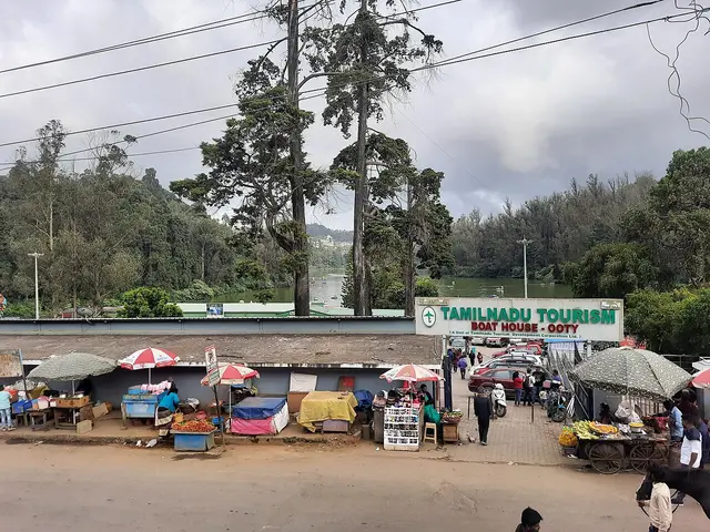
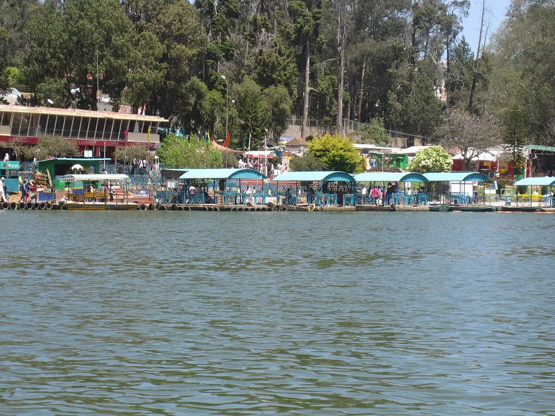
Ooty Lake, Ooty
Practical guide

Plan Ooty

Who's going?Tailor Ooty to your trip
DistrictThe Nilgiris
RoleHill-station hub
Time neededTwo nights, three if you want Avalanche…
Places to visit28Listed businesses25
What to expect

Highlights

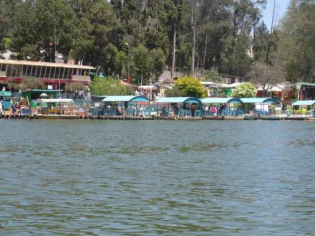
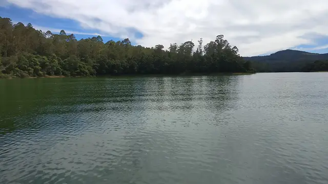
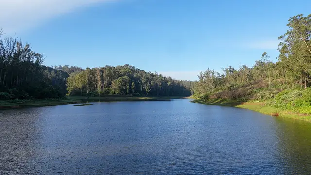
  • Ooty Lake — An artificial lake created in 1824 by John Sullivan, the founder of Ooty, now used for boating amid eucalyptus-lined banks.
  • Government Botanical Garden, Ooty — A terraced garden of 55 acres below Doddabetta, run by the Tamil Nadu Horticulture Department, holding a fossilised tree trunk reckoned at 20 million years old and hosting the flower show every May. Its founding year is published two ways, 1848 and 1897.
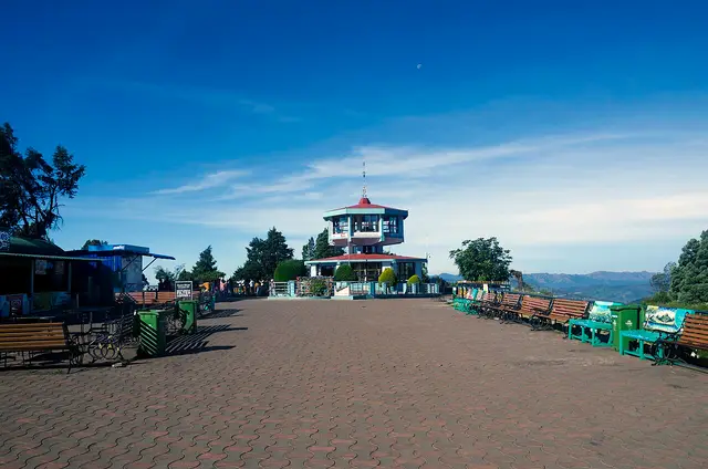
  • Doddabetta Peak — The highest peak in the Nilgiris and in Tamil Nadu, with a telescope house at the top. Three arms of the government publish three different heights for it — 2,623 m, 2,636 m and 2,637 m.
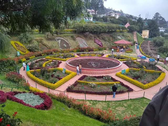
  • Government Rose Garden, Ooty — Four hectares in five terraces on the slopes of Elk Hill, with more than 3,000 varieties of roses on the district administration’s own count, and an International Rose Society award for the best rose garden in South Asia in 2006.
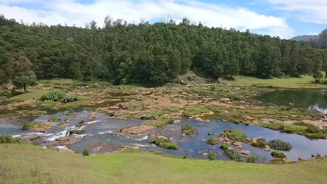
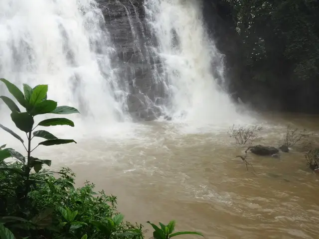
  • Pykara Falls — The Pykara river drops here in two stages of 55 and 61 metres, on the Mysuru road 22.5 km from the Ooty bus stand by routed road — the municipality publishes it as about 20 km. The river above the falls is held sacred by the Toda.
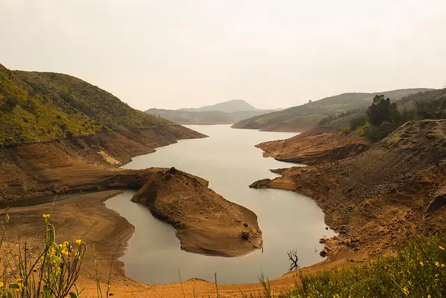
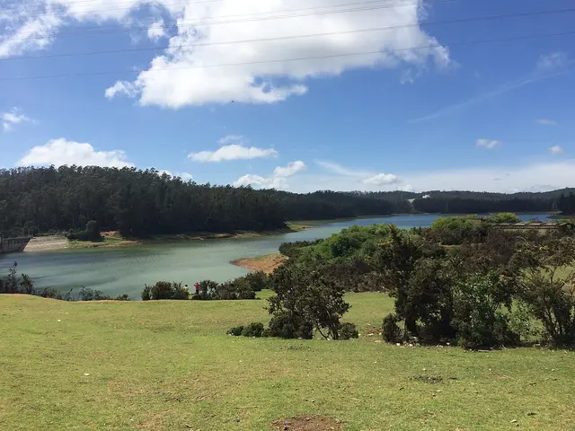
  • Pykara Lake — The reservoir on the Pykara river 22.2 km from the Ooty bus stand by routed road, with a boathouse running motorboat trips over water ringed by pine, shola and grassland; gaur graze the banks. The river above it is held sacred by the Toda, and the falls two kilometres downstream are part of the same site.
Getting there

How to visit

  • Nearest airport: Coimbatore International (CJB), 103.0 km by routed road and about two hours — Tamil Nadu Tourism gives it as 88 km, and the last forty kilometres are the Kallar ghat, which cannot be driven at plains speed. There is no closer airport and no airstrip in the Nilgiris, so allow half a day from the aircraft door to a room.
  • Rail gateway: Two different journeys. Udhagamandalam station is in the town, 219 metres from the bus stand, and is the upper terminus of the Nilgiri Mountain Railway — 45.88 km of metre gauge from Mettupalayam, one train a day each way, capped at 13 km/h on the rack section. It is a scenic railway, not a way of covering ground. The main-line railhead is Coimbatore Junction: the state’s page says about 87 km, routed it is 100.3 km and roughly an hour and three quarters. Mettupalayam, where the mountain line starts, is 60.1 km.
  • The bus stand is the middle of the town and the point every distance on this page is measured from, with services up from Coimbatore, Mettupalayam, Mysuru and Bengaluru and across the hills to Coonoor, Kotagiri and Gudalur. By routed road from it: the Thread Garden 1.2 km, Ooty Lake and the Rose Garden 2.3 km, the Botanical Garden 3.5 km, Raj Bhavan 4.0 km, the Tea Museum 6.0 km, Marlimund Lake 7.3 km, the Tribal Research Centre 8.2 km, the Pine Forest 9.3 km, Doddabetta 9.8 km, Kamaraj Sagar Dam 10.3 km, Kalhatti Falls 13.6 km, Coonoor 18.0 km, Avalanche and Pykara Falls 22.5 km each, Glenmorgan 28.0 km, Kotagiri 29.2 km, Gudalur 51.2 km, Mettupalayam 60.1 km, Coimbatore Junction 100.3 km. ⚠ A night traffic ban applies on the Gudalur road where it runs through Mudumalai, so that route is a daylight one.

Distance by road

  • Coonoor18 km
  • Kotagiri29.2 km
  • Gudalur51.2 km
  • Mettupalayam60.1 km
  • Coimbatore Junction100.3 km
  • Coimbatore International Airport103 km

Road distances measured on real routed roads to Ooty itself, not to the district headquarters, on 30 August 2026. Driving time is deliberately not published: free-flow routing badly understates these roads, so allow more than the distance suggests.

Timing

Best time to visit Ooty

The state’s own page says March to June, and that is the season the town is built around — the summer festival, the flower show at the Botanical Garden in May, the plains at their hottest and the hills at their fullest. It is also when rooms cost the most, the ghat roads queue and Doddabetta has a line at the telescope. September to November is the quieter answer and, for a first visit, the better one: the south-west monsoon has finished with the Nilgiris, the grass is still green, and the air is clear enough to see the ridgelines the viewpoints exist for. December to February is cold — frost in the valley bottoms on clear nights — and it is the season for the hills rather than for the water. Whatever the month, bring a jacket: this is a town at 2,200 metres and the temperature falls with the light.

Weather in OotySeasonal guide

Live forecast loads in your browser.

Today at Ooty
Sunrise6:13 am
Sunset6:21 pm
Golden hour best light5:21 pm–6:21 pm
Blue hour after sunset6:21 pm–6:46 pm
Sun sets toward compass bearingW · 271°
Moon tonight🌔 Waxing gibbous · 63%
South-west monsoon. June to September is the south-west monsoon in Tamil Nadu. Expect heavy showers, mostly in bursts rather than all day — carry rain cover, allow extra time for getting around, and note that ferries and open-air sites are the first things affected.

Sun and moon are calculated for this location and shown in IST. Photography windows are the hour around sunrise and sunset; the sunset bearing is degrees clockwise from true north. Moon phase is accurate to about half a day.

The story

The story of Ooty

A town the British built at 2,200 metres to get out of the heat, on grassland the Toda had grazed buffalo across for centuries, around a lake that a Collector of Coimbatore had dug because the valley floor was a marsh.

Ooty announces itself by temperature, the same as every hill station, but it announces itself by traffic first. The road up from Mettupalayam climbs about 1,900 metres in forty kilometres of hairpins, and on a long weekend in May you will spend part of that climb stationary. Then the gradient eases, the eucalyptus starts, and the air changes. That is the whole reason the town exists: two hundred years ago a British administrator worked out that you could be cold in Tamil Nadu if you went high enough, and everything since has been built on that discovery.

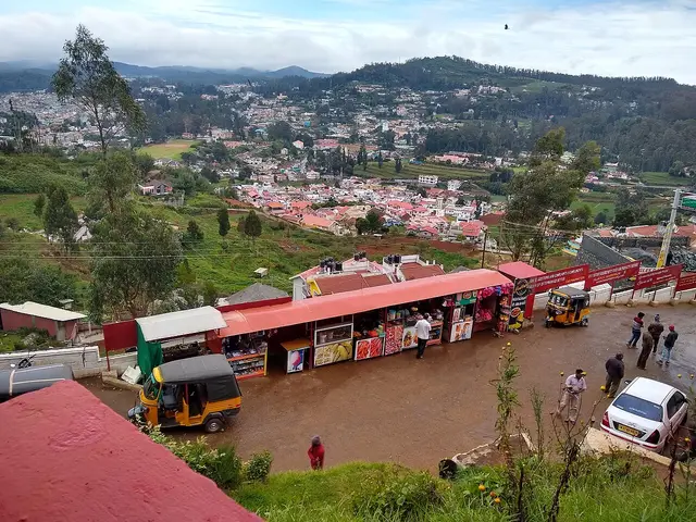
The centre is not a monument, it is a junction. Charing Cross is a road meeting with a fountain in it; the bus stand and the railway station sit 219 metres apart at the bottom of the bazaar; and the town runs uphill from there in every direction, which is the thing photographs never convey. Nothing in Ooty is flat. The lake is 2.3 km from the bus stand and downhill, the Rose Garden is 2.3 km and up, and the Botanical Garden at 3.5 km looks like a walk on a map and is three quarters of an hour of climbing on a road with traffic and very little pavement.

What the town is actually built on is other people’s land. These downs were Toda country — buffalo pasture, hamlets of barrel-vaulted huts, a religion organised around the herd — and the first English house here stands on ground its builder bought from them. The Toda are still here, along with the Kota, the Kurumba, the Irula and the Paniya, and the one place in the district that treats them as living communities rather than as scenery is the Tribal Research Centre Museum, 8.2 km out on the Avalanchi road. It is the least visited thing on this page and the one most worth the drive.

Then there is the cloud, which is the weather rather than bad weather. Doddabetta clears and closes within minutes; a viewpoint that shows a white wall at ten o’clock is often showing three ranges by eleven. The right response is to go twice rather than to wait once, and to do the high things first thing in the morning — the peak is 9.8 km and about a quarter of an hour from the bus stand, and by mid-morning most days it has gone in.

And the town is inside a biosphere reserve, which is not a label but a set of rules you will meet. Nine check posts on the roads in inspect every vehicle for banned plastic, controlled access applies at Avalanche, and a night traffic ban holds on the Gudalur road where it runs through Mudumalai. Gaur come onto the golf course and the estate roads. None of this makes Ooty hard to visit; it makes it a place where the plan has to bend around the forest rather than the other way round.

Legend & myth

The name of the hills is the plain description and the oldest thing here. Neelam is blue and giri is hill, and the district administration takes the first mention of the Nilgiris back to the Silappadikaram. Its own preferred explanation for the colour is not haze but the kurinji, the shrub that flowers across whole slopes about once in twelve years and turns them violet — the plains people, on this reading, named the range for a flowering they saw perhaps twice in a lifetime.

The town’s own name is a different argument and a quieter one. Udhagamandalam is the official name and the one the railway station, the municipality and the taluk all use; Ooty is the contraction the British left behind, and it is what the road signs, the buses and the town itself say. Both are correct, and you will meet both on the same journey: a ticket printed Udhagamandalam, a bus with Ooty on the board.

More about Ooty

History

The British found the Nilgiris almost by accident and then would not leave. In 1818 Whish and Kindersley, assistants to the Collector of Coimbatore, came upon Kotagiri near the Rangaswamy peak; John Sullivan, the Collector himself, established a residence in the hills and reported what he had found to the Board of Revenue on 31 July 1819. In 1822 he built the first English house on these downs, Stone House — Kal Bangala to the Toda he bought the land from — and it still stands, now the residence of the principal of the Government Arts College. The lake followed in 1824, made by damming the marshy valley floor; the municipality puts it at 65 acres.

The administration caught up with the settlement slowly. The hills had been ceded to the British in 1789 and run from Coimbatore; the Nilgiris were separated from that district in August 1868 under Commissioner James Wilkinson Breeks, and made a district in their own right in February 1882, with Richard Wellesley Barlow as the first Collector. Raj Bhavan, on the western slopes of Doddabetta, was built in 1877 by the Duke of Buckingham. Today the district runs from 900 to 2,636 metres, covers 2,452.50 sq km, and held 7,35,394 people at the 2011 census.

The railway is the last piece and the one that made Ooty reachable rather than merely known. Southern Railway’s own figures: 45.88 km of metre gauge from Mettupalayam, opened as far as Coonoor on 15 June 1899 and through to Udhagamandalam on 15 October 1908, worked on the steep section with an Abt rack and limited to 13 km/h on it, with 16 tunnels between Kallar and Ooty and 250 bridges of which 32 are major. The line is often described as having a gradient of 1 in 12; the railway that runs it gives the average as about 1 in 24.5 and the steepest as 1 in 23. UNESCO added it to the Mountain Railways of India on 15 July 2005.

Why visit

For the temperature, which is still the honest answer after two hundred years. If you have come off the Tamil plain in April, the first evening in Ooty is worth the whole climb — and it is cold enough that a jacket is not optional in any month.

For two gardens the state has been keeping for a very long time. The Botanical Garden is 55 acres in terraces below Doddabetta with a fossilised tree trunk reckoned at 20 million years old and the flower show every May; the Rose Garden is four hectares in five terraces on Elk Hill, with more than 3,000 varieties on the district’s own count and an International Rose Society award in 2006 for the best rose garden in South Asia.

For the railway, if you book far enough ahead. It is one train a day each way and reservations open ninety days before; between April and June it is gone weeks in advance. Even half of it — the Coonoor section — is the best hour anyone spends in the Nilgiris.

For the far side of the hills. Avalanche at 22.5 km, Pykara at 22.5 and Glenmorgan at 28.0 are forest, grassland and reservoir country with a fraction of the traffic of the lake road, and the drive out to any of them is the point rather than the getting there.

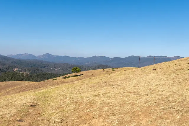
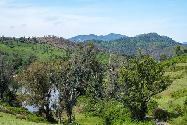
And for the Toda downs themselves, which are the landscape everything else was put on top of. Rolling grassland with shola forest packed into the folds where the water runs is what these hills looked like before the eucalyptus and the tea, and there are still long stretches of it west of the town.
Before you go

Ooty — at a glance

HoursThe town keeps no hours; its gardens and its railway do. The Botanical Garden, the Rose Garden and Deer Park run daylight hours and shut before dusk, and the last tickets go well before the gate does — arriving at four for a five o’clock close is how people end up outside a fence. Doddabetta’s summit enclosure and telescope house close in the late afternoon, and the road up is the one place a queue can cost you the light. The mountain railway is the strict one: it is a single daily train each way between Mettupalayam and Ooty with a handful of shuttles on the Coonoor section, reservations open ninety days ahead, and it sells out in the April-to-June season weeks before the date. If the train is the reason you are coming, book it before you book the room.

Entry: Nothing to enter the town, and the hill itself is free. What costs money is each garden and each gate, paid on the spot: the Government Botanical Garden, the Government Rose Garden, the boat house on Ooty Lake, the Thread Garden, the Tea Museum, Deer Park and the summit enclosure at Doddabetta all charge, and most of them charge separately again for a still camera. Deliberately not printed here: the current figures. Every garden ticket in the Nilgiris is set by the Horticulture Department and revised without notice, the travel sites carry three different numbers for the same gate, and we would rather you asked at the counter than budgeted from a stale one. The thing to plan for is not a charge at all. The Nilgiris has banned nineteen categories of single-use plastic since the district gazette of May 2018, and the Madras High Court has added water cans and soft-drink bottles of one to four litres. It is enforced at nine check posts on the roads into the district — Kallar on the Mettupalayam climb is the one most visitors meet — where vehicles are inspected, banned items are seized and a fine is charged. Bring a refillable bottle; there are kiosks at the check posts selling steel and copper ones if you have not.

Getting here

How to reach Ooty

  • ✈︎ By air Coimbatore International (CJB) is the airport, and it is further than the state’s own page says. Tamil Nadu Tourism gives it as 88 km; routed from the Ooty bus stand it is 103.0 km and about two hours, because the last forty kilometres are the Kallar ghat and its hairpins and you cannot drive them at plains speeds. There is no closer airport, and no airstrip in the Nilgiris. Budget half a day from the aircraft door to a hotel room, and rather more if you land in the afternoon and want to be up the hill before dark.
  • 🚆︎ By train Two answers, and they are not the same journey. Udhagamandalam station is in the town — 219 metres from the bus stand, a three-minute walk — and it is the top of the Nilgiri Mountain Railway, a 45.88 km metre-gauge line from Mettupalayam that Southern Railway runs at a maximum of 13 km/h on the rack section. It is a scenic railway that takes most of a morning, not a way of covering ground. The main-line railhead is Coimbatore Junction, which Tamil Nadu Tourism gives as about 87 km; routed it is 100.3 km and about an hour and three quarters. Mettupalayam, where the mountain railway starts, is 60.1 km and about seventy minutes by road. If you want the train ride, book Mettupalayam and come up on it; if you want to arrive, book Coimbatore and take the road.
  • 🚗︎ By road Everything here is measured in hours rather than kilometres, because every road into the Nilgiris is a ghat. Routed from the bus stand: Coonoor 18.0 km and about half an hour, Kotagiri 29.2 km, Gudalur 51.2 km, Mettupalayam 60.1 km and about seventy minutes, Coimbatore Junction 100.3 km and about an hour and three quarters. Inside the hills the numbers collapse and the times do not — the Thread Garden is 1.2 km, Ooty Lake and the Rose Garden 2.3 km each, the Botanical Garden 3.5 km, Raj Bhavan 4.0 km, the Tea Museum 6.0 km, Marlimund Lake 7.3 km, the Tribal Research Centre 8.2 km, the Pine Forest 9.3 km, Doddabetta 9.8 km, Kamaraj Sagar Dam 10.3 km, Kalhatti Falls 13.6 km, Avalanche and Pykara Falls 22.5 km each, and Glenmorgan 28.0 km. Avalanche and Glenmorgan take far longer than the distance suggests: both are half-hour-plus runs on single-track forest and estate roads.
  • 🚌︎ By bus The bus is how most people arrive, and the stand is the middle of the town — the railway station is 219 metres away, and you can walk to a room in the bazaar with a bag. Services run up from Coimbatore, Mettupalayam, Mysuru and Bengaluru, and across the hills to Coonoor, Kotagiri and Gudalur. Two things to plan for. The Mettupalayam–Ooty road climbs about 1,900 metres in forty kilometres and it is the one most people are travel-sick on; take the front half of the bus and a daylight departure. And the Gudalur road runs through Mudumalai, where a night traffic ban applies on the stretch through the reserve, so an evening bus that way is not an option.
  • ⛴︎ By boat None as transport. There is rowing and pedalling on Ooty Lake and boating at Pykara, but no boat here goes anywhere — these are hill reservoirs with nothing to travel to.
Getting around

Getting around Ooty

Walk the centre, hire something for the rest, and do not underestimate the gradient. From the bus stand, St. Thomas Church is 636 metres, the Thread Garden 1.3 km, the Kandal Mariamman temple 1.7 km, Holy Trinity 1.7 km, St. Stephen’s 1.8 km, Ooty Lake 2.2 km and the Rose Garden 2.3 km — all inside half an hour on foot, all of them with a climb in them somewhere. The Botanical Garden is the line: 3.6 km and about three quarters of an hour uphill on a road with traffic and not much pavement, which is a drive rather than a walk even though it looks close on a map. Everything past that — Doddabetta, the Tea Museum, the Pine Forest, Kalhatti, Pykara, Avalanche, Glenmorgan — is a car or a share-taxi, and the usual arrangement is a half-day or full-day rate agreed at the stand or through the hotel. Autos work in the town and are plentiful at the bus stand and around Charing Cross.

  • 🚕︎ Online taxis Do not build a plan on an app. We have no evidence from any primary source of reliable app-cab supply in Ooty; an operator’s city landing page is marketing, not proof that a driver will accept at seven in the morning on a hill road. What is certain is the offline trade: taxi and auto stands at the bus stand and at Charing Cross, hotels arranging cars by the half day, and share-jeeps out to the estates and villages. Fares are agreed before you get in, and there are no meters. We print no fares, because there is no notified tariff for this district that we can source.
Do

Things to do in Ooty

  • Start with the Government Botanical Garden, 3.5 km from the bus stand — 55 acres in terraces below Doddabetta, run by the Horticulture Department, with a fossilised tree trunk reckoned at 20 million years old and the flower show every May. Its founding year is published two ways and we print both further down this page.
  • Take Doddabetta early, 9.8 km and about a quarter of an hour up. It is the highest point in the Nilgiris and in Tamil Nadu, there is a telescope house at the top, and the cloud usually wins after mid-morning. Three arms of the government give it three different heights.
  • Ride the Nilgiri Mountain Railway, or at least the Coonoor half of it. It is 45.88 km of metre gauge from Mettupalayam, opened to Coonoor on 15 June 1899 and through to Ooty on 15 October 1908, worked with an Abt rack on the steep section and limited to 13 km/h on it. Book it long before you come.
  • Walk to the Government Rose Garden, 2.3 km from the stand on the slopes of Elk Hill — four hectares in five terraces, more than 3,000 varieties of rose on the district’s own count, and an International Rose Society award in 2006 for the best rose garden in South Asia.
  • Row on Ooty Lake, 2.3 km out. It is artificial, made by John Sullivan in 1824, and the municipality puts it at 65 acres; the boat house hires rowing and pedal boats and there is a small train along the shore.
  • Go out to Avalanche, 22.5 km and about half an hour on a forest road toward Upper Bhavani — sholas, grassland and birds, inside a protected zone where access is controlled and worth checking before you set out.
  • Drive to Pykara, 22.5 km on the Mysuru road. The falls drop in two stages of 55 and 61 metres, and the river above them is held sacred by the Toda, whose land this is.
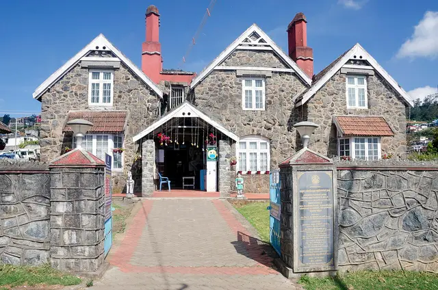
  • See the Tribal Research Centre Museum, 8.2 km out on the Avalanchi road. The building’s foundation stone was laid on 12 September 1989 and it opened on 2 October 1995; it is the one place in the district that treats the Toda, Kota, Kurumba, Irula and Paniya as living communities rather than scenery.
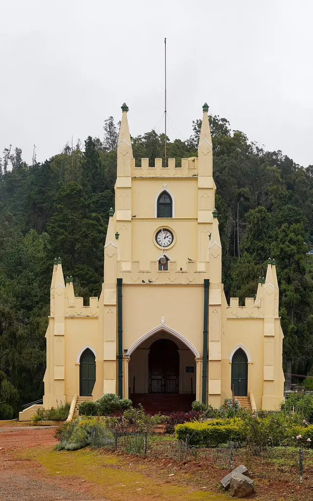
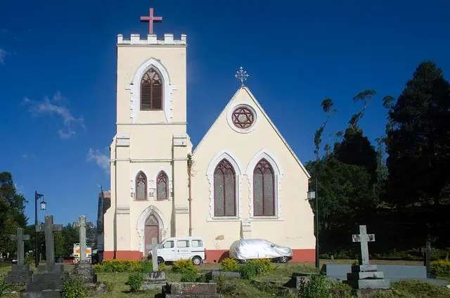
  • Walk the three churches inside twenty minutes of the bus stand — St. Thomas at 636 metres, Holy Trinity at 1.7 km and St. Stephen’s at 1.8 km. St. Stephen’s is the oldest in the Nilgiris and its roof timbers are said to have been hauled up from Tipu Sultan’s palace at Srirangapatna.
  • Take the long western run to Glenmorgan, 28.0 km, for tea estate and reservoir country with almost none of the traffic of the lake road.
Plan

Good to know

  • Book the mountain railway before you book the room. One train a day each way, reservations ninety days ahead, and it is gone weeks in advance between April and June.
  • Do Doddabetta first thing. The peak clouds over most mornings by ten, and there is no second chance later in the day.
  • Bring warm clothes in every month. This is a town at about 2,200 metres; the evenings are cold in May and there is frost in the valleys in January.
  • The Botanical Garden looks walkable and is not. It is 3.6 km and three quarters of an hour uphill from the bus stand on a road with traffic — take an auto up and walk back down if you want the walk.
  • Bring a refillable bottle and no plastic. Nineteen categories of single-use plastic are banned in the Nilgiris, along with one-to-four-litre water cans and soft-drink bottles under a Madras High Court direction, and every vehicle is checked at the district boundary.
  • Do not plan an evening drive through Mudumalai on the Gudalur road. A night traffic ban applies through the reserve, and it is enforced.
  • Cloud is not bad weather here, it is the weather. Viewpoints clear and close within minutes, so go twice rather than waiting once.
Facilities

On site

  • Ooty bus stand, in the centre of town — the anchor for every distance on this page, with services to Coimbatore, Mettupalayam, Mysuru, Bengaluru, Coonoor, Kotagiri and Gudalur
  • Udhagamandalam railway station, 219 metres from the bus stand — the upper terminus of the Nilgiri Mountain Railway, reservations ninety days ahead
  • Boat house on Ooty Lake, 2.3 km — rowing and pedal boats, and a small train along the shore
  • Government Botanical Garden, 3.5 km, and the Government Rose Garden, 2.3 km — both run by the Tamil Nadu Horticulture Department, both ticketed at the gate
  • Taxi and auto stands at the bus stand and at Charing Cross, plus share-jeeps to the estates; no meters, agree the fare before you travel
  • Government Hospital in the town centre, with private clinics and pharmacies along the bazaar
Stay safe

Safety

  • The ghat roads are the real risk, not the town. Hairpins, cloud, and heavy weekend traffic on the Mettupalayam climb; if you are driving yourself, do it in daylight and let the buses past.
  • Gaur come into the town’s edges, the golf course and the estate roads. An Indian bison that feels crowded is dangerous — do not approach one for a photograph, and give it the whole road.
  • Leeches are common in the sholas during and after the monsoon. Socks and closed shoes, and check your ankles after any forest walk.
  • Viewpoints on the estate roads have no continuous railing and the drop-offs are real. Stay behind the wall where there is one, and off the wet rock where there is not.
  • Altitude is not a danger here but the cold is underestimated. Wet clothes at 2,200 metres in a monsoon wind get uncomfortable fast; carry a layer you can put on.
Getting around Ooty

If you need step-free access, contact the site before travelling. Ask about a level entrance, steps along the route, the nearest drop-off point, seating and accessible toilets.

If you need help at Ooty
112All emergencies (police · fire · medical)The single number to call in any emergency (ERSS).

Emergency numbers are verified against official government and state tourism sources. 112 works anywhere in India.

Practical things near Ooty
Bus stopsJss Bus stop1.1 km · 13 min walkMapped Mar 2012DirectionsTaxi & auto standsTaxi / auto stand 1.3 km · 16 min walkMapped Feb 2022DirectionsHospitalGovernment Hospital 922 m · 11 min walkMapped Mar 2020DirectionsClinicHi Physiotherapy Clinic 997 m · 12 min walkMapped Aug 2020DirectionsATMIndian Overseas Bank 1.3 km · 15 min walkMapped Jun 2022DirectionsBankBank 611 m · 7 min walkMapped Apr 2009DirectionsWater & snacksJD MART 675 m · 8 min walkDaily 09:00–21:00Mapped Oct 2025DirectionsGroceries & bakeryImpala varukki shop 1.4 km · 16 min walkMapped Mar 2019DirectionsPost officePost office 1.1 km · 13 min walkMapped Feb 2013DirectionsSomewhere to prayTELC Place of worship469 m · 6 min walkMapped Mar 2012DirectionsPark or gardenArbetoreum Park1.1 km · 13 min walkMapped May 2009Directions
What the cash actually costs
  • Withdrawing from a bank that is not your own is free for a set number of times a month, then costs up to ₹23 plus GST — about ₹27 a withdrawal. This is not one of the RBI’s six metro centres, so the allowance here is the higher one: at least five free other-bank withdrawals a month, and at least five at your own bank.
  • That free allowance belongs to Indian bank accounts. On a card issued abroad your own bank’s international withdrawal and exchange charges apply instead. If the machine offers to bill you in your home currency, choose rupees — the conversion rate on that offer is set by the machine, not by your bank.
  • Choose a well-lit ATM, preferably at a bank branch. Shield your PIN, avoid help from strangers and use your bank’s support number if a withdrawal fails or the machine retains your card.

Charge cap and free-transaction limits: Reserve Bank of India, in force since 1 May 2025.

These services are listed within about 1.2 km of Ooty. Walking distances follow mapped routes; access and opening hours can change. Other services may be closer but are not included here.

Nearby bases

Where to go from Ooty

Coonoor, CoonoorTea-country town
Town / base

Coonoor

Quieter second hill station below Ooty, ringed by tea estates and viewpoints like Dolphin's Nose and Lamb's Rock.

Nilgiri Mountain RailwayCoonoor railway stationSim's ParkPasteur Institute of India, Coonoor
Open Coonoor guide →
Kotagiri, KotagiriEastern hill town
Town / base

Kotagiri

The oldest of the three Nilgiri hill stations and the middle one for height, on the eastern rim of the plateau — the first place in these hills the British came up to, in 1819, and the gateway to Kodanad, Catherine Falls and a Ramsar-listed shola on the town's own edge.

Kodanad View PointCatherine FallsRangaswamy Pillar and PeakLongwood Shola
Open Kotagiri guide →
Masinagudi, MasinagudiWildlife village
Town / base

Masinagudi

The village on the Sigur plateau below the hill stations, at the edge of Mudumalai — the base for the tiger reserve, the Theppakadu elephant camp and the elephant country of the Moyar valley, and the foot of the Kalhatti ghat up to Ooty.

Theppakadu Elephant CampMudumalai National ParkMaravakandy DamMoyar Falls
Open Masinagudi guide →
Needle Rock View Point, GudalurFeatured: Needle Rock View Point
Town / base

Gudalur

The municipality at the western door of the Nilgiris, where the plateau breaks and the road drops into Kerala — a Tamil Nadu town that speaks mostly Malayalam, sitting between the Mudumalai forest, the old Wynaad gold country around Devala and the cinchona slopes of Naduvattam.

Needle Rock View PointFrog Hill View PointNadugani GhatNaduvattam
Open Gudalur guide →
Ketti, KettiValley village
Town / base

Ketti

A revenue village of Coonoor taluk strung along the Ooty–Coonoor road in the valley it is named after, with a station on the Nilgiri Mountain Railway, the needle works the place is known for, and a hillside of boarding schools and colleges above it. Upper Ketti is the separate village of Yellanahalli.

Ketti railway stationKetti Valley View PointNeedle Industries, KettiSt. George's Homes and Laidlaw Memorial School, Ketti
Open Ketti guide →
Wellington, WellingtonCantonment town
Town / base

Wellington

An army cantonment of about twenty thousand people three kilometres above Coonoor, governed by a board under the Ministry of Defence rather than by a municipality, and home to the Madras Regimental Centre and the Defence Services Staff College. It has no bus stand: its station on the Nilgiri Mountain Railway is the way in.

Wellington railway stationWellington CantonmentMadras Regiment War MemorialWellington Gymkhana Club
Open Wellington guide →
Kundah, KundahReservoir country
Town / base

Kundah

The high, empty western end of the plateau, a country of hydro-electric reservoirs — Upper Bhavani, Parsons Valley, Porthimund — and the Sispara pass over into Kerala, most of it needing Forest Department permission to enter.

Mukurthi National ParkSispara PassBangitappalUpper Bhavani Reservoir
Open Kundah guide →
Stay · eat · do · rent · see · shop

Places in Ooty

Every verified place in Ooty — filter by what you’re after.

2 places to eat in Ooty

T
The Culinarium
Where to eat
Restaurant
The Culinarium
European bakery and dining

A bakery and dining room whose own description of its cooking is European. Expect modern dishes alongside country-style classics.

Commission-freeView details
P
Place to Bee
Where to eat
Restaurant
Place to Bee

A restaurant in the town centre. Its own page can no longer be read, so the number below comes from the open map data rather than from the business.

Commission-freeView details

Book with the place itself. India’s cyber-crime coordination centre warned in April 2025 that convincing copies of hotel and pilgrimage booking sites are being pushed through sponsored search and social ads, taking payment for rooms the property never hears about. Every listing here links to the business’s own contact details and its own Google or Bing profile — we take no commission and sit in nobody’s payment path. If a booking page reached you through an ad, check the address bar against the property’s own site before you pay. Fraud can be reported on cybercrime.gov.in or on 1930.

Ranked

The best of Ooty, ranked

Nearest to the centre of Ooty, on foot

Ordered by a real routed walk from the town centre — a different question, and the one that decides what you can do before lunch. Straight-line distance understates a real walk by about half again, so these are walking-network figures, not lines on a map.

Everything around Ooty, by distance

Every place we hold for Ooty, ordered by a real routed drive from the town centre. Times are free-flow and a real road rarely is, so read them as the floor rather than the estimate — anything that routed over ninety minutes is left out rather than published as a number we do not trust.

Places to visit

The places themselves, around Ooty

The best tourist places to visit in Ooty — temples, viewpoints, lakes, heritage and nature, each with a full guide, how to reach it and what to see nearby.

Ooty Lake, Ooty
PlaceOoty Lake

An artificial lake created in 1824 by John Sullivan, the founder of Ooty, now used for boating amid eucalyptus-lined banks.

Open guide →
Government Botanical Garden, Ooty, Ooty
PlaceGovernment Botanical Garden, Ooty

A terraced garden of 55 acres below Doddabetta, run by the Tamil Nadu Horticulture Department, holding a fossilised tree trunk reckoned at 20 million years old and hosting the flower show every May. Its founding year is published two ways, 1848 and 1897.

Open guide →
Doddabetta Peak, Ooty
PlaceDoddabetta Peak

The highest peak in the Nilgiris and in Tamil Nadu, with a telescope house at the top. Three arms of the government publish three different heights for it — 2,623 m, 2,636 m and 2,637 m.

Open guide →
Government Rose Garden, Ooty, Ooty
PlaceGovernment Rose Garden, Ooty

Four hectares in five terraces on the slopes of Elk Hill, with more than 3,000 varieties of roses on the district administration’s own count, and an International Rose Society award for the best rose garden in South Asia in 2006.

Open guide →
Pykara Falls, Ooty
PlacePykara Falls

The Pykara river drops here in two stages of 55 and 61 metres, on the Mysuru road 22.5 km from the Ooty bus stand by routed road — the municipality publishes it as about 20 km. The river above the falls is held sacred by the Toda.

Open guide →
Pykara Lake, Ooty
PlacePykara Lake

The reservoir on the Pykara river 22.2 km from the Ooty bus stand by routed road, with a boathouse running motorboat trips over water ringed by pine, shola and grassland; gaur graze the banks. The river above it is held sacred by the Toda, and the falls two kilometres downstream are part of the same site.

Open guide →
Avalanche Lake, Ooty
PlaceAvalanche Lake

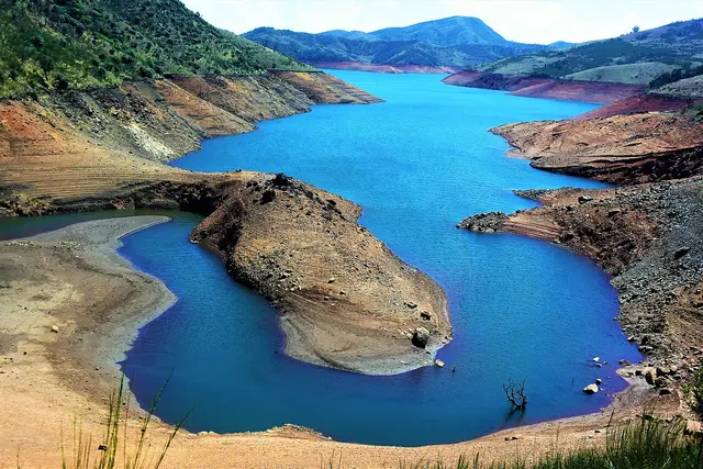
A reservoir among sholas and grassland on the road toward Upper Bhavani, 22.5 km from the Ooty bus stand by routed road — the district and the municipality both publish it as 28 km. It sits inside a protected forest zone where access is controlled, so check before setting out.

Open guide →
St. Stephen's Church, Ooty, Ooty
PlaceSt. Stephen's Church, Ooty

Consecrated in 1830, this is the oldest church in the Nilgiris, built partly from timber salvaged from Tipu Sultan's summer palace in Srirangapatna.

Open guide →
Tea Museum and Factory, Ooty, Ooty
PlaceTea Museum and Factory, Ooty

A working tea factory near Ooty with a small museum explaining tea-processing history and a shop selling estate teas.

Open guide →
Kalhatti Falls, Ooty
PlaceKalhatti Falls

A waterfall on the Ooty-Gudalur road near Kalhatti village, plunging beside an old Shiva shrine set into the rock.

Open guide →
Emerald Lake, Ooty, Ooty
PlaceEmerald Lake, Ooty

A quiet reservoir near Avalanche in the upper Nilgiris, surrounded by tea plantations and sholas, less visited than Ooty Lake.

Open guide →
Wenlock Downs, Ooty
PlaceWenlock Downs

Rolling open grassland west of Ooty named after a former Governor of Madras, used for golf, horse riding, and as an ecologically sensitive shola-grassland tract.

Open guide →
Ooty Thread Garden, Ooty
PlaceOoty Thread Garden

An indoor exhibit near the Botanical Garden displaying handcrafted thread-and-wire replicas of flowers, said to be one of the largest thread gardens in the world.

Open guide →
Kamaraj Sagar Dam, Ooty
PlaceKamaraj Sagar Dam

A small reservoir and dam near Ooty on the outskirts of town, popular as a quiet picnic and photography spot away from the crowds.

Open guide →
Glenmorgan, Ooty
PlaceGlenmorgan

A tea-estate area west of Ooty toward Gudalur, known for scenic valley views, a reservoir, and rolling tea gardens.

Open guide →
T
Tribal Research Centre Museum, Ooty
No photograph yet
PlaceTribal Research Centre Museum, Ooty

Part of the Tribal Research Centre campus at Muthorai near Ooty. It preserves ornaments, tools, weapons, pottery and artwork documenting dozens of ethnic communities of Tamil Nadu, including the Toda, Kota, Kurumba and Irula tribes of the Nilgiris. It is listed on the official Nilgiris district tourism site.

Open guide →
R
Raj Bhavan, Ooty
No photograph yet
PlaceRaj Bhavan, Ooty

The former Government House stands on the western slopes of Doddabetta and served as the summer seat of the Governor of Madras during the colonial era. Built in mid-19th-century colonial style amid extensive gardens, it remains a heritage landmark listed on the Nilgiris district tourism site.

Open guide →
Holy Trinity Church, Ooty, Ooty
PlaceHoly Trinity Church, Ooty

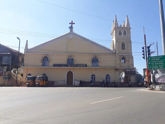
One of Ooty's oldest churches, a dedicated place of worship from 1858, built in Gothic and Tudor style. The Tamil scholar George Uglow Pope helped initiate it and served as its chaplain in 1858-59. It was originally used as a school on weekdays and a church on Sundays.

Open guide →
St. Thomas Church, Ooty, Ooty
PlaceSt. Thomas Church, Ooty

Built in 1870, St. Thomas Church overlooks Ooty Lake and holds the grave of William Patrick Adam, a former Governor of Madras. Its picturesque setting served as a filming location for the Hollywood film 'A Passage to India'. It has been a town landmark for around a century and a half.

Open guide →
M
Mariamman Temple, Ooty
No photograph yet
PlaceMariamman Temple, Ooty

A temple dedicated to the goddess Mariamman, the folk deity associated with rain. Its annual Mariamman festival, held in April, draws large crowds of devotees to Ooty. It is one of the town's principal Hindu places of worship.

Open guide →
Marlimund Lake, Ooty, Ooty
PlaceMarlimund Lake, Ooty

A quiet reservoir on Ooty's western circuit, framed by eucalyptus and pine slopes. Less frequented than Ooty Lake, it is valued for its calm setting and birdlife and is often included in half-day drives around the town.

Open guide →
Pine Forest, Ooty, Ooty
PlacePine Forest, Ooty

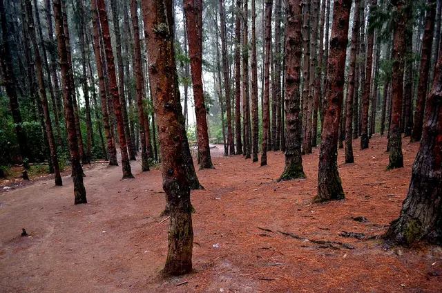
A dense stand of tall, closely planted pines on the slope below the Shooting Point area on the Ooty-Gudalur road. Its symmetrical rows of trees and filtered light have made it a favourite spot for photography and countless Tamil film songs. It is usually visited together with the adjoining 9th Mile Shooting Point.

Open guide →
S
Sandynallah Reservoir
No photograph yet
PlaceSandynallah Reservoir

A reservoir on the Ooty-Gudalur side of the plateau, set amid tea slopes and eucalyptus. Nearby lies a historic government experimental agricultural and sheep-breeding farm. The calm waters and quiet surroundings make it a peaceful, lesser-known drive from Ooty.

Open guide →
W
Wax World Museum, Ooty
No photograph yet
PlaceWax World Museum, Ooty

An indoor wax museum set in a 19th-century colonial mansion about a kilometre from Ooty Railway Station. It displays life-size wax figures of Indian freedom fighters, leaders and spiritual icons such as Mahatma Gandhi, A.P.J. Abdul Kalam and Mother Teresa, alongside dioramas of village life. It is one of Ooty's popular family attractions.

Open guide →
Stone House, Ooty, Ooty
PlaceStone House, Ooty

Regarded as the first British bungalow in Ooty, built around 1822 by John Sullivan, the collector who founded the hill station. Locals nicknamed it 'Kal Bangla', the stone bungalow. It now stands within the Government Arts College campus and is a heritage landmark of the town.
Open guide →
Deer Park, Ooty, Ooty
PlaceDeer Park, Ooty

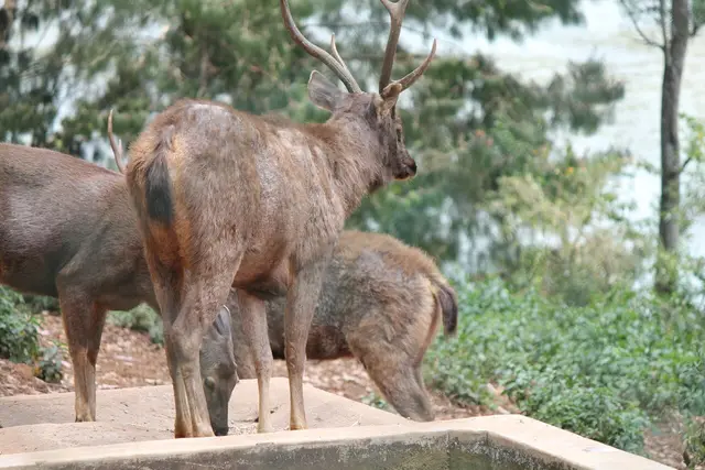
One of the highest-altitude deer parks in India, lying near Ooty Lake. Spread over wooded grounds, it shelters spotted deer, sambar and other herbivores and makes a short stop for families visiting the lake area.

Open guide →
E
Elk Hill Murugan Temple, Ooty
No photograph yet
PlaceElk Hill Murugan Temple, Ooty

A hilltop temple to Lord Murugan crowning Elk Hill in Ooty, reached by a climb to the summit. It commands wide views over the town and hosts a large Thaipusam festival in January-February. It is among the most visited pilgrimage sites in Ooty.

Open guide →
T
Tiger Hill, Ooty
No photograph yet
PlaceTiger Hill, Ooty

Tiger Hill lies at the lower end of Doddabetta peak near Ooty and offers panoramic views of the surrounding Nilgiri ranges and valleys. Its grassy slopes and quiet trails make it a spot for short treks and camping away from the busier tourist points.

Open guide →
For hotels, homestays and local businesses

Get listed in Ooty for free

Roampedia is commission-free. Travellers discover your business, book directly and contact you through official details. Basic listings are free, while Gold and Platinum package upgrades can be requested from the owner dashboard after approval.

List your business — free
Ranked guide modules

The best of Ooty, ranked

10 picks

The places that sit in and around Ooty itself, each with its own guide page.

Ooty Lake, Ooty#1
Ooty · dam

Ooty Lake

Start at the water, 2.3 km from the bus stand. It is artificial — John Sullivan dammed the marshy valley floor in 1824 — and the municipality puts it at 65 acres. Rowing and pedal boats at the boat house, and a small train along the shore.

OotydamThe Nilgiris
Government Botanical Garden, Ooty, Ooty#2
Ooty · park

Government Botanical Garden, Ooty

55 acres in terraces below Doddabetta, 3.5 km out, with a fossilised tree trunk reckoned at 20 million years old and the flower show every May. It looks walkable from town and is three quarters of an hour uphill.

OotyparkThe Nilgiris
Doddabetta Peak, Ooty#3
Ooty · viewpoint

Doddabetta Peak

The highest point in the Nilgiris and in Tamil Nadu, 9.8 km and about a quarter of an hour up, with a telescope house at the top. Go first thing: the cloud usually wins by mid-morning. Three arms of the government give it three different heights.

OotyviewpointThe Nilgiris
Government Rose Garden, Ooty, Ooty#4
Ooty · park

Government Rose Garden, Ooty

Four hectares in five terraces on the slopes of Elk Hill, 2.3 km from the stand — more than 3,000 varieties of rose on the district’s own count, and an International Rose Society award in 2006 for the best rose garden in South Asia.

OotyparkThe Nilgiris
Pykara Falls, Ooty#5
Ooty · waterfall

Pykara Falls

On the Mysuru road 22.5 km out, where the river drops in two stages of 55 and 61 metres. The water above the falls is held sacred by the Toda, whose country this is.

OotywaterfallThe Nilgiris
Avalanche Lake, Ooty#6
Ooty · dam

Avalanche Lake

A reservoir 22.5 km out on a forest road toward Upper Bhavani — sholas, grassland and birds, inside a protected zone with controlled access. The district publishes it as 28 km; routed from the bus stand it is 22.5.

OotydamThe Nilgiris
St. Stephen's Church, Ooty, Ooty#7
Ooty · church

St. Stephen's Church, Ooty

The oldest church in the Nilgiris, 1.8 km from the bus stand and walkable in about twenty minutes. Its roof timbers are said to have been hauled up from Tipu Sultan’s palace at Srirangapatna.

OotychurchThe Nilgiris
Tea Museum and Factory, Ooty, Ooty#8
Ooty · museum

Tea Museum and Factory, Ooty

Six kilometres out, and the one stop that explains what the hills around you are actually growing — the leaf, the withering, the rolling and the grading, in a working factory rather than a display case.

OotymuseumThe Nilgiris
Kalhatti Falls, Ooty#9
Ooty · waterfall

Kalhatti Falls

A single drop in forest 13.6 km north of the town on the Sigur ghat road, at its best during and just after the monsoon and thin for much of the rest of the year.

OotywaterfallThe Nilgiris
Ooty Thread Garden, Ooty#10
Ooty · museum

Ooty Thread Garden

The oddest thing in Ooty and the closest, 1.2 km from the bus stand: an indoor garden in which every flower and leaf is hand-wound from thread, with no machine and no paint anywhere in it.

OotymuseumThe Nilgiris
Read before you go

Ooty guides, stories & itineraries

Stories & history of Ooty

Written about Ooty itself — its history, its legends and the arguments about them.

Nearby in The Nilgiris

Wider reading from The Nilgiris. The stories about Ooty itself are above.

Planning a trip to Ooty

The practical half — what is actually here, in what order to see it, and how to arrive.

Tamil Nadu-wide guides & itineraries

Route-level itineraries and practical guides for the rest of the state.

See all 49 The Nilgiris guides & stories →

Map

Where things are in Ooty

FAQ

Ooty travel FAQs

How far is Ooty from Coimbatore, really?

Further than the published figures. Tamil Nadu Tourism gives Coimbatore Railway Station as about 87 km and Coimbatore International Airport as 88 km. Routed by road from the Ooty bus stand they are 100.3 km and 103.0 km, about an hour and three quarters and about two hours, because the last forty kilometres are the Kallar ghat and cannot be driven at plains speeds. Allow half a day from an aircraft door to a hotel room.

How high is Doddabetta?

Published government pages give elevations from 2,623 to 2,636 metres, while commonly used geographic data gives 2,637 metres. Treat the small difference as a measurement variation. Doddabetta remains the highest point in the Nilgiris and Tamil Nadu, with a telescope house at the top about ten kilometres from Ooty bus stand.

When was the Government Botanical Garden laid out?

That is contested too. The Nilgiris district administration and the Udhagamandalam municipality both publish 1897, and both credit the Marquis of Tweeddale; the usual date in general circulation is 1848. Nobody disputes the rest of it: 55 acres in terraces below Doddabetta, run by the Tamil Nadu Horticulture Department, a fossilised tree trunk reckoned at 20 million years old, and the flower show every May.

Is the toy train worth it, and how do I get a seat?

Yes, and by booking early. The Nilgiri Mountain Railway is 45.88 km of metre gauge from Mettupalayam to Udhagamandalam, worked with an Abt rack on the steep section at a maximum of 13 km/h, and it has been running since 1899. It is one train a day each way; reservations open ninety days ahead and the April-to-June season sells out weeks before the date. If the train is why you are coming, book it before you book the room — and if you cannot get the full run, the Coonoor section is the scenic half.

Should I say Ooty or Udhagamandalam?

Both are right. Udhagamandalam is the official name — the railway station, the municipality and the taluk all use it — and Ooty is the contraction in everyday use on the buses and the road signs. On this site the address is the short one; the long spelling does not resolve.

What is the best time to visit Ooty?

Tamil Nadu Tourism says March to June, and that is the busy season the town is built around: the summer festival, the May flower show, the highest room rates and the longest queues on the ghat. September to November is the quieter answer and, for a first visit, the better one — the south-west monsoon has finished with the Nilgiris, the grass is green and the air is clear enough to see the ridgelines the viewpoints exist for. December to February is cold, with frost in the valley bottoms on clear nights. Bring a jacket whichever month you choose.

Can I walk to the Botanical Garden from the bus stand?

You can, and most people should not. It is 3.6 km on foot and about three quarters of an hour, all of it uphill, on a road with traffic and very little pavement. Take an auto up and walk back down if you want the walk. What genuinely is walkable from the bus stand: St. Thomas Church at 636 metres, the Thread Garden at 1.3 km, the Kandal Mariamman temple and Holy Trinity at about 1.7 km, St. Stephen’s at 1.8 km, Ooty Lake at 2.2 km and the Rose Garden at 2.3 km.

What are the best places to visit in Ooty?

Top places to visit in Ooty include Ooty Lake, Government Botanical Garden, Ooty, Doddabetta Peak, Government Rose Garden, Ooty, Pykara Falls, Pykara Lake, and more — each has a full guide with how to reach it and what to see nearby on this page.

Photographs: Vis710 (CC BY-SA 4.0), Rainer Halama (CC BY-SA 4.0), Pinakpani (CC BY-SA 4.0), Adam Jones (CC BY-SA 3.0), Sasipriya Narayanaswamy (CC BY-SA 4.0). Wikimedia Commons.

Image credits