Places to Visit in Ramakkalmedu

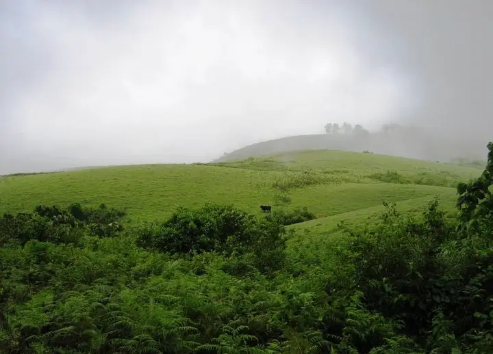
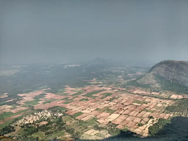
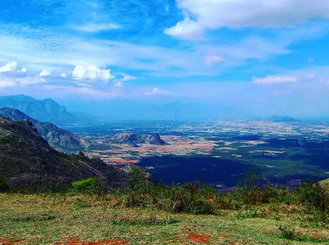
Windy ridge above the Tamil Nadu plains.

Ramakkalmedu
Practical guide

Plan Ramakkalmedu

Who's going?Tailor Ramakkalmedu to your trip
DistrictIdukki
RoleViewpoint base
Time neededAn hour if you are passing through the…
Places to visit4Listed businesses12
What to expect

Highlights

  • Ramakkalmedu — Windy Idukki ridge and viewpoint area above the Tamil Nadu plains, often planned with wind farms and Nedumkandam-side routes.
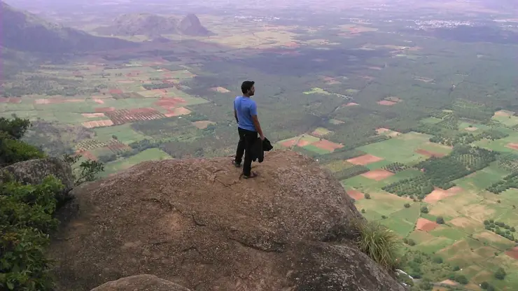
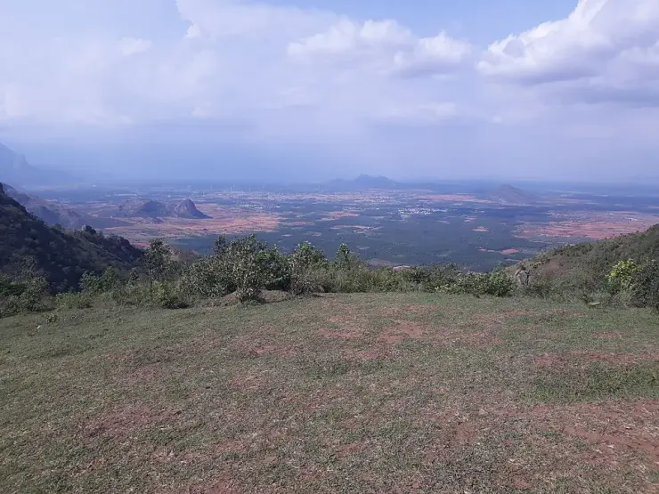
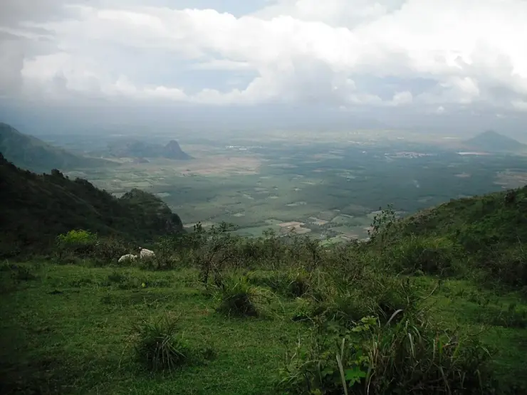
  • Ramakkalmedu viewpoint — Open ridge viewpoint above the Tamil Nadu plains near Nedumkandam, useful for sunset, wind-farm and high-range road planning.
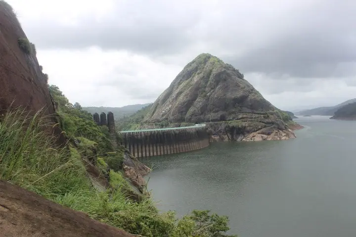
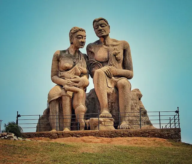
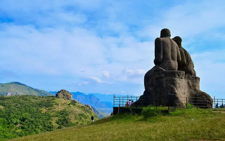
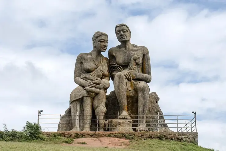
  • Kuravan Kurathi statue — The seated concrete group of a Kuravan, a Kurathi and their child on the open mound at Ramakkalmedu, sculpted by C. B. Jinan and put up in 2005, inside DTPC Idukki’s ticketed viewpoint compound. It commemorates Kuravanmala and Kurathimala, the two hills the Idukki arch dam is wedged between — 30 km away in a straight line, 44 km by road.
  • Aamai Para — Tortoise-shaped rock outcrop above Thovalappady on the Kerala–Tamil Nadu border ridge, reached by jeep track from the Thookkupalam–Ramakkalmedu road, with a two-mouthed passage under the rock and DTPC’s Jaalakam eco-tourism centre on top.
Getting there

How to visit

  • Nearest airport: Madurai Airport (IXM) and Cochin International Airport (COK) are practical gateways depending on arrival side
  • Rail gateway: Theni, Madurai, Kottayam or Ernakulam are practical rail gateways; Ramakkalmedu has no rail station
Timing

Best time to visit Ramakkalmedu

September to May, excluding the heavy monsoon, is the window Malayalam Wikipedia names. The reason is visibility rather than comfort: in the south-west monsoon the cloud comes over the top of the ridge and sits there, sometimes for days. Wind is a year-round condition rather than a seasonal one — a government mast on this ridge records an annual mean of 8.41 m/s and a June monthly mean of 13.04 m/s, which is about 47 km/h of steady wind.

Weather in RamakkalmeduSeasonal guide

Live forecast loads in your browser.

Today at Ramakkalmedu
Sunrise6:11 am
Sunset6:20 pm
Golden hour best light5:20 pm–6:20 pm
Blue hour after sunset6:20 pm–6:45 pm
Sun sets toward compass bearingW · 272°
Moon tonight🌓 First quarter · 56%
South-west monsoon. June to September is the south-west monsoon in Kerala. Expect heavy showers, mostly in bursts rather than all day — carry rain cover, allow extra time for getting around, and note that ferries and open-air sites are the first things affected.

Sun and moon are calculated for this location and shown in IST. Photography windows are the hour around sunrise and sunset; the sunset bearing is degrees clockwise from true north. Moon phase is accurate to about half a day.

The story

The story of Ramakkalmedu

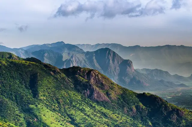
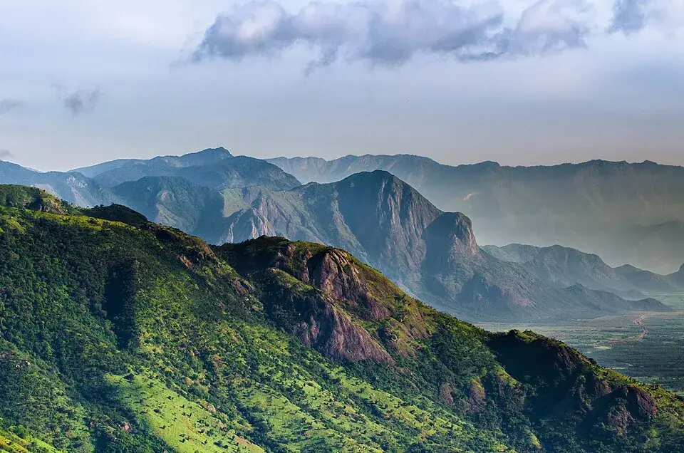
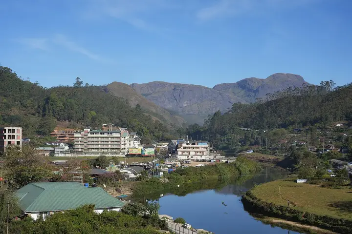
Ramakkalmedu is a hill ward of about a thousand metres on the eastern rim of the Idukki high range, where Kerala stops and the Tamil Nadu plain begins a kilometre below. Almost everything ever written about it describes a gated viewpoint; this page is about the place that viewpoint is named after — Ward 5 of Karunapuram grama panchayat, with a ration shop, a high school, half a dozen named hamlets and a road called after the pass down to Tamil Nadu.

Start with the paperwork, because it is the clearest thing about Ramakkalmedu. The Local Self Government Department of Kerala lists the elected members of Karunapuram grama panchayat ward by ward, and Ramakkalmedu is Ward 5. Ward 1 is Thookkupalam, down the road. Ward 3 is Chottupara. Ward 6 is Kuruvikkanam — the village English Wikipedia names, along with Pushpakandam, as the site of the second wind energy farm ever built in Kerala. Ward 10 is Cumbammettu, the last Kerala ground before the descent into Tamil Nadu. The whole of it is one panchayat of 53.21 square kilometres and, at the 2011 census, 30,473 people in 7,571 households, with a literacy rate of 96.03 per cent against Kerala's 94.

One number in that census stands slightly apart. Karunapuram's sex ratio is 1,020 women to a thousand men, where Kerala's is 1,084 — the state with the highest ratio in India, and this panchayat well below it. That is the signature of a settlement built by in-migration rather than by continuity: the Idukki high range was opened up for farming within living memory, and the people who came up to clear and plant it were disproportionately young men. The hamlet names read the same way. Balanpilla City, 231 metres from this page's pin, is a scatter of houses around a road junction with the word City in its name.

The second thing to know is that maps use Ramakkalmedu for two different points. One marks the settled area among the school, shop and houses; another marks the village centre 1,545 metres north-east and 384 metres from the tourism-centre gate. Neither is necessarily wrong: one answers where people live and the other where visitors stop. Choose the exact attraction rather than the town name when navigating.

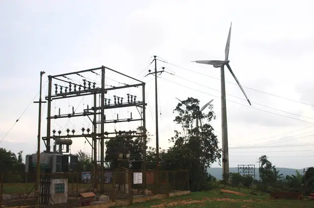
Then there is the energy, which is the ridge's other industry and which is also described two ways. Kerala Tourism's own destination page says the wind farms here "are undertakings of the Government of Kerala" and generate "over 10.5 MW". English Wikipedia says the installations at Pushpakandam and Kuruvikanam are on private holdings, with a capacity of about 14.25 MW of NEG MICON machines feeding the Kerala State Electricity Board. Government or private, 10.5 or 14.25 — the two sources differ on both. What is not in dispute is that the farm is not in this ward. OpenStreetMap maps three turbines within eight kilometres and all three stand by Pushpakandam, five and a half kilometres north-west, in Ward 6.

And in 2023 somebody mapped a solar power station on this ridge, 1.9 kilometres north of the pin — photovoltaic panels, tagged as such, on ground that Malayalam Wikipedia describes as one of the windiest places in India, where the average is 32.5 km/h and gusts reach a hundred. There is no irony in it, only sense: the same cloudless dry season that makes the view worth driving for is the season that makes panels pay. But it is a quietly telling detail about a place whose entire public identity is built on wind.

The border is the last of it, and it is nearer than the map suggests. The road out of the ward towards Tamil Nadu is signed Ramakkalmedu–Cumbummettu, and Cumbummettu is the Kerala village at the top of the descent, 8.9 kilometres away by road and a ward of this same panchayat. Beyond it the ground falls away to Cumbum, which you can see from the ridge and cannot easily reach. Phones along here change networks between the two states without being asked, which is the most everyday way the border makes itself felt.

Legend & myth

The legends of Ramakkalmedu belong to the rock rather than to the ward, and they are set out in full on the viewpoint page: Rama's foot pressed into the stone in the Treta Yuga, and the കല്ലുമ്മേൽ കല്ല്, the stone upon stone that Bhimasena is said to have used to pound betel for Draupadi. Two epics, one outcrop.

What belongs here is the temple at the bottom of the climb. Malayalam Wikipedia records the Sree Rama and Durga Devi temple as standing at Ramakkalmedu, and local descriptions put it at the threshold of the path up the rock, where people take a blessing before going up onto the open ridge. Kerala Tourism's account of the name is the same story from the other end: the place is named for the impressions of feet found on the rock surface, believed to be Rama's, so the hills took the name of the god whose presence blessed them.

It is worth noticing that the legends are about a rock outside the settlement and the settlement is named after the legends. Medu is simply high ground. Ramakkal is the stone. The ward, the school, the ration shop and the panchayat seat all carry a name that belongs, strictly, to a crag none of them can see from the doorstep.

More about Ramakkalmedu

History

The high range around Ramakkalmedu was settled late. This is farming country opened up within living memory — cardamom, pepper, coffee and rubber on the slopes below the grassland — and the census signature of that in-migration is still legible in Karunapuram's numbers: 30,473 people in 2011 across 53.21 square kilometres, with a sex ratio well below the Kerala average.

Wind power came next, and the dates are not precisely published. English Wikipedia records the villages of Pushpakandam and Kuruvikanam as the site of the second wind energy farm installation in Kerala, on private holdings, at about 14.25 MW using NEG MICON turbines. Kerala Tourism describes the same farms as undertakings of the Government of Kerala generating over 10.5 MW. Both accounts are current on the bodies' own websites. Neither gives a year.

Tourism arrived last and was formalised on 23 February 2011, when the District Tourism Promotion Council, Idukki, opened its tourism centre on the ridge above the ward. Malayalam Wikipedia records K. K. Jayachandran MLA inaugurating it and laying the foundation stone for an Energy Park costed at ₹75 lakh in the same ceremony. That centre — its ₹25 ticket, its hours and its hornbill tower — is what most visitors now mean by Ramakkalmedu, and it has its own page here.

By 2015 English Wikipedia records more than 100,000 visitors a year and notes that little had been done to improve basic facilities. It names a circuit of six features — Tortoise Rock, Kuravan Hills, Rama Rock, Wind Mills Viewpoint, Soolapara Hill and Hyderamala Hills — and Kerala Tourism adds a Frog Rock to the list. Most of those six are not signposted, ticketed or mapped, which is a fair summary of how the ward relates to its own fame.

The most recent municipal fact is the panchayat election of 2020, whose result the Local Self Government Department still publishes: Ramakkalmedu, Ward 5, returned Latha Gopakumar. The panchayat president sits at Chennakulam, Ward 9, and the panchayat office and the agriculture office share a building at Karunapuram, 6.6 kilometres from this pin.

Why visit

See the place rather than the viewpoint — a working hill ward of a Kerala panchayat, with a ration shop, a high school and hamlets called Balanpilla City and Combamukku, 2.9 km below the gate everybody photographs.

Stand where two of the world's largest map databases disagree by a mile and a half about what the ground under you is called.

Follow the Ramakkalmedu–Cumbummettu road towards the pass and understand, from the road signs alone, how close Tamil Nadu is and how far away it is to reach.

Look at the energy argument on the ridge: a wind farm two official sources describe with different owners and different capacities, and a solar station mapped in 2023 on the windiest ground in the state.

Use it as an unticketed base for the ridge — the viewpoint compound, the Kuravan and Kurathi statue and Aamai Para are 2.9, 2.9 and 5.6 km away by road, and none of them will sell you a bed.

Take the blessing at the Sree Rama and Durga Devi temple at the foot of the climb, as people going up onto the ridge have done long before there was a ticket counter.
Before you go

Ramakkalmedu — at a glance

HoursThe ward is not gated and keeps no hours: the road, the hamlets, the temple and the shops are simply open. The ticketed tourism centre 2.9 km up the hill is a different matter — DTPC publishes 08:30 to 18:00 daily for it, which is why sunrise and sunset on this ridge have to be planned from outside that compound.

Entry: Nothing is charged in the ward. The DTPC tourism centre up the hill publishes ₹25 for adults and ₹15 for children and senior citizens, with ₹300 for video and ₹1,200 for an album, and takes cash at the counter — DTPC states offline booking only. Ramakkal, the rock the place is named for, stands outside that compound and is free.

Photography: This is a landscape of settlement rather than spectacle — red earth, cardamom and pepper on the slopes below the grassland, roofs and school walls, and the escarpment closing the eastern side. The set-piece views over the Tamil Nadu plain belong to the compound up the hill. Note before you plan a photograph: Wikimedia Commons holds very little of this place that can be republished, because thirteen of the fourteen unused frames geotagged on this ridge carry a photographer's email address burned into the sky.

Getting here

How to reach Ramakkalmedu

  • ✈︎ By air Cochin International is the practical airport. DTPC publishes it as about 123 km for the ridge; from this pin the drive is a little over two hours. Madurai is closer as the crow flies for anyone arriving on the Tamil Nadu side, but the road still has to go round the escarpment rather than over it, because nothing crosses the ridge here.
  • 🚆︎ By train There is no railway on this side of the ridge. DTPC gives Kottayam as the railhead for Ramakkalmedu, about 119 km. The nearest station in a straight line is Bodinayakanur in Tamil Nadu — visible country from the top of the ward, and the best part of an hour and a half by road, because the route has to go round.
  • 🚗︎ By road The Thookkupalam–Ramakkalmedu road, an asphalted two-lane road, is the spine of the ward. Measured with OSRM from this pin on 26 August 2026: Chottupara 4.2 km, Karunapuram panchayat office 6.6 km, Thookkupalam 6.8 km, Pushpakandam 7.9 km, Cumbummettu 8.9 km, Nedumkandam 13.3 km, Kattappana 22.8 km, Kumily 35.7 km, Thekkady 38.1 km, the Idukki arch dam 44.0 km and Munnar 60.1 km. The DTPC viewpoint compound and the Kuravan and Kurathi statue inside it are both 2.9 km; Aamai Para is 5.6 km by way of Thovalappady.
  • 🚌︎ By bus Nedumkandam, 13.3 km down, is the bus town, and Kerala RTC works the Thekkady–Munnar corridor through it. The last leg up onto the ridge is a jeep, an auto or a taxi. No published service sets down at the viewpoint gate, and services along the ward road thin out sharply in the evening.
Getting back

Check your return bus or ferry with the operator before setting out. Leave time to reach the stop or jetty after your visit, and arrange a return vehicle in advance for a remote outing.

Ask at the jetty or the stand for the time of the last service back, not the next one. If you miss it, an auto or a taxi is the fallback — agree the fare before you get in.

Do

Things to do in Ramakkalmedu

  • Walk the ward road between the hamlets — Balanpilla City, Ammavanpady, Combamukku — and read the place as a settlement rather than a viewpoint
  • Take the blessing at the Sree Rama and Durga Devi temple at the foot of the path up Ramakkal, as Malayalam Wikipedia records it
  • Drive the Ramakkalmedu–Cumbummettu road towards the Tamil Nadu pass and see how the ground falls away
  • Go up to the DTPC viewpoint compound, 2.9 km, for the ticketed view and the Kuravan and Kurathi statue inside it
  • Make the separate 5.6 km run to Aamai Para by way of Thovalappady — not by the jeep track a map app will offer you
  • Look for the wind turbines by Pushpakandam, 5.5 km north-west, and the solar station mapped 1.9 km north — the ridge's two arguments about its own weather
  • Buy from the ration shop and the roadside stalls; this is the part of Ramakkalmedu where money stays in the ward
Getting around RamakkalmeduPartly wheelchair accessible
Terrain
Mostly flat
From the entrance
There is nothing to enter. Ramakkalmedu ward is reached on the Thookkupalam–Ramakkalmedu road, an asphalted two-lane road that runs through the settlement past the school, the ration shop and the hamlets, and it is the same road that climbs to the ticketed viewpoint 2.9 km further up. What there is not is any pedestrian infrastructure: no footway, no kerb, no crossing and no lighting. People walk on the carriageway because there is nowhere else, and the traffic is buses, jeeps, lorries and school runs on a hill road with blind bends.
Step-free access
✅ Partly, in the narrow sense that the road is sealed and a vehicle can be driven and parked anywhere along it, so a wheelchair user can see the ward, the hamlets and the escarpment country from a car without any transfer at all. ⚠ Beyond the vehicle there is very little. The ward has no footway of any kind; the verges are red earth that turns slick after rain and drops away to cultivation; and the shops, the temple and the school are all entered off the carriageway rather than off a path. ⚠ No accessible toilet is published anywhere in the ward, and none is mapped. ⚠ Nothing here is a managed visitor site, so there is no operator to ring and ask — the DTPC number on the viewpoint page covers the compound up the hill and not this ground. If a made surface and a toilet matter, the compound 2.9 km up is the better target of the two, and its own page sets out what it does and does not have.
Prams
✅ A pram is workable along the sealed road and impractical anywhere off it. The carriageway is smooth enough, but you are pushing on a road shared with buses and jeeps, with no footway to step onto and no kerb, so this is a walk to do with a hand on the pram and an eye up the hill. ⚠ The verges are unmade and slope. ⚠ The wind that the ridge is known for reaches the ward: a government mast up here records a June monthly mean of 13.04 m/s, about 47 km/h, and a raised pram hood is a sail in that. Fold it down.
  • This is a public hill road with no footway. Walk facing the traffic, keep children on the inside, and expect buses and jeeps to take the crown of the road on the bends.
  • There is no street lighting in the ward and mist closes the ridge in minutes in the cold months. Do not plan to be walking the road after dark.
  • The wind is real at this altitude even below the viewpoint — an annual mean of 8.41 m/s on a government mast on this ridge, and a June monthly mean of 13.04 m/s.
  • The hamlets are homes and the yards beside the road are private. There is no visitor route through them and none should be assumed.
  • No accessible toilet, no fuel, no pharmacy, no ATM and no bank in the ward. Nedumkandam, 13.3 km down, is the nearest of each.
  • The nearest hospital mapped is the government homoeopathic hospital at Chottupara, 4.2 km away — a homoeopathic hospital, which is not an emergency department. Plan accordingly.
  • Do not follow a routing app up the jeep track towards Aamai Para. The driveable route runs by way of Thovalappady and is 5.6 km.
  • Phones roam between the Kerala and Tamil Nadu networks along this ridge. Do not rely on a live data connection.

Checked 26 August 2026 against source 1source 2source 3. Conditions change and surfaces vary with weather — if step-free access is essential, confirm with the site before you travel.

In the district

Where Ramakkalmedu sits in Idukki district

Local transportUse local taxis, autos and verified jeep drivers for Ramakkalmedu viewpoint, wind-farm roads, Kuravan-Kurathi statue, off-road viewpoints and Kumily/Kattappana transfers.
District HQPainavu
LandscapeHigh Western Ghats — tea & spice hills

Idukki district is known for: Munnar tea country, Thekkady/Periyar wildlife and the Cardamom Hills.

Check wind, visibility and rain before planning viewpoint-heavy days.Avoid tight late-evening transfers on narrow high-range roads.Ramakkalmedu works best as a wind-swept viewpoint and border-hill road base.Munnar tea estatesPeriyar Tiger Reserve, ThekkadyCardamom & spice plantations
Stay · eat · do · rent · see · shop

Places in Ramakkalmedu

Every verified place in Ramakkalmedu — filter by what you’re after.

8 places to stay in Ramakkalmedu

Pulliyil Cardamom Estate Ramakkalmedu — Cardamom estate serviced villa in Ramakkalmedu
Top pick Verified
Cardamom estate serviced villa · Ramakkalmedu
Pulliyil Cardamom Estate Ramakkalmedu

Pulliyil Cardamom Estate is a serviced villa set in a cardamom plantation at Kattadipadam, near the Ramakkalmedu wind farm. The estate stay offers a plantation-and-windmill setting with direct phone and email booking.

Directions Commission-freeView details
Salaams Raama Heritage Eco Village — Heritage eco resort in Ramakkalmedu
Top pick Verified
Heritage eco resort · Ramakkalmedu
Salaams Raama Heritage Eco Village

Kerala Tourism-listed Ramakkalmedu eco resort with Ayurveda, yoga, jeep safari, farm visit and trekking evidence.

Directions Commission-freeView details
Vision Homestay Ramakkalmedu — Silver-classified homestay in Ramakkalmedu
Top pick Verified
Silver-classified homestay · Ramakkalmedu
Vision Homestay Ramakkalmedu

Kerala Tourism-listed homestay near Ramakkalmedu windmills with direct phone, email and website evidence.

Directions Commission-freeView details
Crowd Hills Resort Ramakkalmedu — Ramakkalmedu resort in Ramakkalmedu
Verified
Ramakkalmedu resort · Ramakkalmedu
Crowd Hills Resort Ramakkalmedu

Ramakkalmedu resort with direct phone, email, address and Thekkady/Munnar route context. Resort, Ramakkalmedu, Hill stay.

Directions Commission-freeView details
Punarjani Resorts Ramakkalmedu — Cottage resort in Ramakkalmedu
Verified
Cottage resort · Ramakkalmedu
Punarjani Resorts Ramakkalmedu

Ramakkalmedu cottage resort with direct address, phone and activity-context evidence. Resort, Cottages, Ramakkalmedu.

Directions Commission-freeView details
Wind Valley Farm Stay Ramakkalmedu — Homestay and farm stay in Ramakkalmedu
Verified
Homestay and farm stay · Ramakkalmedu
Wind Valley Farm Stay Ramakkalmedu

Homestay and farm stay in Ramakkalmedu. Thookkupalam-Ramakkalmedu Road, Ammavanpady, Ramakkalmedu P.O., Kerala 685552 · Ramakkalmedu, Homestay, Farmstay.

Directions Commission-freeView details
SpiceBuds FarmStay Ramakkalmedu — Plantation farm stay in Ramakkalmedu
Verified
Plantation farm stay · Ramakkalmedu
SpiceBuds FarmStay Ramakkalmedu

Plantation farm stay in Ramakkalmedu. SN School - Chelamoodu Road, Koottar P.O., Koottar, near Ramakkalmedu, Idukki, Kerala 685552 · Ramakkalmedu, Farm stay, Spice plantation.

Directions Commission-freeView details
Paadi Holidays Ramakkalmedu — Ramakkalmedu resort and tent stay in Ramakkalmedu
Verified
Ramakkalmedu resort and tent stay · Ramakkalmedu
Paadi Holidays Ramakkalmedu

Ramakkalmedu resort and tent stay in Ramakkalmedu. Ramakkalmedu, Anniyar Thozhu, Idukki, Kerala 685515 · Ramakkalmedu, Resort, Tent stay.

Directions Commission-freeView details

Book with the place itself. India’s cyber-crime coordination centre warned in April 2025 that convincing copies of hotel and pilgrimage booking sites are being pushed through sponsored search and social ads, taking payment for rooms the property never hears about. Every listing here links to the business’s own contact details and its own Google or Bing profile — we take no commission and sit in nobody’s payment path. If a booking page reached you through an ad, check the address bar against the property’s own site before you pay. Fraud can be reported on cybercrime.gov.in or on 1930.

For hotels, homestays and local businesses

Get listed in Ramakkalmedu for free

Roampedia is commission-free. Travellers discover your business, book directly and contact you through official details. Basic listings are free, while Gold and Platinum package upgrades can be requested from the owner dashboard after approval.

List your business — free
Ranked guide modules

The best of Ramakkalmedu, ranked

4 picks

Ramakkalmedu-scoped cards for Idukki planning: source-backed tourist places, official/public access checks, verified local inventory and practical high-range road context.

Search guides

Hotels, restaurants and stay-budget guides in Ramakkalmedu

Dedicated town guides for high-intent searches. Pages with limited verified supply stay visible for planning but are not submitted for search indexing until enough evidence-backed listings exist.

Food2 matches

Restaurants in Ramakkalmedu

Planning preview kept visible for travellers while more verified listings are added before search indexing.

Planning previewOpen guide →
Hotels0 matches

Hotels in Ramakkalmedu

Planning preview kept visible for travellers while more verified listings are added before search indexing.

Planning previewOpen guide →
Homestays3 matches

Homestays in Ramakkalmedu

Evidence-backed shortlist with verified local matches, direct planning context and clear next steps.

Search-ready guideOpen guide →
Resorts5 matches

Resorts in Ramakkalmedu

Evidence-backed shortlist with verified local matches, direct planning context and clear next steps.

Search-ready guideOpen guide →
Wellness1 match

Ayurveda and wellness places in Ramakkalmedu

Planning preview kept visible for travellers while more verified listings are added before search indexing.

Planning previewOpen guide →
Operators2 matches

Tour operators in Ramakkalmedu

Planning preview kept visible for travellers while more verified listings are added before search indexing.

Planning previewOpen guide →
Transport1 match

Taxi and transport providers in Ramakkalmedu

Planning preview kept visible for travellers while more verified listings are added before search indexing.

Planning previewOpen guide →
Budget stays0 matches

Cheap places to stay in Ramakkalmedu

Planning preview kept visible for travellers while more verified listings are added before search indexing.

Planning previewOpen guide →
Budget stays0 matches

Budget stays in Ramakkalmedu

Planning preview kept visible for travellers while more verified listings are added before search indexing.

Planning previewOpen guide →
Affordable hotels0 matches

Affordable hotels in Ramakkalmedu

Planning preview kept visible for travellers while more verified listings are added before search indexing.

Planning previewOpen guide →
Mid-range stays0 matches

Mid-range stays in Ramakkalmedu

Planning preview kept visible for travellers while more verified listings are added before search indexing.

Planning previewOpen guide →
Premium stays5 matches

Premium stays in Ramakkalmedu

Evidence-backed shortlist with verified local matches, direct planning context and clear next steps.

Search-ready guideOpen guide →
Luxury stays0 matches

Luxury stays in Ramakkalmedu

Planning preview kept visible for travellers while more verified listings are added before search indexing.

Planning previewOpen guide →
Ultra luxury stays0 matches

Ultra luxury stays in Ramakkalmedu

Planning preview kept visible for travellers while more verified listings are added before search indexing.

Planning previewOpen guide →
Town plans

2-day and 3-day plans for Ramakkalmedu

Practical Ramakkalmedu routes built from the town inventory, famous places and official access checks. Confirm activity status, weather, permits and road timing before travel.

2 days

Ramakkalmedu in 2 days

A focused Ramakkalmedu plan using the strongest source-backed places, verified local inventory and practical Idukki road buffers.

First tripHill-road planningOfficial access checks
Moderate, with one core sightseeing day and one flexible nature, wildlife, dam or viewpoint day
3 days

Ramakkalmedu in 3 days

A fuller Ramakkalmedu route with one arrival/local day, one main attraction day and one wider Idukki extension using source-backed stops.

Slow Idukki routeNature and viewpointsStay and food comparisons
Comfortable, with road buffers and one wider day trip
Stay safe

Emergency numbers in Ramakkalmedu

Save these before travelling around Ramakkalmedu and Idukki. Use 112 for any emergency, and confirm local attraction or forest access through official contacts before remote trips.

Read before you go

Ramakkalmedu guides, stories & itineraries

Around Ramakkalmedu

The town itself and the places around it — each written about one subject rather than as a general guide.

Ramakkalmedu: the wind that never stops and the stone couple who wait
Story
Ramakkalmedu: the wind that never stops and the stone couple who wait

On a Western Ghats ridge where the wind never stops, a giant tribal couple keeps watch over two states. This is the story of Ramakkalmedu — its gales, its view, and its legend.

9 min read · Read →
You cannot watch the sunrise or the sunset from Ramakkalmedu viewpoint
Planning
You cannot watch the sunrise or the sunset from Ramakkalmedu viewpoint

The two moments this viewpoint is recommended for both fall outside the hours you are allowed to be there.

4 min read · Read →
Eight towns you can see from Ramakkalmedu, and how long each takes to reach
Landscape
Eight towns you can see from Ramakkalmedu, and how long each takes to reach

You are looking at a country closer to you than the nearest petrol pump and further away than Kattappana.

5 min read · Read →
Ramakkalmedu travel guide: Kerala's windiest hilltop viewpoint in Idukki
Visitor guide
Ramakkalmedu travel guide: Kerala's windiest hilltop viewpoint in Idukki

One of the windiest places in Kerala, with a wind farm on the ridge and the whole Tamil Nadu plain spread out below — here is how to plan it.

7 min read · Read →
Kerala’s tourism department and its district tourism council do not agree how many figures are in the state’s most photographed statue
Explainer
Kerala’s tourism department and its district tourism council do not agree how many figures are in the state’s most photographed statue

Two official Kerala bodies describe the same sculpture differently. We opened nine photographs of it at full resolution to find out which one is counting correctly.

6 min read · Read →
The statue is named after two hills. A man called Chemban Kolumban is the reason anyone built anything between them
History
The statue is named after two hills. A man called Chemban Kolumban is the reason anyone built anything between them

Kerala Tourism quotes DTPC Idukki’s Secretary: “He was the one who showed the hills of Kuravan and Kurathi.” This is who he was.

7 min read · Read →

Kerala-wide guides & itineraries

Route-level itineraries and practical guides for the rest of the state.

See all 152 Idukki guides & stories →

Map

Where things are in Ramakkalmedu

FAQ

Ramakkalmedu travel FAQs

Is Ramakkalmedu a village or a viewpoint?

Both, and they are not in the same place. Ramakkalmedu is Ward 5 of Karunapuram grama panchayat, an inhabited hill ward with a ration shop, a high school and several hamlets. The ticketed viewpoint run by DTPC Idukki, which is what most people mean by the name, is 1,545 m away in a straight line and 2.9 km by road, and has its own page here.

Which panchayat is Ramakkalmedu in?

Karunapuram grama panchayat, in Udumbanchola taluk of Idukki district. The Local Self Government Department lists Ramakkalmedu as Ward 5; its neighbour Kuruvikkanam, where the wind farm stands, is Ward 6, and Cumbammettu at the head of the descent to Tamil Nadu is Ward 10. The panchayat office is 6.6 km from here at Karunapuram.

Can you go paragliding at Ramakkalmedu?

No official source says so. The Kerala Adventure Tourism Promotion Society, the state body that accredits adventure operators, names Vagamon and Varkala as its preferred paragliding destinations and does not name Ramakkalmedu. Kerala Tourism's own destination page for Ramakkalmedu does not mention paragliding at all. The claim is repeated on many travel sites; ask any operator selling a flight here to show their accreditation first.

Where exactly is the Ramakkalmedu wind farm?

Not in Ramakkalmedu ward. English Wikipedia places it in Pushpakandam and Kuruvikanam, and nearby mapped turbines stand by Pushpakandam, about 5.5 km north-west. Published descriptions also disagree on ownership and capacity: Kerala Tourism calls it a Government of Kerala undertaking of over 10.5 MW, while English Wikipedia describes private holdings of about 14.25 MW feeding the state electricity board.

How far is Ramakkalmedu from Nedumkandam, Kattappana and Thekkady?

Measured with OSRM from this pin on 26 August 2026: Nedumkandam 13.3 km, Kattappana 22.8 km, Kumily 35.7 km, Thekkady 38.1 km, Munnar 60.1 km, and the Idukki arch dam 44.0 km. Malayalam Wikipedia publishes rather different figures — Kattappana 20 km, Thekkady 43 km, Munnar 70 km — and English Wikipedia gives Nedumkandam as 15 km. All of them are describing the same drives on the same hill roads.

Is there anything to see in Ramakkalmedu itself, away from the viewpoint?

Not in the sense of an attraction, and that is the point of coming. What is here is a settled hill ward: the Sree Rama and Durga Devi temple that Malayalam Wikipedia records at the foot of the path up the rock, the hamlets of Balanpilla City, Ammavanpady, Combamukku and Thovalappady, a high school, a ration shop, and the Ramakkalmedu–Cumbummettu road running down towards the Tamil Nadu pass. Nothing is ticketed and nothing keeps hours.

What are the best places to visit in Ramakkalmedu?

Top places to visit in Ramakkalmedu include Ramakkalmedu viewpoint, Kuravan Kurathi statue, Wind farms, Aamai Para — each has a full guide with how to reach it and what to see nearby on this page.

How do I reach Ramakkalmedu?

The nearest airport to Ramakkalmedu is Cochin (COK), ~100–110 km. The rail gateway is Kottayam (KTYM) or Ernakulam.

What is the best time to visit Ramakkalmedu?

October to March is the driest and most comfortable season to visit Ramakkalmedu and the rest of Kerala. The June–September monsoon is lush and green but wet, and often brings lower low-season prices.

Photographs: Jaseem Hamza (CC BY 3.0), Dipu TR (CC BY 3.0), Kondephy (CC BY-SA 4.0). Wikimedia Commons.

Image credits