India·Kerala·Idukki·Vagamon·viewpoint

Paragliding viewpoints

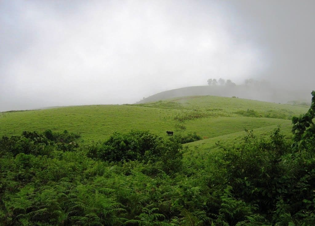
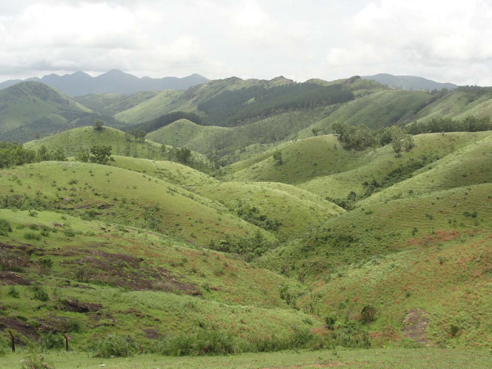
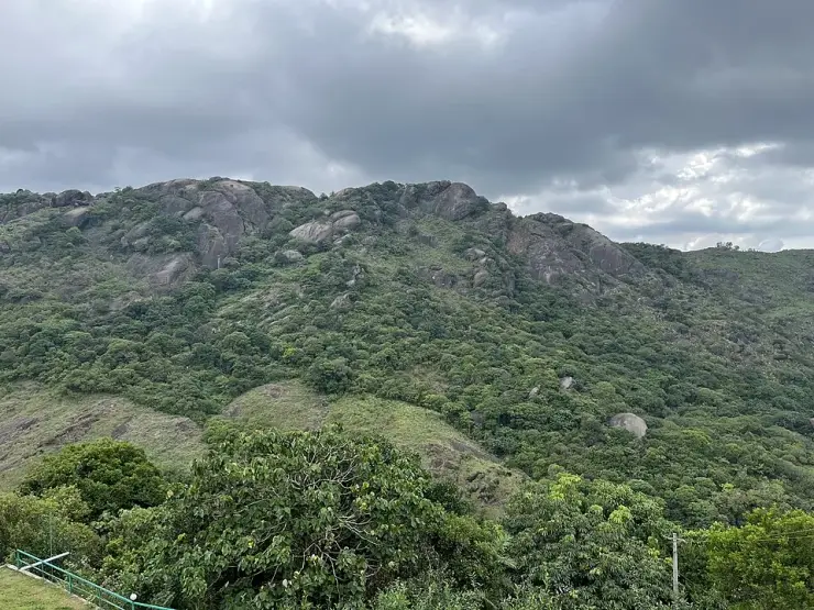
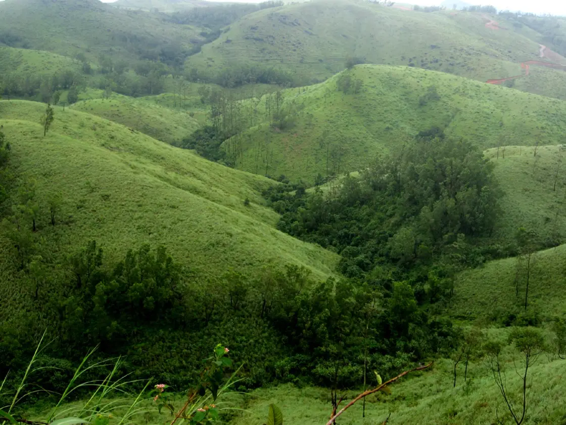
The Kolahalamedu ridge, 4.25 km south-south-east of Vagamon, is one of exactly two places the Kerala Adventure Tourism Promotion Society names as a preferred paragliding destination in the whole state — the other is Varkala. It is a run of bare grass hills at a little over a thousand metres, almost treeless on the windward side, dropping away westward into the valley. The state calls it “the perfect platform”.

Paragliding viewpoints, Vagamon
Practical guide

Plan Paragliding viewpoints

Who's going?Tailor Paragliding viewpoints to your trip
Typeviewpoint
AreaVagamon
DistrictIdukki
Best timeSeptember to January and March to May,…
Time needed1 to 2 hours on the ridge
EntryNothing to stand on the ridge
Places to visit6Listed businesses27

The endorsement is real; the information around it is not maintained. The same page that names this ridge says paragliding in Kerala happens “at nearly 6,000 ft” when nothing within five kilometres reaches 3,700; it heads the entry “Vagamon, Kottayam” while its own prose says Idukki; and its news is a carnival held in February 2015, written in the future tense. The body’s dedicated Vagamon paragliding page returns a database error. So no official source will tell you whether anyone is flying today — that is a phone call to a licensed operator, and this page says so plainly rather than filling the gap with invention.

The story

Kerala's own adventure-tourism body names exactly two places in the state where you should paraglide, and this ridge is one of them. It also gets the district wrong, contradicts itself about the height by nearly a factor of two, and has not updated the page since 2015. This is what is actually up here, measured.

The story of Paragliding viewpoints

Start with the endorsement, because it is real and it is narrower than you would guess. The Kerala Adventure Tourism Promotion Society — the state body that accredits adventure operators — publishes a page on paragliding with a section headed “Preferred Destinations”, and it contains two entries for the whole of Kerala: Vagamon, and Varkala. Nowhere else. Not Munnar, not Wayanad, not Ramakkalmedu, whose own visitors are regularly told they can fly there. Of Vagamon it says: “Kolahalamedu hill, located 4km from Vagamon, provides the perfect platform for paragliding. Over 3,000 feet in height, it has a 10km long ride that is perfect for take-off and landing.”

The 4 km is right. Kolahalamedu is 4.25 kilometres from the middle of Vagamon by road, seven minutes, and 3.26 in a straight line to the south-south-east. The height is right too, as far as it goes: two independent elevation models put the ridge at 1,044 to 1,053 metres, which is 3,425 to 3,455 feet, so “over 3,000 feet” is honest and even modest. What is not right is the sentence at the top of the same page, which invites you to “get a bird's eye view of Kerala, at nearly 6,000 ft above sea level”. Nothing here is near 6,000 feet. The highest point mapped within five kilometres of this pin is 1,113 metres — 3,652 feet. Kerala Tourism, separately, gives Vagamon 1,100 metres. One page, two altitudes, and the headline one is almost double the site it is describing.

The same entry is headed “Vagamon, Kottayam”. Vagamon is in Idukki, and the body's own sentence three paragraphs earlier says so — “Vagamon in the district of Idukki”. Kerala Tourism files it under Idukki; the mapped boundary puts this ridge in Peerumade taluk, Idukki. The confusion is not baseless: the district border genuinely runs across this upland, and Kurisumala — 5.9 kilometres away by road, and the subject of its own page here — really is in Kottayam. But the flying ground is not.

Then there is the date. The page's news is the Mathrubhumi Yathra 7th International Paragliding Carnival, written in the future tense: “The event dates are from 21 Feb 2015 until 1 Mar 2015 at Vedikuzhi suicide point.” It links a 2013 photo gallery and 2014 video highlights. It names the partners — Fly Vagamon club, the Vagamon destination management committee, the Paragliding Association of India — and the acrobatic display led by Calin Popa of Romania, and it says the gates open from noon to six. All of that is more than a decade old and none of it is marked as past. The body's separate page for the Vagamon paragliding event, which is where a current date would live, returns a database error rather than a page: an HTTP 500 that prints the name of a PHP file and a line number to anyone who visits. We checked it three times.

So the honest position is this. The endorsement stands — this is one of two places the state names — and the season it gives is specific and worth having: September to January, and again March to May, when the wind comes from the south-west. But there is no official source that will tell you whether anyone is flying next Tuesday. That is a question for a licensed operator on the phone, and the answer will depend on the wind on the morning, as it does at every flying site in the world.

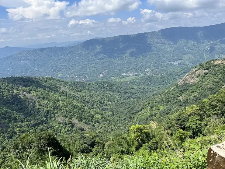
What you are actually looking at, if you drive up and nobody is flying, is the reason they chose it. Kolahalamedu is a run of bare grass hills at a little over a thousand metres with almost no trees on the windward side, ending in a long drop westward into the valley. There is a village of the same name on the ridge with a bus stop that a second mapper spelled “Kolahamedu”; a tertiary road runs along the top of it, signed for Kurisumala and Thangalpara; and the Vagamon meadows and their ticket counter begin about 800 metres away. The carnival site, Vedikkuzhi — വെടിക്കുഴി, and locally “suicide point” — is a separate hamlet 1.35 kilometres further on and about forty metres higher than the platform the state names, which is worth knowing if someone tells you to meet them there.

Legend & myth

Kolahalamedu is കോലാഹലമേട് — medu is high ground, the same word that ends Ramakkalmedu and Chathurangapara's neighbours, and kolaham carries the sense of clamour or uproar. A ridge named for noise, now used for the quietest kind of flying there is. We have found no published account of how it got the name and we are not going to invent one.

Vedikkuzhi is വെടിക്കുഴി — vedi, a shot or an explosion, and kuzhi, a pit or hollow. It is the place the paragliding carnival was held, and it is also the spot English-language travel writing calls “suicide point”, a name attached to a great many Indian viewpoints with a sheer edge and no relationship to this one's history. We record both names because both are used on the ground; we are not attaching a story to either.

The spelling matters more than it should. Search “Vedikuzhi” with one k, as most travel pages write it, and the mapped hamlet does not come back at all; വെടിക്കുഴി and “Vedikkuzhi” return it on the first try. The same is true of the ridge itself, which OpenStreetMap carries twice — as “Kolahalamedu” on the settlement and “Kolahamedu” on its bus stop, forty-nine metres apart.

Read the full history of Paragliding viewpoints 198 more words

History

2013 and 2014 — the Kerala Adventure Tourism Promotion Society publishes a photo gallery from one paragliding festival and video highlights from the next. Both links are still on its paragliding page.

21 February to 1 March 2015 — the Mathrubhumi Yathra 7th International Paragliding Carnival is held at Vedikkuzhi, run by Kerala Tourism under the aegis of KATPS in association with the Fly Vagamon club, the Vagamon destination management committee and the Paragliding Association of India. Over fifty national and international pilots were expected; the carnival ground opened from noon until six; an acrobatic display was led by Calin Popa of Romania. The body's page still describes all of this as forthcoming.

Since 2015 — nothing. The KATPS paragliding page carries no later event, and the body's dedicated Vagamon paragliding event page returns a database error instead of content. A state accrediting body's public record of its own flagship adventure event stops eleven years ago.

Throughout — the endorsement itself has not been withdrawn. Vagamon and Varkala remain the two preferred paragliding destinations KATPS names, and Kerala Tourism's own Vagamon page continues to describe the hill station's “grassy slopes and open spaces” as providing “excellent take-off points”.

What to expect

Highlights

  • The launch ground the state itself names: Kolahalamedu, 4 km from Vagamon by its reckoning and 4.25 km by ours, at 1,044–1,053 m — 3,425 to 3,455 feet.
  • One of only two accredited paragliding destinations in Kerala, the other being Varkala, 200 km away on the coast.
  • The ridge road along the top, signed for Kurisumala and Thangalpara, which is the simplest way to see why this ground was chosen for flying.
  • Vedikkuzhi — വെടിക്കുഴി, locally “suicide point” — 1.35 km further on and about 40 m higher, where the international paragliding carnival was actually held.
  • The published season, which is specific and worth planning around: September to January, and again March to May, when the wind comes from the south-west.
Getting there

How to visit

  • Ring a licensed operator before you drive up. No official source publishes whether anyone is flying, the state’s activities page has not moved since 2015, and its event page for this site currently returns a database error.
  • Come inside the season — September to January or March to May. The south-west monsoon between them puts cloud on this ridge for days at a time and there is no flying at all.
  • Come in the morning if you intend to fly. That is the usual window across the Ghats, and the wind decides, not the clock.
  • Do not confuse the three places on this upland: the launch ground at Kolahalamedu, the ticketed Vagamon meadows about 800 m away, and Kurisumala the pilgrim hill 5.9 km off. They are separate visits with separate pages.
  • Hold on to everything loose. This is an exposed grass top chosen precisely because air moves across it fast, and there is no railing at the drop.

Distance by road

  • Kochi107 km
  • Madurai172 km
  • Thiruvananthapuram226 km
  • Coimbatore252 km
  • Kozhikode276 km

Road km to Idukki; ghat roads and traffic vary — allow extra.

Timing

Best time

September to January and March to May, the season the state’s own adventure body publishes, when the wind blows from the south-west. Mornings for flying. The monsoon in between is cloud on the ridge and nothing in the air.

Weather in Paragliding viewpointsSeasonal guide

Live forecast loads in your browser.

Today at Paragliding viewpoints
Sunrise6:12 am
Sunset6:21 pm
Golden hour best light5:21 pm–6:21 pm
Blue hour after sunset6:21 pm–6:46 pm
Sun sets toward compass bearingW · 272°
Moon tonight🌓 First quarter · 52%
South-west monsoon. June to September brings heavy rain to Kerala. Trails, falls and ghat roads can be slippery, swollen or closed at short notice, and forest departments sometimes suspend access. Check locally on the day before you travel.

Check the official alert before you travel. Kerala’s beaches, waterfalls and trekking routes close at short notice during heavy rain, and district alert levels change day to day. We do not publish an alert level of our own — read it from the state authority: Kerala State Disaster Management Authority, or the district control room on 1077.

Sun and moon are calculated for this location and shown in IST. Photography windows are the hour around sunrise and sunset; the sunset bearing is degrees clockwise from true north. Moon phase is accurate to about half a day.

Visitor notes

  • Nothing to pay to stand on the ridge — it is an open public hilltop with a road along it. The Vagamon meadows nearby are ticketed and are a different place.
  • No official source publishes a flight price or a schedule, so neither do we. Ask the operator and confirm before travelling.
  • There is no mapped car park, toilet, water or food at the launch ground. Vagamon is 4.25 km back down the road.
  • The carnival site is Vedikkuzhi, spelled with a double k — with one k the map returns nothing at all.
Safety

Good to know

  • The edge is unfenced and the ground falls away steeply on the windward side. There is no railing anywhere on this ridge.
  • Strong steady wind is the point of the place. Loose items go over, and it makes uneven grass harder underfoot than the gradient suggests.
  • Fly only with a licensed operator — the state accredits adventure operators through KATPS precisely because this is not something to arrange informally.
  • No shelter on an open grass top at over a thousand metres, and the ridge road is unlit when cloud comes down.
Stay · eat · do · rent · see · shop

Stays, food & things to do near Paragliding viewpoints

Verified hotels, homestays, restaurants, experiences, sights, shops and rentals around Paragliding viewpoints — commission-free, with direct contact. Filter by what you need.

5 things to do near Paragliding viewpoints

Vagamon Taxi Service — Taxi and sightseeing transfer provider in Vagamon
Verified
Taxi and sightseeing transfer provider · Vagamon
Vagamon Taxi Service

A Pulinkatta Junction, Vagamon based 24-hour taxi operator for local cabs, outstation trips, airport pickups, sightseeing packages and jeep safari.

Directions Commission-freeView details
Vagamon Off Road Jeep Safari — Off-road jeep safari and camping operator in Vagamon
Verified
Off-road jeep safari and camping operator · Vagamon
Vagamon Off Road Jeep Safari

A Sositekavala, Vagamon based operator running full-day, half-day and village jeep safaris with tent camping and trekking or tea-garden tour packages.

Directions Commission-freeView details
Vagamon Jeep Safari (Anu Holidays) — Jeep safari and taxi operator in Vagamon
Verified
Jeep safari and taxi operator · Vagamon
Vagamon Jeep Safari (Anu Holidays)

Anu Holidays runs off-road jeep safaris plus taxi, airport transfers and tour packages from Anu Bhavan, Vagamon, with online and WhatsApp booking.

Directions Commission-freeView details
Thekkady Jungle Safari Vagamon Day Tour — Vagamon day-tour and taxi operator in Vagamon
Verified
Vagamon day-tour and taxi operator · Vagamon
Thekkady Jungle Safari Vagamon Day Tour

Periyar Cabs-operated tour and taxi source listing Vagamon day tours, taxi service and guided safari support.

Directions Commission-freeView details
V
Vagamon Bamboo Nest Paragliding
Things to do
Verified
Paragliding and activities · Vagamon
Vagamon Bamboo Nest Paragliding

Vagamon Bamboo Nest paragliding record for adventure activity planning. Vagamon, do, Paragliding and activities.

Directions Commission-freeView details

Book with the place itself. India’s cyber-crime coordination centre warned in April 2025 that convincing copies of hotel and pilgrimage booking sites are being pushed through sponsored search and social ads, taking payment for rooms the property never hears about. Every listing here links to the business’s own contact details and its own Google or Bing profile — we take no commission and sit in nobody’s payment path. If a booking page reached you through an ad, check the address bar against the property’s own site before you pay. Fraud can be reported on cybercrime.gov.in or on 1930.

Ranked lists

The best of Vagamon, ranked

Browse food, accommodation and activities across Vagamon. Check each address and journey before adding it to your day; these selections are not all beside Paragliding viewpoints.

Ranked guides

Top experiences around Vagamon

6 more places around Vagamon. Open a guide to plan the visit and onward journey.

hill stationVagamon

4.3 km · 7 min drive

Rolling meadows, pine patches and viewpoints on the Idukki/Kottayam highland edge.

hill stationVagamon meadows

810 m · 10 min walk

Open meadow landscape forming the classic Vagamon sightseeing circuit.

viewpointPine forest

1.7 km · 20 min walk

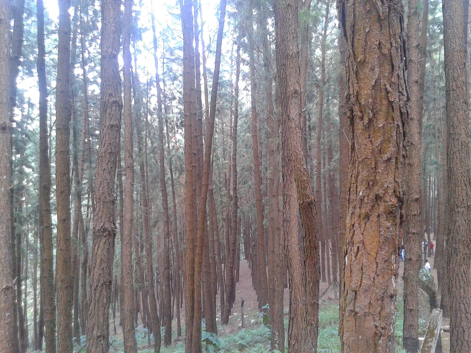
A 61.40-hectare plantation of Caribbean pine on the Kolahalamedu shoulder above Vagamon — planted in rows by the Kerala Forest Department’s research wing on land that was not legally forest at all until March 2021, and run today as a ticketed ecotourism centre with a counter, a car park and a made path. Every travel site calls it a British-era forest; the state’s own record calls it the Kolahalamedu Pine Plantation.

mosqueThangalpara

1.5 km · 18 min walk

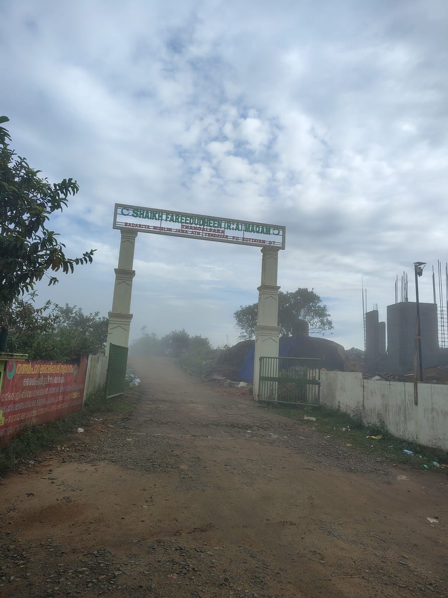
A working Muslim pilgrimage centre on a bare granite dome above Vagamon, on the Kottayam side of the district line. It calls itself the Shaikh Fareedudheen (R.A) Maqam, and the life set out at its gate — the saint’s father, mother, teachers and date of death — is that of Fariduddin Ganjshakar, Baba Farid, whose dargah is at Pakpattan in the Punjab. Kerala Tourism calls this rock his grave; the shrine says maqam, which is the smaller and more careful word.

churchKurisumala

5.9 km · 13 min drive

The pilgrim hill above Vagamon — a bare rock dome climbed by a 1.2 km path lined with the Stations of the Cross to St Thomas Church on the summit, and, 818 m away and lower down, the separate Cistercian monastery of Kurisumala Ashram, founded in 1958. Most descriptions run the two together; they are different places with different approaches and different people in charge.

trekVagavanam Windy Walk trek

14.2 km · 23 min drive

The Forest Department’s guided walk on the grass tops at the southern end of the Idukki Wildlife Sanctuary, about ten kilometres by road from Vagamon — some seven kilometres on foot up jeep track and open ridge, with the Idukki reservoir catchment below you. The state will not sell it to fewer than six people, and it will not take more than seven.

Roampedia is commission-free — own or know a stay, eatery, guide or shop near Paragliding viewpoints? List it and it appears here once verified.

Add a nearby business
Before you go

Paragliding viewpoints — at a glance

DifficultyEasy
Duration1 to 2 hours on the ridge; a tandem flight itself is a matter of minutes and the waiting for wind is the rest of the day
OperatorThe Kerala Adventure Tourism Promotion Society accredits adventure operators and names Vagamon as one of Kerala’s preferred paragliding destinations. Its published carnival partners date from 2015 and do not identify today’s operator. Use the accredited adventure-operator section on Kerala Tourism’s Vagamon page for a current booking.
TimingsOpen ridge with a public road along it, so there is no gate and no closing time on the hill itself. The Vagamon meadows nearby DO have a ticket counter and their own hours — that is a separate place and a separate ticket. Flying is not a timetable: it happens when a licensed operator is on the ground and the wind allows, usually in the morning.
Best timeSeptember to January, and again March to May, when the wind comes from the south-west — the season KATPS itself publishes. It also records a paragliding Grand Prix held in September. The south-west monsoon in between is not flying weather and cloud sits on this ridge for days at a time. Mornings are the usual flying window everywhere in the Ghats.

Entry: Nothing to stand on the ridge. A tandem flight is priced by the operator and we are not publishing a figure, because no official source publishes one and a made-up price is worse than none. Ask the operator directly and confirm before you travel.

Photography: No restriction published; it is an open public ridge. Wind is the practical problem rather than permission — this is an exposed grass top chosen precisely because air moves over it, and lens caps, hats and lightweight bags go a long way.

Booking: 🔴 There is no official booking channel and no published schedule. KATPS's activities page has not been updated since 2015 and its dedicated Vagamon paragliding event page returns a database error rather than a page — checked three times. Book by phone with a licensed operator, confirm on the morning, and treat any site advertising guaranteed daily flights at a fixed price as reselling something the state does not publish.

Parking: Roadside on the ridge. The tertiary road signed for Kurisumala and Thangalpara runs along the top about 300 m from the pin, and there is no mapped car park at the launch ground itself. The nearest formal parking and ticketing on this upland belongs to the Vagamon meadows, roughly 800 m away, which is a different site.

Getting here

How to reach Paragliding viewpoints

  • ✈︎ By air Cochin International Airport at Nedumbassery, 95.9 km by road to the ridge, a little under two hours in clear traffic.
  • 🚆︎ By train Kottayam is the nearest useful railhead at 76.0 km, about an hour and twenty minutes by road, with buses and taxis onward via Erattupetta.
  • 🚗︎ By road 4.25 km from the middle of Vagamon, about seven minutes, south-south-east — which confirms the 4 km the state's own adventure body publishes. Kurisumala is 5.9 km away and Vedikkuzhi, where the carnival was held, is 1.35 km beyond the launch ground.
  • 🚌︎ By bus Buses on the Erattupetta–Peermade road serve Vagamon; the ridge itself has a bus stop mapped as “Kolahamedu”, 49 m from the village node, on the road along the top.
Getting back

If you are travelling by bus or ferry, check the return service with the operator before setting out. Leave time to reach the stop or jetty after your visit.

Ask at the bus stand for the time of the last service back, not the next one. If you miss it, an auto or app cab is the fallback — agree the fare before you get in.

Do

Things to do

  • Stand on the launch ground itself — the bare grass shoulder the state names as the platform, at a little over a thousand metres, with the valley dropping away westward.
  • Walk the ridge road signed for Kurisumala and Thangalpara, which runs along the top of the flying ground and is the simplest way to see why it was chosen.
  • Go on to Vedikkuzhi, 1.35 km further and about 40 m higher, where the international carnival was actually held.
  • Pair it with Thangal Para, 848 m from the launch ground, and with the Vagamon meadows, whose ticket counter is about 800 m away.
  • Fly, if the wind and a licensed operator both cooperate — arranged in advance by phone, not turned up for.
Plan

Good to know

  • Ring an operator before you drive up. No official source publishes whether anyone is flying, and the state's own event page for this site is currently broken.
  • Treat the season as real: September to January and March to May. Turning up in the monsoon means cloud on the ridge and no flying at all.
  • Do not confuse the launch ground with the carnival site. Kolahalamedu is what the state names as the platform; Vedikkuzhi, where the carnival ran, is 1.35 km further on. If someone says “meet at suicide point”, they mean Vedikkuzhi.
  • Spell it with the double k when you search for it — Vedikkuzhi. With one k the map returns nothing, which is why so many descriptions are vague about where it is.
  • This is not the Vagamon meadows and it is not Kurisumala. Three different places on one upland, roughly 800 m and 5.9 km away respectively, each with its own page here.
Facilities

On site

  • A public tertiary road along the ridge, signed for Kurisumala and Thangalpara, about 300 m from the launch ground.
  • A bus stop on the ridge, mapped as “Kolahamedu”, 49 m from the village.
  • The Vagamon meadows and their ticket counter about 800 m away — a separate site with its own entry charge.
  • 🔴 No mapped car park, toilet, drinking water or food at the launch ground itself. Vagamon town is 4.25 km back down the road and is where to buy anything you need.
Stay safe

Safety

  • This is an open, exposed grass ridge chosen because wind moves across it fast. Loose items — hats, lens caps, light bags, hoods — go over the edge, and the edge is what makes the site.
  • The ground falls away steeply on the windward side. Stay back from the lip for photographs; there is no railing anywhere on this ridge.
  • Cloud can close the whole upland within minutes, and the road along the top is unlit.
  • Fly only with a licensed operator and equipment you have not supplied yourself. The state accredits adventure operators through KATPS precisely because this is not an activity to arrange informally.
  • There is no shelter and no mapped water on the launch ground. At a little over a thousand metres a thunderstorm on an open grass top is a real hazard.
Getting around Paragliding viewpointsPartly wheelchair accessible
Terrain
Mostly flat
From the entrance
A public tertiary road runs along the top of the ridge, signed for Kurisumala and Thangalpara, and comes within about 300 m of the launch ground. From the road it is open grass — no made path, no steps, no railing. The ground is a rolling grass shoulder at 1,044–1,053 m that falls away steeply on the windward side.
Step-free access
⚠ Partly, with a real qualification. The ridge road is surfaced and a vehicle can reach the top, so the view from the roadside is genuinely available to a wheelchair user — and on this ridge the view from the road is most of what there is. The launch ground itself is unmade grass with no path to it and no railing at the drop, and we would not describe that as accessible. There is no mapped parking bay at the launch ground; the nearest formal parking on this upland belongs to the Vagamon meadows about 800 m away, which is a separate ticketed site.
Prams
On the road, yes. On the grass, with difficulty — it is tussocky and uneven, and there is no made surface anywhere on the launch ground.

A public road along the ridgeA bus stop mapped as “Kolahamedu”, 49 m from the village

  • No railing anywhere. The ground falls away steeply on the windward side and the edge is unfenced — this is an open hilltop, not a viewpoint compound.
  • Strong, steady wind is the whole reason the site exists. Loose items go over, and it makes footing on uneven grass harder than the gradient suggests.
  • No mapped toilet, drinking water, food or car park at the launch ground. Vagamon is 4.25 km back down the road.
  • Cloud closes this upland within minutes and the ridge road is unlit.

Checked 29 August 2026 against source 1source 2source 3source 4. Conditions change and surfaces vary with weather — if step-free access is essential, confirm with the site before you travel.

Practical things near Paragliding viewpoints

These services are listed within about 1.2 km of Paragliding viewpoints. Walking distances follow mapped routes; access and opening hours can change. Other services may be closer but are not included here.

If you need help at Paragliding viewpoints
112All emergencies (police · fire · medical)The single number to call in any emergency (ERSS).

Emergency numbers are verified against official government and state tourism sources. 112 works anywhere in India.

Nearby

What’s near Paragliding viewpoints

hill stationVagamon meadows

Open meadow landscape forming the classic Vagamon sightseeing circuit.

810 m · 10 min walk · straight line
mosqueThangalpara

A working Muslim pilgrimage centre on a bare granite dome above Vagamon, on the Kottayam side of the district line. It calls itself the Shaikh Fareedudheen (R.A) Maqam, and the life set out at its gate — the saint’s father, mother, teachers and date of death — is that of Fariduddin Ganjshakar, Baba Farid, whose dargah is at Pakpattan in the Punjab. Kerala Tourism calls this rock his grave; the shrine says maqam, which is the smaller and more careful word.

1.5 km · 18 min walk
viewpointPine forest

A 61.40-hectare plantation of Caribbean pine on the Kolahalamedu shoulder above Vagamon — planted in rows by the Kerala Forest Department’s research wing on land that was not legally forest at all until March 2021, and run today as a ticketed ecotourism centre with a counter, a car park and a made path. Every travel site calls it a British-era forest; the state’s own record calls it the Kolahalamedu Pine Plantation.

1.7 km · 20 min walk
hill stationVagamon

Rolling meadows, pine patches and viewpoints on the Idukki/Kottayam highland edge.

4.3 km · 7 min drive
churchKurisumala

The pilgrim hill above Vagamon — a bare rock dome climbed by a 1.2 km path lined with the Stations of the Cross to St Thomas Church on the summit, and, 818 m away and lower down, the separate Cistercian monastery of Kurisumala Ashram, founded in 1958. Most descriptions run the two together; they are different places with different approaches and different people in charge.

5.9 km · 13 min drive
hill stationKuttikkanam

Peermade-side hill-station and adventure-tourism area, useful for tea estates, pine roads and central high-range routing.

10.4 km · ~17 min by cab · straight line
hill stationPeermade

Peermade, also written Peerumedu or Peermede, is a plantation settlement and highland landscape on the Kottayam–Kumily road in Idukki. The map uses the town centre as a visitor base, not a single hilltop attraction.

13.0 km · ~22 min by cab · straight line
A
Ayyappancoil Hanging Bridge
Place
heritageAyyappancoil Hanging Bridge

The long pedestrian suspension bridge above the Idukki reservoir at Ayyappancoil, valued for water and hill views as well as the crossing itself.

13.9 km · ~23 min by cab · straight line
trekVagavanam Windy Walk trek

The Forest Department’s guided walk on the grass tops at the southern end of the Idukki Wildlife Sanctuary, about ten kilometres by road from Vagamon — some seven kilometres on foot up jeep track and open ridge, with the Idukki reservoir catchment below you. The state will not sell it to fewer than six people, and it will not take more than seven.

14.2 km · 23 min drive
wildlifeIdukki Wildlife Sanctuary

Protected forest around the Idukki and Cheruthoni reservoirs near Painavu, with hilly evergreen woodland, elephants and boat-and-trek access arranged through the Forest Department.

15.2 km · ~25 min by cab · straight line
viewpointPanchalimedu

Meadow and hill-viewpoint landscape near the Peermade/Kuttikkanam side of Idukki.

15.7 km · ~26 min by cab · straight line
damKulamavu Dam

Kulamavu is KSEB’s gravity dam on Kilivallithodu and one of three dams forming the Idukki reservoir. Visit through the hydel-tourism arrangements; reservoir views do not authorise entry to restricted infrastructure.

16.1 km · ~27 min by cab · straight line

All 6 places to visit in Vagamon →

Walking and driving times are real routed distances, except the few marked “straight line”, which are direct-line estimates and will read short. Fare figures are estimates from Kerala’s notified auto/taxi tariff and exclude waiting and night charges. Routing: © openrouteservice.org by HeiGIT | Map data © OpenStreetMap contributors

Nearby toilets, pharmacies, ATMs, seating and vets are community-mapped and may be incomplete or out of date. Map data © OpenStreetMap contributors | Walking times © openrouteservice.org by HeiGIT

On the map

Where Paragliding viewpoints is

Good to know

Paragliding viewpoints — frequently asked

Is Vagamon officially recognised for paragliding?

Yes, and unusually narrowly. The Kerala Adventure Tourism Promotion Society, the state's accrediting body, names exactly two preferred paragliding destinations in Kerala: Vagamon and Varkala. It points specifically at Kolahalamedu hill, 4 km from Vagamon, as the launch platform — a figure that checks out at 4.25 km by road.

How high is the launch site, really?

About 1,044 to 1,053 metres — 3,425 to 3,455 feet — from two independent elevation models. KATPS's “over 3,000 feet” is fair. Its other figure on the same page, “nearly 6,000 ft above sea level”, is not: the highest mapped point within 5 km is 1,113 m, or 3,652 ft. Kerala Tourism separately gives Vagamon 1,100 m.

Can I turn up and fly?

No official source will tell you whether anyone is flying on a given day, and we are not going to pretend otherwise. The state body's own Vagamon paragliding event page currently returns a database error, and its activities page has not been updated since 2015. Flying depends on the wind on the morning and on a licensed operator being there. Arrange it in advance by phone, and treat any website quoting fixed daily flights with suspicion.

When is the paragliding season?

September to January, and again March to May, according to KATPS, which is when the wind blows from the south-west. It also records a paragliding Grand Prix held in September. The monsoon months in between are not flying weather, and cloud sits on this ridge for days at a time.

Where exactly was the paragliding carnival held?

At Vedikkuzhi — വെടിക്കുഴി — a hamlet 1.35 km by road beyond Kolahalamedu and about 40 metres higher, at 1,089 to 1,094 m. It is the place travel writing calls “suicide point”. Note the double k: “Vedikuzhi” returns nothing from the map, which is why the location is so often described vaguely.

Which district is this in?

Idukki, in Peerumade taluk. KATPS heads its own entry “Vagamon, Kottayam”, which contradicts its own sentence “Vagamon in the district of Idukki” three paragraphs above it. Kerala Tourism files Vagamon under Idukki and the mapped boundary agrees. The neighbouring pilgrim hill of Kurisumala genuinely is in Kottayam, which is where the mix-up comes from.

What is there to see if nobody is flying?

The ground itself, which is why it was chosen: bare rolling grass at a little over a thousand metres, almost treeless on the windward side, dropping away westward into the valley. A tertiary road runs the length of the ridge signed for Kurisumala and Thangalpara, the Vagamon meadows and their ticket counter start about 800 m away, and Thangal Para is 848 m from the launch ground.

When is the best time to visit Paragliding viewpoints?

September to January and March to May, the season the state’s own adventure body publishes, when the wind blows from the south-west. Mornings for flying. The monsoon in between is cloud on the ridge and nothing in the air.

What are the entry fee and timings at Paragliding viewpoints?

Entry: Nothing to stand on the ridge. A tandem flight is priced by the operator and we are not publishing a figure, because no official source publishes one and a made-up price is worse than none. Ask the operator directly and confirm before you travel. Timings: Open ridge with a public road along it, so there is no gate and no closing time on the hill itself. The Vagamon meadows nearby DO have a ticket counter and their own hours — that is a separate place and a separate ticket. Flying is not a timetable: it happens when a licensed operator is on the ground and the wind allows, usually in the morning.

How do I reach Paragliding viewpoints?

Ring a licensed operator before you drive up. No official source publishes whether anyone is flying, the state’s activities page has not moved since 2015, and its event page for this site currently returns a database error. Come inside the season — September to January or March to May. The south-west monsoon between them puts cloud on this ridge for days at a time and there is no flying at all. Come in the morning if you intend to fly. That is the usual window across the Ghats, and the wind decides, not the clock. Do not confuse the three places on this upland: the launch ground at Kolahalamedu, the ticketed Vagamon meadows about 800 m away, and Kurisumala the pilgrim hill 5.9 km off. They are separate visits with separate pages. Hold on to everything loose. This is an exposed grass top chosen precisely because air moves across it fast, and there is no railing at the drop.

How much time do I need for Paragliding viewpoints?

1 to 2 hours on the ridge; a tandem flight is minutes and the waiting for wind is the rest of the day.

What else is near Paragliding viewpoints?

Nearby you can pair Vagamon meadows (810 m), Thangalpara (1.5 km), Pine forest (1.7 km), Vagamon (4.3 km).

What should I know before visiting Paragliding viewpoints?

The edge is unfenced and the ground falls away steeply on the windward side. There is no railing anywhere on this ridge. Strong steady wind is the point of the place. Loose items go over, and it makes uneven grass harder underfoot than the gradient suggests. Fly only with a licensed operator — the state accredits adventure operators through KATPS precisely because this is not something to arrange informally. No shelter on an open grass top at over a thousand metres, and the ridge road is unlit when cloud comes down.

Read before you go

Paragliding viewpoints guides, stories & itineraries

Stories & history of Paragliding viewpoints

Written about Paragliding viewpoints itself — its history, its legends and the arguments about them.

Around Vagamon

These guides explore Vagamon and the surrounding area. Choose a visit that fits your interests, allowing separately for travel between stops.

Kerala-wide guides & itineraries

Route-level itineraries and practical guides for the rest of Kerala.

See all 152 Idukki guides & stories →

Image credits

Photographs: Bibin C. Alex / Bibinca (CC BY-SA 3.0), Jaseem Hamza (CC BY 3.0), Ragul.r at ml.wikipedia. (CC BY-SA 3.0), Bibin C.Alex - Bibinca (CC BY-SA 3.0). Wikimedia Commons.