Thangalpara

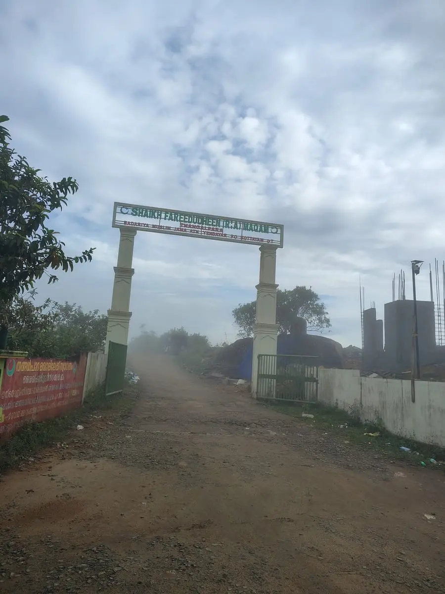
Thangalpara is a working Muslim pilgrimage centre on a bare granite dome above Vagamon, and almost everything written about it in English comes from a single paragraph on Kerala Tourism. The shrine publishes a fuller account of itself, in the open, on two signs at its own gate — and it is a far better source than anything written about it. It gives the place a name, the Shaikh Fareedudheen (R.A) Maqam; a body in charge, the Yendayar Badhariya Muslim Jama-ath; a postal address at Yendayar in Kottayam district; and a Waqf registration number.

Thangalpara, Vagamon
Practical guide

Plan Thangalpara

Who's going?Tailor Thangalpara to your trip
Before you go to Thangalpara

Open to visitors of all faiths.Kerala Tourism says of the prayer centre here that tourists are also allowed to enter, and nothing at the entrance restricts admission by religion. The one condition the shrine does impose, in writing, is dress.

Dress code
Set out in English at the entrance: only those who arrive in decent clothing will be admitted to the maqam. Dress as for any working shrine — shoulders and knees covered — and expect to remove footwear at the maqam itself.
Footwear, bags & phones
No footwear rule is published, but this is a maqam in daily use and the ordinary practice at a Muslim shrine applies: shoes off before entering the tomb chamber or the prayer space.
Busiest season
The annual Uroos in April and the monthly Swalath Majlis on the last Sunday. Both bring a crowd to a small compound on a rock.
  • Visitors are asked to keep silence, and to follow the instructions of the staff inside the compound. Drugs are prohibited within it.
  • The shrine is controlled by the Yendayar Badhariya Muslim Jama-ath, which says so at the entrance in those words.
  • It calls itself a maqam rather than a dargah — a place the saint is remembered rather than one that necessarily holds a grave. Worth knowing before you arrive expecting a tomb.

Checked 29 August 2026 against source 1source 2source 3source 4. Check the institution’s current rules and visiting session before travelling.

Typemosque
AreaVagamon
DistrictIdukki
Best timeSeptember to May, when the ground is…
Time needed1 to 2 hours
Places to visit6Listed businesses27

It also gives a life, and in detail: a birthplace in Khorasan, a father, a mother, a teacher and a date of death, set out line by line. Those details belong to one man in the whole Chishti record — Fariduddin Masud Ganjshakar, better known as Baba Farid, who died in 1265 and whose dargah has stood at Pakpattan in the Punjab ever since. That is not the contradiction it looks like, and the shrine is more careful about it than the tourism copy is. The word it uses for itself is maqam — which is not the same thing as a grave, and is much the smaller and more careful of the two claims.

The story

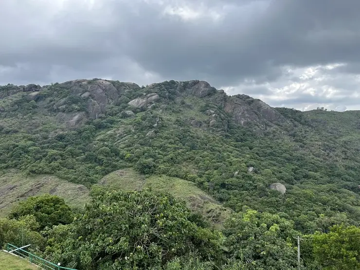
Para is rock, and the rock is the reason for the name: a dome of bare granite coming out of the grass in one unbroken sweep, dark and streaked with water in every season, with a pond at its foot and a path round the edge of it. Most people photograph it and drive away. Almost nobody reads what is written at the gate.

The story of Thangalpara

Through the arch there is a second sign, standing on bare rock, and it is the fullest published account of this place anywhere. It names the shrine — the Shaikh Fareedudheen Valiyullahi Maqam, Thangalpara–Kolahalamedu — carries a Waqf registration number, and then sets out a life line by line. Born in the Hijri year 585, in Khorasan province in what is now Afghanistan. Descended from the second caliph, Umar al-Farooq. Father Shaikh Jamaluddin Sulaiman, mother Qarsum Khatun. Taught by Qutbuddin Bakhtiar Kaki and a second Chishti master. Died on a Thursday, the fifth of Muharram, 664 AH.

Those details are worth pausing on, because they are precise rather than devotional. A father named Jamaluddin Sulaiman, a mother named Qarsum, a master named Qutbuddin Bakhtiar Kaki and a death in 664 AH belong to exactly one man in the whole Chishti record: Fariduddin Masud Ganjshakar — Baba Farid. The obvious objection follows at once: he is buried at Pakpattan Sharif, two thousand kilometres north in the Punjab, and nobody is buried in two countries.

He is not, and this shrine has never said he is. The word used at the gate is maqam, and a maqam is not a grave. In the older usage the maqamat are the places where a revered person lived, stayed or worshipped; the building raised over a body is something else and has its own word. The Malayalam record says the same thing, and it is the only one that carries the story at all: Shaikh Fariduddin Ganjshakar travelled the peninsula preaching, reached this country in the 1240s, and the Poonjar Raja granted land free of tax at Erattupetta, twenty-two kilometres west, for a memorial to him. The English record of Erattupetta has not a word of it. Kerala Tourism, meanwhile, calls this rock the saint’s final resting place — a larger claim than the shrine itself has ever made.

Then there is the rock, which is the other half of the name. This one is not a boulder but a hill of stone: the mapped outcrop covers about forty-eight hectares and runs roughly 1.4 kilometres north to south and 1.6 east to west, rising in one unbroken sweep out of grass and scrub. Photographed from below it is almost black where it is wet, and it is wet in long pale runnels down the face all year — the perennial seepage the state says does not dry even in summer, and the reason a pond lies at the foot of it. Geologically it is an inselberg: a resistant granite core left standing as the softer ground around it wore away.

What you walk into is smaller and far more domestic than the rock behind it. Through the arch there is mown grass and planted beds, and two parallel runs of stone blocks set level into the turf, curving round the edge of the pond at the foot of the dome. Benches stand on the far bank. Off the path there is a tiled pavilion — a hipped roof over an open-sided shelter, with an Islamic arch worked in white on the green gable panel — the kind of building put up for people who have come to stay a while rather than to look and drive on. Nothing about it is grand. It is the layout of a parish, and it is the plainest evidence that this is a place which expects pilgrims.

Two things about it are printed wrongly nearly everywhere. The height first. Kerala Tourism gives 2,500 metres, the travel sites give 2,500 feet, and Malayalam Wikipedia gives 1,882 metres. Read off three independent elevation models, the entrance stands at 1,070 to 1,084 metres and the top of the rock at 1,116 to 1,144 — about 3,600 feet. It is the same unit error this site has already documented at Kakkayam, where a figure was read out of the feet column of a signboard and printed as metres. The district second. The arch gives the postal address as Yendayar P.O., Kottayam, and tested point by point against the mapped administrative boundary the entrance, the sign and the whole rock fall inside Kottayam — the entrance in Kanjirappally taluk, the summit in Meenachil. Kerala Tourism heads its article “Vagamon, Idukki”. So, for now, does our own address bar.

Legend & myth

The legend is about the rock growing. It is told locally and Kerala Tourism prints it: that the stone was once small, that the saint used it to grind his betel, and that after his death it swelled to the size it is now. It belongs in the legend column rather than the geology one — but it is a fine way of saying what anyone standing there feels, which is that the rock is out of all proportion to everything around it, and that it stands where a man is remembered.

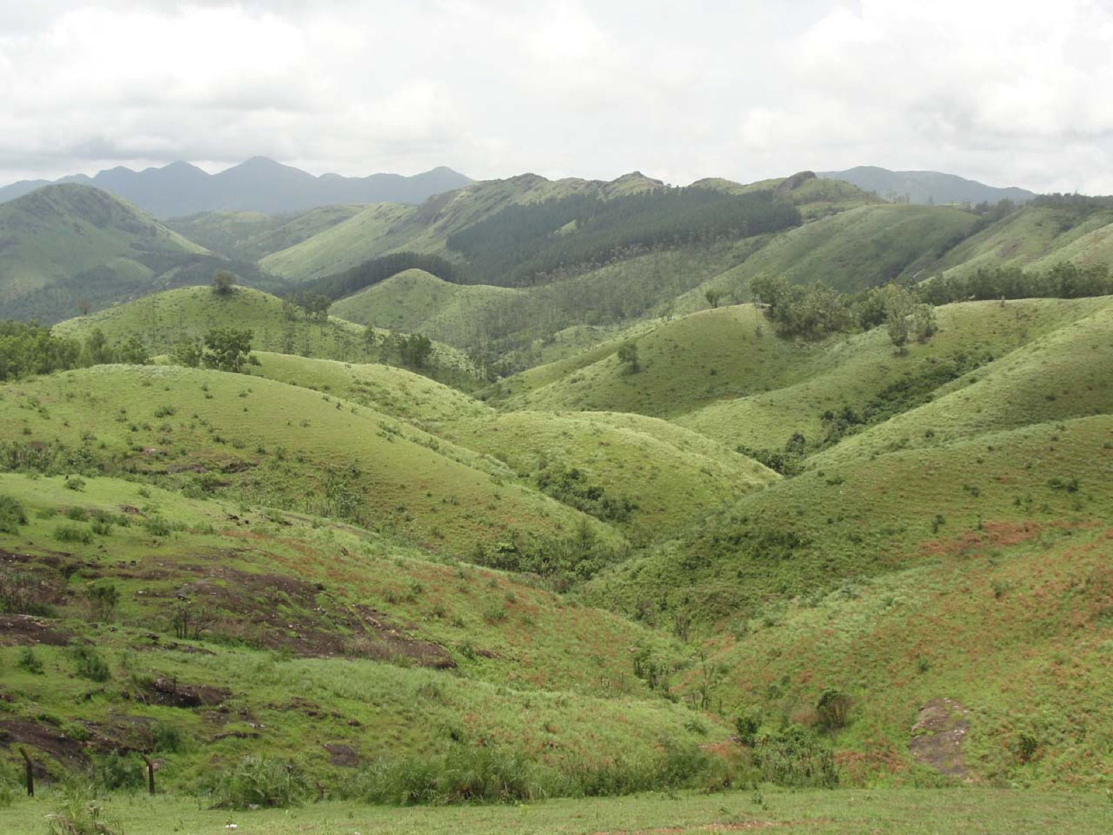
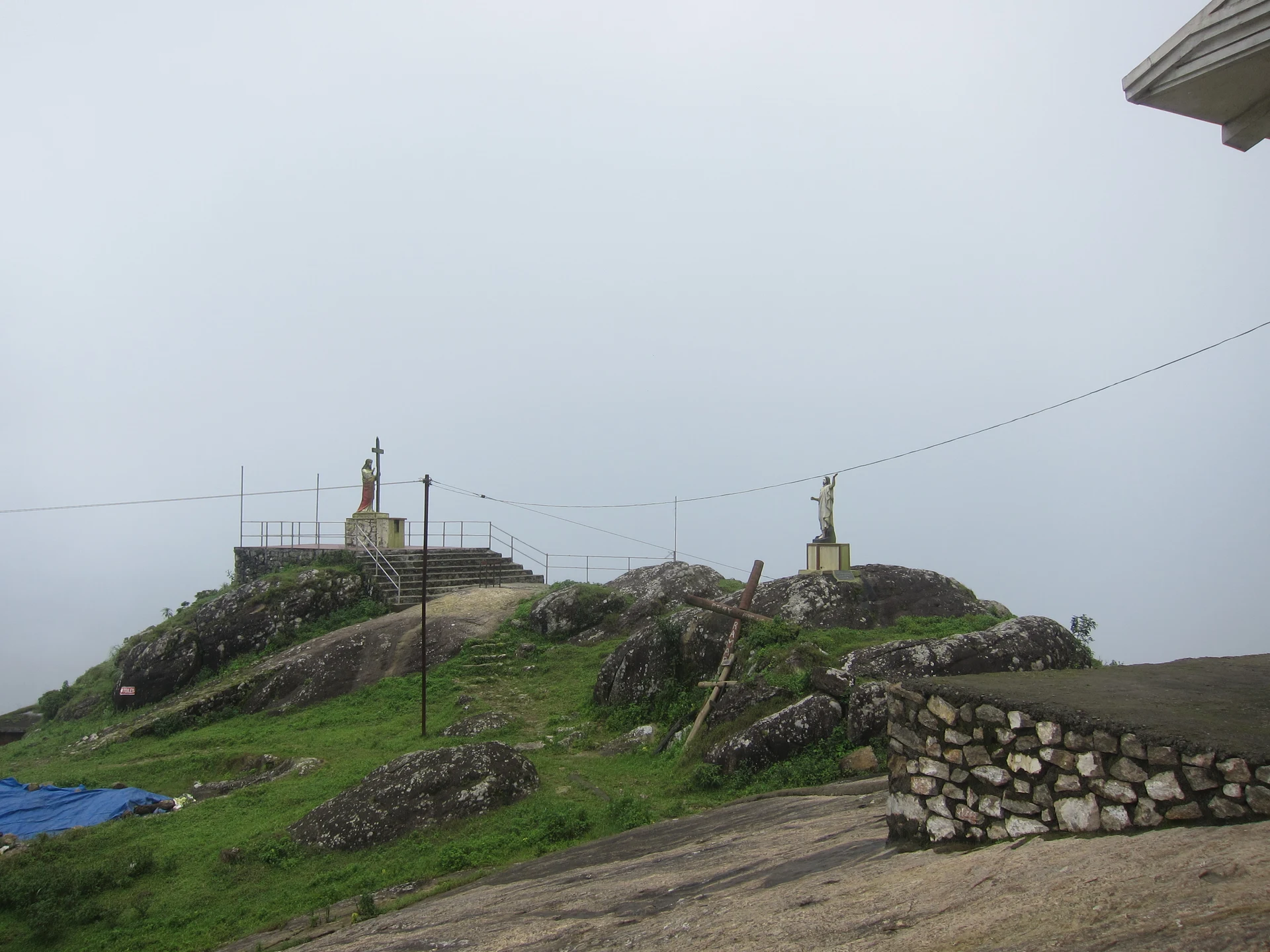
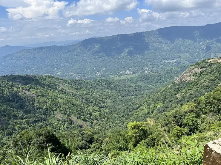
Vagamon’s hills are told as a set — Kurisumala for the Christians, this rock for the Muslims, Murugan Mala for the Hindus — and on a clear day you can pick out the other two from here. None of it was planned. Each grew on its own timeline, and the arrangement is the accident of three communities choosing the same high, quiet ground.

One name, two places. There is a Senapathi Thangalpara elsewhere in Idukki district with the tomb of Peer Muhammad — a different shrine to a different saint. Searching the name on its own will hand you the wrong one.

Read the full history of Thangalpara 436 more words

History

1240s — by the account preserved in Malayalam and nowhere in English, Shaikh Fariduddin Ganjshakar reaches this country while travelling the peninsula to preach, and the Poonjar Raja grants land free of tax at Erattupetta, then the commercial town of the Poonjar kingdom, for a memorial to him.

5 Muharram 664 AH, a Thursday — the date of death recorded at the gate here. In the Common Era it falls in 1265–66, and it is the date recorded for Baba Farid, who is buried at Pakpattan in the Punjab.

Long before either — the rock itself, a granite inselberg of the kind that stands out all along this edge of the Western Ghats. The perennial seepage in its joints is part of the headwaters of this upland; the Meenachil River rises at the edge of the Kolahalamedu ward.

Today — the site is a registered waqf under the Yendayar Badhariya Muslim Jama-ath, which is named at the gate as having complete control of it. We could not check the registration number against a public register: Kerala publishes no searchable waqf list, its gazette page asks you to obtain the date from the waqf office first, and the national portal it points at no longer resolves. The number is real and on display; the register behind it is not open to look up.

November 2025 — the compound is photographed in the middle of building work: concrete columns and standing rebar beside the gate, spoil and stacked material along the wall. Whatever is there now is newer than any published picture of it, this page’s included.

27 May 2026 — the information sign is photographed and released into the public domain, making the shrine’s own account readily available to readers for the first time.

Why visit

Because the shrine explains itself better than the guidebooks do, and the explanation is at the gate where anyone can read it.

Because the rock is genuinely remarkable — a granite dome close to a kilometre and a half across, wet down its face all year, with a pond and a level walk at the foot of it.

Because it is the quietest of Vagamon’s three hills, and the least visited.

Because it fits the Vagamon shoulder without doubling back: the paragliding ridge is 1.45 km away by road, the pine forest 2.44 and Kurisumala 4.42, so all four sit inside one half-day.

Because the saint’s other Kerala memorial stands twenty-two kilometres down the same road — the Puthuppally Maqam at Erattupetta, on the land the Poonjar Raja gave free of tax. The two belong together, and almost nothing in English connects them.
What to expect

Highlights

  • The two signs at the gate, which between them are the best account of this place in existence and cost nothing to read.
  • The rock — a granite dome about 1.4 km north to south, streaked all year with the water running down its face, with a pond at its foot and a level path around it.
  • A saint who is buried two thousand kilometres away, at a shrine that has never claimed otherwise.
  • The height, measured rather than repeated: about 1,070 m at the entrance and 1,144 at the top, on three independent elevation models. All three published figures are wrong, in three different directions.
  • The quietest of Vagamon’s three hills, and the only one that asks for silence in writing.
Getting there

How to visit

  • Drive from Vagamon. It is 5.69 km and about nine minutes, on the Pullikkanam–Elappara road, the Erattupetta–Peermade road and then the Kurishumala–Thangalpara Road.
  • Expect the last stretch to be unsealed. Photographs from November 2025 show gravel and earth with a crash barrier along the drop, and Kerala Tourism describes the place as reachable by jeep over muddy and rocky roads.
  • Come as you would to a shrine rather than to a viewpoint. This is a place of prayer in daily use, and it sets conditions on how visitors arrive dressed.
  • Without a car, the road to aim for is the Erattupetta–Peermade route; from the junction a mapped footway called the Thangal Para access road runs 313 metres to the entrance, and it is the only way in on foot anyone has mapped.
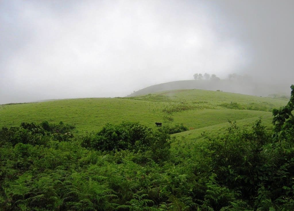
  • Go early. Cloud closes this dome in within minutes and can sit on it for days, and the compound is at its quietest in the first hour.

Distance by road

  • Kochi107 km
  • Madurai172 km
  • Thiruvananthapuram226 km
  • Coimbatore252 km
  • Kozhikode276 km

Road km to Idukki; ghat roads and traffic vary — allow extra.

Timing

Best time

September to May, when the ground is firm and the rock is out of cloud. The dome sits at over a thousand metres on the wettest edge of the Vagamon shoulder, and roughly half the published photographs of it are mist. April brings the Uroos and the largest crowds of the year; on any other day, early morning is when the rock is clearest and the compound quietest.

Weather in ThangalparaSeasonal guide

Live forecast loads in your browser.

Today at Thangalpara
Sunrise6:12 am
Sunset6:21 pm
Golden hour best light5:21 pm–6:21 pm
Blue hour after sunset6:21 pm–6:46 pm
Sun sets toward compass bearingW · 272°
Moon tonight🌓 First quarter · 52%
South-west monsoon. June to September is the south-west monsoon in Kerala. Expect heavy showers, mostly in bursts rather than all day — carry rain cover, allow extra time for getting around, and note that ferries and open-air sites are the first things affected.

Sun and moon are calculated for this location and shown in IST. Photography windows are the hour around sunrise and sunset; the sunset bearing is degrees clockwise from true north. Moon phase is accurate to about half a day.

Visitor notes

  • This is a place of worship in daily use, not a viewpoint with a shrine attached.
  • The compound was being built on when it was last photographed in November 2025, with concrete columns and rebar standing beside the gate. Expect the ground to have changed since any picture you have seen, ours included.
  • The postal address at the gate is Yendayar P.O., Kottayam — not Idukki, where most guides and, for now, our own address bar file it.
  • One name, two places: there is a second Thangalpara elsewhere in Idukki, holding the tomb of a different saint. Searching the name alone will hand you the wrong one.
Safety

Good to know

  • It is bare rock, and the water running down its face keeps parts of it wet in every season. Granite under a film of water is as slippery as anything in these hills.
  • There is no fence between the made ground and the water at the foot of the dome, and none on the rock itself.
  • Cloud can close the site in within minutes and stay for days.
  • The last kilometre of road is unsealed and unlit, with a drop on one side behind a crash barrier.
Stay · eat · do · rent · see · shop

Stays, food & things to do near Thangalpara

Verified hotels, homestays, restaurants, experiences, sights, shops and rentals around Thangalpara — commission-free, with direct contact. Filter by what you need.

3 places to eat near Thangalpara

Vagamon Cafe — Multi-cuisine family restaurant in Vagamon
Verified
Multi-cuisine family restaurant · Vagamon
Vagamon Cafe

Vagamon Cafe is a well-known multi-cuisine family restaurant in Vagamon town. It seats up to 180 guests across Kerala, South Indian, North Indian and Arabic menus.

Directions Commission-freeView details
Sobremesa Restaurant Vaasta Vagamon — Multi-cuisine restaurant in Vagamon
Verified
Multi-cuisine restaurant · Vagamon
Sobremesa Restaurant Vaasta Vagamon

Vaasta Vagamon restaurant serving Indian, Chinese and Continental food on Palozhukumpara Waterfalls Road.

Directions Commission-freeView details
Palette Hill View Restaurant Vagamon — Multi-cuisine restaurant in Vagamon
Verified
Multi-cuisine restaurant · Vagamon
Palette Hill View Restaurant Vagamon

Restaurant at Palette Hill View Resort for Vagamon meadow and hill-route visitors. Vagamon, eat, Multi-cuisine restaurant.

Directions Commission-freeView details

Book with the place itself. India’s cyber-crime coordination centre warned in April 2025 that convincing copies of hotel and pilgrimage booking sites are being pushed through sponsored search and social ads, taking payment for rooms the property never hears about. Every listing here links to the business’s own contact details and its own Google or Bing profile — we take no commission and sit in nobody’s payment path. If a booking page reached you through an ad, check the address bar against the property’s own site before you pay. Fraud can be reported on cybercrime.gov.in or on 1930.

Ranked lists

The best of Vagamon, ranked

Browse food, accommodation and activities across Vagamon. Check each address and journey before adding it to your day; these selections are not all beside Thangalpara.

Ranked guides

Top experiences around Vagamon

6 more places around Vagamon. Open a guide to plan the visit and onward journey.

hill stationVagamon

5.7 km · 9 min drive

Rolling meadows, pine patches and viewpoints on the Idukki/Kottayam highland edge.

hill stationVagamon meadows

1.5 km · 18 min walk

Open meadow landscape forming the classic Vagamon sightseeing circuit.

viewpointPine forest

2.4 km · 3 min drive

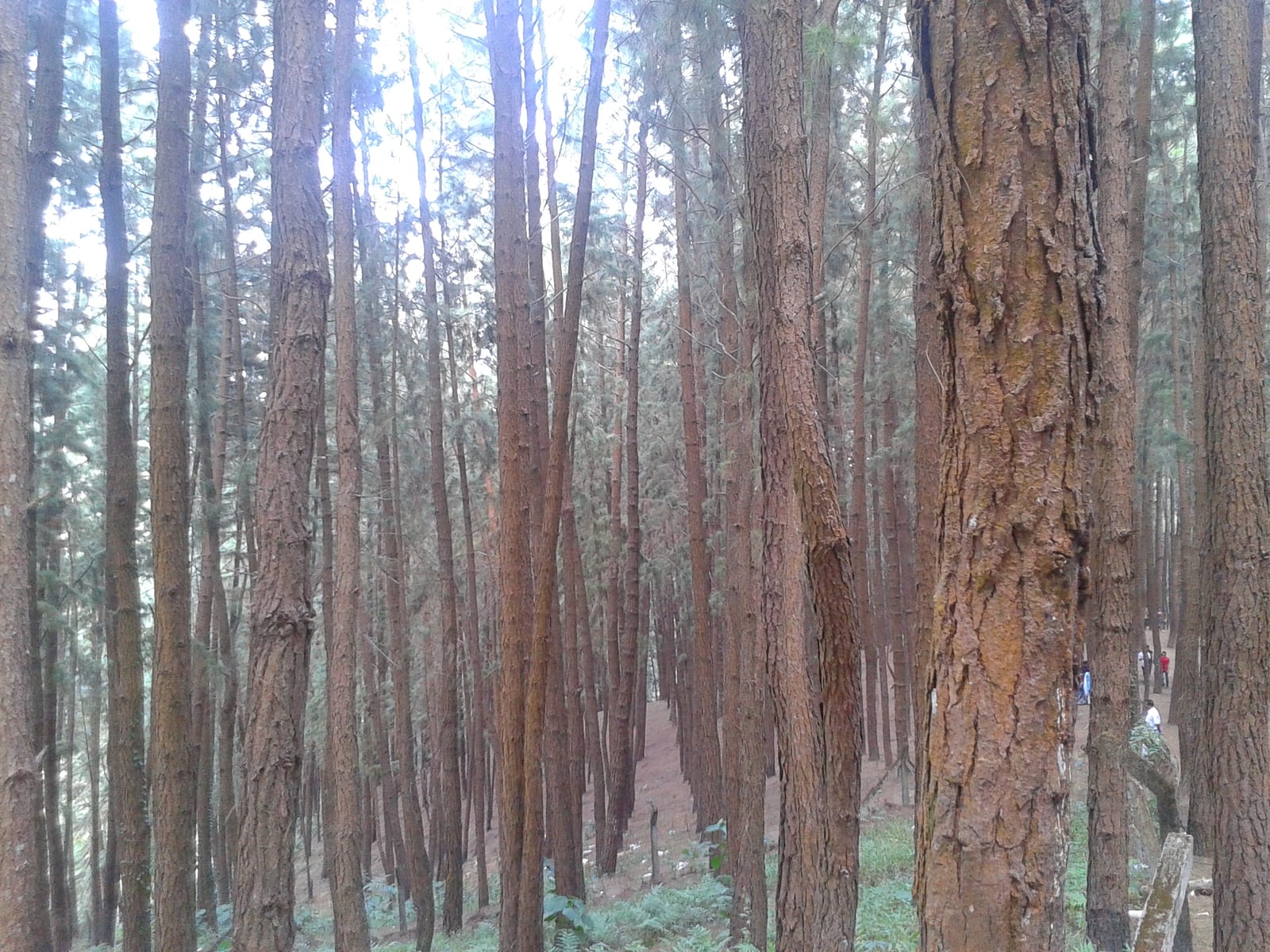
A 61.40-hectare plantation of Caribbean pine on the Kolahalamedu shoulder above Vagamon — planted in rows by the Kerala Forest Department’s research wing on land that was not legally forest at all until March 2021, and run today as a ticketed ecotourism centre with a counter, a car park and a made path. Every travel site calls it a British-era forest; the state’s own record calls it the Kolahalamedu Pine Plantation.

churchKurisumala

4.4 km · 11 min drive

The pilgrim hill above Vagamon — a bare rock dome climbed by a 1.2 km path lined with the Stations of the Cross to St Thomas Church on the summit, and, 818 m away and lower down, the separate Cistercian monastery of Kurisumala Ashram, founded in 1958. Most descriptions run the two together; they are different places with different approaches and different people in charge.

viewpointParagliding viewpoints

1.5 km · 18 min walk

The Kolahalamedu ridge above Vagamon — grass hills the state names as one of only two accredited paragliding sites in Kerala, and the launch ground for a carnival its own website has not updated since 2015. What you come for is the open meadow ridge and the valley it drops into; whether anyone is flying on the day is a question for a licensed operator, not a website.

trekVagavanam Windy Walk trek

15.7 km · 25 min drive

The Forest Department’s guided walk on the grass tops at the southern end of the Idukki Wildlife Sanctuary, about ten kilometres by road from Vagamon — some seven kilometres on foot up jeep track and open ridge, with the Idukki reservoir catchment below you. The state will not sell it to fewer than six people, and it will not take more than seven.

Roampedia is commission-free — own or know a stay, eatery, guide or shop near Thangalpara? List it and it appears here once verified.

Add a nearby business
Before you go

Thangalpara — at a glance

DifficultyEasy
DistanceA short walk on made ground — a stone-block path runs round the pond at the foot of the dome. The rock itself rises about 40 m above the entrance and is not a marked route.
TimingsNot published, and we would rather say so than guess. The sign at the entrance carries an entrance timing, but the only photograph of it does not resolve the figures and no other source prints them. Treat the compound as open in daylight and confirm on the spot.
Best timeSeptember to May, when the ground is firm and the dome is out of cloud. This is the wettest edge of the Vagamon shoulder and roughly half the published photographs of the rock are mist. Early morning is when it is clearest and the compound quietest.

Entry: None is published anywhere, and nothing at the entrance carries a tariff. This is a shrine run by a local Jama-ath rather than a ticketed attraction, so expect a donation box rather than a counter — and free food at the monthly majlis rather than anything for sale.

Festivals: The Uroos, the shrine's annual festival, falls in April and is the busiest time of its year. Monthly, the Thangalpara Swalath Majlis is held on the last Sunday of every English month from 11:30 am to 1:00 pm, with food distributed free. Both fill a small compound on a rock, and both are the place doing what it exists to do rather than standing empty.

Photography: No photography rule is published or posted. It is a working shrine and silence is asked for, so treat the maqam itself as you would any place of prayer, and ask before photographing people at it.

Booking: None. Nothing here is bookable, and no contact number for the shrine is published anywhere.

Parking: No formal car park is mapped or published. The approach road is unsealed near the site and vehicles stop where the ground allows; photographs from November 2025 show a jeep at the roadside by the gate.

Getting here

How to reach Thangalpara

  • ✈︎ By air Cochin International at Nedumbassery, about 105 km by road, again Kerala Tourism's own figure for this site.
  • 🚆︎ By train Kottayam is the nearest railhead, about 65 km away by road, which is the figure Kerala Tourism gives for this site. Everything from there is by road.
  • 🚗︎ By road From Vagamon take the Pullikkanam–Elappara road, join the Erattupetta–Peermade road and turn onto the Kurishumala–Thangalpara Road for the last 1.3 km. ⚠ Watch the name on that turn: a separate set of ways nearby is mapped as the Kurishumala–Thangalpara Track Road, surfaced with cobblestone and recorded as being in bad condition. One word apart, and only one of them is a road. The final approach is unsealed either way — gravel and earth with a crash barrier on the drop side. If you are set down at the junction rather than driven to the gate, there is a mapped footway off that tertiary road, named the Thangal Para access road: 313 metres, and it ends at the entrance.
  • 🚌︎ By bus Buses run the Erattupetta–Peermade road, which is the road you turn off. There is no published service to the shrine itself and no timetable we can verify, so treat the last stretch as a walk, an autorickshaw or a jeep from the junction. The walk is the 313-metre footway named above, and it is the only mapped way in on foot.
Getting back

If you are travelling by bus or ferry, check the return service with the operator before setting out. Leave time to reach the stop or jetty after your visit.

Ask at the bus stand for the time of the last service back, not the next one. If you miss it, an auto or app cab is the fallback — agree the fare before you get in.

Do

Things to do

  • Read the two signs at the gate. Between them they give the saint, the body in charge, the conduct expected and the calendar, and they are the only real source on this place.
  • Walk the path round the water at the foot of the dome, which is where most visitors spend their time.
  • Look at the face of the rock for the pale runnels of water coming down it, which run even in the dry months.
  • Come on the last Sunday of a month, if you would rather see the place in use than look at it.
  • Pick out Kurisumala and Murugan Mala from here on a clear day — the other two of Vagamon's three hills.
  • Carry on to Erattupetta, 22 km west, where the saint's other memorial stands on land the Poonjar Raja granted free of tax.
Plan

Good to know

  • Go early for the rock. Cloud closes this dome in within minutes and can sit on it for days.
  • Allow for the last kilometre. It is unsealed and slower than the distance makes it look.
  • Do your eating and buying in Vagamon before you come up. Nothing is published as being on sale at the shrine, and the last kilometre is not a road anyone wants to drive twice for a bottle of water.
  • Do not plan around an opening time you have read online. Nobody has published one anyone can stand behind, ourselves included.
Facilities

On site

  • A gated entrance under a signed arch
  • An information sign at the entrance
  • A tiled pavilion at the foot of the rock
  • A stone-block path and benches round the pond
Stay safe

Safety

  • The last kilometre of road is unsealed and unlit, with a drop on one side behind a crash barrier.
  • Cloud can close the site in within minutes and takes the visibility with it.
  • Bare granite with water running down it is as slippery as anything in these hills, and it is wet in every season.
  • Building work was in progress when the site was last photographed in November 2025 — expect open ground and stacked material near the gate.
Getting around ThangalparaPartly wheelchair accessible
Terrain
Mostly flat
From the entrance
Level made ground at the site, rough road getting to it. Photographs from November 2025 show a gravel-and-earth approach with a crash barrier on the drop side, a gated arch, and then inside the compound a stone-block path laid through grass, running level round the pond at the foot of the rock, with benches beside it and a tiled pavilion off it. That path is the part of Thangalpara most visitors use and it has no steps. The granite dome itself rises about 40 m above the entrance in one unbroken sweep. A footway is mapped running on from the entrance for 650 m towards the high ground at the centre of the rock, but weigh it carefully before you count on it: it was drawn in 2012 by the same mapper whose two guesses at where this place is were 605 m apart, it has not been revised since, and it carries no name, no surface and no condition of its own. Treat it as a line on a map rather than as a path anyone has promised you.
Step-free access
⚠ Partly, and the qualification is the road rather than the site. The made ground inside is genuinely promising: a level stone-block path on grass, benches, and the rock and the water in full view from it, which is most of what there is to see here. Getting to it is the problem. The last stretch of approach is unsealed, there is no formal or mapped parking, and the compound was under construction when it was last photographed. No accessible route, ramp or accessible toilet is published for this site by anyone, and no photograph of the maqam building itself exists, so the approach to the tomb is genuinely unknown rather than merely unassessed — treat it that way if you need certainty.
Prams
On the made path round the water, yes. On the approach road and the open ground by the gate, expect gravel, loose earth and building materials. A carrier is the safer answer while the works are going on.

A gated entrance under a signed archAn information sign at the entranceA level stone-block path and benches round the pondA tiled pavilion in the grounds

  • No fence between the made ground and the water at the foot of the dome, and none on the rock itself.
  • The dome is not a marked route — 40 m of bare granite in one sweep, wet down its face in every season.
  • The ground between the gate and the made path is loose earth and gravel while the building work continues.
  • The approach road is unsealed near the site, with a drop on one side behind a crash barrier, and it is unlit.

Checked 29 August 2026 against source 1source 2source 3source 4. Conditions change and surfaces vary with weather — if step-free access is essential, confirm with the site before you travel.

Practical things near Thangalpara

These services are listed within about 1.2 km of Thangalpara. Walking distances follow mapped routes; access and opening hours can change. Other services may be closer but are not included here.

Nearby

What’s near Thangalpara

hill stationVagamon meadows

Open meadow landscape forming the classic Vagamon sightseeing circuit.

1.5 km · 18 min walk · straight line
viewpointParagliding viewpoints

The Kolahalamedu ridge above Vagamon — grass hills the state names as one of only two accredited paragliding sites in Kerala, and the launch ground for a carnival its own website has not updated since 2015. What you come for is the open meadow ridge and the valley it drops into; whether anyone is flying on the day is a question for a licensed operator, not a website.

1.5 km · 18 min walk
viewpointPine forest

A 61.40-hectare plantation of Caribbean pine on the Kolahalamedu shoulder above Vagamon — planted in rows by the Kerala Forest Department’s research wing on land that was not legally forest at all until March 2021, and run today as a ticketed ecotourism centre with a counter, a car park and a made path. Every travel site calls it a British-era forest; the state’s own record calls it the Kolahalamedu Pine Plantation.

2.4 km · 3 min drive
churchKurisumala

The pilgrim hill above Vagamon — a bare rock dome climbed by a 1.2 km path lined with the Stations of the Cross to St Thomas Church on the summit, and, 818 m away and lower down, the separate Cistercian monastery of Kurisumala Ashram, founded in 1958. Most descriptions run the two together; they are different places with different approaches and different people in charge.

4.4 km · 11 min drive
hill stationVagamon

Rolling meadows, pine patches and viewpoints on the Idukki/Kottayam highland edge.

5.7 km · 9 min drive
hill stationKuttikkanam

Peermade-side hill-station and adventure-tourism area, useful for tea estates, pine roads and central high-range routing.

10.9 km · ~18 min by cab · straight line
hill stationPeermade

Peermade, also written Peerumedu or Peermede, is a plantation settlement and highland landscape on the Kottayam–Kumily road in Idukki. The map uses the town centre as a visitor base, not a single hilltop attraction.

13.5 km · ~23 min by cab · straight line
A
Ayyappancoil Hanging Bridge
Place
heritageAyyappancoil Hanging Bridge

The long pedestrian suspension bridge above the Idukki reservoir at Ayyappancoil, valued for water and hill views as well as the crossing itself.

14.6 km · ~24 min by cab · straight line
wildlifeIdukki Wildlife Sanctuary

Protected forest around the Idukki and Cheruthoni reservoirs near Painavu, with hilly evergreen woodland, elephants and boat-and-trek access arranged through the Forest Department.

15.6 km · ~26 min by cab · straight line
trekVagavanam Windy Walk trek

The Forest Department’s guided walk on the grass tops at the southern end of the Idukki Wildlife Sanctuary, about ten kilometres by road from Vagamon — some seven kilometres on foot up jeep track and open ridge, with the Idukki reservoir catchment below you. The state will not sell it to fewer than six people, and it will not take more than seven.

15.7 km · 25 min drive
damKulamavu Dam

Kulamavu is KSEB’s gravity dam on Kilivallithodu and one of three dams forming the Idukki reservoir. Visit through the hydel-tourism arrangements; reservoir views do not authorise entry to restricted infrastructure.

15.9 km · ~27 min by cab · straight line
viewpointPanchalimedu

Meadow and hill-viewpoint landscape near the Peermade/Kuttikkanam side of Idukki.

16.0 km · ~27 min by cab · straight line

All 6 places to visit in Vagamon →

Walking and driving times are real routed distances, except the few marked “straight line”, which are direct-line estimates and will read short. Fare figures are estimates from Kerala’s notified auto/taxi tariff and exclude waiting and night charges. Routing: © openrouteservice.org by HeiGIT | Map data © OpenStreetMap contributors

Nearby toilets, pharmacies, ATMs, seating and vets are community-mapped and may be incomplete or out of date. Map data © OpenStreetMap contributors | Walking times © openrouteservice.org by HeiGIT

On the map

Where Thangalpara is

Good to know

Thangalpara — frequently asked

Who is the saint at Thangalpara?

Fariduddin Masud Ganjshakar, known as Baba Farid. The shrine names him as Shaikh Fareedudheen Valiyullahi and sets out his father, his mother, his teacher and his date of death — details that belong to Baba Farid alone, who died in 1265 and whose dargah is at Pakpattan in the Punjab. The site calls itself a maqam, which marks a place where a revered person lived, stayed or worshipped rather than necessarily a grave, and Malayalam sources say Baba Farid travelled through this country in the 1240s.

Which district is Thangalpara in — Idukki or Kottayam?

Kottayam, on the evidence. The postal address at the entrance gives Yendayar P.O., Kottayam District, and tested against the mapped administrative boundary the entrance, the sign and the rock all fall inside Kottayam — the entrance in Kanjirappally taluk, the summit in Meenachil. Kerala Tourism files it under Idukki, as does our own address bar for now. The border genuinely runs across this upland: the paragliding ridge and the pine forest a couple of kilometres away really are in Idukki, and so is Vagamon town.

How high is Thangalpara?

About 1,070 to 1,084 metres at the entrance and 1,116 to 1,144 at the top of the rock — roughly 3,600 feet — read off three independent elevation models. The published figures are all wrong and in different directions: 2,500 metres from Kerala Tourism, 2,500 feet from the travel sites, 1,882 metres from Malayalam Wikipedia.

Is there an entry fee, and who runs it?

There is no published fee and nothing at the entrance carries a tariff. The shrine is controlled by the Yendayar Badhariya Muslim Jama-ath, which is named at the gate in those words, and it holds a Waqf registration number — though Kerala publishes no searchable waqf register to check it against. Expect a donation box rather than a counter.

What happens at Thangalpara, and when?

Two things are published. The Swalath Majlis is held on the last Sunday of every English month from 11:30 am to 1:00 pm, with food distributed free. The annual Uroos festival falls in April and is the busiest time of the shrine’s year. Visitors are asked to keep silence, to arrive in decent clothing and to follow the staff’s instructions inside the compound.

How do I get to Thangalpara from Vagamon?

It is 5.69 km and about nine minutes by road, on the Pullikkanam–Elappara road, then the Erattupetta–Peermade road, then the Kurishumala–Thangalpara Road. The last stretch is unsealed — photographs from November 2025 show gravel and earth with a crash barrier along the drop — and Kerala Tourism describes the place as reachable by jeep over muddy and rocky roads.

Why is it called Thangalpara?

Para is rock, and thangal is the honorific used in Kerala for a sayyid, a man of the Prophet’s lineage, and by extension for a revered Muslim holy man. Thangalpara is the thangal’s rock — a description of what is there rather than a formal name, which is why the same name attaches to a different shrine elsewhere in Idukki district.

Is there really a cave at Thangalpara?

Kerala Tourism says there is an ancient cave near the rock, and that a masjid, a tomb, a prayer centre and a well stand beside it. We could not corroborate the cave from any second source and it is not mapped, so we print it as the state’s claim rather than as something to set out to find.

When is the best time to visit Thangalpara?

September to May, when the ground is firm and the rock is out of cloud. The dome sits at over a thousand metres on the wettest edge of the Vagamon shoulder, and roughly half the published photographs of it are mist. April brings the Uroos and the largest crowds of the year; on any other day, early morning is when the rock is clearest and the compound quietest.

What are the entry fee and timings at Thangalpara?

Entry: None is published anywhere, and nothing at the entrance carries a tariff. This is a shrine run by a local Jama-ath rather than a ticketed attraction, so expect a donation box rather than a counter — and free food at the monthly majlis rather than anything for sale. Timings: Not published, and we would rather say so than guess. The sign at the entrance carries an entrance timing, but the only photograph of it does not resolve the figures and no other source prints them. Treat the compound as open in daylight and confirm on the spot.

How do I reach Thangalpara?

Drive from Vagamon. It is 5.69 km and about nine minutes, on the Pullikkanam–Elappara road, the Erattupetta–Peermade road and then the Kurishumala–Thangalpara Road. Expect the last stretch to be unsealed. Photographs from November 2025 show gravel and earth with a crash barrier along the drop, and Kerala Tourism describes the place as reachable by jeep over muddy and rocky roads. Come as you would to a shrine rather than to a viewpoint. This is a place of prayer in daily use, and it sets conditions on how visitors arrive dressed. Without a car, the road to aim for is the Erattupetta–Peermade route; from the junction a mapped footway called the Thangal Para access road runs 313 metres to the entrance, and it is the only way in on foot anyone has mapped. Go early. Cloud closes this dome in within minutes and can sit on it for days, and the compound is at its quietest in the first hour.

How much time do I need for Thangalpara?

1 to 2 hours — longer if you walk the path round the water at the foot of the rock, which is where most visitors spend their time.

What else is near Thangalpara?

Nearby you can pair Vagamon meadows (1.5 km), Paragliding viewpoints (1.5 km), Pine forest (2.4 km), Kurisumala (4.4 km).

What should I know before visiting Thangalpara?

It is bare rock, and the water running down its face keeps parts of it wet in every season. Granite under a film of water is as slippery as anything in these hills. There is no fence between the made ground and the water at the foot of the dome, and none on the rock itself. Cloud can close the site in within minutes and stay for days. The last kilometre of road is unsealed and unlit, with a drop on one side behind a crash barrier.

Read before you go

Thangalpara guides, stories & itineraries

Stories & history of Thangalpara

Written about Thangalpara itself — its history, its legends and the arguments about them.

Around Vagamon

These guides explore Vagamon and the surrounding area. Choose a visit that fits your interests, allowing separately for travel between stops.

Kerala-wide guides & itineraries

Route-level itineraries and practical guides for the rest of Kerala.

See all 152 Idukki guides & stories →

Image credits

Photographs: Manukrishnan80 (CC BY-SA 4.0), Neoammil (CC0). Wikimedia Commons.