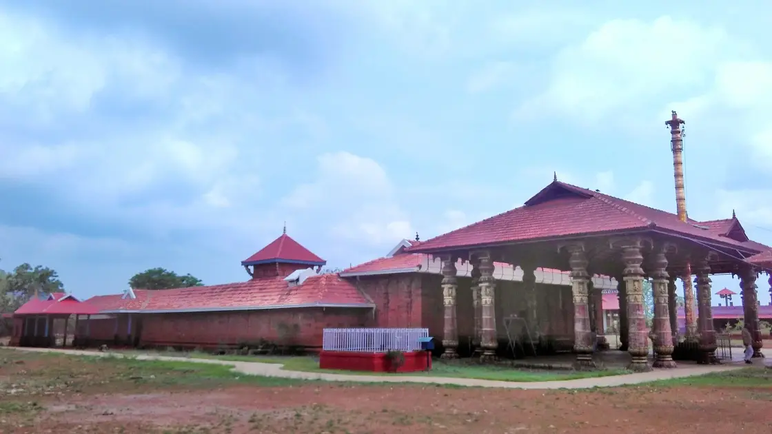
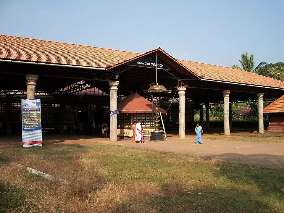
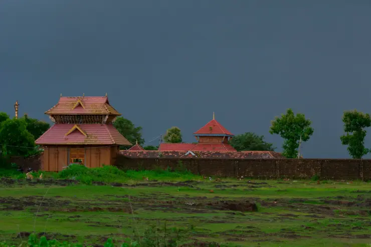
A dark laterite wall runs across the open ground, holding a cluster of red roofs within it. At the entrance, turned pillars support a broad tiled shelter; a tall lamp and flagstaff line up with the worship space beyond. Outside that enclosure, Madayipara opens again into low rock, seasonal grass and the separate Vadukunda pond.
The story of Vadukunnu Siva Temple
The name on the temple’s own entrance board is Madai Sree Vadukunda Siva Temple. This is the Shiva shrine on Madayipara in Kannur district, reached from Pazhayangadi. The spelling Vadukunnu survives in this guide’s route, but it should not lead a visitor to Vadakkunnathan in Thrissur. The names are similar enough for a careless search to cross districts; the temple board, plateau setting and local approach establish which place is intended.
The immediate landscape is low coastal laterite, not a Western Ghats mountain station. Madayipara rises above the settled country around Pazhayangadi, opening views beyond its edges while retaining broad stretches of relatively open ground on top. That combination explains the temple’s visual presence: red roofs and a dark wall stand out against a surface whose cover changes dramatically with the rains. The horizon is part of the experience, but the ground underfoot deserves as much attention.
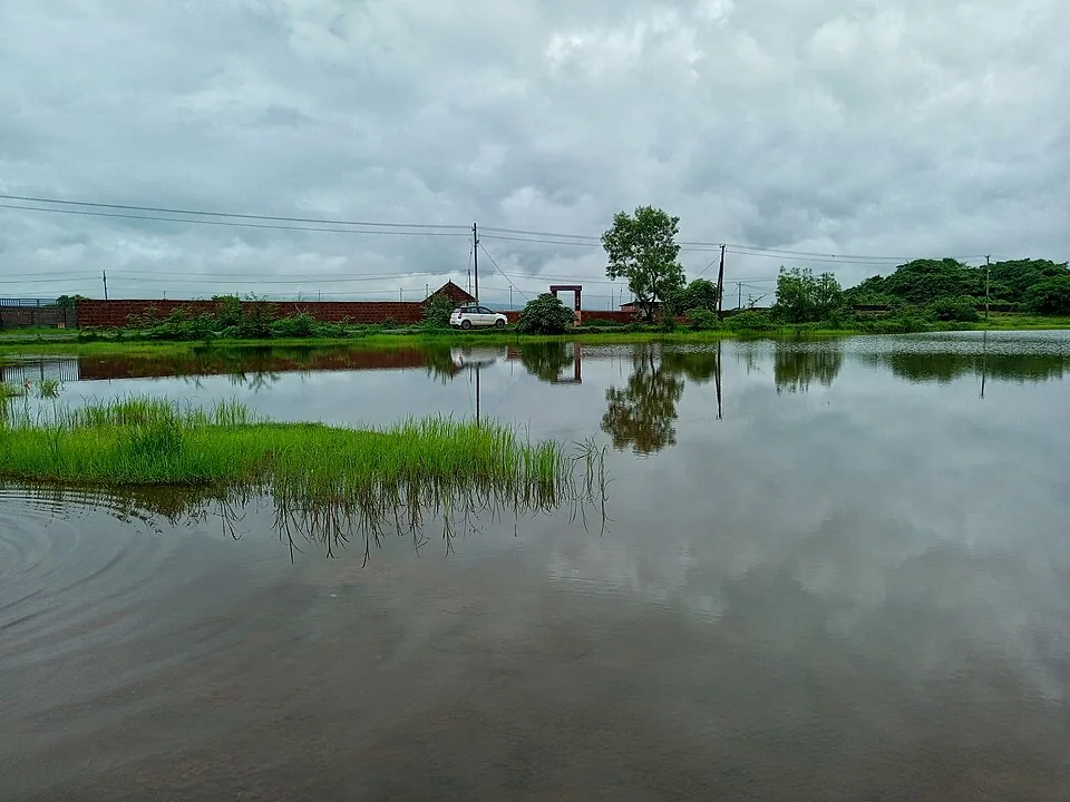
The temple and its pond are separate features. The shrine is a roofed and enclosed worship space; the pond occupies a depression outside it. A map result for the water does not bring a vehicle to the temple entrance. For someone arriving to pray, the named temple approach is the correct base. For someone interested in the landscape, the water can be appreciated from a safe bank without entering the ritual enclosure.
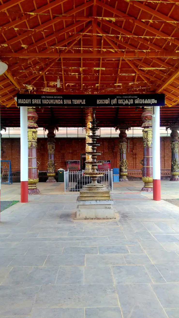
The entrance photograph provides a useful orientation. A long signboard spans the porch, with English and Malayalam naming the shrine. Below it stand a multi-tiered lamp and, behind, the taller flagstaff. The carved columns are markedly different from the plain outer supports. Look at those relationships from the permitted approach: the objects organise a line towards the temple, so the space between them should be kept clear for worship rather than occupied as a photographic set.
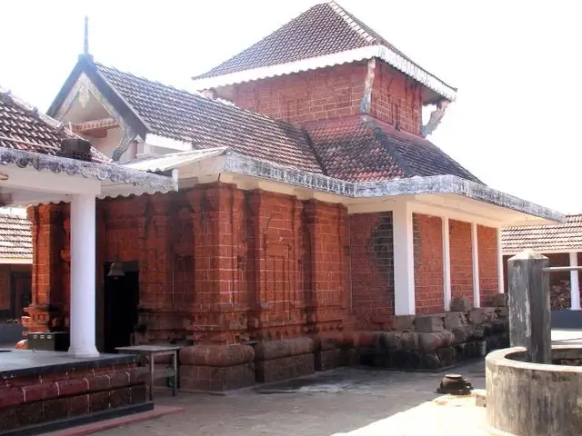
The outer wall is more than a convenient foreground. It draws a boundary between the open plateau and the ordered space of the shrine. Red tile, laterite masonry and the smaller roofs within the enclosure form a compact group rather than a single towering urban gateway. Seeing that low profile is one reason to pause outside before entering. It also prevents the whole plateau from being misrepresented as temple premises open under one set of rules.
The community’s account identifies Shiva as the presiding deity and describes the lingam as swayambhu, or self-manifested. That is a statement of sacred tradition. The same account mentions Ganapathy and Ayyappa in the temple’s ritual setting. A visitor should not transfer the deities, legends or entry customs of another Kannur shrine simply because it stands nearby or shares a Kerala architectural vocabulary.
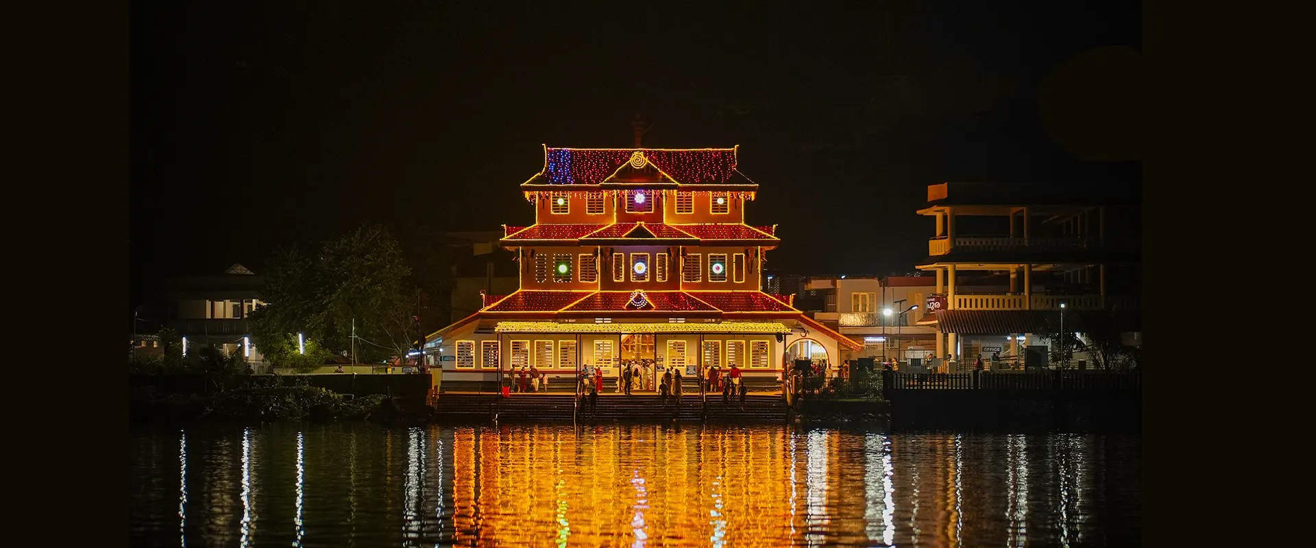
The pond has a specific place in the annual ritual account: the festival culminates in a holy bath associated with the deity. That connection gives the water a role beyond reflecting the sky. It does not turn the pond into a managed swimming area. A photograph showing someone in the water records an individual moment, not a general access policy, and an observer can understand the ritual geography without descending to the waterline.
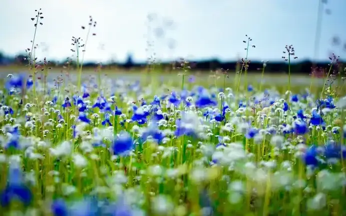
Madayipara’s wet season produces a close-grained landscape. Water sits in shallow depressions; green cover occupies thin soil around darker rock; small flowering plants can make a broad field look coloured from a distance. Those details are easily missed by someone walking straight towards a skyline photograph. The useful observation is how the ground changes over a few steps, not whether the entire plateau resembles the most colourful image on a tourism poster.
In the dry season, more of the laterite surface becomes visible and grass changes colour. The temple’s roofline can then seem more exposed against the sky. This seasonal contrast is part of the place, rather than evidence that the landscape has failed to deliver its “correct” appearance. A December photograph and a rain-season photograph may show strikingly different colours while both truthfully describe Madayipara.
The open ground also makes visitor pressure visible. A fresh vehicle track cuts across vegetation more sharply than it would on a paved urban approach, and walking around wet patches can widen a path into several parallel lines. Use the established road and foot access even when an apparent shortcut crosses open space. A small temple visit can be made without turning the surrounding plant community into an informal car park.
The plateau contains other religious and historic features, including Madayikavu. Their presence enriches a wider Madayipara outing but does not make them parts of Vadukunda’s shrine. The temple’s own archived festival page explicitly distinguishes Madayikavu’s Pooram from its own revived annual celebration. This matters for travellers choosing a date: a festival poster using Madayi in its address needs the institution’s full name checked.
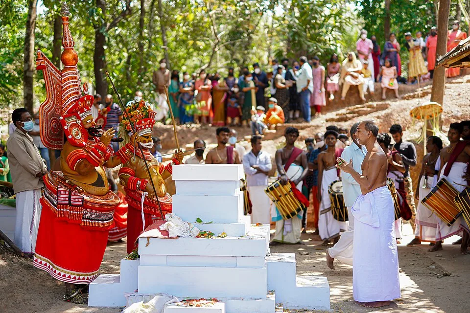
The experience changes during a ceremony. The same forecourt used for a quiet weekday approach can become circulation space for participants, attendants and processional movement. Visitors should use the viewing position offered by the organisers and keep routes clear. A description of Thidambu Nrutham or Pallivetta in an older programme is a way of understanding the tradition, not a promise that a performance will occur on any casual visit.
For an architectural visit, the strongest sequence is simple: recognise the temple from its board, look at the porch and enclosure, then step back to see how the roofline sits on the plateau. For a devotional visit, the sequence is determined by the temple’s current practice. Neither requires a long hike, and neither should be sold as unrestricted access to the innermost worship space.
Pazhayangadi remains important even when the temple is the purpose of the trip. It is the transport settlement below the plateau, with a railway station and road connections. Arranging the descent from there makes a short visit more dependable than assuming a vehicle will be waiting at an isolated patch of open ground. The last-mile arrangement matters particularly if the plan ends after an evening ritual.
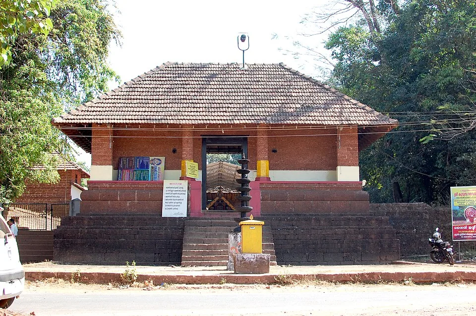
The named entrance gate is a distinct building from the pillared porch shown in many temple photographs. Kerala Tourism’s entrance frame shows carved double doors beneath two stages of red tiles, with a large tree to one side and the laterite enclosure continuing outward. A short metal railing stands in front of the doorway; the approach is earth, with puddles in the photograph. This is the gate identified by the map marker. The open pillared shelter and tall flagstaff belong to the next architectural view, rather than proving that a vehicle can drive directly to the shrine.
The difference between a gate and a porch is useful when explaining the visit to someone who needs assistance. Reaching the outside door answers only the first access question. The threshold, internal surface and route to the permitted worship area still matter. A photograph can reveal that sequence but cannot guarantee today’s arrangement at each transition. Name the gate when discussing arrival and the required interior destination when discussing assistance; otherwise two people can answer different access questions while both say that the temple is reachable.
The temple community’s archived ritual account describes worship at the main Shiva shrine and the subsidiary Ganapathy and Ayyappa shrines. It names Pradhosha Pooja, Ganapathi Homam, Mrithyumjaya Homam and Niramala among the offerings. These names describe the devotional life recorded by the community, rather than a current visitor menu. An offering requested by a worshipper and a general architectural visit are different purposes, so make any ritual arrangement through the temple itself instead of treating an old web list as a booking confirmation.
The broader plateau contains water features with very different forms. Kerala Tourism maps Vadukunda Temple Pond separately from a well and a further rock pond, and its photographs show the distinction clearly: a broad open water surface, a deep vegetation-covered opening, and water held in a separate rocky depression. None is a substitute label for another. This matters when following directions to a festival location, and when judging the edge from which to look. A deep well may be partly hidden by vegetation even while the surrounding grass appears open and easy to cross.
Madayi junction gives the landscape an everyday lower-town counterpart. Shops and traffic gather around a central island, while the temple visit takes a local approach onto the plateau. The railway and river views from above make that relationship visible at a larger scale. Madayipara is therefore not an isolated mountain destination: its exposed laterite surface stands close to settled coastal country. Using Pazhayangadi as the transport base and Vadukunda’s named gate as the final destination preserves both parts of that geography.
Legend & myth
The temple’s own tradition connects its foundation with the Kolathiri rulers and regards its Shiva lingam as self-manifested. These are sacred accounts preserved by the worshipping community. They should be understood in that register, without borrowing the Parashurama story or other legends associated with a similarly named Shiva temple elsewhere.
The pond is remembered by the community as water that endures through the dry season and is linked with the deity’s festival bath. That devotional and local memory explains its importance. It is not a scientific guarantee of a permanent water level, a statement about water quality or permission for recreational bathing.