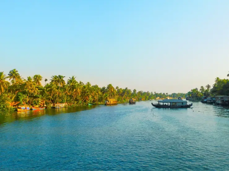
What to expect
Highlights
- Boat or canoe routes around Kallada river
- Village life, canals and lake/river scenery
- Good fit for homestays and local food stops
The river that rises in the Western Ghats behind Thenmala, is impounded at the Parappar dam, and reaches the sea through Ashtamudi past Munroe Island — the thread that connects the east of this district to the west.
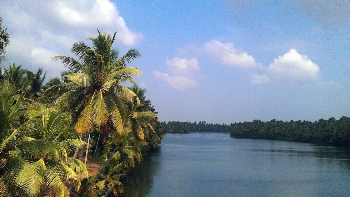
It is formed by three rivers meeting at a place that is now under a reservoir, runs 121 km west, and reaches the sea through Ashtamudi past an island that is losing ground. The Kallada is the thread that ties the far east of Kollam district to the far west — and the reason both ends look the way they do.
Most river pages describe a view. This one describes a connection. The Kallada is the spine of Kollam district: it forms where three headstreams meet at Parappar, is impounded there, runs 121 km west through Punalur — where an 1877 suspension bridge still hangs over it — and finally breaks up into the islets of Munroe Island before joining Ashtamudi and the sea. The Central Water Commission gives its basin as 1,699 square kilometres.
Its beginning is the strangest fact about it, and no page we can find mentions it. The Kallada as a named river does not start at a spring. It starts at a confluence: the Central Water Commission records that the river is formed by three rivers — the Kulathupuzha, the Chendurni and the Kalthuruthy — joining together near Parappar, with the ultimate origin in the Papanasam range south of Kulathupuzha at about 900 m. And Parappar is exactly where the dam was built. The reservoir therefore stands on the river's own birthplace and drowns the meeting of all three of its headstreams. The Kallada begins underwater.
One of those three names will be familiar if you have looked at the map. The Chendurni — Chenthurunipuzha — is the river that gives Shendurney Wildlife Sanctuary its name; the sanctuary is that headstream's catchment. Three of this district's attractions turn out to be three parts of one drainage.
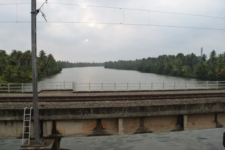
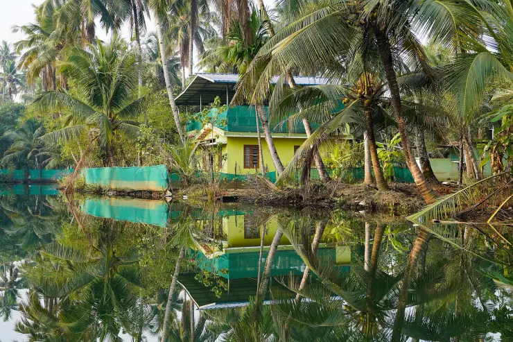
You can meet it at any of those points and get a different river. At Thenmala it is a reservoir in forest, quiet and held. At Punalur it is a working town river with a Victorian bridge across it. At West Kallada it is broad and slow through paddy. At Munroe it has stopped looking like a river at all and become a maze of brackish channels.
The most rewarding way to think about a visit is to pick two of those and do them in one day, because the contrast is the story. Thenmala in the morning and Munroe at sunset is a long drive but a genuinely coherent one — the same water at the beginning and end of its working life.
The river carries a boat race, and its date is the single most misreported thing about it. The Kallada Jalotsavam is held on the 28th day of the Onam season, which falls in the Malayalam month of Kanni — late September or October — and not during Onam week itself. Kerala Tourism describes it as the final boat race of the Kerala season. It is run at Munroe Thuruthu, on the river itself, over a 1,400-metre course at Puthiraparambu–Karuthrakadavu–Nettayam. Anyone who plans an August trip around it, as our own pages used to advise, will miss it by about a month. It is also now part of the Champions Boat League, a televised franchise series, so the old assurance that it is a quiet alternative to the Alappuzha races may no longer hold. Dates follow the Malayalam calendar — confirm locally.
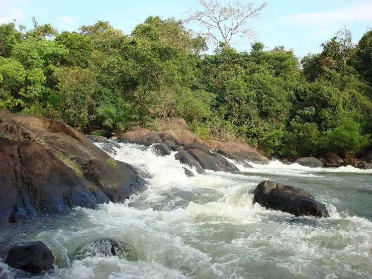
There is more river to meet than the broad slow reaches suggest. At Kakod, on the road between Punalur and Anchal, the Kallada breaks into genuine rapids over bare rock — which is worth knowing, because every description of this river including our own has implied it is placid from the dam to the sea.
For most of its length there is no visitor infrastructure whatsoever — no promenade, no jetty economy, no ticket. You look at it from a bridge, from a paddy bund, from a canoe. That is a fair description of most Indian rivers and an unusual one for a Kerala waterway, where the backwaters have been thoroughly commercialised.
The Punalur stretch repays a stop even if you are only passing through. The 1877 suspension bridge hangs directly over the river in the middle of the town, and standing on it puts you above moving water with the town on both banks — a completely different relationship to the Kallada than you get anywhere else on its length. It is also the only point where the river is framed by something built to be looked at.
If you want the river at its least mediated, go to West Kallada in the early morning. The water is broad and slow there, paddy runs down to the banks, and there is nothing to do but watch it — no boat to catch, nobody selling anything. It is the reach where the Kallada is simply a river, before it becomes either a reservoir or a maze.
The most widely cited fact about the Kallada is that it delivers 76,000 million cubic metres of fresh water into Ashtamudi every year. It appears on government pages, in academic introductions and in conservation literature, and it traces to one place: the Ramsar Information Sheet for the Ashtamudi Wetland, filed in August 2002, where it sits in the opening overview — the sentence most likely to be copied.
It is wrong by a factor of about thirty-five, and the remarkable thing is that you can disprove it with a second number printed on official record, without needing a hydrologist. The Central Water Commission gives the Kallada's basin as 1,699 square kilometres. Pour 76,000 million cubic metres over 1,699 square kilometres and you are claiming a runoff depth of 44.7 metres — that is, that every square metre of this basin sheds nearly forty-five metres of water a year, and must therefore receive at least that much as rain. Kerala's wettest ground gets around 2.5 to 3.5 metres. Cherrapunji, among the wettest inhabited places on earth, averages under twelve. The figure is not merely too large; it is impossible on this planet.
A second check makes the scale of it plain. Kerala's forty-four rivers together have a total average annual yield of about 70,323 million cubic metres. The Ramsar sheet credits this one minor river, in one district, with more than everything the Periyar, the Bharathappuzha, the Pamba and forty-one others carry combined.
The real figure, from a 2022 peer-reviewed study of saltwater intrusion in this river, is 2,152 million cubic metres a year. Run the same arithmetic on it and you get 1,266 mm of runoff against basin rainfall of roughly 2,500 to 3,000 mm — a runoff coefficient near 45%, which is exactly what a steep, forested, monsoon-fed Western Ghats catchment ought to produce. The real number passes the test the printed one fails.
How it got there is worth offering as a hypothesis rather than a finding: 76,000 sits suspiciously close to Kerala's statewide river runoff, and the likeliest explanation is that whoever completed the 2002 form put a state-level aggregate into a river-level field. What makes that reading persuasive is that it is not the only such error on the sheet. The area field on the same four-page document reads 61,400 hectares — 614 square kilometres — for a lagoon the same government's own literature puts at about 61.4. Two fields, one form, each out by a clean power of ten. This is not a typo. It is an unaudited form that has been the citable international record for this site since 2002.
The island at the river's mouth is the other thing stated too confidently. The mechanism is presented as settled: that damming cut the sediment supply, and that is why Munroe Island is losing ground. The first half is well supported — the 2023 study in Scientific Reports names the loss of freshwater and sediment after the Thenmala reservoir, together with uncontrolled sand mining, as its key factors. But the wider literature treats the subsidence as multi-causal, listing sea-level rise, changes in estuary morphology after the 2004 tsunami, soil consolidation, vibration from the railway, groundwater drawdown and sand mining alongside it, and some studies weight those differently. Reduced sediment is a major documented factor. It is not an undisputed sole cause, and we should not have written as though it were.
None of this is an argument that the dam should not exist. It irrigates a large area and supplies water, and those benefits are real and are why it was built. It is an argument against the version of Kerala's backwaters in which nothing has consequences and every landscape is simply nature — and against repeating a number for twenty-four years because it appeared on a form.
One genuine caution about the folklore: several traditions and temple stories attach to points along this river, as they do to every Kerala river, and they are told locally in variant forms. We have not found sources that let us set any of them out reliably, and we would rather say so than repeat a version we cannot stand behind.
The Kallada has its origin in the Papanasam range south of Kulathupuzha at about 900 m above sea level, and is formed as a named river where three headstreams — the Kulathupuzha, the Chendurni and the Kalthuruthy — join near Parappar. It runs 121 km and drains 1,699 sq km before joining Ashtamudi and thence the Arabian Sea. Those figures are the Central Water Commission's, from its Integrated Hydrological Data Book for non-classified river basins, 2006; the 120 km on the Ramsar sheet and the 128 km and 1,614 sq km circulating on aggregator sites are not CWC numbers and we do not use them. The official gauge-and-discharge station on the river is at Pattazhy.
It is impounded at the Parappar dam, built as part of the Kallada Irrigation Project — the largest irrigation project in Kerala by the state Irrigation Department's own description, commissioned in 1986. The dam stands at the confluence of the three headstreams, so the reservoir covers the point at which the river forms. It is the reservoir that the Thenmala eco-tourism development is built around.
At Punalur the river is crossed by a suspension bridge begun in 1871 and completed in 1877, during the reign of Ayilyam Thirunal Rama Varma, engineered by a Scot the Kerala Department of Archaeology names only as Henry — its sister page calls him Albert Henry, while the Chief Engineer of Travancore across four of the bridge’s six construction years was in fact Walthew Clarance Barton. It hangs on iron chains of 53 rings each, anchored to four discs set in four wells, carrying a deck of wooden planks over iron bars. It was notified as a protected monument in 1990 and is now pedestrian-only.
At its mouth the river breaks into the low brackish islets of Munroe Thuruthu. The interruption of its flood-borne sediment supply after damming is a major documented factor in the land loss recorded there, alongside sand mining and several other causes that the research treats as acting together.
The Kallada Jalotsavam takes place on the river at Munroe Thuruthu on the 28th day of the Onam season, in the Malayalam month of Kanni, and Kerala Tourism describes it as the final boat race of the Kerala season. The course is 1,400 m. Secondary listings report a 1969 founding year, a Kallada Rolling Trophy and a ₹1 lakh purse, but no primary source cited here establishes those details.
It is the single thread that makes sense of Kollam district — the same water at Thenmala, Punalur and Munroe Island, doing three completely different things.
Seeing two points on it in one day is the most coherent way to understand this district, and almost nobody does it.
The 1877 Punalur suspension bridge crosses it, and is worth the stop on its own.
The Kallada Jalotsavam, on the 28th day of the Onam season, is the final boat race of the Kerala calendar and is run on this water at Munroe Thuruthu.
Because its beginning is underwater: the dam sits on the confluence of the three headstreams that form it, so the river's birthplace is inside the reservoir.
At Kakod, between Punalur and Anchal, it breaks into rapids over bare rock — not what anyone expects of a Kerala backwater river.
And it is the clearest available lesson in what damming a river actually does to the coast at the end of it.
Road km to Kollam; ghat roads and traffic vary — allow extra.
October to March is best for comfortable boat trips; monsoon is greener but weather can disrupt plans.
Live forecast loads in your browser.
Check the official alert before you travel. Kerala’s beaches, waterfalls and trekking routes close at short notice during heavy rain, and district alert levels change day to day. We do not publish an alert level of our own — read it from the state authority: Kerala State Disaster Management Authority, or the district control room on 1077.
Sun and moon are calculated for this location and shown in IST. Photography windows are the hour around sunrise and sunset; the sunset bearing is degrees clockwise from true north. Moon phase is accurate to about half a day.
Verified hotels, homestays, restaurants, experiences, sights, shops and rentals around Kallada river — commission-free, with direct contact. Filter by what you need.
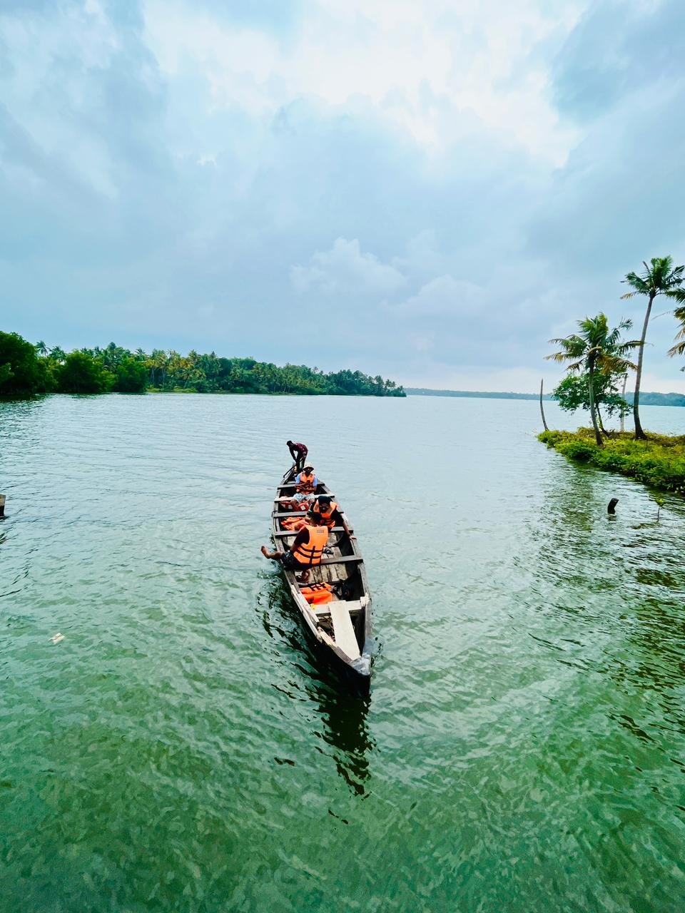
Munroe Island canoe and backwater tour operator for slow-water village routes. Munroe-island, do, Canoe and backwater tour.
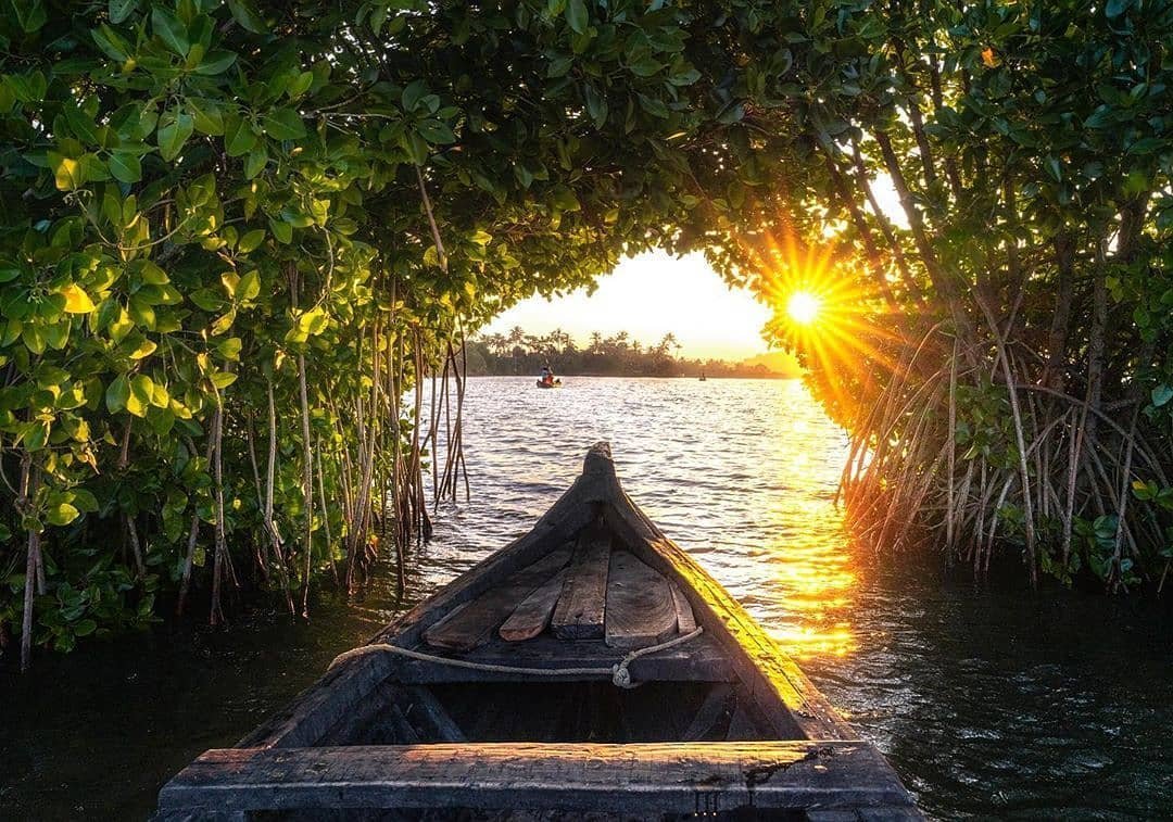
Scenic Mundro offers Munroe Island canoe packages covering Kallada River, narrow canals, mangroves and Ashtamudi backwater routes. Published package rates · Munroe Island, Canoe, Backwaters.
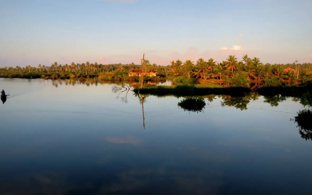
Munroe Island is Kollam district canal-village and backwater island, officially described by Kerala Tourism as an island at the confluence of Ashtamudi Lake and the Kallada River. Public destination · Munroe Island, Backwaters, Kallada River.
Book with the place itself. India’s cyber-crime coordination centre warned in April 2025 that convincing copies of hotel and pilgrimage booking sites are being pushed through sponsored search and social ads, taking payment for rooms the property never hears about. Every listing here links to the business’s own contact details and its own Google or Bing profile — we take no commission and sit in nobody’s payment path. If a booking page reached you through an ad, check the address bar against the property’s own site before you pay. Fraud can be reported on cybercrime.gov.in or on 1930.
Find food, accommodation and activities across Munroe Island. Browse the guides for places to eat, stay and explore along your route.
4 more places around Munroe Island. Open a guide to plan the visit and onward journey.
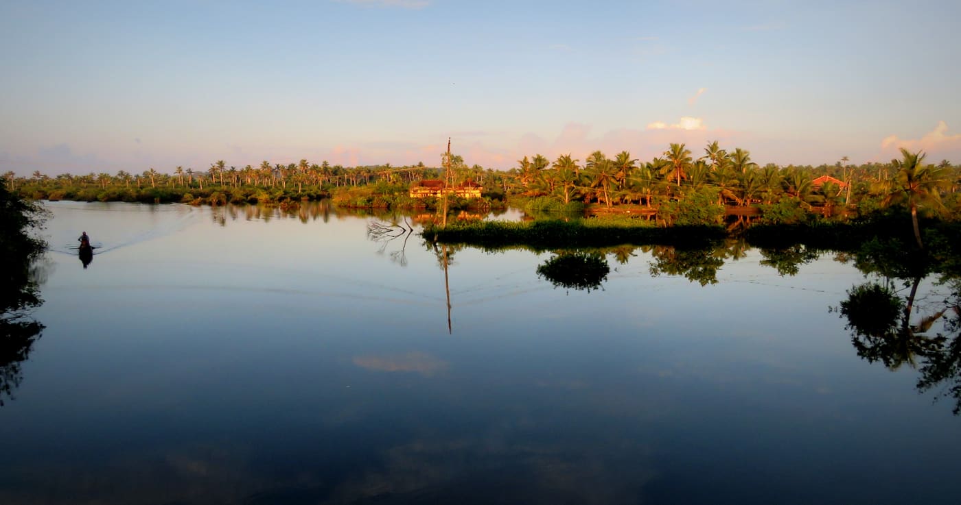
570 m · 7 min walk
Canal village island known for canoe trips, coir work and slow backwater life.
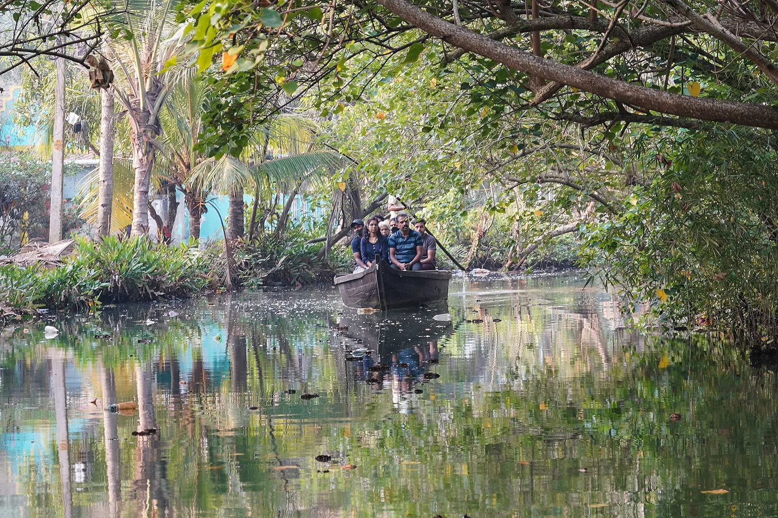
1.1 km · 13 min walk
The narrow inland canal network threading Munroe Island, navigable only by small country canoe — the reason the island is visited at all, and a different waterway entirely from the open Ashtamudi lake.
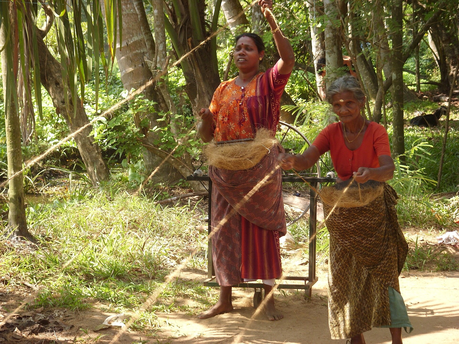
2.9 km · 5 min drive
The coir-working settlements of Munroe Island, where coconut husk is retted in the backwater and spun into yarn — a working craft economy on the canal banks rather than a demonstration laid on for visitors.
7.0 km · 13 min drive
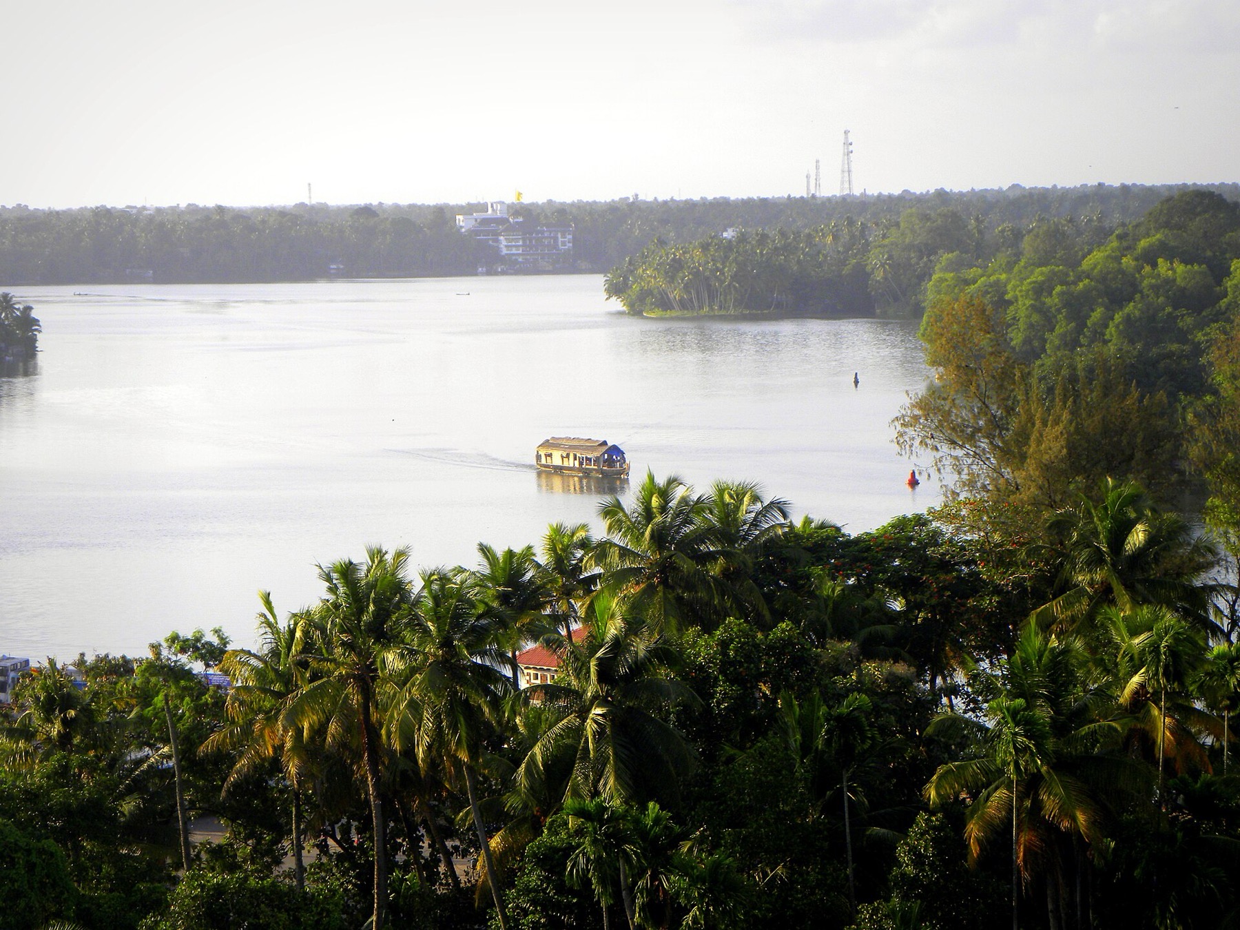
The open-water outlooks on the Munroe Island and Perumon side of Ashtamudi, where the lake widens out — the wide views the canal trips themselves do not give you.
Roampedia is commission-free — own or know a stay, eatery, guide or shop near Kallada river? List it and it appears here once verified.
Add a nearby businessEntry: Free. The river is open, and any charge is for a boat rather than for access.
If you are travelling by bus or ferry, check the return service with the operator before setting out. Leave time to reach the stop or jetty after your visit.
Ask at the bus stand for the time of the last service back, not the next one. If you miss it, an auto or app cab is the fallback — agree the fare before you get in.
If you need step-free access, contact the site before travelling. Ask about a level entrance, steps along the route, the nearest drop-off point, seating and accessible toilets.
Charge cap and free-transaction limits: Reserve Bank of India, in force since 1 May 2025.
These services are listed within about 1.2 km of Kallada river. Walking distances follow mapped routes; access and opening hours can change. Other services may be closer but are not included here.
Emergency numbers are verified against official government and state tourism sources. 112 works anywhere in India.
Canal village island known for canoe trips, coir work and slow backwater life.
570 m · 7 min walkThe narrow inland canal network threading Munroe Island, navigable only by small country canoe — the reason the island is visited at all, and a different waterway entirely from the open Ashtamudi lake.
1.1 km · 13 min walkThe coir-working settlements of Munroe Island, where coconut husk is retted in the backwater and spun into yarn — a working craft economy on the canal banks rather than a demonstration laid on for visitors.
2.9 km · 5 min drive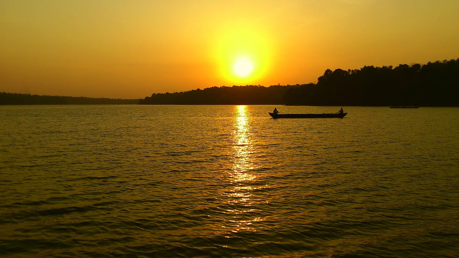
Kerala’s largest freshwater lake, a Ramsar wetland ringed by hills and a Sastha temple, north of Kollam.
4.6 km · ~12 min by auto · straight lineThe open-water outlooks on the Munroe Island and Perumon side of Ashtamudi, where the lake widens out — the wide views the canal trips themselves do not give you.
7.0 km · 13 min drive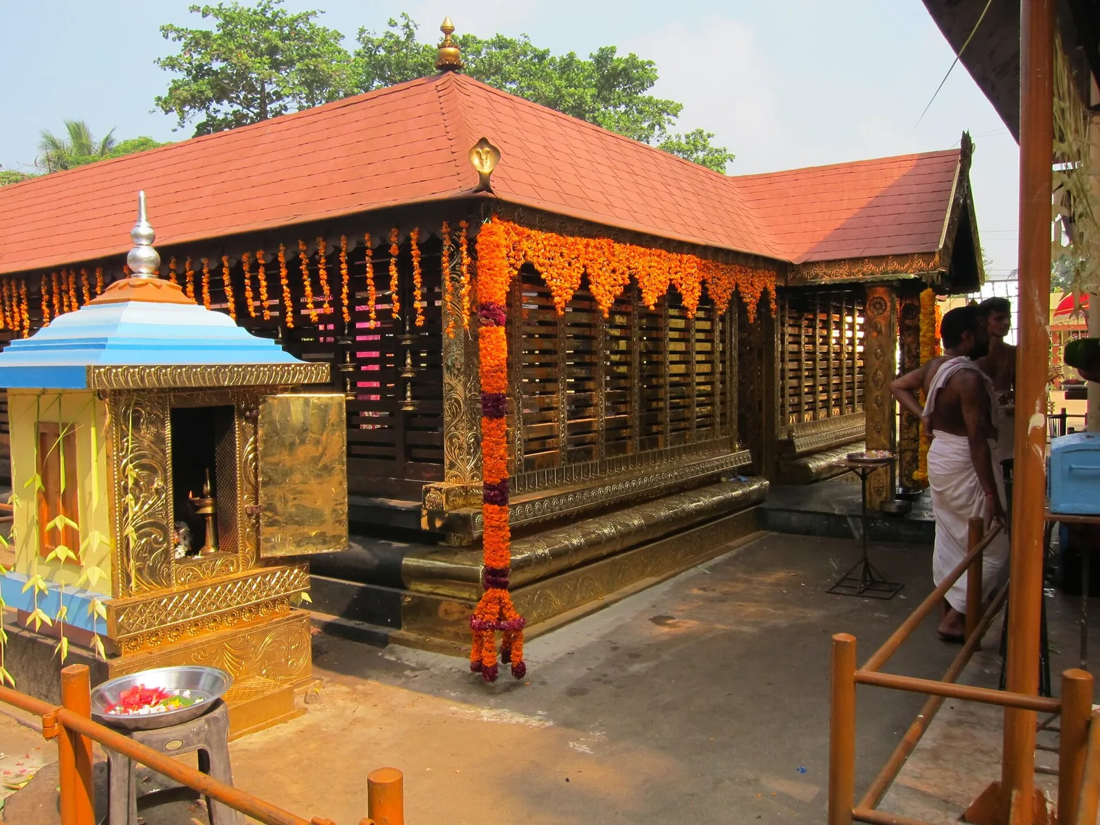
A Devi temple at Chavara north of Kollam, known across Kerala for Chamayavilakku — the two nights in Meenam when men and boys dress in saris and carry lamps in procession to the goddess, re-enacting the cowherd boys of its founding legend.
9.1 km · ~15 min by cab · straight line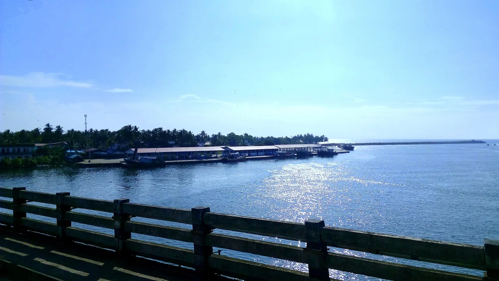
By most accounts Kerala’s largest fishing harbour, at the mouth of Ashtamudi Lake about 9 km from Kollam town, and where Indian fishing was mechanised; two bridges cross the confluence and the early-morning auction is the sight to catch.
10.9 km · ~18 min by cab · straight line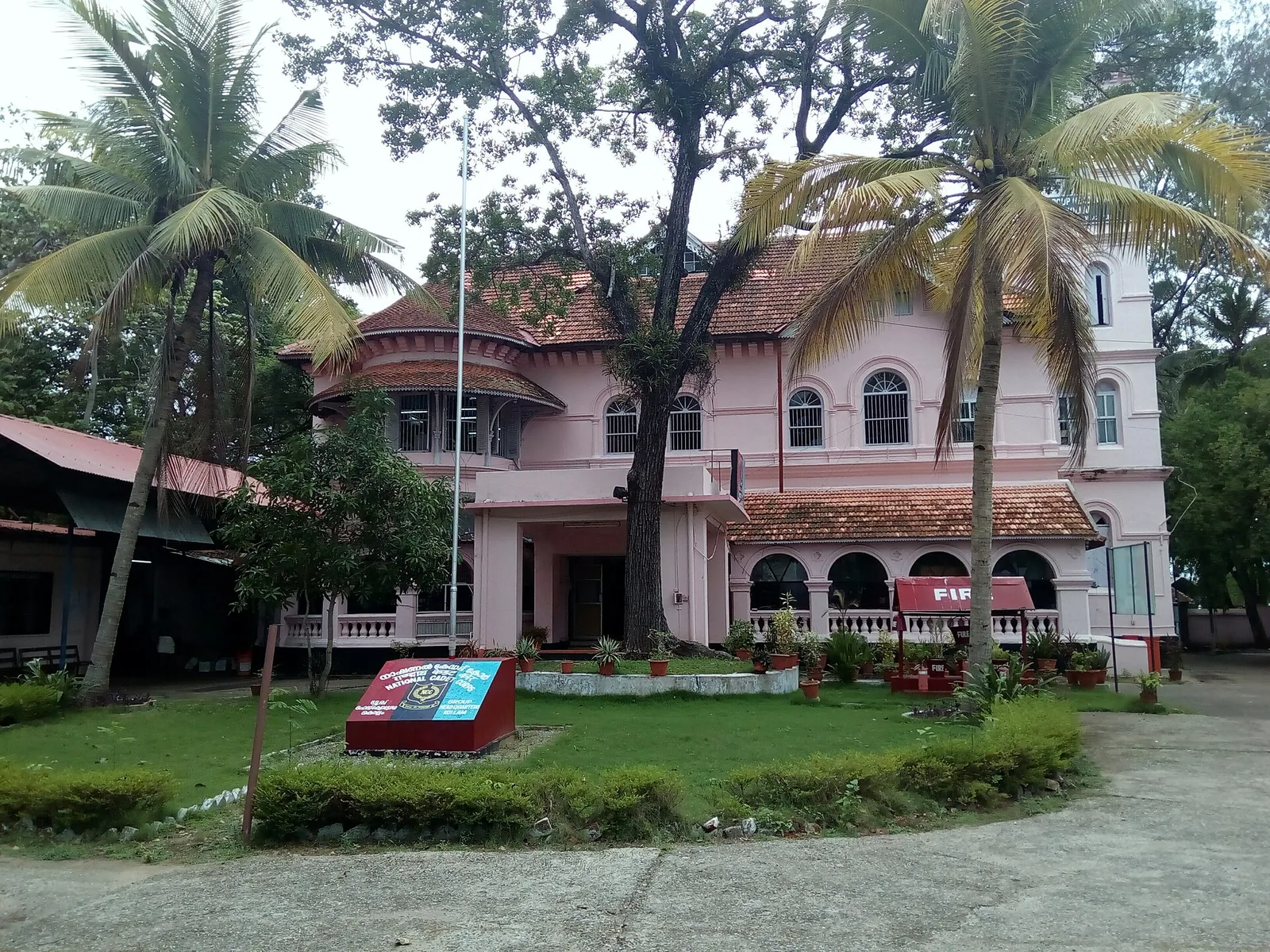
A Travancore royal residence on the Ashtamudi shore in Kollam, built to be arrived at by boat and now a working NCC establishment — viewed from outside or from the water.
11.5 km · ~19 min by cab · straight line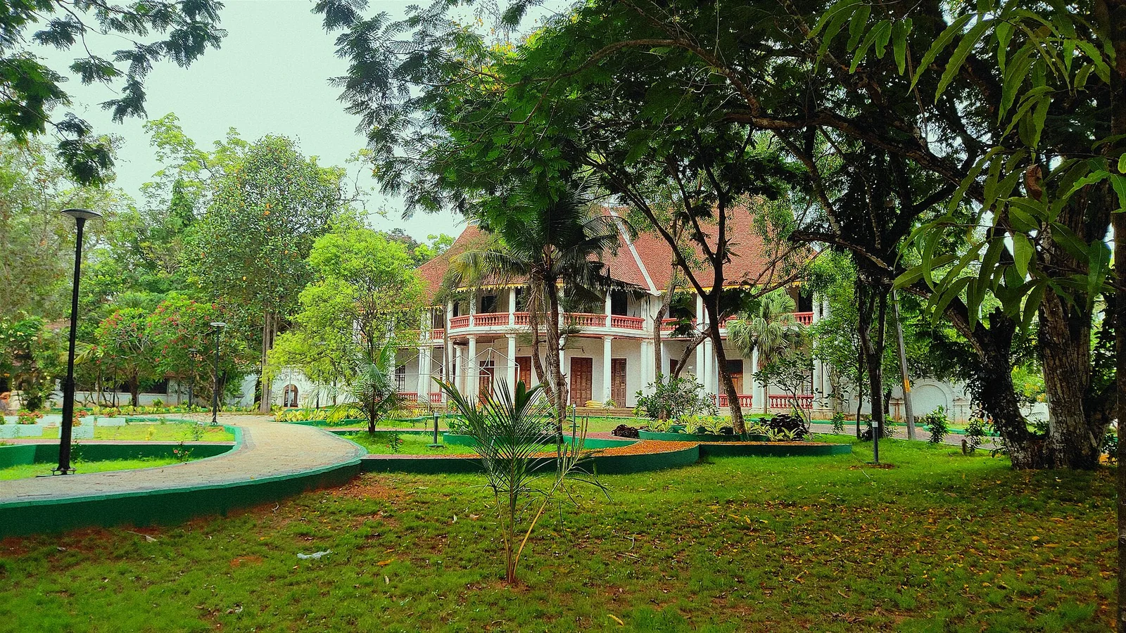
The former British Residency at Asramam survives as a government guest house beside Kollam’s backwater landscape. Its architecture is the attraction, with access governed by its working use.
11.8 km · ~20 min by cab · straight line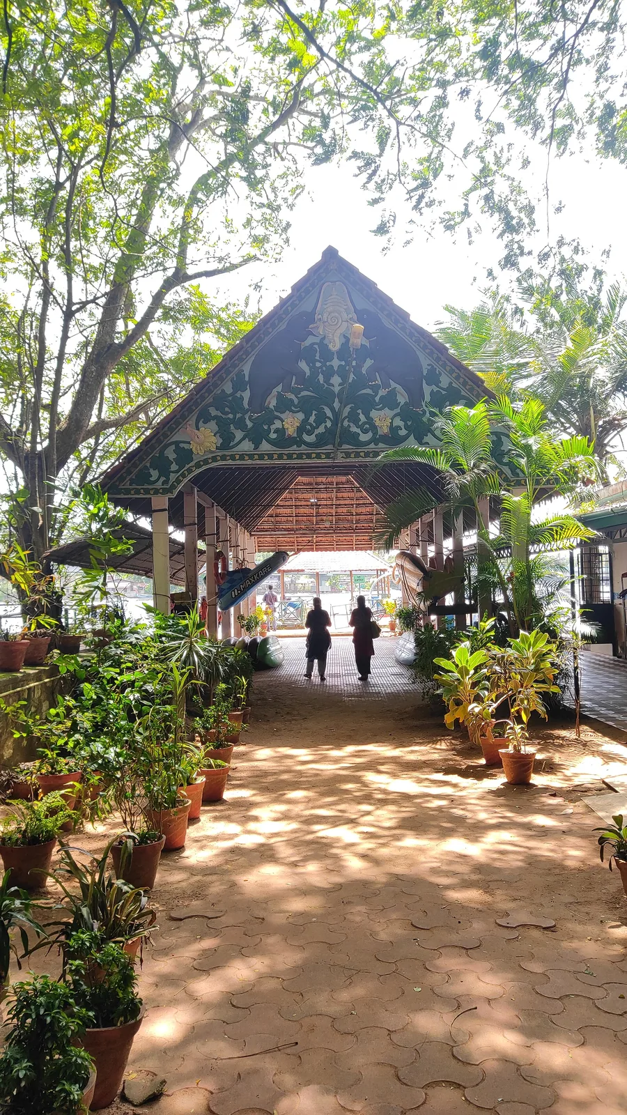
Forty-eight acres of municipal park on the Ashtamudi shore in the middle of Kollam, run by the DTPC — boating and kayaking off a painted jetty, ziplines and rope courses, a heritage walkway of terracotta reliefs, contemporary sculpture left behind by a 2012 festival, and a mangrove wetland with a state biodiversity heritage tag.
12.0 km · ~20 min by cab · straight line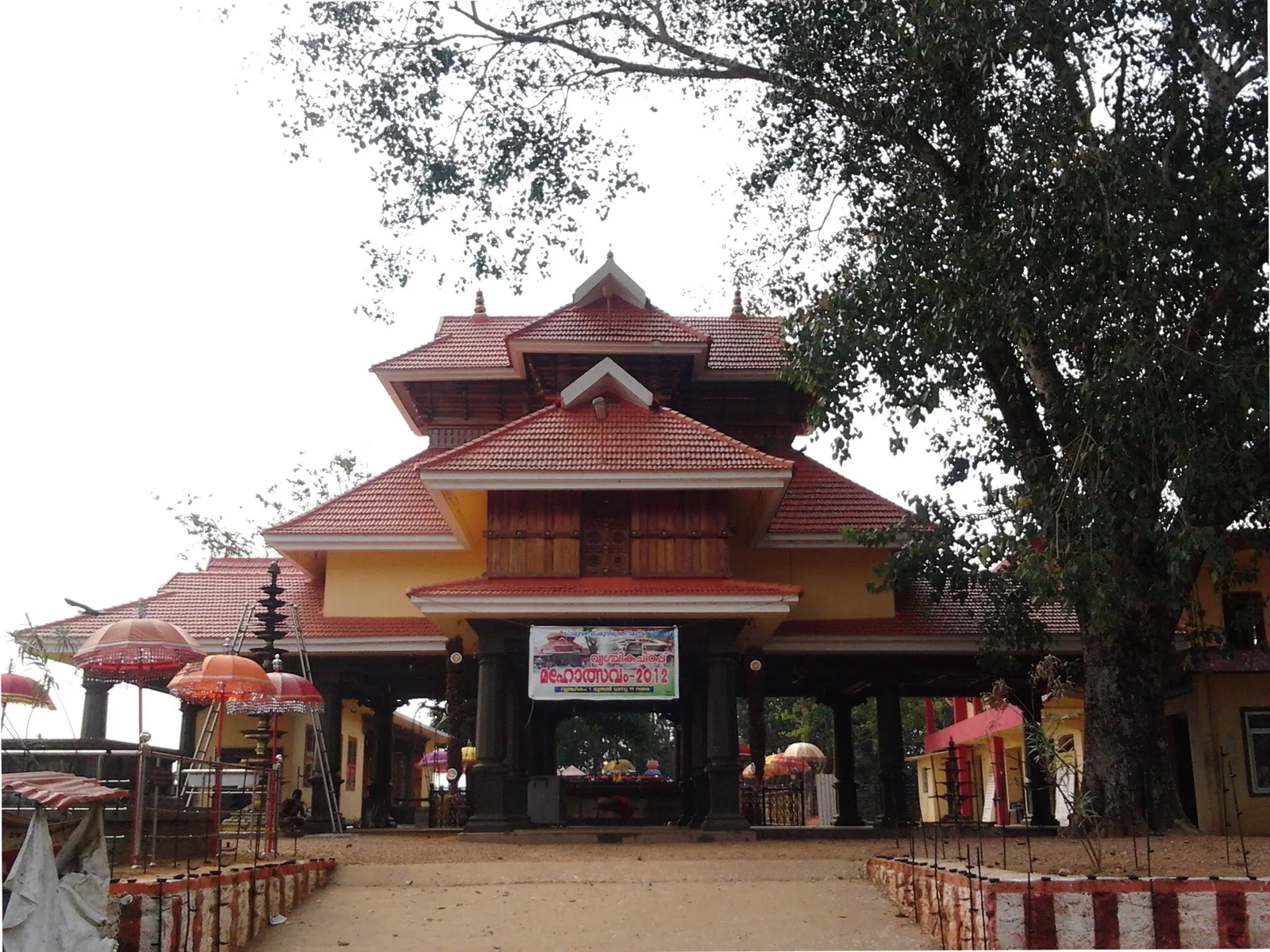
A temple with no idol and no sanctum — an open pillared mandapam over a raised platform, worshipped by sankalpam. The presiding figure is Mala Appooppan, the grandfather of the hill, conceived in the form of Duryodhana; the priest is the Oorali rather than a Brahmin, and toddy is the traditional offering.
12.3 km · ~21 min by cab · straight line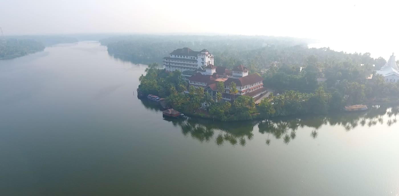
Large palm-fringed backwater system and houseboat base around Kollam.
12.4 km · ~21 min by cab · straight lineWalking and driving times are real routed distances, except the few marked “straight line”, which are direct-line estimates and will read short. Fare figures are estimates from Kerala’s notified auto/taxi tariff and exclude waiting and night charges. Routing: © openrouteservice.org by HeiGIT | Map data © OpenStreetMap contributors
Nearby toilets, pharmacies, ATMs, seating and vets are community-mapped and may be incomplete or out of date. Map data © OpenStreetMap contributors | Walking times © openrouteservice.org by HeiGIT
121 km, draining 1,699 sq km before it joins Ashtamudi Lake. Both figures are the Central Water Commission's, from its Integrated Hydrological Data Book (Non-Classified River Basins), 2006. Other lengths circulate — 120 km on the Ramsar sheet, 128 km on various aggregators — but the CWC number is the one to use.
In the Papanasam range south of Kulathupuzha, at about 900 m. But strictly, the Kallada as a named river begins where three headstreams — the Kulathupuzha, the Chendurni (Chenthurunipuzha) and the Kalthuruthy — meet at Parappar. The Parappar dam stands on that confluence, so the river's meeting point is now under the reservoir. The Chendurni is also what gives Shendurney Wildlife Sanctuary its name.
About 2,152 million cubic metres a year, per a 2022 peer-reviewed study of saltwater intrusion in the river. The figure of 76,000 million m³ printed in Ashtamudi's Ramsar Information Sheet and copied ever since is wrong by roughly thirty-five times: it would exceed what all forty-four of Kerala's rivers carry combined, and would require 44.7 metres of runoff per square metre of the basin per year.
Pick two points and do them in a day — the contrast is the point. Thenmala in the morning and Munroe Island at sunset is a long drive but shows you the same water at the beginning and end of its working life. There is no visitor infrastructure along most of it.
On the 28th day of the Onam season, in the Malayalam month of Kanni — late September or October, not Onam week itself. Kerala Tourism calls it the last boat race of the Kerala season. The course is Puthiraparambu–Karuthrakadavu–Nettayam at Munroe Thuruthu, 1,400 m. It is now part of the Champions Boat League, so the old claim that it is a quiet alternative to the Alappuzha races may not hold. Confirm the date locally.
The Parappar dam at Thenmala, headworks of the Kallada Irrigation Project — the largest irrigation project in Kerala by the state Irrigation Department's own description, commissioned in 1986. It is a straight gravity masonry dam, 335 m long and 85.35 m high from deepest foundation, in 12 blocks with three gated ogee spillway bays, plus a 225.7 m earthen dam and a saddle dam.
The river's floods used to deposit sediment that rebuilt the low islets at its mouth each year, and the Kallada Irrigation Project and the Thenmala reservoir cut that supply — the 2023 NCESS study names it, with uncontrolled sand mining, as a key factor, and about 14% of Munroe Thuruthu's land area has gone. But the wider literature treats the subsidence as multi-causal, naming sea-level rise, post-tsunami changes in estuary morphology, soil consolidation, vibration from the railway and groundwater drawdown alongside it. Anyone who tells you it has a single cause is simplifying.
That is not what the evidence says and not our claim. The Kallada Irrigation Project irrigates a large area and supplies water, and those benefits are real. The point is that the consequences downstream are also real, and both belong in an honest description of this river.
Not as an organised activity along most of its length. There is canoeing in the estuarine channels at Munroe Island and boating on the reservoir at Thenmala; the 121 km in between has no jetty economy or visitor infrastructure at all. It runs high and fast after the southwest monsoon and has rock rapids in its middle course, at Kakod among other places — treat it as a working river rather than a leisure water.
Kerala banned sand mining outright on the Kallada and five other rivers in June 2015, after river-bank mapping and sand auditing under the state's sand rules; illegal mining continued regardless, and the deepening of the riverbed is one of the measured causes of trouble downstream. In May 2025 the state moved to resume river sand mining after the ten-year ban. Check the current position before treating either as settled.
October to March is best for comfortable boat trips; monsoon is greener but weather can disrupt plans.
Entry: Free. The river is open, and any charge is for a boat rather than for access.
Base yourself in Munroe Island or a nearby town in Kollam, then confirm the last-mile route locally before leaving. Plan boat timings first, then arrange road transfer around the departure point. If the visit depends on forest, temple, boat, ferry, weather or seasonal access, check the official/local rule on the day before travel.
2 hours to a full day; overnight if using a houseboat area.
Nearby you can pair Munroe Island (570 m), Munroe canals (1.1 km), Coir villages (2.9 km), Sasthamcotta Lake (4.6 km).
Use operators with life jackets and clear weather judgement. Avoid overloaded boats.
Written about Kallada river itself — its history, its legends and the arguments about them.
These guides explore Munroe Island and the surrounding area. Choose a visit that fits your interests, allowing separately for travel between stops.
Route-level itineraries and practical guides for the rest of Kerala.
Photographs: Arun Muralidhar (CC BY-SA 3.0), Danielsdelhi (CC BY-SA 3.0), KannanVM (CC BY-SA 4.0), Akhilan (CC BY-SA 4.0), Sprouter13 (CC BY-SA 4.0). Wikimedia Commons.