What to expect
Highlights
- Boat or canoe routes around Munroe canals
- Village life, canals and lake/river scenery
- Good fit for homestays and local food stops
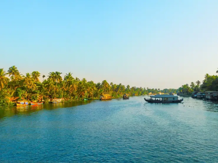
The narrow inland canal network threading Munroe Island, navigable only by small country canoe — the reason the island is visited at all, and a different waterway entirely from the open Ashtamudi lake.
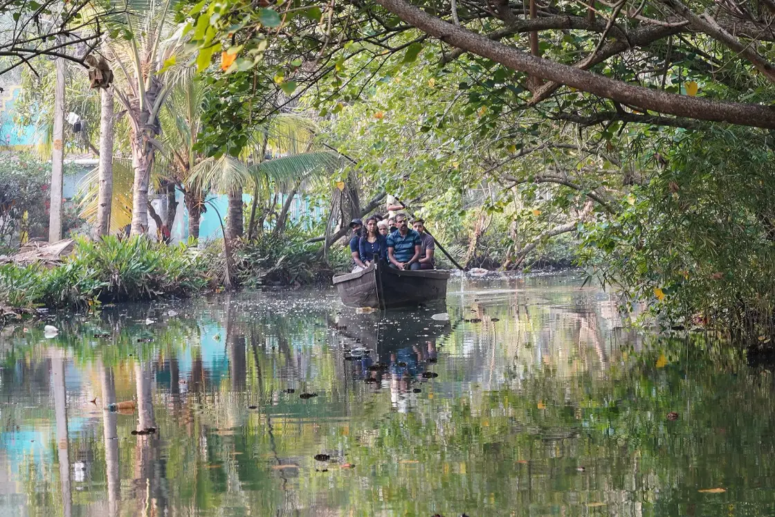
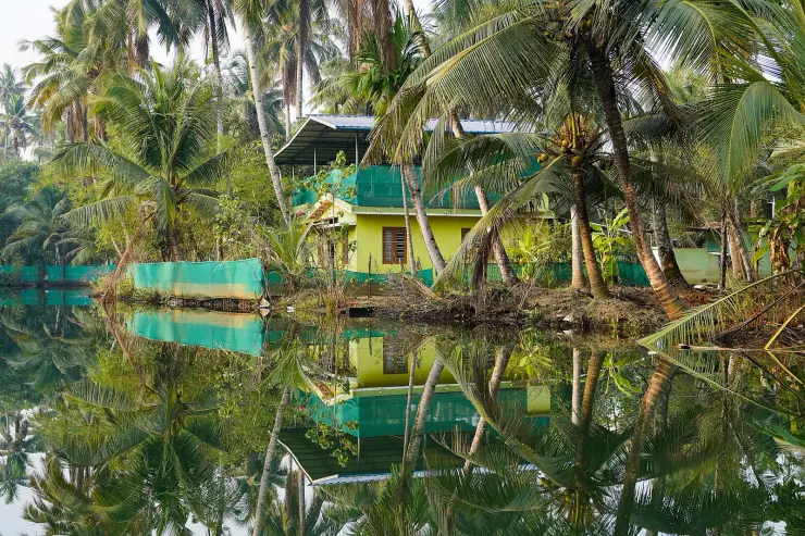
A network of channels narrow enough that a canoe touches both banks, threading between coconut palms, house plots and paddy on the islets where the Kallada river breaks up into Ashtamudi. Most of them are dug. You go in a country canoe because nothing else fits, and the silence is the point.
The canals are not scenery arranged for visitors. They are the roads, and a good number of them are earthworks. Munroe Island is a cluster of low islets at the meeting of the Kallada river and the Ashtamudi backwater, and the water between them has always been how people moved, carried coir, went to school and got to church. A canoe trip here is a trip along somebody's street.
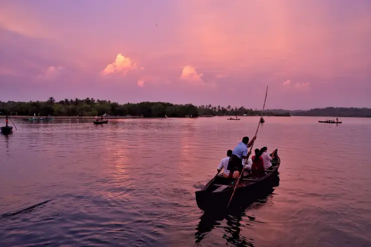
The boat matters more than anywhere else in Kerala — but be precise about which water you mean. The narrow inland village channels, the ones actually worth coming for, are too tight and too shallow for a shikara, let alone a houseboat. What fits is a small country canoe, poled or paddled rather than driven, and the difference is total: no engine noise, no wake, and a waterline low enough that the bank is at eye level. If an operator offers you a larger covered boat you will get the wide water and miss the thing itself. It does not follow that the whole network is canoe-only: the trunk cut, Puthanar, is fifty metres wide and carries ferries.
Go at first light. The canals hold mist until the sun clears the palms, kingfishers work the channels, and the day's first sounds are domestic rather than mechanical — someone washing, someone's radio, a paddle. By mid-morning the light is flat and the magic has gone. The 2.5-hour sunrise trip is the one to book.
The canal trip's own landmarks are mapped, and it is worth knowing their real names. The boating cluster sits at the island's eastern side, and within about two hundred metres of it are three named places: S Valavu, literally the S bend, where the channel doubles back on itself; Kandal Cave, kandal being Malayalam for mangrove, which is the tunnel section everyone photographs; and Ottakkandal, the lone mangrove. Coir retting frames stand in the shallows, prawn traps are checked, and in places the canal opens into small ponds where the water is completely still. None of it is staged, which also means none of it is guaranteed on a given morning.
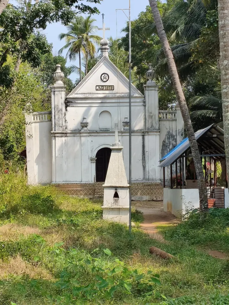
Two sights commonly sold as part of the canal trip are not on it, and it is better to plan them separately than to be disappointed. The Perumon rail bridges stand about 1.8 km south on open Ashtamudi at the island's tip; the church known locally as the Dutch Church is about 2 km west on the far shore. Both are worth seeing. Neither is reachable through the narrow channels, and a trip that takes them in is a trip on the open water rather than a canal trip.
The overhanging vegetation is part of the experience and part of the navigation. Boatmen duck under branches, push off trunks and read water levels that change through the year — which channels are passable in February and which in September are not the same set. This is why the trip you get depends on the season as much as on the operator, and why the widely repeated advice to time your canoe to high tide is worth ignoring.
Three things almost everyone believes about these canals are wrong, and all three have been measured. They are not a natural delta — the main one was dug. They are not silting up — they are getting deeper. And there is no point timing your canoe to the tide, because by the time the tide reaches here it has almost stopped being a tide.
Start with the digging, because it changes what you are looking at. The 2023 NCESS paper in Scientific Reports records that the trunk channel was cut in the 1820s to soften the monsoon floods and spread the river's silt onto the farmland in the south of the island. Its name is Puthanar, which is Malayalam for new river — the island's own language has been telling anyone who asked for two centuries. It is fifty metres wide. And the same paper notes that several of the islets exist because of that drainage network of natural and artificial streams: the cutting of the channels is part of why there are islands here at all. One honest caveat on the attribution — the work is credited to Colonel John Munro, who was Diwan of Travancore from about 1811 to 1814 and left in 1819, so an 1820s cut is after his own tenure. It was made on his design or by his successors; he did not stand over it.
The purpose is worth holding onto too. This was agricultural engineering — flood control and silt distribution — not a transport scheme and certainly not scenery. The tourism arrived a century and a half later.
Now the silting, which visitors ask about constantly because the mangrove tunnels look as though they are closing in. Measured bathymetry says the opposite: the river channel has deepened from 5–6 metres in the 1980s to about 14 metres now, driven by unregulated sand mining and by the sediment that the Thenmala reservoir upstream no longer sends down. The same paper's management recommendation refers in passing to the digging of boat channels, which is the detail that recasts the whole trip. The waterway you are paddling was cut two centuries ago and is dredged now. It is infrastructure at both ends of its life.
That deepening also explains why the flooding here is salt. Mining has dropped the riverbed below the base level of erosion, so dense seawater now sits trapped in the deeps instead of being flushed out, and the monsoon's fresh water no longer washes the surface soils clean. It is a plumbing failure rather than a sea-level story, and it is why houses fail.
Then the tide, which is the advice most worth discarding. The NCESS team put three tide gauges in and around the island and took readings at four locations across three seasons. What they found is that the inland tidal range is almost the same at spring tides as at neap; that the twice-daily component largely dies inside the estuary through friction and time lag; and, in their own words, that the flooding on Munroe Island is not related to the spring tide of the open ocean. There is no high-tide window to book. What decides which narrow channels a canoe can enter is the season's water level, and the hour that matters is dawn. Anyone telling you to go at high tide is repeating a line, not a measurement.
One last correction, and it is ours as much as anyone's. Munroe Island is sold as a timeless backwater idyll, and that framing is close to the opposite of what is happening here. The 2023 study measured about 14% of Munroe Thuruthu's total land area lost, with more than a quarter of the remainder under stress; the losses are very unevenly spread, with Cheriyakadavu at 46.95% against Peringalam at 11.78%. More than 500 households have been forced to vacate their homes. Kerala's first climate refugees is a phrase that has been used about this place, and it is not rhetorical.
The cause is the part travel writing almost never mentions, because it implicates another attraction in the same district. The Kallada river used to flood, and each flood laid down fresh sediment that rebuilt these low islets faster than the tide could take them away. Then the Kallada Irrigation Project and the dam at Thenmala put a barrier across the river's sediment supply. The floods stopped; the rebuilding stopped; the tide did not. Add uncontrolled sand mining on top, which has cut the river's own channel from 5–6 m deep in the 1980s to about 14 m today, and you have a landscape losing ground every year. The 2004 tsunami is commonly added to that list, but the satellite record dates the degradation to the 1980s and the peer-reviewed conclusion names only the dam and the mining.
So the two Kollam attractions are connected in a way neither page usually admits. The reservoir that makes Thenmala's eco-tourism possible is part of why the canals you are paddling through are flooding houses that were dry thirty years ago. We are not going to pretend that a canoe trip is a neutral act of appreciation while leaving that out.
One thing that is a genuine misconception rather than an omission: visitors sometimes read the flooding as picturesque — water in the yards, steps disappearing — and photograph it as atmosphere. It is damage. Houses here are abandoned because salt water gets into them. Read it correctly and the trip becomes a different and more serious thing.
Munroe Island — Munroe Thuruthu — is a cluster of low brackish islets at the confluence of the Kallada river and the Ashtamudi backwater, named after Colonel John Munro, the British Resident of Travancore in the early nineteenth century and its Diwan from about 1811 to 1814.
The islets were built and maintained by river sediment: the Kallada's floods deposited material that offset the tidal loss, which is what allowed low-lying land here to be settled and farmed at all. The river arrives here having run 121 km from the Karimalai hills of the Western Ghats, where it rises at about 1,524 m.
The canal network is partly engineered. The trunk channel, Puthanar — new river — was cut in the 1820s, fifty metres wide, to connect the Kallada with the eastern arm of Ashtamudi, reduce the monsoon floods and carry alluvium to the southern part of the island. The island's own revenue paperwork records what that was for: the southern accretion is mapped as Puthan Yekkalpuram, new alluvium land, against Pazhaya Yekkalpuram, old alluvium land, on the north bank. The cadastral map is a record of where silt used to arrive.
That balance broke with the damming of the Kallada. The Kallada Irrigation Project and the Thenmala reservoir cut the flood-borne sediment supply, and the islets began losing ground without being replenished.
Uncontrolled sand mining added further pressure, deepening the river channel from 5–6 m in the 1980s to about 14 m today. Measured land loss runs to about 14% for Munroe Thuruthu as a whole, with individual islets far higher — 46.95% at Cheriyakadavu. The 2004 tsunami is widely blamed here, but the satellite record dates the degradation to the 1980s, two decades earlier.
The consequence has been out-migration. More than 500 households have been forced to vacate their homes, with flooding, salinity and falling agricultural productivity making established homes untenable. Paddy cultivation on the island fell from 227 acres in 1950 to 8 acres in 1995 and under 2 acres by 2018 — the panchayat's own annual report is the source — and named tracts including Kaniyampalli Vayal, Manakkadavu Vayal, Panampu Vayal and Pattamthuruth Vayal have gone. Recent satellite images show no paddy cultivation on the island at all. Population fell from 10,013 in 2001 to 9,440 in 2011.
What replaced it is the boat. The same study states it plainly: local people are now more dependent on coconut cultivation and tourism for their livelihoods. The canoe trip is not a side-show on this island — it stepped into the space the rice economy left. And in one corner of the island the adaptation has gone the other way and turned the problem into the method: some paddy fields have been converted into filtration ponds, to take the benefit of the frequent tidal flooding. People are farming the flood.
The narrow inner channels are genuinely unlike the rest of the Kerala backwaters — too tight for any boat but a country canoe, and quiet in a way the houseboat routes never are.
The sunrise trip, with mist on the water and kingfishers working the channels, is one of the best early mornings available anywhere in the state.
You travel along a village's actual roads, past coir retting, prawn traps and people's front steps, rather than along a tourist circuit.
The mapped landmarks — S Valavu, the S bend; Kandal Cave, the mangrove tunnel; Ottakkandal, the lone mangrove — give the trip structure without turning it into a checklist.
Because the main channel is a two-hundred-year-old piece of flood engineering called new river, which is a stranger thing to paddle down than a natural creek.
And because this landscape is measurably disappearing. Seeing it now is not the same as seeing it in twenty years, and that is a statement of fact rather than a sales line.
Road km to Kollam; ghat roads and traffic vary — allow extra.
October to March is best for comfortable boat trips; monsoon is greener but weather can disrupt plans.
Live forecast loads in your browser.
Check the official alert before you travel. Kerala’s beaches, waterfalls and trekking routes close at short notice during heavy rain, and district alert levels change day to day. We do not publish an alert level of our own — read it from the state authority: Kerala State Disaster Management Authority, or the district control room on 1077.
Sun and moon are calculated for this location and shown in IST. Photography windows are the hour around sunrise and sunset; the sunset bearing is degrees clockwise from true north. Moon phase is accurate to about half a day.
Verified hotels, homestays, restaurants, experiences, sights, shops and rentals around Munroe canals — commission-free, with direct contact. Filter by what you need.
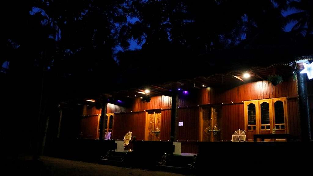
Kerala Tourism-listed homestay in timber-and-tile cottages at Nenmeni on Munroe Island, set among the canals and paddy of the Ashtamudi backwaters in Kollam. The hosts offer quiet garden-side rooms and home-cooked island meals, a laid-back base for backwater canoeing.
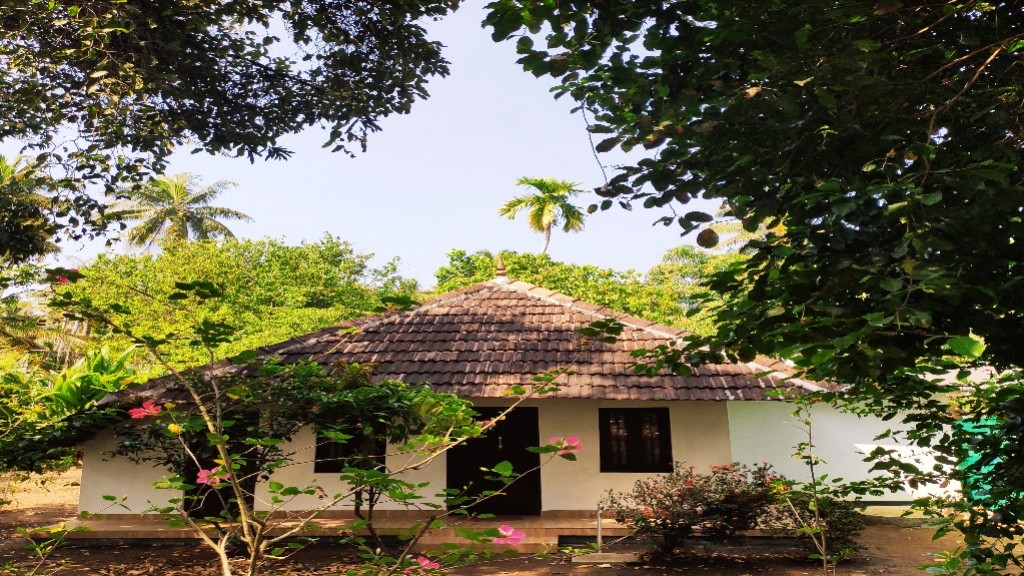
Kerala Tourism Silver House-classified homestay in a traditional tiled Kerala house on Munroe Island, amid the coconut groves and canals of the Ashtamudi backwaters. The host family offers clean rooms, home-cooked meals and guided canoe trips, a personal island base rather than a hotel.
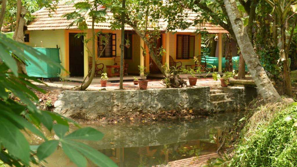
Kerala Tourism Silver House-classified homestay in a traditional tiled Kerala cottage beside a canal on Munroe Island, in the Ashtamudi backwaters of Kollam. The resident hosts offer simple canal-side rooms and home-cooked food, an authentic island stay for canoe rides and village walks rather than a hotel.
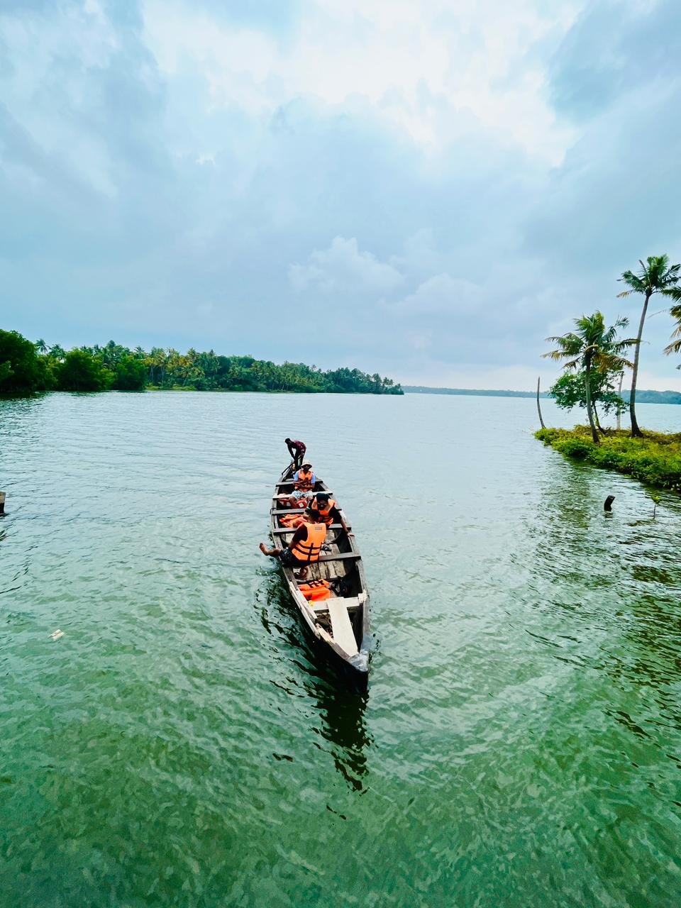
Munroe Island canoe and backwater tour operator for slow-water village routes. Munroe-island, do, Canoe and backwater tour.
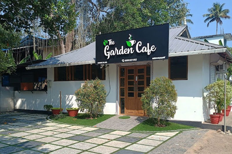
The Garden Cafe is a meal-stop option on Munroe Island. Arrange food around your actual canoe or backwater departure, allowing time to reach the boarding point rather than assuming the café is beside it.
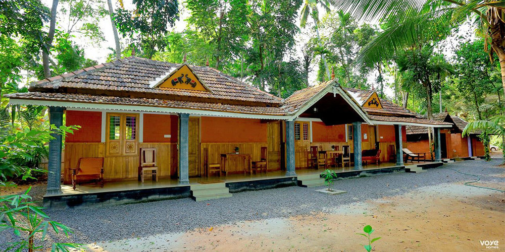
Private holiday home in Munroe Island. Mundro Green Land, Munroe Island, Kollam, Kerala · Munroe Island, Holiday home, Backwater view.
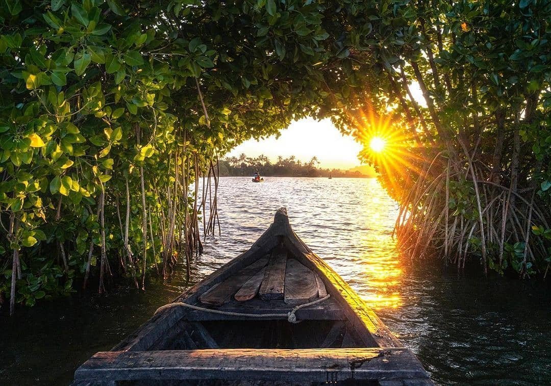
Scenic Mundro offers Munroe Island canoe packages covering Kallada River, narrow canals, mangroves and Ashtamudi backwater routes. Published package rates · Munroe Island, Canoe, Backwaters.
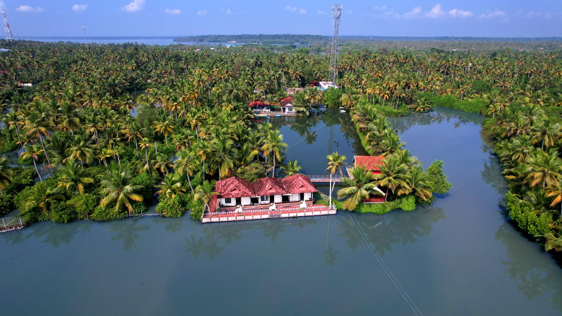
Resort in Munroe Island. Nenmani South, Munroethuruth P.O., Munroe Island, Kollam, Kerala 691502 · Munroe Island, Resort, Backwaters.
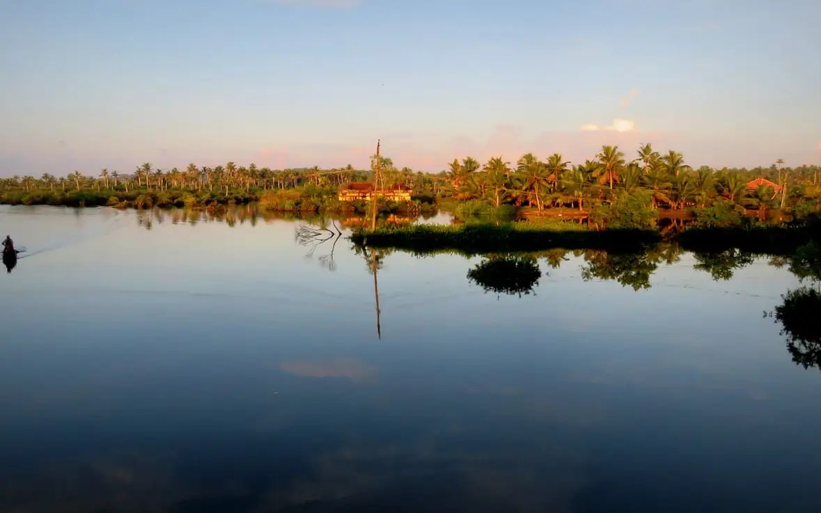
Munroe Island is Kollam district canal-village and backwater island, officially described by Kerala Tourism as an island at the confluence of Ashtamudi Lake and the Kallada River. Public destination · Munroe Island, Backwaters, Kallada River.
A homestay at Thoompum Mukham on Munroe Island. Canoe tours run the local waterways and the kitchen serves Kerala dishes and signature mocktails.
A homestay on Munroe Island built around paddling the backwaters. Kayak trips and canal boating explore the island's narrow waterways.
Private island farm stay on Munroe Island with organic food, backwater setting and direct booking contact.
Backwater resort in Munroe Island. Munroethuruth P.O., Munroe Island, Kollam, Kerala · Munroe Island, Backwater stay, Canoe.
Book with the place itself. India’s cyber-crime coordination centre warned in April 2025 that convincing copies of hotel and pilgrimage booking sites are being pushed through sponsored search and social ads, taking payment for rooms the property never hears about. Every listing here links to the business’s own contact details and its own Google or Bing profile — we take no commission and sit in nobody’s payment path. If a booking page reached you through an ad, check the address bar against the property’s own site before you pay. Fraud can be reported on cybercrime.gov.in or on 1930.
Find food, accommodation and activities across Munroe Island. Browse the guides for places to eat, stay and explore along your route.
4 more places around Munroe Island. Open a guide to plan the visit and onward journey.
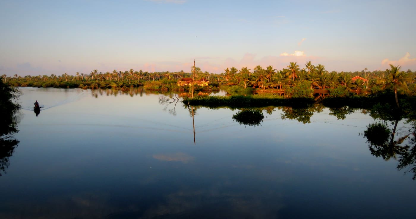
1.1 km · 14 min walk
Canal village island known for canoe trips, coir work and slow backwater life.
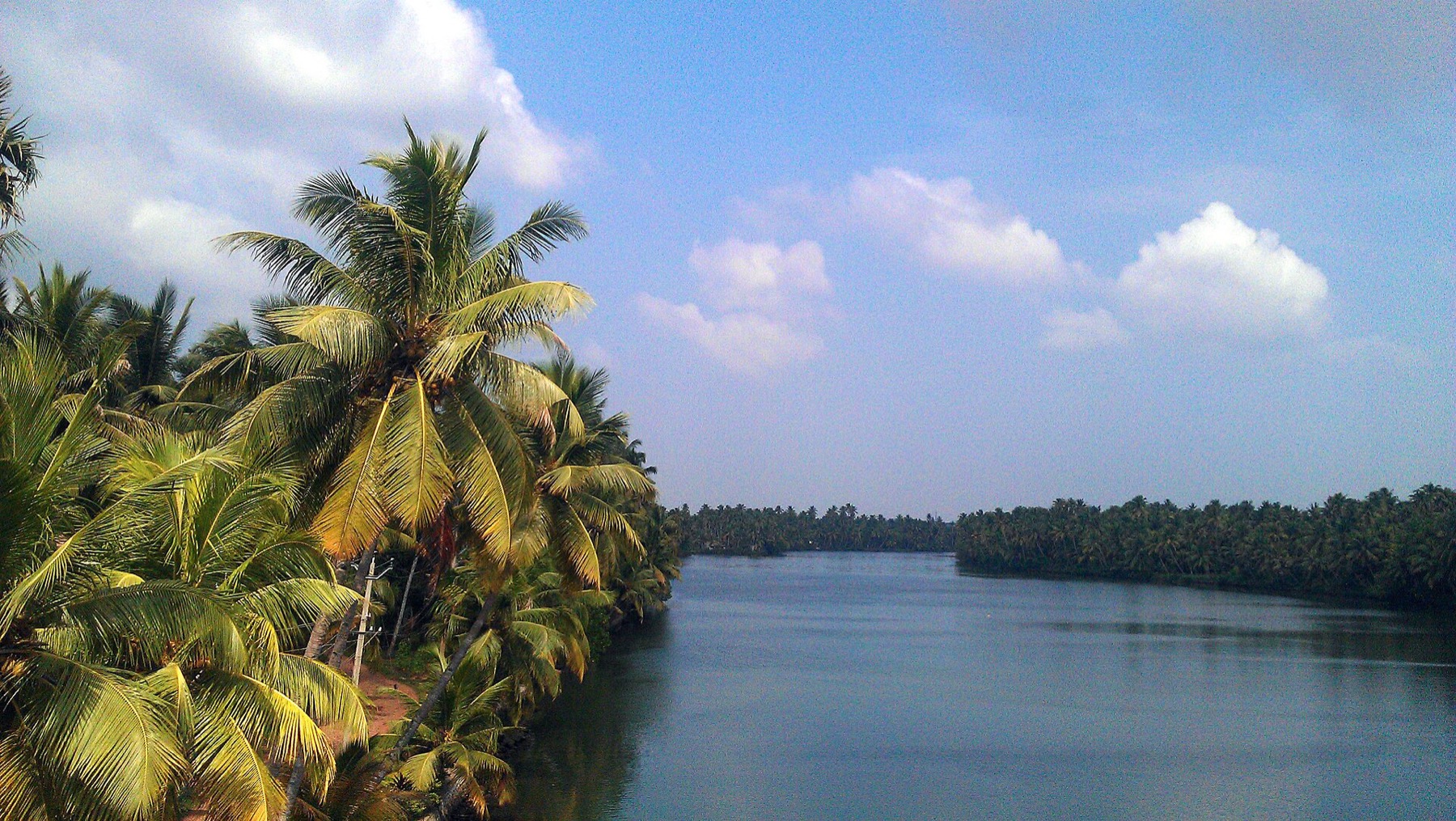
1.1 km · 13 min walk
The river that rises in the Western Ghats behind Thenmala, is impounded at the Parappar dam, and reaches the sea through Ashtamudi past Munroe Island — the thread that connects the east of this district to the west.
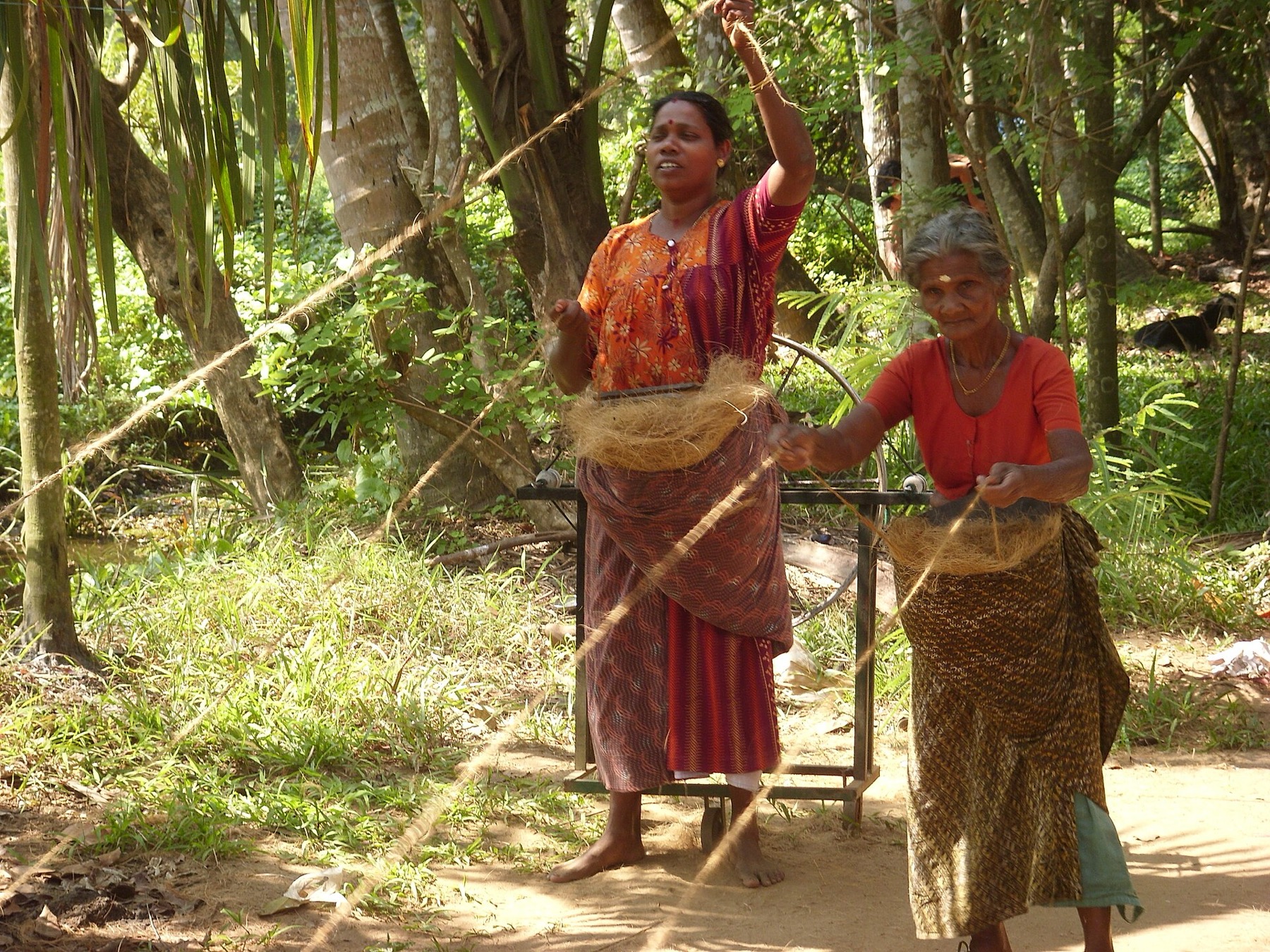
2.4 km · 29 min walk
The coir-working settlements of Munroe Island, where coconut husk is retted in the backwater and spun into yarn — a working craft economy on the canal banks rather than a demonstration laid on for visitors.
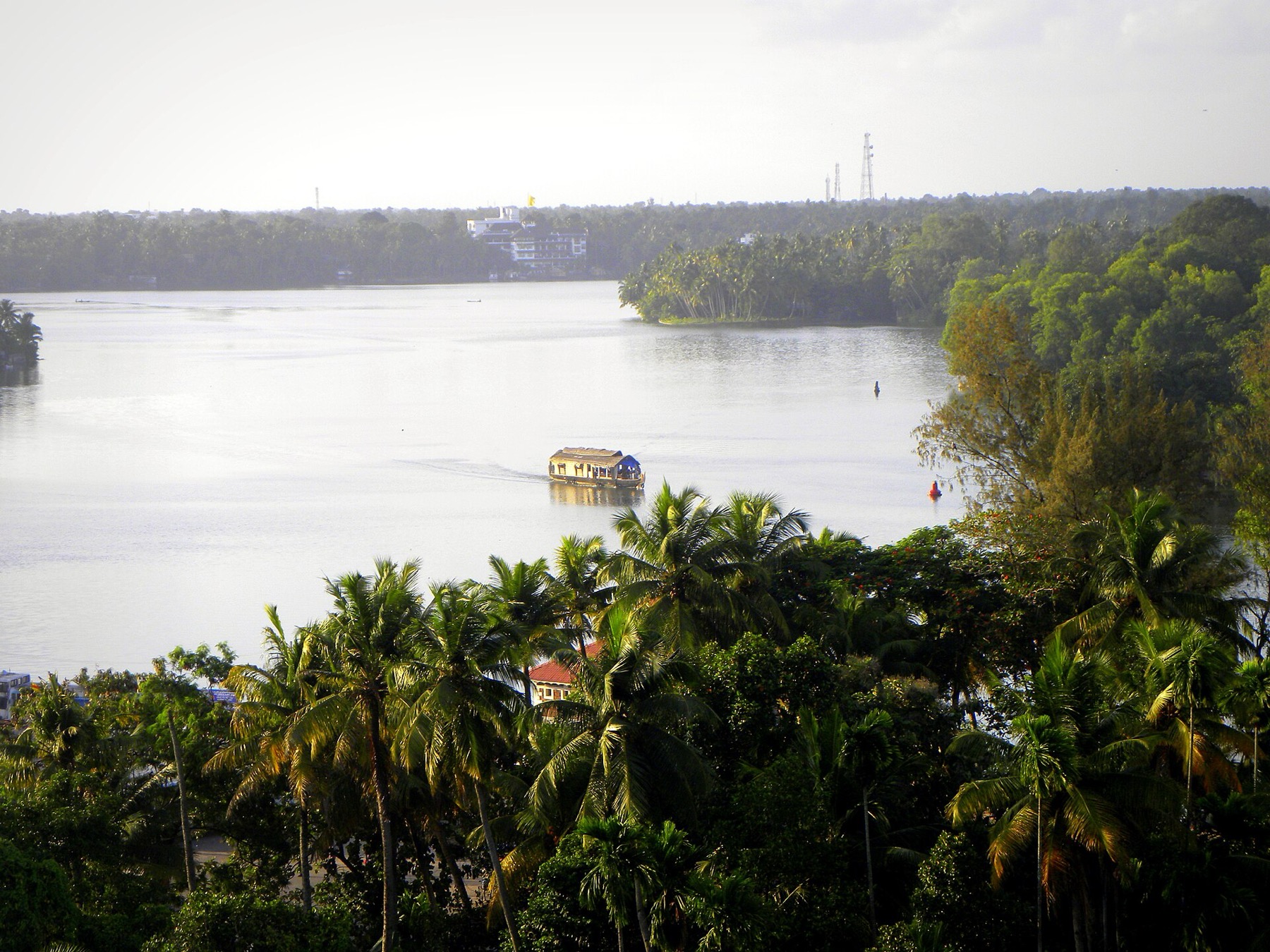
6.4 km · 13 min drive
The open-water outlooks on the Munroe Island and Perumon side of Ashtamudi, where the lake widens out — the wide views the canal trips themselves do not give you.
Roampedia is commission-free — own or know a stay, eatery, guide or shop near Munroe canals? List it and it appears here once verified.
Add a nearby businessEntry: Private and homestay boats are usually priced per boat, not per head: around ₹1,000 for a three-hour canoe seating up to six was observed in August 2026, ₹1,500–₹2,500 with resort access or food added, and ₹2,500–₹3,500 for a two-hour covered 'roof boat' seating up to twelve. DTPC Kollam runs its own boating and is reported at about ₹400 per person for a kayak or canoe and ₹600 for a country boat over roughly two hours and 10 km; book on +91 474 2745625 or +91 474 2750170. Rates are set locally and change.
If you are travelling by bus or ferry, check the return service with the operator before setting out. Leave time to reach the stop or jetty after your visit.
Ask at the jetty or stand for the time of the last service back, not the next one. If you miss it, an auto or app cab is the fallback — agree the fare before you get in.
If you need step-free access, contact the site before travelling. Ask about a level entrance, steps along the route, the nearest drop-off point, seating and accessible toilets.
Charge cap and free-transaction limits: Reserve Bank of India, in force since 1 May 2025.
These services are listed within about 1.2 km of Munroe canals. Walking distances follow mapped routes; access and opening hours can change. Other services may be closer but are not included here.
Emergency numbers are verified against official government and state tourism sources. 112 works anywhere in India.
The river that rises in the Western Ghats behind Thenmala, is impounded at the Parappar dam, and reaches the sea through Ashtamudi past Munroe Island — the thread that connects the east of this district to the west.
1.1 km · 13 min walkCanal village island known for canoe trips, coir work and slow backwater life.
1.1 km · 14 min walkThe coir-working settlements of Munroe Island, where coconut husk is retted in the backwater and spun into yarn — a working craft economy on the canal banks rather than a demonstration laid on for visitors.
2.4 km · 29 min walk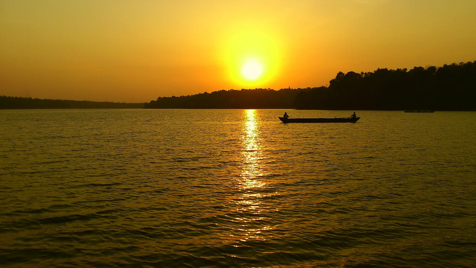
Kerala’s largest freshwater lake, a Ramsar wetland ringed by hills and a Sastha temple, north of Kollam.
5.2 km · ~13 min by auto · straight lineThe open-water outlooks on the Munroe Island and Perumon side of Ashtamudi, where the lake widens out — the wide views the canal trips themselves do not give you.
6.4 km · 13 min drive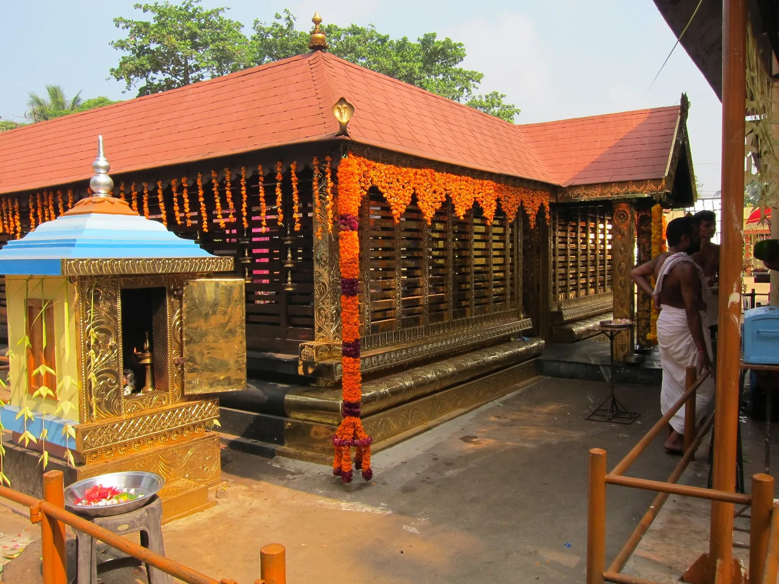
A Devi temple at Chavara north of Kollam, known across Kerala for Chamayavilakku — the two nights in Meenam when men and boys dress in saris and carry lamps in procession to the goddess, re-enacting the cowherd boys of its founding legend.
8.8 km · ~15 min by cab · straight line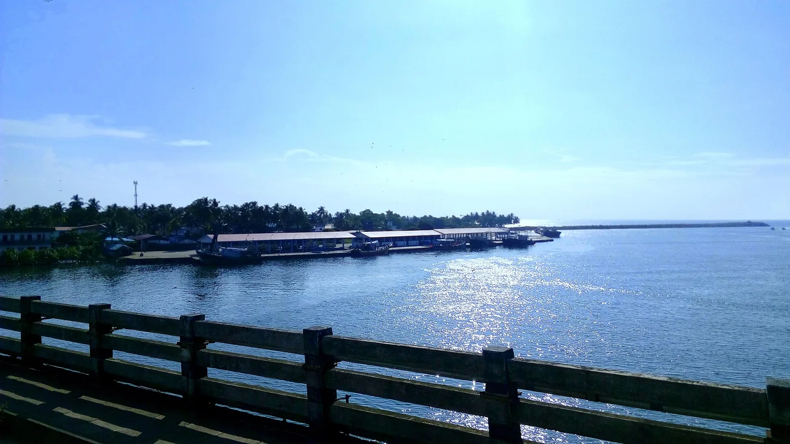
By most accounts Kerala’s largest fishing harbour, at the mouth of Ashtamudi Lake about 9 km from Kollam town, and where Indian fishing was mechanised; two bridges cross the confluence and the early-morning auction is the sight to catch.
10.4 km · ~17 min by cab · straight line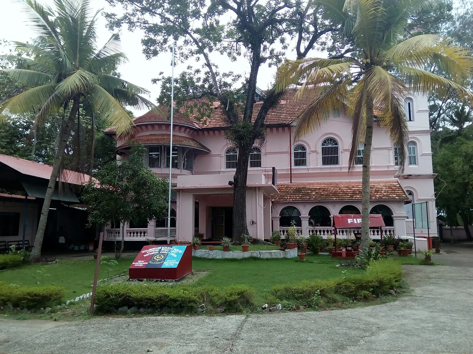
A Travancore royal residence on the Ashtamudi shore in Kollam, built to be arrived at by boat and now a working NCC establishment — viewed from outside or from the water.
10.9 km · ~18 min by cab · straight line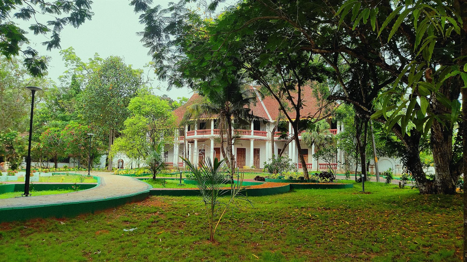
The former British Residency at Asramam survives as a government guest house beside Kollam’s backwater landscape. Its architecture is the attraction, with access governed by its working use.
11.2 km · ~19 min by cab · straight line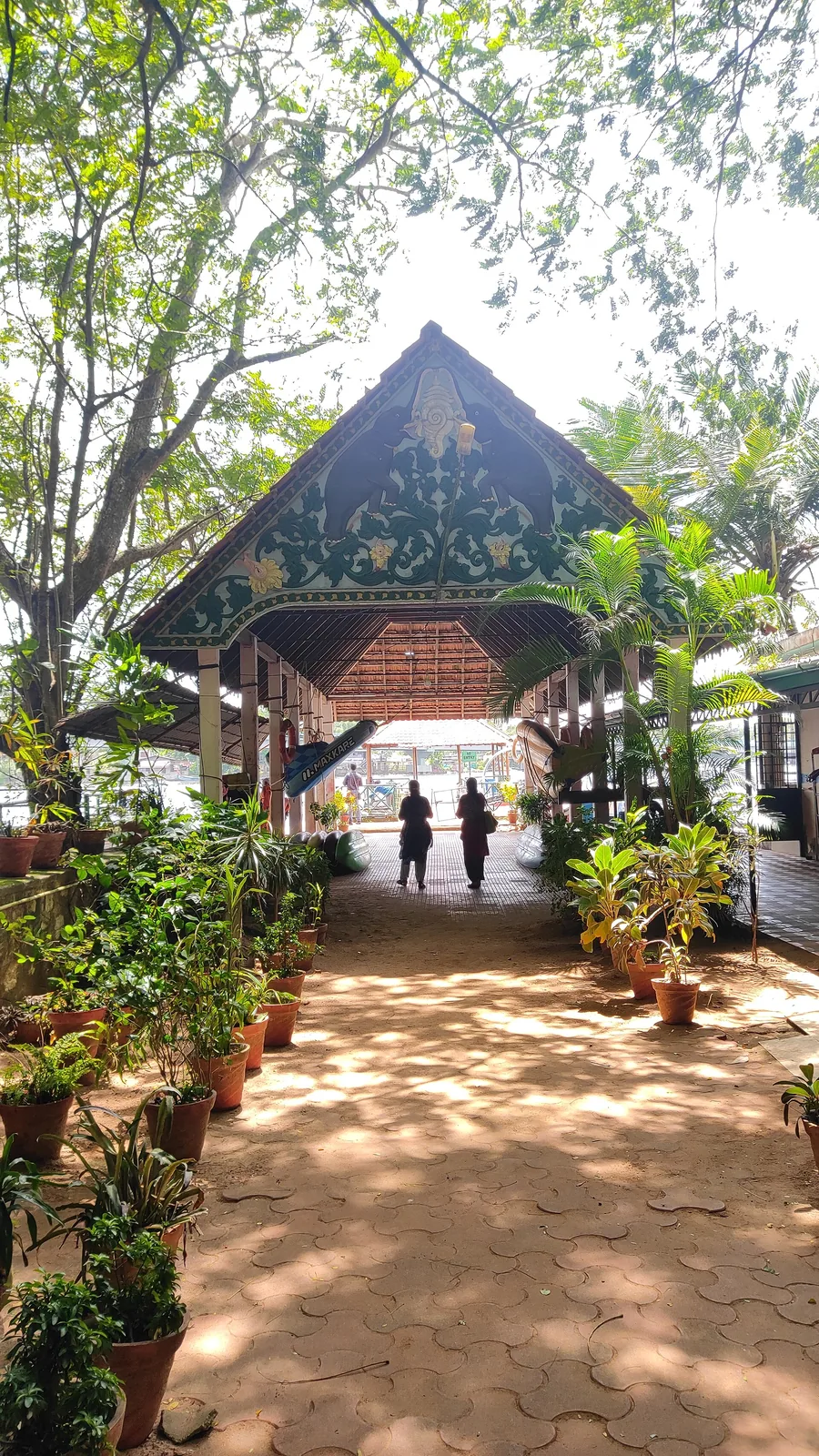
Forty-eight acres of municipal park on the Ashtamudi shore in the middle of Kollam, run by the DTPC — boating and kayaking off a painted jetty, ziplines and rope courses, a heritage walkway of terracotta reliefs, contemporary sculpture left behind by a 2012 festival, and a mangrove wetland with a state biodiversity heritage tag.
11.3 km · ~19 min by cab · straight line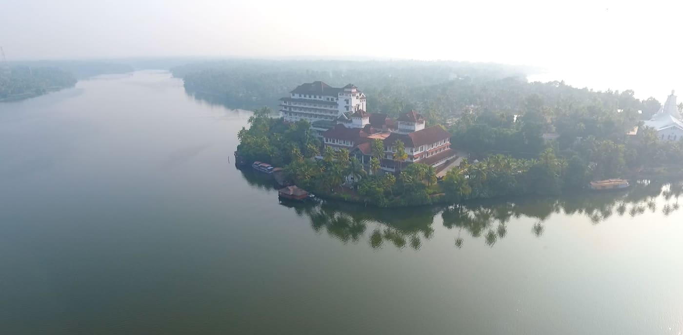
Large palm-fringed backwater system and houseboat base around Kollam.
11.7 km · ~20 min by cab · straight line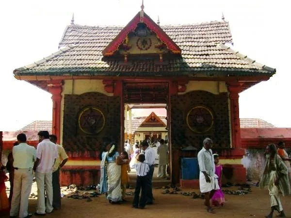
Anandavalleeswaram is an active Shiva temple in Kollam, with an Anandavally shrine and a ten-day annual festival in March or April. Ritual processions and cultural performances bring another dimension to the temple visit. Follow its worship session, admission and photography rules.
12.1 km · ~20 min by cab · straight lineWalking and driving times are real routed distances, except the few marked “straight line”, which are direct-line estimates and will read short. Fare figures are estimates from Kerala’s notified auto/taxi tariff and exclude waiting and night charges. Routing: © openrouteservice.org by HeiGIT | Map data © OpenStreetMap contributors
Nearby toilets, pharmacies, ATMs, seating and vets are community-mapped and may be incomplete or out of date. Map data © OpenStreetMap contributors | Walking times © openrouteservice.org by HeiGIT
Not all of them, and the main one certainly is not. The trunk channel, Puthanar — Malayalam for new river — is a 50 m-wide artificial cut made in the 1820s, credited to Colonel John Munro's design, to soften the monsoon floods and spread river silt onto the farmland in the south of the island. The 2023 NCESS study in Scientific Reports also notes that several of the islets exist because of that drainage network of natural and artificial streams. It was agricultural engineering; the tourism came a century and a half later.
A small country canoe, poled or paddled. The narrow inner village channels — the reason to come — are too tight and shallow for a covered roof boat or any larger craft. If you are offered a big boat you will see the wide water and miss the canals entirely. Note the reverse is also a misconception: the network as a whole is not canoe-only, since Puthanar is 50 m wide and carries ferries.
No, and this is the single most repeated bad tip about this place. A 2023 NCESS study put three tide gauges in and around the island and found the inland tidal range is almost the same at spring and neap tides, with the twice-daily tide largely dying out inside the estuary through friction and lag — the flooding here is not related to the open ocean's spring tide. There is no high-tide window worth planning around. What matters is the season's water level (November to March is the settled advice) and going at first light.
The measured trend is the opposite. Bathymetry shows the river channel deepened from 5–6 m in the 1980s to about 14 m, driven by unregulated sand mining and the loss of sediment after the Thenmala reservoir was built; the same study refers to boat channels being dug. The threat to this landscape is salt and land loss, not infill.
Two to three hours is standard. Private and homestay boats are usually priced per boat rather than per head — around ₹1,000 for a three-hour canoe seating up to six was observed in August 2026, rising to ₹1,500–₹2,500 with resort access or food, while a two-hour covered roof boat for up to twelve ran ₹2,500–₹3,500. DTPC Kollam runs its own boating and is reported at about ₹400 per person for a kayak or canoe and ₹600 for a country boat on a roughly two-hour, 10 km circuit; its booking numbers are +91 474 2745625 and +91 474 2750170. Rates are set locally and change — confirm before you go.
There is no single co-operative, and 'community-owned' overstates it. DTPC Kollam operates boats, and alongside it hundreds of island households own tourist boats individually. Tourism surged after 2022, and over 90% of residents are now reported to depend on it directly or indirectly — in a place where paddy fell from 227 acres in 1950 to under 2 acres by 2018. Booking a boat locally is not a gesture; it is most of the island's remaining economy.
Land is certainly being lost — about 14% of Munroe Thuruthu by the 2023 NCESS measurement, with Cheriyakadavu at 46.95%, and more than 500 households have vacated their homes. Whether the land itself is subsiding is genuinely contested: an earlier NCESS study using satellite radar and GPS concluded it is not, and that what settles is heavy concrete building on soft mud. The main causes are the loss of the Kallada's flood-borne sediment after the river was dammed, and sand mining.
Because the islets were built and maintained by sediment carried down in the Kallada's floods. The Kallada Irrigation Project and the Thenmala reservoir blocked that supply. The floods stopped rebuilding the land; the tide kept taking it. The two places are at opposite ends of the district and directly connected.
Coir retting frames in the shallows, prawn traps being checked, paddy and house plots at eye level, and three mapped landmarks clustered within about 200 m of the boating point on the island's eastern side: S Valavu, the S bend where the channel doubles back; Kandal Cave, the mangrove tunnel; and Ottakkandal, the lone mangrove. Which channels are passable depends on the season's water level.
Generally no, and a trip that does is not really a canal trip. The Perumon rail bridges are about 1.8 km south on open Ashtamudi at the island's southern tip — the old and new bridges stand side by side, the older one the site of the 1988 Island Express disaster in which 105 people died. The church known locally as the Dutch Church is about 2 km west on the far shore. Both are worth seeing as separate outings from the narrow channels.
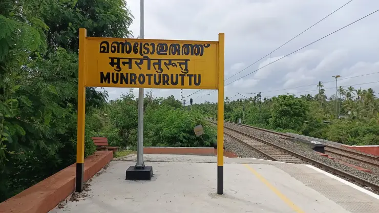
About 25–27 km from Kollam town. Munroturuttu station sits about 250 m west of the village centre — walkable to the village, though the boating point is a further 1.3 km or so and an autorickshaw is right for that. Kollam Junction is the major railhead. The peer-reviewed study describes the Idiyakkadavu bridge as the sole road entry. There are also ferry services between the island's many kadavus, which are genuine public transport rather than tours and the cheapest way onto the water.
Ask first, every time, and accept a refusal. These are working waterways through a lived-in village. The tidal flooding in particular should not be photographed as atmosphere — it is damage to people's homes.
October to March is best for comfortable boat trips; monsoon is greener but weather can disrupt plans.
Entry: Private and homestay boats are usually priced per boat, not per head: around ₹1,000 for a three-hour canoe seating up to six was observed in August 2026, ₹1,500–₹2,500 with resort access or food added, and ₹2,500–₹3,500 for a two-hour covered 'roof boat' seating up to twelve. DTPC Kollam runs its own boating and is reported at about ₹400 per person for a kayak or canoe and ₹600 for a country boat over roughly two hours and 10 km; book on +91 474 2745625 or +91 474 2750170. Rates are set locally and change. Timings: Trips run through daylight hours, with the early morning departure the one worth taking. Operators set their own times.
Base yourself in Munroe Island or a nearby town in Kollam, then confirm the last-mile route locally before leaving. Plan boat timings first, then arrange road transfer around the departure point. If the visit depends on forest, temple, boat, ferry, weather or seasonal access, check the official/local rule on the day before travel.
2 hours to a full day; overnight if using a houseboat area.
Nearby you can pair Kallada river (1.1 km), Munroe Island (1.1 km), Coir villages (2.4 km), Sasthamcotta Lake (5.2 km).
Use operators with life jackets and clear weather judgement. Avoid overloaded boats.
Written about Munroe canals itself — its history, its legends and the arguments about them.
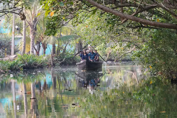
These guides explore Munroe Island and the surrounding area. Choose a visit that fits your interests, allowing separately for travel between stops.
Route-level itineraries and practical guides for the rest of Kerala.
Photographs: Timothy A. Gonsalves (CC BY-SA 4.0), Kondephy (CC BY-SA 4.0), Dr. Chinchu C. (CC BY 4.0), Shagil Kannur (CC BY-SA 4.0), Sanu N (CC BY-SA 4.0). Wikimedia Commons.