Places to Visit in Munroe Island

Quiet island area for canoe rides and village walks.

Munroe Island
Practical guide

Plan Munroe Island

Who's going?Tailor Munroe Island to your trip
DistrictKollam
RoleCanal village base
Time neededA canoe cruise alone takes roughly 2–3…
Places to visit4Listed businesses13
What to expect

Highlights

  • Munroe Island — Canal village island known for canoe trips, coir work and slow backwater life.
  • Munroe canals — The narrow inland canal network threading Munroe Island, navigable only by small country canoe — the reason the island is visited at all, and a different waterway entirely from the open Ashtamudi lake.
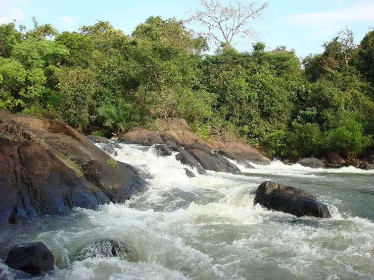
  • Kallada river — The river that rises in the Western Ghats behind Thenmala, is impounded at the Parappar dam, and reaches the sea through Ashtamudi past Munroe Island — the thread that connects the east of this district to the west.
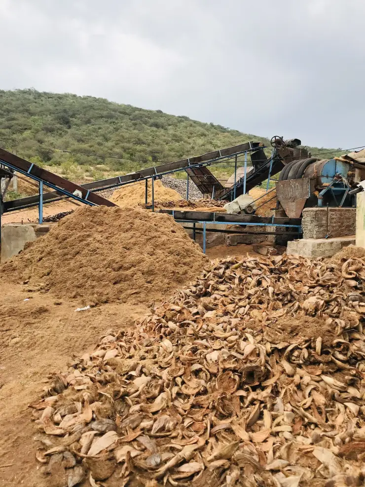
  • Coir villages — The coir-working settlements of Munroe Island, where coconut husk is retted in the backwater and spun into yarn — a working craft economy on the canal banks rather than a demonstration laid on for visitors.
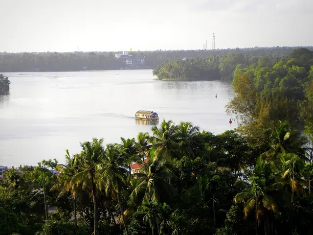
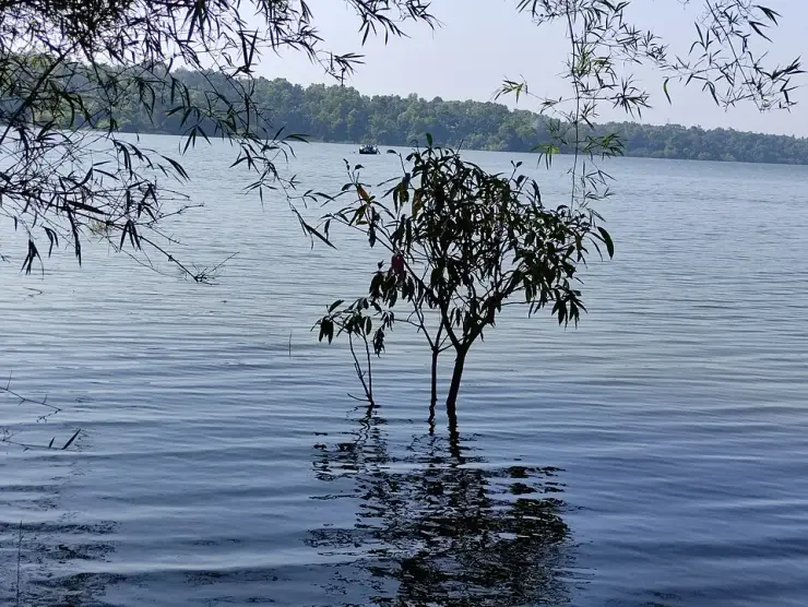
  • Ashtamudi backwater viewpoints — The open-water outlooks on the Munroe Island and Perumon side of Ashtamudi, where the lake widens out — the wide views the canal trips themselves do not give you.
Getting there

How to visit

  • Nearest airport: Trivandrum (TRV), ~69 km
  • Rail gateway: Kollam Junction (QLN)
Timing

Best time to visit Munroe Island

October to March is the dry, cool window, with November to February the sweet spot for birds. The monsoon (around June–September) brings lush green scenery but heavier rain and prolonged flooding, during which the piped drinking-water supply is suspended and Pattamthuruth ward can be cut off from the rest of the island for want of a road and a railway overbridge. The Kallada boat race falls on the 28th day of the Onam season, in the Malayalam month of Kanni — late September or October, not during Onam week in August–September, which is a common and costly misreading. Note that the usual advice to plan around the tide table does not hold here: NCESS measurements found that even the highest spring tide does not flood the island, and the flooding that does occur has no established schedule, so ask locally on the day.

Weather in Munroe IslandSeasonal guide

Live forecast loads in your browser.

Today at Munroe Island
Sunrise6:13 am
Sunset6:22 pm
Golden hour best light5:22 pm–6:22 pm
Blue hour after sunset6:22 pm–6:47 pm
Sun sets toward compass bearingW · 272°
Moon tonight🌓 First quarter · 54%

Sunset is in about 1 hour.

South-west monsoon. June to September is the south-west monsoon in Kerala. Expect heavy showers, mostly in bursts rather than all day — carry rain cover, allow extra time for getting around, and note that ferries and open-air sites are the first things affected.

Sun and moon are calculated for this location and shown in IST. Photography windows are the hour around sunrise and sunset; the sunset bearing is degrees clockwise from true north. Moon phase is accurate to about half a day.

The story

The story of Munroe Island

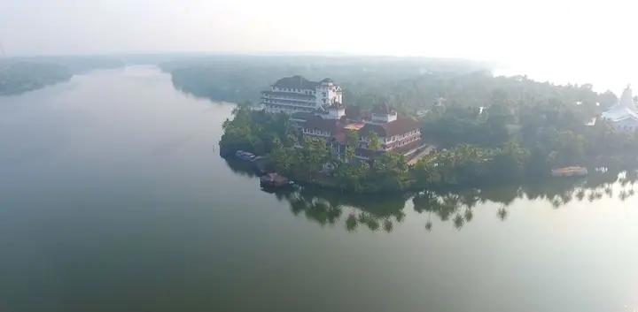
Where the Kallada River spills quietly into Ashtamudi Lake, eight major islands and a scatter of smaller ones float in a maze of glassy canals — Munroe Island, Kollam’s hushed, canoe-paddled corner of the Kerala backwaters, and the most closely measured piece of ground in the district.

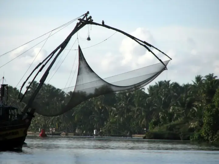
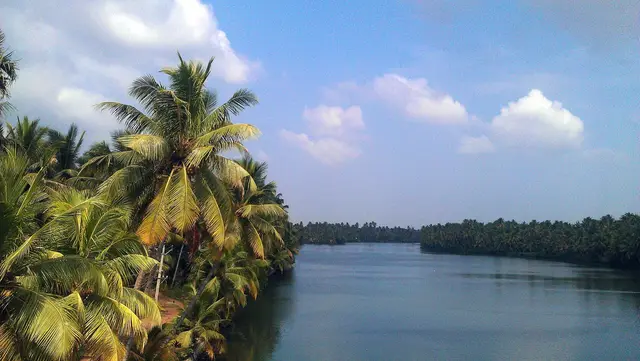
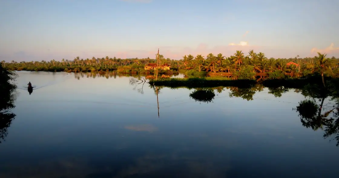
Munroe Island — Mundrothuruthu to the people who live there — is not a single island but eight major islands and an uncounted number of smaller islets, stitched together by narrow water-channels across roughly 13.4 square kilometres of the delta where the Kallada River meets the vast Ashtamudi Lake in Kollam district. It is a place best measured not in kilometres but in the slow dip of a paddle, in the way morning mist lifts off still water and coconut palms lean out over channels barely wider than a country boat.

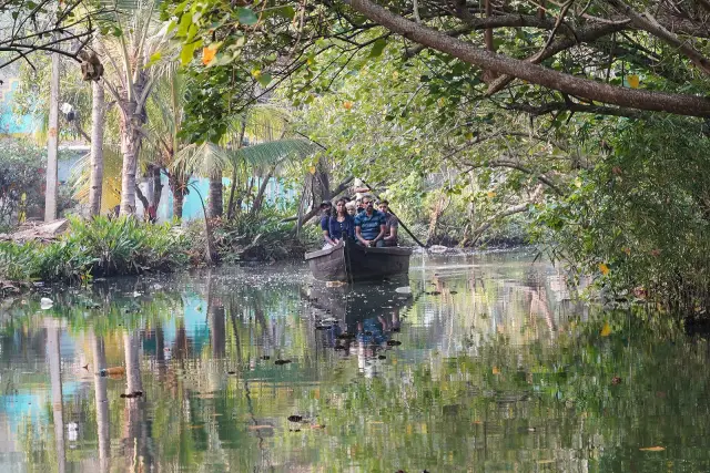
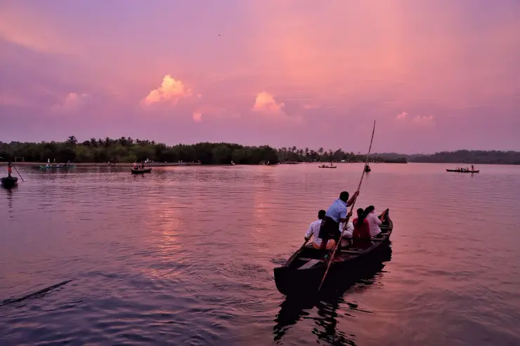
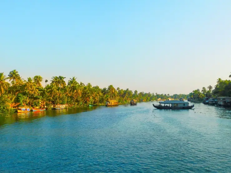
The signature experience here is the canal cruise by canoe. The inner waterways — called thodu locally — are far too slender for the big houseboats that ply Alappuzha and Kumarakom, and that narrowness is exactly the point. A small wooden canoe, poled or paddled by a local boatman, slips beneath low bridges and overhanging branches into a green tunnel of mangroves and palm, past homes whose front steps drop straight into the water. The quiet is almost complete: birdsong, the drip of the paddle, the occasional splash of a fish. DTPC Kollam runs its cruises twice daily, at 9 am and 2 pm, covering about ten kilometres of canal in roughly two hours; homestays and independent boatmen run their own trips at dawn and in the golden hour, which is where the familiar advice about early light comes from.

One detail on that trip is worth watching for, because it is the island's condition written into its architecture. Many houses here carry an open extra storey on top — a bare upper platform under a roof, unwalled, apparently unfinished. It is not unfinished. When the water comes up, that is where the household and its possessions go. A visitor reads it as a half-built house; it is a flood plan.

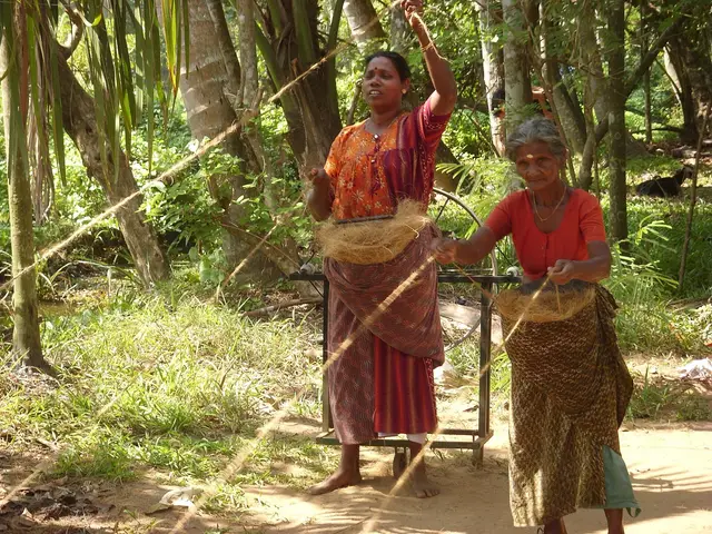
Village life is woven right into the tour rather than staged for it. Along the banks you may see women beating and spinning coir — the golden fibre extracted from coconut husk — while men mend nets, build boats, or tend small paddy plots and prawn ponds. Ducks paddle in file, cattle graze thin strips of bund between water and field, and children wave from jetties. Many families here have earned their living from the water and the coconut for generations, and a Munroe Island cruise is as much a glimpse of that amphibious way of life as it is a nature outing.

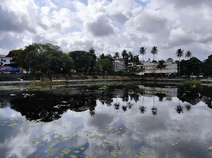
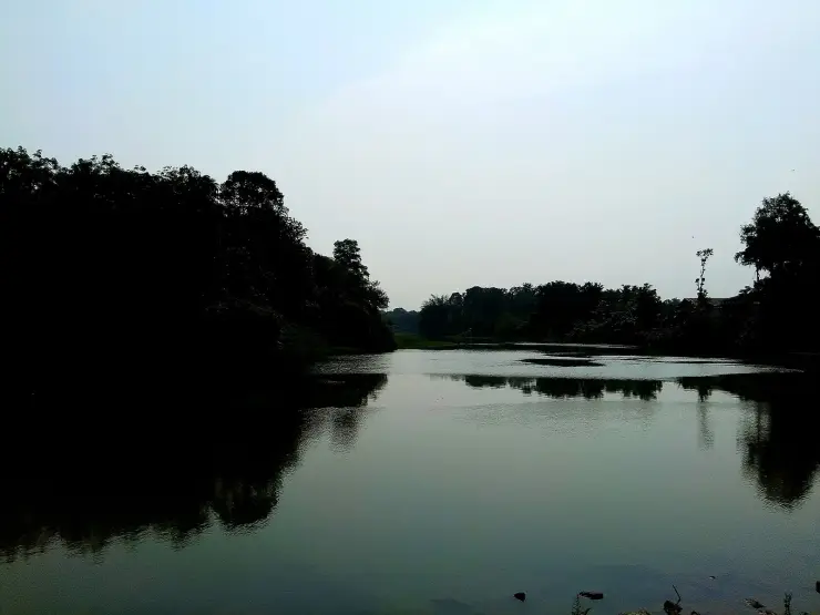
The wider setting is Ashtamudi — the eight-armed lake — Kerala's second-largest estuary after Vembanad and a Ramsar-listed site, so the islands sit within genuinely rich birding country. Egrets, kingfishers, herons, cormorants and, in season, migratory visitors work the shallows and mangrove fringes. Slow, engine-free canoes make Munroe one of the calmer places in the state to simply drift and watch water birds go about their day (best confirmed with a local guide for the current season).

It is also worth correcting the picture of a uniformly flat, low-lying island, because the survey sheets say otherwise. About 58% of Munroe Island's land sits within five metres of mean sea level, and the railway platform is at one metre — but the highest point, Peringalam hill, reaches 21.8 metres, and the geomorphology here is formally classified as denudational hills and valleys as well as flood plains and wetlands. There is a hill on Munroe Island. Almost nothing written about the place mentions it, and Peringalam is also one of the two islets whose land loss has been measured most precisely.

Because there are no big hotels, most visitors stay in family-run homestays scattered across the islets, sharing simple, often superb Kerala home-cooking — fresh fish, prawns from the very ponds you paddled past, coconut in everything. Evenings settle into a deep, unhurried quiet, the kind that has largely vanished from busier backwater towns. Sunset over the open water of Ashtamudi, watched from a jetty or a slow canoe, is the day’s natural finale.

The backwaters here come alive for the Kallada boat race (Kallada Jalotsavam), a regatta of twelve snake boats — five of them A-grade iruttukuthi — run since 1969 on the straight stretch of the Kallada, the nettayam, at Munroe Thuruthu. The date is precise and often misreported: it is held on the 28th day of the Onam season, the day known locally as 28-aam Onam, which falls in the Malayalam month of Kanni — late September or October, not during Onam week in August–September. Kerala Tourism calls it the final boat race of the Kerala season. If you plan around Onam you will miss it by about a month. It is a rare burst of noise and colour in a place whose ordinary register is stillness — and, for many travellers, the surest sign that Munroe Island, for all its fragility, remains a living, working community rather than a museum of itself.

Legend & myth

Almost everything a visitor is told about why Munroe Island is going under is wrong, and the corrections are more interesting than the story they replace. The island did not start sinking in 2004. The sea is not the thing taking it. And the most closely studied question here — whether the land itself is subsiding at all — has been answered twice, in opposite directions, by scientists at the same institute.

Start with the tsunami, because it is the version most often repeated. Satellite imagery spanning 1960 to 2021 shows the degradation beginning in the 1980s, and residents date the serious trouble to around the year 2000. The 2004 Indian Ocean tsunami arrives at the end of that sequence. The 2023 Scientific Reports paper by Rafeeque and colleagues at the National Centre for Earth Science Studies names two causes in its conclusion and the tsunami is neither of them: the loss of freshwater and sediment from the Kallada after the Thenmala reservoir was built, and uncontrolled sand mining. The tsunami appears in other people's lists of causes, and that is where it belongs — attributed and dated out, not stated as fact.

Now the tide, which is the more surprising correction. Every account of this island tells you it floods at spring tide and advises planning around the tide table. The NCESS team tested that directly, with three tide gauges at four locations across three seasons, and found that the inland tidal range is almost the same at spring tides as at neap — that the tidal flooding at Munroe Island is not related to the ocean's spring tide at all. A one-metre spring tide at the open coast arrives here, 10.5 kilometres inland, at less than half that height. In the words of K.K. Ramachandran, who led the earlier study: even at the highest spring tide, they found that it does not flood. The team also tested whether the shape of the basin had changed, comparing bathymetric surveys from 2000 and 2017, and eliminated that too. Two candidate explanations measured and ruled out.

What the measurements do show is a river that has dug itself a trench. The Kallada's channel has deepened from 5–6 metres in the 1980s to about 14 metres now — roughly a tripling in one human generation — as sand mining removed riverbed material that the dammed river no longer replaces. And the ground the island sits on is not ground in any reassuring sense: boreholes found more than 120 metres of unconsolidated loose sediment below the surface, medium-to-high-compressibility clay with unconfined compressive strengths of 9 to 34.5 kilonewtons per square metre. This is not an island resting on rock. It is 120 metres of soft mud.

Which brings the two studies into collision. In 2019, after two years of satellite radar interferometry and a continuously monitoring array of GPS stations, NCESS concluded that the land, as such, is not subsiding — that what is going down is heavy, poorly engineered concrete buildings pressing into fluidised mud, some by a foot to a foot and a half. In 2023, the same institute published a paper describing land subsidence and measuring 14% of the island's area lost. Both agree the ocean tide does not explain the flooding and the basin's shape has not changed. They disagree on whether the island itself is settling, or only what has been built on it. Ramachandran's own summary of the open question is the most honest sentence anyone has published about this place: it is not the tide alone, it is not accelerated sea level, all of these must be contributing, but there is something happening within the Ashtamudi lake — some kind of internal resonance which we are yet to decode.

Two smaller cautions, both checkable. The 2023 paper states the panchayat's area as 13,400 hectares, or 134 square kilometres; Munroe Thuruthu is about 13.4 square kilometres, so that is a factor-of-ten slip inside a peer-reviewed paper, and the figure should not be repeated. And the widely circulated prediction that the island will be underwater by 2050 has no named scientist attached to it anywhere we can find. The practical upshot for a visitor is simple and runs against the standard advice: do not plan your trip around a tide table. Plan around the monsoon, and ask locally on the day.

More about Munroe Island

History

The island takes its name from Colonel John Munro, 9th of Teaninich (1778–1858), a Scot who was British Resident of Travancore and Cochin from 1810 and Diwan of Travancore from 1812 to 1814, going home on leave in 1819. He reformed the judiciary, raised state revenues, attacked corruption, seated Christian judges alongside Brahmin ones, and set in motion the abolition of slavery in Travancore. He oversaw land reclamation in this delta, and the reclaimed cluster took his name — Munroe Island, or Mundrothuruthu (thuruthu meaning island) in Malayalam. Those are tenure dates and nothing on the island was built in them; he is also credited locally with encouraging the digging of the canals, which is a local attribution we have not been able to source to any primary record, and the islets themselves were built by the Kallada depositing sediment rather than by anybody's order.

Two origin stories attach themselves to this island and neither survives checking. The first dates its formation to the great flood of 1341 — a real and much-discussed event, but one belonging to the Periyar and the making of Vypin near Kochi, some 130 kilometres north, not to the Kallada. The second holds that Stone Age tools have been found here; it circulates on aggregator travel sites and rests on no archaeological source we can find. The sourced account of how these islands came to be is prosaic: estuarine sediment, laid down on Holocene alluvium where a river meets a lake.

For most of its history Munroe Island has lived by water and coconut. Coir-making — retting coconut husk in the brackish backwaters until the fibre softens, then beating and spinning it into yarn and rope — has been a mainstay home industry, historically employing many of the island’s women. Alongside it, the men have fished the lake and river, built and repaired the region’s wooden country boats, farmed prawns and small paddy plots, and worked the water in the countless small ways that a delta community must.

In recent decades Munroe Island has drawn national attention for a far more sobering reason: it is losing ground. Tidal flooding regularly reaches homes, wells, paddy fields and paths that were once dry — a slow, grinding change rather than a single dramatic flood. A 2023 study by the National Centre for Earth Science Studies, published in Scientific Reports, measured about 14% of the island's total land area lost over its study period, with more than a quarter of what remains under stress. The loss is very unevenly spread: the same study measured 46.95% depletion at Cheriyakadavu against 11.78% at Peringalam, together 38.73 acres gone from those two islets between 1989 and 2021. More than 500 households have been forced to vacate their homes.

The clearest single measure of what that has done is agricultural. Paddy cultivation on the island fell from 227 acres in 1950 to 8 acres in 1995, and to under 2 acres by 2018. The same study documents 22 historically named paddy fields that have disappeared entirely — the fields are gone, and so are their names. Men who farmed coconut and coir now pick clams in the inland canals; the coconut palms across Pattamthuruth and Peringalam stand as barren stumps with their roots killed by salt.

The causes are where the honest account parts company with the popular one. Sea-level rise and climate change are routinely given as the explanation, but the 2023 study's own conclusion names two different culprits: the loss of freshwater and sediment from the Kallada after the Thenmala reservoir was built upstream, and uncontrolled sand mining in the river. Satellite imagery going back to 1960 dates the onset to the 1980s, with residents feeling it seriously around 2000 — which places the 2004 tsunami, commonly blamed here, at the end of the sequence rather than the start of it. This is a genuine environmental stress on a fragile deltaic community, and it is not a reason to stay away; but it is worth understanding correctly, because the causes that are usually named are not the ones the measurements support.

Today Munroe Island balances these two threads — a serene, coir-and-canoe backwater beloved by slow travellers, and a low-lying island community negotiating a changing waterscape. Responsible, low-impact tourism through homestays and local boatmen is, for many residents, one of the ways the island keeps its people, its boats and its way of life afloat.

Why visit

A genuinely quiet, uncommercialised backwater — canoe canals too narrow for houseboats, so it stays wild and hushed.

The classic Munroe canal cruise by wooden canoe through green, palm-tunnelled thodu waterways.

An unstaged look at coastal village life — coir retting and spinning, prawn ponds, boat-building, fishing.

Excellent slow, engine-free birdwatching within the Ramsar-listed Ashtamudi wetland system.

Warm family-run homestays and home-cooked Kerala seafood, with none of the resort crowds.

Big-sky sunsets over Ashtamudi Lake, and — on the 28th day of the Onam season, in Kanni — the Kallada boat race.

The Dutch Church at Pattamthuruth, whose pediment carries a carved A.D. 1878 date-stone and whose April feast is organised by the island's Hindu families.
Before you go

Munroe Island — at a glance

HoursThere is no gate or fixed opening time for the island itself. DTPC Kollam runs its canal cruises twice daily, at 9 am and 2 pm. Homestays and independent boatmen run their own trips, most memorably in the early morning and again in the late afternoon for cool light and active birdlife (confirm timings with your boatman or homestay locally).

Entry: There is no entry fee to reach or walk around the island. You pay only for the boat experience. DTPC Kollam's published rates are ₹600 per person for the country-boat canal cruise and ₹400 per person for a kayak or canoe, lasting about two hours over roughly 10 km of canal; the DTPC Munroe Island canoe booking office is on 091883 55625. Homestays and independent boatmen set their own rates.

Photography: Photography is welcome and the light on the water is superb, especially at dawn and dusk. Please be considerate: this is a working village, so ask before photographing people, their homes or coir work up close, and respect villagers’ privacy (a small courtesy that is much appreciated).

Getting here

How to reach Munroe Island

  • ✈︎ By air The nearest major airport is Thiruvananthapuram (Trivandrum) International Airport, roughly 90–100 km away by road; Kochi (Cochin) airport is a longer alternative to the north.
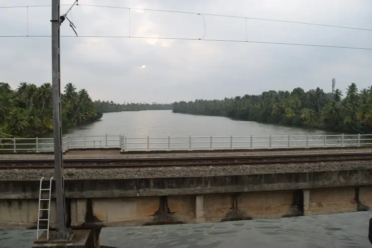
  • 🚆︎ By train Munroe Island has its own halt, Munroturuttu (station code MQO), on the Ernakulam–Kottayam–Kayamkulam–Kollam line — two platforms, two tracks, and a platform elevation of one metre above sea level, which is the island's whole situation in one number. About ten services stop, MEMU and passenger trains plus the Thiruvananthapuram Central–Guruvayur Intercity Express; most expresses do not stop, so check your specific train rather than assuming. ⚠ The station was closed on 31 January 2024 and reopened rebuilt on 25 September 2024 — re-check any older timetable. From the station an auto-rickshaw reaches most homestays. Kollam Junction is the nearest major railhead.
  • 🚗︎ By road By road it is about 25 km from Kollam town, and also roughly 38 km north of Paravur, 12 km west of Kundara and about 25 km from Karunagappally. There are two named approaches: the Perumon–Munroe Island Road from the south, over the Perumon bridge, and the Chittumala–Munroe Island Road from the east.
  • 🚌︎ By bus KSRTC and local buses serve Kollam and the surrounding area; from Kollam you can continue by local bus, auto-rickshaw or taxi towards the island, and reach the inner islets by boat. For door-to-jetty convenience many visitors simply take a taxi or the train to Munroturuttu and let their homestay arrange the final transfer.
Getting back

Check your return bus or ferry with the operator before setting out. Leave time to reach the stop or jetty after your visit, and arrange a return vehicle in advance for a remote outing.

Ask at the jetty or the stand for the time of the last service back, not the next one. If you miss it, an auto or a taxi is the fallback — agree the fare before you get in.

Do

Things to do in Munroe Island

  • Take the signature canoe canal cruise through the narrow palm-fringed thodu waterways.
  • Watch — and try — traditional coir-making: retting coconut husk and spinning the golden fibre.
  • Go birdwatching by slow, engine-free canoe within the Ashtamudi wetland.
  • See village life up close: prawn and fish farming, net-mending and wooden boat-building.
  • Stay overnight in a family-run homestay and share home-cooked Kerala seafood.
  • Watch the sunset over the open water of Ashtamudi Lake from a jetty or canoe.
  • On the 28th day of the Onam season (Kanni — late September or October), catch the Kallada boat race (Kallada Jalotsavam) on the nettayam, the straight stretch of the river at Munroe Thuruthu.
  • See the Dutch Church at Pattamthuruth and its carved A.D. 1878 date-stone.
  • Cross on the Perumon–Munroe Island ferry (roughly 06:30–20:30), which is local transport rather than a tourist attraction and is the better for it.
Getting around Munroe Island

If you need step-free access, contact the site before travelling. Ask about a level entrance, steps along the route, the nearest drop-off point, seating and accessible toilets.

Practical things near Munroe Island
What the cash actually costs
  • Withdrawing from a bank that is not your own is free for a set number of times a month, then costs up to ₹23 plus GST — about ₹27 a withdrawal. This is not one of the RBI’s six metro centres, so the allowance here is the higher one: at least five free other-bank withdrawals a month, and at least five at your own bank.
  • That free allowance belongs to Indian bank accounts. On a card issued abroad your own bank’s international withdrawal and exchange charges apply instead. If the machine offers to bill you in your home currency, choose rupees — the conversion rate on that offer is set by the machine, not by your bank.
  • Choose a well-lit ATM, preferably at a bank branch. Shield your PIN, avoid help from strangers and use your bank’s support number if a withdrawal fails or the machine retains your card.

Charge cap and free-transaction limits: Reserve Bank of India, in force since 1 May 2025.

These services are listed within about 1.2 km of Munroe Island. Walking distances follow mapped routes; access and opening hours can change. Other services may be closer but are not included here.

Nearby bases

Where to go from Munroe Island

Kollam town, Kollam townBackwater and coast base
Town / base

Kollam town

Ashtamudi Lake, beach, lighthouse and ferry base.

Ashtamudi LakeThangassery LighthouseKollam BeachThevally Palace
Open Kollam town guide →
Thenmala, ThenmalaEco-tourism base
Town / base

Thenmala

Forest, dam and adventure activity base in the southern ghats, with two of the Pancha Sastha temples on the road towards the Tamil border.

Thenmala DamPalaruvi WaterfallsAryankavuShendurney Wildlife Sanctuary
Open Thenmala guide →
Chadayamangalam, ChadayamangalamViewpoint base
Town / base

Chadayamangalam

Hill and sculpture park stop between Kollam and Thiruvananthapuram, with an unstaffed river shelf on the Ithikkara 4 km away.

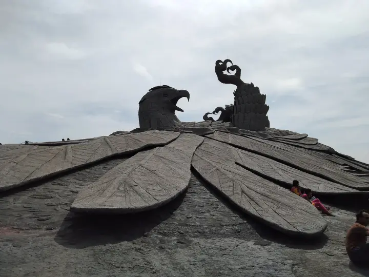
Jatayu Earth’s CenterChadayamangalam hill viewsLocal temple trailsVattathil Waterfalls
Open Chadayamangalam guide →
Karunagappally, KarunagappallyCoastal north base
Town / base

Karunagappally

Backwater-and-highway town in Kollam’s northern taluk, on the Alappuzha seam. Four singular places ring it — two shrines with no idol, the Chamayavilakku temple, and the Alumkadavu boatyards on Kayamkulam Kayal.

Oachira Parabrahma TemplePoruvazhy Peruviruthy MalanadaKottankulangara Devi TempleAlumkadavu
Open Karunagappally guide →
Kottarakkara, KottarakkaraInland temple and arts base
Town / base

Kottarakkara

Taluk town on the MC Road north-east of Kollam — the Mahaganapathi temple, its tank, and the memorial to the Thampuran credited with Ramanattam.

Kottarakkara Sree Mahaganapathi Temple
Open Kottarakkara guide →
Achankovil, AchankovilForest and pilgrimage base
Town / base

Achankovil

Remote Achankovil river valley on the road to the Chenkottai gap — forest waterfalls and the Sastha temple where the god is a householder and a physician.

Kumbhavurutty WaterfallsAchankovil Sastha Temple
Open Achankovil guide →
In the district

Where Munroe Island sits in Kollam district

District HQKollam
LandscapeCoast, Ashtamudi backwaters and southern ghats

Kollam district is known for: Ashtamudi Lake, Munroe Island, Thenmala eco-tourism and the Kollam coast.

Ashtamudi Lake backwatersMunroe Island canoe tripsThenmala and Palaruvi Waterfalls
Stay · eat · do · rent · see · shop

Places in Munroe Island

Every verified place in Munroe Island — filter by what you’re after.

1 place to eat in Munroe Island

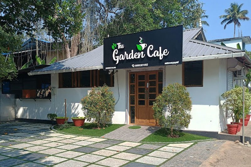
The Garden Cafe Munroe Island — Cafe and restaurant in Munroe Island
Verified
Cafe and restaurant · Munroe Island
The Garden Cafe Munroe Island

The Garden Cafe is a meal-stop option on Munroe Island. Arrange food around your actual canoe or backwater departure, allowing time to reach the boarding point rather than assuming the café is beside it.

Directions Commission-freeView details

Book with the place itself. India’s cyber-crime coordination centre warned in April 2025 that convincing copies of hotel and pilgrimage booking sites are being pushed through sponsored search and social ads, taking payment for rooms the property never hears about. Every listing here links to the business’s own contact details and its own Google or Bing profile — we take no commission and sit in nobody’s payment path. If a booking page reached you through an ad, check the address bar against the property’s own site before you pay. Fraud can be reported on cybercrime.gov.in or on 1930.

For hotels, homestays and local businesses

Get listed in Munroe Island for free

Roampedia is commission-free. Travellers discover your business, book directly and contact you through official details. Basic listings are free, while Gold and Platinum package upgrades can be requested from the owner dashboard after approval.

List your business — free
Read before you go

Munroe Island guides, stories & itineraries

We have not published a story about Munroe Island itself yet. These cover Kollam, the district it sits in, and travel in Kerala generally.

Around Munroe Island

These are written about individual places you can reach from Munroe Island, rather than about the town as a whole.

More from Kollam

Wider guides to Kollam — its coast, its culture and the routes through it.

See all 129 Kollam guides & stories →

Map

Where things are in Munroe Island

FAQ

Munroe Island travel FAQs

What exactly is Munroe Island?

It is a cluster of eight major islands and an uncounted number of smaller islets — Mundrothuruthu in Malayalam — covering about 13.4 sq km at the confluence of the Kallada River and Ashtamudi Lake in Kollam district, laced together by narrow canals. Named islands include Peringalam, Cheriyakadavu, Pattamthuruth, Pezhumthuruth, Nenmeni and Neettamthuruth. It is a working village destination best known for canoe cruises, coir-making and birdlife.

Who was Munroe Island named after, and did he build it?

Colonel John Munro, 9th of Teaninich (1778–1858), a Scot who was British Resident of Travancore and Cochin from 1810 and Diwan of Travancore from 1812 to 1814. He oversaw land reclamation in this delta and the reclaimed islets took his name. He did not build the islands — the Kallada did, by depositing sediment — and no structure here dates from his tenure.

What is the canoe cruise like, when does it run, and what does it cost?

A local boatman paddles or poles a small wooden canoe through narrow, palm-fringed canals too tight for large houseboats, passing homes, coir workers and birdlife. DTPC Kollam runs cruises twice daily at 9 am and 2 pm, about two hours over roughly 10 km of canal, at ₹600 per person by country boat and ₹400 by kayak or canoe; the booking office is on 091883 55625. Homestays and independent boatmen run their own dawn and golden-hour trips at their own rates. Book ahead — there is no operator scale here.

Is it true the island is sinking?

That depends on what you mean, and two studies by the same institute disagree. A 2017–2019 NCESS study using satellite radar interferometry and a GPS array concluded that the land itself is not subsiding — only heavy, poorly engineered buildings are, by up to a foot and a half. A 2023 NCESS paper in Scientific Reports documents land subsidence and measures roughly 14% of the island's land lost, with over a quarter of the remainder under stress. What is beyond dispute: houses, bridges and the railway platform have settled, land has been lost at the water's edge, and more than 500 households have moved out.

Did the 2004 tsunami cause it?

No — or at most it made an existing problem worse. Satellite imagery back to 1960 shows the degradation beginning in the 1980s, two decades before the tsunami, with residents dating the serious trouble to around 2000. The 2023 NCESS paper's own conclusion names two causes and the tsunami is neither: the loss of freshwater and sediment from the Kallada after the Thenmala reservoir was built, and uncontrolled sand mining.

Do the tides flood the island? Should I plan around a tide table?

Not in the way visitors are told, and no. NCESS measured a 1-metre spring tide at the open coast arriving at Munroe Island, 10.5 km inland, at less than half that height, and found that even the highest spring tide does not flood it. The flooding that does happen is real, but its mechanism is unexplained — the lead scientist called it some kind of internal resonance which we are yet to decode. Plan around the monsoon instead, and ask locally on the day.

How do I get to Munroe Island?

The island has its own halt, Munroturuttu (station code MQO), on the Kollam–Ernakulam line, where about ten passenger, MEMU and one intercity service stop; most express trains do not, so check your specific train. The station was closed on 31 January 2024 and reopened rebuilt on 25 September 2024, so re-check any older timetable. By road it is about 25 km from Kollam town via the Perumon–Munroe Island Road or the Chittumala–Munroe Island Road. Nearest major airport is Thiruvananthapuram, roughly 90–100 km.

Is the island flat?

Not entirely, which surprises most visitors. About 58% of its land sits within 5 m of mean sea level and the railway platform is at 1 m — but the highest point, Peringalam hill, reaches 21.8 m above sea level, and the geology is formally classified as denudational hills and valleys as well as flood plains and wetlands.

Where do visitors stay, and how long should I plan?

There are no large hotels — accommodation is in family-run homestays across the islets. A half-day covers the main canoe cruise, but an overnight stay is far more rewarding, letting you catch both the misty morning and golden-hour cruises plus a lakeside sunset.

Is there a church worth seeing?

Yes, the church locally called the Dutch Church, at Pattamthuruth. Its pediment carries a carved A.D. 1878 date-stone. Only one Christian family remains on the island, so it has no resident priest; its three-day April feast, which feeds over 4,000 people, is organised by the island's Hindu families. Note that Dutch describes the style rather than the builder — the Dutch had left Kerala more than eighty years before 1878.
What are the best places to visit in Munroe Island?

Top places to visit in Munroe Island include Munroe canals, Kallada river, Coir villages, Ashtamudi backwater viewpoints — each has a full guide with how to reach it and what to see nearby on this page.

What is the best time to visit Munroe Island?

October to March is the driest and most comfortable season to visit Munroe Island and the rest of Kerala. The June–September monsoon is lush and green but wet, and often brings lower low-season prices.

Photographs: Kondephy (CC BY-SA 4.0), Shagil Kannur (CC BY-SA 4.0), Dr. Chinchu C. (CC BY 4.0), Timothy A. Gonsalves (CC BY-SA 4.0), Kayal Vizhi (CC BY-SA 4.0). Wikimedia Commons.

Image credits