Places to Visit in Meppadi and Chembra

Meppadi and Chembra form Wayanad's main trek, waterfall and 900 Kandi planning base, with Chembra Peak, Soochipara, Meenmutty, Kanthanpara, Neelimala, Sunrise Valley, Skypark/Glass Bridge 900 Kandi, tea-estate routes, resorts, camping operators and hill-road transfers spread across the plantation side. Use it when the trip is built around walking, waterfalls, glass-bridge/viewpoint activities and weather-sensitive access checks.

Meppadi and Chembra
Practical guide

Plan Meppadi and Chembra

Who's going?Tailor Meppadi and Chembra to your trip
DistrictWayanad
RoleTrek base
Time neededTwo nights minimum for the…
Places to visit12Listed businesses23
What to expect

Highlights

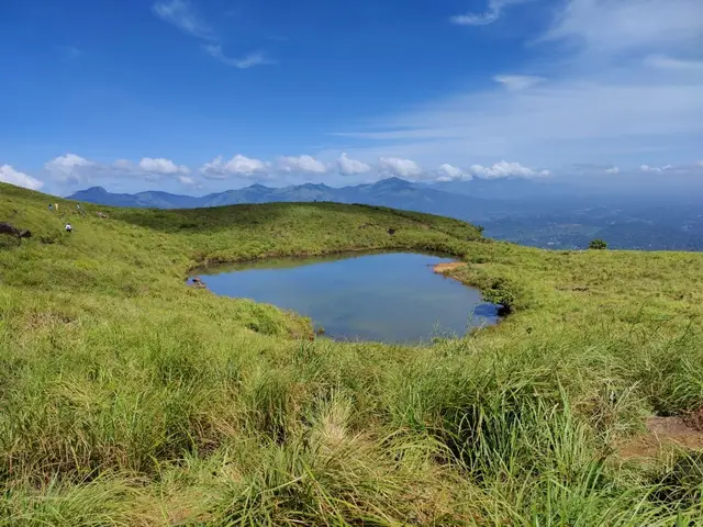
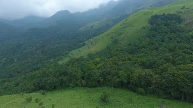
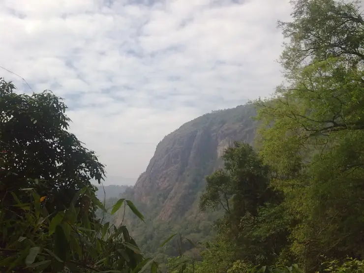
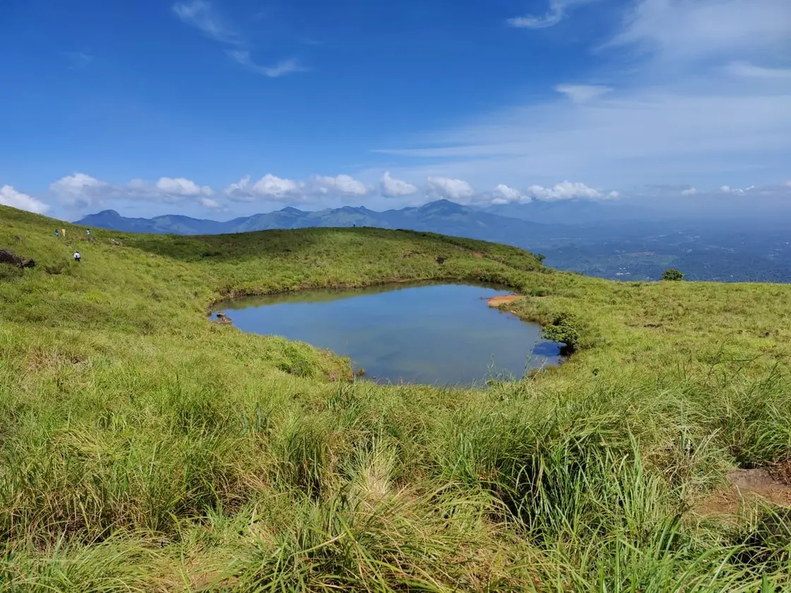
  • Chembra Peak trek — Famous highland trek area, known for the heart-shaped lake viewpoint; permits and access vary.
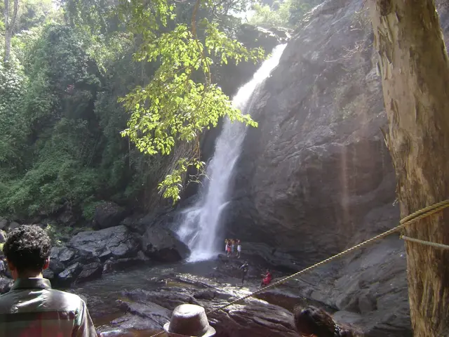
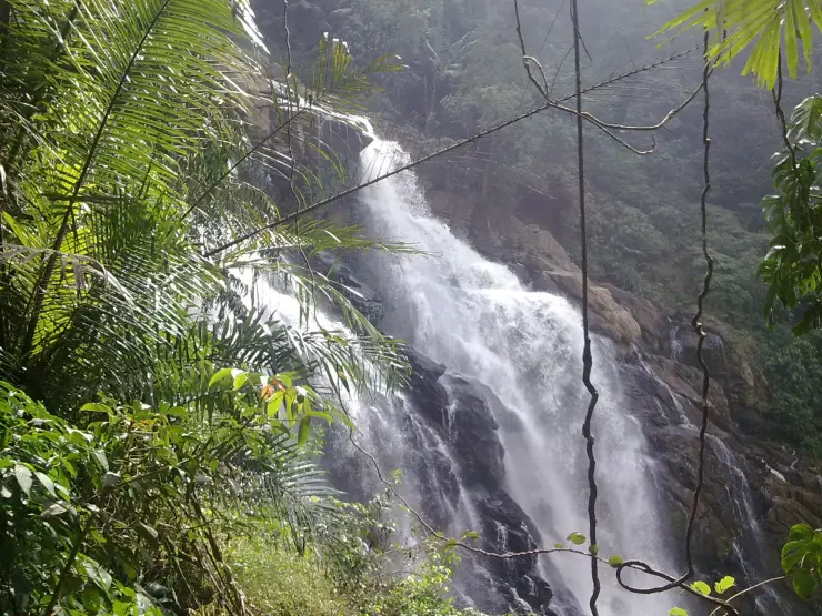
  • Soochipara Waterfalls — Popular waterfall reached by a short forest walk, access varies by season.
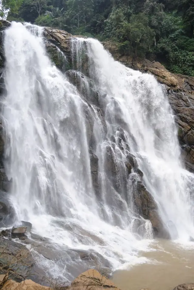
  • Meenmutty Waterfalls — The closed Meppadi–Vaduvanchal waterfall, also listed as Meenmutty Falls trek. The map marks Vaduvanchal bus stand for town orientation, not an open waterfall entrance. Banasura Meenmutty is a different site.
  • Meenmutty Falls trek — The closed forest approach to Meenmutty Falls near Vaduvanchal on the Meppadi–Gudalur side of Wayanad. This is not Banasura Meenmutty near Padinjarathara; use this guide for identity and access context, not a bookable trek.
  • Banasura Meenmutty Waterfalls — The Banasura-side Meenmutty at Kappikkalam, five kilometres from Banasura Sagar Dam—not the Meppadi or Makkiyad waterfalls with the same name.
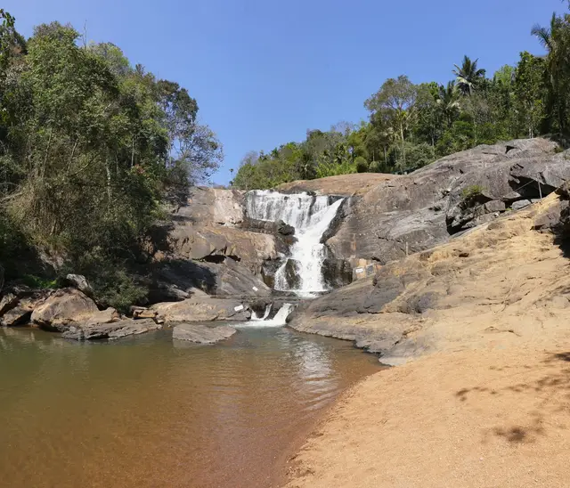
  • Kanthanpara Waterfalls — Meppadi-side waterfall with easier access than some larger Wayanad falls, still weather-sensitive in monsoon.
Getting there

How to visit

  • Nearest airport: Calicut International Airport (CCJ), about 95-110 km by road depending on ghat and Meppadi-side traffic
  • Rail gateway: Kozhikode railway station (CLT), about 80-100 km by road; Wayanad has no rail station
  • KSRTC/private buses and taxis connect Kalpetta, Sulthan Bathery and Mananthavady from Kozhikode/Calicut, Mysuru and Bengaluru; confirm current ghat-road timings before travel.
Timing

Best time to visit Meppadi and Chembra

October to March is the reliable window — clear mornings, safe rock, open trails. June to September is the south-west monsoon: heavy, cold, prone to red alerts and to blanket suspension of trekking and waterfall access. April and May are dry, hazy and the peak fire-risk season on the Chembra grassland.

Weather in Meppadi and ChembraSeasonal guide

Live forecast loads in your browser.

Today at Meppadi and Chembra
Sunrise6:15 am
Sunset6:24 pm
Golden hour best light5:24 pm–6:24 pm
Blue hour after sunset6:24 pm–6:49 pm
Sun sets toward compass bearingW · 272°
Moon tonight🌓 First quarter · 52%
South-west monsoon. June to September is the south-west monsoon in Kerala. Expect heavy showers, mostly in bursts rather than all day — carry rain cover, allow extra time for getting around, and note that ferries and open-air sites are the first things affected.

Sun and moon are calculated for this location and shown in IST. Photography windows are the hour around sunrise and sunset; the sunset bearing is degrees clockwise from true north. Moon phase is accurate to about half a day.

The story

The story of Meppadi and Chembra

Meppadi is a plantation town on State Highway 29 between Kozhikode and Ooty, about eleven kilometres south of Kalpetta, and it is also the name of a grama panchayat that covers 198.65 square kilometres of Vythiri taluk in twenty-one wards. That is the first thing to hold on to, because the wards include Chembra, Puthumala, Chooralmala and Mundakkai. Almost everything a visitor comes here for — the highest peak in Wayanad, three of the district’s best-known waterfalls, the viewpoints, the glass bridge at 900 Kandi — sits inside this one local body, and so does the site of the landslide of 30 July 2024, the deadliest in Kerala’s recorded history. Meppadi itself is a working tea town of estate offices, a bus stand, a vegetable market and a hospital, and it is best understood as the administrative and industrial centre of a landscape rather than as a sight.

The town reads as a short, busy stretch of the Kalpetta–Ooty road with tea on both sides of it. There is a bus stand, a market where the fruit is stacked out onto the pavement, estate offices, a police station, banks, the Wayanad Institute of Medical Sciences on the Kalpetta side, and schools whose catchments run out into the estates for ten kilometres in every direction. The panchayat around it is enormous by Kerala standards — 198.65 square kilometres — and its boundaries tell you the shape of the place: Kalpetta municipality to the north, the Ernad taluk of Malappuram to the south over the crest, Ambalavayal and Muppainad to the east, Vythiri to the west. Its twenty-one wards are Ezhamchira, Vellithode, Thrikkaipetta, Poothakkolli, Meppadi, Nedumbala, Nellimunda, Puthumala, Chooralmala, Chulika, Attamala, Mundakkai, Kunnamangalamvayal, Chembra, Kadoor, Kunnampetta, Kottanad, Anappara, Odathode, Chempothara and Puthoorvayal. At the 2001 Census the panchayat held 56,530 people at 82.32 per cent literacy.

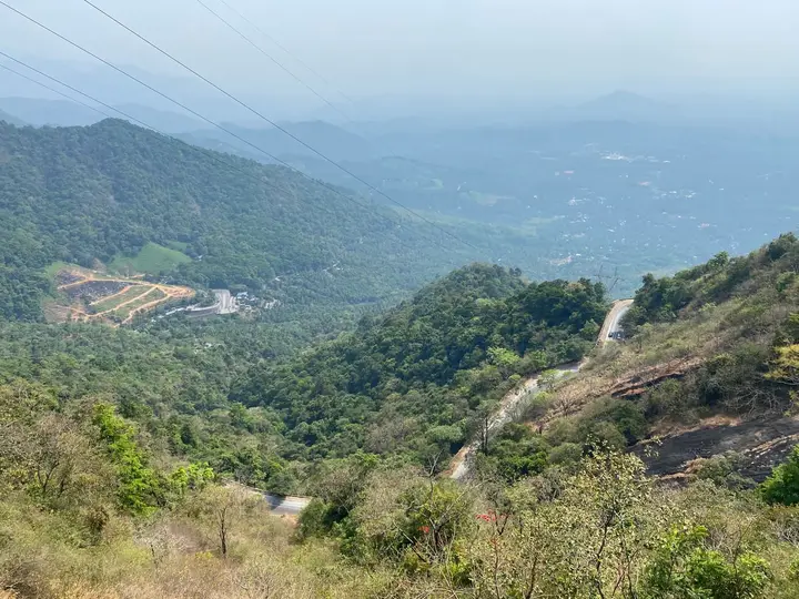
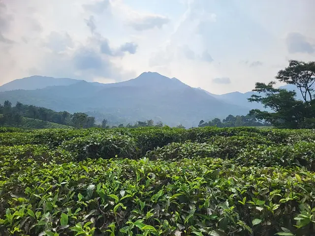
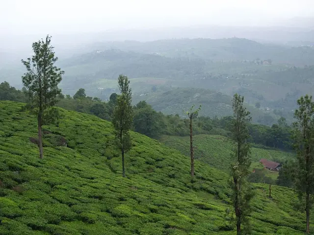
What the panchayat does for a living is tea, and it has done so for longer than any other part of Wayanad. Harrisons Malayalam still runs four estates in and around this belt and publishes their particulars itself: Arrapetta, whose postal address is simply Meppadi Post, making about two million kilogrammes of orthodox tea a year; Sentinel Rock, addressed at Vellarmala Post via Meppadi, making about a million kilogrammes of orthodox; Achoor, about two million kilogrammes of CTC; and Chundale, about two million of CTC. The company gives the planting elevation across all of them as roughly 2,500 to 3,500 feet. Those are company figures rather than audited public ones, but they are the operator’s own, and they are the reason the roads here are estate roads: single-track tar between drystone revetments, built to move leaf to a factory rather than tourists to a viewpoint.

Read that estate list against a map and the disaster stops being an abstraction. Sentinel Rock Estate’s post office is Vellarmala — the same name as the Government Vocational Higher Secondary School at Chooralmala. In the early hours of 30 July 2024 a rockslide high on the Vellarimala slopes became a debris flow that ran down the Punnapuzha through Punchirimattam, Mundakkai and Chooralmala. Three settlements of the panchayat were destroyed. The mechanism, the satellite measurements and the mountain’s own long record of failure belong to our Vellarimala record and are set out there; what belongs here is what it did to a local body.

The casualty figures never fully converged and it would be dishonest to print one as final. In the first days the confirmed count climbed in stages — 84, then 123, 165, 222, 274. On 3 August 2024 Kerala’s Health Minister, Veena George, confirmed 308 deaths, noting that 195 bodies and 113 body parts had been recovered; the gap between those two numbers is itself a description of what the flow did. The state separately confirmed 221 identified dead — 97 men, 87 women and 37 children. Later compilations run higher, from 298 up to a tally of 420 dead, 397 injured and somewhere between 47 and 118 missing. More than two hundred bodies or body parts were recovered downstream in the Chaliyar, into which the Punnapuzha drains, some of them tens of kilometres away in Malappuram district. DNA matching between unidentified remains and the relatives of the missing ran for months. Among the dead were more than twenty pupils of the Vellarmala school; the building was destroyed and the school was rebuilt on a new campus at Meppadi and inaugurated in 2025.

The response was the largest civil rescue operation the district has seen. More than 1,500 personnel — Army, NDRF, state police, fire and rescue services and very large numbers of volunteers — worked a site cut in two by a river with the far bank unreachable. The Madras Engineer Group built a 190-foot Bailey bridge across the water in thirty-one hours, finished on 1 August, which is what finally let excavators and stretchers cross. Reported figures for shelter are over 4,000 people rescued and more than 10,000 moved into 93 relief camps across Wayanad, with a smaller figure of 45 camps also in circulation for the district’s immediate response; we print both because the sources differ on how camps were counted.

Rehabilitation has been slower and it is still running. The Kerala government took over 64.4 hectares at Elstone Estate, in the Nedumbala ward of this panchayat near Kalpetta, on 11 April 2025, for a purpose-built township planned at 410 houses for 402 families. The Chief Minister inaugurated the first phase on 1 March 2026, handing over 178 houses, with a further 157 under construction through mid-2026 and the remainder promised by December. Alongside it has run a long public argument about relief funds and a separate agitation by plantation workers over compensation, because many of the displaced were estate employees whose housing, employment and land tenure were the same arrangement. On the classification, the Union Home Ministry told Kerala that the Inter-Ministerial Central Team had considered the Meppadi landslide “a disaster of severe nature for all practical purposes”, a communication reported at the very end of December 2024 — five months after the event, a delay the state revenue minister, K. Rajan, criticised publicly at the time.

The scientific and policy argument over why it happened is genuinely an argument, and this record reports it rather than settling it. The Western Ghats Ecology Expert Panel chaired by Madhav Gadgil, reporting in 2011, classified all three of Wayanad’s taluk divisions as Ecologically Sensitive Zone I and recommended tight restrictions including bans on new quarrying and construction; Gadgil said after the disaster that his panel’s recommendations would have made a difference. The later High Level Working Group under K. Kasturirangan proposed a smaller ecologically sensitive area covering roughly 37 per cent of the Ghats and a different regulatory regime, and successive draft ESA notifications by the Union environment ministry have been issued, extended and never finalised, with Kerala among the states objecting to the extent of the coverage. Against that, researchers point to measurable land-use change: a 2022 study found Wayanad lost about 62 per cent of its forest cover between 1950 and 2018 while plantation cover rose roughly eighteenfold, and quarrying in the district has been repeatedly cited in post-disaster analysis. Planters’ associations and many local politicians have argued that blanket ecological zoning would strip livelihoods from settlements that are already legal and long-established. All of these positions are on the record and we attribute rather than adjudicate them.

For a traveller the practical position is short and it is not negotiable. Mundakkai and Chooralmala are not places to go and look at. They are the site of a mass-casualty event whose survivors are, in 2026, still moving into new houses a few kilometres away, and route notes that still offer Chooralmala as the gentler way onto Vellarimala were written before 30 July 2024 and have not been revised. What Meppadi is genuinely for is what it has always been for: it is the base for Chembra, for Soochipara, Kanthanpara and Meenmutty, for the Neelimala side and the 900 Kandi activity park, and it is a good place to see a working tea landscape from a public road. Access to the forest and waterfall sites in this belt has been repeatedly suspended since 2024 for rainfall, fire risk and human–wildlife conflict, so treat every one of them as conditional and ask locally on the day.

Legend & myth

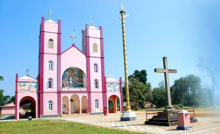
The religion of an estate panchayat is largely imported religion, and Meppadi wears that history openly. The Malayalam record for Mundakkai lists three institutions for a settlement of a few hundred households: a government lower primary school, the Munawwirul Islam Juma Masjid, and the Sri Mariyamman Temple. At Chooralmala the list is a mosque, St Sebastian’s Roman Catholic church and a Siva temple, all within a few hundred metres of one another. In Meppadi town itself the two most photographed buildings are the masjid at Ambalakkunnu and St Joseph’s Shrine at Mooppanad. Nothing about that arrangement is accidental: it is what a nineteenth- and twentieth-century labour settlement looks like when Tamil, Kannada and Malayali workers, Hindu, Muslim and Christian, are recruited into the same valley within two generations of one another.

The Mariamman temple is the most telling of them. Mariamman is a Tamil village goddess whose name is built from mari, rain, and amman, mother, and who is asked for the monsoon and for protection from the so-called heat diseases — smallpox, chicken pox, cholera — that used to arrive with the hot season. Her worship travels with Tamil labour: her temples mark the routes of kangani-recruited and indentured workers from Madurai and Theni out to the plantation districts of Kerala and Sri Lanka and on to Malaysia, Singapore, Mauritius and Fiji. The offerings are pongal cooked in earthen pots and pots dressed with neem leaves; the great festival falls in Adi, at the turn of the hot season into the rains. A Mariamman shrine standing four hundred kilometres from the Vaigai, high on a Wayanad hillside among tea bushes, is not a curiosity. It is a receipt for how this valley was staffed, and it is the closest thing Meppadi has to a founding myth of its own.

There is a name here that will tempt any writer, and it should be resisted. The waterfall above Mundakkai is called Seethammakundu — Sita’s pool — and Wayanad does hold a substantial Ramayana tradition. But that tradition is anchored a long way east of here, at Pulpally and Sulthan Bathery, where the Seetha Lava Kusha temple and its associated sites carry the story of Sita’s exile and the birth of her sons, and our record for that temple is where it belongs. We searched in Malayalam for a Meppadi-side Sita legend — സീതമ്മക്കുണ്ട്, മുണ്ടക്കൈ ഐതിഹ്യം, മേപ്പാടി ക്ഷേത്രം ഐതിഹ്യം — and found the name and no story attached to it. A pool name is not a legend, and we are not going to move one across the district to fill a slot.

Three other stories belong to neighbours and are refused here by name. The heart-shaped lake on Chembra is said locally never to have been seen to dry, even in the fiercest Wayanad summer; that belief belongs to our Chembra Peak record and is told there. The chain tree on the ghat road, and the story of Karinthandan, the Paniya guide said to have shown the British the line of the pass and to have been killed for it, belongs to Lakkidi, fifteen kilometres away, and to our Vythiri and Lakkidi pages. The cheerful gloss of Vellarimala as cucumber hill, and the fish-blocked etymology of Meenmutty, are handled in the records for those two places, which also explain why one of them is folk etymology rather than settled fact.

As for the town’s own name, we could not source it, and we would rather say so than invent one. Meppadi is commonly parsed by Malayalam speakers as an upper or higher settlement — mel, above, with a second element variously read as padi, a step or a gateway — but we have found no authority for that in the Malayalam or English Wikipedia articles, in the panchayat material, or in the colonial-era Malabar literature, and we treat the parsing as plausible speculation rather than a fact. The same applies to the name 900 Kandi, now attached to a glass bridge and an eco park: kandi is a unit of highland holding, and the number is generally taken to record an estate acreage, but we have not found a document that fixes it.

One piece of language is worth handling carefully because visitors will hear it constantly here. The Malayalam word for what happened on 30 July 2024 is uruḷ pottal, ഉരുൾപൊട്ടൽ, usually read as the bursting of a rolling mass — a term that describes a slope emptying itself downhill rather than a slab sliding, and one that predates any geological vocabulary in the district. It is an old word for an old phenomenon, and its existence is a quiet corrective to the idea that these hills only recently became dangerous. Wayanad had a name for this before it had rain gauges.

Finally, a boundary this page will not cross. The events of 2024 are recent history and living grief, not folklore, and there is already a body of anecdote circulating about premonitions, warnings and signs on the mountain that night. We have not published any of it and will not. The one dispute in that territory that is genuinely on the public record — whether a warning from a community rain-gauge network reached the district administration in time — is set out in our Vellarimala record with both sides attributed, and that is the correct level of care for it.

More about Meppadi and Chembra

History

The Malayalam account of Meppadi describes three waves of arrival, on top of the Adivasi communities who were here before any of them. The first, in the nineteenth century, was European: prospectors who came into the Wayanad hills looking for gold, and who found instead a climate and an altitude that suited tea. The second was the plantation proper, when British companies cleared and planted tea, coffee and cardamom across the whole belt and imported a workforce to tend it. The third came with the Malabar migration of the early twentieth century, when Travancore Christian and other settler families moved north into the highlands. Most of Meppadi’s present population descends from the second wave.

The first tea estate in Wayanad, by the local account, was planted not at Meppadi itself but at Perunthatta just outside it, by Parry & Company. Harrisons Malayalam, the Podar company and A. V. Thomas followed, and between them they set the pattern of the district: contiguous estates, each with its own factory, its own labour lines, its own road, and often its own school, canteen, temple, mosque and church. A company heritage account — self-published and therefore reported here rather than relied on — dates the corporate consolidation precisely: the East India Tea and Produce Company was formed in 1907, and in 1910 the Meppadi–Wynaad Tea Company was formed to buy the Arrapetta, Kardoora and Sentinel Rock estates, 5,304 acres between them.

The labour came through the kangani system, in which an intermediary — a kangani or mestri — travelled to recruit whole groups from his own home district and stood as their overseer and creditor. Meppadi’s workers came predominantly from Madurai and Theni in Tamil Nadu and from the Mangalore side of Karnataka. The Malayalam article names the leading recruiter here as Palakkal Sankaran Mestri, said to have come from Vaniyamkulam in Palakkad during the first period of settlement, a Thiyya who married a Brahmin woman called Paruvamma. That statement carries no citation and we flag it as such, but it is the kind of detail — a named man, a home village, a marriage across caste in an estate frontier — that no English-language source about this town preserves at all.

By the local account the companies treated their workers as chattel until about 1930, when the national freedom movement began to be felt in the estates as organised protest; trade unions became active in the plantation sector during the 1940s, and union organisation together with post-independence legislation is what changed conditions. That is the same history that produced the estate-line housing which was still standing at Mundakkai and Puthumala in the twenty-first century, and it is why the question of who owns the land under a destroyed labour line became a live legal problem in the rehabilitation.

Civically, Meppadi is a grama panchayat in the Kalpetta block of Vythiri taluk, ten to twelve kilometres from the district headquarters. Its modern history has two dates in it. On 8 August 2019 the slope above Puthumala, a ward of this panchayat, failed after roughly 500 millimetres of rain in a day, killing seventeen people and erasing a post office, a temple, a mosque, an estate canteen and two lines of workers’ housing. On 30 July 2024 the same flank failed on a far larger scale above Mundakkai and Chooralmala. Between those two dates the panchayat’s landslide susceptibility had been mapped, published and discussed repeatedly. It is a local body that has now lost three settlements in five years, and that fact governs how it is administered.

Why visit

It is the practical base for the whole southern Wayanad walking country — Chembra, Soochipara, Kanthanpara, Meenmutty, Neelimala and the 900 Kandi activities are all inside this one panchayat.

The tea landscape here is the oldest in Wayanad and still entirely a working one, with four Harrisons Malayalam estates and their factories visible from public roads.

The market and the bus stand are a real hill-country town rather than a resort strip, and prices, food and timings behave accordingly.

It sits on State Highway 29 between Kozhikode and Ooty, which makes it an unusually easy place to stop, resupply and check conditions before committing to a hill road.

Not as a place to see the landslide: Mundakkai and Chooralmala are a bereaved community and a recovery site, and there is nothing there for a visitor to do.

Not as a fixed itinerary either — access to the forest and waterfall sites in this belt has been suspended more than once since 2024, so build the day around what is actually open.
Before you go

Meppadi and Chembra — at a glance

HoursOpen place, no gate. Shops and the market run roughly 08:00–20:00; the bus stand thins out sharply after dark and estate roads are effectively closed to strangers at night.

Entry: Nothing to enter the town. Individual sites inside the panchayat are separately ticketed — Chembra by Forest Department trek package, Soochipara and Kanthanpara by DTPC counter, 900 Kandi by its operator.

Getting here

How to reach Meppadi and Chembra

On State Highway 29 between Kozhikode and Ooty, about 11–12 km south of Kalpetta, roughly 78 km from Kozhikode and about 106 km from Ooty. Nearest railway station Kozhikode (about 78 km); nearest airport Kozhikode (Karipur) International, about 90 km. Frequent buses from Kalpetta; jeeps and autos for the estate roads.

Getting back

Check your return bus or ferry with the operator before setting out. Leave time to reach the stop or jetty after your visit, and arrange a return vehicle in advance for a remote outing.

Ask at the jetty or the stand for the time of the last service back, not the next one. If you miss it, an auto or a taxi is the fallback — agree the fare before you get in.

Plan

Good to know

  • Meppadi is the last town with banks, a pharmacy, fuel and a proper market before the estate roads — draw cash and buy what you need here, because the hill hamlets above have neither ATMs nor reliable mobile signal.
  • The Wayanad Institute of Medical Sciences on the Kalpetta side of town is the nearest full hospital to the whole trekking belt; if you are walking here, know where it is before you need it.
  • Estate roads are private working roads even where there is no gate: tea is a shift industry and leaf lorries have priority. Pull in, do not block a bend, and do not walk into a plucking block for a photograph.
Getting around Meppadi and Chembra

If you need step-free access, contact the site before travelling. Ask about a level entrance, steps along the route, the nearest drop-off point, seating and accessible toilets.

If you need help at Meppadi and Chembra
112All emergencies (police · fire · medical)The single number to call in any emergency (ERSS).

Emergency numbers are verified against official government and state tourism sources. 112 works anywhere in India.

In the district

Where Meppadi and Chembra sits in Wayanad district

Nearest airportCalicut International Airport (CCJ), about 95-110 km by road depending on ghat and Meppadi-side traffic
Rail gatewayKozhikode railway station (CLT), about 80-100 km by road; Wayanad has no rail station
Bus / road accessKSRTC/private buses and shared road links connect Meppadi with Kalpetta, then onward to Kozhikode/Calicut, Sulthan Bathery, Mananthavady, Mysuru and Bengaluru. Most fixed public-transport plans should use Kalpetta as the transfer point.
Local transportUse local taxis, autos and verified drivers for Chembra Peak, Soochipara, Kanthanpara, Meenmutty, 900 Kandi, plantation stays and Meppadi waterfall routes; app-cab coverage is not dependable for full-day hill routing.
District HQKalpetta
LandscapeWestern Ghats highland — forests & plantations

Wayanad district is known for: Wildlife sanctuary, waterfalls, caves and spice estates.

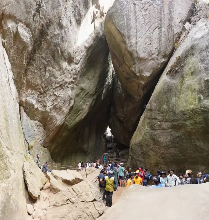
Confirm Chembra trek permits, waterfall access and weather before leaving the stay.Keep extra road buffer for narrow hill roads, monsoon closures, mist and weekend crowding.Meppadi and Chembra work best as the trek, waterfall, 900 Kandi and plantation-stay base of Wayanad.Wayanad Wildlife SanctuaryEdakkal CavesChembra Peak & waterfalls
Stay · eat · do · rent · see · shop

Places in Meppadi and Chembra

Every verified place in Meppadi and Chembra — filter by what you’re after.

2 places to eat in Meppadi and Chembra

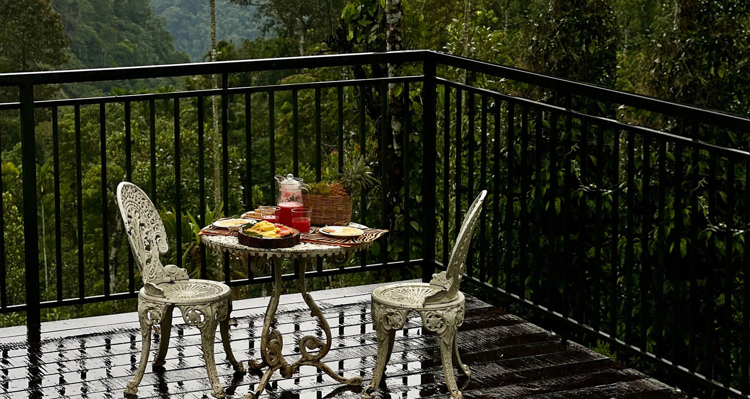
After The Rains Dining Meppadi — Resort dining and local food in Meppadi and Chembra
Verified
Resort dining and local food · Meppadi and Chembra
After The Rains Dining Meppadi

Resort dining and local food in Meppadi and Chembra. After The Rains, Valathoor, Rippon, Wayanad, Kerala · Restaurant, Dining, Meppadi.

Directions Commission-freeView details
T
Tea Terrace Restaurant Meppadi
Where to eat
Verified
Plantation restaurant · Meppadi and Chembra
Tea Terrace Restaurant Meppadi

Plantation restaurant in Meppadi and Chembra. Near Meppadi and Chembra route, Wayanad district, Kerala · meppadi-and-chembra, eat, Plantation restaurant.

Directions Commission-freeView details

Book with the place itself. India’s cyber-crime coordination centre warned in April 2025 that convincing copies of hotel and pilgrimage booking sites are being pushed through sponsored search and social ads, taking payment for rooms the property never hears about. Every listing here links to the business’s own contact details and its own Google or Bing profile — we take no commission and sit in nobody’s payment path. If a booking page reached you through an ad, check the address bar against the property’s own site before you pay. Fraud can be reported on cybercrime.gov.in or on 1930.

Places to visit

The places themselves, around Meppadi and Chembra

The best tourist places to visit in Meppadi and Chembra — temples, viewpoints, lakes, heritage and nature, each with a full guide, how to reach it and what to see nearby.

Chembra Peak trek, Meppadi and Chembra
PlaceChembra Peak trek

Chembra Peak is the Meppadi-side trek landmark of Wayanad. Plan it only with current official permit, weather and reporting-time checks, then keep the rest of the day light for food, transfers or a nearby waterfall.

Open guide →
Soochipara Waterfalls, Meppadi and Chembra
PlaceSoochipara Waterfalls

Soochipara Waterfalls is a Meppadi-side waterfall reached through controlled access and a short forest walk. Check seasonal opening, crowding and rain conditions before adding it to a Chembra or 900 Kandi day.

Open guide →
Kanthanpara Waterfalls, Meppadi and Chembra
PlaceKanthanpara Waterfalls

Kanthanpara Waterfalls is a smaller Meppadi-side waterfall often used as a lighter alternative to busier falls. Confirm access, weather and local road conditions before pairing it with plantation stays or Chembra-side routes.

Open guide →
Meenmutty Waterfalls, Meppadi and Chembra
PlaceMeenmutty Waterfalls

The closed Meppadi–Vaduvanchal waterfall, also listed as Meenmutty Falls trek. The map marks Vaduvanchal bus stand for town orientation, not an open waterfall entrance. Banasura Meenmutty is a different site.

Open guide →
Neelimala View Point, Meppadi and Chembra
PlaceNeelimala View Point

Vaduvanchal/Meppadi-side viewpoint and trek route known for views toward Meenmutty Waterfalls and the Western Ghats.

Open guide →
Sunrise Valley View Point, Meppadi and Chembra
PlaceSunrise Valley View Point

A weather-dependent sunrise viewpoint name in the Vaduvanchal circuit. The map marks Vaduvanchal as the honest reporting base because no authoritative exact public gate is documented; it is not presented as an alias for Neelimala.

Open guide →
Skypark 900 Kandi, Meppadi and Chembra
PlaceSkypark 900 Kandi

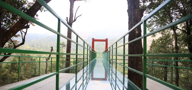
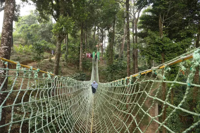
The distinct Skypark adventure operator at 900 Kandi, with a glass walk, zip activities and a DTPC-published visitor marker separate from the neighbouring Eco Park.

Open guide →
Glass Bridge 900 Kandi, Meppadi and Chembra
PlaceGlass Bridge 900 Kandi

A comparison guide to the distinct glass-bridge offers at 900 Kandi Eco Park and Skypark; choose the operator before navigating or buying a ticket.

Open guide →
900 Kandi Eco Park, Meppadi and Chembra
Place900 Kandi Eco Park

The named private Eco Park at 900 Kandi, with its own glass bridge, skywalk and activity ticketing; it is separate from nearby Skypark.

Open guide →
Achoor Tea Museum, Meppadi and Chembra
PlaceAchoor Tea Museum

Harrisons Malayalam’s three-storey tea museum in its 1911 former factory at Achoor, with separately scheduled museum, tasting, working-factory and garden visits.

Open guide →
Aranamala Peak, Meppadi and Chembra
PlaceAranamala Peak

Meppadi-side hill and trek landscape around Aranamala, best planned with local route, weather and access checks.

Open guide →
Ripon Tea Estate, Meppadi and Chembra
PlaceRipon Tea Estate

A working tea-estate landscape rather than a single ticketed attraction. The map marks Rippon 52 village as the honest visitor base; any private walk or factory visit needs its own confirmed property address.

Open guide →
Official eco & forest programmes

Forest stays, camping and treks around Meppadi and Chembra

Official/public-sector eco offerings mapped to this town base. Always confirm current availability, tariff, permits and reporting time before travelling.

Chembra Peak, Meppadi and Chembra
trekviewpoint

Chembra Peak trek

Full-day forest-department trek from Meppadi side to the heart-shaped lake viewpoint area on Chembra Peak.

Chembra PeakFull day
Official source →
For hotels, homestays and local businesses

Get listed in Meppadi and Chembra for free

Roampedia is commission-free. Travellers discover your business, book directly and contact you through official details. Basic listings are free, while Gold and Platinum package upgrades can be requested from the owner dashboard after approval.

List your business — free
Ranked guide modules

The best of Meppadi and Chembra, ranked

10 picks

Meppadi and Chembra-scoped cards for trek, waterfall and plantation-stay planning: Chembra official access, 900 Kandi operators, researched resorts, food stops and transfer support.

Chembra Peak Trek Official, Meppadi and Chembra#1
Meppadi and Chembra · Official trek check

Chembra Peak Trek Official

DTPC-backed Chembra trek record for permit, timing, fee and weather-sensitive access checks from Meppadi.

TrekOfficial sourceMeppadi
After The Rains Rainforest Lodge Meppadi, Meppadi and Chembra#2
Meppadi and Chembra · Rainforest lodge

After The Rains Rainforest Lodge Meppadi

Direct-source Meppadi rainforest lodge for plantation, Chembra and waterfall-side stay planning.

LodgeRainforestStay
LanternStay Meppadi, Meppadi and Chembra#3
Meppadi and Chembra · Jungle resort

LanternStay Meppadi

Direct-source Meppadi jungle resort with suites, tree house, cottages, camping and birding context.

ResortCampingMeppadi
900 Woods Eco Resort Wayanad, Meppadi and Chembra#4
Meppadi and Chembra · Eco resort

900 Woods Eco Resort Wayanad

900 Kandi-side eco resort with route, pickup/drop, trekking and food-option context from its official contact source.

900 KandiEco resortTrekking
Skypark 900 Kandi DTPC Wayanad, Meppadi and Chembra#5
Meppadi and Chembra · Official adventure stop

Skypark 900 Kandi DTPC Wayanad

DTPC 900 Kandi adventure record for glass bridge, skywalk and activity-status checks.

900 KandiDTPCAdventure
900 Kandi Eco Park Meppadi, Meppadi and Chembra#6
Meppadi and Chembra · Adventure park

900 Kandi Eco Park Meppadi

Direct-source 900 Kandi eco/adventure stop for Meppadi-side activity planning.

Adventure900 KandiMeppadi
T
Tea Terrace Restaurant Meppadi
Place
#7
Meppadi and Chembra · Food stop

Tea Terrace Restaurant Meppadi

Direct-source plantation restaurant record for Meppadi and Vythiri-side food planning.

RestaurantPlantationFood stop
Chembra Peak Resort Wayanad, Meppadi and Chembra#8
Meppadi and Chembra · Hotel stay

Chembra Peak Resort Wayanad

Kerala Tourism-listed Meppadi hotel record for Chembra-side stay planning.

HotelChembra sideKerala Tourism
Wayanad Taxi Meppadi Transfers, Meppadi and Chembra#9
Meppadi and Chembra · Transport

Wayanad Taxi Meppadi Transfers

District-wide taxi service for Meppadi, Chembra, 900 Kandi, airport transfers and hotel pickups.

TaxiTransferSightseeing
S
Skyfall Adventures 900 Kandi
Place
#10
Meppadi and Chembra · Adventure stay

Skyfall Adventures 900 Kandi

Direct-source 900 Kandi adventure stay/operator for Meppadi-side hill activities.

Adventure900 KandiOperator
Search guides

Hotels, restaurants and stay-budget guides in Meppadi and Chembra

Dedicated town guides for high-intent searches. Pages with limited verified supply stay visible for planning but are not submitted for search indexing until enough evidence-backed listings exist.

Food2 matches

Restaurants in Meppadi and Chembra

Planning preview kept visible for travellers while more verified listings are added before search indexing.

Planning previewOpen guide →
Hotels9 matches

Hotels in Meppadi and Chembra

Evidence-backed shortlist with verified local matches, direct planning context and clear next steps.

Search-ready guideOpen guide →
Homestays2 matches

Homestays in Meppadi and Chembra

Planning preview kept visible for travellers while more verified listings are added before search indexing.

Planning previewOpen guide →
Resorts8 matches

Resorts in Meppadi and Chembra

Evidence-backed shortlist with verified local matches, direct planning context and clear next steps.

Search-ready guideOpen guide →
Wellness0 matches

Ayurveda and wellness places in Meppadi and Chembra

Planning preview kept visible for travellers while more verified listings are added before search indexing.

Planning previewOpen guide →
Operators6 matches

Tour operators in Meppadi and Chembra

Evidence-backed shortlist with verified local matches, direct planning context and clear next steps.

Search-ready guideOpen guide →
Transport1 match

Taxi and transport providers in Meppadi and Chembra

Planning preview kept visible for travellers while more verified listings are added before search indexing.

Planning previewOpen guide →
Budget stays1 match

Cheap places to stay in Meppadi and Chembra

Planning preview kept visible for travellers while more verified listings are added before search indexing.

Planning previewOpen guide →
Budget stays1 match

Budget stays in Meppadi and Chembra

Planning preview kept visible for travellers while more verified listings are added before search indexing.

Planning previewOpen guide →
Affordable hotels1 match

Affordable hotels in Meppadi and Chembra

Planning preview kept visible for travellers while more verified listings are added before search indexing.

Planning previewOpen guide →
Mid-range stays4 matches

Mid-range stays in Meppadi and Chembra

Evidence-backed shortlist with verified local matches, direct planning context and clear next steps.

Search-ready guideOpen guide →
Premium stays5 matches

Premium stays in Meppadi and Chembra

Evidence-backed shortlist with verified local matches, direct planning context and clear next steps.

Search-ready guideOpen guide →
Luxury stays0 matches

Luxury stays in Meppadi and Chembra

Planning preview kept visible for travellers while more verified listings are added before search indexing.

Planning previewOpen guide →
Ultra luxury stays0 matches

Ultra luxury stays in Meppadi and Chembra

Planning preview kept visible for travellers while more verified listings are added before search indexing.

Planning previewOpen guide →
Town plans

2-day and 3-day plans for Meppadi and Chembra

Practical Meppadi and Chembra routes built from the town inventory, famous places and official access checks. Confirm activity status, weather, permits and road timing before travel.

2 days

Meppadi and Chembra in 2 days

A focused trek-and-waterfall plan using Meppadi for Chembra official access checks, Soochipara/Kanthanpara choices, 900 Kandi operators and plantation-side stays.

Treks and waterfallsPlantation staysAdventure routes
Moderate to active, with one official trek/access day and one waterfall or 900 Kandi day
3 days

Meppadi and Chembra in 3 days

A fuller Meppadi route with Chembra, one waterfall day and one 900 Kandi or plantation-stay day, built around permit and weather checks.

Active Wayanad tripWaterfalls and 900 KandiRainforest stays
Comfortable-active, with one trek day, one waterfall day and one adventure or slow-stay day
Stay safe

Emergency numbers in Meppadi and Chembra

Save these before travelling around Meppadi and Chembra and Wayanad. Use 112 for any emergency, and confirm local attraction or forest access through official contacts before remote trips.

Read before you go

Meppadi and Chembra guides, stories & itineraries

Around Meppadi and Chembra

These are written about individual places you can reach from Meppadi and Chembra, rather than about the town as a whole.

Kerala-wide guides & itineraries

Route-level itineraries and practical guides for the rest of the state.

See all 55 Wayanad guides & stories →

Map

Where things are in Meppadi and Chembra

FAQ

Meppadi and Chembra travel FAQs

Can I visit Mundakkai or Chooralmala?

No, and please do not try. Both were settlements of this panchayat and both were destroyed by the debris flow of 30 July 2024, with hundreds killed. The surviving residents are being rehoused in a government township at Elstone Estate in the Nedumbala ward near Kalpetta, where the first 178 houses were handed over on 1 March 2026 and construction was still running through the year. It is a rehabilitation landscape, a recovery operation and a burial ground, not a viewpoint. Route descriptions online that still list Chooralmala as an approach to Vellarimala were written before the disaster and have never been updated.

How many people died in the 2024 landslide?

There is no single agreed figure and we will not print one as final. On 3 August 2024 Kerala’s Health Minister, Veena George, confirmed 308 deaths, noting 195 bodies and 113 body parts recovered. The state separately confirmed 221 identified dead — 97 men, 87 women and 37 children. Later compilations run from 298 up to 420 dead with 397 injured and between 47 and 118 missing. More than two hundred bodies or body parts were found downstream in the Chaliyar. Dozens of people were never recovered and DNA matching with relatives of the missing continued for months.

Is the Chembra Peak trek open?

Treat it as conditional and check on the day. Access is run by the Chembra Peak Vana Samrakshana Samithi under the South Wayanad Forest Division from a check-post above Meppadi, and it has been closed and reopened more than once since 2024 — for fire risk in the dry season, for red-alert rainfall in the monsoon, and under a Kerala High Court order of 17 February 2024 that shut a list of Wayanad ecotourism centres over human–wildlife conflict. In recent years permission has often been given only as far as the heart-shaped lake rather than the summit. Our Chembra Peak record covers the trek itself; for current status, ask the range office or DTPC Wayanad.

What is Meppadi actually like as a town?

Small, working and unglamorous in a way that is useful. It is a strip of shops, a bus stand, a produce market, banks, estate offices, schools and a medical college hospital on the Kalpetta side, sitting at around 900 to 1,000 metres on the Kozhikode–Ooty highway. It is not a hill station in the Ooty sense and does not pretend to be. Its value to a traveller is that it is the last proper town before the estate roads, so it is where you eat, draw cash, buy provisions and ask whether the road you want is open.
Why is the whole district argued about ecologically?

Because two central expert reports proposed very different answers and neither was implemented. The Gadgil panel of 2011 classified all three of Wayanad’s divisions as Ecologically Sensitive Zone I with strict limits on quarrying and construction; the later Kasturirangan group proposed a much smaller ecologically sensitive area and a lighter regime; draft ESA notifications have been issued and extended for a decade without being finalised, with Kerala among the objectors. Researchers point to land-use change — a 2022 study found Wayanad lost roughly 62 per cent of its forest cover between 1950 and 2018 while plantation cover rose about eighteenfold — while planters and many local representatives argue that blanket zoning would penalise settlements that are legal and generations old. We report the argument and do not settle it.

Was the disaster officially recognised as a national one?

Not as a “national disaster”, which is not a category that exists in Indian disaster law. What happened is that the Union Home Ministry told the Kerala government that the Inter-Ministerial Central Team had considered the Meppadi landslide “a disaster of severe nature for all practical purposes” — a classification reported at the end of December 2024, five months after the event, and criticised as late by the state revenue minister, K. Rajan. In practice it means relief is paid first from the State Disaster Response Fund and then supplemented from the National Disaster Response Fund on the central team’s assessment.

How do I get to Meppadi, and how long should I stay?

It is on State Highway 29, about 11 to 12 km south of Kalpetta, roughly 78 km from Kozhikode and about 106 km from Ooty; the nearest railway station is Kozhikode and the nearest airport Kozhikode (Karipur) International, about 90 km away. Buses run frequently from Kalpetta and less often up the estate roads. Two nights is the sensible minimum if you want a trek and a waterfall without driving these roads after dark; three lets you absorb a closure, which in this belt is a realistic thing to plan for.

What are the best places to visit in Meppadi and Chembra?

Top places to visit in Meppadi and Chembra include Chembra Peak trek, Soochipara Waterfalls, Kanthanpara Waterfalls, Meenmutty Waterfalls, Neelimala View Point, Sunrise Valley View Point, and more — each has a full guide with how to reach it and what to see nearby on this page.

What is the best time to visit Meppadi and Chembra?

October to March is the driest and most comfortable season to visit Meppadi and Chembra and the rest of Kerala. The June–September monsoon is lush and green but wet, and often brings lower low-season prices.

Photographs: Prof tpms (CC BY-SA 3.0), Jaseem Hamza (CC BY 3.0). Wikimedia Commons.

Image credits