Ambalappuzha is a taluk town of about 34,000 people on the coast road 13 to 14 kilometres south of Alappuzha, and for three centuries it was a capital. The kingdom of Chembakassery — Porca to the Dutch, after its port at Purakkad — was ruled from here by Brahmin kings who all took the name Devanarayana, and it covered what are now the Ambalappuzha and Kuttanad taluks. In 1746 it backed Kayamkulam against Travancore and lost everything: Marthanda Varma annexed it, and the Devanarayanas end there. What the conquest did not destroy is still in use. The war dance the Chembakassery army commander built out of kalarippayattu is danced at the temple for eight days a year, and it also opens the festival of the dynasty that took the kingdom away. The town around it is ordinary — paddy, coir, fishing, a railway halt, a medical college — and that is the point.
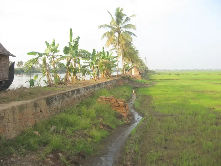
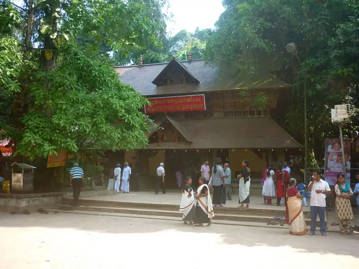
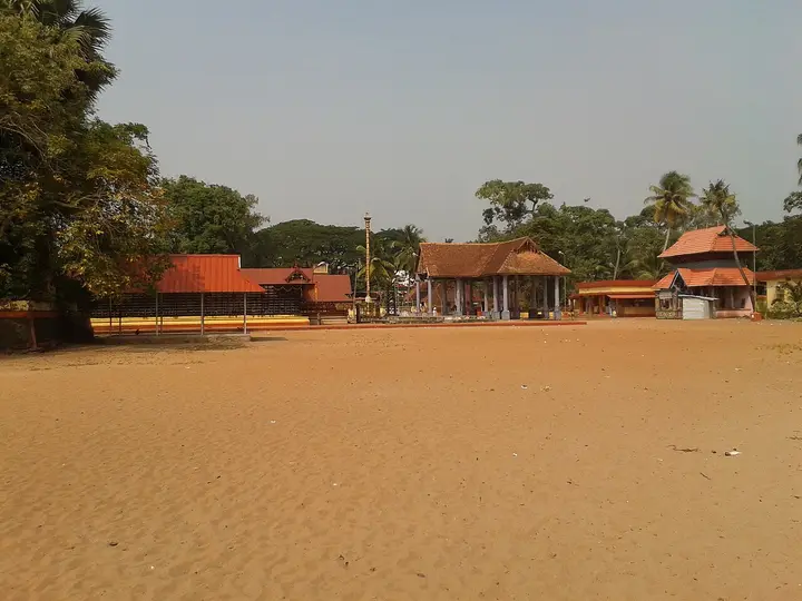
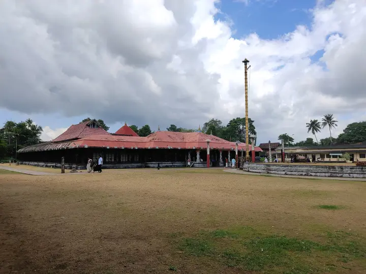
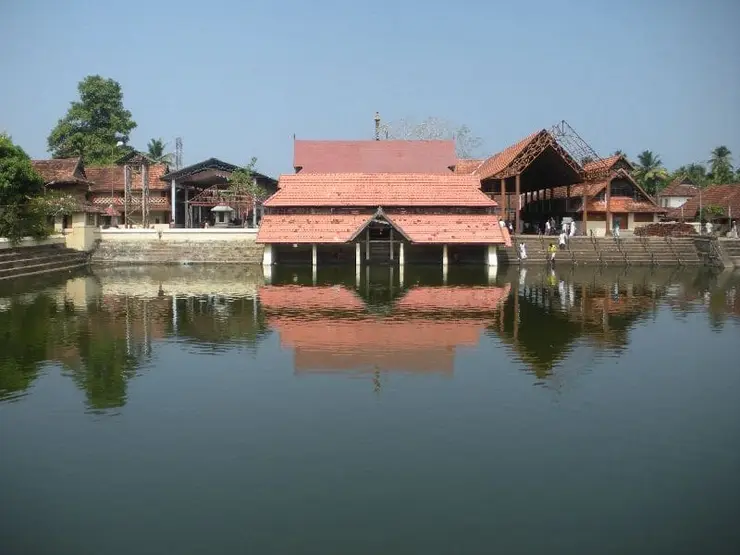
Start with the geography, because it explains the politics. Ambalappuzha sits on the narrow coastal strip between the Arabian Sea and the Kuttanad backwater, on what is now National Highway 66. The Sree Krishna temple stands about 1.5 kilometres east of the town junction. The 2011 census gives the village a population of 33,939 — 16,620 men and 17,319 women — in 7,856 households across 9.18 square kilometres, with literacy at 93.2 per cent, above the national figure and just under Kerala’s own.
Administratively the place has been divided and subdivided. The old Ambalappuzha panchayat was split in September 2000 into Ambalappuzha North, 10.88 square kilometres, and Ambalappuzha South, 24.17. The northern half runs from the Pookkaitha river on the east to the sea on the west and takes in the Ambalappuzha and Punnapra revenue villages and part of Karumadi. Above them sits the Ambalappuzha block panchayat, 68.63 square kilometres, five grama panchayats — the two Ambalappuzhas, Punnapra North, Punnapra South and Purakkad — with its office at Sanathanapuram. Above that again is Ambalappuzha taluk, one of six in the district.
And here is a small oddity worth knowing before you look at a map. The taluk called Ambalappuzha has its headquarters not at Ambalappuzha but at Alappuzha, because the district capital falls inside it. The taluk is named for the small town; the offices are in the big one. Malayalam Wikipedia gives the taluk thirteen villages in one place and ten grama panchayats in another — those count different things, revenue villages and elected local bodies, and both figures can be true at once.
The kingdom that was run from here was larger than any of those units. Chembakassery took in Ambalappuzha, Purakkad and Kuttanad — the coastal strip and the paddy country behind it — and its rulers were Brahmins, which was unusual in itself. They came originally from Chembakasseri Illam at Kudamaloor, in what is now Kottayam taluk, and every one of them ruled under the title Devanarayana. The Alappuzha district administration’s own history lists three sixteenth-century principalities in this territory: Kayamkulam in the south, Karappuram at Cherthala in the north, and Purakkad or Chempakasseri in the middle. This was the middle one.
Purakkad itself is six kilometres south of Ambalappuzha — or four, depending which sentence of the Malayalam article you read; the two figures sit in the same paragraph and we are not going to pick one. The name means, literally, outside the forest. It is a coastal village of just under 30,000 people now, with a Venugopala Swamy temple and a beach, and nothing about it announces that European traders once knew this coast by its name. They did. Purakkad was Porca in Dutch and Portuguese records, and the state was often called Porca after it rather than after its capital.
The Chembakassery rulers were good at foreign relations for as long as that was possible. They had excellent relations with the Portuguese, and then good ones with the Dutch East India Company, and they kept a fleet of their own under a commander styled the Purakkattarayan. What ended them was choosing the wrong side in a land war rather than a sea one.
The town today works at agriculture, fishing and coir, in that order, and its most conspicuous modern institution is a hospital. The Government T. D. Medical College stands at Vandanam, facing NH-66 about nine kilometres south of Alappuzha, inside the Ambalappuzha North panchayat — two of that panchayat’s wards are named for it. It opened in August 1963 with a first MBBS batch of fifty students, and its initials stand for Thirumala Devaswom, the temple trust at Anantha Narayana Puram under whose patronage it was started.
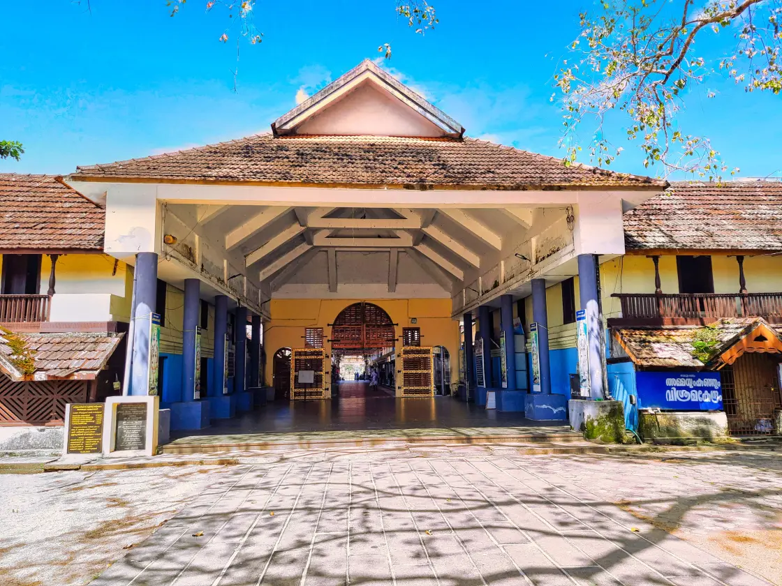
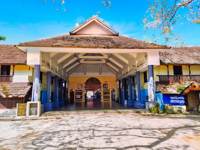
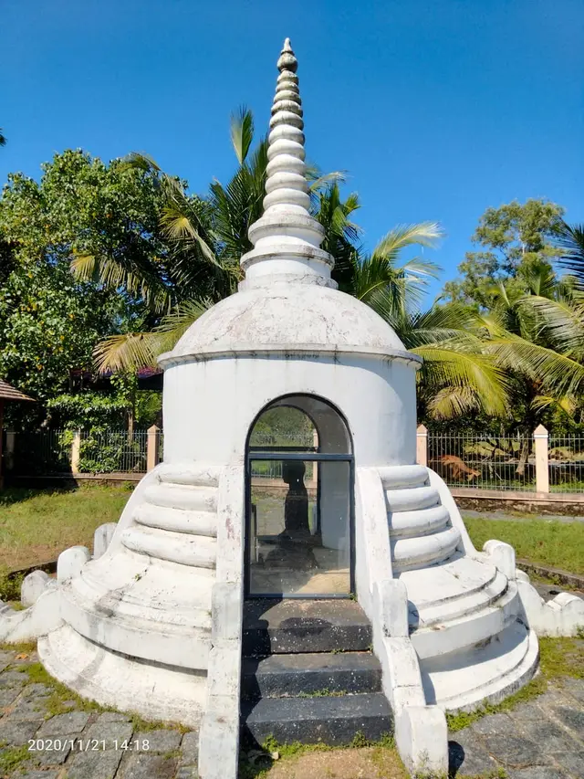
There is a railway station, code AMBL, on the Southern Railway’s Thiruvananthapuram division, and the Malayalam entry for it lists what people get off here for: the Krishna temple, the Kunchan Nambiar memorial, the Karumadi Buddha and Thakazhi’s house. That is a fair summary of the day. The memorial complex on the temple’s western side is the one thing on that list that belongs to the town rather than to another of our pages — an open-air ground with curved stone benches, a relief-carved screen wall, a tiled two-tier pavilion over an inscribed pillar, and a thatched timber kalithattu, a raised performance platform, still standing and still used.
Ambalappuzha’s other export was music. The nadaswaram players known as the Ambalappuzha Brothers were from here — K. Sankaranarayana Panicker, born 9 January 1911, K. Gopalakrishna Panicker, born 11 November 1914, and K. Ramakrishna Panicker, born in March 1917, sons of the nadaswaram vidwan Vaikom Kuttappa Panicker and of Thottakkattu Kuttiyamma. The two eldest were honoured at the all-India music conference at Bombay in 1946 and took the Kerala Sangeetha Nataka Akademi award for music in 1963; the youngest took the same academy’s award for dance in the same year, founded two dance schools, and acted in Aravindan’s film Kummatty. One of those schools he named Chembakassery Nadanakalamandalam — the kingdom’s name, still being used as a signature two hundred years after the kingdom stopped existing.
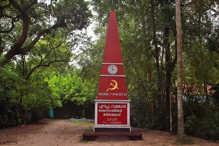
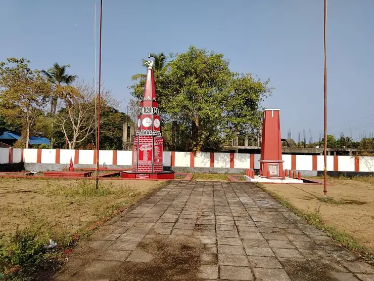
A last practical note on what is and is not here. The Buddha at Karumadi, the Punnapra–Vayalar memorial and the Thottappally spillway all fall within this taluk and all have their own pages; so does the temple. The town itself is worth an unhurried hour on foot, which is roughly what the memorial ground, the kalithattu and the walk to the junction take.
Legend & myth
The legend Ambalappuzha owns, as a town rather than as a temple, is the origin of velakali — and it comes in two versions that point in opposite directions, one divine and one military. Both are worth having, because the difference between them is the difference between what a place says about itself and what actually happened.
The divine version begins on the bank of the Kalindi. Krishna and the cowherd boys, having bathed, pull up lotus leaves and buds on their stalks and start a mock battle with them — leaf for shield, bud for sword. Narada, passing, is delighted by it. He goes to Vilwamangalam Swamiyar, who wanted the whole of Kerala turned into devotees of Krishna, and tells him to spread this game through the Vishnu temples. Vilwamangalam sinks into meditation on Krishna; Krishna shows him the game and then hides with his friends. The sage propagates it, and where the children of Ambadi had a lotus leaf and a stalk, the players are given a shield and a short sword of roughly the same shapes. Kerala’s own taste for arms did the rest.
The military version has no gods in it. Mathoor Panicker was padanayakan — commander — of the Chembakassery army, and Velloor Kurup served with him; both were formidable kalarippayattu masters with large followings of pupils. The king backed them, and the two of them decided to rework kalarippayattu into something that could be performed in front of the temple at festival time, for the king and for the people. That is how velakali entered the temple calendar. Many of its stances, steps and footwork are lifted directly from the kalari. The version most often told outside Kerala splices the two: Vilwamangalam asks the ruler of Ambalappuzha for the dance, and the ruler passes the order to Mathoor Panicker and Velloor Kurup.
What makes the military reading hard to dismiss is the detail that survives inside the performance. The instructions to the dancers are given through the drums, so that an enemy could not read the movement from the calling of it. When the muriyadantha rhythm sounds the movement quickens; when adantha sounds it drops to a slow measure; and when panchari sounds it means the fight cannot be won and the line is to turn and run. The set piece ends with the whole troupe fleeing as the defeated. A dance whose prescribed conclusion is a retreat is not a dance that was invented for a temple.
The training was equally unsentimental. Boys under twelve were chosen, the season began with the monsoon, and they were tied into the kacha and put through oil massage and trampling until the joints gave. Around two hundred young men were taken from each kara, with kalaris at Champakulam and in the Mathoor family’s own house, and the king carried the entire cost of the soldiers’ families. When the reputation of the Chembakassery fighters spread, the training of Travancore’s soldiers was handed to Mathoor Panicker as well, and some two hundred of the men he trained performed velakali in front of the tahsildar at Karunagappally.
There is a proverb about all this, and it is not a subtle one: അമ്പലപ്പുഴ വേല കണ്ടവന് അമ്മയേം വേണ്ട — he who has seen the Ambalappuzha vela has no need even of his mother. The festival once ran to eight velas and eight padayanis. The padayanis have thinned out; the eight days of velakali have not.
The strangest thing that happened to it happened after the conquest. Since Ambalappuzha was annexed into Travancore, velakali has marked the opening of the annual Painkuni festival at the Sree Padmanabhaswamy temple in Thiruvananthapuram — the war dance of a defeated kingdom used to start the state festival of the dynasty that defeated it. It also changed meaning on the way. At Trivandrum huge effigies of the Pandavas are raised at the eastern entrance, the dancers stand for the Kauravas, and they break off and retreat when they reach the effigy of Yudhishthira, so the retreat is read as dharma defeating adharma. The scholar Alf Hiltebeitel’s observation is that in central Travancore velakali re-enacts supposedly historical battles rather than the Mahabharata war, and that it is at the Padmanabhaswamy temple specifically that the Mahabharata frame is applied. The retreat, in other words, may be older than the story now given for it.
The town’s other ritual is rarer, and it belongs to the people who were kept furthest out. The pallipana at Ambalappuzha is held once in twelve years — after twelve successive pantrandukalabham observances, each in the month of Makaram — and it is conducted by the Velan community. The legend is that Mahavishnu, worn out by his labours, fell asleep; Subrahmanya, god of astrology, prescribed a pallipana to wake him; and Shiva and Parvathi came down as a Velan and a Velathi and sang him awake. That is why the pana songs praise Shiva first and are played on Shaiva instruments. The rite was begun by the Chembakassery king Devanarayana, and the first pana is dated to Kollam Era 841 — 1665 or 1666. Its two halves are the oth, sung in daylight by Velan men, and the muroth, sung at night by Velan women, and the men divide into the kuttadikal, who perform the oth, and the puranadikal, who wear ilanji flowers and palm-leaf caps, paint their faces and run about pulling the audience’s attention away — they are reckoned to be Shiva’s bhutaganas. The tantri opens proceedings by bringing out the koymavathi, a rod standing for divine power, and setting it in the pandal. Judged by the age of its language the ritual is three to four hundred years old, and the Malayalam account draws the conclusion itself: in a period when untouchability was enforced and lower-caste people were barred from entering the temple at all, the Velans already held a central part in it — years before temple entry was granted.
🚫 One legend we are not going to tell here. The chessboard, the doubling grains of rice and the debt paid in payasam is the best-known story in this district, and it belongs to the temple page, along with the quite different origin the Malayalam sources actually give. It is one kilometre and a half up the road from the junction and it is not the town’s story to borrow.
More about Ambalappuzha
History
The fall of Chembakassery is not a legend and it has a documented sequence, though not a tidy one. Marthanda Varma of Travancore beat the Dutch at Colachel in 1741. In 1742 Kayamkulam sued for peace and signed the Treaty of Mannar, becoming a tributary. In 1743 Marthanda Varma declared a state monopoly on pepper — which was the real war, because Dutch power in Kerala rested on the spice trade at Kochi, and between then and 1752 he annexed the pepper-producing states one after another: Quilon, Kayamkulam, Thekkumkur, Vadakkumkur and Purakkad.
By 1746 the Dutch had persuaded Odanad, the Kayamkulam state, to lead a new confederation against Travancore, and Chembakassery, Thekkumkur and Purakkad joined it. The fighting that settled it is remembered as the Battle of Purakkad, in 1746, fought on this coast. Odanad was defeated and annexed. Malayalam Wikipedia’s article on the Purakkad dynasty is explicit about what followed: because it had helped Kayamkulam in the war against Travancore, Marthanda Varma seized Chembakassery in 1746 and joined it to Travancore.
⚠ The date is not unanimous. Malayalam sources and the ml.wikipedia article on the Ambalappuzha temple give 1746 for the conquest of Chembakassery. The English Wikipedia article on Marthanda Varma instead says that after the fall of Kayamkulam in 1746, “Ambalapuzha, Kottayam and Changanassery were also annexed to Travancore by 1753” — a window rather than a year. The Alappuzha district administration’s history page names the annexations of Kayamkulam, Ambalappuzha and Karappuram without dating them. One plausible reading is that 1746 marks the war and collapse while the later date marks completion of a drawn-out settlement, but the sources do not prove that interpretation, so both dates are retained.
One consequence of the conquest is visible in our own pages and needs stating plainly, because the same place-name carries two different battles. The Battle of Purakkad of 1746 was Travancore against the Odanad confederation. There was a second engagement at Purakkad in 1755, in which Marthanda Varma’s forces defeated the Zamorin of Kozhikode and the chiefs supporting him — a different opponent, a different war, nine years later. Our Cherthala and Mavelikkara pages use the 1755 date and are correct to; this page uses 1746 and is also correct. Neither has anything to do with the Treaty of Mavelikkara, which was signed with the Dutch at Mavelikkara on 15 August 1753 and concerned the Company alone.
The port is the other half of the story. Porca was originally an English trading post, taken by the Dutch in 1666, after which the Company built a stone lodge and a pepper warehouse and stationed a resident here; it secured a friendship treaty with the rajah of Porca in 1724. The VOC held the pepper monopoly along the coast from Porca up to Cranganore, and pepper was brought down from the Thekkumkur uplands to the Purakkad factory by inland waterway rather than by sea. After the conquest the same stretch of coast changed function: Travancore’s artillery batteries facing the Arabian Sea were laid out from Purakkad to Cape Comorin, with Eustachius De Lannoy commanding the army from 1741 to 1758 and Ramayyan Dalawa serving as chief minister from 1737 to 1756. The northern end of Travancore’s gun line was the port of the kingdom it had just swallowed.
🔴 A note on a date we ourselves have printed two ways. Our page on this town’s temple says Marthanda Varma adopted the Chembakassery style “in 1746 when he dedicated Travancore to Sree Padmanabha and took the name Padmanabhadasa”. The Malayalam sentence that came from attaches 1746 to the conquest of Chembakassery, not to the dedication; the Trippadidanam itself is dated 3 January 1750, 5 Makaram 925 in the Kollam Era, which is the figure our own Thiruvananthapuram pages use. The 1746 in that sentence is the year the kingdom fell.
Nothing after that is dynastic. The coir factories arrived in the nineteenth century — the district’s first modern coir mat and matting factory dates from 1859 — the taluk went through the 1946 rising at Punnapra, and Alappuzha district was constituted on 17 August 1957 out of parts of Kottayam and Kollam. Ambalappuzha, having been a capital, became a taluk headquarters that is not even the headquarters of its own taluk.
Why visit
This was the capital of a kingdom — Chembakassery, the Porca of European records — and the town is small enough that you can still read the shape of it in an hour.
Velakali, the Nair war dance built out of kalarippayattu by the Chembakassery army’s own commander, is danced here for eight days of the temple festival and nowhere with a better claim to it.
The Kunchan Nambiar memorial ground, with its stone benches, relief screen and thatched timber kalithattu, is an open, free, unhurried place a few minutes from the temple wall.
Purakkad, six kilometres south, gave a Dutch factory, a pepper monopoly and an entire kingdom their name, and there is a beach and a Venugopala Swamy temple at the end of the road.
The pallipana, conducted by the Velan community once in twelve years, is one of the few Kerala rituals where the community kept furthest from the sanctum held the central office in it.
It is fourteen kilometres from Alappuzha with its own railway station, which makes it the easiest serious detour on the coast road south.