Places to Visit in Cherthala

Taluk town on NH-66 between Alappuzha and Kochi — the Karthyayani temple at its centre, the Cherthala Pooram and its padayanis, and the lagoon-and-coast country north of Alappuzha.

Cherthala
Practical guide

Plan Cherthala

Who's going?Tailor Cherthala to your trip
DistrictAlappuzha
RoleCoastal taluk-town base
Time neededAn hour or two, or a half day if you…
Places to visit2Listed businesses11

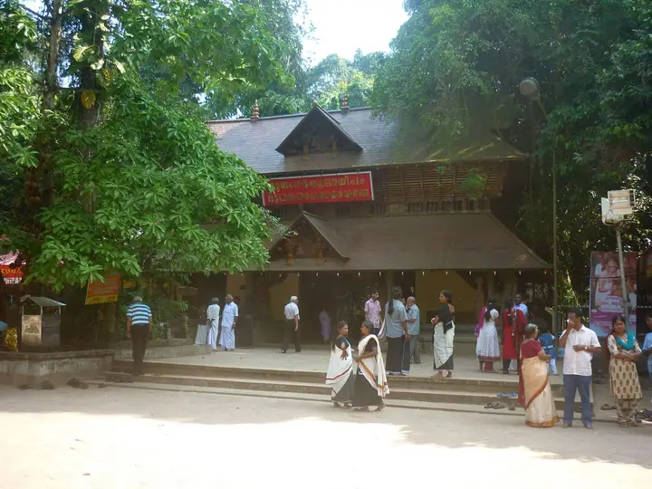
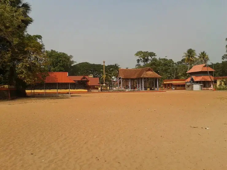
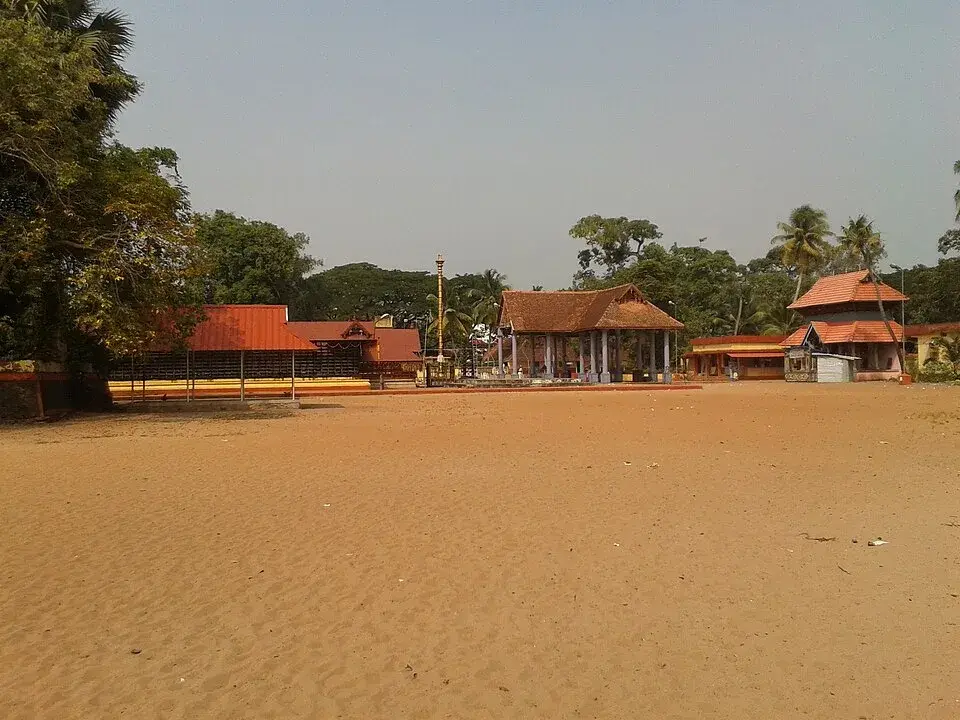
Cherthala is the taluk town at the top of Alappuzha district, directly on NH-66 between Alappuzha and Kochi, on the strip of coconut country between the sea and the Vembanad backwater. Its centre is the Karthyayani temple, one of the 108 Durgalayas, where the goddess sits about four feet below ground level and released cockerels wander the compound.

What the town makes is rope. Coir here is a working industry rather than an exhibit — husks retting in the shallows, yarn drying along walls, and nothing arranged for visitors. With its own station and bus stand and Kochi an hour north, it also makes a cheap, sane base when Alappuzha is full in season.

What to expect

Highlights

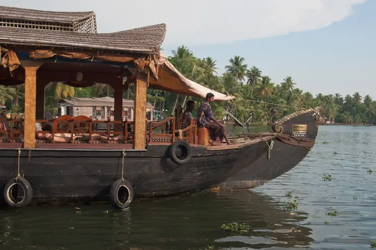
  • Kakkathuruthu — A small inhabited Vembanad-side island near Ezhupunna where sunset, local boat access and respect for residents matter more than conventional attraction facilities.
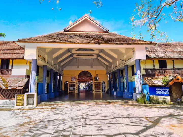
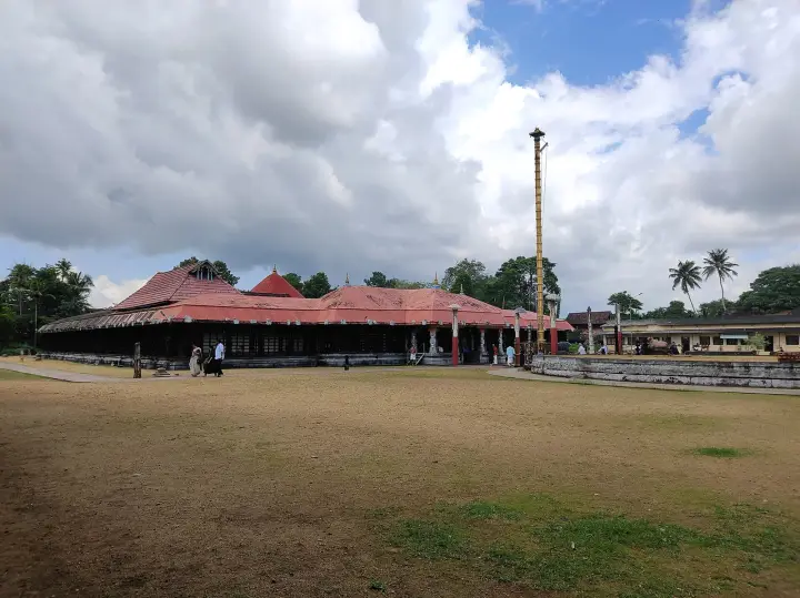
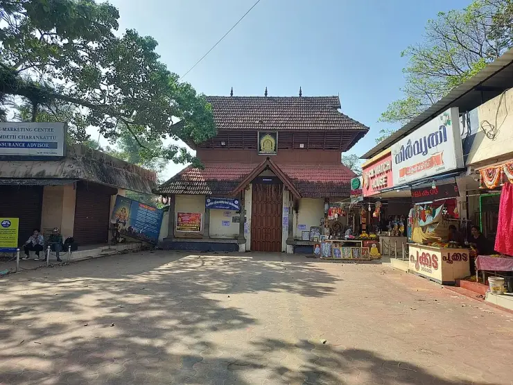
  • Cherthala Karthyayani Temple — The Devi temple in the middle of Cherthala town, one of the 108 Durgalayas — where the goddess sits about four feet below ground level, hundreds of cockerels released as offerings live in the compound, and the town’s own name is said to come from the legend of her rescue from the mud.
Getting there

How to visit

  • Nearest airport: Cochin (COK), ~86 km
  • Rail gateway: Alappuzha (coastal line)
Timing

Best time to visit Cherthala

October–February is the comfortable season on this coast. The Cherthala Pooram at the Karthyayani Devi temple runs eight days in May–June and is the busiest week of the year in the town.

Weather in CherthalaSeasonal guide

Live forecast loads in your browser.

Today at Cherthala
Sunrise6:13 am
Sunset6:15 pm
Golden hour best light5:15 pm–6:15 pm
Blue hour after sunset6:15 pm–6:40 pm
Sun sets toward compass bearingW · 266°
Moon tonight🌖 Waning gibbous · 60%

Sun and moon are calculated for this location and shown in IST. Photography windows are the hour around sunrise and sunset; the sunset bearing is degrees clockwise from true north. Moon phase is accurate to about half a day.

The story

The story of Cherthala

The coir town at the north end of Alappuzha district, on the strip of coconut country between the sea and the Vembanad backwater. Cherthala taluk was once Karappuram — a small kingdom of two principalities that the Dutch signed treaties with, that Cochin held only loosely, and that Travancore absorbed some time in the middle of the eighteenth century. What it makes today is rope.

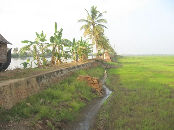
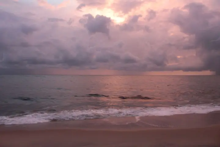
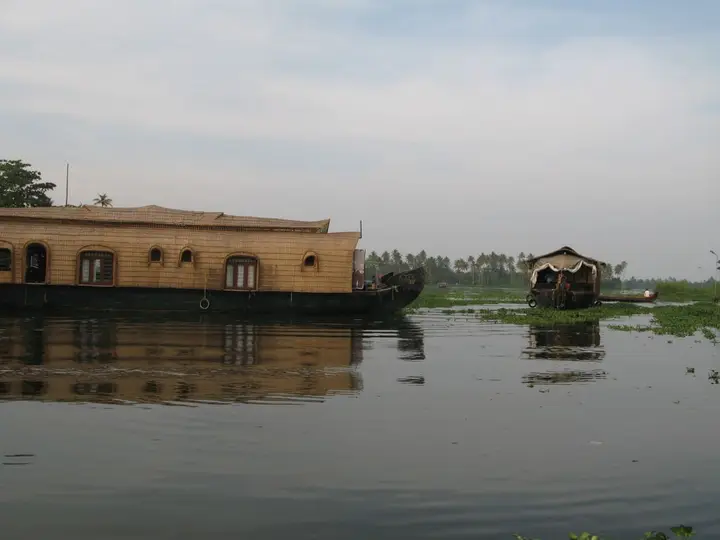
Cherthala sits on the narrow coastal shelf north of Alappuzha, on the NH-66 road between Alappuzha and Kochi, with the Arabian Sea a few kilometres west and the Vembanad backwater a few kilometres east. It is a taluk headquarters in a landscape that is almost entirely coconut: sandy, low, densely planted, threaded with canals and lagoons. That geography is not scenery here. It is the reason for everything the place has ever done.

Before it was a taluk it was a kingdom, or something close to one. In the sixteenth century this tract was Karappuram, and it comprised two principalities — recorded as Moothedath and Iledath — which together cover roughly what is now Cherthala taluk. Karappuram is one of those names that has almost entirely dropped out of everyday use while remaining the correct historical name for the ground you are standing on, and it is still attached to the local coconut trade.

Karappuram mattered to Europeans because of what grew here. The Dutch signed treaties with the rajas of Purakkad, Kayamkulam and Karappuram, and built factories and warehouses through this district to store pepper and ginger. A small coastal principality with a harbour-facing hinterland and a spice trade was exactly the kind of counter the Dutch East India Company built its Malabar position on.

It ended when Marthanda Varma of Travancore turned his attention north. The annexation of Kayamkulam, Ambalappuzha, Thekkumkur, Vadakkumkur and Karappuram to Travancore is described by the district's own history as the thing that set the Dutch back decisively — and this is the same expansion, and the same adversary, as the war that produced the Battle of Colachel. Exactly when Karappuram itself changed hands is genuinely unsettled, and we set out below why we are not going to pretend otherwise.

The second thing to know about Cherthala is coir, and it is the thing that actually shapes the town. Coir is the fibre of the coconut husk, retted in backwater mud, beaten out, spun into yarn and woven into mats, matting and rope. The first modern factory for coir mats and mattings was set up in 1859 at Alappuzha, just down the coast, and the industry spread through this coconut belt from there. Cherthala became one of its centres, and remains one: coir is the traditional and most widespread manufacture in the taluk, and Karappuram coir has its own reputation.

This is genuinely visible if you drive here rather than through. Husks soaking in the shallows; yarn drying in long ochre skeins along walls and fences; small sheds with a spinning wheel and two people working it; the particular smell of retted husk near the water. It is not staged for visitors — Kerala has a dedicated coir museum at Alappuzha for that — but it is the ordinary industry of the place, and it is much more interesting seen at this scale than in a display case.

The town itself is a working junction: the temple and its ground at the centre, a bus stand, the highway running through, shops and small workshops. The reason most visitors know the name is the Cherthala Sree Karthyayani Devi Temple, whose eight-day Pooram in May-June is one of the big festivals of northern Alappuzha, and whose founding legend is where the town's name comes from. We tell that story properly on the temple's own page rather than repeating it here.

Around Cherthala the coast opens out. Arthunkal, with its great pilgrimage church, is a short way west; Mararikulam's beach is south; Thanneermukkom, where the bund crosses the Vembanad, is east across the taluk. Cherthala is the road junction and the market for all of it, which is a fair description of what it has been for four hundred years.

It is not, in honesty, a sightseeing town. It has no fort, no palace and no preserved quarter. What it has is a name that used to belong to a kingdom, a landscape entirely given over to one tree, and an industry that turns that tree's waste into rope — and those three things are the same story told in three ways.

Legend & myth

The first thing we want to be straight about is a date we cannot give you. Karappuram passed from Cochin's orbit to Travancore in the middle of the eighteenth century, and the year depends entirely on which source you open. Some give 1753. Some give 1755, and attach it to a named campaign — Ramayyan Dalawa annexing Karappuram at the instance of Marthanda Varma. Some say the area remained part of the Kingdom of Cochin until 1762. And the Alappuzha district administration's own history page, which lists the annexation of Kayamkulam, Ambalappuzha, Thekkumkur, Vadakkumkur and Karappuram in one breath, gives no year for any of them.

There is a decent chance these are not really in conflict. A tributary territory changing hands in this period was rarely one event with one date: there is the campaign, there is the submission, there is the formal settlement with the displaced overlord, and there is the administrative absorption, and they can be years apart. That is very likely what is happening here, and it is the same shape as the reader who meets two different years for one transfer and assumes somebody is wrong. But we have not found the source that lays the sequence out, so we are not going to manufacture one. Treat the transfer as a process of the 1750s and be suspicious of anything that states a single year without saying what it is dating.

This matters to us specifically because we publish a year elsewhere. Our own guide to the Thanneermukkom bund says Karappuram and Alangad passed to Travancore in 1753, and that sentence was itself a correction of a worse one — an earlier version had Travancore attacking in 1753 and annexing Karappuram under the Treaty of Mavelikkara, which was wrong three separate ways. The Treaty of Mavelikkara, signed at Mavelikkara on 15 August 1753, was an agreement with the Dutch about non-intervention, alliances, a pepper quota and arms; it did not concern Karappuram. The battle at Purakkad is 1755 and was fought against the Zamorin. Those corrections stand. The residual 1753 does not stand as firmly as we would like, and rather than quietly change it we have flagged it in the code and told you here.

The second caution is the equation of Karappuram with Cherthala. It is close enough to be useful and loose enough to mislead. Karappuram is described as comprising two principalities, Moothedath and Iledath, which together correspond to the present Cherthala taluk — a taluk, not a town. So Karappuram is not another name for Cherthala town; it is the old name for the district-sized block of coconut country the town administers. If you see Karappuram used as a synonym for the town, that is a compression.

The third is about coir, where the famous date belongs to somewhere else. 1859 is the year the first modern factory for coir mats and matting was established — at Alappuzha, not at Cherthala. Cherthala is a major centre of the industry that grew out of that, and coir here is much older than any factory, being a household and village craft long before it was a manufacture. But if you read that coir began at Cherthala in 1859, that is the Alappuzha factory being quietly relocated up the coast.

The fourth is a gentle expectation-setting note. Cherthala is a taluk town on a national highway, and the coir you can see is working coir — husks in a backwater, yarn on a fence, a shed with a wheel — not an exhibit. Visitors who arrive expecting a curated craft village will find the International Coir Museum at Alappuzha is the place built for that purpose. What Cherthala offers is the unedited version, which requires you to look out of the car window rather than buy a ticket.

The fifth belongs to the temple rather than the town, but it is the thing most people arrive knowing and it is worth pointing in the right direction. The name Cherthala is traditionally derived from cher, mud, and thala, head, from the story of the goddess found with her head in a muddy pond and raised from it by Vilwamangalam Swamiyar. That legend, the temple it founded and the eight-day Pooram that follows from it are set out on the temple's own page. It is a founding legend, told as one.

More about Cherthala

History

In the sixteenth century the tract corresponding to the present Cherthala taluk was Karappuram, comprising two principalities recorded as Moothedath and Iledath. It lay in the belt of small coastal polities between Cochin and the Travancore lands to the south, and like its neighbours it was drawn into the European spice trade: the Dutch concluded treaties with the rajas of Purakkad, Kayamkulam and Karappuram, and built factories and warehouses across this district for pepper and ginger.

Karappuram was a tributary of Cochin rather than a fully independent kingdom, and for a long period was held semi-autonomously by local chiefs under only nominal Cochin authority. That arrangement ended during the northward expansion of Travancore under Marthanda Varma, whose annexation of Kayamkulam, Ambalappuzha, Thekkumkur, Vadakkumkur and Karappuram is described in the district's own history as the decisive setback to Dutch influence here — part of the same confrontation that produced the Battle of Colachel.

The year of the Karappuram transfer is not settled in the sources. 1753 is commonly given; 1755 is given for an annexation carried out by Ramayyan Dalawa at Marthanda Varma's instance, after which Kumbalam became the southern boundary of Cochin; and some accounts have the area remaining part of Cochin until 1762. The Alappuzha district administration gives no date. These may record successive stages of one process rather than rival claims, but no source we have found sets the sequence out, and this page does not choose between them.

Under Travancore the area became Cherthala taluk, and it is today the northernmost taluk of Alappuzha district. Its economy has been shaped throughout by the coconut: the first modern factory for coir mats and mattings was established in 1859 at Alappuzha, and the industry spread through the surrounding coconut belt, with coir becoming the traditional and most widespread manufacture of Cherthala. Karappuram coir and coir products retain a distinct reputation, and the old name survives commercially long after it left the map.

The town's religious centre is the Sree Karthyayani Devi Temple, whose annual eight-day Pooram in May-June is among the major festivals of northern Alappuzha, and from whose foundation legend the name Cherthala is traditionally derived.

Why visit

To see working coir country rather than a coir exhibit — husks retting in the backwater shallows, yarn drying in ochre skeins along walls, small spinning sheds — in the taluk where it is the traditional industry.

For the Cherthala Sree Karthyayani Devi Temple and, if the timing suits, its eight-day Pooram in May-June, one of northern Alappuzha's big festivals.

To stand in what was Karappuram — a two-principality statelet the Dutch signed treaties with and Travancore absorbed in the 1750s — a kingdom that has left its name on the coconut trade and almost nothing else.

As the natural road base for this stretch of coast: Arthunkal's pilgrimage church to the west, Mararikulam's beach to the south, and the Thanneermukkom bund across the taluk to the east.

For the landscape itself — a low, sandy, wholly coconut-planted shelf between the Arabian Sea and Vembanad, threaded with canals, which is unlike either the beach strip or the paddy backwaters it sits between.

Because it is on the NH-66 between Kochi and Alappuzha and costs almost nothing to stop in, which is the honest case for a working taluk town rather than a destination.
Before you go

Cherthala — at a glance

Getting here

How to reach Cherthala

  • ✈︎ By air Cochin International Airport is the nearest, roughly 55 km north.
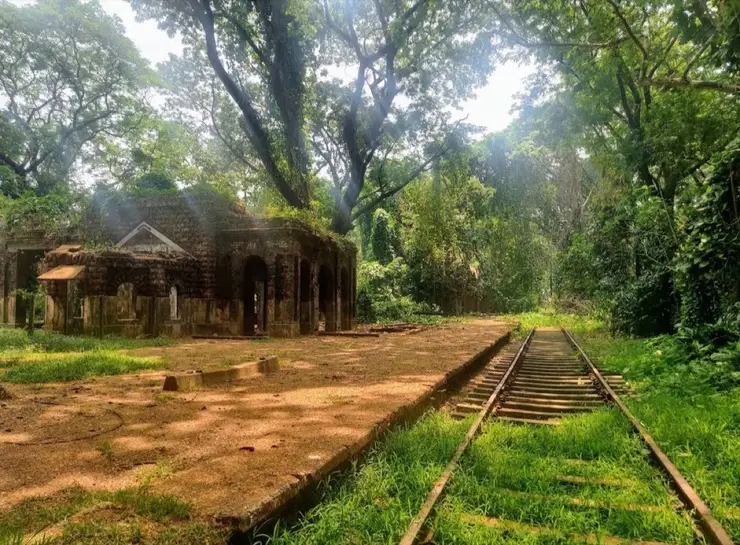
  • 🚆︎ By train Cherthala has its own station on the Ernakulam–Alappuzha coastal line.
  • 🚗︎ By road On the NH-66 roughly midway between Kochi and Alappuzha — about 32 km south of Kochi and 24 km north of Alappuzha.
  • 🚌︎ By bus Frequent private and KSRTC services along the NH-66 in both directions.
Getting back

Check your return bus or ferry with the operator before setting out. Leave time to reach the stop or jetty after your visit, and arrange a return vehicle in advance for a remote outing.

Ask at the jetty or the stand for the time of the last service back, not the next one. If you miss it, an auto or a taxi is the fallback — agree the fare before you get in.

Getting around Cherthala

If you need step-free access, contact the site before travelling. Ask about a level entrance, steps along the route, the nearest drop-off point, seating and accessible toilets.

Practical things near Cherthala
Bus stopsCherthala Temple 42 m · 1 min walkMapped Jan 2025DirectionsParkingParking 462 m · 6 min walkMapped Sept 2024DirectionsFuelFuel station 1.5 km · 18 min walkMapped Jan 2024DirectionsPharmacyLalitha Medicals Pharmacy293 m · 4 min walkMapped Jan 2026DirectionsHospitalSree Venkateswara Hospital 544 m · 7 min walkMapped Dec 2023DirectionsClinicDr. Isha's Skin Care Centre Clinic1.1 km · 13 min walkMapped Sept 2022DirectionsPolice stationCherthala Police station 1.3 km · 15 min walkMapped Nov 2019DirectionsATMATM 58 m · 1 min walkMapped Jan 2026DirectionsBankCherthala Service Cooperative Bank 141 m · 2 min walkMapped Dec 2019DirectionsWater & snacksSupplyco Super Market 682 m · 8 min walkMapped Sept 2022DirectionsGroceries & bakeryFour Brothers Bakery87 m · 1 min walkMapped Sept 2018DirectionsBarber & salonWomens Care Unisex Salon 67 m · 1 min walkMapped Mar 2021DirectionsBookshopVidhyarambham Book Stall Bookshop255 m · 3 min walkMapped Mar 2021DirectionsPublic art & memorialsVayalar Ramavarma memorial statue Public artwork100 m · 1 min walkMapped Sept 2023DirectionsVetVeterinary Hospital 1.3 km · 16 min walkMapped Nov 2019Directions
What the cash actually costs
  • Withdrawing from a bank that is not your own is free for a set number of times a month, then costs up to ₹23 plus GST — about ₹27 a withdrawal. This is not one of the RBI’s six metro centres, so the allowance here is the higher one: at least five free other-bank withdrawals a month, and at least five at your own bank.
  • That free allowance belongs to Indian bank accounts. On a card issued abroad your own bank’s international withdrawal and exchange charges apply instead. If the machine offers to bill you in your home currency, choose rupees — the conversion rate on that offer is set by the machine, not by your bank.
  • Choose a well-lit ATM, preferably at a bank branch. Shield your PIN, avoid help from strangers and use your bank’s support number if a withdrawal fails or the machine retains your card.

Charge cap and free-transaction limits: Reserve Bank of India, in force since 1 May 2025.

These services are listed within about 1.2 km of Cherthala. Walking distances follow mapped routes; access and opening hours can change. Other services may be closer but are not included here.

Nearby bases

Where to go from Cherthala

Alappuzha town, Alappuzha townHouseboat base
Town / base

Alappuzha town

Canals, beach, lighthouse and main houseboat departure point.

Alappuzha BeachAlappuzha LighthouseFinishing PointCanal walks
Open Alappuzha town guide →
Kuttanad, KuttanadBackwater village base
Town / base

Kuttanad

Low-lying paddy and canal region for slow village travel.

Kuttanad canalsPaddy fieldsChampakulamNedumudy
Open Kuttanad guide →
Mararikulam, MararikulamBeach base
Town / base

Mararikulam

Quiet beach belt north of Alappuzha town.

Marari BeachFishing villagesArthunkal Church
Open Mararikulam guide →
Ambalappuzha, AmbalappuzhaTemple base
Town / base

Ambalappuzha

Historic Krishna temple town south of Alappuzha.

Ambalappuzha Sree Krishna TempleKarumadikuttanPunnapra beach belt
Open Ambalappuzha guide →
Haripad and Mannarasala, Haripad and MannarasalaTemple base
Town / base

Haripad and Mannarasala

Serpent shrine and temple circuit in south Alappuzha.

Mannarasala TempleHaripad templesKayamkulam lake side
Open Haripad and Mannarasala guide →
Chengannur, ChengannurPampa-side temple base
Town / base

Chengannur

Rail and pilgrim town on the Pampa in eastern Alappuzha, carrying two crowds. It starts the Pancha Pandava circuit of five Divya Desams, and it is the railhead most Sabarimala pilgrims arrive at.

Chengannur Mahadeva TempleThrichittatt Maha Vishnu TempleChakkulathukavu Bhagavathy Temple
Open Chengannur guide →
Mavelikkara, MavelikkaraOnattukara temple town
Town / base

Mavelikkara

Market and temple town on the Achankovil in eastern Alappuzha — Kandiyoor’s 823 AD epigraph, the Buddha at Buddha Junction, and the Onattukara country of Chettikulangara’s kettukazhcha.

Kandiyoor Sree Mahadeva Temple
Open Mavelikkara guide →
In the district

Where Cherthala sits in Alappuzha district

District HQAlappuzha
LandscapeBackwaters & coastal Kuttanad

Alappuzha district is known for: The Alleppey backwaters, houseboats and the Nehru Trophy Boat Race.

Houseboat cruisesAlleppey Beach & pierKuttanad — farming below sea level
Stay · eat · do · rent · see · shop

Places in Cherthala

Every verified place in Cherthala — filter by what you’re after.

3 things to do in Cherthala

Ayurveda & wellness · Cherthala
Carnoustie Ayurveda & Wellness Resort

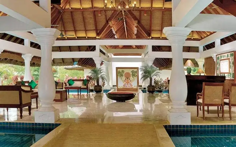
Kerala Tourism-registered Ayurveda centre at Chethy, Cherthala.

Directions Commission-freeView details
Top pick
Railway station · Cherthala
Cherthala Railway Station

Southern Railway station (code SRTL) on the Ernakulam–Alappuzha coastal line. Cherthala, Alappuzha District, Kerala.

Directions Commission-freeView details
Bus station · Cherthala
KSRTC Bus Station, Cherthala

The KSRTC bus station at Kodathikavala, the town's main road-transport hub.

Directions Commission-freeView details

Book with the place itself. India’s cyber-crime coordination centre warned in April 2025 that convincing copies of hotel and pilgrimage booking sites are being pushed through sponsored search and social ads, taking payment for rooms the property never hears about. Every listing here links to the business’s own contact details and its own Google or Bing profile — we take no commission and sit in nobody’s payment path. If a booking page reached you through an ad, check the address bar against the property’s own site before you pay. Fraud can be reported on cybercrime.gov.in or on 1930.

For hotels, homestays and local businesses

Get listed in Cherthala for free

Roampedia is commission-free. Travellers discover your business, book directly and contact you through official details. Basic listings are free, while Gold and Platinum package upgrades can be requested from the owner dashboard after approval.

List your business — free
Read before you go

Cherthala guides, stories & itineraries

Stories & history of Cherthala

Written about Cherthala itself — its history, its legends and the arguments about them.

Around Cherthala

These are written about individual places you can reach from Cherthala, rather than about the town as a whole.

Planning a trip to Cherthala

The practical half — what is actually here, in what order to see it, and how to arrive.

Kerala-wide guides & itineraries

Route-level itineraries and practical guides for the rest of the state.

See all 100 Alappuzha guides & stories →

Map

Where things are in Cherthala

FAQ

Cherthala travel FAQs

What was Karappuram?

Karappuram was the historical name for the tract that is now Cherthala taluk — in the 16th century it comprised two principalities recorded as Moothedath and Iledath. It was a tributary of Cochin, held semi-autonomously by local chiefs, and the Dutch signed treaties with its raja alongside those of Purakkad and Kayamkulam. It was absorbed by Travancore under Marthanda Varma in the 1750s. The name survives mainly in the coconut and coir trade.

When did Karappuram become part of Travancore?

The sources disagree and we do not pick between them. 1753 is commonly given; 1755 is given for an annexation by Ramayyan Dalawa at Marthanda Varma's instance; and some accounts say the area was part of Cochin until 1762. The Alappuzha district administration's own history lists the annexation without a year. These may be stages of one process — campaign, submission, settlement, administrative absorption — rather than a genuine contradiction.

Why is Cherthala associated with coir?

The taluk is almost entirely coconut country, and coir — the fibre of the coconut husk, retted in backwater mud, spun and woven into yarn, mats and rope — is its traditional and most widespread industry. The first modern coir mat and matting factory was established in 1859 at Alappuzha nearby, and the manufacture spread through this coconut belt. Karappuram coir has its own reputation in the trade.

Where does the name Cherthala come from?

Traditionally from cher (mud) and thala (head), after the legend of an idol of the Devi found with its head in a muddy pond and raised, cleaned and consecrated by Vilwamangalam Swamiyar. The full story belongs to the Cherthala Sree Karthyayani Devi Temple, which that legend founded.

Is there anything to see in Cherthala town itself?

It is a working taluk town rather than a sightseeing one — no fort, palace or preserved quarter. The Karthyayani Devi Temple and its festival ground are the centre. The real interest is the coir landscape around it, and the town's position as the road junction for Arthunkal, Mararikulam and Thanneermukkom.

How do I reach Cherthala?

It is on the NH-66 between Kochi and Alappuzha, roughly midway, and has its own railway station on the Ernakulam–Alappuzha line. Cochin International Airport is the nearest airport. Buses along the NH-66 are frequent.

What are the best places to visit in Cherthala?

Top places to visit in Cherthala include Cherthala Karthyayani Temple, Kakkathuruthu — each has a full guide with how to reach it and what to see nearby on this page.

What is the best time to visit Cherthala?

October to March is the driest and most comfortable season to visit Cherthala and the rest of Kerala. The June–September monsoon is lush and green but wet, and often brings lower low-season prices.

Photographs: Gannu03 (CC BY-SA 3.0), Vis M (CC BY-SA 4.0), Ganesh Mohan T (CC BY-SA 4.0). Wikimedia Commons.

Image credits
  • Cherthala:Vanischenu · CC BY-SA 3.0
  • Cherthala — photo 1:Gannu03 · CC BY-SA 3.0
  • Cherthala — photo 2:Vis M · CC BY-SA 4.0
  • Cherthala — photo 3:Vis M · CC BY-SA 4.0
  • Cherthala — photo 4:Ganesh Mohan T · CC BY-SA 4.0
  • Cherthala Karthyayani Temple:Vis M · CC BY-SA 4.0