Kottancheri Hills trek

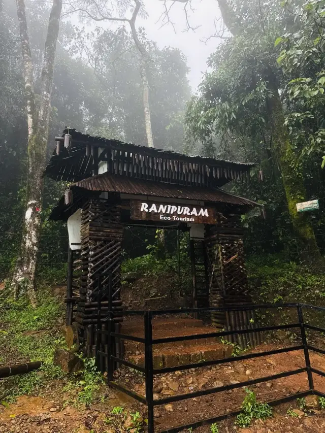
Kottancheri is four hills, not one. Kottancheri mala, Kumban mala, Pannyar mala and Kanthanppara stand together above the village of Konnakad in a ring, and Kerala Tourism’s own account of the name says the ring is the point: kotta is the Malayalam for a fort, and that is the shape they make. Inside it is rainforest — closed canopy, wet ground and streams — which is what separates this from the hill next door. Ranipuram, on the far side of the same ridge, is open grassland with a ticket counter at the bottom of it. Kottancheri is neither of those things.

Kottancheri Hills trek, Ranipuram
Practical guide

Plan Kottancheri Hills trek

Who's going?Tailor Kottancheri Hills trek to your trip
Typetrek
AreaRanipuram
DistrictKasaragod
Best timeOctober to March
Time neededA full day from Konnakad, starting early
Places to visit2Listed businesses6

Nothing about the visit is bought. There is no gate, no counter, no tariff board and no marked path, because this is reserved forest and none of that was ever built here. What the state asks for instead is permission, arranged with the Kasaragod range office before you set out, and a guide to walk with. Plan a full day, drive to Konnakad rather than to Panathady, and expect the last stretch of road to end in a dirt track above the village.

The story

Most hill days in Kerala are bought with a climb and paid off with a view. This is the other kind. For almost all of it the canopy is shut over your head, the ground underfoot is wet and rooted, and the only thing to look at is whatever stands within ten metres of you — which, in a wood this old, is a great deal. The view does come, from the top of Kumban mala, and it is worth the wait. But a walker who came only for the view will spend most of the day wondering when it starts.

The story of Kottancheri Hills trek

The approach is the first honest thing to say about Kottancheri, because it is longer than the guidebooks make it sound. Kerala Tourism puts the hills thirty kilometres north-east of Kanhangad, and thirty kilometres is right — as the crow flies. On the ground the drive is fifty-one, because the road has to go around the hills rather than through them, out along the coast and back inland on the Hill Highway through Malom. Konnakad, the village the walk starts from, sits four kilometres east of Malom in Balal panchayat, and from there the last stretch climbs to Vazhathattu, where the tar stops.

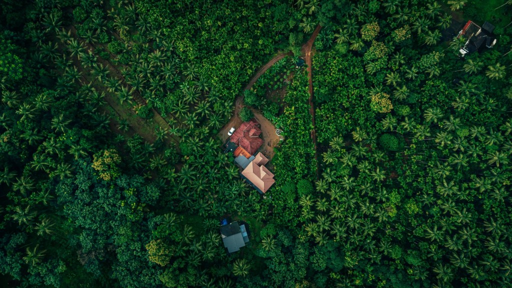
What you drive through on the way is not wilderness, and the contrast is worth noticing before it disappears behind you. The Hill Highway runs through rubber — sheet rubber drying under porches, tapping cups on the trunks, the smell of it in the air after rain. Read the place names as you pass them and half of them end in the word Colony: Balal Colony, Neelachal Colony, Kundappally Colony, Vazhathattu Colony, and a Scheduled Tribe colony at Peruthady. Then the tar narrows, the last houses stop, and the canopy starts. There is no buffer between the two, and the people who farm the last plot before the trees are the ones who lose a night’s sleep when the elephants come down. That is a different relationship with this place than a visitor’s.

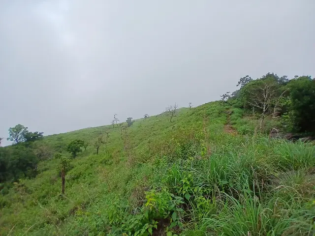
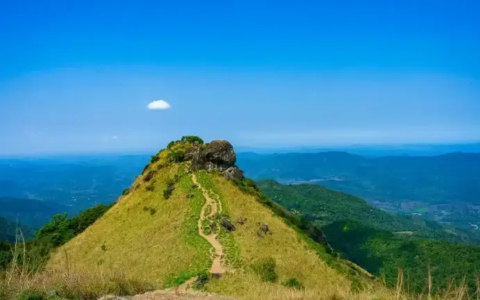
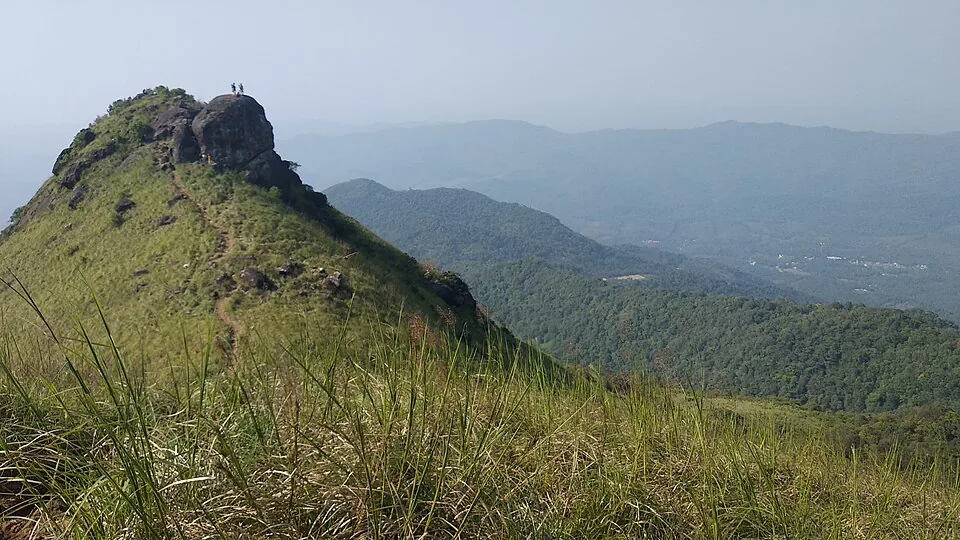
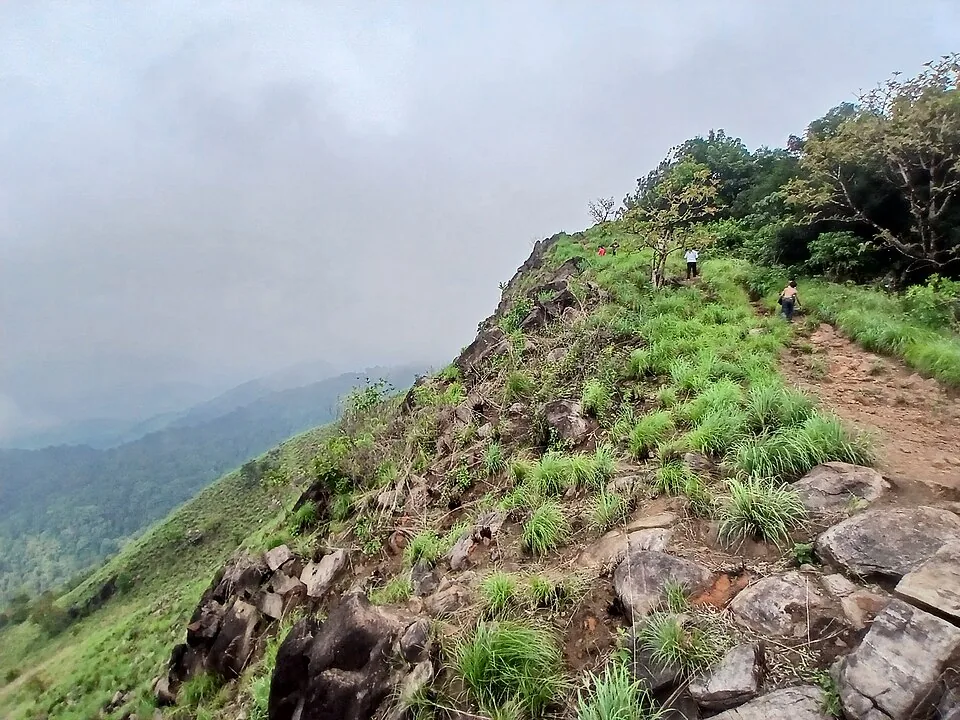
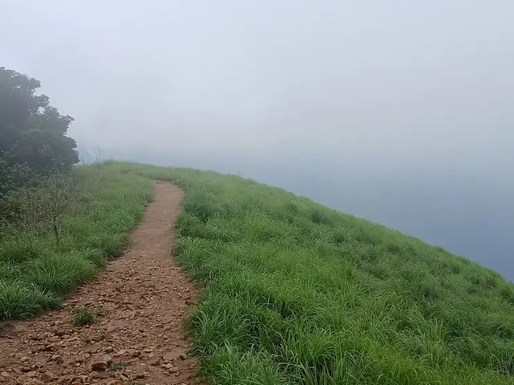
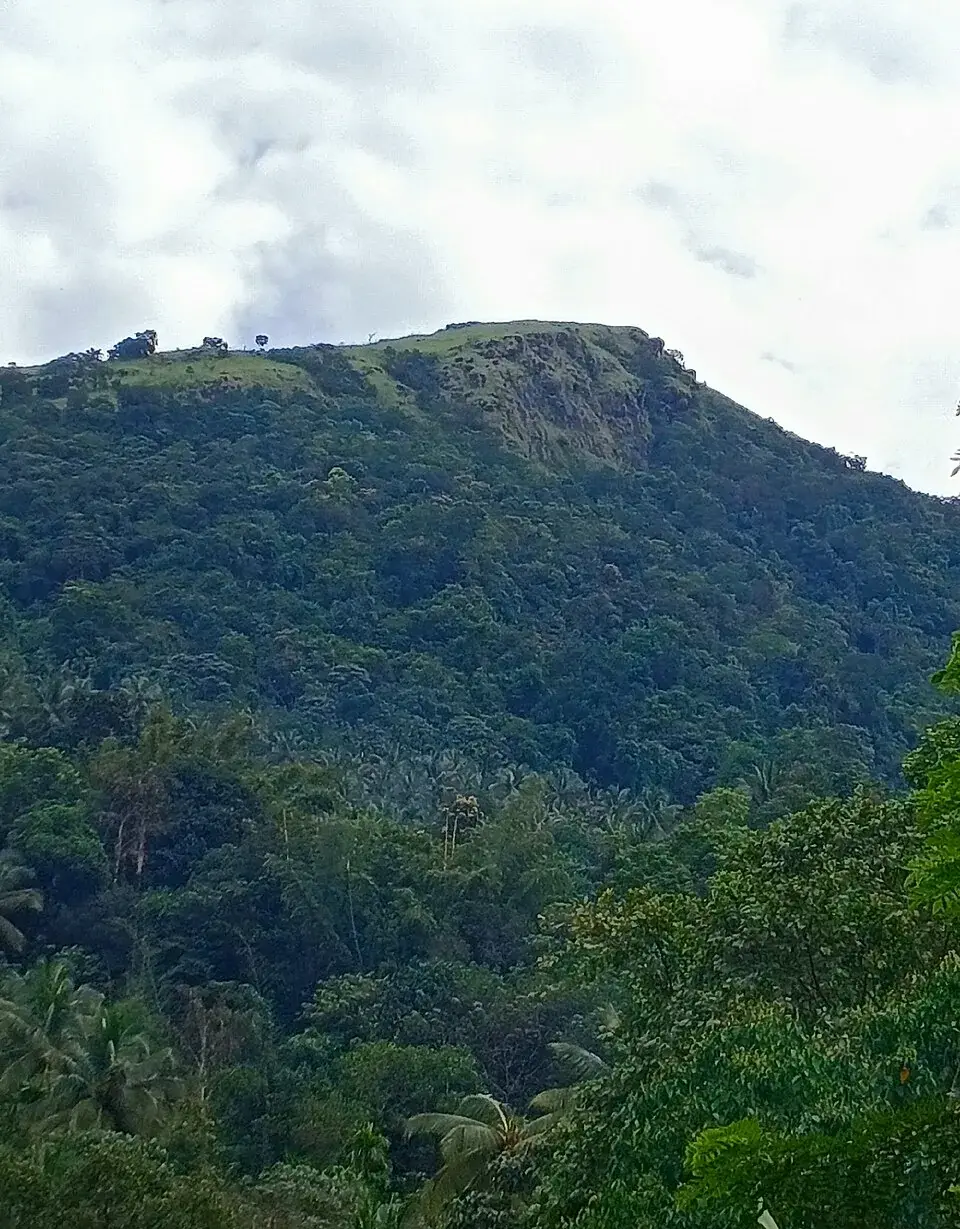
The four hills are what you have come for, and they are not interchangeable. Kumban mala is the one people climb for the view, and the view has an oddity in it: a stone wall runs along the top, and it is the line between two states. Stand on it and Kodagu — Coorg — opens out in front of you in Karnataka while Kasaragod falls away behind. Pannyar mala is the flat-topped ridge with the grass cap that shows in almost every photograph taken from the valley, a long green table above a wall of forest.

Between the hills the ground is close, wet and dark. The photographic record of these woods is unusually good for a place nobody writes about — one naturalist walked the ridges above Konnakad on a single day in October 2025 and left more than seventy pictures of it, and what they show is not scenery. They show giant ferns with fronds taller than a person, brackets stepping down a rotting log, balsams in flower on the cut banks, streams running clear over rock, and the canopy closing so completely overhead that the sky appears in almost none of the frames.

What grows here is the reason a botanist would make this trip and a landscape photographer would not. Anaphyllum wightii lifts a single dark maroon hood straight out of the leaf litter; it is an arum of the southern Western Ghats, it is listed as threatened, and it grows nowhere else in the world. Angiopteris, the giant fern, throws fronds taller than the person standing beside them. There is Strobilanthes on the banks — the genus that turns whole hillsides of the Ghats blue once every twelve years — and balsams, and begonias, and wild pepper growing through the leaf mould as a weed, which in a country whose entire early trade with the Mediterranean was built on that plant is a quietly extraordinary thing to walk past. The shieldtails are here too: burrowing snakes, blue-black and iridescent with a line of yellow down each flank, a Western Ghats group so seldom seen that several of its species are known from a handful of specimens.

One of those frames is of a kaavu. Sacred groves are the old religion of north Malabar — patches of woodland left standing because they belong to a deity rather than to anyone — and there is one up here: a buttressed tree with a ring of laterite stones at its foot, an iron trident planted in front of it, and a mossed laterite platform cut into the slope nearby. Nothing is published about which deity it belongs to or who keeps it, and we are not going to invent one. It is simply there, in the middle of all that green, and it is the clearest sign you will get that these hills were not empty before they were a trekking route.

The animals are the reason the Forest Department cares who walks here. Elephants use these slopes and cross the farmed ground below them, which is a problem for the villages long before it is an experience for anybody else — the department names them first in its own account of the hills, ahead of everything else that lives in them. That is why permission here is a real permission and not a formality, and why nobody sensible walks in without a guard who knows where the herds have been this week.

Konnakad itself will take about four minutes to look at, and it is worth knowing precisely what is in it before you rely on anything. Inside a kilometre and a half of the junction the map holds a primary health centre, a government veterinary hospital, the Karimbil Kunchikoman Memorial public library, and an Akshaya centre — one of the state’s e-governance kiosks, and the one place here you can count on for an internet connection. It holds no hotel, no restaurant and no fuel pump. That is not the same as saying there is nowhere to buy a bottle of water; small shops are simply not mapped in villages this size, and we are not going to promise you one we have not seen. The nearest stays and eating places we hold verified records for sit around Ranipuram and Rajapuram, half an hour off in the other direction. So the practical shape of the day is: sleep somewhere else, arrive early, carry everything in, and drive back out. Treat the village as the last point at which anything can be arranged rather than as a base.

The other thing the map shows about Konnakad is water, and it explains the walking. Three separate streams here are simply labelled Konnakad, and the Irrigation Department has a check dam on the Chamakkulam thodu at the edge of the village — a thodu being the ordinary Malayalam word for the kind of stream that runs hard in the rains and is a bed of stones in March. Multiply that by the whole hillside above and you have the reason the ground underfoot is what it is: this is not a dry ridge you climb, it is a catchment you cross, and how many times you get your boots wet depends entirely on the month.

The elephants are not an attraction here and it would be dishonest to sell them as one. Kasaragod’s hill villages live with crop raiding — elephants and wild boar coming down out of the reserve into the farmed ground at the forest edge — and the village of Maloth, which Konnakad belongs to, records it as a serious problem for the families whose plots run up against the trees. That is the same herd movement a visitor is being protected from by being told to take a guide, and it is the reason the department would rather know who is in there. If you meet anybody on the way up who farms the last field before the canopy, the elephants are not a story to them.

Stand on the ridge and you are on a divide, which is the most interesting thing about where these hills are. The streams you have been stepping over all morning gather into the Tejaswini — the Kariangode, the second largest river in Kasaragod — which runs sixty-four kilometres west and reaches the Arabian Sea at Nileshwar, the town whose railway station you probably arrived at. Twenty of those kilometres are rafted. On the other side of the same watershed, a few hours’ walk east and over the state line, the water goes the other way: into the Kaveri, and eventually across the whole peninsula to the Bay of Bengal. Two seas, one ridge, and no sign anywhere to tell you that you are standing on the line between them.

There is one more thing the state’s pages say about Kottancheri that is easy to misread. Eleven kilometres of unbroken green, they write, lie between these hills and Talakaveri — the spring in the Brahmagiri range where the Kaveri rises. That is a true statement about geography and a bad idea as an itinerary. Talakaveri is in Karnataka, inside its own protected forest, and walking to it means crossing a state line and needing that state’s permission as well as Kerala’s. Take the eleven kilometres as a description of where you are standing, not as a route somebody has cleared for you.

Legend & myth

The name is the story here. Kotta is a fort in Malayalam, and the four hills — Kottancheri mala, Kumban mala, Pannyar mala and Kanthanppara — are said to stand in the shape of one, a rampart of high ground closing a piece of country off. It is the sort of etymology that turns out to be visible: from the valley floor at Konnakad the ridges do wall the eastern sky.

The other names on the ring are worth saying aloud, because Malayalam does not waste them. Mala is simply a hill, and it is the ending on three of the four — Kottancheri mala, Kumban mala, Pannyar mala. Para, the ending on Kanthanppara, is a rock: the bare stone kind, not the wooded kind, and it is the same word that names outcrops all over Kerala. So the ring reads, in its own language, as three hills and a rock — which is a more accurate description of what you are looking at than anything a map will give you.

The kaavu up here belongs to a much older layer of the same idea. Across Kannur and Kasaragod, a kaavu is a grove that was never cleared because a deity is held to live in it, and the trees standing in one are frequently the oldest for miles in any direction — the botany is a by-product of the belief. The grove up here has its stones, its trident and its platform, and it has no published name, no recorded festival and no account of its origin that we could find in English or Malayalam. That silence is normal for a small kaavu and it is more honest than a legend would be.

Read the full history of Kottancheri Hills trek 782 more words

History

The country below the hills is younger than it looks, and it has a date. On 2 February 1943, seventy-two selected families from Kidangoor, Koodalloor, Punnathura and Pala boarded a train in Travancore, got off at Kanhangad — the same station that is still the nearest railhead to these hills — and walked inland to take up land at Chullikara, Rajapuram, Kallar and Malakkallu. That was the first organised settlement of the Malabar migration, and Rajapuram is half an hour from Konnakad. A second party of a hundred families followed to Madampam near Kannur five weeks later. Behind them came decades of it: Syrian Christian families from Kottayam, Idukki and Ernakulam clearing hill land for rubber and coconut, until the Christian population of Malabar had gone from 31,191 in the 1931 census to 442,510 in the 1971 one, a fifteen-fold rise inside forty years. Maloth itself, the village Konnakad belongs to, was held by a Nair landlord whose title gave the place its name, and Nair families from the Bekal side settled it in the 1950s. Every rubber tree, every church at a junction and every place on the map called Colony is that history standing up.

Kottancheri is reserved forest, and that single fact has shaped everything about how it is visited. There is no infrastructure here because none was ever built: no counter, no cottage, no interpretation board, no metalled road to the top and no board at the roadside telling you that any of this is here at all. A place that was never developed for visitors is not the same as a place that was closed to them, and the distinction is the whole reason this walk still feels the way it does.

It is worth understanding what Kottancheri is outside of. Kerala runs its forest tourism through a single system: eighty-two ecotourism centres across the state, each with its programmes, its published tariff, its daily ticket ceiling and its advance-booking window, all held in one register the Forest Department maintains and sells from. A centre is a place the department has decided to admit the public to on stated terms. Ranipuram is number forty-seven in that register. The whole of Kasaragod district has exactly one entry, and Kottancheri is not it. That is not a gap in the paperwork; it is the status. What you are asking for here is not a ticket to a programme but permission to enter reserved forest, which is a different transaction with a different person, and it is why nothing about the visit can be settled on a website.

The neighbouring hill went a different way, and a great deal of writing about Kottancheri borrows Ranipuram’s status by mistake. Ranipuram lies in the Panathady reserve, and for years there has been a proposal to raise that ground to a wildlife sanctuary — Kerala Tourism still publishes the page under the heading “Ranipuram Proposed Wildlife sanctuary”. The sanctuary has not been notified. A great many travel pages, and some encyclopaedia entries, describe Kottancheri as lying inside the “Ranipuram Wildlife Sanctuary”. What they mean is that it is part of the same belt of reserved forest, which it is; what they say is a legal status that does not exist.

The distance between the two hills is a useful measure of how separate they remain in practice. Across the ridge they are five and a half kilometres apart. There is no road over it, so getting from one to the other means driving right round the range — about half an hour, because one is approached from Panathady on the north side and the other from Konnakad on the south. The department will sell up to 998 tickets a day for the one; for the other it sells nothing at all.

Why visit

Rainforest walking rather than viewpoint walking — the canopy stays shut for most of it, and that is the appeal, not a shortcoming.

Western Ghats endemics at close range: plants and snakes that grow and live nowhere else on earth, at eye level rather than through binoculars.

A walk that still has to be arranged with a person rather than bought from a website.

Almost nobody else, and no counter to queue at.

A ridge you can stand on with one state in front of you and another behind, on foot, which is rare in Kerala.

A watershed: the streams at your feet end in the Arabian Sea, and the ones over the ridge end in the Bay of Bengal.

Country whose whole settled landscape has a date on it — the rubber and the colonies below the forest are one migration, and it began at the railway station you arrived at.
What to expect

Highlights

  • Kumban mala, and the stone wall along the top of it that is the boundary between Kerala and Karnataka, with the Kodagu hills opening out beyond.
  • Pannyar mala — the flat, grass-capped crest you can pick out from the valley floor before you have taken a step.
  • A kaavu in the middle of the woods: one enormous buttressed tree, a ring of laterite stones round its foot, an iron trident, and a mossed platform cut into the slope.
  • The streams, running clear over rock, which are most of the open ground you will see all day.
  • The plants at eye level — tree ferns, aroids and balsams that a Western Ghats botanist would cross the state for.
  • Vazhathattu, where the tar stops and the walking starts — and the laterite building at the foot of the hills with “forest school” painted on its wall in Malayalam.
  • The stream crossings, which are the honest measure of the season: ankle-deep in March, a decision to make in October.
Getting there

How to visit

  • Book the guide with the Kasaragod range office before you leave home. There is nothing here to arrange anything at when you arrive.
  • Drive to Konnakad, off the Hill Highway through Malom — not to Panathady, which is the road up the other hill and an hour in the wrong direction.
  • Leave the vehicle where the tar ends above the village. Everything after that is on foot.
  • Start at first light and give it the whole day, so that you are back out from under the trees in daylight.

Distance by road

  • Mangaluru53 km
  • Kozhikode181 km
  • Mysuru226 km
  • Coimbatore356 km
  • Kochi358 km

Road km to Kasaragod; ghat roads and traffic vary — allow extra.

Timing

Best time

October to March. The rains leave the streams running and the woods at their richest through October and November, and the ground stays walkable into the cool months; the monsoon itself, roughly June to September, means heavy rain and slick rock.

Weather in Kottancheri Hills trekSeasonal guide

Live forecast loads in your browser.

Today at Kottancheri Hills trek
Sunrise6:18 am
Sunset6:13 pm
Golden hour best light5:13 pm–6:13 pm
Blue hour after sunset6:13 pm–6:38 pm
Sun sets toward compass bearingW · 263°
Moon tonight🌑 New moon · 0%
Retreating monsoon. October and November still see spells of rain from the retreating monsoon, though it is usually lighter than mid-year. Conditions are generally good but worth checking.

Sun and moon are calculated for this location and shown in IST. Photography windows are the hour around sunrise and sunset; the sunset bearing is degrees clockwise from true north. Moon phase is accurate to about half a day.

Visitor notes

  • This is a walk under trees, not a viewpoint drive. The canopy stays shut for most of it, and that is the point of coming.
  • It is a separate outing from Ranipuram, half an hour away by road. Doing both in one day means two approaches from two different sides of the ridge.
  • Nobody is stationed on this route and nothing on it is signposted, including the grove.
Safety

Good to know

  • Elephants use these slopes and cross the farmed ground below them. That is why the permission here is a real permission, and why the guide is not a formality.
  • The only people who will know you went in are the ones you told. Arrange the party with the range office rather than walking in on your own account.
  • Nothing on this route is graded, marked or lit, and there is no shelter anywhere on it. Weather that would be an inconvenience on a made path is a reason to turn round here.
Official eco & forest programmes

Experiences around Kottancheri Hills trek

These are official or public-sector eco offerings that match this place, town or forest destination. Confirm availability, permits, tariffs and reporting times with the official operator before travel.

Ranipuram, Kottancheri Hills trek
trekviewpointwildlife

Ranipuram hill trek

One-day hill trek from the Panathady/Ranipuram side through shola, monsoon evergreen forest and grasslands.

Kerala Forest Department / DTPC KasaragodShort day trek
Official source →
Ranipuram, Kottancheri Hills trek
forest staytrek

Ranipuram DTPC forest-base cottages

Hill-station base accommodation near the Ranipuram trek start, useful for early starts and misty grassland walks.

DTPC Kasaragod / local operatorsforest cottageOvernight
Official source →
Stay · eat · do · rent · see · shop

Stays, food & things to do near Kottancheri Hills trek

Browse listed stays, food, activities, sights, shops and rentals around Kottancheri Hills trek. Check each listing’s locality and contact the business directly for current arrangements.

3 things to do near Kottancheri Hills trek

Farm homestay · Ranipuram
The Palavayal Farmresorts
Est. 17.0 km · 19 min drive~₹410–480 by taxi

Kerala Tourism-listed riverside farm stay with kayaking, trekking and houseboat-ride context. The Palavayal Farmresorts, Kadalikkattil House, Enichal, Palavayal, Kasaragod, Kerala 670511 · Farm stay, Tejaswini River, Kayaking.

Directions Commission-freeView details
Hill and trek destination · Ranipuram
Ranipuram Hills Kerala Tourism
Est. 25.3 km · 30 min drive~₹560–660 by taxi

Ranipuram Hills is Kasaragod highest hill-and-grassland route, with a short forest-and-shola trek best planned around weather, road condition, forest sensitivity and local transport from Panathady or Kanhangad. Hill station, Trek, Panathady.

Directions Commission-freeView details
Kerala Tourism-listed travel agent · Ranipuram
Bekal Holidays Ranipuram Travel Agent

Bekal Holidays Ranipuram Travel Agent is a researched kerala tourism-listed travel agent record for ranipuram, added to improve practical Kerala trip planning without duplicating an existing same-place listing.

Directions Commission-freeView details

Book with the place itself. India’s cyber-crime coordination centre warned in April 2025 that convincing copies of hotel and pilgrimage booking sites are being pushed through sponsored search and social ads, taking payment for rooms the property never hears about. Use the contact and source details on each profile to confirm the exact business and booking channel. A directory entry or map pin alone does not establish an operator’s identity or current availability. Roampedia takes no commission and does not collect booking payments. If a booking page reached you through an ad, check the address bar against the property’s own site before you pay. Fraud can be reported on cybercrime.gov.in or on 1930.

Options

More ways to explore Ranipuram

Find food, accommodation and activities across Ranipuram. Browse the guides for places to eat, stay and explore along your route.

Across the whole of Ranipuram

Nearby guides

Top experiences around Ranipuram

2 more places around Ranipuram. Open a guide to plan the visit and onward journey.

hill stationRanipuram

6.5 km · straight line

A grassland-and-shola hill topping out at 1,049 m, the “Ooty of Kerala”, with easy treks and montane forest on the Western Ghats edge.

trekRanipuram trek

25.3 km · 30 min drive

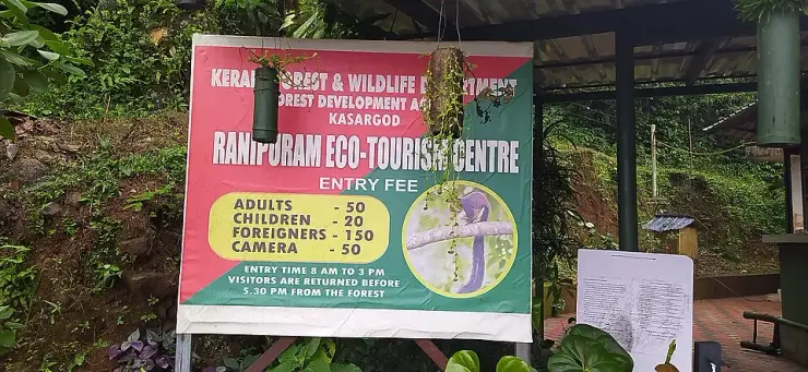
The hill you can drive most of the way up. A tarred road climbs six hundred metres out of Panathady to an eco-tourism counter at about 780 m, and from there Kerala Tourism describes two kilometres on foot — about an hour, on a track with stone steps in places — through evergreen shola and out onto lemongrass grassland, ending at the bare rock of Manimala Top at 1,049 m. Fifty rupees, cash at the window, entry between eight and three.

Roampedia is commission-free — own or know a stay, eatery, guide or shop near Kottancheri Hills trek? Submit public business details for review.

Add a nearby business
Trek facts

Kottancheri Hills trek — at a glance

DistanceKerala Tourism gives two different figures on two of its own pages — a 13 km walk through the trees from Konnakad on one, and eight kilometres from Konnakad to the hills on another. We have not walked it, and we will not average two published numbers into a third that nobody printed. Ask the range office what the day actually covers.
TimingsNo opening or closing time is published, because there is no gate to open. In practice the constraint is daylight and the guide's judgement: start at first light and plan to be back out well before dusk.

Entry: Official pages describe the Kottancheri routes, but the source review on 4 September 2026 found no current operator, permit process or tariff published for them. That absence is not evidence of free or unrestricted access: confirm permission, guide arrangements and any charge with the Forest Range Office before travelling.

Photography: No camera fee is charged, since there is nobody charging anything. It is dark under canopy for most of the walk and a fast lens is worth more than a long one.

Permit: Kerala Tourism's instruction is to take permission from the Forest Department before starting, and to walk with one of its guards or a local rather than alone; it will provide an experienced guide. The contact it publishes for this is the Forest Range Officer, Kasaragod, on +91 4994 225072 or 8547602576. Ring before you travel — there is nobody at the roadside to ask on the day.

Parking: There is no car park. Vehicles are left at the village or at the point where the tar ends; ask locally rather than blocking a lane.

Wildlife: The Forest Department names elephants first, ahead of wild dogs, deer and wild boar, and calls the hills rich in birds and butterflies. Set expectations accordingly: this is closed canopy, so most of what is here is heard rather than seen, and what a walker actually meets tends to be small, still and within a few metres of the route.

Getting here

How to reach Kottancheri Hills trek

  • ✈︎ By air Kannur International Airport is the nearer of the two at 78 km by road, about an hour and twenty; Mangaluru International is 121 km and roughly two hours. That is the opposite way round from the rest of Kasaragod district, where Mangaluru is normally closer — Konnakad sits at the district's southern inland corner.
  • 🚆︎ By train Nileshwar is the nearest station by road at 42 km, a little under an hour. Kanhangad is 51 km and takes no longer, because the road out of it is the better one; Cheruvattur is 44 km and slower than either. There is no station anywhere near the hills themselves.
  • 🚗︎ By road Konnakad is reached off the Hill Highway (SH59) through Malom, four kilometres to the west. From Kanhangad the drive is 51 km and about fifty minutes — note that Kerala Tourism's widely repeated "30 km north-east of Kanhangad" is the straight-line distance, not the road. Beyond Konnakad the tar continues to Vazhathattu and then becomes a dirt track.
  • 🚌︎ By bus Konnakad is served off the Hill Highway, with buses from Kanhangad, Cherupuzha and Nileshwaram. There is no service beyond the village and nothing at all up the track, so the last stretch is on foot or in a hired jeep.
Getting back

If you are travelling by bus or ferry, check the return service with the operator before setting out. Leave time to reach the stop or jetty after your visit.

Ask at the bus stand for the time of the last service back, not the next one. If you miss it, an auto or app cab is the fallback — agree the fare before you get in.

Do

Things to do

  • Walk the ridge line to Kumban mala for the Kodagu view and the state-boundary wall.
  • Find the kaavu — it is not signposted, and the guide will know where it is.
  • Photograph the understorey rather than the view. This is a macro walk, not a panorama walk.
  • Stop at the streams. They are the only open ground and the only reliable water on the route.
Prepare

What to carry

  • Boots and long trousers, and salt or tobacco in a pocket: leeches are constant from roughly June into November and they will find your ankles.
  • Fill up at Konnakad or Malom — food, water and fuel all stop at the village.
  • Cash. Nothing here takes a card and nothing here has a card machine to take one with.
Facilities

On site

  • No ticket counter, no gate, no visitor centre and no interpretation board.
  • No toilet, no drinking water and nothing to buy once you leave the village. Carry the day's water in.
  • No marked path and no signage on the route — this is why the department wants a guide with you.
  • No mobile coverage should be assumed once you are in under the trees.
Stay safe

Safety

  • Watch where you put your hands. The Malabar pit viper is venomous, patterned exactly like wet bark, and hunts by lying still along a branch or a fallen trunk — often at the height at which a person steadies themselves going downhill. It does not move away and it gives no warning.
  • Turn back in heavy rain. The streams rise fast and the rock underfoot goes slick.
  • Do not walk it alone or without permission. This is not open country, and a party nobody knows about is a party nobody comes looking for.
Getting around Kottancheri Hills trekNot wheelchair accessible
Terrain
Steep
From the entrance
The tar ends at Vazhathattu, above Konnakad, and becomes a dirt track. Everything past that is bare ground — leaf litter, roots, wet rock and stream crossings — with no made path, no steps cut, no handrail and no signage. There is no drop-off point close to anything worth seeing.
Step-free access
A full day of unmade walking under canopy, on a route with no built surface at any point, reached down a dirt track. There is nothing here a wheelchair user can do, and no partial version of it, and we would rather say that plainly than describe some short accessible stretch that does not exist.
Prams
No. There is no surface to push anything along, and a carrier is the only way a small child comes on this walk at all.

Nothing built on the route: no shelter, no bench, no toilet, no water point and no board.The last building on the way in is at the foot of the hills near Vazhathattu; there is nothing beyond it.

  • The stream crossings are the part that changes most with the month — ankle-deep and dull in March, a decision to make after a night of rain in October.
  • The gradient is not graded anywhere and there is nothing to hold on to. Anyone unsure of their footing on wet rock should know that before the day, not during it.

Checked 31 August 2026 against source 1source 2source 3. Conditions change and surfaces vary with weather — if step-free access is essential, confirm with the site before you travel.

Nearby

What’s near Kottancheri Hills trek

hill stationRanipuram

A grassland-and-shola hill topping out at 1,049 m, the “Ooty of Kerala”, with easy treks and montane forest on the Western Ghats edge.

6.5 km · straight line
trekRanipuram trek

The ticketed walk up Kasaragod’s highest hill — a tarred road to a counter at about 780 m, then two kilometres on foot through shola forest into open grassland and up to the rock at 1,049 m.

25.3 km · 30 min drive
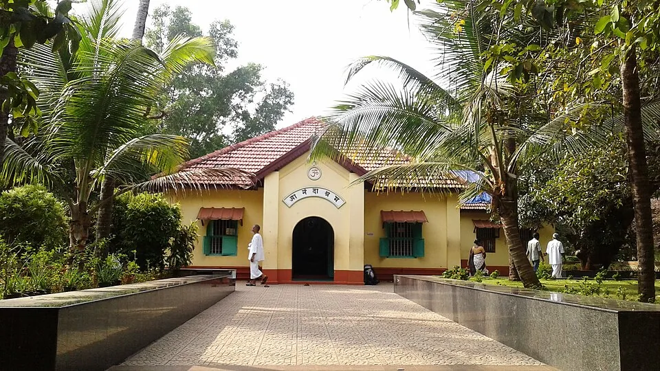
heritageAnandashram

A tranquil spiritual retreat at Kanhangad founded in 1931 by Swami Ramdas (Papa) and Mother Krishnabai, set in quiet wooded grounds; open to visitors of every faith under its motto of “universal love and service”.

28.6 km · straight line
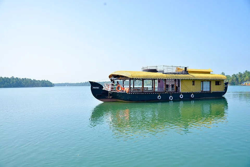
heritageNileshwar

The cultural capital of Kasaragod — a Theyyam and folk-arts town on the Nileshwaram backwaters, with kovilakams, kavus and a lively ritual-arts season.

29.0 km · straight line
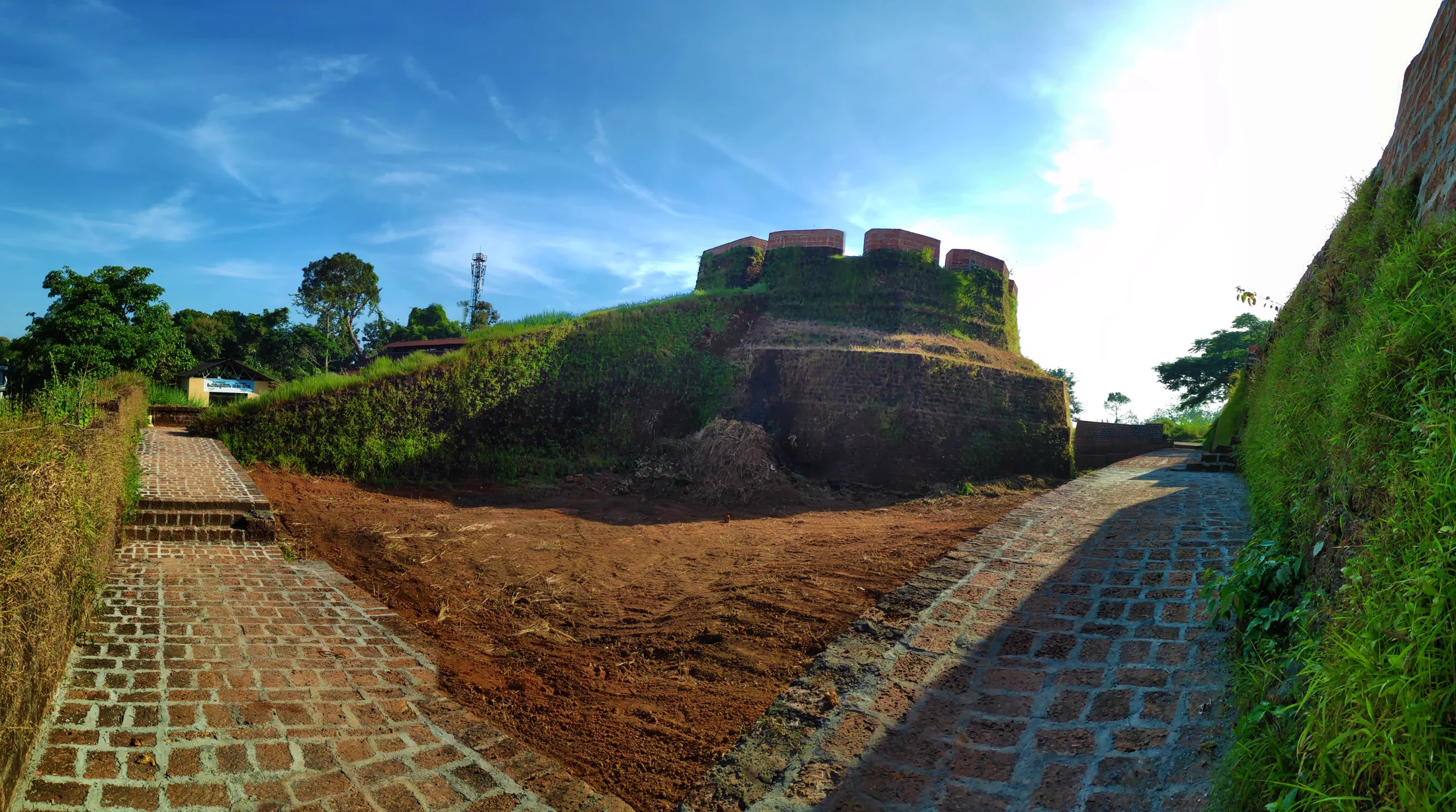
heritageHosdurg Fort

The surviving laterite fort at Hosdurg in Kanhangad is associated with the Ikkeri Nayakas and recognised by its rounded bastion and broad ramp; Nithyananda Ashram is a separate neighbouring institution.

30.9 km · straight line
heritageNithyanandashram

The hillside cave complex at Hosdurg where Bhagawan Nityananda cut meditation chambers by hand out of a single mass of laterite — 43 by the ashram’s own account — with the Nithyananda Temple built above them in 1963. Mobile phones are prohibited in the caves.

31.4 km · straight line
beachKanhangad beach

Kanhangad Beach is the Hosdurg coastal frontage of Kanhangad in Kasaragod district, with a broad sandy shore and an established fish-landing setting. It is a beach visit from Kanhangad town, distinct from Hosdurg Fort, the town’s ashrams and the separately named beaches at Ajanur, Ozhinhavalappu and Thaikadappuram. Use the named beach approach rather than a generic Kanhangad map result. The shore’s working character is central to the visit: leave boats, nets and landing passages clear while enjoying the sea-facing sand.

32.5 km · straight line
backwaterValiyaparamba Backwaters

An inhabited coastal backwater landscape in southern Kasaragod, with fishing shores, coconut groves and island settlements. The map uses the Valiyaparamba village jetty as a shoreline orientation base.

34.9 km · straight line
beachBekal Beach

The beach stretch below Bekal Fort, with a landscaped park — famously the setting of the song “Uyire” from the film Bombay.

36.2 km · straight line
heritageBekal Fort

Kerala’s largest fort (~40 acres), a keyhole-shaped laterite bastion jutting into the Arabian Sea, built around 1650 by the Keladi Nayakas; its observation tower once mounted cannons.

37.1 km · straight line
heritageChandragiri Fort

A 17th-century hilltop fort above the Chandragiri river built by the Keladi Nayakas, with sweeping views of the river mouth and the Arabian Sea — good at sunset.

41.8 km · straight line
mosqueMalik Deenar Mosque

The Malik Ibn Dinar Juma Masjid in Thalankara, Kasaragod — by tradition among the oldest mosques in India, linked to the earliest arrival of Islam on the Malabar coast.

43.8 km · straight line

2 detailed place guides in Ranipuram →

Road and walking figures are route estimates, with travel times dependent on access, traffic and conditions. Figures marked “straight line” show direct separation and do not describe a road or walking route. Fare estimates use Kerala’s 26 April 2022 auto/taxi notification and exclude waiting, night and applicable one-way surcharges. Confirm the current meter or operator quote before travelling. Routing: © openrouteservice.org by HeiGIT | Map data © OpenStreetMap contributors

On the map

Where Kottancheri Hills trek is

Good to know

Kottancheri Hills trek — frequently asked

Is Kottancheri the same place as Ranipuram?

No. They are neighbouring hills on the same range and they are visited quite differently. Ranipuram is a ticketed Forest Department programme with a counter, a published fee and a fixed closing time, approached from Panathady. Kottancheri has none of those things and is approached from Konnakad, on the other side of the ridge — five and a half kilometres away in a straight line, and about half an hour’s drive round the range, because no road crosses between them.

Do I need permission to trek in the Kottancheri hills?

Yes, and a guide with it. Ring the Forest Range Officer, Kasaragod, on +91 4994 225072 or 8547602576, days before you travel. Nothing here can be arranged on the day, because there is nobody at the roadside to arrange it with.

How long is the walk?

Kerala Tourism gives two different figures on two of its own pages — thirteen kilometres of walking from Konnakad on one, and eight kilometres from Konnakad to the hills on another. We have not walked it and we do not average two numbers into a third. Treat it as a full day, ask the forest office what the party is actually doing, and start early.

Can you walk from Kottancheri to Talakaveri?

Eleven kilometres of unbroken green separate the two, and the state’s pages say so — but Talakaveri is in Karnataka, inside that state’s protected forest, so the walk crosses a state line and needs Karnataka’s permission on top of Kerala’s. It is a fact about the geography rather than an itinerary anyone has cleared for visitors.

When is the best time to go?

October to March. The rains leave the streams full and the woods at their best in October and November, and the ground stays walkable through the cool months. The monsoon itself, roughly June to September, means heavy rain, leeches and slick rock underfoot.

Is there anything at Konnakad if something goes wrong?

There is a primary health centre in the village and a government veterinary hospital, plus a public library and an Akshaya centre for an internet connection. There is no hotel, no restaurant and no fuel pump on the map. Fill the tank and buy the day’s food before you turn off the Hill Highway.

Will I get a phone signal?

Do not plan on it. Coverage in the village is one thing and coverage under closed canopy on a ridge is another, and nothing about this route is arranged so that a phone can rescue it. That is the practical reason the range office wants to know your party is going in.

If I want the ticketed version instead, what does Ranipuram cost?

The state’s register puts Ranipuram at ₹50 for an Indian adult, ₹20 for an Indian child under fifteen, ₹20 for students and ₹150 for a foreign visitor of any age, plus ₹50 for a still camera and ₹50 for video, and vehicles from ₹10 for a two-wheeler to ₹100 for a heavy one. It runs 08:00 to 15:00, releases up to 998 tickets a day, takes bookings twenty days ahead, has online booking switched off, and sets no minimum party size. Confirm on the day: these are the department’s published figures, not a quotation.

Which river rises here?

The streams on this walk feed the Tejaswini, also called the Kariangode — the second largest river in Kasaragod. It runs sixty-four kilometres to the Arabian Sea at Nileshwar, and about twenty kilometres of it are used for rafting further down. Over the ridge to the east, the water belongs to the Kaveri instead and ends up in the Bay of Bengal.

Is Kottancheri a wildlife sanctuary?

No. It is reserved forest. Kerala Tourism publishes a page headed “Ranipuram Proposed Wildlife sanctuary” for the neighbouring hill, and the sanctuary has never been notified, so a great deal of writing that places Kottancheri “inside the Ranipuram Wildlife Sanctuary” is describing a legal status that does not exist. The belt of protected forest is real; the sanctuary is not.

How high are the hills?

Nobody publishes a figure for Kottancheri itself, so we do not print one. For scale, the hill country immediately around Maloth reaches about 500 metres, and Ranipuram’s summit across the ridge is 1,048 metres, the highest ground in Kasaragod district.

Is there anywhere to eat or stay at Konnakad?

Not that we can verify. There is no stay, no eatery and no shop listed anywhere in the hills themselves, and the nearest places we hold records for sit around Ranipuram and Rajapuram, half an hour or more away by road. Bring your own water and food for the day.

When is the best time to visit Kottancheri Hills trek?

October to March. The rains leave the streams running and the woods at their richest through October and November, and the ground stays walkable into the cool months; the monsoon itself, roughly June to September, means heavy rain and slick rock.

What are the entry fee and timings at Kottancheri Hills trek?

Entry: Official pages describe the Kottancheri routes, but the source review on 4 September 2026 found no current operator, permit process or tariff published for them. That absence is not evidence of free or unrestricted access: confirm permission, guide arrangements and any charge with the Forest Range Office before travelling. Timings: No opening or closing time is published, because there is no gate to open. In practice the constraint is daylight and the guide's judgement: start at first light and plan to be back out well before dusk.

How do I reach Kottancheri Hills trek?

Book the guide with the Kasaragod range office before you leave home. There is nothing here to arrange anything at when you arrive. Drive to Konnakad, off the Hill Highway through Malom — not to Panathady, which is the road up the other hill and an hour in the wrong direction. Leave the vehicle where the tar ends above the village. Everything after that is on foot. Start at first light and give it the whole day, so that you are back out from under the trees in daylight.

How much time do I need for Kottancheri Hills trek?

A full day from Konnakad, starting early. There is no short version that returns a view — the view is at the top of Kumban mala and the walking in between is under closed canopy.

What else is near Kottancheri Hills trek?

Nearby you can pair Ranipuram (6.5 km, approximate straight-line separation), Ranipuram trek (25.3 km, route estimate), Anandashram (28.6 km, approximate straight-line separation), Nileshwar (29.0 km, approximate straight-line separation).

What should I know before visiting Kottancheri Hills trek?

Elephants use these slopes and cross the farmed ground below them. That is why the permission here is a real permission, and why the guide is not a formality. The only people who will know you went in are the ones you told. Arrange the party with the range office rather than walking in on your own account. Nothing on this route is graded, marked or lit, and there is no shelter anywhere on it. Weather that would be an inconvenience on a made path is a reason to turn round here.

Image credits

Photographs: Nativeplants garden (CC BY-SA 4.0), Shem.iz (CC BY 4.0). Wikimedia Commons.