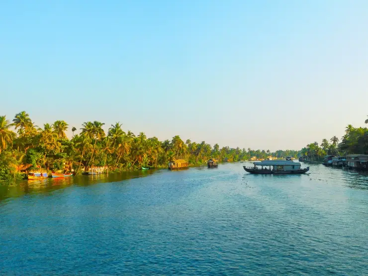
What to expect
Highlights
- Viewpoint stop at Ashtamudi backwater viewpoints
- Photography and landscape views
- Good add-on to nearby town or hill routes
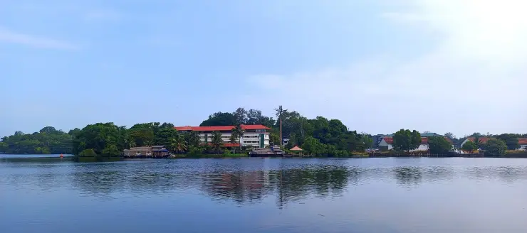
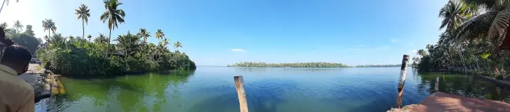
The open-water outlooks on the Munroe Island and Perumon side of Ashtamudi, where the lake widens out — the wide views the canal trips themselves do not give you.
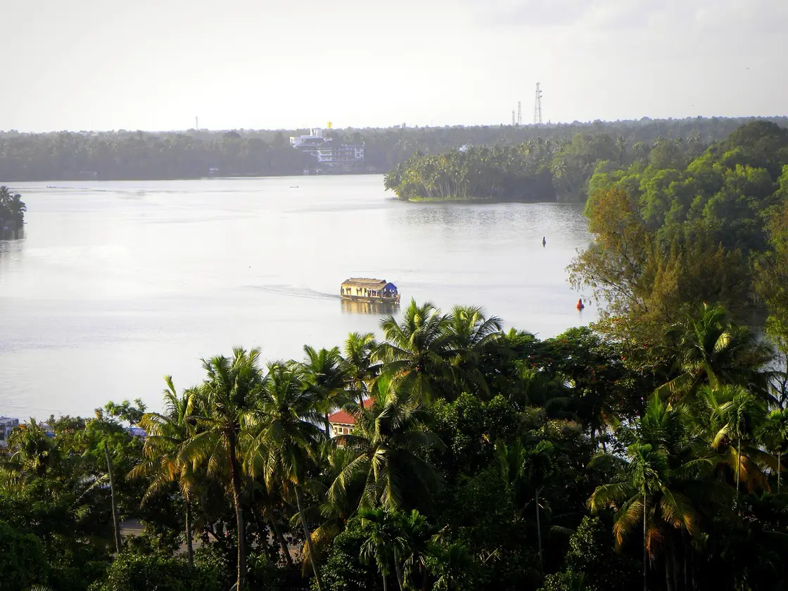
The canal trips are enclosed by design — that is their charm. But Ashtamudi is a big estuary with many arms, and to see it as a lake rather than a corridor you have to get out onto the open water. There are more named, mapped outlooks here than any listing admits, and the best of them is a seat on a government boat.
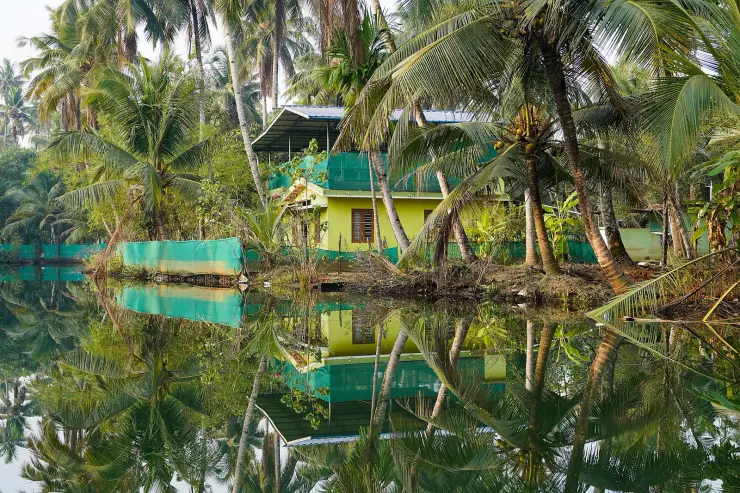
Ashtamudi's name promises eight arms, and the lake reaches inland in long limbs rather than sitting as a single sheet. From a canoe in the canals you never see this. You see banks, two metres apart, and the sky above them. The open-water outlooks are the corrective — the place where the lake stops being a corridor and becomes a body of water with distance in it.
It is commonly said that there are no real viewpoints on Ashtamudi — no built lookouts with names, no car parks — and that there is no facility to go looking for. OpenStreetMap flatly disagrees. There is a named, mapped, built viewpoint on the Kollam waterfront called Presidents Trophy View Point, beside the boat jetty. There is a named Sunset Point on Munroe Island. There is a state-run adventure park and a DTPC-operated park with lake frontage, a string of public parks along the Ashramam shore, and at least six further mapped viewpoint nodes around the water that no travel site lists. That advice sends you away from things that exist.
The Kollam town waterfront is in fact the most accessible outlook, not the Perumon bridge. It is about two kilometres from Chinnakada, served by every bus and auto in the district, and it has parks, parking and a working jetty. Perumon gives the best long view; it is not the easiest to reach.
The Perumon bridge area does give that long view. The bridge carries the road and the railway towards the island across open water, and from the approaches you get the distance the enclosed channels withhold. One thing to know before you stand there: about 140 metres away, on the bank, is the Perumon Tragedy Memorial. On 8 July 1988 the Island Express derailed on the rail bridge here and its carriages went into the lake; 105 people died. There are two rail bridges side by side now, the old and its replacement, fifteen metres apart, and nothing on the ground tells you which is which. The view from here is extraordinary, and the bridge is more than the ordinary piece of infrastructure it is usually called. The full account is told on the Ashtamudi Lake page and we will not repeat it here; but a page that recommends this vantage point without mentioning the memorial is failing its reader.
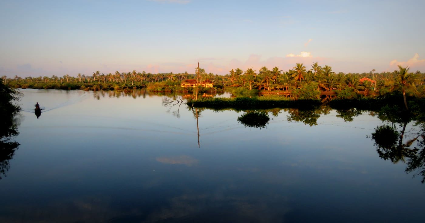
Sunset is the hour, with one geographical correction. The lake reaches the sea westward at Neendakara, but from the Perumon side the sun sets over land and water towards Chavara rather than over the sea. The genuinely west-facing open-water sunset is from the Chavara and Thekkumbhagom side looking back east, from the Dalavapuram shore, or from Munroe Island's mapped Sunset Point. Fishing craft cross at that hour and the far shore goes to silhouette.
This is also the best place in the district to understand how the pieces fit. From the open water you can see why Munroe Island exists where it does, where the Kallada arrives, and which direction the sea lies in. Ten minutes here does more for your mental map of Kollam than an hour of reading.
Ashtamudi is a Ramsar-listed wetland of international importance, and the birdlife reflects it — waterfowl and waders on the shallows and margins, with more in the cooler months. Bring binoculars if you have them; this is open-water watching rather than close-up.
Stand at any of these outlooks and the lake's name sets you a task: eight arms, go and count them. Try, and you will discover something odd. Nobody can tell you which eight. Not the state tourism board, not the encyclopedias, not any government document we could reach — and the lists that do circulate contradict each other and, in one case, contradict themselves.
Start with the word, which has at least four published meanings in English. English Wikipedia's article on the lake says Ashtamudi means eight hills or peaks — ashta, eight; mudi, peaks. English Wikipedia's article on the islands of Kollam says it means eight coned. Those two sentences are on the same encyclopedia, about the same water. Kerala Tourism, the state's own department, says eight braids. And virtually every travel site says eight branches. The two families of translation describe opposite shapes: peaks and cones rise, braids and branches spread. Malayalam mudi genuinely carries several senses — the knot or braid of hair, a crown, a peak — and which one the name intends is unresolved in print. Our own page used to commit to eight-braided as though it were settled. It is not, and saying so is more useful than picking a side.
Now the arms themselves. Two lists circulate widely and they differ in three of their eight entries. The common tourism list runs Thevally, Kandachira, Kureepuzha, Thekkumbagham, Kallada, Perumon, Kumbalathu and Kanjirottu. A second list drops Thevally and Perumon, and adds Munrothuruttu — which is an island cluster, not an arm — and Ashtamudi Kayal itself. That second entry is the one that gives the game away: a lake cannot be its own eighth branch. It shows the list is a compilation of water-body names rather than a survey of an estuary's limbs.
And English Wikipedia's own article on the lake names only seven top-level arms. The eighth, Thevally, appears as a subsection nested underneath Kureepuzha. A reader counting the headings gets seven, and the enumeration carries no citation at all.
Kerala Tourism, having offered the eight-braids gloss, then declines on the same page to name them, speaking only of numerous arms extending into the surrounding landscape. We could not reach the Ramsar Information Sheet during this work — the site returned server errors — so we will not assert what it does or does not say. But the gap is itself the finding: the enumeration cannot be sourced to any government document we could open. Eight is a name, not a count, and nobody appears to have gone out and counted.
The same looseness attaches to the lake's size, which matters here because size is what a viewpoint is for. Kerala Tourism says Ashtamudi covers around 170 square kilometres. English Wikipedia's infobox says 61.4. Its own body text says the lake had an area of 54 square kilometres by old survey reports and has shrunk to 34 through encroachment. So a reader can find 170, 61.4, 54 and 34 for the same water, from the state tourism department and from a single page contradicting itself. We are not going to adjudicate that. The honest thing to take to the shore is this: whatever figure you were given, the water in front of you is smaller than it was, and the direction of change is the one thing every source agrees on.
What you can count is the mouth. However many arms this system has, it reaches the Arabian Sea at exactly one point, at Neendakara, and you can stand on a public road bridge and look at it. The deepest water in the whole lake is 6.4 metres, at the confluence — about the height of a two-storey house, in the famous deep estuary of Kerala, and deepest precisely where you can go and see it.
One older correction still worth keeping: Ashtamudi is not Vembanad. Vembanad is the much larger system north of here, behind Alappuzha and Kumarakom, and that is where the houseboats and the Nehru Trophy race are. Trips are sold with the two blurred together, and the classic houseboat experience is not what this lake does best — the small-canoe canal trip at Munroe Island is, and Vembanad cannot offer it.
Finally, the water you are looking at is under pressure of the same kind as everything else in this district — the sediment regime altered by damming upstream, and land loss on the islets at the Kallada's mouth. A wide calm view is not evidence that a system is healthy.
Ashtamudi is a large estuarine backwater system in Kollam district, Kerala's second-largest estuary after Vembanad, reaching inland in a set of long arms and connecting to the Arabian Sea at a single mouth at Neendakara. Its name is ashta, eight, plus mudi — a word published variously as peaks, cones, braids and branches, with no settled reading.
It is designated a Wetland of International Importance under the Ramsar Convention, designated 19 August 2002, reflecting its ecological significance and its birdlife. Its maximum recorded depth is 6.4 m, at the confluence zone.
The Kallada river discharges into the system past the low islets of Munroe Thuruthu, which sit at the meeting of river and backwater, having run 121 km from the Western Ghats across a catchment of 1,699 sq km.
The Perumon bridge crosses the lake to serve Munroe Island by road and rail, and there are now two rail bridges standing side by side — the original and its replacement. The old one is the site of the Peruman rail disaster of 8 July 1988, in which the Island Express went into the lake and 105 people died; a memorial stands on the bank.
The mouth at Neendakara has been developed into a harbour serving over 3,000 marine fishing boats and trawlers, so the point where the whole system meets the sea is also its busiest working water.
Land loss on the islets at the Kallada's mouth, following the interruption of the river's sediment supply after damming, has become the defining environmental issue of this part of the system.
It is the only way to see Ashtamudi as a lake rather than as a corridor — the canal trips are enclosed by design and never show you the open water.
Sunset over a very large sheet of still water, with fishing craft crossing and the far shore in silhouette, and no ticket or platform between you and it.
The Perumon bridge approach gives the longest view down the lake — and the Perumon Tragedy Memorial stands 140 m from it, which is part of what you are looking at.
Presidents Trophy View Point on the Kollam waterfront is a named, built, free outlook two kilometres from Chinnakada, at the finish line of a 1,200 m snake-boat course.
The ₹400 'See Ashtamudi' state boat, five hours around the lake's named islands and bridges, is the best value on this water by a distance.
Ashtamudi is a Ramsar wetland, and the open shallows and margins are where the waterbirds are.
Ten minutes here makes sense of the whole district's geography — where the river arrives, why the island is there, and which way the sea is.
Road km to Kollam; ghat roads and traffic vary — allow extra.
Clear post-monsoon and winter days are best; mist can block views in hill areas.
Live forecast loads in your browser.
Check the official alert before you travel. Kerala’s beaches, waterfalls and trekking routes close at short notice during heavy rain, and district alert levels change day to day. We do not publish an alert level of our own — read it from the state authority: Kerala State Disaster Management Authority, or the district control room on 1077.
Sun and moon are calculated for this location and shown in IST. Photography windows are the hour around sunrise and sunset; the sunset bearing is degrees clockwise from true north. Moon phase is accurate to about half a day.
Verified hotels, homestays, restaurants, experiences, sights, shops and rentals around Ashtamudi backwater viewpoints — commission-free, with direct contact. Filter by what you need.
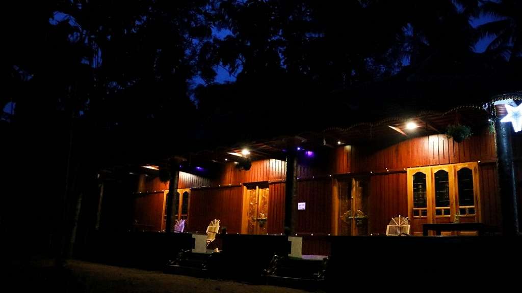
Kerala Tourism-listed homestay in timber-and-tile cottages at Nenmeni on Munroe Island, set among the canals and paddy of the Ashtamudi backwaters in Kollam. The hosts offer quiet garden-side rooms and home-cooked island meals, a laid-back base for backwater canoeing.
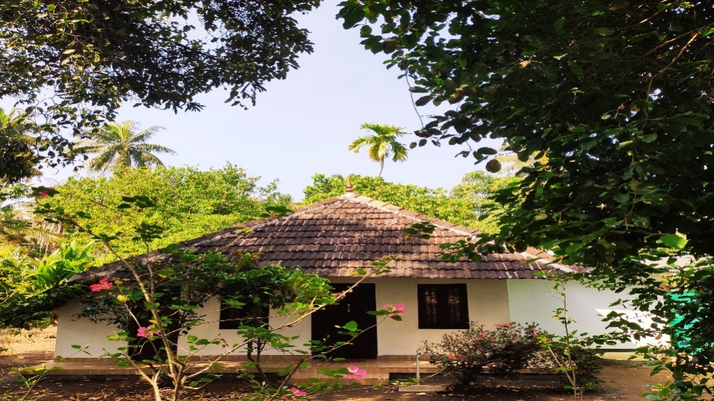
Kerala Tourism Silver House-classified homestay in a traditional tiled Kerala house on Munroe Island, amid the coconut groves and canals of the Ashtamudi backwaters. The host family offers clean rooms, home-cooked meals and guided canoe trips, a personal island base rather than a hotel.
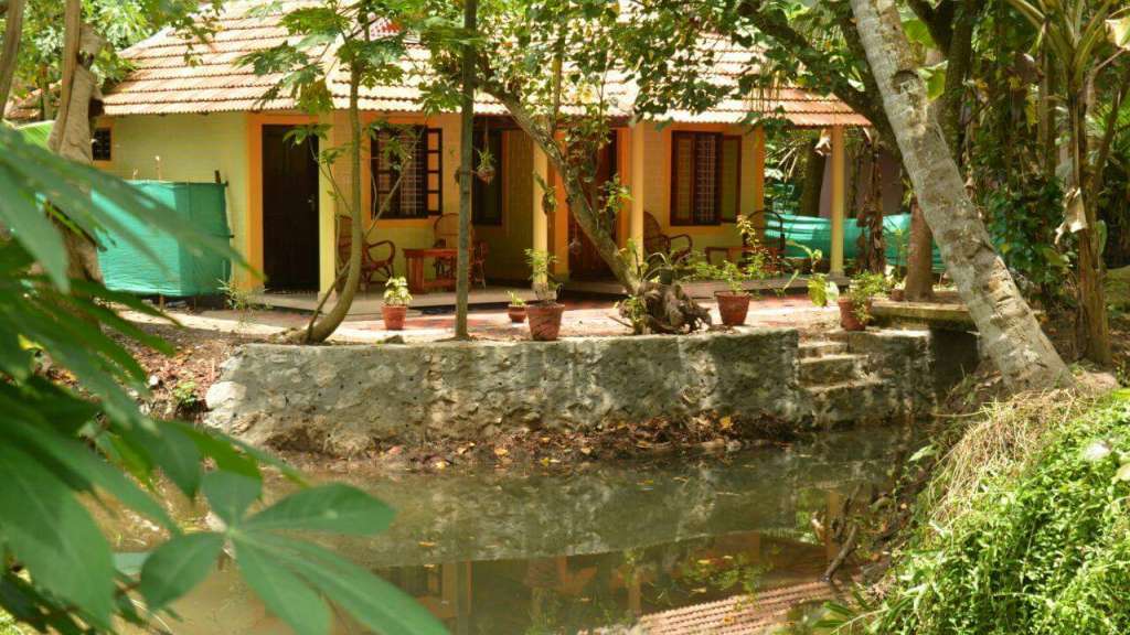
Kerala Tourism Silver House-classified homestay in a traditional tiled Kerala cottage beside a canal on Munroe Island, in the Ashtamudi backwaters of Kollam. The resident hosts offer simple canal-side rooms and home-cooked food, an authentic island stay for canoe rides and village walks rather than a hotel.
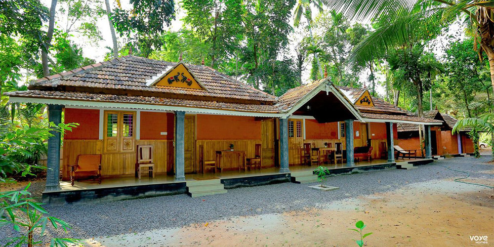
Private holiday home in Munroe Island. Mundro Green Land, Munroe Island, Kollam, Kerala · Munroe Island, Holiday home, Backwater view.
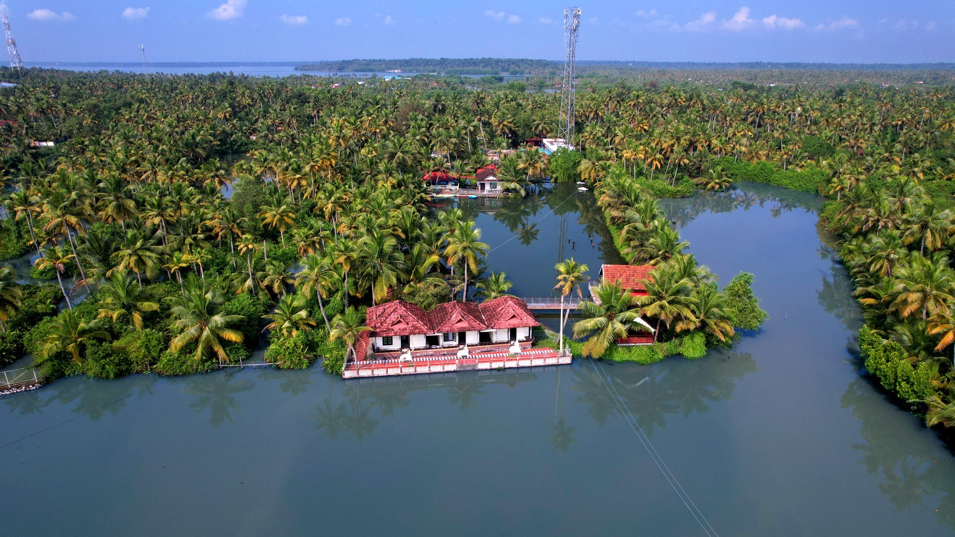
Resort in Munroe Island. Nenmani South, Munroethuruth P.O., Munroe Island, Kollam, Kerala 691502 · Munroe Island, Resort, Backwaters.
A homestay at Thoompum Mukham on Munroe Island. Canoe tours run the local waterways and the kitchen serves Kerala dishes and signature mocktails.
A homestay on Munroe Island built around paddling the backwaters. Kayak trips and canal boating explore the island's narrow waterways.
Private island farm stay on Munroe Island with organic food, backwater setting and direct booking contact.
Backwater resort in Munroe Island. Munroethuruth P.O., Munroe Island, Kollam, Kerala · Munroe Island, Backwater stay, Canoe.
Book with the place itself. India’s cyber-crime coordination centre warned in April 2025 that convincing copies of hotel and pilgrimage booking sites are being pushed through sponsored search and social ads, taking payment for rooms the property never hears about. Every listing here links to the business’s own contact details and its own Google or Bing profile — we take no commission and sit in nobody’s payment path. If a booking page reached you through an ad, check the address bar against the property’s own site before you pay. Fraud can be reported on cybercrime.gov.in or on 1930.
Find food, accommodation and activities across Munroe Island. Browse the guides for places to eat, stay and explore along your route.
4 more places around Munroe Island. Open a guide to plan the visit and onward journey.
7.5 km · 14 min drive
Canal village island known for canoe trips, coir work and slow backwater life.
6.4 km · 13 min drive
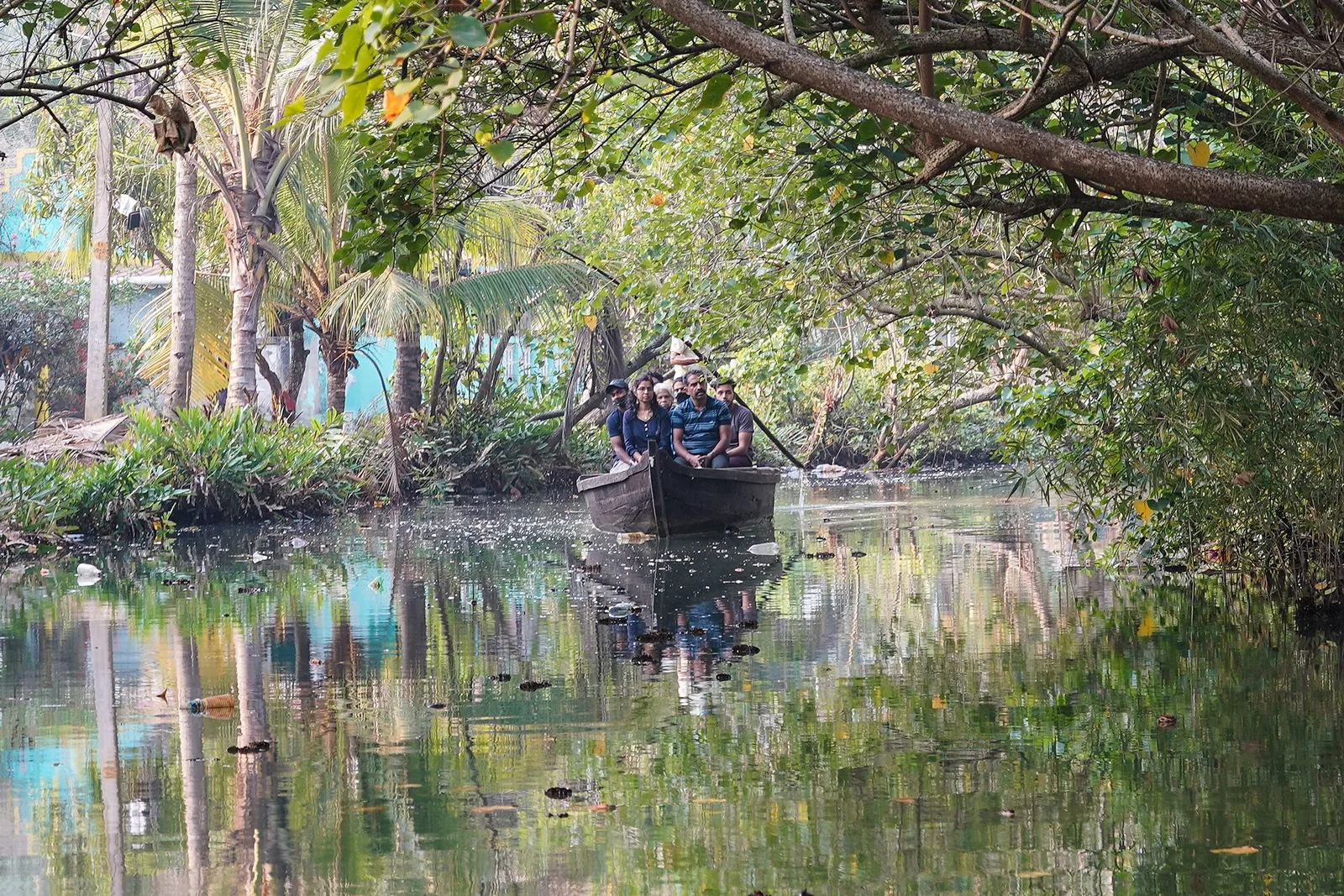
The narrow inland canal network threading Munroe Island, navigable only by small country canoe — the reason the island is visited at all, and a different waterway entirely from the open Ashtamudi lake.
7.0 km · 13 min drive
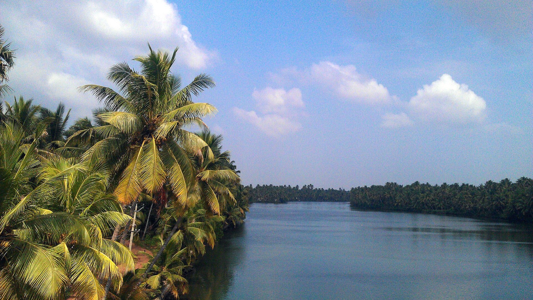
The river that rises in the Western Ghats behind Thenmala, is impounded at the Parappar dam, and reaches the sea through Ashtamudi past Munroe Island — the thread that connects the east of this district to the west.
4.7 km · 11 min drive
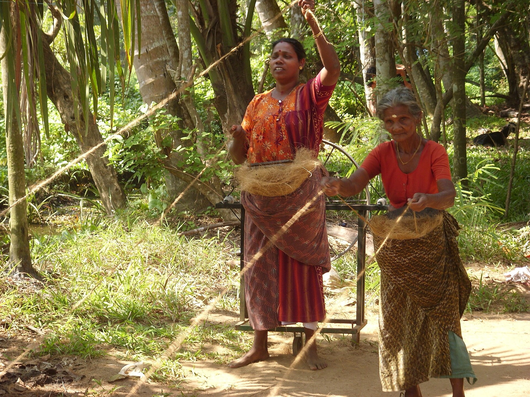
The coir-working settlements of Munroe Island, where coconut husk is retted in the backwater and spun into yarn — a working craft economy on the canal banks rather than a demonstration laid on for visitors.
Roampedia is commission-free — own or know a stay, eatery, guide or shop near Ashtamudi backwater viewpoints? List it and it appears here once verified.
Add a nearby businessEntry: Free. These are open shoreline and roadside outlooks.
If you are travelling by bus or ferry, check the return service with the operator before setting out. Leave time to reach the stop or jetty after your visit.
Ask at the jetty or stand for the time of the last service back, not the next one. If you miss it, an auto or app cab is the fallback — agree the fare before you get in.
If you need step-free access, contact the site before travelling. Ask about a level entrance, steps along the route, the nearest drop-off point, seating and accessible toilets.
Charge cap and free-transaction limits: Reserve Bank of India, in force since 1 May 2025.
These services are listed within about 1.2 km of Ashtamudi backwater viewpoints. Walking distances follow mapped routes; access and opening hours can change. Other services may be closer but are not included here.
Emergency numbers are verified against official government and state tourism sources. 112 works anywhere in India.
The coir-working settlements of Munroe Island, where coconut husk is retted in the backwater and spun into yarn — a working craft economy on the canal banks rather than a demonstration laid on for visitors.
4.7 km · 11 min driveThe narrow inland canal network threading Munroe Island, navigable only by small country canoe — the reason the island is visited at all, and a different waterway entirely from the open Ashtamudi lake.
6.4 km · 13 min driveThe river that rises in the Western Ghats behind Thenmala, is impounded at the Parappar dam, and reaches the sea through Ashtamudi past Munroe Island — the thread that connects the east of this district to the west.
7.0 km · 13 min drive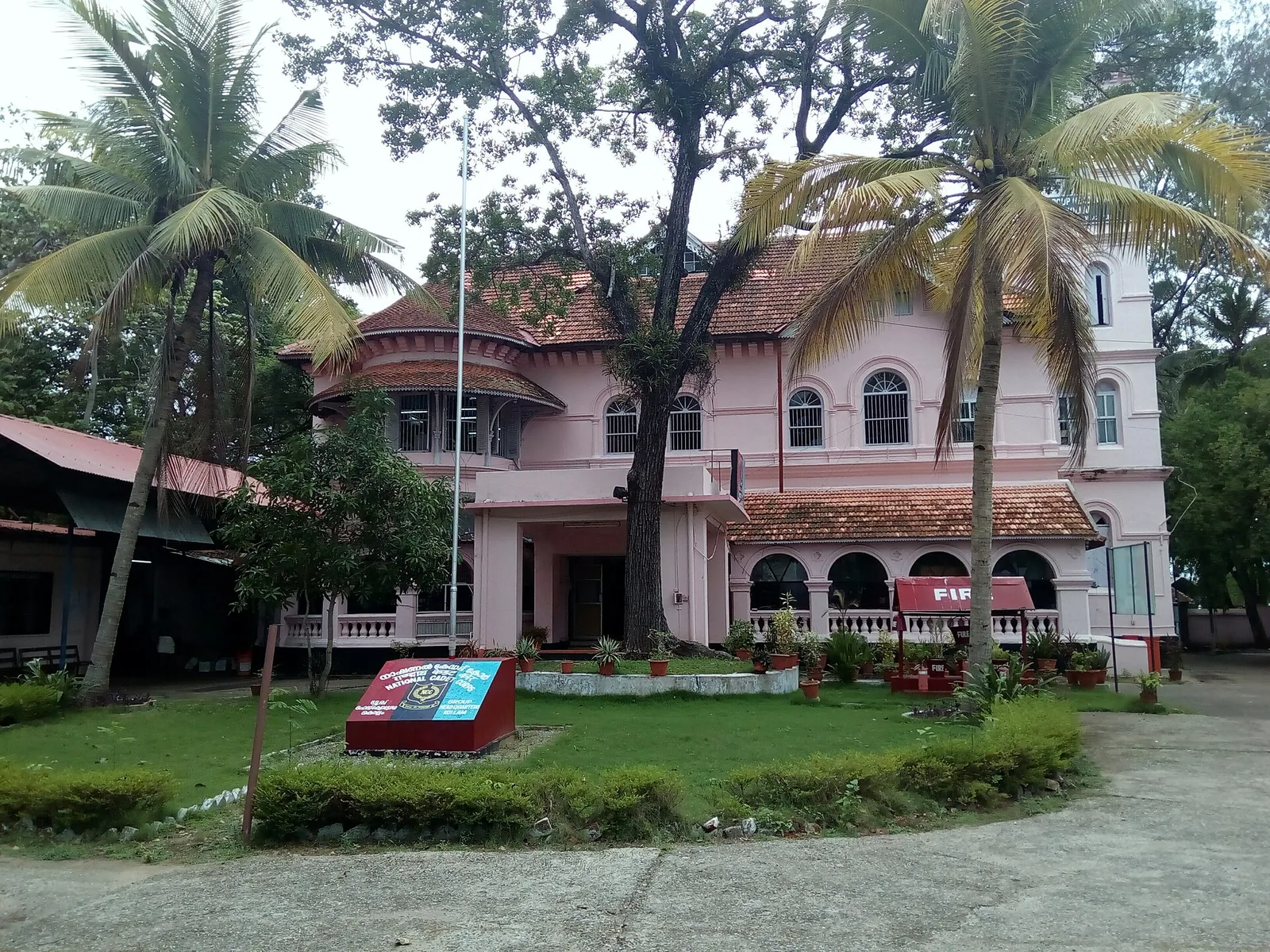
A Travancore royal residence on the Ashtamudi shore in Kollam, built to be arrived at by boat and now a working NCC establishment — viewed from outside or from the water.
7.0 km · ~18 min by auto · straight line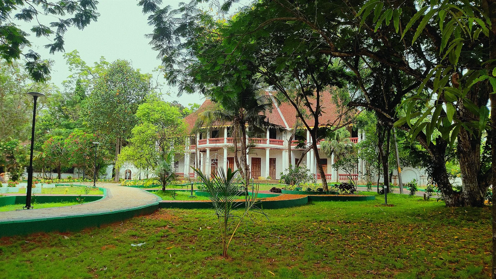
The former British Residency at Asramam survives as a government guest house beside Kollam’s backwater landscape. Its architecture is the attraction, with access governed by its working use.
7.1 km · ~18 min by auto · straight line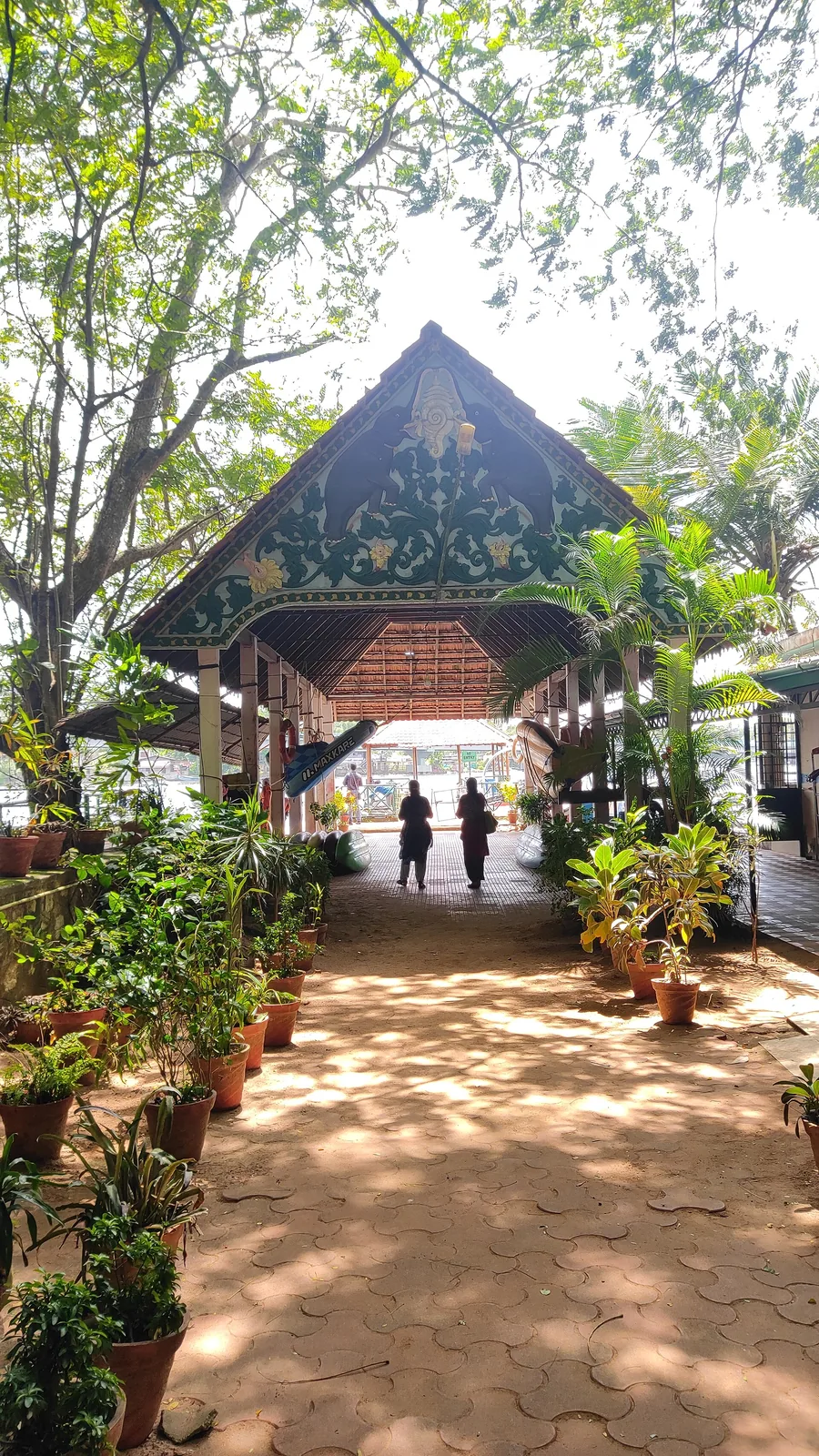
Forty-eight acres of municipal park on the Ashtamudi shore in the middle of Kollam, run by the DTPC — boating and kayaking off a painted jetty, ziplines and rope courses, a heritage walkway of terracotta reliefs, contemporary sculpture left behind by a 2012 festival, and a mangrove wetland with a state biodiversity heritage tag.
7.3 km · ~18 min by auto · straight lineCanal village island known for canoe trips, coir work and slow backwater life.
7.5 km · 14 min drive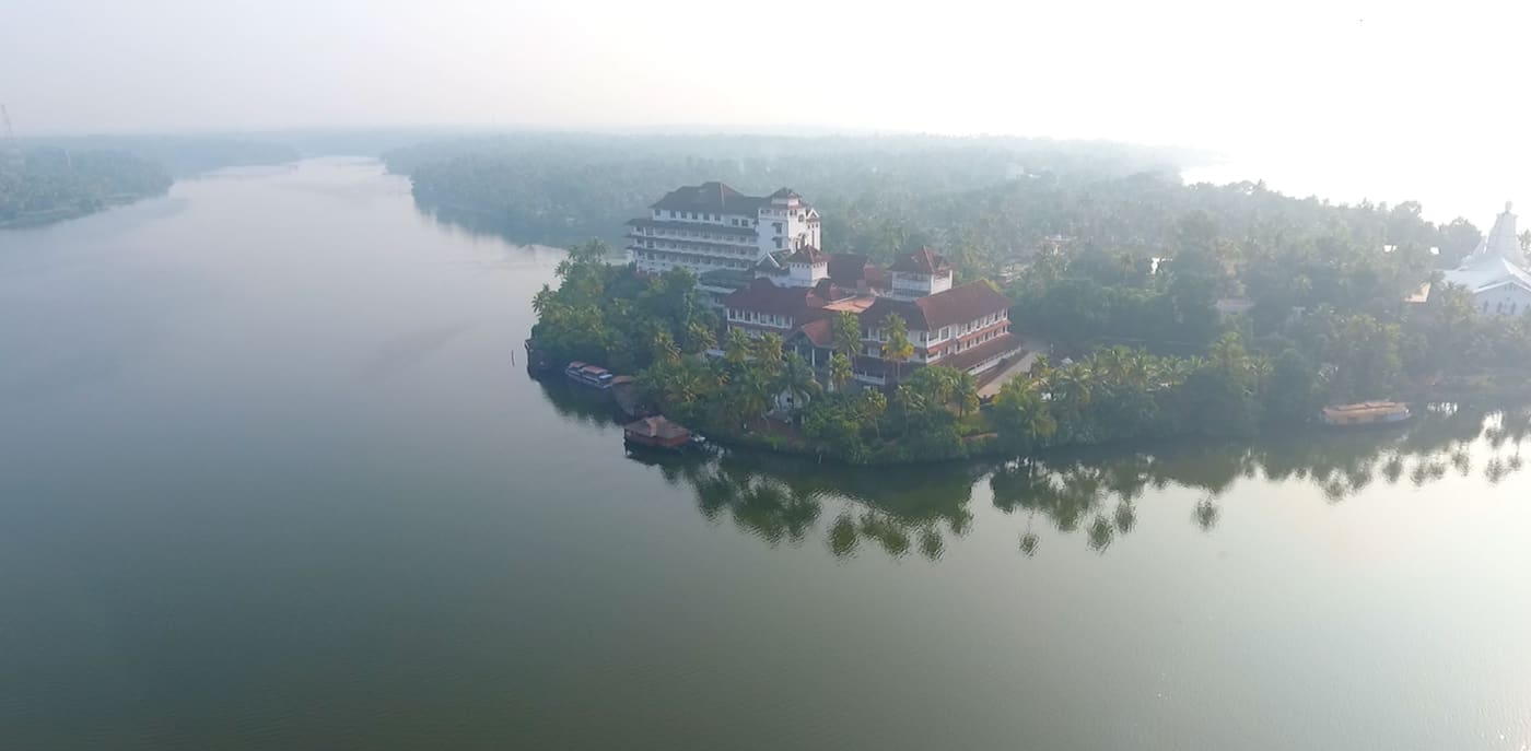
Large palm-fringed backwater system and houseboat base around Kollam.
7.6 km · ~19 min by auto · straight line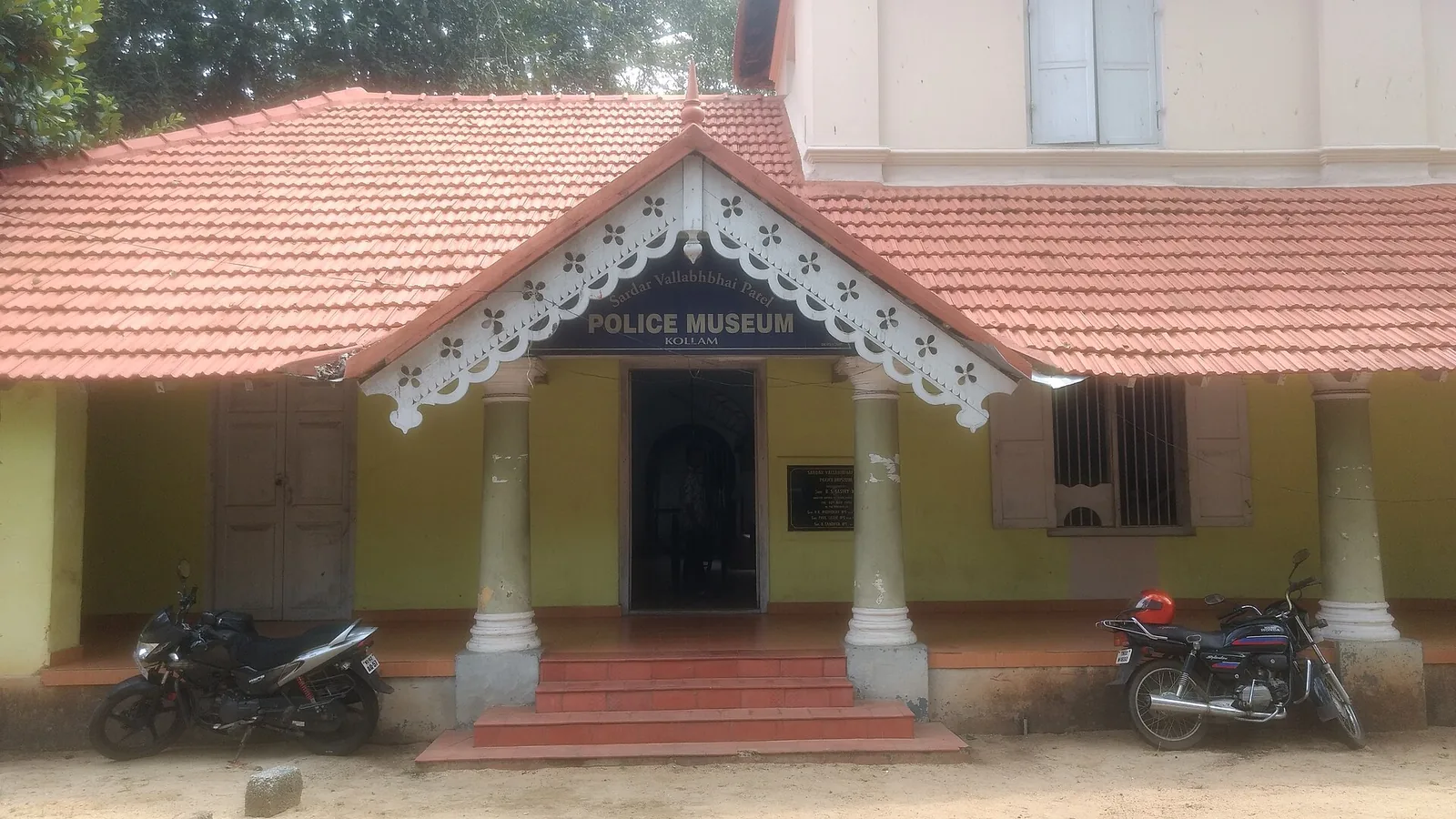
Kollam’s Sardar Vallabhbhai Patel Police Museum introduces the history of policing through arms, equipment and investigation displays. It offers an indoor history stop during a city outing. Check the museum’s session before choosing your day, and leave time to read the displays.
8.2 km · ~14 min by cab · straight line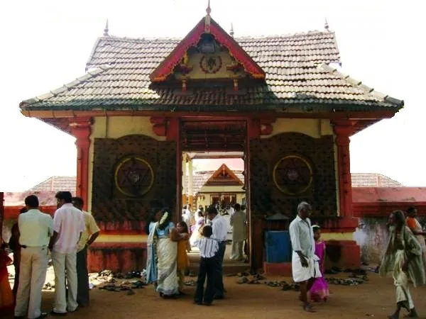
Anandavalleeswaram is an active Shiva temple in Kollam, with an Anandavally shrine and a ten-day annual festival in March or April. Ritual processions and cultural performances bring another dimension to the temple visit. Follow its worship session, admission and photography rules.
8.3 km · ~14 min by cab · straight line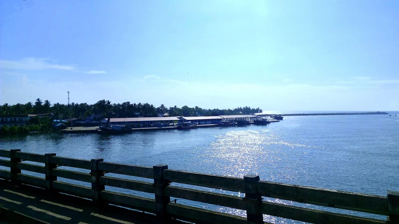
By most accounts Kerala’s largest fishing harbour, at the mouth of Ashtamudi Lake about 9 km from Kollam town, and where Indian fishing was mechanised; two bridges cross the confluence and the early-morning auction is the sight to catch.
8.5 km · ~14 min by cab · straight line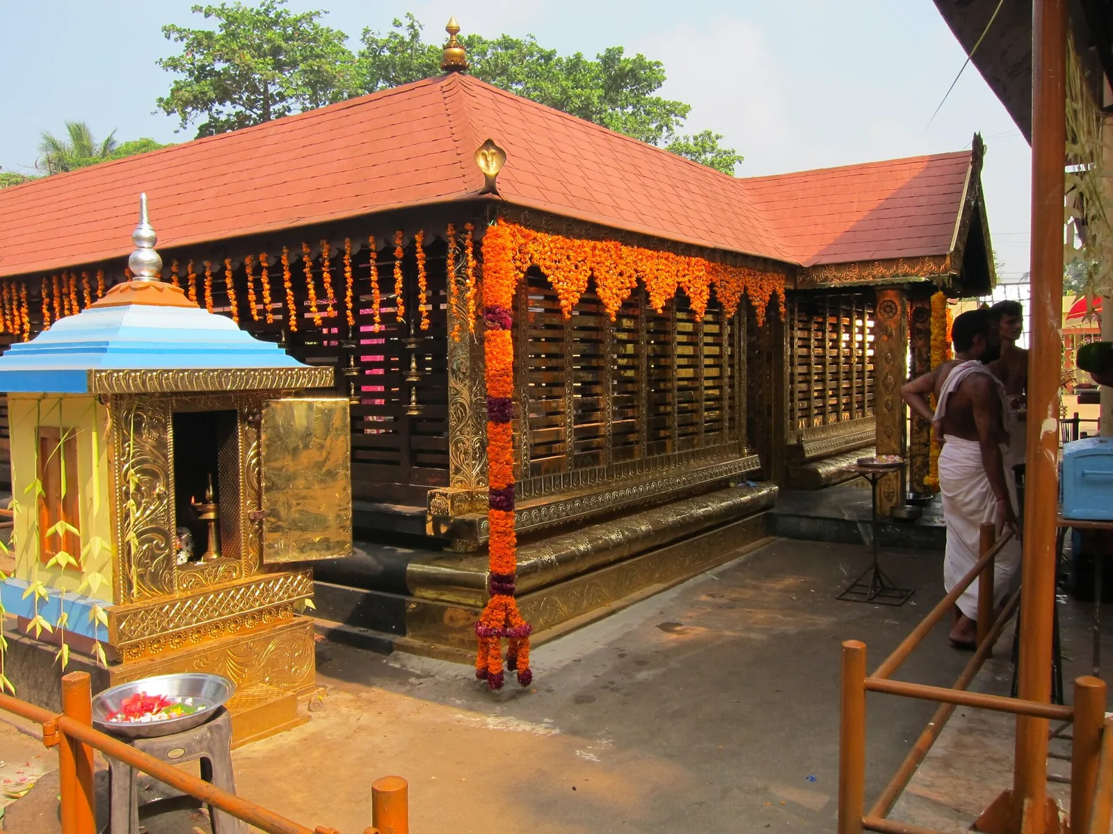
A Devi temple at Chavara north of Kollam, known across Kerala for Chamayavilakku — the two nights in Meenam when men and boys dress in saris and carry lamps in procession to the goddess, re-enacting the cowherd boys of its founding legend.
9.1 km · ~15 min by cab · straight lineWalking and driving times are real routed distances, except the few marked “straight line”, which are direct-line estimates and will read short. Fare figures are estimates from Kerala’s notified auto/taxi tariff and exclude waiting and night charges. Routing: © openrouteservice.org by HeiGIT | Map data © OpenStreetMap contributors
Nearby toilets, pharmacies, ATMs, seating and vets are community-mapped and may be incomplete or out of date. Map data © OpenStreetMap contributors | Walking times © openrouteservice.org by HeiGIT
No, and this is the most common confusion in the district. Ashtamudi is Kerala's second-largest wetland system, in Kollam in the south. Vembanad is the larger system further north behind Alappuzha and Kumarakom, and that is where the classic houseboat scene and the Nehru Trophy race are. They are frequently sold as though they were interchangeable.
Yes. OpenStreetMap records a named, built Presidents Trophy View Point on the Kollam waterfront beside the boat jetty (8.89183, 76.58548) and a named Sunset Point on Munroe Island (8.98116, 76.60784), along with a state adventure park and a DTPC-operated park with lake frontage, a run of public parks on the Ashramam shore, and at least six further mapped viewpoint nodes that no travel site lists. There is also plenty of unbuilt open shoreline, which is what most descriptions cover.
The state's own boat. Kerala's Water Transport Department runs a 'See Ashtamudi' tourist service from Kollam, advertised at 11.30 daily, about five hours, ₹400 lower deck and ₹500 upper, with food from a Kudumbashree unit on board. Its circuit takes in Sambranikkodi, Koyivila, Munroe Thuruthu, the Kannankaatt Kadav bridge, Peringalam, the Peruman bridge and Kakkathuruthu, with about an hour ashore on Sambranikkodi island. That one ticket visits more of this lake's named outlooks than any road itinerary can. Enquiries and booking on 9400050390 — confirm the departure, as the department's page has not been reworded since 2023.
Because the canal trips are enclosed by design — narrow channels with banks a couple of metres apart. That is what makes them special, but it means you never see the lake's scale. The two experiences are complementary rather than alternatives.
Sunset, without much argument. The lake faces west towards the sea at Neendakara and the light comes back off a very large area of still water. November to March is the most comfortable season.
The name is ashta, eight, plus mudi — and mudi is where it gets interesting, because it is published as peaks, cones, braids and branches by different authorities, including two different articles on the same encyclopedia. Peaks and cones rise; braids and branches spread. As for which eight: no source we could reach enumerates them consistently. Two lists circulate that differ in three entries, one of them includes Ashtamudi Kayal as an arm of Ashtamudi Kayal, and English Wikipedia's own article names only seven top-level arms with the eighth nested under another. Treat eight as a name rather than a count.
Not from Perumon, despite the impression most descriptions give. From Perumon the sun sets over land and water towards Chavara, not over the sea. For a genuinely west-facing open-water sunset, go to Munroe Island's mapped Sunset Point, or to the Chavara and Thekkumbhagom side, or the Dalavapuram shore, looking back east across the water.
Yes — Ashtamudi is a Ramsar-listed Wetland of International Importance, and the shallows and margins hold waterfowl and waders, with more in the cooler months. It is open-water watching, so bring binoculars if you have them.
Do the canoe at first light and the open water at sunset, with the middle of the day spent elsewhere on the island or in Kollam. The two bracket the day neatly and show you the same water system at its two extremes — enclosed and expansive.
Only in season, and our previous answer would have stranded you — we presented it as a standing service. It is a seasonal, alternate-day tourist boat running roughly December to March; it was suspended when the canal was blocked in 2023 and resumed on 5 December 2025. It is about eight hours over some 55 km, ₹600 Alappuzha to Kollam, cash only. Most tellingly, it appears on the Water Transport Department's Alappuzha timetable and not on its Kollam one — the word Alappuzha does not appear on the Kollam page at all. Ask at the jetty or ring 9400050390 before building a day around it. The reliable year-round option from Kollam is the ₹400 'See Ashtamudi' service.
Yes, and they are the cheapest way onto this water — around eighty-five sailings a day across three rosters, first boat about 05.00 and last about 21.30, at commuter fares paid on board. One roster serves the Munroe Island waters: it reaches Pezhamthuruth from Kollam at about 12.30 and returns to Kollam about 09.00 the next morning, with legs to Koivila and the Ashtamudi Temple across the golden hour. These are working transport, not tours, and none of it appears in a guidebook.
For the easiest outlook, the Kollam town waterfront: Presidents Trophy View Point (8.89183, 76.58548) beside the boat jetty, with the Ashramam parks behind it, about two kilometres from Chinnakada. For the longest view down the lake, the Perumon bridge approach. For sunset over open water, Munroe Island's mapped Sunset Point (8.98116, 76.60784). Beyond those, the shore is organised by kadavus — landings — and about twenty of them are named on the map; several are scheduled ferry stops. There is no ticket and no railing at any of them.
Clear post-monsoon and winter days are best; mist can block views in hill areas.
Entry: Free. These are open shoreline and roadside outlooks.
Base yourself in Munroe Island or a nearby town in Kollam, then confirm the last-mile route locally before leaving. Go early for clearer light and easier parking; sunset viewpoints can crowd quickly. If the visit depends on forest, temple, boat, ferry, weather or seasonal access, check the official/local rule on the day before travel.
45 minutes to 2 hours.
Nearby you can pair Coir villages (4.7 km), Munroe canals (6.4 km), Kallada river (7.0 km), Thevally Palace (7.0 km).
Stay behind barriers and away from cliff edges. Avoid viewpoints during lightning or heavy rain.
Written about Ashtamudi backwater viewpoints itself — its history, its legends and the arguments about them.
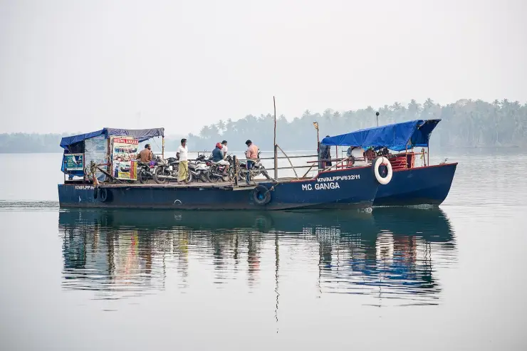
These guides explore Munroe Island and the surrounding area. Choose a visit that fits your interests, allowing separately for travel between stops.
Route-level itineraries and practical guides for the rest of Kerala.
Photographs: Arunvrparavur (CC BY-SA 3.0), Timothy A. Gonsalves (CC BY-SA 4.0), Fotokannan (CC BY-SA 4.0). Wikimedia Commons.