Bharathapuzha estuary

Two rivers leave Kerala through this one gap. The Bharathapuzha — the Nila, 209 kilometres from the Anamalai hills and the second-longest river in the state — is joined by the Tirur Puzha in the last few hundred metres of its life, and the two go out together between Ponnani on the south bank and the Padinjarekkara sandspit on the north. The gap they go out through is 336 metres wide, and it is that width because two rock breakwaters hold it there.

Bharathapuzha estuary, Ponnani
Practical guide

Plan Bharathapuzha estuary

Who's going?Tailor Bharathapuzha estuary to your trip
Typebackwater
AreaPonnani
DistrictMalappuram
Best timeLate February to May, which is not when…
Time neededTwo to three hours for one bank
EntryNothing at the water is ticketed
Places to visit3Listed businesses6

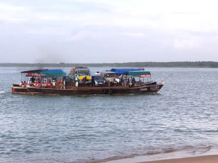
What makes the place worth the detour is not scenery so much as arithmetic. The two banks are a few hundred metres apart and 25 kilometres apart by road, so a ferry does in four minutes what a car does in half an hour. Ponnani’s trawler fleet moors less than a kilometre inside the mouth and has to cross the bar to reach the sea. And the birds that gather on the sand are here in the wrong season — the months when most of Kerala’s migrants have already gone.

The story

The Nila is the river Malayalam writes about, and this is where it stops. Two hundred and nine kilometres from the Anamalai hills, past Kalamandalam and the Mamankam ground at Thirunavaya, the Bharathapuzha arrives at Ponnani with the Tirur Puzha alongside it and goes out through a gap in the sand — and for most of the year it arrives with startlingly little. Six dams stand on the system, the bed has been dug for sand for decades, and in the dry months long reaches of Kerala’s second-longest river carry no water at all. What is left at the mouth is an estuary that the sea keeps filled rather than the river: brackish, shallow, banked with sand, and — for reasons nobody has fully explained — one of the best places on this coast to stand and watch gulls.

The story of Bharathapuzha estuary

Begin with what actually comes down. The Bharathapuzha drains 6,186 square kilometres, roughly 4,400 of them in Kerala and 1,786 across the watershed in Tamil Nadu, and its long-run discharge at Ponnani is put at about 161 cubic metres a second. That average conceals the whole story. The flow is monsoon flow; six dams — Malampuzha the largest, with Walayar, Mangalam, Pothundi, Meenkara and Chulliar behind it — hold back what they can for 773 square kilometres of irrigation, and by March the river in its middle reaches is a bed of sand with pools in it. The estuary is therefore not the end of a flowing river in any month you are likely to visit — it is a tidal inlet with a trickle attached.

The second thing that shaped it is the sand itself, taken out rather than brought down. Sand mining, legal and illegal, is named alongside deforestation and pollution as one of the three standing threats to this river basin, and it works on an estuary in two directions at once: it lowers the bed upstream so that salt water pushes further inland, and it removes the sediment the mouth needs to keep rebuilding its own banks. Salinity and conductivity have both been recorded rising through the coastal stretch — Purathur, Padinjarekkara and Ponnani, the three localities that share this water.

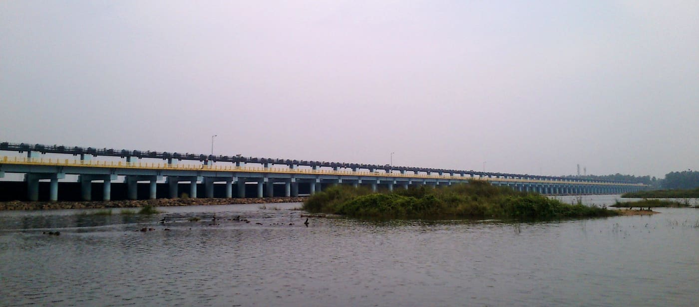
That rising salt is what the biggest thing ever built here was meant to stop. Eight and a half kilometres upstream by road, at Chamravattom, a regulator-cum-bridge crosses the river on 70 shutters: 978 metres long, ten and a half wide, ₹130 crore, opened in 2012. It was supposed to hold a freshwater pond behind it through the dry months, keep the sea out of the wells, and carry a road over the top as well. It carries the road. A technical investigation for the state government by the Indian Institute of Technology Delhi found the design at fault, and the structure now functions as a bridge rather than as a regulator. A barrage that does not hold water still changes an estuary — it interrupts the natural flushing — so the estuary got the interference without the benefit.

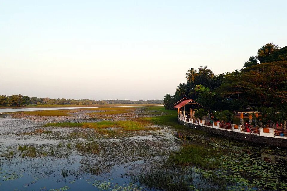
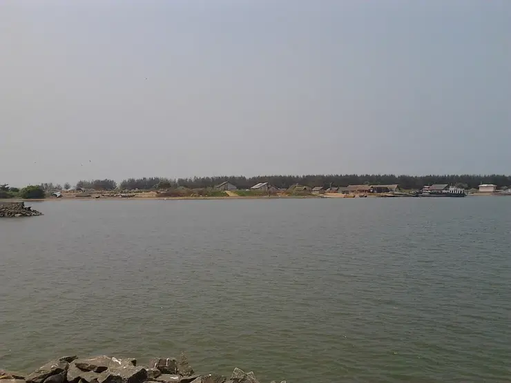
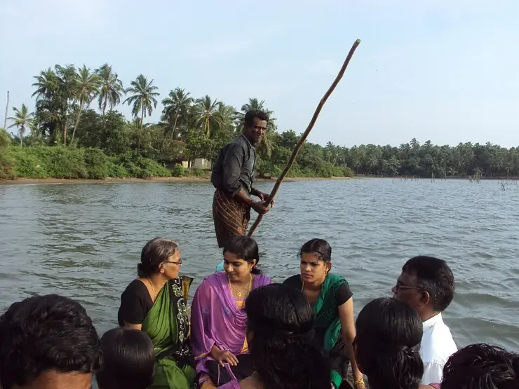
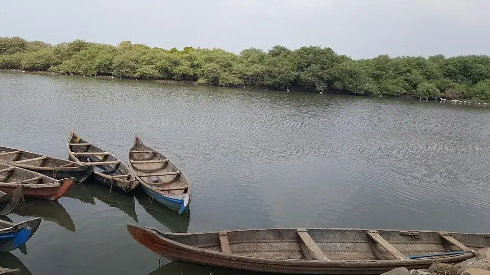
None of this is what a visitor sees. What a visitor sees is a wide, quiet sheet of brown-green water with a low spit of sand across it, dugout canoes drawn up against a fringe of mangrove on the inner shore, and a line of steel trawlers moored less than a kilometre inside the gap. The mangrove is a thin band rather than a forest, along the Purathur shore and in the corners the current does not scour, and it is doing the work mangrove does everywhere — holding the bank and keeping the brackish water off the fresh.

The bar is the feature that decides everything else. Sand accumulates across the mouth of a river that no longer flushes it, and a shallow bar in a surf zone is a hard thing to keep open: this one is held by two rock breakwaters, built so the fishing fleet can get in and out. That is why Ponnani’s harbour is inside the estuary rather than on the open coast, and why every boat that lands a catch here crosses the bar twice a day. In the monsoon the surf stands up over it, and the crossing is the part of the working day that is not routine.

The water itself has been counted, and it is richer than it looks. A survey of the Ponnani estuary recorded 112 species of fish in 14 orders, 53 families and 80 genera — 53 of them marine species that come in through the gap, and 41 that live in both the sea and the brackish water. Alongside them came nine kinds of prawn, ten kinds of crab and three molluscs, and on the bed 23 genera of burrowing invertebrates across six groups: polychaete worms, bivalves, gastropods, amphipods, isopods and tanaids. That last list is not decoration — burrowing invertebrates are what the waders on the sand are eating, and a bed with 23 genera in it is a canteen.

Two of the crabs are a livelihood rather than a statistic. The mud crab and the swimming crabs support an established fishery here, which is worth knowing when you see the dugouts pulled up against the mangrove: some of those are not working the channel at all but the shallow edges where the crabs are, and the mangrove roots are the reason there is anything to work.

Then there are the birds, and they are the reason to make the trip. A survey of the whole Bharathapuzha basin, run across 70 one-kilometre grids between October 2017 and July 2019, recorded 262 species. Diversity was highest in the upper reaches; abundance was highest down here — and one grid at Ponnani held 2,200 individual birds. Black-headed Gull and Pallas’s Gull are the two that mass, in flocks that have been put above five thousand, with terns, plovers and sandpipers working the same sand. Seventeen Western Ghats endemics were recorded in the basin, and one of the birds of this river system, the Black-bellied Tern, is Endangered.

The timing is the strange part. Most of Kerala watches migrants between roughly November and March and then puts the binoculars away. This mouth does its best work as that window closes: the record for Purathur puts the birds here in their thousands from February to April, and the Malayalam account of the azhimukham puts the main arrival between March and May. The two windows do not coincide, and both of them are late. A tern photographed on this coast on 10 April is not an outlier here.

There is one made way along this water and it is worth knowing about, because on foot the south bank is otherwise a matter of finding gaps between boatyards. The Nilayora Patha, which everybody calls the Karma Road, runs 5.8 kilometres inside the Ponnani municipal limit, from the Chamravattom pier down to the harbour area and the Nila Tourism Bridge — a footbridge put across to link the harbour to the coastal road. A tourist boat service centre stands along it. Nothing about that centre’s hours, boats or prices is published anywhere, so treat it as something to ask about on the day rather than something to plan around.

The one authority that has put anything at all on the ground here is the Social Forestry Division of the Kerala Forest and Wildlife Department, and what it has put up is two boards. The first stands beside the mangrove. It calls the stand a breeding ground for crab, prawn, karimeen and pallathi, a biological defence against tsunami and sea surge, a refuge for migratory birds and a carbon sink, and it names the kinds of mangrove growing at this spot: uppatti, kannampotti, nakshatra kandal, swarna kandal and pranthan kandal, the star mangrove and the golden mangrove among them. Five named species on a strip of shore that no map treats as a habitat.

The second board is on the sand, and it is about turtles. Five of the world’s seven sea turtle species reach Indian shores, and the one that comes to Kerala is the Olive Ridley. The department lists what is against it — fishing nets, groynes, sea walls, climate change — and then, in a boxed warning beside a pair of handcuffs, states the law: collecting, keeping or destroying sea turtle eggs is an offence under the Wildlife Protection Act of 1972, carrying imprisonment of up to seven years. Both boards close by quoting Article 51A(g) of the Constitution, the citizen’s duty to protect the natural environment.

It is worth sitting with what the second board says, because the department is describing this place to itself. Groynes and sea walls are named as a threat to nesting turtles in a place whose defining structures are two rock breakwaters, built so the fishing fleet can cross the bar. Nobody is being dishonest; the harbour and the turtles are simply two true things that do not fit together, and the only sign at this estuary that acknowledges the conflict is the one warning you about the eggs.

For all of that, the estuary has almost no legal standing. It is on the state’s books: the State Wetland Authority of Kerala carries Ponnani among the wetlands it has identified, with its own brief document prepared for it, which is the first step under the national wetland rules of 2017. Identification is not notification, and nothing further has followed. On the wildlife side there is nothing at all — a bird sanctuary at Purathur was proposed in 2010 and never notified, and Malappuram’s one protected area is Karimpuzha Wildlife Sanctuary, far inland in the ghats. The nearest estuary on this coast with real legal standing is the Kadalundi–Vallikkunnu Community Reserve, declared in 2007, and that is 39 kilometres north.

On the ground it shows. There is no warden, no hide, no boardwalk and no viewing platform anywhere on this water, and a place holding gull flocks in the thousands has nothing built for looking at them.

Legend & myth

The river has more names than the town does, and each one belongs to a different way of thinking about it. Nila is the literary name, the one Malayalam poetry uses; Bharathappuzha is the formal one; Peraar, the great river, is the old Dravidian name, with Korayar, Varattar and Valayar attaching to particular stretches; and Sanskrit gives it Gayatri and Mangala Nadi. Vallathol’s salute to it — obeisance for ever to Nila, the goddess-river famed in the three worlds — is the line most often quoted, and it is quoted because the river had already become a shorthand for Kerala itself.

That standing is not decoration; it is why the river’s condition is argued about the way it is. Malayalam writing about the Bharathapuzha treats it as one of the cultural emblems of the state rather than as a watercourse, which means that a dry bed at Pattambi is read as a moral fact and not only a hydrological one. Anyone who comes to the mouth expecting the river of the poems should know that they are looking at the end of a river that Kerala argues about, and that the argument is genuinely about this water and not about a metaphor.

It is also a funerary river. Along its length the Bharathapuzha is where ancestral rites are performed — the ghats at Thirunavaya are the best known, and the Karkidaka Vavu new moon brings crowds to the banks — so what reaches this mouth has been, for a very long time, water that people have stood in for the sake of the dead. The estuary itself has no rite of its own. It is simply the end of the line, which is a plain enough thing to say and is not a legend at all.

Read the full history of Bharathapuzha estuary 491 more words

History

The gap at Ponnani has never been deep. Sand across the mouth is the recurring fact of the place, and the one serious attempt to fix it is dated: on 1 April 1969 a dredger arrived to deepen the channel, and by the port’s own account two dredgers, the Neendakara and the Beypore, worked here for about a year. The depth did not improve, the work stopped part-way and was never finished, and the shallowing carried on being noted in annual reports without anything further being done about it.

The engineering that did get built came later and went to the fleet rather than the trade. Two rock breakwaters were thrown out at the mouth so that fishing vessels could reach the Ponnani fishery harbour inside the estuary, and the harbour was still under construction in 2010. What exists now is a river mouth trained for boats that draw very little and can time the bar.

Upstream, the Chamravattom regulator-cum-bridge has its own dates. It was conceived in the late 1970s or mid-1980s depending on which account is followed, its foundation stone was laid on 13 September 2009 and it was inaugurated on 17 May 2012. Besides the water it was meant to hold, it shortened the road between Kozhikode and Kochi by 38 kilometres and put a direct link between Ponnani and Tirur where the ferry had been the only crossing.

The banks themselves have been separately governed throughout. The south side is Ponnani; the north side, including the Padinjarekkara spit, is Purathur grama panchayat in Tirur taluk — 19.15 square kilometres and 31,915 people at the 2011 census — and the boundary between the two runs down the water. Nothing about the estuary has ever been administered as one thing.

Why visit

To stand at the end of the Nila, the river Malayalam literature has treated as a stand-in for Kerala for a century.

For a confluence you can see in one glance: the Tirur Puzha joining the Bharathapuzha within sight of the surf, and both going out through one 336-metre gap.

For the gulls — Black-headed and Pallas’s in flocks counted in the thousands, in a basin where 262 bird species have been recorded.

Because the birding season here runs late, from about February into May, when most of Kerala’s migratory watching is already over.

For the ferry, which crosses in a few minutes what costs 25.6 kilometres by road.

For a working estuary rather than a scenic one: a trawler fleet moored inside the mouth, dugouts against the mangrove, and a bar that decides when anybody moves.

For two Forest Department boards that are the only interpretation anywhere here, and that between them name five mangrove species growing here and the sea turtle that nests on this coast.

For the plainest statement of the trade-off on this coast: the same department that built the breakwaters names groynes and sea walls as a threat to the turtles nesting beside them.

What to expect

Highlights

  • The bar itself: a moving bank of sand across the mouth, held open by two breakwaters whose heads stand 336 metres apart.
  • The confluence, where the Tirur Puzha comes in from the north and joins the Bharathapuzha within sight of the sea.
  • The ferry — a 1.2-kilometre crossing that replaces a 25.6-kilometre drive.
  • Gulls and terns massing on the sand and the shallows, in flocks that have been counted in the thousands.
  • The mangrove fringe on the estuary’s inner shore, with dugout canoes moored against it.
  • The trawler fleet lying inside the mouth, in an estuary that is the harbour.
Getting there

How to visit

  • Decide which bank first. Ponnani, on the south, is the town, the harbour and the food. Padinjarekkara, on the north, is the spit, the sand and the open view back across the mouth.
  • From Ponnani the ferry is the short way over and the road is the long way round, through the Chamravattom bridge.
  • Come in the late afternoon for the light, and early in the morning for the birds and the landing.
  • Bring binoculars if the birds are the reason. There is no hide, no boardwalk and no warden.

Distance by road

  • Kozhikode49 km
  • Coimbatore133 km
  • Kochi168 km
  • Mysuru192 km
  • Mangaluru277 km

Road km to Malappuram; ghat roads and traffic vary — allow extra.

Timing

Best time

Late February to May, which is not when the rest of Kerala watches birds. The state’s general migratory window closes around March, and this mouth is at its fullest just as that happens: the Purathur record puts the flocks in their thousands from February to April, and the Malayalam account of the azhimukham puts the main arrival between March and May. Those are two different windows, and the overlap between them is the safe answer. For weather rather than birds, November to February is the comfortable half of the year, and the June-to-September monsoon makes the bar rough.

Weather in Bharathapuzha estuarySeasonal guide

Live forecast loads in your browser.

Today at Bharathapuzha estuary
Sunrise6:16 am
Sunset6:25 pm
Golden hour best light5:25 pm–6:25 pm
Blue hour after sunset6:25 pm–6:50 pm
Sun sets toward compass bearingW · 272°
Moon tonight🌓 First quarter · 56%
South-west monsoon. June to September is monsoon season: the sea gets rough, swimming is often unsafe and boat services can be suspended. Follow lifeguard and local warnings, and expect changeable conditions.

Check the official alert before you travel. Kerala’s beaches, waterfalls and trekking routes close at short notice during heavy rain, and district alert levels change day to day. We do not publish an alert level of our own — read it from the state authority: Kerala State Disaster Management Authority, or the district control room on 1077.

Sun and moon are calculated for this location and shown in IST. Photography windows are the hour around sunrise and sunset; the sunset bearing is degrees clockwise from true north. Moon phase is accurate to about half a day.

Visitor notes

  • The two banks are in different taluks. Ponnani is in Ponnani taluk; Padinjarekkara is in Purathur grama panchayat in Tirur taluk, which is why an address here can say Tirur and still mean the mouth.
  • Kerala Tourism’s own destination page files Padinjarekkara under Ponnani while describing it as lying opposite Ponnani port. Both halves are true and they are on opposite banks.
  • The estuary is identified but not notified: the State Wetland Authority of Kerala lists Ponnani among its wetlands, and nothing has followed. It carries no wildlife protection at all — a bird sanctuary at Purathur was proposed in 2010 and never notified, and the nearest protected estuary on this coast is the Kadalundi–Vallikkunnu Community Reserve, 39 kilometres north.
  • There is no ticket, no gate and no closing time at the water itself.
Safety

Good to know

  • A river mouth is not a beach. The current through a 336-metre gap that is draining two rivers is strong, it reverses with the tide, and the sandbanks that look walkable at low water are cut off at high.
  • The fleet uses this channel. Keep off the breakwaters when boats are moving, and out of the way of a landing.
  • The bar is shallow and the surf over it stands up quickly in the monsoon.
Stay · eat · do · rent · see · shop

Stays, food & things to do near Bharathapuzha estuary

Verified hotels, homestays, restaurants, experiences, sights, shops and rentals around Bharathapuzha estuary — commission-free, with direct contact. Filter by what you need.

Hangout Cafe Ponnani — Cafe and casual food in Ponnani
Top pick Verified
Cafe and casual food · Ponnani
Hangout Cafe Ponnani

Cafe and casual food in Ponnani. Classic Complex, Vijayamatha Convent, Ponnani, Malappuram district, Kerala · eat, Cafe and casual food, Hangout Cafe Ponnani.

Directions Commission-freeView details
Rouba Residency Ponnani — Direct hotel and restaurant stay in Ponnani
Top pick Verified
Direct hotel and restaurant stay · Ponnani
Rouba Residency Ponnani

Direct Ponnani hotel source for rooms, restaurant support and town-base stays near NH 66. Stay, Direct hotel and restaurant stay, Rouba Residency Ponnani.

Directions Commission-freeView details
Ponnani Responsible Tourism Kerala Tourism — Responsible tourism in Ponnani
Verified
Responsible tourism · Ponnani
Ponnani Responsible Tourism Kerala Tourism

Kerala Tourism Responsible Tourism source for Ponnani village, heritage and coast experiences. Ponnani, Responsible Tourism, Malabar cuisine.

Directions Commission-freeView details
R
Rouba Residency
Place to stay
Top pick
Hotel · Ponnani
Rouba Residency
9.4 km · 25 min drive ~₹140–170 by auto

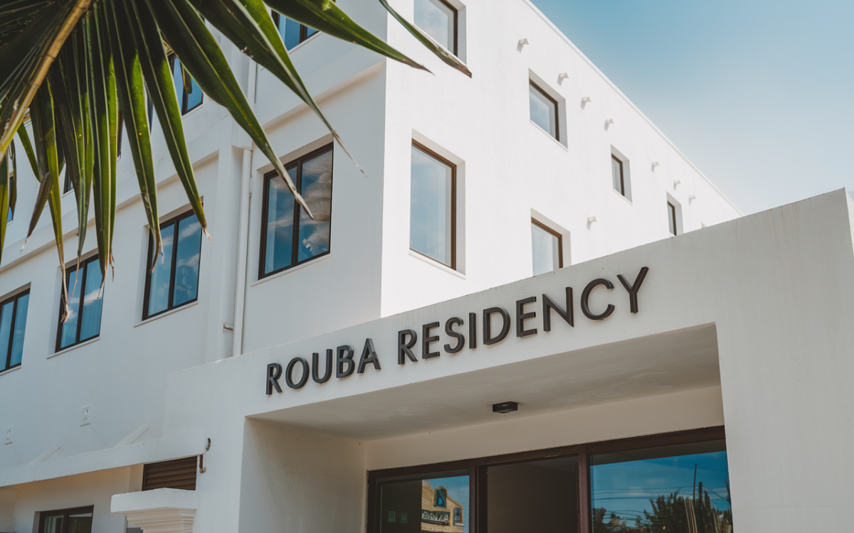
Three-star hotel with the in-house Palmstrip restaurant at C.V. Junction on NH-66. It sits in central Ponnani, a short drive from Padinjarekkara beach and the fishing port.

Directions Commission-freeView details
H
Harbour Heritage Hotel Ponnani
Where to eat
Top pick Verified
Restaurant · Ponnani
Harbour Heritage Hotel Ponnani

Harbour Heritage Hotel Ponnani is a named restaurant listing for Ponnani food planning. It replaces a generic cafe shortlist entry while keeping the town above the minimum coverage floor. Eat, Restaurant, Harbour Heritage Hotel Ponnani.

Directions Commission-freeView details
P
Ponnani Malabar Kerala Tourism
Things to do
Top pick Verified
Coastal heritage · Ponnani
Ponnani Malabar Kerala Tourism

Kerala Tourism Malabar source for Ponnani estuary, coast, fishing and heritage context. Public destination information · Ponnani, Bharathapuzha, Malabar coast.

Directions Commission-freeView details

Book with the place itself. India’s cyber-crime coordination centre warned in April 2025 that convincing copies of hotel and pilgrimage booking sites are being pushed through sponsored search and social ads, taking payment for rooms the property never hears about. Every listing here links to the business’s own contact details and its own Google or Bing profile — we take no commission and sit in nobody’s payment path. If a booking page reached you through an ad, check the address bar against the property’s own site before you pay. Fraud can be reported on cybercrime.gov.in or on 1930.

Ranked

More ways to explore Ponnani

Find food, accommodation and activities across Ponnani. Browse the guides for places to eat, stay and explore along your route.

Across the whole of Ponnani

Ranked guides

Top experiences around Ponnani

4 more places around Ponnani. Open a guide to plan the visit and onward journey.

heritagePonnani

1.2 km · 14 min walk

Historic coastal town known for mosque traditions and Bharathapuzha estuary.

mosquePonnani Juma Masjid

3.1 km · 18 min drive

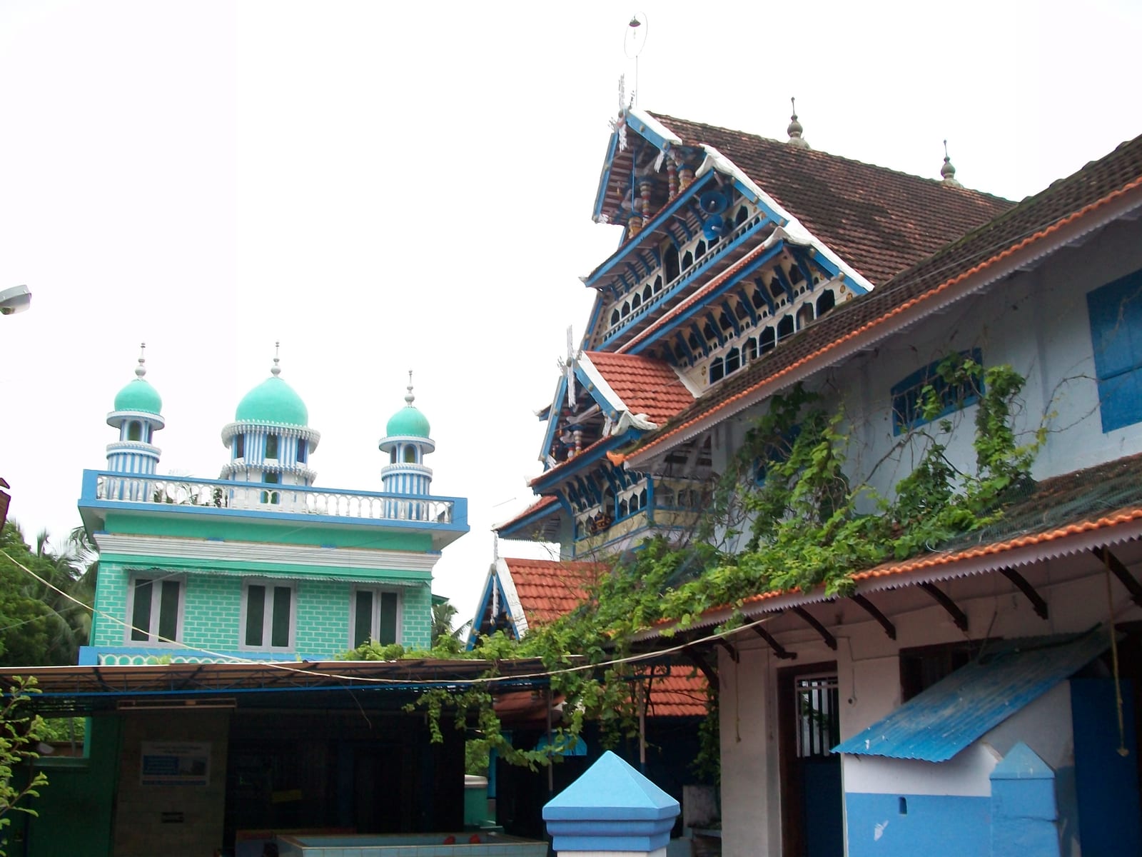
The great Juma Masjid of Ponnani, a centuries-old centre of Islamic learning on the Malabar coast, long called the “Mecca of Malabar”.

backwaterBiyyam Kayal

6.1 km · ~15 min by auto

A calm coconut-fringed backwater and park near Ponnani, with boating and kayaking — a quieter, lesser-known alternative to the Alappuzha backwaters.

beachPadinjarekara Beach

440 m · 5 min walk

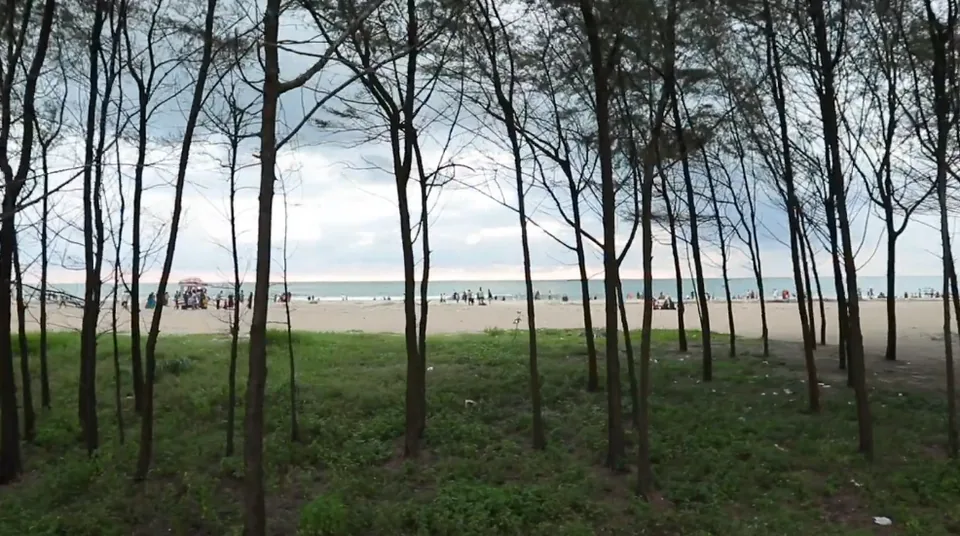
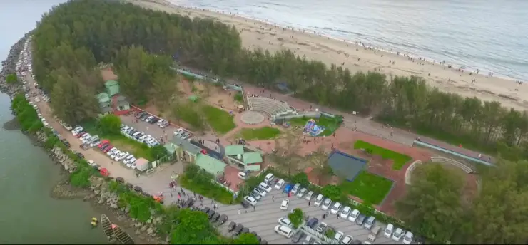
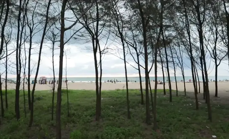
The sea-facing beach on the Padinjarekkara sandspit, with a casuarina belt behind the sand and a government park at the end of Tipu Sultan Road.

Roampedia is commission-free — own or know a stay, eatery, guide or shop near Bharathapuzha estuary? List it and it appears here once verified.

Add a nearby business
Before you go

Bharathapuzha estuary — at a glance

TimingsThe estuary itself has no opening or closing time. No current official timetable or operating-status notice for the passenger ferry was found in the source review on 4 September 2026, so do not build a crossing into the day without confirming at the jetty. The fish landing at the harbour is an early-morning business.

Entry: Nothing at the water is ticketed. The banks, sand and jetties are public ground with no gate. A passenger ferry has charged a fare when operating, but no current official fare or operating-status notice was found in the 4 September 2026 review; confirm locally rather than assuming a crossing is available.

Wildlife: Three different things use this water and they are counted separately. The estuary itself holds 112 species of fish in 53 families, nine prawns, ten crabs and 23 genera of burrowing invertebrates on the bed; mud crab and swimming crabs are fished commercially. The wider river basin has produced 262 bird species, and the abundance is down here at the mouth — gull and tern flocks in the thousands, and the Endangered Black-bellied Tern among the birds of this river. On the sand, the Olive Ridley is the sea turtle the Forest Department names for this coast; taking its eggs carries up to seven years under the Wildlife Protection Act. The mangrove fringe is the link between all three, and the department's own board here names five kinds growing at this spot.

Getting here

How to reach Bharathapuzha estuary

  • ✈︎ By air Calicut International Airport at Karipur is the nearest, roughly 60 km by road; Kochi is the other option and is further. Taxis run from both.
  • 🚆︎ By train Tirur is the railhead for the north bank — 18.7 km by road to Padinjarekkara, about 22 minutes. Kuttippuram and Tirur both serve Ponnani on the south bank.
  • 🚗︎ By road Ponnani sits on the coastal highway with Edappal and Kuttippuram inland. For the north bank, the Tirur–Koottayi road ends at Padinjarekkara; there is no through road across the mouth.
  • 🚌︎ By bus KSRTC and private buses serve Ponnani town and Purathur. Purathur has its own bus stand on the north side. It is about 1.5 km from the spit in a straight line and 11.8 km by road, about 17 minutes, because the road has to go round the Tirur Puzha.
  • ⛴︎ By boat A passenger ferry has served the crossing between the two sides of the mouth, taking foot passengers and bicycles. It is the short way over; the same journey by road is 25.6 km. No current official timetable, fare or operating-status notice was found in the source review on 4 September 2026, so treat the crossing as conditional and confirm at the jetty before relying on it.
Getting back

If you are travelling by bus or ferry, check the return service with the operator before setting out. Leave time to reach the stop or jetty after your visit.

Ask at the jetty or stand for the time of the last service back, not the next one. If you miss it, an auto or app cab is the fallback — agree the fare before you get in.

Do

Things to do

  • Watch the bar from either breakwater — the sand across the mouth is what the whole place is arranged around.
  • If the passenger ferry is operating that day, cross the mouth to understand why the two banks feel like different places; confirm locally before making it part of the plan.
  • Look for gulls and terns on the sand and the shallows, best from late February into May.
  • Walk the inner shore for the mangrove fringe and the dugout canoes moored against it.
  • Watch the trawler fleet come in to the harbour inside the mouth, early in the morning.
  • Take the light at the end of the afternoon from the Padinjarekkara side, looking back across the water at Ponnani.
Plan

Good to know

  • Binoculars matter more than a camera here; the birds are on open sand and water at a distance, and there is nothing built to bring you closer.
  • Carry cash. There is nothing to buy at the water and the ferry is not a card transaction.
  • The two banks are in different taluks, so a Tirur address can still mean this river mouth.
  • Pair it with the town on the south bank or the spit on the north, rather than travelling for the mouth alone.
Facilities

On site

  • Nothing at the water itself. There is no visitor centre, no hide, no boardwalk, no warden and no interpretation beyond two Forest Department boards.
  • The Padinjarekkara side has a government park behind the spit with a car park, an amphitheatre and an amenity block.
  • Food, fuel, cash and stays are in Ponnani town on the south bank; Purathur has a bus stand on the north.
Getting around Bharathapuzha estuaryPartly wheelchair accessible
Terrain
Mostly flat
From the entrance
There is no single arrival point, because the estuary has two banks in two taluks. On the Ponnani side the water is reached from the town and the harbour on level ground. On the Padinjarekkara side there is a government park with a car park directly behind the spit, and the walk from it to the water is short and flat. Beyond any of those, the ground is loose dry sand.
Step-free access
The paved and level parts — the road ends, the park behind the Padinjarekkara spit and the harbour road on the Ponnani side — are reachable on wheels, and the water is visible from them. The sand is not: it is soft, unsurfaced and unedged, and there is no boardwalk, ramp or matting anywhere at this mouth. The breakwaters are rock and are not accessible. We could find no record of an accessible toilet on either bank and are not going to assume one.
Prams
A pram is fine on the paved approaches and in the park behind the spit; it will not go on the sand. A carrier is the better choice if the sand is the point of the trip.
  • This is a river mouth, not a bathing beach. The channel drains two rivers through a gap about 336 metres wide, the flow reverses with the tide, and sandbanks that look walkable at low water are cut off as it rises.
  • The breakwaters are working structures made of loose rock, wet at the seaward end, with no handrail. The fishing fleet uses the channel between them.
  • There is no lifeguard, no warden and no first aid at the water on either bank.
  • In the monsoon, roughly June to September, the surf stands up over the bar and the whole mouth is rough.

Checked 31 August 2026 against source 1source 2. Conditions change and surfaces vary with weather — if step-free access is essential, confirm with the site before you travel.

If you need help at Bharathapuzha estuary
112All emergencies (police · fire · medical)The single number to call in any emergency (ERSS).

Emergency numbers are verified against official government and state tourism sources. 112 works anywhere in India.

Nearby

What’s near Bharathapuzha estuary

beachPadinjarekara Beach

The sea-facing beach on the Padinjarekkara sandspit, with a casuarina belt behind the sand and a government park at the end of Tipu Sultan Road.

440 m · 5 min walk
heritagePonnani

Historic coastal town known for mosque traditions and Bharathapuzha estuary.

1.2 km · 14 min walk · straight line
mosquePonnani Juma Masjid

The great Juma Masjid of Ponnani, a centuries-old centre of Islamic learning on the Malabar coast, long called the “Mecca of Malabar”.

3.1 km · 18 min drive
backwaterBiyyam Kayal

A calm coconut-fringed backwater and park near Ponnani, with boating and kayaking — a quieter, lesser-known alternative to the Alappuzha backwaters.

6.1 km · ~15 min by auto · straight line
templeTriprangode Maha Shiva Temple

A west-facing Shiva temple south of Tirur, nine shrines inside six acres, built around the moment Shiva came out of the linga to stop Death taking the boy Markandeya.

8.6 km · ~14 min by cab · straight line
templeAlathiyur Hanuman Temple

The Alathiyur Perumthrikkovil near Tirur, where the sanctum holds Sri Rama alone and the Hanuman carved outside it — leaning, caught in the act of listening to his orders — is the figure the crowds come for.

9.9 km · ~16 min by cab · straight line
heritageThunchath Ezhuthachan Malayalam University

The state university at Vakkad, four kilometres west of Thunchan Parambu, founded in 2012 to teach the humanities and social sciences through Malayalam rather than English.

10.8 km · ~18 min by cab · straight line
templeTrikkandiyoor Mahadeva Temple

One of the hundred and eight Shiva temples of Kerala, a kilometre from Thunchan Parambu — an apsidal ninth-century shrine that opens at half past two in the morning because the god here was installed at dusk.

13.2 km · ~22 min by cab · straight line
heritageThunchan Parambu

At Tirur, the ground of Thunchath Ezhuthachan, the “father of the Malayalam language” — a working literary institution with a museum, a manuscript library and the Vidyarambham first-letters tradition at Vijayadashami.

13.4 km · ~22 min by cab · straight line
templeThirunavaya Nava Mukunda Temple

An ancient Vishnu temple on the Bharathapuzha at Thirunavaya, near the historic Mamankam fair-ground and a major venue for ancestral (bali/shraddha) rites.

14.0 km · ~23 min by cab · straight line
heritageWagon Tragedy Memorial

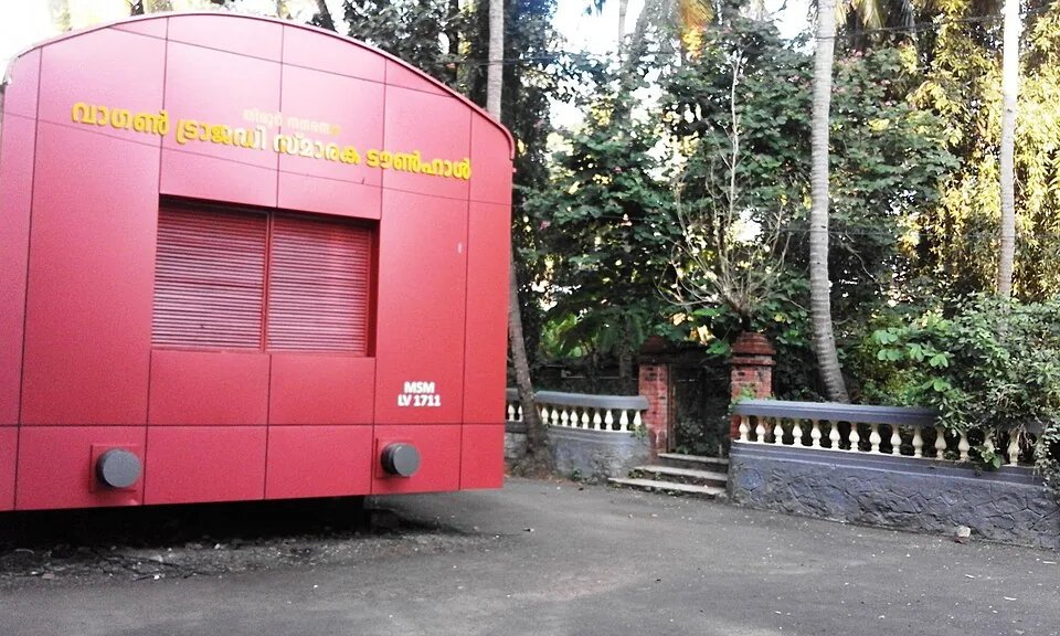
Tirur's town hall, built as a full-size railway goods wagon in signal red and lettered MSM LV 1711 — the memorial to the hundred prisoners shut into wagon 1711 at the station down the road on 19 November 1921.

14.2 km · ~24 min by cab · straight line
templeKadampuzha Devi Temple

A revered Devi temple near Vettichira with no idol — the goddess is worshipped in a natural rock fissure; devotees offer the poomoodal and muri-pooja. Founded by legend of Adi Shankara.

22.6 km · ~38 min by cab · straight line

All 3 places to visit in Ponnani →

Walking and driving times are real routed distances, except the few marked “straight line”, which are direct-line estimates and will read short. Fare figures are estimates from Kerala’s notified auto/taxi tariff and exclude waiting and night charges. Routing: © openrouteservice.org by HeiGIT | Map data © OpenStreetMap contributors

On the map

Where Bharathapuzha estuary is

Good to know

Bharathapuzha estuary — frequently asked

Where exactly is the Bharathapuzha estuary?

At Ponnani in Malappuram district, where the Bharathapuzha and the Tirur Puzha reach the Arabian Sea together. Ponnani town is on the south bank; the Padinjarekkara sandspit on the north bank is in Purathur grama panchayat, Tirur taluk. The gap between the two breakwater heads at the mouth is about 336 metres.

Is the Bharathapuzha really Kerala's second-longest river?

Yes. It runs 209 kilometres from the Anamalai hills in Tamil Nadu to the sea at Ponnani, draining 6,186 square kilometres, of which about 4,400 are in Kerala and 1,786 in Tamil Nadu. Only the Periyar is longer.

When is the best time to see birds at the estuary?

Later than most of Kerala. The record for Purathur puts migratory birds here in their thousands from February to April, and the Malayalam account puts the main arrival between March and May; the two do not agree precisely. The state's general migratory window closes around March, so this mouth is at its fullest as the rest of Kerala is emptying.

Is the estuary a protected area or a bird sanctuary?

No. A bird sanctuary at Purathur was proposed in 2010 and none was ever notified. There is no warden, no hide and no boardwalk. The nearest protected estuary on this coast is the Kadalundi–Vallikkunnu Community Reserve, declared in 2007, about 39 kilometres north.

How do I get from Ponnani to the Padinjarekkara side?

By ferry across the mouth, or by road the long way round over the Chamravattom bridge. The road route measures 25.6 kilometres and takes about half an hour; the ferry crossing is a little over a kilometre of water. Timings and fares for the crossing are not published anywhere we can point you to, so ask at the jetty on the day.

What lives in the Bharathapuzha estuary?

A survey of the estuary recorded 112 species of fish in 53 families — 53 of them marine species that come in through the mouth and 41 that use both the sea and the brackish water — together with nine prawns, ten crabs, three molluscs and 23 genera of burrowing invertebrates on the bed. Mud crab and swimming crabs support an established local fishery.

Is the estuary recognised as a wetland?

It is identified but not notified. The State Wetland Authority of Kerala carries Ponnani among the wetlands it has identified and a brief document has been prepared for it, which is the first step under the 2017 national wetland rules. No notification has followed, and the estuary has no wildlife-protection status of any kind.

Are there mangroves at the Bharathapuzha estuary?

Yes, as a thin fringe rather than a forest, mostly along the inner shore and the Purathur side. The Kerala Forest Department's board here names five kinds growing at this spot — uppatti, kannampotti, nakshatra kandal, swarna kandal and pranthan kandal — and describes the stand as a breeding ground for crab, prawn, karimeen and pallathi and a refuge for migratory birds.

Do sea turtles nest at Ponnani?

The Forest Department's board on the sand here says the Olive Ridley is the sea turtle found on Kerala's shores, and names fishing nets, groynes, sea walls and climate change as the main threats to it. Collecting, keeping or destroying the eggs is an offence under the Wildlife Protection Act of 1972, with imprisonment of up to seven years.

Why is there so little water in the Bharathapuzha?

Six dams on the system hold water back for 773 square kilometres of irrigation, and decades of sand mining have lowered the bed. Long reaches run dry in the hot months, and the estuary is kept full by the tide rather than by the river for much of the year. The Chamravattom regulator, opened in 2012 to hold a freshwater pond and keep the sea out, was found by an IIT Delhi investigation to be faulty in design and now works as a bridge rather than as a regulator.

When is the best time to visit Bharathapuzha estuary?

Late February to May, which is not when the rest of Kerala watches birds. The state’s general migratory window closes around March, and this mouth is at its fullest just as that happens: the Purathur record puts the flocks in their thousands from February to April, and the Malayalam account of the azhimukham puts the main arrival between March and May. Those are two different windows, and the overlap between them is the safe answer. For weather rather than birds, November to February is the comfortable half of the year, and the June-to-September monsoon makes the bar rough.

What are the entry fee and timings at Bharathapuzha estuary?

Entry: Nothing at the water is ticketed. The banks, sand and jetties are public ground with no gate. A passenger ferry has charged a fare when operating, but no current official fare or operating-status notice was found in the 4 September 2026 review; confirm locally rather than assuming a crossing is available. Timings: The estuary itself has no opening or closing time. No current official timetable or operating-status notice for the passenger ferry was found in the source review on 4 September 2026, so do not build a crossing into the day without confirming at the jetty. The fish landing at the harbour is an early-morning business.

How do I reach Bharathapuzha estuary?

Decide which bank first. Ponnani, on the south, is the town, the harbour and the food. Padinjarekkara, on the north, is the spit, the sand and the open view back across the mouth. From Ponnani the ferry is the short way over and the road is the long way round, through the Chamravattom bridge. Come in the late afternoon for the light, and early in the morning for the birds and the landing. Bring binoculars if the birds are the reason. There is no hide, no boardwalk and no warden.

How much time do I need for Bharathapuzha estuary?

Two to three hours for one bank. Half a day if you cross, because the crossing is the point.

What else is near Bharathapuzha estuary?

Nearby you can pair Padinjarekara Beach (440 m), Ponnani (1.2 km), Ponnani Juma Masjid (3.1 km), Biyyam Kayal (6.1 km).

What should I know before visiting Bharathapuzha estuary?

A river mouth is not a beach. The current through a 336-metre gap that is draining two rivers is strong, it reverses with the tide, and the sandbanks that look walkable at low water are cut off at high. The fleet uses this channel. Keep off the breakwaters when boats are moving, and out of the way of a landing. The bar is shallow and the surf over it stands up quickly in the monsoon.

Image credits

Photographs: Vicharam (CC BY-SA 4.0), Dhruvaraj S from India (CC BY 2.0), Manoj Karingamadathil (CC BY-SA 4.0), PP Yoonus (CC BY-SA 3.0), Vicharam at Malayalam Wikipedia (CC BY 3.0), Anish nellickal (CC BY-SA 4.0), Dr Ajay B. MD (CC BY 3.0), Prof tpms (CC BY-SA 4.0), Mohamod Fasil (CC BY 2.0), Navaneeth Kishor (CC BY 2.0), Danyprasad (CC BY-SA 3.0), Natukkukachi (CC BY 3.0), Manikandan Kottathara Ponnani (CC BY-SA 3.0), Yousefmadari at Malayalam Wikipedia (Public domain). Wikimedia Commons.