The Nila is the river Malayalam writes about, and this is where it stops. Two hundred and nine kilometres from the Anamalai hills, past Kalamandalam and the Mamankam ground at Thirunavaya, the Bharathapuzha arrives at Ponnani with the Tirur Puzha alongside it and goes out through a gap in the sand — and for most of the year it arrives with startlingly little. Six dams stand on the system, the bed has been dug for sand for decades, and in the dry months long reaches of Kerala’s second-longest river carry no water at all. What is left at the mouth is an estuary that the sea keeps filled rather than the river: brackish, shallow, banked with sand, and — for reasons nobody has fully explained — one of the best places on this coast to stand and watch gulls.
The story of Bharathapuzha estuary
Begin with what actually comes down. The Bharathapuzha drains 6,186 square kilometres, roughly 4,400 of them in Kerala and 1,786 across the watershed in Tamil Nadu, and its long-run discharge at Ponnani is put at about 161 cubic metres a second. That average conceals the whole story. The flow is monsoon flow; six dams — Malampuzha the largest, with Walayar, Mangalam, Pothundi, Meenkara and Chulliar behind it — hold back what they can for 773 square kilometres of irrigation, and by March the river in its middle reaches is a bed of sand with pools in it. The estuary is therefore not the end of a flowing river in any month you are likely to visit — it is a tidal inlet with a trickle attached.
The second thing that shaped it is the sand itself, taken out rather than brought down. Sand mining, legal and illegal, is named alongside deforestation and pollution as one of the three standing threats to this river basin, and it works on an estuary in two directions at once: it lowers the bed upstream so that salt water pushes further inland, and it removes the sediment the mouth needs to keep rebuilding its own banks. Salinity and conductivity have both been recorded rising through the coastal stretch — Purathur, Padinjarekkara and Ponnani, the three localities that share this water.
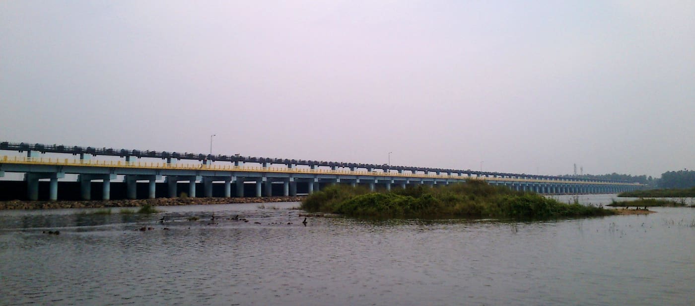
That rising salt is what the biggest thing ever built here was meant to stop. Eight and a half kilometres upstream by road, at Chamravattom, a regulator-cum-bridge crosses the river on 70 shutters: 978 metres long, ten and a half wide, ₹130 crore, opened in 2012. It was supposed to hold a freshwater pond behind it through the dry months, keep the sea out of the wells, and carry a road over the top as well. It carries the road. A technical investigation for the state government by the Indian Institute of Technology Delhi found the design at fault, and the structure now functions as a bridge rather than as a regulator. A barrage that does not hold water still changes an estuary — it interrupts the natural flushing — so the estuary got the interference without the benefit.
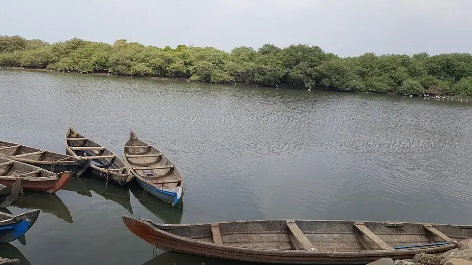
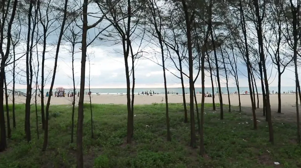
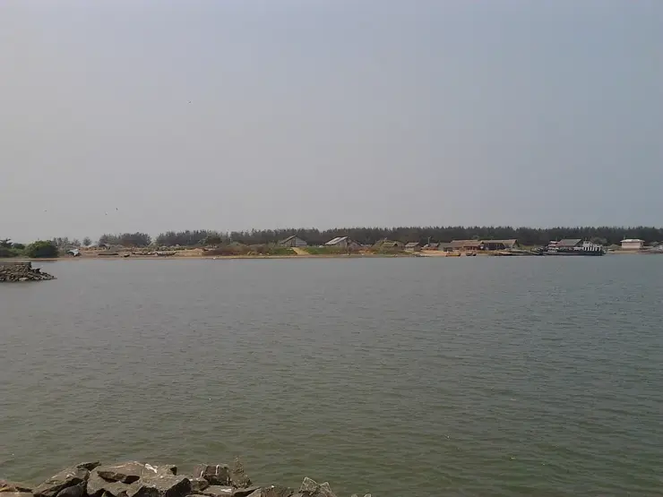
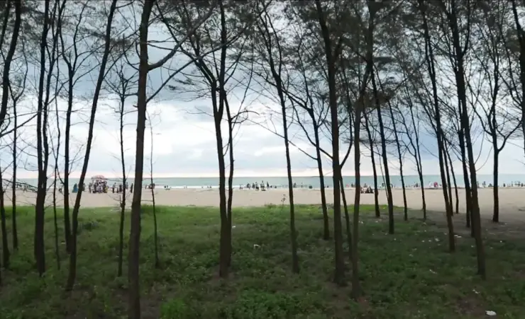
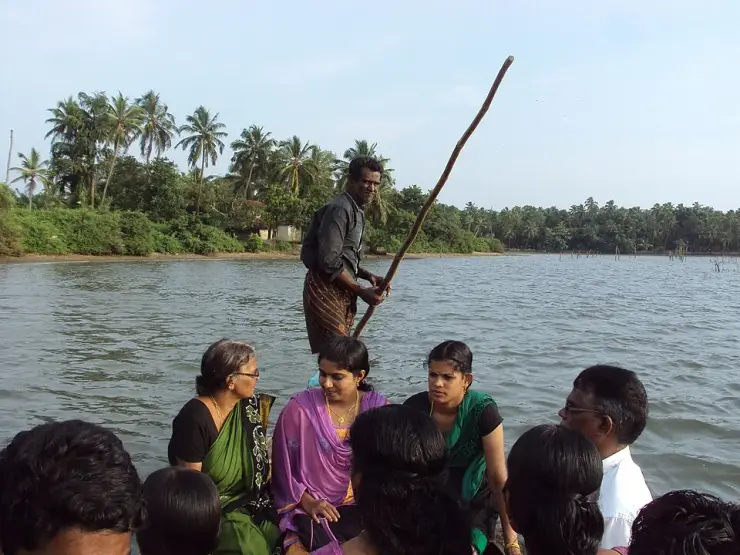
None of this is what a visitor sees. What a visitor sees is a wide, quiet sheet of brown-green water with a low spit of sand across it, dugout canoes drawn up against a fringe of mangrove on the inner shore, and a line of steel trawlers moored less than a kilometre inside the gap. The mangrove is a thin band rather than a forest, along the Purathur shore and in the corners the current does not scour, and it is doing the work mangrove does everywhere — holding the bank and keeping the brackish water off the fresh.
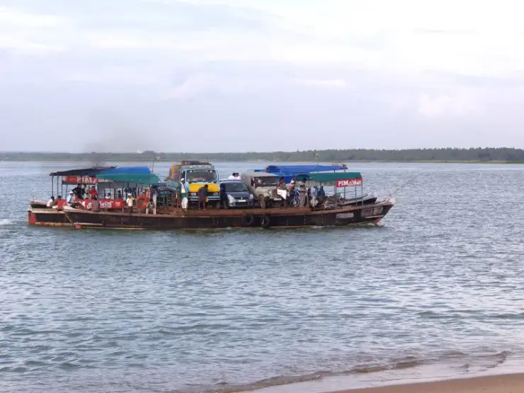
The bar is the feature that decides everything else. Sand accumulates across the mouth of a river that no longer flushes it, and a shallow bar in a surf zone is a hard thing to keep open: this one is held by two rock breakwaters, built so the fishing fleet can get in and out. That is why Ponnani’s harbour is inside the estuary rather than on the open coast, and why every boat that lands a catch here crosses the bar twice a day. In the monsoon the surf stands up over it, and the crossing is the part of the working day that is not routine.
The water itself has been counted, and it is richer than it looks. A survey of the Ponnani estuary recorded 112 species of fish in 14 orders, 53 families and 80 genera — 53 of them marine species that come in through the gap, and 41 that live in both the sea and the brackish water. Alongside them came nine kinds of prawn, ten kinds of crab and three molluscs, and on the bed 23 genera of burrowing invertebrates across six groups: polychaete worms, bivalves, gastropods, amphipods, isopods and tanaids. That last list is not decoration — burrowing invertebrates are what the waders on the sand are eating, and a bed with 23 genera in it is a canteen.
Two of the crabs are a livelihood rather than a statistic. The mud crab and the swimming crabs support an established fishery here, which is worth knowing when you see the dugouts pulled up against the mangrove: some of those are not working the channel at all but the shallow edges where the crabs are, and the mangrove roots are the reason there is anything to work.
Then there are the birds, and they are the reason to make the trip. A survey of the whole Bharathapuzha basin, run across 70 one-kilometre grids between October 2017 and July 2019, recorded 262 species. Diversity was highest in the upper reaches; abundance was highest down here — and one grid at Ponnani held 2,200 individual birds. Black-headed Gull and Pallas’s Gull are the two that mass, in flocks that have been put above five thousand, with terns, plovers and sandpipers working the same sand. Seventeen Western Ghats endemics were recorded in the basin, and one of the birds of this river system, the Black-bellied Tern, is Endangered.
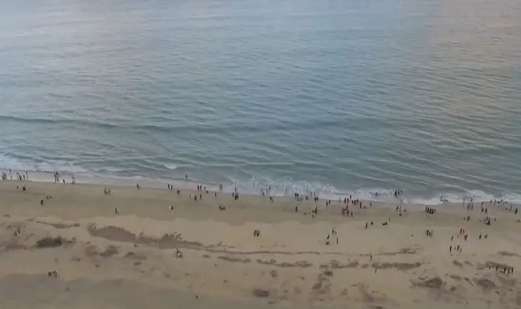
The timing is the strange part. Most of Kerala watches migrants between roughly November and March and then puts the binoculars away. This mouth does its best work as that window closes: the record for Purathur puts the birds here in their thousands from February to April, and the Malayalam account of the azhimukham puts the main arrival between March and May. The two windows do not coincide, and both of them are late. A tern photographed on this coast on 10 April is not an outlier here.
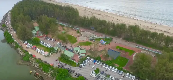
There is one made way along this water and it is worth knowing about, because on foot the south bank is otherwise a matter of finding gaps between boatyards. The Nilayora Patha, which everybody calls the Karma Road, runs 5.8 kilometres inside the Ponnani municipal limit, from the Chamravattom pier down to the harbour area and the Nila Tourism Bridge — a footbridge put across to link the harbour to the coastal road. A tourist boat service centre stands along it. Nothing about that centre’s hours, boats or prices is published anywhere, so treat it as something to ask about on the day rather than something to plan around.
The one authority that has put anything at all on the ground here is the Social Forestry Division of the Kerala Forest and Wildlife Department, and what it has put up is two boards. The first stands beside the mangrove. It calls the stand a breeding ground for crab, prawn, karimeen and pallathi, a biological defence against tsunami and sea surge, a refuge for migratory birds and a carbon sink, and it names the kinds of mangrove growing at this spot: uppatti, kannampotti, nakshatra kandal, swarna kandal and pranthan kandal, the star mangrove and the golden mangrove among them. Five named species on a strip of shore that no map treats as a habitat.
The second board is on the sand, and it is about turtles. Five of the world’s seven sea turtle species reach Indian shores, and the one that comes to Kerala is the Olive Ridley. The department lists what is against it — fishing nets, groynes, sea walls, climate change — and then, in a boxed warning beside a pair of handcuffs, states the law: collecting, keeping or destroying sea turtle eggs is an offence under the Wildlife Protection Act of 1972, carrying imprisonment of up to seven years. Both boards close by quoting Article 51A(g) of the Constitution, the citizen’s duty to protect the natural environment.
It is worth sitting with what the second board says, because the department is describing this place to itself. Groynes and sea walls are named as a threat to nesting turtles in a place whose defining structures are two rock breakwaters, built so the fishing fleet can cross the bar. Nobody is being dishonest; the harbour and the turtles are simply two true things that do not fit together, and the only sign at this estuary that acknowledges the conflict is the one warning you about the eggs.
For all of that, the estuary has almost no legal standing. It is on the state’s books: the State Wetland Authority of Kerala carries Ponnani among the wetlands it has identified, with its own brief document prepared for it, which is the first step under the national wetland rules of 2017. Identification is not notification, and nothing further has followed. On the wildlife side there is nothing at all — a bird sanctuary at Purathur was proposed in 2010 and never notified, and Malappuram’s one protected area is Karimpuzha Wildlife Sanctuary, far inland in the ghats. The nearest estuary on this coast with real legal standing is the Kadalundi–Vallikkunnu Community Reserve, declared in 2007, and that is 39 kilometres north.
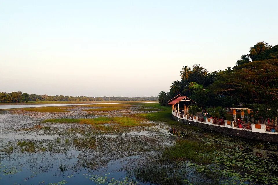
On the ground it shows. There is no warden, no hide, no boardwalk and no viewing platform anywhere on this water, and a place holding gull flocks in the thousands has nothing built for looking at them.
Legend & myth
The river has more names than the town does, and each one belongs to a different way of thinking about it. Nila is the literary name, the one Malayalam poetry uses; Bharathappuzha is the formal one; Peraar, the great river, is the old Dravidian name, with Korayar, Varattar and Valayar attaching to particular stretches; and Sanskrit gives it Gayatri and Mangala Nadi. Vallathol’s salute to it — obeisance for ever to Nila, the goddess-river famed in the three worlds — is the line most often quoted, and it is quoted because the river had already become a shorthand for Kerala itself.
That standing is not decoration; it is why the river’s condition is argued about the way it is. Malayalam writing about the Bharathapuzha treats it as one of the cultural emblems of the state rather than as a watercourse, which means that a dry bed at Pattambi is read as a moral fact and not only a hydrological one. Anyone who comes to the mouth expecting the river of the poems should know that they are looking at the end of a river that Kerala argues about, and that the argument is genuinely about this water and not about a metaphor.
It is also a funerary river. Along its length the Bharathapuzha is where ancestral rites are performed — the ghats at Thirunavaya are the best known, and the Karkidaka Vavu new moon brings crowds to the banks — so what reaches this mouth has been, for a very long time, water that people have stood in for the sake of the dead. The estuary itself has no rite of its own. It is simply the end of the line, which is a plain enough thing to say and is not a legend at all.