Places to Visit in Mananthavady

Mananthavady is the practical north-Wayanad base for Tholpetty Wildlife Sanctuary, Kuruva Island, Pazhassi Smarakam, Thirunelli Temple, Valliyoorkavu Bhagavathy Temple, Brahmagiri Hills, Pakshipathalam, Priyadarshini Tea Environs, Kambamala Ecotourism, village-side homestays, forest-edge stays, restaurants and longer road links toward Kannur, Kodagu and Mysuru. Use it when the trip is built around northern wildlife access, river-island eco visits, heritage stops and quieter Wayanad routes, while confirming forest rules, island opening status, safari timing and hill-road buffers before travel.

Mananthavady
Practical guide

Plan Mananthavady

Who's going?Tailor Mananthavady to your trip
DistrictWayanad
RoleForest and river base
Time neededHalf a day for the town itself
Places to visit9Listed businesses24
What to expect

Highlights

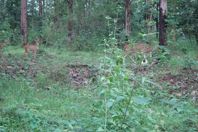
  • Tholpetty Wildlife Sanctuary — Northern Wayanad wildlife zone usually planned from Mananthavady or Thirunelli with current safari timing confirmed.
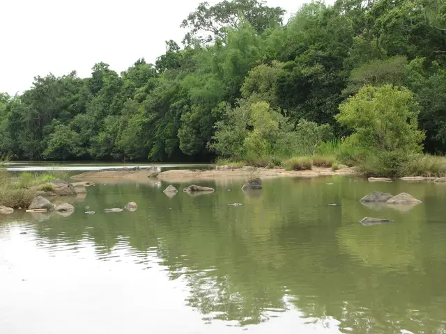
  • Kuruva Island — Protected river-island eco-tourism area on the Mananthavady/Pulpally side, with seasonal and capacity-based access restrictions.
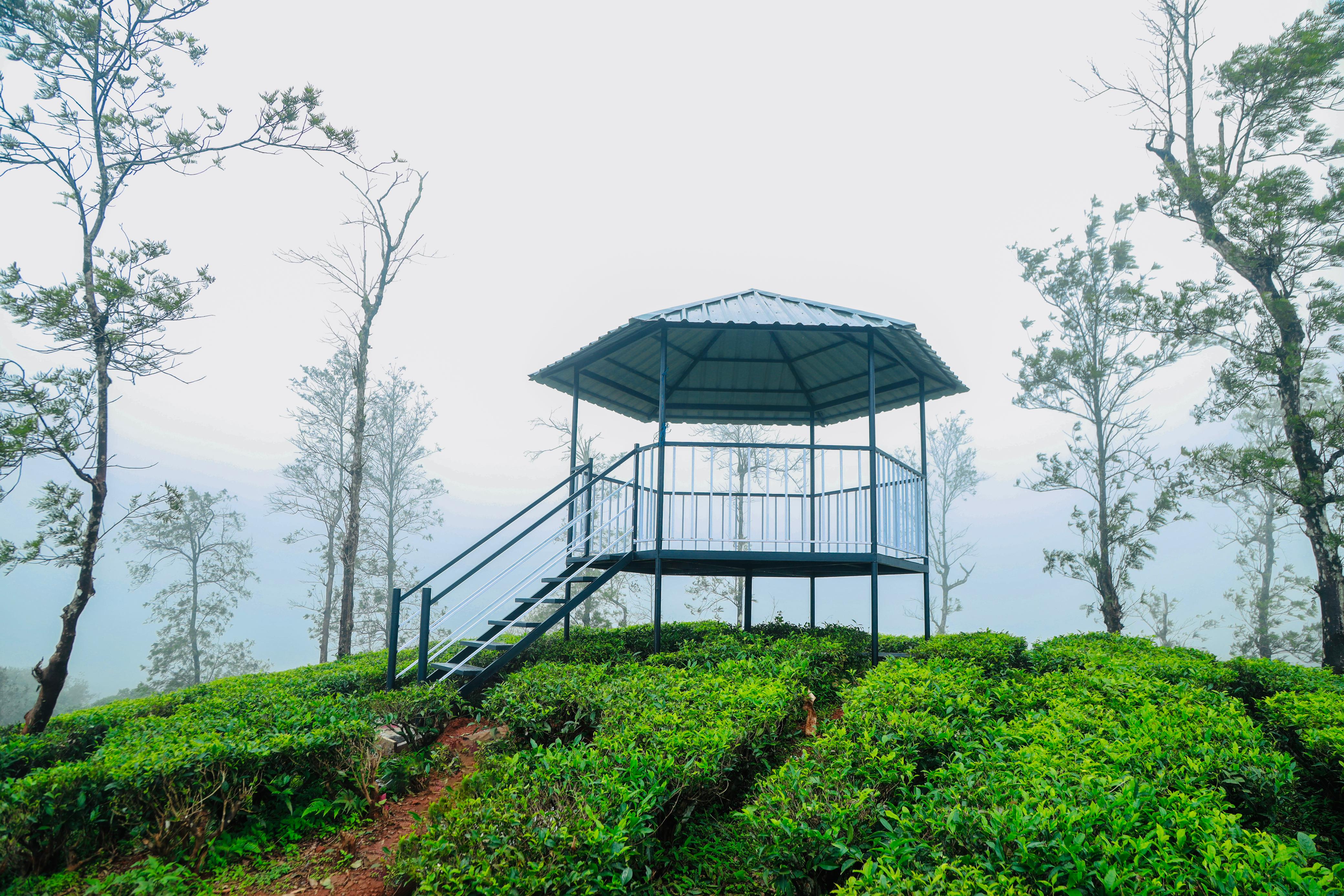
  • Priyadarshini Tea Environs — The Mananthavady Tribal Plantation Co-operative tea estate at Pancharakolly, combining a plantation walk, factory, museum, tasting and Vishwas Point.
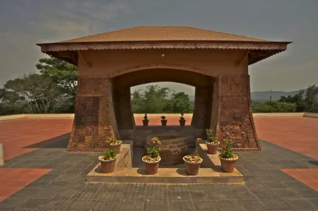
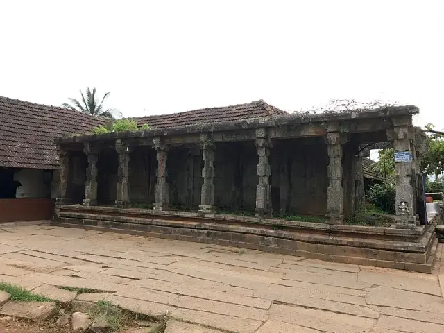
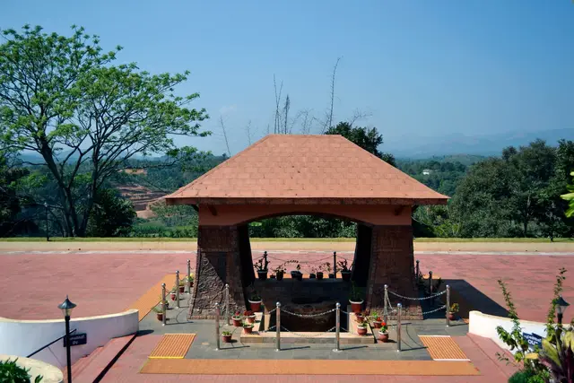
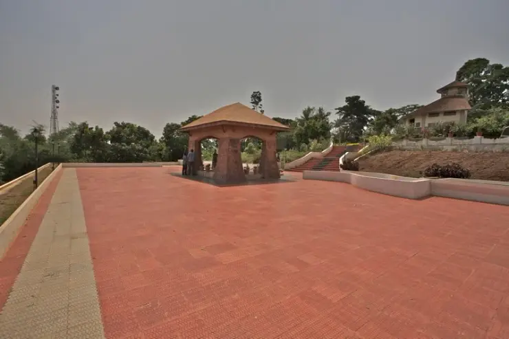
  • Pazhassi Smarakam — Pazhassi Raja’s memorial and the Kerala Archaeology Department museum at Mananthavady’s Hospital Hill, with four galleries connecting the resistance leader, Wayanad’s communities and the district’s material history.
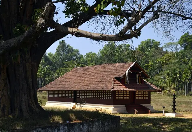
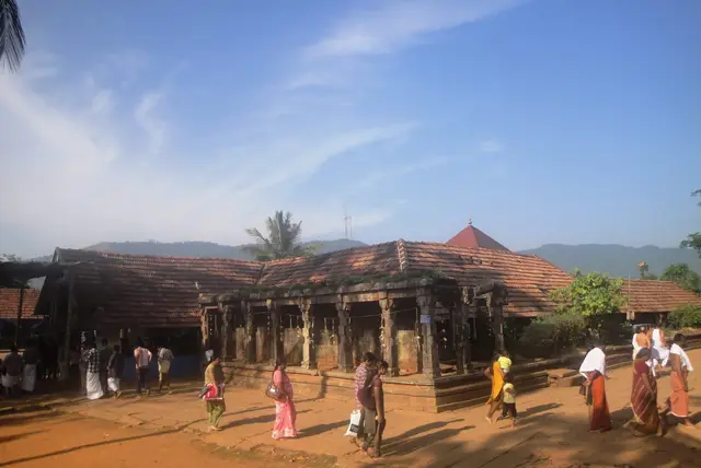
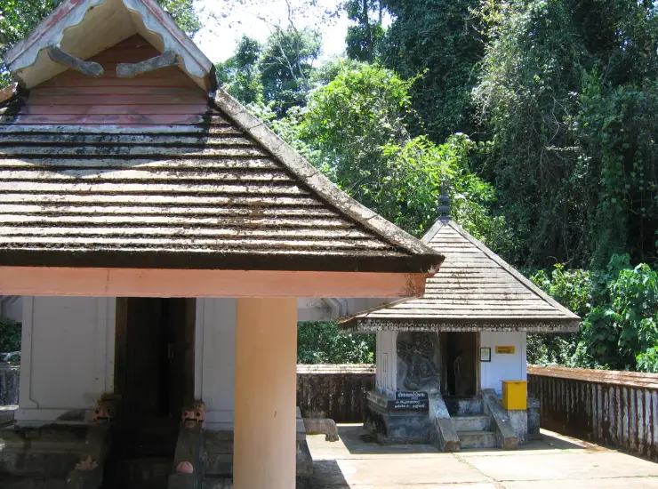
  • Thirunelli Temple — Ancient temple near the Brahmagiri forest edge, paired with Mananthavady and north-Wayanad routes.
  • Valliyoorkavu Bhagavathy Temple — Important Mananthavady-side Bhagavathy temple known for festival and local cultural context.
Getting there

How to visit

  • Nearest airport: Kannur International Airport (CNN), about 60-75 km by road; Calicut (CCJ) is another Wayanad airport option
  • Rail gateway: Kozhikode, Kannur or Thalassery railway stations depending on the arrival side; Wayanad has no rail station
  • KSRTC/private buses and taxis connect Kalpetta, Sulthan Bathery and Mananthavady from Kozhikode/Calicut, Mysuru and Bengaluru; confirm current ghat-road timings before travel.
Timing

Best time to visit Mananthavady

October to May. The plateau is clear and cool from October, driest and dustiest from February, and hot but workable to May. June to September brings around 3,010mm of rain across the year’s heaviest months, when hill roads, forest access and river crossings close at short notice.

Weather in MananthavadySeasonal guide

Live forecast loads in your browser.

Today at Mananthavady
Sunrise6:15 am
Sunset6:25 pm
Golden hour best light5:25 pm–6:25 pm
Blue hour after sunset6:25 pm–6:50 pm
Sun sets toward compass bearingW · 272°
Moon tonight🌓 First quarter · 52%
South-west monsoon. June to September is the south-west monsoon in Kerala. Expect heavy showers, mostly in bursts rather than all day — carry rain cover, allow extra time for getting around, and note that ferries and open-air sites are the first things affected.

Sun and moon are calculated for this location and shown in IST. Photography windows are the hour around sunrise and sunset; the sunset bearing is degrees clockwise from true north. Moon phase is accurate to about half a day.

The story

The story of Mananthavady

Mananthavady is the administrative town of northern Wayanad, an 80.10 square kilometre municipality set at about 760 metres on the Deccan-facing edge of the plateau, bounded by Thirunelli panchayat to the north, Thavinjal to the west and the Kabani river along its south and east. Its name is usually explained as a hunt — “māne eytha vāḍi”, the place where the deer was shot — but the oldest written form of it, cut in Kannada script on a copper water-spout plaque kept at the Anantanatha Swami shrine at Varadoor, calls the place Hosangadi, the new market. Both readings are true to what the town became: a market that the East India Company turned into a garrison, and the place to which Kerala Varma Pazhassi Raja’s body was carried under guard on 1 December 1805. Almost everything Mananthavady is now grew out of that.

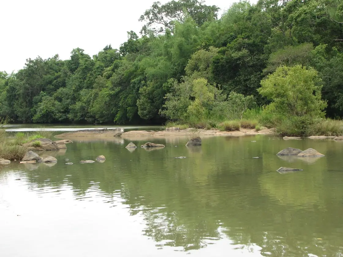
The municipality is large and mostly not urban. Its 80.10 square kilometres make it one of the biggest municipal areas in Kerala, and the built-up town is only a small knot within it — a bus stand, a bazaar of two or three streets, the district hospital, and then paddy, plantation and forest-edge in every direction. The Mananthavady river rises near Periya on the western rim, runs along the boundary and joins the Kabani at Koodalkadavu; the Kabani itself, one of the few rivers of Kerala that flows east, forms the whole southern and eastern edge and carries the town’s water away from the Arabian Sea and into the Kaveri.

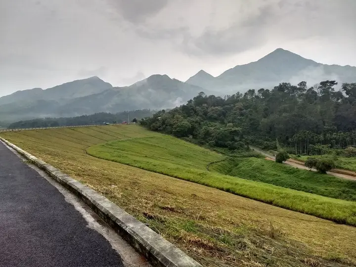
The elevation is given two ways and we print both: English sources put Mananthavady at 760 metres (2,490 feet), while the Malayalam Wikipedia article states 2,570 feet, which is about 783 metres. The climate is what that height implies — a mean daily maximum near 27°C and roughly 3,010 millimetres of rain a year, most of it between June and September, when the plateau disappears into cloud for weeks at a time.

For a town of this size the civic apparatus is unusually heavy, and the reason is historical. Mananthavady was the taluk headquarters of Wayanad under the Madras Presidency, and it is still the headquarters of Mananthavady taluk and of the revenue division. The taluk covers about 740 square kilometres across 16 villages and held 258,140 people at the 2011 census. The town’s own local government came late: a panchayat was constituted in 1935 covering only about twenty square kilometres, without Kaniyaram and Ozhakkodi, with the rest added afterwards, and municipal status followed on 14 January 2015, the first council election being held that November across 36 wards.

The colonial machinery that gave the place its shape is still legible on the ground. The Company stationed troops here to hold down the Wayanad country, and the remains of the barracks, the canteen and the officers’ club survive — Club Hill still carries the name — along with a separate military cemetery at Gorimoola and a powder magazine near Chuttakadavu that has been standing, damaged, ever since. Mananthavady began under the Sub-Collector at Thalassery and was later given a Deputy Collector of its own with magisterial powers; between 1859 and 1879 that officer also held civil powers. When William Logan described the town in the Malabar Manual of 1887, its offices ran to a Deputy Collector, a police inspector, a sub-registrar and a sub-assistant conservator of forests, with a government middle school and a post office. Until 1886, every medical officer posted here was European.

The plantations that now define upland Wayanad started, oddly enough, as an army pastime. Private coffee gardens existed around Mananthavady by about 1830, and the panchayat’s own history credits a Ceylon man named Pugh with opening the first proper coffee plantation here around 1835 — the work having begun as recreation for the soldiers garrisoned in the town. Tea followed in 1854 at Chirakkara and Jessie, and by 1892 Parry and Company had established itself in the district. The Forest Department, created in 1859, divided the Wayanad forests into fourteen blocks and put the sub-assistant conservator’s office at Mananthavady, which is why the forest bureaucracy that now controls access to Tholpetty, Kuruva and Brahmagiri has always been administered from this town.

Underneath the planters lay an older tenurial order. Most of the farmland in the panchayat belonged to the Sree Valliyoorkavu Devaswom and to the Vadiyoor Devaswom at Koyileri, with Brahmin, Chetti and Gowda landlords holding it and tenants working it on written lease. A tenant paid the landlord an amount of paddy equal to the seed sown for wet land, and five rupees an acre for dry. The agricultural labour was done by the Paniyan, Kurichiya, Adiyan and Kuruma communities. That arrangement is the direct ancestor of the labour question this district is still arguing about, and it is why land, not scenery, is the subject that matters most here.

Two waves of newcomers reshaped the town in the twentieth century. Muslim families trace themselves to the Pathans who reached Mananthavady in Tipu Sultan’s campaigns and to those who followed; the Pathani mosque at Thazheyangadi is recorded as the oldest. Christian migration began as a trickle in the early 1930s and became a flood by the 1960s, driven initially by the food shortages of the Second World War, with families arriving from Thodupuzha, Muvattupuzha and Pala. The first church, Amalothbhava, dates from 1848, and a second small church was maintained at Pathivayal specifically for converts from the Kurichiya community — a detail that says a good deal about how mission and caste worked in the hills. The 2011 census returned the municipality as 46.31 per cent Hindu, 29.52 per cent Muslim and 23.6 per cent Christian.

The town was also, until quite recently, a hard place to live. Malaria was endemic across Wayanad and Mananthavady was not spared; local memory records that the usual recourse in serious illness was the long journey down to a vaidyar at Vadakara. When petrol ran short in the war, buses here were run on charcoal and coir. In 1946–47, on the suspicion of plague, the town was closed and the roofs of houses were pulled apart to get at the rats. Set against that, the present figures are a genuine achievement: 47,974 people at the 2011 census, a density of 599 per square kilometre, 1,051 women per 1,000 men and literacy at 91.98 per cent.

What Mananthavady is for the traveller follows from all of this. It is not a viewpoint town; it is the service town — the hospital, the banks, the fuel, the buses and the forest offices for the whole northern half of the district. Roads run west over the ghat to Thalassery and Vatakara, about 65 kilometres to the latter and around 110 kilometres down to Kozhikode, south to Kalpetta at a distance variously given as 32 and 35 kilometres, and north-east through Tholpetty and Kutta into Karnataka for Kodagu and Mysuru. That last road crosses the Nagarhole forest, where through traffic is barred at night, generally quoted as 6 pm to 6 am. Plan the day around that gate rather than around the distance.

Legend & myth

The name is the town’s first legend, and it is a hunting story. The prevailing explanation is that Mananthavady is a worn-down form of māne eytha vāḍi — the settlement where the deer was shot — and the argument is usually clinched by pointing at Ambukuthi, “where the arrow struck”, on the far side of the plateau. It is a satisfying etymology and it may well be right. But it is not the oldest name on record. A copper water-spout plaque preserved at the Anantanatha Swami temple at Varadoor carries an inscription in Kannada script that calls this place Hosangadi — new market, or new town — and one reading of the local past has that new market rising between an older settlement and a bead-and-pearl bazaar after the fall of the Mahodayapuram kings. Among the Adivasi communities the town is not called Mananthavady at all but Manthodi. In Pazhassi Raja’s own time the tract was Vemom, in Ilamkur nadu, and the British wrote it Manantoddy or simply called the whole thing Wayanad Bazaar. Later still the town was known by its trades — Chettitheruvu, Erumatheruvu, Anchampeedika. Five names, and only one of them involves a deer.

Behind the Kottayam rajas and the Company lies an older tradition of who owned this country. Wayanad remembers a line of Girivargam — hill-people — chieftains, of whom the last two were kinsmen named Arippan and Vedan; everything north of Panamaram, which is to say the whole of the present Mananthavady taluk, is said to have been Arippan’s. The tradition holds that the line ended not in battle but in treachery, Vedan being destroyed by the raja of Kumbala Maippadi. What lifts this above campfire history is its provenance: the oral traditions of Wayanad were collected and written down under an order of the Malabar district court in 1810, and versions of them survive in the Mackenzie manuscripts. It is still tradition rather than record — but it is tradition taken down within living memory of the events it describes, which is more than most Kerala origin stories can claim.

The Adivasi communities of the taluk carry their own cosmologies, and they are not decoration. The Adiyan, who after Thirunelli are most numerous in Mananthavady, trace themselves to ancestors named Keeyoruthi and Meloorachavan, and the landscape their myth attaches to lies in the country between Thirunelli, Pakkam and this town. Their song-and-story tradition is one of the richest in the district. The Ooralikkuruma, the craft specialists who make almost everything a household needs, are described as naga-makkal, children of the serpent. The Paniyar remember Ippimala as their home hill. These are living traditions belonging to particular families in particular hamlets, and the honest thing to say about them here is that they are theirs to tell — this record notes that they exist and where, and does not paraphrase them into travel prose.

The town’s most famous story is a death, and it has two endings. On 30 November 1805 Kerala Varma Pazhassi Raja was brought to bay at Mavila Thodu near Pulpally. The Company’s account, and the version most historians accept, is that he was shot in a short and violent skirmish. The tradition preserved in Malayalam is different: that rather than be taken alive he swallowed his diamond ring. Both survive side by side in the sources and neither has displaced the other, so both are printed here. What is not in dispute is what happened next, and it is the reason this town holds his memory at all. The body was carried the fifteen-odd miles to Mananthavady the following day under strong guard, and the British — who had hunted him for twelve years — had him cremated at Thazheyangadi with Brahmin rites and the remains interred, the ceremony conducted with official honours. They then built the tomb. A tree grew over it and is standing yet.

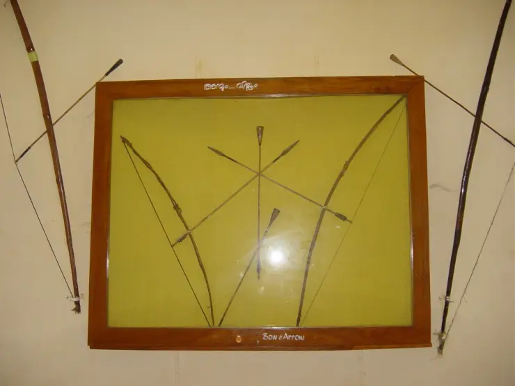
The war that ended there had produced a folklore of its own around a Kurichiya archer. Thalakkal Chandu commanded the bow companies, and Pazhassi is remembered saying that even if every Nair deserted him he would fight the Company again so long as the Kurichiya stood. Chandu was taken by a ruse in November 1805, a fortnight before the Raja himself, and beheaded beside a koli tree near the Panamaram post. When Edachena Kunkan heard of it he is said to have answered only that he had lost his right hand. The koli tree at Panamaram is still pointed out, and it took 207 years for the state to put a memorial beside it; a second memorial to Chandu on the Kabani bank near Panamaram was opened on 22 September 2012, displaying replicas of the weapons and the traditional farm tools of the Kurichiya. Since 1982 KIRTADS has run an archery competition in his name for Kerala’s Scheduled Tribes — a commemoration that is also, unusually, a continuation.

The revolt of 1812 came wrapped in omen and ritual. The Wayanad bamboos flowered and died that year, which is a real ecological event on a decades-long cycle and reliably brings rats and then hunger, and Malayalam accounts wonder whether the famine that followed helped light the fire. Kurichiya priests told the fighters that the gods of their own hills would be with them. The weapon was the bow, and the arrowheads, tradition insists, were made from iron bars prised out of the Company’s bridges — the colonial infrastructure disassembled into ammunition. Thomas Hervey Baber, the sub-collector who had hunted Pazhassi and now had to face his old enemies again, recorded that the aim of the rising was to drive the vattathoppikkar — the round-hat men — out of the country. It is the most quotable line anyone left from the whole affair, and it comes to us through the man it was aimed at.

Three well-known legends of this landscape are deliberately left alone here, because they belong elsewhere and are told in full on their own pages. The story of Brahma, the swan and the amla tree that gives Thirunelli its name, and the Papanasini that dissolves sin, belong to Thirunelli. The tradition that the Bhagavathy of Valliyoorkavu is swayambhu and chose the river grove for herself — and the far harder history of nilppupanam, the standing money handed over before the goddess to bind a year’s labour — belongs to Valliyoorkavu, three kilometres from this town, and we tell it there rather than borrowing its weight for the town hub. The arrow of Lakshmana and the spring it opened belong to the Karnataka face of Brahmagiri. A town that has its own five names and its own two accounts of a king’s death does not need to annex anyone else’s miracles.

More about Mananthavady

History

Before the Kottayam rajas, Wayanad was divided among hill chieftains, and the tradition recorded in 1810 names Arippan and Vedan as the last of them. After the Vedar line was destroyed the Kottayam raja took the plateau, absorbing along the way the rights of a chief called Parakkumithal. When Hyder Ali invaded, the Kottayam raja Ravi Varma took his family into exile in Travancore; he returned with troops during the second Mysore campaign and recovered Wayanad, after which the country was redivided into nadus. Mananthavady fell in Ilamkur nadu and was known as Vemom, its local chief being the Vemoth Nambiar. On 18 March 1792 the peace between Tipu Sultan and the East India Company transferred sovereignty over Malabar to the Company, which then declined to leave the native rulers the authority the settlement implied — the grievance from which everything that follows in this taluk proceeds.

The single most damaging blow the rebels struck fell inside this taluk. On 11 October 1802 the British post at Panamaram, about fifteen kilometres from Mananthavady, was surrounded and taken by a force under Edachena Kunkan Nair and Thalakkal Chandu. The garrison was a detachment of Bombay troops under Captain Dickenson. Our sources disagree on the detail and we print the disagreement: Malayalam accounts, citing Logan’s Malabar Manual, say the whole garrison of seventy was killed including Dickenson and Lieutenant Maxwell, with five dead on the attackers’ side, and put the assault force at 150 or 175 Kurichiya bowmen; the English Wikipedia article on Pazhassi Raja gives the same casualty figures for the rebels but dates the action to 1803, while its article on the war keeps 11 October 1802. The plunder is agreed everywhere at 112 muskets, six boxes of ammunition and 6,000 rupees, after which the post was burned. A larger force under Major Drummond lay a few miles away at Pulinjali and did not intervene in time.

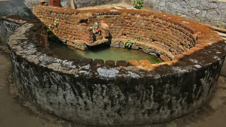
The war ended three years later and its last act was performed in this town. Pazhassi Raja was killed at Mavila Thodu near Pulpally on 30 November 1805, aged 47. His body was brought to Mananthavady the next day under heavy guard and cremated at Thazheyangadi with Brahmin officiants, the remains interred at a spot recorded variously as Thazhankari and as the hospital ground, and the Company built the tomb that stands there now. The Kerala State Archaeology Department declared the tomb a protected monument in 1980, and in December 2010 a museum was added beside it with introductory, historical, tribal, heritage and coin galleries. The site now also carries a park with boating and a small aquarium, which is an odd but not dishonest fate for a war grave: it is where Wayanad families actually go.

Seven years after the Raja’s death his surviving allies rose on their own account, and that rising is the one this taluk should be known for. The Kurichiya revolt of 1812 was a revenue rebellion. Under the settlement pressed by the Principal Collector, Thomas Warden, the cultivator kept a third of what was left after costs while the Company took six parts in ten of the remainder and the landlord four, and the Company’s share had to be paid in cash — a demand that fell hardest on people who had never held much money. Assessments rose about ten per cent over what had been paid before, taxes were laid on pepper and other produce, shifting cultivation by burning was stopped, small holdings were seized, households sold their utensils to clear arrears, and defaulters were put to work as bondsmen. The rising began when tax collectors were blocked. It ran for about six weeks and it was not a riot. A council of Kurichiya met at Malloor on 25 March 1812 and the police had to use force to break it up; that was the spark. The rebels closed the ghat passes completely, attacked police stations, took control of movement across Wayanad and defeated a Company detachment at Elachuram. Men in Company employment resigned to join. Plakka Chandu, Ayiraveettil Konthappan, Masilottadan Yamu and Venkalon Kelu led in the field, under the overall leadership of a Kurichiya named Ramanambi. It ended only when Baber applied for reinforcements and modern-armed troops were brought in from Srirangapatnam in Mysore to converge from every side; by 8 May 1812 it was over. Venkalon Kelu was publicly hanged. Malayalam sources say Ramanambi was beheaded on 1 May, but give the year as 1825, which we cannot reconcile with the rest of the chronology and flag as unresolved. Historians describe the revolt as both the first and the last anti-colonial tribal rising in South India.

The land question the Company opened has never entirely closed, and Mananthavady sits at the centre of the modern version of it. Wayanad has the highest proportion of Scheduled Tribe population of any Kerala district, 18.86 per cent, with the Paniyan the largest community at 92,787 people, the Kurichiyan at 35,909 and the Mullukkuruman at 21,375, and the Malayalam Wikipedia records the headquarters of the Adivasi Gothra Maha Sabha as being in this town. The agitation of 2001 — camps outside the Chief Minister’s residence in Thiruvananthapuram, and a seven-point agreement to distribute land — led, when the agreement stalled, to the occupation of forest land and to the police firing at Muthanga on 19 February 2003, in which a constable, K. V. Vinod, and at least one Adivasi occupier were killed. Muthanga is on the Sulthan Bathery side of the district and not in Mananthavady taluk, and the resettlement that followed was made at Aralam in Kannur; both are told on their own pages. What belongs here is the through-line, from the cash assessment of 1812 to the standing money at Valliyoorkavu to the acre-per-family allotments of 2006.

The modern administrative frame arrived on 1 November 1980, when Wayanad was constituted as Kerala’s twelfth district out of the North and South Wayanad taluks of Kozhikode and Kannur, with Kalpetta as headquarters; North Wayanad taluk was renamed Mananthavady on the same date. Municipal status for the town itself came on 14 January 2015. The two dates together explain the odd feeling of the place — an old capital that was made a district town’s subordinate, and a village panchayat that became a municipality eighty years after it was first constituted.

Why visit

The tomb of Pazhassi Raja stands in the town itself — a state-protected monument since 1980, with a museum of five galleries added in December 2010.

This is the practical base for northern Wayanad: the hospital, the banks, the fuel, the forest offices and the buses for Tholpetty, Thirunelli and Kuruva are all here.

The colonial garrison left the town its shape, and the traces are still findable — Club Hill, the Gorimoola military cemetery and the powder magazine near Chuttakadavu.

Panamaram, where the East India Company suffered its heaviest single reverse in Malabar on 11 October 1802, lies about fifteen kilometres away in the same taluk.

Roads run from here into Kodagu and towards Mysuru through the Nagarhole forest, making Mananthavady the natural last stop before the Karnataka border.

It is an ordinary working Malayali town rather than a resort strip, which is exactly why the food, the bus stand and the bazaar are worth an hour of anyone’s time.
Before you go

Mananthavady — at a glance

HoursThe town runs on ordinary hours; shops from roughly 9am and the bazaar busiest in the morning. The Pazhassi tomb site and museum keep fixed daytime hours with a weekly holiday — check on the day. The forest roads north-east into Karnataka through Tholpetty and Kutta are barred to through traffic overnight, generally quoted as 6pm to 6am.

Entry: Nothing to enter the town — Mananthavady is a working municipality, and the bazaar, the bus stand and the streets cost nothing. The one ticketed sight inside it is the Pazhassi Raja tomb and its museum, which charges a small fee; confirm the current rate and the museum’s weekly closing day at the counter.

Getting here

How to reach Mananthavady

Road only; there is no railway in Wayanad. Buses run west over the ghat to Thalassery and Vatakara (about 65km), down to Kozhikode (about 110km, the usual railhead and airport), and south to Kalpetta, which sources give as 32 or 35km. North-east the road runs through Tholpetty and Kutta into Kodagu and on towards Mysuru, crossing the Nagarhole forest with its overnight closure.

Getting back

Check your return bus or ferry with the operator before setting out. Leave time to reach the stop or jetty after your visit, and arrange a return vehicle in advance for a remote outing.

Ask at the jetty or the stand for the time of the last service back, not the next one. If you miss it, an auto or a taxi is the fallback — agree the fare before you get in.

Plan

Good to know

  • Time the Karnataka run by the forest gate, not the distance. The Tholpetty–Kutta road crosses the Nagarhole reserve, where through traffic is barred overnight — the ban is generally quoted as 6pm to 6am — so a late start turns a two-hour drive into an overnight stop.
  • The Pazhassi tomb has been a state-protected monument since 1980, and the museum beside it — introductory, historical, tribal, heritage and coin galleries — only opened in December 2010. Guidebooks written before then describe a bare grave and are out of date.
  • Do the errands here. Mananthavady holds the district hospital, the banks, the fuel and the forest offices for the whole northern half of Wayanad; Thirunelli, Tholpetty and Kuruva have almost no services, and forest-area mobile signal is thin.
Getting around Mananthavady

If you need step-free access, contact the site before travelling. Ask about a level entrance, steps along the route, the nearest drop-off point, seating and accessible toilets.

Nearby bases

Where to go from Mananthavady

Use Mananthavady as the north-Wayanad base, then choose Tholpetty wildlife access, Kuruva Island and Kabini-side eco visits, Thirunelli temple/forest routes, Kalpetta for central Wayanad logistics, or Sulthan Bathery for Edakkal and east-Wayanad heritage.

In the district

Where Mananthavady sits in Wayanad district

Nearest airportKannur International Airport (CNN), about 60-75 km by road; Calicut (CCJ) is another Wayanad airport option
Rail gatewayKozhikode, Kannur or Thalassery railway stations depending on the arrival side; Wayanad has no rail station
Bus / road accessKSRTC and private buses connect Mananthavady with Kalpetta, Sulthan Bathery, Kozhikode/Calicut, Kannur, Thalassery, Mysuru and Kodagu-side routes. Road timing changes with ghat, forest and monsoon conditions.
Local transportUse local taxis, autos and verified drivers for Tholpetty, Kuruva Island, Thirunelli, Pazhassi Tomb, Banasura-side extensions and north-Wayanad forest routes.
District HQKalpetta
LandscapeWestern Ghats highland — forests & plantations

Wayanad district is known for: Wildlife sanctuary, waterfalls, caves and spice estates.

Confirm current Tholpetty safari timing, Kuruva Island opening status and Thirunelli access before leaving town.Keep extra road buffer for forest sections, river-island access rules, monsoon weather and late-evening returns.Mananthavady is the north-Wayanad base for Tholpetty, Kuruva, Thirunelli, Pazhassi Tomb and Kannur/Kodagu-side road links.Wayanad Wildlife SanctuaryEdakkal CavesChembra Peak & waterfalls
Stay · eat · do · rent · see · shop

Places in Mananthavady

Every verified place in Mananthavady — filter by what you’re after.

3 places to eat in Mananthavady

ABAD Parisons Plantation Restaurant — Plantation resort restaurant in Mananthavady
Verified
Plantation resort restaurant · Mananthavady
ABAD Parisons Plantation Restaurant

Plantation resort restaurant in Mananthavady. Parisons Plantation Experiences by ABAD, Wayanad, near Mananthavady, Kerala · eat, Plantation resort restaurant, ABAD Parisons Plantation Restaurant.

Directions Commission-freeView details
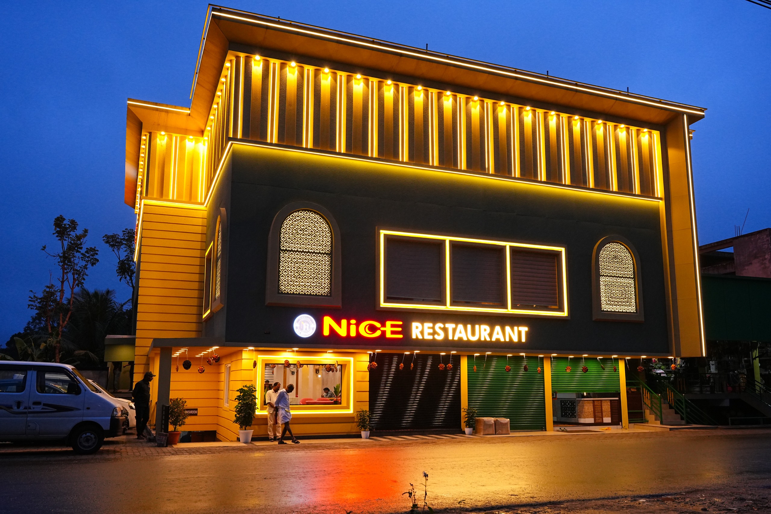
Nice Restaurant Mananthavady — Restaurant in Mananthavady
Verified
Restaurant · Mananthavady
Nice Restaurant Mananthavady

Nice Restaurant is a Mananthavady-side restaurant at Kuzhinilam, useful as a sourced food stop for north Wayanad, Tholpetty and Kuruva routes. Mananthavady food, Restaurant, Kuzhinilam.

Directions Commission-freeView details
N
Nice Restaurant
Where to eat
Restaurant · Mananthavady
Nice Restaurant
Kerala

A family-run Kerala restaurant at Kuzhinilam in Mananthavady town, open 25 years. Pepper roasts, mappas and biryani lead a menu of traditional Kerala fare.

Directions Commission-freeView details

Book with the place itself. India’s cyber-crime coordination centre warned in April 2025 that convincing copies of hotel and pilgrimage booking sites are being pushed through sponsored search and social ads, taking payment for rooms the property never hears about. Every listing here links to the business’s own contact details and its own Google or Bing profile — we take no commission and sit in nobody’s payment path. If a booking page reached you through an ad, check the address bar against the property’s own site before you pay. Fraud can be reported on cybercrime.gov.in or on 1930.

Places to visit

The places themselves, around Mananthavady

The best tourist places to visit in Mananthavady — temples, viewpoints, lakes, heritage and nature, each with a full guide, how to reach it and what to see nearby.

Tholpetty Wildlife Sanctuary, Mananthavady
PlaceTholpetty Wildlife Sanctuary

Tholpetty Wildlife Sanctuary is the Mananthavady-side wildlife gateway of Wayanad Wildlife Sanctuary. Plan it through current official safari timing, forest contact checks and responsible road buffers before adding nearby stays, food or drivers.

Open guide →
Kuruva Island, Mananthavady
PlaceKuruva Island

Protected river-island eco-tourism area on the Mananthavady/Pulpally side, with seasonal and capacity-based access restrictions.

Open guide →
Pazhassi Smarakam, Mananthavady
PlacePazhassi Smarakam

Pazhassi Raja’s memorial and the Kerala Archaeology Department museum at Mananthavady’s Hospital Hill, with four galleries connecting the resistance leader, Wayanad’s communities and the district’s material history.

Open guide →
Thirunelli Temple, Mananthavady
PlaceThirunelli Temple

Thirunelli Temple is a north-Wayanad forest-edge temple near the Brahmagiri landscape, usually planned from Mananthavady or Thirunelli. Check temple timing, road conditions and respectful visitor rules before pairing it with Tholpetty or Kuruva routes.

Open guide →
Valliyoorkavu Bhagavathy Temple, Mananthavady
PlaceValliyoorkavu Bhagavathy Temple

Important Mananthavady-side Bhagavathy temple known for festival and local cultural context.

Open guide →
Brahmagiri Hills, Mananthavady
PlaceBrahmagiri Hills

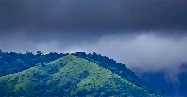
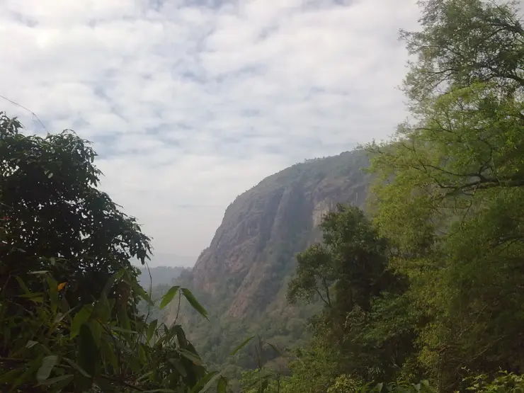
Highland forest-and-peak landscape near Thirunelli, with access dependent on rules and conditions.

Open guide →
Pakshipathalam, Mananthavady
PlacePakshipathalam

Brahmagiri Hills trek and cave landscape near Thirunelli, known for birdlife and permit-dependent forest access.

Open guide →
Priyadarshini Tea Environs, Mananthavady
PlacePriyadarshini Tea Environs

The Mananthavady Tribal Plantation Co-operative tea estate at Pancharakolly, combining a plantation walk, factory, museum, tasting and Vishwas Point.

Open guide →
Kambamala Ecotourism, Mananthavady
PlaceKambamala Ecotourism

KFDC’s Camellia Eco Cottages stay inside its working Kambamala tea estate, with guided plantation and forest-edge activities arranged as part of the programme.

Open guide →
Official eco & forest programmes

Forest stays, camping and treks around Mananthavady

Official/public-sector eco offerings mapped to this town base. Always confirm current availability, tariff, permits and reporting time before travelling.

Wayanad Wildlife Sanctuary, Mananthavady
safariwildlife

Tholpetty wildlife safari

Northern Wayanad wildlife safari zone around Tholpetty, usually planned from Mananthavady or Thirunelli.

Wayanad Wildlife Sanctuary
Official source →
Thirunelli, Mananthavady
wildlifetrekinterpretation

Thirunelli forest and temple eco visit

Temple, forest and Brahmagiri-edge landscape in north Wayanad, listed among Kerala Tourism ecotourism destinations.

Thirunelli
Official source →
Kuruva Island, Mananthavady
wildlifeboatinginterpretation

Kuruva Island eco visit

River-island eco-tourism area with seasonal and carrying-capacity restrictions; confirm opening status before travel.

Kuruva Island
Official source →
For hotels, homestays and local businesses

Get listed in Mananthavady for free

Roampedia is commission-free. Travellers discover your business, book directly and contact you through official details. Basic listings are free, while Gold and Platinum package upgrades can be requested from the owner dashboard after approval.

List your business — free
Ranked guide modules

The best of Mananthavady, ranked

10 picks

Mananthavady-scoped cards for north-Wayanad planning: Tholpetty wildlife checks, Kuruva Island access, Thirunelli and Pazhassi heritage, homestays, food stops, adventure operators and Kannur/Kodagu-side road context.

Tholpetty Wildlife Sanctuary DTPC Wayanad, Mananthavady#1
Mananthavady · Wildlife check

Tholpetty Wildlife Sanctuary DTPC Wayanad

Official-source Mananthavady-side Tholpetty record for safari timing, contacts and current visitor movement checks.

TholpettyWildlifeDTPC
Kuruva Island, Mananthavady#2
Mananthavady · River island

Kuruva Island

Protected Kabini river-island eco visit best planned from the Mananthavady/Pulpally side with current forest access confirmed.

Kuruva IslandForest rulesRiver island
Varnam Homestay Mananthavady, Mananthavady#3
Mananthavady · Homestay

Varnam Homestay Mananthavady

Kerala Tourism-listed Kurukkanmoola homestay for Tholpetty, Kuruva and north-Wayanad routing.

HomestayKurukkanmoolaNorth Wayanad
Wayanad Adventures Eco Lodging Mananthavady, Mananthavady#4
Mananthavady · Adventure operator

Wayanad Adventures Eco Lodging Mananthavady

Direct-source Mananthavady adventure stay/operator for jeep safari, sightseeing, campfire and packages.

Eco lodgingJeep safariOperator
Nice Restaurant Mananthavady, Mananthavady#5
Mananthavady · Food stop

Nice Restaurant Mananthavady

Direct-source Kuzhinilam restaurant for north-Wayanad food planning between Tholpetty, Kuruva and town stays.

RestaurantKuzhinilamFood stop
Thirunelli Temple, Mananthavady#6
Mananthavady · Temple and forest route

Thirunelli Temple

Forest-edge temple route near Brahmagiri, best planned from Mananthavady with road and timing checks.

TempleBrahmagiriForest route
Pazhassi Tomb, Mananthavady#7
Mananthavady · Heritage stop

Pazhassi Tomb

Town-side heritage stop tied to Pazhassi Raja and north-Wayanad history.

HeritageTown stopHistory
Tholpetty Wildlife Sanctuary, Mananthavady#8
Mananthavady · Wildlife side

Tholpetty Wildlife Sanctuary

Northern Wayanad safari side that needs official timing, forest rules and careful dawn/evening road planning.

SafariForestTholpetty
ABAD Parisons Plantation Restaurant, Mananthavady#9
Mananthavady · Plantation dining

ABAD Parisons Plantation Restaurant

Official ABAD restaurant record for plantation-side dining near Mananthavady.

PlantationRestaurantOfficial source
Kuruva Island eco visit, Mananthavady#10
Mananthavady · Eco programme

Kuruva Island eco visit

Forest-controlled river-island eco visit that should be checked for opening, carrying capacity and seasonal restrictions.

Eco visitForest rulesKabini
Search guides

Hotels, restaurants and stay-budget guides in Mananthavady

Dedicated town guides for high-intent searches. Pages with limited verified supply stay visible for planning but are not submitted for search indexing until enough evidence-backed listings exist.

Food3 matches

Restaurants in Mananthavady

Evidence-backed shortlist with verified local matches, direct planning context and clear next steps.

Search-ready guideOpen guide →
Hotels10 matches

Hotels in Mananthavady

Evidence-backed shortlist with verified local matches, direct planning context and clear next steps.

Search-ready guideOpen guide →
Homestays6 matches

Homestays in Mananthavady

Evidence-backed shortlist with verified local matches, direct planning context and clear next steps.

Search-ready guideOpen guide →
Resorts10 matches

Resorts in Mananthavady

Evidence-backed shortlist with verified local matches, direct planning context and clear next steps.

Search-ready guideOpen guide →
Wellness3 matches

Ayurveda and wellness places in Mananthavady

Evidence-backed shortlist with verified local matches, direct planning context and clear next steps.

Search-ready guideOpen guide →
Operators2 matches

Tour operators in Mananthavady

Planning preview kept visible for travellers while more verified listings are added before search indexing.

Planning previewOpen guide →
Transport1 match

Taxi and transport providers in Mananthavady

Planning preview kept visible for travellers while more verified listings are added before search indexing.

Planning previewOpen guide →
Budget stays2 matches

Cheap places to stay in Mananthavady

Planning preview kept visible for travellers while more verified listings are added before search indexing.

Planning previewOpen guide →
Budget stays2 matches

Budget stays in Mananthavady

Planning preview kept visible for travellers while more verified listings are added before search indexing.

Planning previewOpen guide →
Affordable hotels1 match

Affordable hotels in Mananthavady

Planning preview kept visible for travellers while more verified listings are added before search indexing.

Planning previewOpen guide →
Mid-range stays3 matches

Mid-range stays in Mananthavady

Evidence-backed shortlist with verified local matches, direct planning context and clear next steps.

Search-ready guideOpen guide →
Premium stays5 matches

Premium stays in Mananthavady

Evidence-backed shortlist with verified local matches, direct planning context and clear next steps.

Search-ready guideOpen guide →
Luxury stays2 matches

Luxury stays in Mananthavady

Planning preview kept visible for travellers while more verified listings are added before search indexing.

Planning previewOpen guide →
Ultra luxury stays1 match

Ultra luxury stays in Mananthavady

Planning preview kept visible for travellers while more verified listings are added before search indexing.

Planning previewOpen guide →
Town plans

2-day and 3-day plans for Mananthavady

Practical Mananthavady routes built from the town inventory, famous places and official access checks. Confirm activity status, weather, permits and road timing before travel.

2 days

Mananthavady in 2 days

A north-Wayanad plan using Mananthavady for Tholpetty Wildlife Sanctuary, Kuruva Island, Pazhassi Tomb, Thirunelli-side checks and sourced town food or stays.

Wildlife and river islandNorth-Wayanad baseQuieter Wayanad routes
Moderate, with one wildlife/heritage day and one Kuruva or Thirunelli-side day
3 days

Mananthavady in 3 days

A fuller north-Wayanad route with Tholpetty wildlife, Kuruva Island, Thirunelli/Pazhassi heritage and a choice of Kalpetta, Sulthan Bathery or Vythiri extension.

Forest side staysRiver island and temple routeSlow Wayanad routing
Comfortable, with one wildlife day, one river/temple day and one wider Wayanad extension
Stay safe

Emergency numbers in Mananthavady

Save these before travelling around Mananthavady and Wayanad. Use 112 for any emergency, and confirm local attraction or forest access through official contacts before remote trips.

Read before you go

Mananthavady guides, stories & itineraries

Around Mananthavady

The town itself and the places around it — each written about one subject rather than as a general guide.

Kerala-wide guides & itineraries

Route-level itineraries and practical guides for the rest of the state.

See all 55 Wayanad guides & stories →

Map

Where things are in Mananthavady

FAQ

Mananthavady travel FAQs

What does the name Mananthavady mean?

The usual explanation is that it comes from māne eytha vāḍi, “the place where the deer was shot”, with the nearby place-name Ambukuthi, “where the arrow struck”, offered as supporting evidence. It is not the oldest recorded name, though: a Kannada-script inscription on a copper water-spout plaque at the Anantanatha Swami temple at Varadoor calls the town Hosangadi, meaning new market. Adivasi communities call it Manthodi, it was Vemom in Pazhassi Raja’s time, and the British wrote it Manantoddy or Wayanad Bazaar.

Is Pazhassi Raja really buried at Mananthavady?

Yes. He was killed at Mavila Thodu near Pulpally on 30 November 1805, and his body was brought here the following day under guard. The British had him cremated at Thazheyangadi with Brahmin rites and the remains interred, and they built the tomb that still stands in the town. It was declared a protected monument by the Kerala State Archaeology Department in 1980 and a museum was added beside it in December 2010. Note that the Pazhassi memorial at Mattannur in Kannur district, dedicated in 2014, is a different site.

What was the Kurichiya revolt of 1812?

A revenue rebellion by the Kurichiya and Kuruma communities, seven years after Pazhassi Raja’s death, against a settlement that demanded the Company’s share in cash, raised assessments by about ten per cent, taxed pepper and produce, banned shifting cultivation and put defaulters to bonded work. It broke out after police forcibly dispersed a Kurichiya council at Malloor on 25 March 1812, closed the ghat passes, defeated a Company detachment at Elachuram, and was suppressed by 8 May 1812 with troops brought from Srirangapatnam. It is often described as the first and last anti-colonial tribal rising in South India.

Did the Muthanga incident happen at Mananthavady?

No. The police firing of 19 February 2003 took place at Muthanga, on the Sulthan Bathery side of Wayanad, not in Mananthavady taluk, and the resettlement that followed was made at Aralam in Kannur district. The connection to this town is that the Adivasi Gothra Maha Sabha, which led that agitation, is recorded as having its headquarters at Mananthavady, and that Mananthavady taluk contains a large share of the district’s Adivasi settlements.

How high is Mananthavady, and how wet does it get?

Sources disagree slightly on the height and we print both: English sources give 760 metres, or 2,490 feet, while the Malayalam Wikipedia article gives 2,570 feet, about 783 metres. Rainfall is around 3,010 millimetres a year with a mean daily maximum near 27°C. The heavy months are June to September, when hill roads, forest trails and river crossings across northern Wayanad close or become unreliable at short notice.

Is Mananthavady a good base, or should I stay at Kalpetta?

Stay here if your trip is built around the north — Tholpetty, Thirunelli, Brahmagiri, Kuruva, and the road on into Kodagu. Kalpetta, which is 32 to 35 kilometres away depending on which source you trust, is the district headquarters and better placed for Chembra, the waterfalls and the Sulthan Bathery side. Mananthavady is a working town with the district hospital, banks and the forest offices, not a resort strip; the accommodation sits mostly outside it, along the Kuruva, Thirunelli and Tholpetty roads.

Can I drive from Mananthavady into Karnataka at night?

Not through the forest. The route north-east through Tholpetty and Kutta crosses the Nagarhole reserve, where through traffic is barred overnight — the ban is generally quoted as 6 pm to 6 am. Plan to clear the forest stretch well before dusk, and treat the published timings as subject to change, since Kerala and Karnataka both close forest roads and ecotourism sites at short notice for rain, fire risk or human–animal conflict.

What are the best places to visit in Mananthavady?

Top places to visit in Mananthavady include Tholpetty Wildlife Sanctuary, Kuruva Island, Pazhassi Smarakam, Thirunelli Temple, Valliyoorkavu Bhagavathy Temple, Brahmagiri Hills, and more — each has a full guide with how to reach it and what to see nearby on this page.

How do I reach Mananthavady?

The nearest airport to Mananthavady is Calicut (CCJ), ~95 km. The rail gateway is Kozhikode (CLT), ~80–100 km (no rail in Wayanad). KSRTC/private buses and taxis connect Kalpetta, Sulthan Bathery and Mananthavady from Kozhikode/Calicut, Mysuru and Bengaluru; confirm current ghat-road timings before travel.

What is the best time to visit Mananthavady?

October to March is the driest and most comfortable season to visit Mananthavady and the rest of Kerala. The June–September monsoon is lush and green but wet, and often brings lower low-season prices.

Photographs: Mullookkaaran (CC BY-SA 3.0), Zus (CC BY-SA 3.0), LJAlumkal (CC BY-SA 4.0). Wikimedia Commons.

Image credits