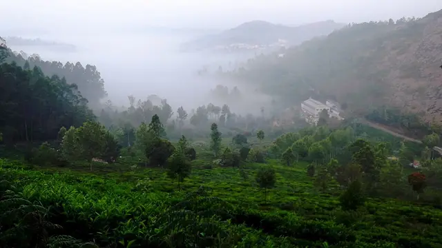
Places to Visit in Kotagiri

The oldest of the three Nilgiri hill stations and the middle one for height, on the eastern rim of the plateau — the first place in these hills the British came up to, in 1819, and the gateway to Kodanad, Catherine Falls and a Ramsar-listed shola on the town's own edge.

Kotagiri
Practical guide

Plan Kotagiri

Who's going?Tailor Kotagiri to your trip
DistrictThe Nilgiris
RoleEastern hill town
Time neededTwo nights, and Kotagiri rewards the…
Places to visit6Listed businesses9
What to expect

Highlights

  • Kodanad View Point — A viewpoint near Kotagiri overlooking the Bhavani valley and, on clear days, the plains of Kerala's Wayanad and Mysore.
  • Catherine Falls — A twin-tiered waterfall near Kotagiri, one of the tallest in the Nilgiris, formed on the Kallar river. Tamil Nadu Tourism and the district administration both say it takes its name from the wife of M.D. Cockburn, the planter credited with bringing coffee to Kotagiri, though the older form St Catherine's Falls was already in use.
  • Rangaswamy Pillar and Peak — A rock pillar and viewpoint east of Kotagiri associated with a local Rangaswamy temple legend, offering views over the Nilgiri plateau. Sources place it differently: OpenStreetMap maps the cliff at one point and Wikipedia gives another about 4.5 km further east, while Wikipedia's own text calls it 20 km from Kotagiri, which matches neither.
  • Longwood Shola — A protected shola forest reserve on Kotagiri's eastern edge, known for birdwatching and for sightings of endemic species such as the Nilgiri wood pigeon. It was designated a Ramsar Wetland of International Importance on 24 May 2023, covering 116.01 hectares.
  • Elk Falls, Kotagiri — Elk Falls, also called Uyilatty Falls after the village beside it, drops in the hills north of Kotagiri; the district administration lists it among the town's waterfalls and the usual published figure is about 7 km out. The fall itself is on no map we can read, so the marker here sits on Uyilatty village, 7.4 km from the bus stand by routed road, and not on the water.
  • John Sullivan Memorial (Kannerimukku Bungalow), Kotagiri — This restored stone bungalow at Kannerimukku near Kotagiri was one of the earliest European residences in the Nilgiris, associated with John Sullivan, the British collector who opened up the hills from 1819. It now houses a memorial and small museum on Nilgiri history run by a heritage trust, 3.4 km from the Kotagiri bus stand by routed road.
Getting there

How to visit

  • Nearest airport: Coimbatore International (CJB), 74.4 km by routed road and about an hour and twenty-five minutes — the shortest airport run of the three Nilgiri hill stations, against 88.6 km from Coonoor and 103.0 km from Ooty. Kotagiri sits on the eastern shoulder of the plateau, nearest the edge, and the ghat below it drops straight towards Mettupalayam and the Coimbatore plain. There is no closer airport and no airstrip in the Nilgiris, and the last thirty kilometres are still a ghat — but it is the gentlest of them.
  • Rail gateway: There is none, and Kotagiri is the only one of the three hill stations of which that is true. The Nilgiri Mountain Railway runs Mettupalayam–Coonoor–Udhagamandalam on the other side of the plateau and does not come near this town. The nearest station on that line is Coonoor, 21.6 km away by routed road; Mettupalayam, where the mountain line starts, is 31.5 km; and the main-line railhead is Coimbatore Junction, 71.8 km. If you want the famous train, ride it up to Coonoor and take the bus across the hill from there.
  • The bus stand is the middle of the town and the point every distance on this page is measured from, with services up the ghat from Mettupalayam and Coimbatore and across the hills to Coonoor, Ooty and the estate villages. By routed road from it: the town centre 0.6 km, Jawaharlal Nehru Park 0.7 km, Sakthi Malai Murugan temple 1.9 km, the nearest tea factory 2.1 km, the Kotagiri Medical Fellowship Hospital 2.3 km, Aravenu 3.1 km, Kannerimukku 3.3 km, the John Sullivan Memorial 3.4 km, Longwood Shola 3.4 km, Catherine Falls 7.3 km and its viewpoint 8.1 km, Uyilatty 7.4 km, Kattabettu 8.1 km, Ralliah Dam 10.7 km, Kookal 12.9 km, Kodanad View Point 17.9 km, Coonoor 21.6 km, Dolphin’s Nose 23.0 km, Doddabetta 25.1 km, Ooty 28.3 km, Mettupalayam 31.5 km, Sirumugai 38.9 km, Coimbatore Junction 71.8 km, Coimbatore airport 74.4 km, Gudalur 77.8 km. ⚠ Come up the Kotagiri ghat rather than the Coonoor one: State Highway 15 is the oldest route into these hills and has four hairpin bends where the Coonoor road has fourteen. ⚠ Rangaswamy Pillar carries no figure anywhere on this page because it stands on an unroaded ridge and no road route to it exists.

Distance by road

  • Coonoor21.6 km
  • Ooty28.3 km
  • Mettupalayam31.5 km
  • Sirumugai38.9 km
  • Coimbatore Junction71.8 km
  • Coimbatore International Airport74.4 km
  • Gudalur77.8 km
  • Tiruppur85.5 km
  • Erode Junction129.8 km
  • Kozhikode184.9 km
  • Mysuru198 km
  • Bengaluru317.7 km
  • Chennai Central532.1 km

Road distances measured on real routed roads to Kotagiri itself, not to the district headquarters, on 31 August 2026. Driving time is deliberately not published: free-flow routing badly understates these roads, so allow more than the distance suggests.

Timing

Best time to visit Kotagiri

September to November, if you can choose. The south-west monsoon has finished with this shoulder of the plateau by then, the tea is at its greenest, and the air off the eastern edge is clear enough to see down into the Bhavani valley and across to the plains — which is the whole point of Kodanad and of the ridge walks. March to June is the season the hills are built around and it is when the rooms cost most, though Kotagiri stays markedly quieter than Coonoor or Ooty in any month, which is its principal advantage over both. December to February is cold, dry and very clear, and it is the season for the walks rather than the water: Catherine Falls in February is a trickle. If the falls are what you have come for, come between June and September and expect cloud with them. One thing about this town’s weather that follows from its position rather than its height: Kotagiri sits on the eastern rim, so it catches the north-east monsoon in October and November harder than Ooty does on the far side, and it clears earlier in the morning than either of the others. Whatever the month, bring a jacket and something that sheds rain.

Weather in KotagiriSeasonal guide

Live forecast loads in your browser.

Today at Kotagiri
Sunrise6:13 am
Sunset6:33 pm
Golden hour best light5:33 pm–6:33 pm
Blue hour after sunset6:33 pm–6:58 pm
Sun sets toward compass bearingW · 279°
Moon tonight🌖 Waning gibbous · 83%
South-west monsoon. June to September is the south-west monsoon in Tamil Nadu. Expect heavy showers, mostly in bursts rather than all day — carry rain cover, allow extra time for getting around, and note that ferries and open-air sites are the first things affected.

Sun and moon are calculated for this location and shown in IST. Photography windows are the hour around sunrise and sunset; the sunset bearing is degrees clockwise from true north. Moon phase is accurate to about half a day.

The story

The story of Kotagiri

The oldest of the three Nilgiri hill stations and the one nobody stops at — the eastern shoulder of the plateau, where the British first came up in 1819 and where the mountain railway never arrived.

Kotagiri is the hill station the Nilgiris started with and then walked away from. John Sullivan came up here in 1819, before there was anything at Ootacamund but downland and Toda hamlets, and what he found at Dhimbatty and Kannerimukku on this eastern shoulder was the thing the East India Company had sent him to look for: a temperate climate inside the tropics. The house he built at Kannerimukku still stands. Within a few years the capital of the whole enterprise had moved fourteen miles west to Ooty, the railway when it came went up the other side of the mountain, and Kotagiri settled into being what it still is — a working tea town of twenty-eight thousand people that happens to have the oldest history and the best view in the district.

It is worth being clear about what this town is and is not, because a great deal of what is written about it is wrong. It is the oldest of the three hill stations. It is not the highest: Ooty stands at 2,240 metres, Kotagiri at about 1,950, and Coonoor lowest at about 1,850, so Kotagiri is the middle one. Its own elevation is argued over by everyone who publishes it — English Wikipedia says 1,950 metres, a Kotagiri resort’s own site says 1,847, and 1,793 is printed too, a spread of more than a hundred and fifty metres. We print the range and invent nothing between them. And it is not a municipality, whatever the encyclopedias say: the district administration lists Kotagiri among its town panchayats, and its municipalities are Gudalur, Nelliyalam, Coonoor and Udhagamandalam.

The name says who was here first. Kota-giri is the mountains of the Kotas, one of the indigenous peoples of these hills, and older records write it Kota-keri or Kota-gherry, the street of the Kotas. The Kotas were the artisan community of the Nilgiri economy — smiths, potters and musicians — in a set of relationships that also involved the Todas with their buffaloes, the Kurumbas in the forest below and the Badagas on the plateau. That arrangement predates every road on this page by a very long way, and the town’s name is the last public trace of it.

The centre is small and it is on a hill, and everything worth walking to is uphill from the bus stand. The town centre is 527 metres away and about six minutes; St Mary’s Church is 465 metres, Jawaharlal Nehru Park 790, and past those the walks become real ones — the nearest tea factory 1.6 km, Kannerimukku 2.9 km and thirty-five minutes, Sullivan’s house 3.0 km, and Longwood Shola 3.9 km and rather under an hour. Beyond the shola the town gives out into estate country, and the roads to the falls and the viewpoints become single-track between tea slopes.

What the place lives on is tea, and it lives on it differently from Coonoor. Coonoor is the trade’s administrative centre, with the auction and the association and the co-operative headquarters. Kotagiri is where a good deal of the leaf is actually grown, on smallholdings rather than estates, on a shoulder of hill that runs down steeply to the east. The slopes you can see from anywhere in the town are somebody’s two acres more often than they are a company’s two hundred, and the difference shows in the town: no colonial club culture to speak of, no grand hotels, a bazaar that serves growers rather than visitors.

The other thing this small town does is out of all proportion to its size, and it is the reason a certain kind of traveller comes here specifically. Since 1993 Kotagiri has been the headquarters of the Keystone Foundation, which began by surveying honey hunters and beekeepers in these hills and asking why the people who gathered the forest’s produce got so little for it. What grew out of that is a cluster of things on one road: the first Green Shop, selling wild honey and forest produce direct; Last Forest Enterprises, incorporated in 2010 to take that produce to market; the Nilgiri Natural History Society, founded in 2009; a community radio station, Radio Kotagiri on 90.4 MHz; and Aadhimalai Pazhangudiyinar, a producer company registered in 2013 that is owned and run by tribal producers themselves and that won the United Nations Development Programme’s Equator Prize in 2021.

And then there is the forest on the edge of town, which is the single most surprising thing about Kotagiri. Longwood Shola is 116 hectares of montane forest that begins three and a half kilometres from the bus stand, and on 24 May 2023 it was designated a Ramsar Wetland of International Importance — site number 2538 on a list that mostly contains lakes, marshes and estuaries. It is there because a shola is a wetland in the way that matters: it holds water and lets it out slowly, and this one supplies eighteen villages. It is the only major piece of natural shola left anywhere near this town, and it is small enough to walk across in a morning.

The last thing to understand about Kotagiri is where it sits. Coonoor and Ooty are inside the plateau and look across it. Kotagiri is on the rim, and it looks out and down. Seventeen kilometres east of the bus stand the ground simply ends at Kodanad and drops into the Bhavani valley, with the Moyar country and then the plains beyond; and the road below the town, State Highway 15, is the oldest way into these hills and has four hairpin bends where the Coonoor road has fourteen. Everything about arriving here is easier than arriving at the other two, and almost nobody does it.

Legend & myth

The rock east of the town carries the story the town’s eastern skyline is named for. Rangaswamy Pillar is a column of stone standing clear of the ridge, and the peak beside it is held locally to be the seat of the god Rangaswamy, who is said in the local telling to have quarrelled with his wife and moved here from the plains below, leaving the pillar as the mark of it. Pilgrims have long climbed to the peak, and the story is told here as story. What is not in dispute is that the two features are there, that they stand on an unroaded ridge, and that our own record for them was more than twelve kilometres wrong until this page was measured.

The waterfall’s name is a smaller argument and a more documentable one. Catherine Falls is generally said to commemorate the wife of M.D. Cockburn, the planter credited with introducing coffee to Kotagiri — that is what Tamil Nadu Tourism and the district administration both publish. Against that, the form St Catherine’s Falls appears to have been in use before the Cockburn story attached to it. We print both and resolve neither, because there is no source that settles it.

The bungalow at Kannerimukku is named for a stone rather than a person. Pethakal, the name the house has always carried, refers to a sacred stone that stood on the site before the house did — which is a small, ordinary and rather telling detail about how the first European building in these hills came to be where it is. It was not put on an empty spot.

More about Kotagiri

History

The Nilgiris entered British records in 1818 and 1819, and the entry point was here. In 1818 two assistants to the Collector of Coimbatore, Whish and Kindersley, came upon Kotagiri in the country below the Rangaswamy peak. In 1819 the Collector himself, John Sullivan, came up to see what lay behind what the Company’s order called the fabulous tales circulated concerning the Blue Mountains, and arrived at a village called Dhimbatty, north of the present town. He reported to the Board of Revenue on 31 July 1819. What he described was a temperate plateau inside the tropics, and what he proposed was a sanatorium.

Sullivan built here before he built anywhere else in the hills. The house at Kannerimukku — known as the Pethakal bungalow, after a sacred stone on the site — went up in 1819 and is generally reckoned the first European residence in the Nilgiris. It still stands, three and a half kilometres from the modern bus stand. He also began work on a road from Sirumugai, below the hills near Mettupalayam, up to Dhimbatty; that line is roughly what State Highway 15 still follows, which is why the Kotagiri ghat is described as the oldest route into the district.

Then the centre of gravity moved. In 1822 Sullivan built Stone House at Ootacamund — Kal Bangala to the Todas he bought the land from — and dammed the marshy valley there to make the lake in 1824. Ooty became the summer capital of the Madras Presidency; Coonoor got the railway, which reached it on 15 June 1899 and Ooty on 15 October 1908. Kotagiri got neither. It kept the first house, the oldest road and the original claim, and it lost the traffic — which is the whole reason it is the quietest of the three today.

The Nilgiris was constituted a district in its own right on 1 February 1882. Kotagiri became the headquarters of one of its taluks and one of its four panchayat unions, and a town panchayat rather than a municipality — the status it still holds. At the 2011 census the town had 28,207 people, 13,607 men and 14,600 women, a literacy rate of 86.79% against the state’s 80.09%, and 1,073 women for every 1,000 men, a ratio well above the state average of 996.

The planters left one institution behind. The NPA Centenary Polytechnic College was established in 1991 by a charitable trust formed by the Nilgiri Planters’ Association to mark its own hundredth year; it is a government-aided institution offering three-year engineering diplomas, and it sits alongside a District Institute of Education and Training that trains the district’s teachers. For a town of this size that is an unusual amount of tertiary education.

The most recent history here is conservation history rather than colonial history. Keystone Foundation was registered as a trust in Pondicherry in 1993 and moved its headquarters to Kotagiri soon after, beginning its surveys of bees, honey hunters and beekeepers on 1 April of that year with permissions from the Khadi and Village Industries Board. The Green Shop followed, then the Nilgiri Natural History Society in 2009, Last Forest Enterprises in 2010, and Aadhimalai in 2013 — first with fourteen shareholders drawn from the communities, later 1,609, later still 1,809. In 2021 Aadhimalai won the UNDP Equator Prize. And in 2023 the forest at the end of the road was added to the Ramsar list.

Why visit

For the oldest claim in the Nilgiris, still standing three and a half kilometres from the bus stand. Sullivan’s house at Kannerimukku went up in 1819, before Ooty existed, and it is now a small museum and documentation centre rather than a ruin or a plaque.

For a Ramsar site you can walk to. Longwood Shola was added to the international list on 24 May 2023 — 116 hectares of montane forest with 177 recorded bird species, fourteen of them endemic to the Western Ghats, and a frog described from the site itself. It is under an hour on foot from the town, and there is nothing else like it that close to any town in these hills.

For Kodanad, which is the best view in the district and not a close-run thing. The plateau ends and drops into the Bhavani valley, and on a clear morning after the monsoon you can see a very long way east.

For the road. State Highway 15 up from Mettupalayam is the oldest route into the Nilgiris, roughly Sullivan’s own line, and it has four hairpin bends against the Coonoor road’s fourteen. If hill roads make you ill, this is the way to come up.

For being twenty minutes from Coonoor and forty from Ooty while costing less and being emptier than either, and for being the closest of the three to an airport by a comfortable margin.

And for the reason people who know the Nilgiris well come here specifically: a small town that has spent thirty years working out how the people who live in a biosphere reserve can make a living from it, and that you can walk into on a Tuesday morning and buy honey from.

Before you go

Kotagiri — at a glance

HoursThe town keeps no hours; two places on this page do. The John Sullivan Memorial at Kannerimukku, 3.4 km out, is a trust-run museum and keeps museum hours rather than daylight ones — the published times are ten in the morning to five in the evening, and it is worth a telephone call before making the trip because a small trust-run house is not a government office and does not always keep to a timetable. Keystone Foundation’s campus on Groves Hill Road, which is the other thing in this town people come specifically to see, publishes 9.30 to 5.30, Monday to Friday. Everything else — the shola, the falls, the viewpoints — runs on daylight, and daylight here is the real constraint: the cloud comes up the eastern slope in the afternoon and a viewpoint that was clear at nine can be inside a cloud by two.

Entry: Nothing to enter the town, and this is the cheapest of the three Nilgiri hill stations to be in — there is no botanical garden charging at a turnstile, no boat house and no summit enclosure. What costs money is the museum at the John Sullivan Memorial, which is trust-run and takes a small charge at the door, and the parking and viewing fees collected at Kodanad. Deliberately not printed here: the figures. Every ticket in this district is revised without notice and the travel sites carry three different numbers for the same gate, and we would rather you asked at the counter than budgeted from something stale. The thing to plan for is not a charge at all. The Nilgiris has banned nineteen categories of single-use plastic since the district gazette of May 2018, and the Madras High Court has added water cans and soft-drink bottles of one to four litres. It is enforced at check posts on the roads into the district, and every vehicle coming up the Kotagiri ghat is inspected; banned items are seized and a fine is charged. Bring a refillable bottle.

Getting here

How to reach Kotagiri

  • ✈︎ By air Coimbatore International (CJB), 74.4 km by routed road from the bus stand and about an hour and twenty-five minutes. That is the shortest run to an aircraft from any of the three Nilgiri hill stations — fourteen kilometres closer than Coonoor and nearly thirty closer than Ooty — and the reason is geography rather than luck: Kotagiri sits on the eastern shoulder of the plateau, nearest the edge, and the ghat below it drops straight towards Mettupalayam and the Coimbatore plain. There is no closer airport and no airstrip anywhere in the Nilgiris. The last thirty kilometres are still a ghat, so this is not a road that can be driven at plains speeds, but it is the gentlest of the ghats and that matters more than the distance.
  • 🚆︎ By train There is none, and Kotagiri is the only one of the three hill stations of which that is true. The Nilgiri Mountain Railway climbs from Mettupalayam to Coonoor and on to Udhagamandalam and it does not come near this town; the nearest station on the line is Coonoor, 21.6 km away by road, and the nearest station of any kind on the plains is Mettupalayam at 31.5 km, where the mountain line begins. For arriving rather than sightseeing the main-line railhead is Coimbatore Junction, 71.8 km. If you want the famous train, the sensible arrangement is to ride it up to Coonoor and take the bus across the hill from there; if you simply want to arrive, come to Mettupalayam or Coimbatore and take the road, which is quicker and considerably less trouble.
  • 🚗︎ By road This is the road worth choosing rather than the one you end up on, and almost nobody knows it. The Kotagiri ghat is State Highway 15, it is the oldest route into these hills, it roughly follows the line John Sullivan took on his journeys of 1819 — and it has FOUR hairpin bends. The Coonoor ghat, which is what nearly all traffic uses, has fourteen. Wikipedia gives the Kotagiri ghat as 33 km from Mettupalayam; routed from the bus stand it is 31.5. The same source records that its surface has been in better condition than the Coonoor road and that it is statistically less prone to landslip, and that in the high season the district runs the two as a one-way pair — up the hill by Coonoor, down it by Kotagiri. Beyond that: Coonoor 21.6 km and about twenty minutes, Ooty 28.3 km and about forty, Sirumugai 38.9 km, Coimbatore Junction 71.8 km and about an hour and ten, the airport 74.4 km, Gudalur 77.8 km, Kozhikode 184.9 km, Mysuru 198.0 km, Bengaluru 317.7 km, Chennai 532.1 km. Inside the hills the numbers collapse and the times do not — Sakthi Malai Murugan temple is 1.9 km, the Sterling tea factory 2.1 km, Kannerimukku 3.3 km, the John Sullivan Memorial 3.4 km, Longwood Shola 3.4 km, Catherine Falls 7.3 km and its viewpoint 8.1 km, Uyilatty 7.4 km, Kattabettu 8.1 km, Ralliah Dam 10.7 km, Kookal 12.9 km, Kodanad 17.9 km, Dolphin’s Nose 23.0 km, Doddabetta 25.1 km.
  • 🚌︎ By bus The bus is how nearly everyone arrives, and the stand is the middle of the town — the town centre is 527 metres from it and you can walk to a room with a bag. Services run up the ghat from Mettupalayam and Coimbatore, across the hill from Coonoor and Ooty, and out to the estate villages on the plateau. Two things to plan for, and the first is the good news. The Mettupalayam–Kotagiri climb is the easiest ghat in the district: four hairpin bends against the Coonoor road’s fourteen, so if travel sickness is the thing that spoils hill journeys for you, this is the side of the mountain to come up. Take a daylight departure anyway, for the view rather than the road. The second is that the local services out to the villages and the viewpoints thin out sharply in the afternoon; Kodanad is 17.9 km each way and getting back from it after four is a taxi, not a bus.
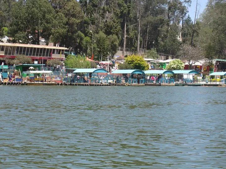
  • ⛴︎ By boat None. There is no lake at Kotagiri and no water here goes anywhere — the streams off this shoulder of the plateau fall east into the Bhavani and the Moyar, several hundred metres below the town.
Getting around

Getting around Kotagiri

Walk the town, hire something for the rest, and remember you are on a slope. From the bus stand the town centre is 527 metres and about six minutes, the government hospital 173 metres, St Mary’s Church 465 metres, Jawaharlal Nehru Park 790 metres. Past that the walks get real: the Sterling tea factory is 1.6 km and about twenty minutes on foot, Donnington 2.0 km and twenty-five, Kannerimukku 2.9 km and thirty-five, the John Sullivan Memorial 3.0 km and about thirty-six minutes, and Longwood Shola 3.9 km and rather under an hour. Every one of those is uphill on the way out and pleasant on the way back, which is the standard Nilgiri arrangement — take an auto up and walk down. Everything beyond Longwood is a car or a share-jeep: Catherine Falls, Uyilatty, Kodanad and Ralliah are half-day arrangements agreed at the stand or through a hotel. Autos work in the town and are plentiful at the stand; there are auto stands at Donnington and on the Ooty road as well.

  • 🚕︎ Online taxis Do not build a plan on an app. We have no evidence from any primary source of reliable app-cab supply in Kotagiri, and a town landing page on an operator’s website is marketing rather than proof that a driver will accept at seven in the morning on an estate road. What is certain is the offline trade: a taxi and auto stand at the bus stand, hotels and homestays arranging cars by the half day, and share-jeeps out to the estate villages and the tribal hamlets. Fares are agreed before you get in and there are no meters. We print no fares, because there is no notified tariff for this district that we can source.
Do

Things to do in Kotagiri

  • Walk into Longwood Shola, 3.4 km out by road or about fifty minutes on foot — and understand what you are walking into. This 116.01-hectare patch of montane forest on the town’s eastern edge was designated a Ramsar Wetland of International Importance on 24 May 2023 as site number 2538, and it is the only major piece of natural shola left anywhere near Kotagiri. The official information sheet records 177 bird species in it, of which fourteen are endemic to the Western Ghats and seven are on the IUCN threatened list, along with 44 amphibians and reptiles, 78 butterflies and 19 dragonflies. A frog new to science, Nyctibatrachus indraneili, was described from this forest. It supplies water to eighteen villages and it is watched over by a committee of local residents.
  • Go out to Kodanad, 17.9 km east and about eighteen minutes, for the view the town exists to give. The plateau ends here and falls away into the Bhavani valley, with the Moyar country and the plains beyond it; on a clear morning after the monsoon the horizon runs a very long way. Note that our own pin for this viewpoint was more than nine kilometres wrong until this page was measured, and so are a good many published ones — it is east-north-east of the town, not west of it.
  • See Catherine Falls, 7.3 km out, with the viewpoint above it at 8.1 km. It falls in two steps on the Kallar river and the combined drop is about 76 metres, which makes the upper fall the second highest in the Nilgiris. Its name is a small argument: Tamil Nadu Tourism and the district administration both say it commemorates the wife of M.D. Cockburn, the planter credited with bringing coffee to Kotagiri, while the older form St Catherine’s Falls was already in use before that story. We print both and settle neither.
  • Visit the John Sullivan Memorial at Kannerimukku, 3.4 km out — the Pethakal bungalow, one of the earliest European houses in these hills, built by the Collector of Coimbatore who came up in 1819, reported a temperate climate inside the tropics, and changed what the British did with the Nilgiris. It was restored in 2002 and now houses the Nilgiris Documentation Centre and a small museum on the district’s history and its indigenous peoples. Published hours are ten to five; telephone first.
  • Spend an hour on Groves Hill Road with the organisations that have made this small town matter out of proportion to its size. Keystone Foundation, registered in 1993 and headquartered here, began by surveying honey hunters and beekeepers in the Nilgiris; it opened the first Green Shop for wild and organic forest produce, founded Last Forest Enterprises in 2010 and the Nilgiri Natural History Society in 2009, and launched Radio Kotagiri on 90.4 MHz. Aadhimalai Pazhangudiyinar, the producer company that grew out of that work, is owned and run by tribal producers themselves and won the UNDP Equator Prize in 2021.
  • Buy from the Green Shop rather than from a stall. The first one opened in Kotagiri and there are now three in the hills, one each here, in Coonoor and in Ooty, selling wild honey, beeswax, pepper, millets, coffee and forest produce bought from indigenous gatherers at prices the producers set. This is the rare souvenir where the money demonstrably goes back up the hill.
  • Walk out to Kannerimukku through the tea, 2.9 km and about thirty-five minutes on foot. It is the best short walk from the town: estate road most of the way, a village at the end of it, and Sullivan’s house a few hundred metres beyond that. Do it in the morning and take an auto back.
  • Take the Kotagiri ghat at least once, in daylight, whichever way you are travelling. State Highway 15 is the oldest road into the Nilgiris, it approximately follows the route Sullivan took in 1819, and it has four hairpin bends where the Coonoor road has fourteen. It is 31.5 km down to Mettupalayam by our routing and 33 km by Wikipedia’s, and it is the pleasantest arrival into these hills that exists.
  • Drive up to Ralliah Dam, 10.7 km out on the Kattabettu road — a 1914 catchment that still supplies drinking water to both Coonoor and Kotagiri, ringed by eucalyptus and almost never busy. It is shared with Coonoor, which is 11.4 km from it on the other side, and it is quieter from this direction.
  • Use Kotagiri as the base and take the other two as day trips. Coonoor is 21.6 km and about twenty minutes; Ooty is 28.3 km and about forty. The rooms here cost less, the town is quieter than either, and the airport is closer than from either — which is a better arrangement than the reverse and almost nobody uses it.
Plan

Good to know

  • Come up the Kotagiri ghat, not the Coonoor one. State Highway 15 has four hairpin bends where the Coonoor road has fourteen, it is the oldest route into the hills, and it is statistically less prone to landslip. If hill roads make you ill, this is the side of the mountain to use — and in the high season the district itself sends downhill traffic this way.
  • Kotagiri is the closest of the three hill stations to an aeroplane. The airport is 74.4 km against Coonoor’s 88.6 and Ooty’s 103.0, and Coimbatore Junction is 71.8 km against 86.0 and 100.3. If you are flying in and out, this is the cheapest hill station in the district to reach and the least tiring to leave.
  • Do Kodanad as its own trip and go in the morning. It is 17.9 km east and the cloud comes up that slope in the afternoon; a viewpoint that was clear at nine is often inside a cloud by two, and the last buses back thin out early.
  • Do not do Kodanad and Catherine Falls as one outing. They are on different roads out of the town — the falls 7.3 km south-west towards the Mettupalayam ghat, Kodanad 17.9 km east — and combining them means driving through the town twice.
  • Longwood Shola is a protected Ramsar site three and a half kilometres from the bus stand, not a park. It has no gate, no ticket and no facilities; go in the morning, take nothing in with you, and leave nothing behind. It is also the best birdwatching within walking distance of any town in the Nilgiris.
  • Bring a refillable bottle and no plastic. Nineteen categories of single-use plastic are banned across the Nilgiris, along with one-to-four-litre water cans and soft-drink bottles under a Madras High Court direction, and vehicles are checked at the district boundary below the town.
  • Telephone the Sullivan Memorial before going. It is a small trust-run house rather than a government museum, its published hours are ten to five, and a wasted seven-kilometre round trip is an annoying way to spend a morning.
  • Catherine Falls has a season and it is not the dry one. Between December and March it is a thread of water; if the falls are the reason you are coming, come between June and September and accept the cloud that comes with them.
Facilities

On site

  • Kotagiri bus stand, in the centre of town — the anchor for every distance on this page, with services up the ghat from Mettupalayam and Coimbatore and across the hills to Coonoor, Ooty and the estate villages
  • No railway station: the Nilgiri Mountain Railway does not reach Kotagiri, and the nearest platform on it is Coonoor, 21.6 km away
  • Government Hospital, Kotagiri, 173 metres from the bus stand, with the Kotagiri Medical Fellowship Hospital 2.3 km out and private clinics and pharmacies through the bazaar
  • Jawaharlal Nehru Park, 790 metres on foot — a public garden rather than a ticketed one, and the site of the annual vegetable show that opens the Nilgiris summer festival
  • The Green Shop on Groves Hill Road, selling wild honey and forest produce bought from indigenous gatherers, with the Keystone Foundation campus on the same road, open 9.30 to 5.30 Monday to Friday
  • Taxi and auto stands at the bus stand, at Donnington and on the Ooty road, plus share-jeeps to the estate villages; no meters, agree the fare before you travel
  • Working tea factories on the town’s edge, the nearest 2.1 km out; and the NPA Centenary Polytechnic College, founded in 1991 by the Nilgiri Planters’ Association to mark its centenary
Stay safe

Safety

  • The ghat roads are the risk, not the town — and the Kotagiri ghat is the mildest of them. Four hairpin bends, a better surface than the Coonoor road and less landslip history, but it is still a ghat: drive it in daylight, let the buses past, and do not attempt it in heavy rain if you can wait.
  • Kodanad is an escarpment edge with a drop of several hundred metres and only partial railings. Stay behind the parapet where there is one and off the wet rock where there is not; the surface there is often greasy with cloud even when it is not raining.
  • Catherine Falls kills people. The rock around it is smooth and the water is fast after rain, several deaths have led to access being restricted at various times, and the viewpoint above it exists precisely so that you do not have to stand at the lip. Look from the viewpoint.
  • Gaur come onto the estate roads, the tea slopes and the town’s edges, particularly around Longwood Shola at dawn and dusk. An Indian bison that feels crowded is dangerous; do not approach one for a photograph, and give it the whole road.
  • Leeches are common in Longwood Shola and on every shola path during and after the monsoon. Socks and closed shoes, and check your ankles afterwards.
  • Elk Falls is not somewhere to go looking for on your own. It is not mapped, the approach is unsignposted, access has been restricted after accidents, and the honest position is that we cannot tell you where it is — only which village it is named after.
Getting around Kotagiri

We have not assessed physical access at this place yet. Across India, step-free routes, handrails and accessible toilets are the exception rather than the rule, and pavements are often interrupted — if step-free access matters to you, contact the site or a local operator before committing to the trip.

If you need help at Kotagiri
112All emergencies (police · fire · medical)The single number to call in any emergency (ERSS).

Emergency numbers are verified against official government and state tourism sources. 112 works anywhere in India.

Practical things near Kotagiri
What the cash actually costs
  • Withdrawing from a bank that is not your own is free for a set number of times a month, then costs up to ₹23 plus GST — about ₹27 a withdrawal. This is not one of the RBI’s six metro centres, so the allowance here is the higher one: at least five free other-bank withdrawals a month, and at least five at your own bank.
  • That free allowance belongs to Indian bank accounts. On a card issued abroad your own bank’s international withdrawal and exchange charges apply instead. If the machine offers to bill you in your home currency, choose rupees — the conversion rate on that offer is set by the machine, not by your bank.
  • Given a choice, use an ATM inside or attached to a branch: it sits in view of staff and cameras, and there is someone to ask if the machine keeps your card. A machine standing alone on a tourist street is the one to be wary of. Banks are listed here alongside the ATMs, but the map data does not record which ATMs sit inside a branch — check when you get there.

Charge cap and free-transaction limits: Reserve Bank of India, in force since 1 May 2025.

Mapped within about 1.2 km of Kotagiri, with real walking routes rather than straight-line distances. Community-mapped data: opening hours are shown only where they are recorded, and this is not a complete list — something unmapped may well be closer. Please confirm on the ground.

Nearby bases

Where to go from Kotagiri

Ooty Lake, OotyFeatured: Ooty Lake
Town / base

Ooty

The Nilgiris capital and queen of hill stations, base for the botanical gardens, Ooty Lake, Doddabetta and the toy train.

Ooty LakeGovernment Botanical Garden, OotyDoddabetta PeakGovernment Rose Garden, Ooty
Open Ooty guide →
Coonoor, CoonoorTea-country town
Town / base

Coonoor

Quieter second hill station below Ooty, ringed by tea estates and viewpoints like Dolphin's Nose and Lamb's Rock.

Nilgiri Mountain RailwayCoonoor railway stationSim's ParkPasteur Institute of India, Coonoor
Open Coonoor guide →
Masinagudi, MasinagudiWildlife village
Town / base

Masinagudi

The village on the Sigur plateau below the hill stations, at the edge of Mudumalai — the base for the tiger reserve, the Theppakadu elephant camp and the elephant country of the Moyar valley, and the foot of the Kalhatti ghat up to Ooty.

Theppakadu Elephant CampMudumalai National ParkMaravakandy DamMoyar Falls
Open Masinagudi guide →
Needle Rock View Point, GudalurFeatured: Needle Rock View Point
Town / base

Gudalur

The municipality at the western door of the Nilgiris, where the plateau breaks and the road drops into Kerala — a Tamil Nadu town that speaks mostly Malayalam, sitting between the Mudumalai forest, the old Wynaad gold country around Devala and the cinchona slopes of Naduvattam.

Needle Rock View PointFrog Hill View PointNadugani GhatNaduvattam
Open Gudalur guide →
Stone House, Ooty, KettiFeatured: Stone House, Ooty
Town / base

Ketti

The village in the Ketti valley on the road between Ooty and Coonoor, looked down on from the Ketti Valley view point and passed by the mountain railway.

Wax World Museum, OotyStone House, OotyDeer Park, OotyElk Hill Murugan Temple, Ooty
Open Ketti guide →
Wellington, WellingtonCantonment town
Town / base

Wellington

An army cantonment of about twenty thousand people three kilometres above Coonoor, governed by a board under the Ministry of Defence rather than by a municipality, and home to the Madras Regimental Centre and the Defence Services Staff College. It has no bus stand: its station on the Nilgiri Mountain Railway is the way in.

Wellington railway stationWellington CantonmentMadras Regiment War MemorialSt. George's Garrison Church, Wellington
Open Wellington guide →
Mukurthi National Park, KundahFeatured: Mukurthi National Park
Town / base

Kundah

The high, empty western end of the plateau, a country of hydro-electric reservoirs — Upper Bhavani, Parsons Valley, Porthimund — and the Sispara pass over into Kerala, most of it needing Forest Department permission to enter.

Mukurthi National ParkSispara PassBangitappalUpper Bhavani Reservoir
Open Kundah guide →
Stay · eat · do · rent · see · shop

Places in Kotagiri

Every verified place in Kotagiri — filter by what you’re after.

2 things to do in Kotagiri

K
Keystone Foundation
Things to do
Top pick
Conservation organisation
Keystone Foundation

The organisation that has done more than anything else to make this small town matter, headquartered on Groves Hill Road since the 1990s. Its campus is open to visitors on weekdays and it publishes its own visiting hours.

Commission-freeView details
N
Nilgiri Natural History Society
Things to do
Natural history society
Nilgiri Natural History Society

A natural history society founded in Kotagiri in 2009 to tell the story of the Nilgiri Biosphere Reserve through field learning rather than display cases. It runs conservation education, film festivals and field programmes across the hills.

Commission-freeView details

Book with the place itself. India’s cyber-crime coordination centre warned in April 2025 that convincing copies of hotel and pilgrimage booking sites are being pushed through sponsored search and social ads, taking payment for rooms the property never hears about. Every listing here links to the business’s own contact details and its own Google or Bing profile — we take no commission and sit in nobody’s payment path. If a booking page reached you through an ad, check the address bar against the property’s own site before you pay. Fraud can be reported on cybercrime.gov.in or on 1930.

Ranked

The best of Kotagiri, ranked

Nearest to the centre of Kotagiri, on foot

Ordered by a real routed walk from the town centre — a different question, and the one that decides what you can do before lunch. Straight-line distance understates a real walk by about half again, so these are walking-network figures, not lines on a map.

  • Kotagiri town centre527 m · 6 min
  • Jawaharlal Nehru Park790 m · 9 min
  • Sterling Tea Factory1.6 km · 19 min
  • Donnington2.0 km · 25 min
  • Kannerimukku2.9 km · 35 min
  • John Sullivan Memorial (Kannerimukku Bungalow), Kotagiri3.0 km · 36 min

Everything around Kotagiri, by distance

Every place we hold for Kotagiri, ordered by a real routed drive from the town centre. Times are free-flow and a real road rarely is, so read them as the floor rather than the estimate — anything that routed over ninety minutes is left out rather than published as a number we do not trust.

  • Kotagiri town centre0.6 km · 1 min
  • Jawaharlal Nehru Park0.7 km · 1 min
  • Sakthi Malai Murugan Temple1.9 km · 5 min
  • Sterling Tea Factory2.1 km · 3 min
  • Aravenu3.1 km · 4 min
  • Kannerimukku3.3 km · 4 min
  • John Sullivan Memorial (Kannerimukku Bungalow), Kotagiri3.4 km · 4 min
  • Longwood Shola3.4 km · 4 min
  • Catherine Falls7.3 km · 12 min
  • Elk Falls, Kotagiri7.4 km · 9 min
  • Catherine Falls view point8.1 km · 12 min
  • Kattabettu8.1 km · 8 min
  • Ralliah Dam10.7 km · 12 min
  • Kookal12.9 km · 14 min
  • Kodanad View Point17.9 km · 18 min
  • Coonoor21.6 km · 21 min
  • Dolphin's Nose, Coonoor23 km · 29 min
  • Doddabetta25.1 km · 35 min
  • Ooty28.3 km · 38 min
  • Mettupalayam31.5 km · 31 min
Places to visit

The places themselves, around Kotagiri

The best tourist places to visit in Kotagiri — temples, viewpoints, lakes, heritage and nature, each with a full guide, how to reach it and what to see nearby.

Kodanad View Point, Kotagiri
PlaceKodanad View Point

A viewpoint near Kotagiri overlooking the Bhavani valley and, on clear days, the plains of Kerala's Wayanad and Mysore.

Open guide →
Catherine Falls, Kotagiri
PlaceCatherine Falls

A twin-tiered waterfall near Kotagiri, one of the tallest in the Nilgiris, formed on the Kallar river. Tamil Nadu Tourism and the district administration both say it takes its name from the wife of M.D. Cockburn, the planter credited with bringing coffee to Kotagiri, though the older form St Catherine's Falls was already in use.

Open guide →
Rangaswamy Pillar and Peak, Kotagiri
PlaceRangaswamy Pillar and Peak

A rock pillar and viewpoint east of Kotagiri associated with a local Rangaswamy temple legend, offering views over the Nilgiri plateau. Sources place it differently: OpenStreetMap maps the cliff at one point and Wikipedia gives another about 4.5 km further east, while Wikipedia's own text calls it 20 km from Kotagiri, which matches neither.

Open guide →
Longwood Shola, Kotagiri
PlaceLongwood Shola

A protected shola forest reserve on Kotagiri's eastern edge, known for birdwatching and for sightings of endemic species such as the Nilgiri wood pigeon. It was designated a Ramsar Wetland of International Importance on 24 May 2023, covering 116.01 hectares.

Open guide →
Elk Falls, Kotagiri, Kotagiri
PlaceElk Falls, Kotagiri

Elk Falls, also called Uyilatty Falls after the village beside it, drops in the hills north of Kotagiri; the district administration lists it among the town's waterfalls and the usual published figure is about 7 km out. The fall itself is on no map we can read, so the marker here sits on Uyilatty village, 7.4 km from the bus stand by routed road, and not on the water.

Open guide →
John Sullivan Memorial (Kannerimukku Bungalow), Kotagiri, Kotagiri
PlaceJohn Sullivan Memorial (Kannerimukku Bungalow), Kotagiri

This restored stone bungalow at Kannerimukku near Kotagiri was one of the earliest European residences in the Nilgiris, associated with John Sullivan, the British collector who opened up the hills from 1819. It now houses a memorial and small museum on Nilgiri history run by a heritage trust, 3.4 km from the Kotagiri bus stand by routed road.

Open guide →
For hotels, homestays and local businesses

Get listed in Kotagiri for free

Roampedia is commission-free. Travellers discover your business, book directly and contact you through official details. Basic listings are free, while Gold and Platinum package upgrades can be requested from the owner dashboard after approval.

List your business — free
Ranked guide modules

Top Kotagiri experiences

5 picks

The places that sit in and around Kotagiri itself, each with its own guide page.

Kodanad View Point, Kotagiri#1
Kotagiri · viewpoint

Kodanad View Point

The best view in the district, 17.9 km east and about eighteen minutes: the plateau ends and falls into the Bhavani valley, with the Moyar country and the plains beyond. Go first thing — the cloud comes up that slope by early afternoon and the buses back thin out. Our stored pin for it was 9.4 km wrong until this page was measured.

KotagiriviewpointThe Nilgiris
Catherine Falls, Kotagiri#2
Kotagiri · waterfall

Catherine Falls

Two steps on the Kallar river 7.3 km from the town, with a combined drop of about 76 metres that makes the upper fall the second highest in the Nilgiris, and a viewpoint above it at 8.1 km. The state and the district both say it is named for the wife of the planter M.D. Cockburn; the older form St Catherine’s Falls was in use before that story. Look from the viewpoint — people have died at the lip.

KotagiriwaterfallThe Nilgiris
Longwood Shola, Kotagiri#3
Kotagiri · park

Longwood Shola

A Ramsar Wetland of International Importance three and a half kilometres from the bus stand — site 2538, designated 24 May 2023, 116.01 hectares, and the only major piece of natural shola left near this town. The official sheet counts 177 bird species in it, fourteen endemic to the Western Ghats, along with 44 amphibians and reptiles and 78 butterflies; a frog new to science was described here. It supplies water to eighteen villages. Our pin for it sat outside its own mapped boundary until this page was measured.

KotagiriparkThe Nilgiris
E
Elk Falls, Kotagiri
Place
#4
Kotagiri · heritage

Elk Falls, Kotagiri

The honest entry on this rail. Elk Falls, or Uyilatty Falls, is listed by the district among Kotagiri’s waterfalls and usually published as about 7 km out — but it is on no map we can read: no OpenStreetMap feature, no Wikidata item, no geotagged photograph. The 7.4 km here is routed to Uyilatty, the village it is named after. Access has been restricted after accidents, so this is not one to go hunting for alone.

KotagiriheritageThe Nilgiris
John Sullivan Memorial (Kannerimukku Bungalow), Kotagiri, Kotagiri#5
Kotagiri · heritage

John Sullivan Memorial (Kannerimukku Bungalow), Kotagiri

The Pethakal bungalow at Kannerimukku, 3.4 km out, built in 1819 and generally reckoned the first European house in the Nilgiris — three years before Sullivan built Stone House at Ooty. Restored in 2002, it now holds the Nilgiris Documentation Centre and a small museum on the district and its indigenous peoples. Published hours are ten to five; telephone before making the trip.

KotagiriheritageThe Nilgiris
Read before you go

Kotagiri guides, stories & itineraries

Stories & history of Kotagiri

Written about Kotagiri itself — its history, its legends and the arguments about them.

Nearby in The Nilgiris

Wider reading from The Nilgiris. The stories about Kotagiri itself are above.

Tamil Nadu-wide guides & itineraries

Route-level itineraries and practical guides for the rest of the state.

See all 11 The Nilgiris guides & stories →

Map

Where things are in Kotagiri

FAQ

Kotagiri travel FAQs

Is Kotagiri the highest of the three Nilgiri hill stations?

No, and it is worth correcting because the claim is everywhere, including on this site until this page was written. Ooty is the highest at 2,240 metres. Kotagiri is the middle one at about 1,950 metres, and Coonoor is the lowest at about 1,850. What Kotagiri genuinely is, is the OLDEST — the first place in these hills the British reached and reported on, in 1819, three years before Sullivan built Stone House at Ootacamund. Kotagiri’s own elevation is itself contested three ways: English Wikipedia gives 1,950 m (6,400 ft), a local resort’s own website gives 1,847 m, and 1,793 m is published too. That is a spread of more than a hundred and fifty metres, and we print the range rather than choosing.

Which road should I take up to Kotagiri?

The Kotagiri ghat, State Highway 15, from Mettupalayam — and take it even if you are going on to Ooty afterwards. It is the oldest route into the Nilgiris, it approximately follows the line John Sullivan took in 1819, and it has FOUR hairpin bends where the Coonoor ghat has fourteen. Wikipedia’s Nilgiri Ghat Roads article records that its surface has been in better condition than the Coonoor road’s and that it is statistically less prone to landslip, and that in the busy season the district runs the two as a one-way pair — uphill via Coonoor, downhill via Kotagiri. Routed from the bus stand it is 31.5 km to Mettupalayam; Wikipedia gives 33 km. Both figures are on this page.

Does the mountain railway go to Kotagiri?

No. Kotagiri is the one of the three Nilgiri hill stations the Nilgiri Mountain Railway does not reach, and it has no railway station of any kind. The line runs Mettupalayam–Coonoor–Udhagamandalam on the other side of the plateau. The nearest station on it is Coonoor, 21.6 km away by routed road; the nearest main-line railhead is Coimbatore Junction at 71.8 km, and Mettupalayam, where the mountain line starts, is 31.5 km. If you want the train, ride it up to Coonoor and take the bus across the hill from there.

Why is a forest a Ramsar wetland?

Because a shola behaves like one. Longwood Shola Reserve Forest was designated Ramsar site number 2538 on 24 May 2023, covering 116.01 hectares. Sholas are patches of stunted tropical montane forest sitting in valleys between grassland, classified as Southern Montane Wet Temperate Forest, and they hold water and release it slowly — the official information sheet records that this one supplies thousands of cubic metres of water to eighteen villages, among them Kairbetta, Hosahatti and Aravenu, and that it regulates Kotagiri’s own microclimate and rainfall. The same sheet counts 177 bird species, 14 of them endemic to the Western Ghats and 7 IUCN-threatened, along with 44 amphibians and reptiles, 78 butterflies and 19 dragonflies; a frog new to science, Nyctibatrachus indraneili, was described from it. It carries an unofficial local name, Dodda Shola, is managed by the District Forest Officer of the Nilgiris Forest Division, and is watched over by a committee of local residents.

How far is Kodanad View Point, and where actually is it?

It is 17.9 km from the Kotagiri bus stand by routed road, about eighteen minutes, and it is east-north-east of the town — not west, which is where our own stored pin put it until this page was measured, more than nine kilometres from the truth. It is the point where the Nilgiri plateau ends and drops into the Bhavani valley. Go in the morning: the cloud comes up that slope in the afternoon, and the local buses back thin out early.

Where is Elk Falls?

We cannot honestly tell you, and we would rather say so than guess. Elk Falls, also called Uyilatty Falls, is listed by the district administration among Kotagiri’s attractions and the usual published figure is about 7 km from the town — but the fall itself is on no map we can read. There is no waterfall named Elk or Uyilatty in OpenStreetMap within twenty-five kilometres of Kotagiri, no Wikidata item for it, and no geotagged photograph of it. The only thing that can be sourced is the village it is named after, Uyilatty, which is 7.4 km from the bus stand by road, so that is where the marker on this page sits — on the village, not on the water. Our previous pin for it sat ten metres from Catherine Falls, which is a different waterfall nine kilometres away in the opposite direction. Access has also been restricted after accidents there, so this is not a place to go looking for on your own.

Is Kotagiri a municipality?

No. The Nilgiris district administration lists Kotagiri among the district’s town panchayats, and lists its municipalities as Gudalur, Nelliyalam, Coonoor and Udhagamandalam. English Wikipedia contradicts itself on this inside a single article, opening by calling Kotagiri a municipality and then describing the 2011 census figures for "Kotagiri (TP)" — TP being town panchayat — four lines later. We follow the district administration. Kotagiri is also the headquarters of one of the district’s six taluks and one of its four panchayat unions.

Should I stay in Kotagiri instead of Coonoor or Ooty?

If you want the plateau quiet and cheap, yes. Coonoor is 21.6 km and about twenty minutes away, Ooty 28.3 km and about forty, so nothing on the plateau is out of reach for a day. Kotagiri is a town of twenty-eight thousand rather than forty-five or a hundred thousand, the rooms cost less, and it is the closest of the three to Coimbatore — the airport is 74.4 km from here against 88.6 from Coonoor and 103.0 from Ooty, and Coimbatore Junction is 71.8 km against 86.0 and 100.3. What you give up is the mountain railway, which does not come here, and any real choice of hotels. If it is your first visit to the Nilgiris and you want the train, base in Coonoor. If it is your second, come here.

What can you actually buy in Kotagiri?

Honey, and the rest of what the forest gives, from the people who gather it. The first Green Shop opened here — there are now three in the hills, one each in Kotagiri, Coonoor and Ooty — selling wild honey, beeswax products, pepper, millets and coffee sourced from indigenous gatherers through Last Forest Enterprises, which was incorporated in 2010, and Aadhimalai Pazhangudiyinar, the producer company registered in 2013 and owned by tribal producers themselves. Aadhimalai’s own material says producers are paid twenty to thirty per cent above market rate; it also gives its own scale inconsistently, as over 4,500 producers in one place and over 1,800 in another, while its timeline records shareholders rising from 14 at registration to 1,609 and then 1,809. Tea, obviously, is the other thing — and here it is more often smallholder tea than estate tea, which is the difference between this town and Coonoor.

When should I come?

September to November if you can choose. The south-west monsoon has finished with this shoulder of the plateau, the tea is at its greenest and the air off the eastern rim is clear enough to see down the Bhavani valley, which is what Kodanad is for. March to June is the season the hills are built around and the rooms cost most, though Kotagiri stays quieter than its neighbours in any month. December to February is cold, dry and very clear and is the season for walking rather than for waterfalls — Catherine Falls in February is a thread. If the falls are the point, come between June and September and accept the cloud that comes with them.

What are the best places to visit in Kotagiri?

Top places to visit in Kotagiri include Kodanad View Point, Catherine Falls, Rangaswamy Pillar and Peak, Longwood Shola, Elk Falls, Kotagiri, John Sullivan Memorial (Kannerimukku Bungalow), Kotagiri — each has a full guide with how to reach it and what to see nearby on this page.

What is the best time to visit Kotagiri?

November to February is the coolest, most comfortable season to visit Kotagiri and the rest of Tamil Nadu. April to June is very hot, and the October–December north-east monsoon brings the delta its main rains.

Photographs: Harsha328 (CC BY 4.0), Sudarshia (CC BY-SA 4.0), Niranjan Ramamurthy (CC BY-SA 4.0), D momaya (CC BY-SA 3.0), earnest.edison9 (CC BY 2.0), Hari Prasad Sridhar (CC BY-SA 4.0), Ramana from Coimbatore, India (CC BY 2.0), Shansudhakar (CC BY-SA 4.0), Paramatamil (CC0), rajaraman sundaram (CC BY 3.0), Vincent Granouillac (CC BY-SA 4.0), Ramya.pressy (CC BY-SA 4.0), PJeganathan (CC BY-SA 3.0). Wikimedia Commons.

Image credits