Aamai Para

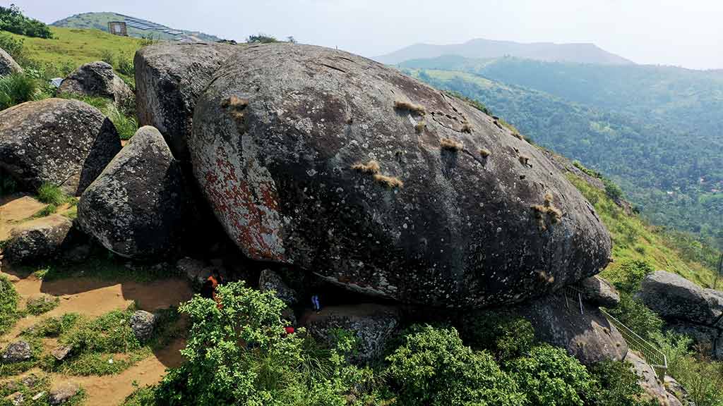
Aamai Para is a pile of granite on the lip of the Kerala–Tamil Nadu border ridge that, seen from below, looks like a tortoise crawling up the hill. Kerala Tourism says so in as many words: “In its shape, the structure resembles a tortoise and hence the name Amappara [tortoise-rock].” ആമ is tortoise in both Malayalam and Tamil, പാറ is rock, and the rock is the whole of the name. You get there by jeep up a red-earth track from Thovalappady junction, and the thing people actually come to do is crawl underneath it — two mouths open at the foot of one boulder, and you go in through one and come out of the other.

Aamai Para, Ramakkalmedu
Practical guide

Plan Aamai Para

Who's going?Tailor Aamai Para to your trip
Typeviewpoint
AreaRamakkalmedu
DistrictIdukki
Best timeJune to September for the wind
Time neededTwo to three hours from Thovalappady
Entry₹25
Places to visit4Listed businesses12

It sits 25 metres inside Kerala. The state border runs along this ridge, and on OpenStreetMap’s boundary Aamai Para is the only one of Ramakkalmedu’s named features that falls on the Kerala side — the Kuravan and Kurathi statue, the viewpoint and Ramakkal itself, the rock the place is named after, all fall in Theni district, Tamil Nadu. That is not a curiosity. When the Centre for Wind Energy Technology surveyed this ridge for the Kerala government it wrote that “the Kerala–Tamilnadu border line divides the ridge equally and it confines the utilization of lands for wind power projects”, and the same line is why the jeeps drive six kilometres to reach a rock that is barely one kilometre away.

The story

A tortoise made of granite, sitting 25 metres inside Kerala. Aamai Para is a heap of boulders on the eastern lip of the Ramakkalmedu ridge that reads, from the track below, as a tortoise crawling uphill — ആമ, tortoise, and പാറ, rock, and Kerala Tourism gives the same etymology in its own words. You reach it by jeep up a red-earth track from Thovalappady junction, and what people come to do is crawl underneath it: two mouths open at the foot of one boulder, joined by a passage you go through on your hands and knees. Above it stands a ₹3.21 crore state eco-tourism centre called Jaalakam, the Malayalam for window.

The story of Aamai Para

Start with the name, because an English search for “Aamai Para” often returns nothing. Search instead for the Malayalam ആമപ്പാറ or Tamil ஆமைப்பாறை, which locate “Turtle Rock” at 9.8163656, 77.2345285 on the Thookkupalam–Ramakkalmedu road at Thovalappady. Save those coordinates before departure; the local-script names are much more reliable than the English transliteration.

What is at that point is worth listing, because a name on a map is not evidence and four independent objects around it are. One hundred and ten metres to the north is a polygon somebody mapped separately as bare rock — the granite itself, recorded by a different hand for a different reason. Eighty metres away is the unpaved track that the jeeps grind up. Twenty-five metres to the east is a line that belongs to two boundary relations at once: Kerala and Tamil Nadu. And the geocoder, asked what administrative unit the point falls in, answers Thovalappady, Chottupara, Udumbanchola, Idukki, Kerala, 685552. The rock is Kerala's by twenty-five metres.

That margin is the surprise of this page, because almost nothing else up here is. Ask the same question of the famous things at Ramakkalmedu and the answers come back differently. The Kuravan and Kurathi statue: Uthamapalayam, Theni, Tamil Nadu. The viewpoint everyone photographs: Tamil Nadu. Ramakkal itself — രാമക്കൽ, the rock the whole place is named after, mapped as a peak at 1,063 metres — Tamil Nadu. Even the settlement node that carries the Malayalam name രാമക്കൽമേട് and links to the English Wikipedia article about a hill station in Idukki district, Kerala, falls on the Tamil Nadu side of that line. On this boundary, Aamai Para is the only one of Ramakkalmedu's named features that OpenStreetMap places in Kerala at all. Kerala Tourism and Wikipedia both call the whole ridge Idukki's, and they are describing the same ground.

The border is not a mapping curiosity here; it is a working constraint, and the Government of Kerala has said so in print. In January 2005 ANERT, the state's renewable energy agency, commissioned the Centre for Wind Energy Technology in Chennai to survey this ridge and the one at Pushpakandam for wind farms. The resulting report describes the Ramakkalmedu site as a one-kilometre, narrow, uneven, L-shaped ridge with an average top elevation of 1,058 metres — and then says, without elaboration, that “the Kerala–Tamilnadu border line divides the ridge equally and it confines the utilization of lands for wind power projects”. Later, working out where turbines could actually stand, it adds that “boundary of the area has limited the flexibility of deploying machines”. The most installable capacity the surveyors could find on Kerala's half of the windiest ridge in the state was five megawatts. Half of the best wind resource in Kerala is in another state.

And it is the best. The same survey put a mast on this ridge — at 9°48.967′ north, 77°14.482′ east, 1,070 metres, which is 750 metres due east of this rock and ten metres above its crest — and ran it from January 1992 to December 1995 with cup anemometers at ten and twenty metres. The annual mean wind speed at twenty metres came out at 8.41 metres a second, which the agency described as one of the highest annual mean wind speeds observed in the country. The annual mean wind power density was 546 watts per square metre. The predominant direction is west, thirty-two per cent of the time during the south-west monsoon, swinging to north-east for eighteen per cent during the north-east one. And there is a sentence in that report that is worth carrying up the hill with you: “the maximum wind pressure is felt close to the points, which abruptly ends with steep escarpment in the eastern side”. That is a description of where you will be standing.

Which brings up the one genuine contradiction in the government's own document, and it is on a single page. Three sentences after publishing a maximum monthly mean of 13.04 metres a second in June and a minimum of 4.96 in April, the report states: “It is also observed that the wind speed is almost constant throughout the year.” It is not. June is two and a half times April. Every travel page written about Ramakkalmedu since repeats some version of a constant wind of around thirty-five kilometres an hour blowing regardless of season, and that sentence is where the idea comes from. The measurements in the same report say the annual mean is thirty kilometres an hour, June is forty-seven, and April is eighteen. If you have come a long way for the wind, the difference between those two numbers is the difference between the trip you imagined and a warm afternoon on a rock.

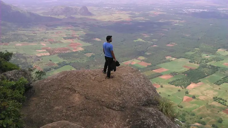
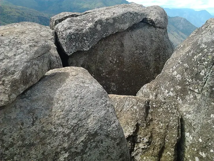
Now the rock, and the thing you do to it. Kerala Tourism's own description is unusually physical for a tourism board: mammoth rocks leaning on each other over a deep valley, and to see them you hop over a set of huge boulders and squeeze yourself through a jumble of rocks. What that means in practice is a footpath that only one person fits along, and, at the base of the largest boulder, two big openings. You enter by one and come out of the other. Malayalam Manorama's writer, who went through in 2023, reaches for the only comparison that fits: you have to squirm through the way soldiers crawl under barbed wire. There are steel handrails at several points inside, and steel guards fitted underneath so that nobody drops down through the crevice. The inside is big enough for two people to shelter in. Locals call the passage the punarjani gap, borrowing the name of the rebirth tunnel at Thiruvilwamala in Thrissur, where pilgrims crawl through a natural rock channel to be born again. Some people in the valley also say a thief called Kodali Paramu sheltered in here during the rice-smuggling years, which is offered in the source exactly as it is offered here — as something some people say.

Those rice-smuggling years are the reason there is a path up this ridge at all. The fields you look down on from the top are in Tamil Nadu, and sacks of rice used to come up over Ramakkalmedu into Idukki as head-loads, carried on foot across the border by people who lived on both sides of it. Manorama's writer records a local telling him that the composer Ilaiyaraaja was among those who carried rice up this way from his village below — a story told to a reporter on the hill, printed as a story, and repeated here as one. Ilaiyaraaja was born at Pannaipuram in Theni district, which is in the plain directly under this rock. The ridge was a supply line before it was a viewpoint, and the article's own heading for that passage is simply “the ridge the rice came over”.

What is on top now cost ₹3.21 crore. The District Tourism Promotion Council built an eco-tourism centre here in two phases with money from the state Tourism Department, and gave it a good name: ജാലകം, Jaalakam, the window. The construction was done by Steel Industrials Kerala Limited, the state undertaking based in Thrissur. What was built is a ticket counter, security fencing, a watch tower, walkways, lighting, electrical and plumbing work, benches to sit on while you look, and a toilet block. Kerala Tourism adds that the several viewpoints scattered around the rock — each of which, it says, has its own local name — are all fitted with protective fencing; the best known of them is called the flight view point, for the bird's-eye view it gives over the villages in the valley.

It took a long time to open, and the record of that is quietly comic. In September 2022 Manorama reported that steel fencing had gone up around the hills and that visitor numbers had risen sharply as a result, and that ₹2.25 crore of tourism work was coming, including a twenty-metre watch tower and a hanging bridge. In April 2023 the same paper sent a travel writer up, and he found a watch tower standing right beside the rock that had not been opened, no facilities ready at all, and one small stall selling black tea, which he drank sitting on the granite. In March 2024 ETV Bharat reported the whole project complete and awaiting inauguration. Today the DTPC lists Aamappara Tourism Centre among its operating centres, open from six in the morning until seven in the evening, twenty-five rupees for an adult and fifteen for a child. Neither the twenty-metre height nor the hanging bridge appears in the finished list.

One more practical fact, and it is the one that will affect you most. In 2025 the Idukki district administration banned off-road jeep safaris across the whole district after a series of accidents, exempting only Kolukkumala, which cannot be reached any other way. Around a hundred and three jeeps work the Ramakkalmedu–Amappara run alone, and Amappara was named among the destinations shut. Services restarted on 16 July 2025 in phases, under the Kerala Adventure Tourism Promotion Society, with each route to be inspected and cleared by a committee under the local Sub-Collector, six passengers to a vehicle, breathalyser tests, and drivers holding special licences and three to five years of experience. Nine routes were named in the first phase. This one was not among them, and no report of its reopening has been published since. The ticket counter at the top and the jeeps that get you there are answerable to two different arms of the same district, and they are not currently saying the same thing.

Legend & myth

There are two origin stories for this rock and they belong to different worlds. Kerala Tourism publishes the Ramayana one, and publishes it with an exclamation mark: “According to local lore, the mythological heroes of the Ramayana – Rama and Lakshmana – spent some time here during their search for Seetha!” That is really the ridge's story rather than the rock's — രാമക്കൽമേട് is the upland of Rama's stone, and the stone in question is Ramakkal, 1.26 kilometres east of here, which row 13 of this guide will deal with properly.

The other story is the tortoise's own, and it is the better fit for the thing you are standing on. Malayalam Manorama sets it out plainly: the tortoise is the second of the ten avatars, Kurma; this valley is said to have been a sea shore in the earliest times; and a sea turtle that came ashore then may have been cursed into stone where it lay. The writer adds a line that is closer to an argument than a legend — that Aamai Para ought to have become famous before Ramakkalmedu did. Told from up here, with the plains laid out flat below, the sea-shore version is easier to picture than it sounds.

The passage under the rock carries a borrowed name rather than a legend of its own. People call it the punarjani gap, after the punarjani nuzhal at Thiruvilwamala in Thrissur, where pilgrims crawl through a natural tunnel in the rock as a rite of rebirth. Nobody claims this crevice is a sacred one. The name is a comparison — you go in one side and come out the other, and you come out changed the way anybody comes out of a tight space in the ground changed, which is to say slightly.

The one piece of human lore attached specifically to the inside of the rock is a bandit. During the years when rice was carried over the border on people's heads, some say a thief called Kodali Paramu — Paramu of the axe — lived in here. The Malayalam source that records it is careful with it, attributing it to what some people say rather than to any record, and so is this page. The inside is described as big enough for two people to stay in, which is at least consistent with the story.

Ramakkal, seen from this rock, has generated a small folklore of its own that has nothing to do with Rama. Manorama's writer, looking east from Aamai Para, thought it looked like a gorilla's head, and noted that if you stand and look at the scattered stone shapes on the green slope for long enough you begin to find figures in all of them, with the smaller rocks below arranged like soldiers. That is what the ridge does to people, and it is presumably how the tortoise got its name in the first place.

We searched Malayalam and Tamil for anything further — ആമപ്പാറ, ഐതിഹ്യം, ஆமைப்பாறை — before writing any of this, because an English-language blank is not evidence of absence. What came back was the tortoise-avatar story, the punarjani nickname, the Kodali Paramu tale and the rice-carrying history, all in the Malayalam press, and none of it in English anywhere. What did not come back was any temple, festival or shrine associated with the rock itself. That is a report of a search, not a claim that the settlements here have nothing more to say about it.

Read the full history of Aamai Para 911 more words

History

The ridge's documented history is a border history, and it starts with the border. The line that runs 25 metres east of this rock separates Idukki from Theni and Udumbanchola taluk from Uthamapalayam, and it follows the crest — which is why the villages below on the eastern side are Tamil and the villages behind you are Malayalam. The two hamlets nearest the rock are Combamukku, കോമ്പമുക്ക്, 676 metres away, and Ammavanpady, അമ്മാവൻപടി, at 721 metres; Thovalappady, where the jeeps start, is 1.29 kilometres off; Chottupara, the revenue village, is 2.19 kilometres.

Before it carried tourists this ridge carried food. Rice grown in the Tamil plains below was head-loaded up over Ramakkalmedu into the Idukki high range, and the trade left the paths that the jeep track now partly follows. Malayalam Manorama's account of the route records a local man's claim that the composer Ilaiyaraaja, who was born at Pannaipuram in Theni district in the plain directly below, was among those who carried rice up this way as a young man. It is a hillside story told to a reporter and it is repeated here as exactly that.

The wind was surveyed before it was exploited, and unusually thoroughly. ANERT, the Agency for Non-Conventional Energy and Rural Technology established by the Government of Kerala, wrote to the Centre for Wind Energy Technology in Chennai on 13 January 2005 asking for micrositing work at Ramakkalmedu and Pushpakandam; the work order followed on 25 January and C-WET's officials visited the sites on 27 and 28 January 2005 with ANERT and EMC Thiruvananthapuram. The data they analysed was older still — a mast on this ridge had been logging wind speed and direction at ten and twenty metres continuously from January 1992 to December 1995. Four other masts in the neighbourhood, at Perampukettimedu, Sakkulathumedu, Kailasamedu and Kulathummedu, all showed the same strong winds.

What the survey concluded is the reason the turbines you can see from here are where they are and not on this ridge. On the Ramakkalmedu parcel, the maximum installable capacity was five megawatts using 1,250 kW machines or 3.75 megawatts using 750 kW ones — four or five turbines, no more, because the border and the east–west orientation of the ridge between them left nowhere else to put them. Pushpakandam, four kilometres north-west and one of the highest ridges in the Western Ghats at 1,428 metres, took 2.5 megawatts or 1.5. The estimated capacity factors were 33 and 32 per cent. The wind farm that now runs at Pushpakandam and Kuruvikanam is described locally as Kerala's second, with NEG Micon machines feeding the Kerala State Electricity Board and a capacity usually given as 14.25 megawatts — which is nineteen of the 750 kW machines the survey modelled, and well above what that survey found installable on the two parcels it was asked about.

The tourism history is short and recent. Kerala Tourism published an article about Amappara in 2021 calling it an emerging destination and giving the jeep-from-Thovalappady instruction that still holds. In September 2021 ETV Bharat reported that people had begun walking up where only off-road jeeps had gone before. Steel fencing went round the hills, and Manorama reported in September 2022 that visitor numbers rose noticeably once it was there. The District Tourism Promotion Council then built the Jaalakam eco-tourism centre in two phases with ₹3.21 crore of state tourism money, through Steel Industrials Kerala Limited of Thrissur, and ETV Bharat reported the work finished and awaiting inauguration in March 2024.

The most recent chapter is a restriction rather than a construction. Following a run of accidents attributed to unsafe driving, the Idukki district administration banned off-road jeep safaris across the district in 2025, with Kolukkumala exempt on the ground that it has no other access. The published figures give a sense of the scale of what stopped: 103 jeeps in the Ramakkalmedu–Amappara region, more than 300 in Marayur and Kanthalloor supporting some 1,500 families, 500 owners around Anachal and Mankulam. Operations resumed on 16 July 2025 under the Kerala Adventure Tourism Promotion Society with nine routes in the first phase and a route-by-route clearance process under the local Sub-Collector. Ramakkalmedu–Amappara was not one of the nine.

Why visit

A tortoise-shaped pile of granite you can crawl underneath — in through one mouth at the foot of the boulder and out through the other, on your hands and knees, with steel handrails to hold.

The windiest measured ground in Kerala: 8.41 metres a second annual mean at twenty metres, which the surveying agency called one of the highest in the country.

Twenty-five metres from Tamil Nadu, on the only one of Ramakkalmedu's named features that the boundary actually puts in Kerala.

Open from six in the morning to seven at night, when the famous viewpoint down the road opens at half past eight and shuts at six — this is the ridge's sunrise and its late sunset.

A red-earth off-road climb from Thovalappady junction that only Motor Vehicles Department-approved jeeps are allowed to make.

Ramakkal seen side-on from 1.26 kilometres away, which Malayalam Manorama's writer thought looked like a gorilla's head — a view you cannot get from Ramakkalmedu itself.

The flight view point and a scatter of other viewpoints around the rock, each of which Kerala Tourism says carries its own local name, all fenced.

A ₹3.21 crore state eco-tourism centre called Jaalakam — the window — that took three years to open and is worth the twenty-five rupees.
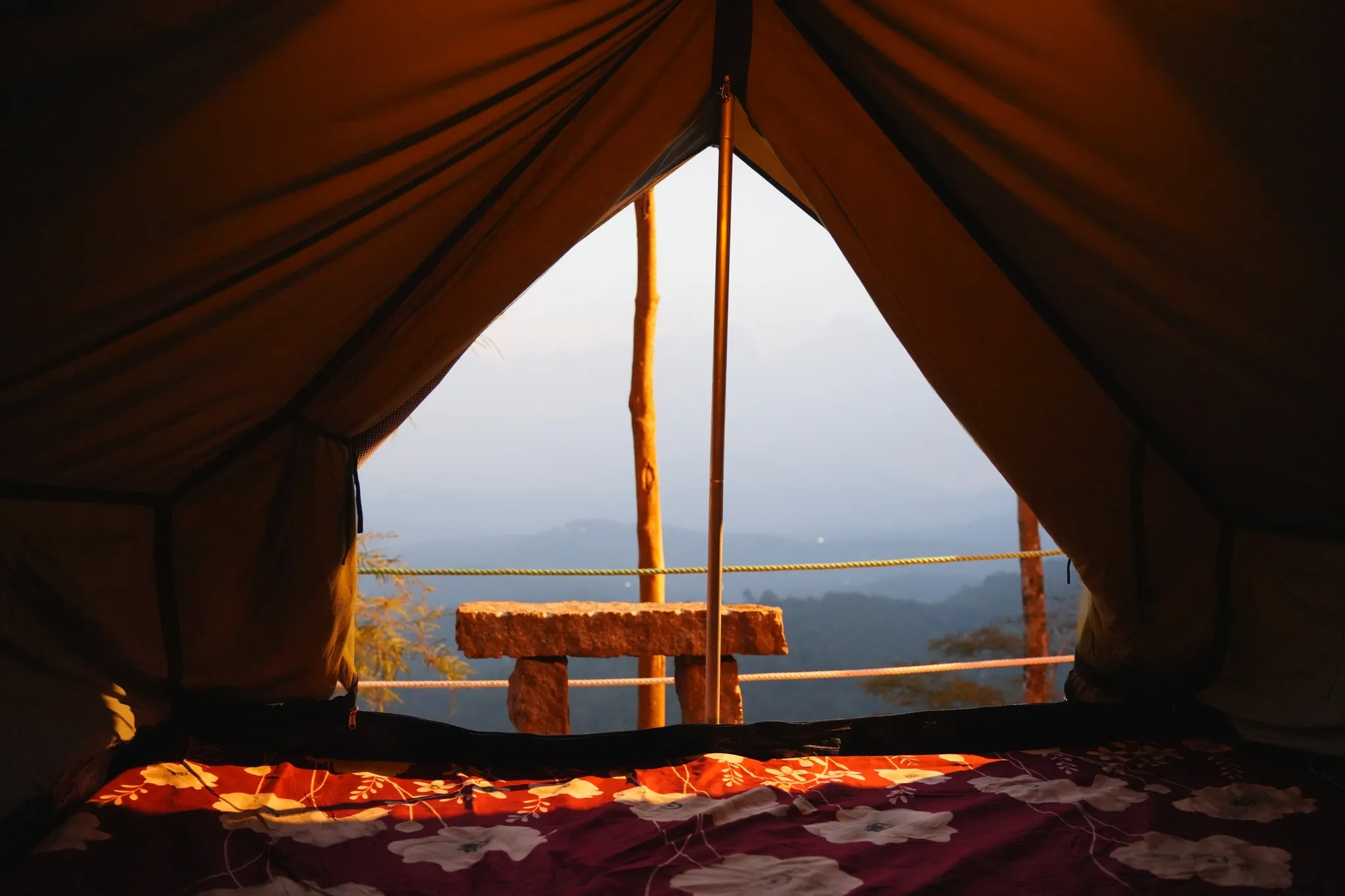
What to expect

Highlights

  • The crawl-through. Two large mouths open under one boulder and a passage connects them — Malayalam Manorama, which went through it, says you have to squirm the way soldiers crawl under barbed wire, and that there are steel handrails at several points and steel guards below so you do not drop into the crevice. Locals call it the punarjani gap, after the rebirth tunnel at Thiruvilwamala.
  • A tortoise you can only see from a distance. The rock reads as a tortoise from the approach and as a jumble of granite once you are on it, which is why the jeep drivers stop and point on the way up rather than at the top.
  • The windiest ground in Kerala, measured rather than claimed. A government mast 750 m east of this rock recorded an annual mean of 8.41 m/s at 20 m — which the surveying agency called one of the highest annual mean wind speeds observed in the country.
  • DTPC’s ₹3.21 crore Jaalakam eco-tourism centre on top: ticket counter, fencing, watch tower, walkways, lights, benches and a toilet block, built by a Kerala state PSU in two phases.
  • Opening hours that beat Ramakkalmedu’s. DTPC runs this centre 06.00 to 19.00 and the Ramakkalmedu centre a mile away 08.30 to 18.00 — so this is the ridge’s sunrise option and its late-sunset option, and the famous viewpoint is neither.
  • Ramakkal seen side-on. From here the rock that gave Ramakkalmedu its name is 1.26 km east and reads, in Manorama’s phrase, like a gorilla’s head — a view you cannot get from Ramakkalmedu itself.
  • The flight view point, one of several viewpoints around the rock that Kerala Tourism says each carry a local name, giving what it calls a bird’s-eye view of the villages in the valley.
  • A red-earth off-road climb that only Motor Vehicles Department-approved taxis are allowed to make — the sticker sits on the left of the windscreen, and the classic vehicle for it is a Mahindra CJ 550 MDI.
Getting there

How to visit

  • Drive to Thovalappady junction on the Thookkupalam–Ramakkalmedu road and pick the jeep up there. Kerala Tourism gives exactly this instruction — “take a jeep ride from Thovalappady junction on the Thookupalam - Ramakkalmedu stretch” — and it is 4 km from Thookkupalam, which we measured at 3.90 km by road on 25 August 2026. From the junction it is 2.25 km of track to the rock.
  • ⚠ Check that the jeeps are running before you drive out. In 2025 the Idukki district administration banned off-road jeep safaris across the district after a run of accidents; around 103 jeeps work the Ramakkalmedu–Amappara stretch alone. Safaris restarted on 16 July 2025 in phases, but the nine routes published for the first phase do not include this one, and no reopening of it has been reported since. Telephone the DTPC counter on 04868 243356 first.
  • The published “6 km from Ramakkalmedu” is right and your map app is wrong. Routed on 25 August 2026, going the way people go — down to Thovalappady and back up the track — it is 5.78 km from the Ramakkalmedu viewpoint. Routed as the crow drives, over the ridge, it is 2.17 km. Do not set off expecting the short one.
  • You can walk it. An ETV Bharat report in September 2021 recorded that where the site had once been reachable only by off-road jeep, visitors were now walking up — about fifteen minutes uphill. DTPC does not publish it as a trekking trail, so this is a report and not a timetable.
  • Entry is ₹25 for adults and ₹15 for children, published by DTPC Idukki, and the centre is open 06.00 to 19.00. A jeep from Ramakkalmedu including the entry ticket is reported at ₹1,600 for the vehicle.
  • Go early or go late, because the hours allow it. This is the only place on the ridge open at six in the morning and still open at seven in the evening, and the wind and the light are both better at those ends of the day than in the middle of it.

Distance by road

  • Kochi107 km
  • Madurai172 km
  • Thiruvananthapuram226 km
  • Coimbatore252 km
  • Kozhikode276 km

Road km to Idukki; ghat roads and traffic vary — allow extra.

Timing

Best time

June to September for the wind; October to February for the view, and April is the one month to avoid. That is not a preference — it is what the Government of Kerala’s own measurements say. The Centre for Wind Energy Technology ran a mast 750 m east of this rock from January 1992 to December 1995 for ANERT and recorded a maximum monthly mean of 13.04 m/s in June and a minimum of 4.96 m/s in April, against an annual mean of 8.41 m/s. Every month except April fell between 6.94 and 14.5 m/s. So if the reason you are coming to Ramakkalmedu is the wind everybody writes about, June to August is when it is nearly three times what April gives you — and June to August is also when the mist comes over, which the Malayalam travel press warns makes the track genuinely risky. October to February is the compromise: strong wind, clear air, and the Tamil Nadu plains visible all the way to Kombai and Cumbum. March to May is the weakest wind and the hardest light, and April specifically is the month the state’s own data singles out.

Weather in Aamai ParaSeasonal guide

Live forecast loads in your browser.

Today at Aamai Para
Sunrise6:11 am
Sunset6:20 pm
Golden hour best light5:20 pm–6:20 pm
Blue hour after sunset6:20 pm–6:45 pm
Sun sets toward compass bearingW · 272°
Moon tonight🌓 First quarter · 52%
South-west monsoon. June to September brings heavy rain to Kerala. Trails, falls and ghat roads can be slippery, swollen or closed at short notice, and forest departments sometimes suspend access. Check locally on the day before you travel.

Check the official alert before you travel. Kerala’s beaches, waterfalls and trekking routes close at short notice during heavy rain, and district alert levels change day to day. We do not publish an alert level of our own — read it from the state authority: Kerala State Disaster Management Authority, or the district control room on 1077.

Sun and moon are calculated for this location and shown in IST. Photography windows are the hour around sunrise and sunset; the sunset bearing is degrees clockwise from true north. Moon phase is accurate to about half a day.

Visitor notes

  • 🔴 The Government of Kerala’s own wind report contradicts itself on the one thing this ridge is famous for. In the same section, the Centre for Wind Energy Technology publishes a June monthly mean of 13.04 m/s and an April monthly mean of 4.96 m/s — a factor of 2.6 — and then writes, three sentences later, “It is also observed that the wind speed is almost constant throughout the year.” Travel pages everywhere repeat that a constant wind of about 35 km/h blows here regardless of season. The agency’s own annual mean, 8.41 m/s, is 30 km/h; its June figure is 47 km/h and its April figure is 18 km/h. Both halves are printed here. The measurements are the useful part.
  • ✅ The wind is strongest exactly where this rock is. The same report notes that “winds are generally decreasing as one goes towards west” and that “the maximum wind pressure is felt close to the points, which abruptly ends with steep escarpment in the eastern side”. Aamai Para sits on that eastern lip, 25 m from the state line. The annual mean wind power density measured here was 546 W/m² at 20 m.
  • 🔴 The jeep run may not be running. Off-road jeep safaris were banned district-wide in Idukki in 2025 after accidents, with only Kolukkumala exempted because it cannot be reached any other way. Around 103 jeeps work the Ramakkalmedu–Amappara region and Amappara was named among the destinations affected. Services restarted on 16 July 2025 under the Kerala Adventure Tourism Promotion Society, with each route cleared by a Route Monitoring Committee under the local Sub-Collector, a six-passenger limit, breathalyser tests and drivers holding special licences with three to five years’ experience. Nine routes were published for the first phase — Parunthumpara–Sathram, Pambanar–Mlamala–Uppupara, Kuttikanam–Madammakulam, Elappara–Kappakanam–Uluppooni–Chakkimali–Vellaramkallu, Vagamon–Ottamarampara, Vagamon–Kallattupara, Munnar–Ponmudi–Nadukani, and Mankulam–Anakulam–Viripara. Ramakkalmedu–Amappara is not on that list, and we have found no published report of it being added. Telephone before you drive.
  • ⚠ The centre was built before it was open, and for a while it was open before it was finished. Malayalam Manorama’s travelogue of April 2023 found a watch tower standing beside the rock that had not been opened and reported plainly that no facilities were ready — the only thing to buy on top was black tea from a small stall. ETV Bharat reported the construction complete and awaiting inauguration in March 2024. DTPC Idukki now lists Aamappara Tourism Centre among its operating centres with published hours and rates, so on the operator’s own record it is open.
  • 🔴 Two figures circulate for what the centre cost and two organisations are credited with building it. Manorama in September 2022 described tourism projects worth ₹2.25 crore being planned here and named the Steel Authority of India as supervising. ETV Bharat in March 2024, reporting the finished work, gives ₹3.21 crore from the Tourism Department spent in two phases and names Steel Industrials Kerala Limited — SILK, the Kerala state undertaking based in Thrissur, which is a different organisation from the central government’s SAIL. The 2022 report also described a 20-metre watch tower and a hanging bridge; neither height nor bridge appears in the completed list. The later, more specific account is the one this page leads with.
  • The two origin stories do not agree, and both are worth having. Kerala Tourism publishes the Ramayana one: “According to local lore, the mythological heroes of the Ramayana – Rama and Lakshmana – spent some time here during their search for Seetha!” Malayalam Manorama publishes the tortoise one, which belongs to this rock rather than to the ridge: ആമ is the second of the ten avatars, the valley below is said to have been seashore in ancient times, and a sea turtle that came ashore may have been turned to stone. The same writer adds a pointed line — that Aamai Para ought to have been famous before Ramakkalmedu was.
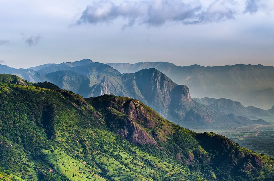
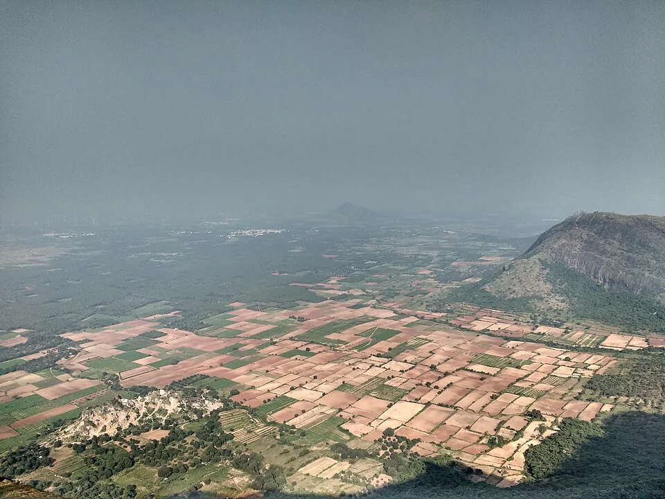
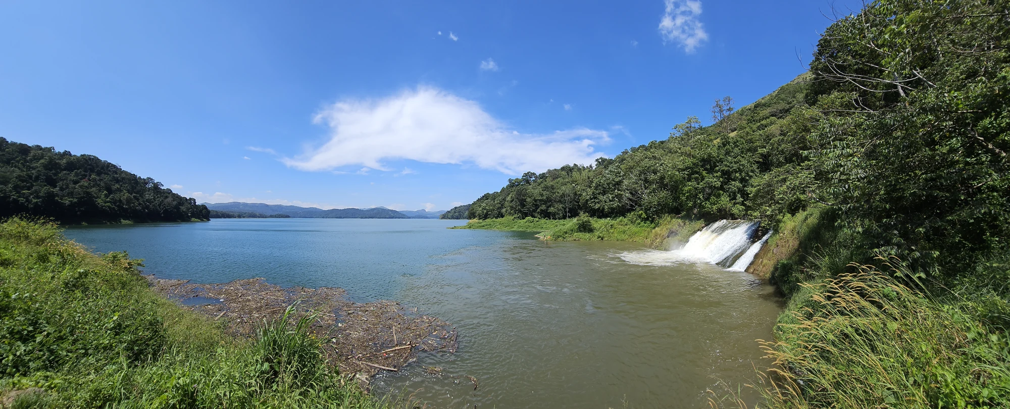
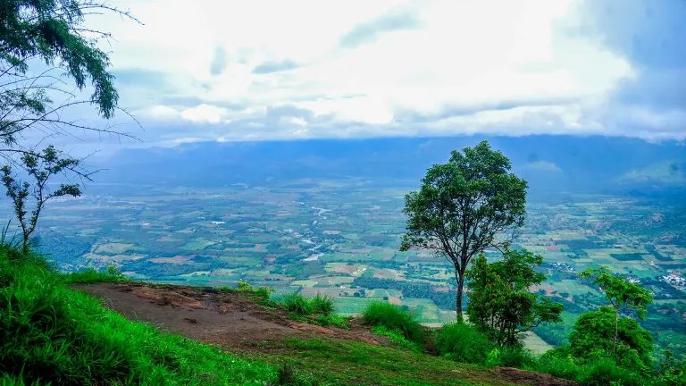
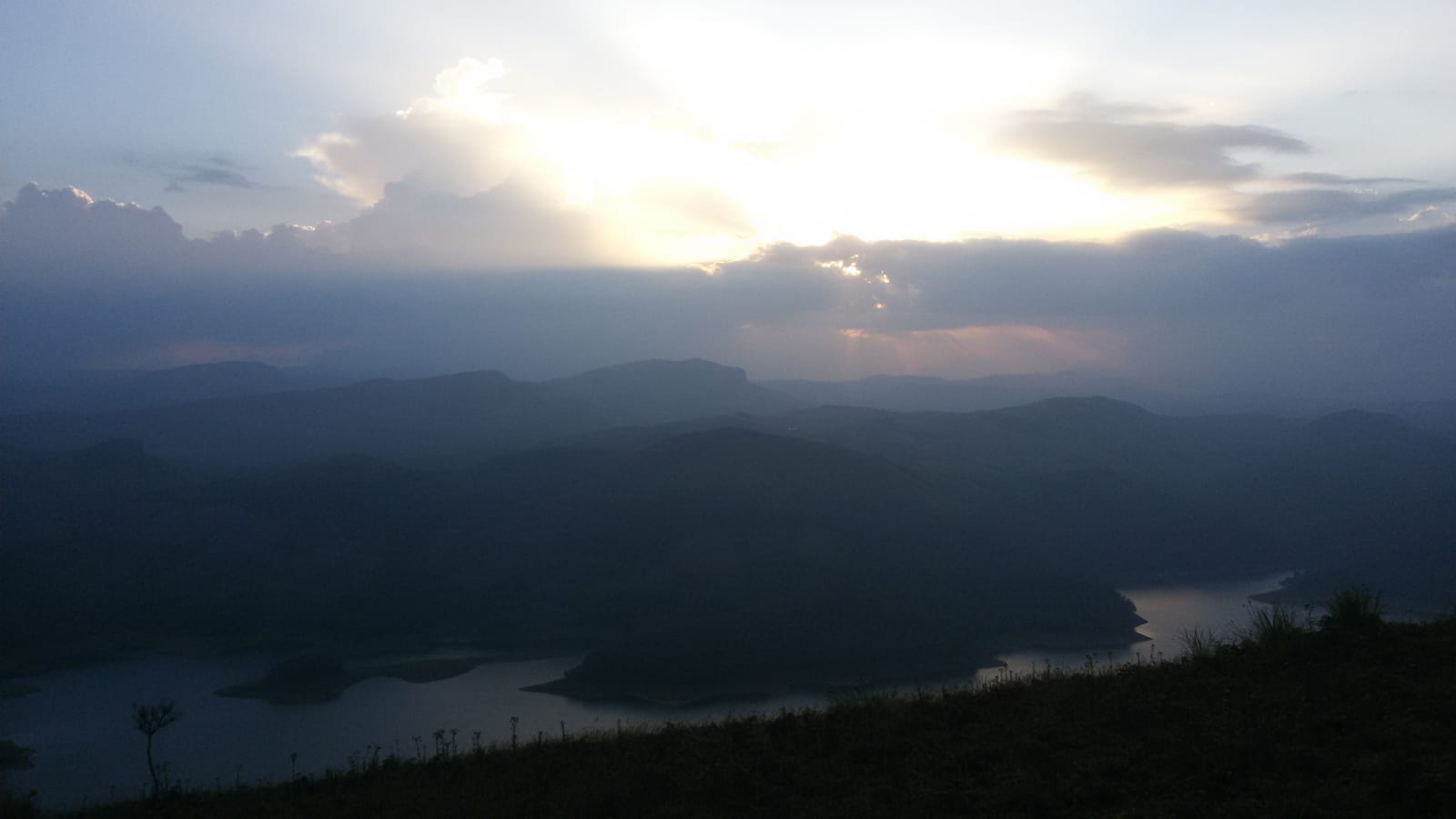
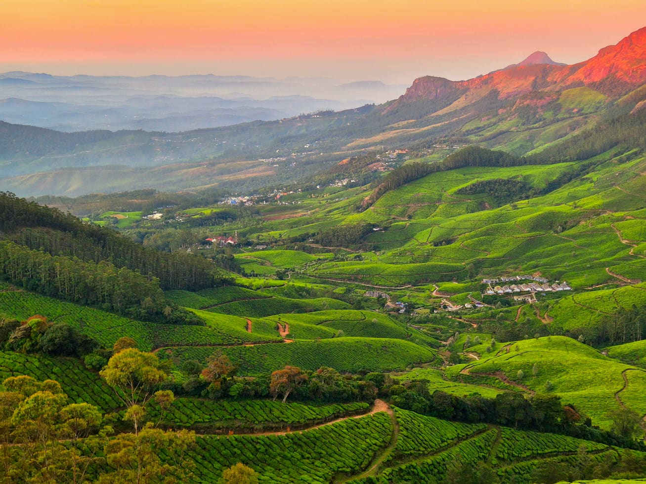
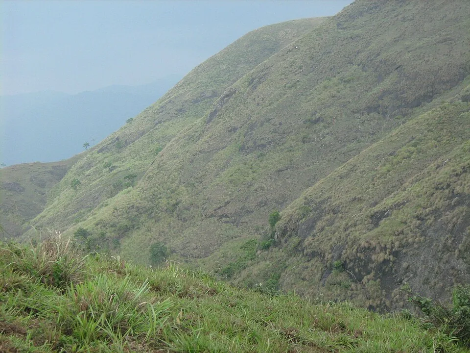
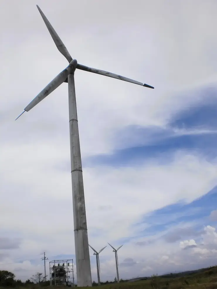
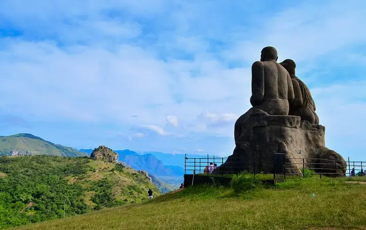
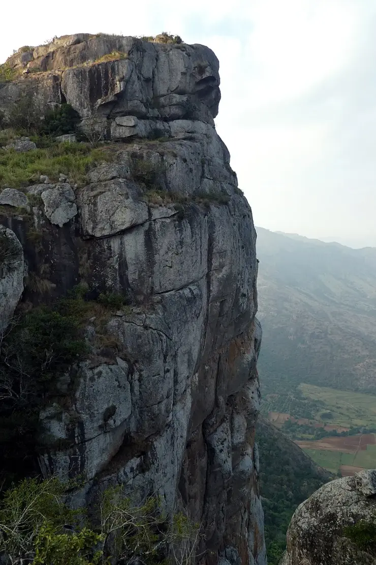
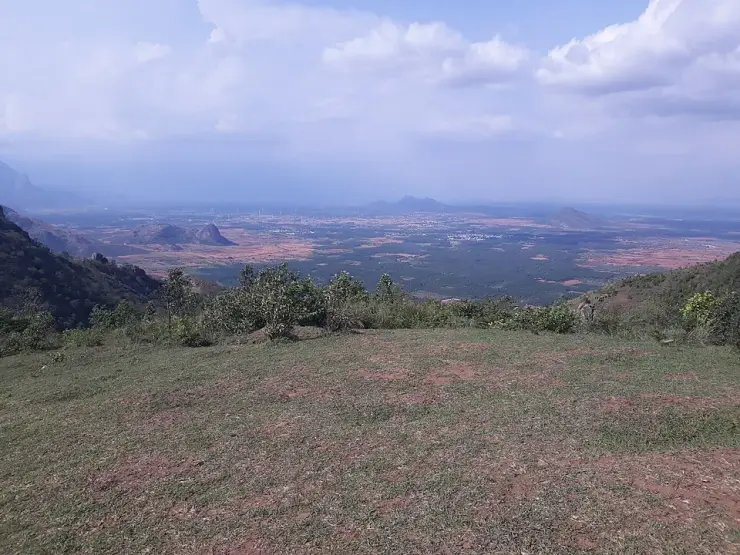
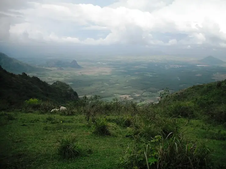
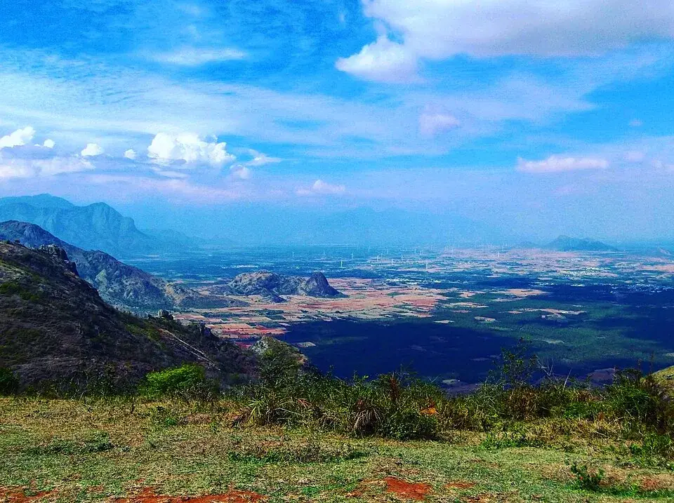
  • There is no photograph of this rock on Wikimedia Commons and this page does not pretend otherwise. Searching Commons for “Amappara” on 25 August 2026 returns nothing at all, and every close-up of granite in the Ramakkalmedu category that carries a geotag sits at Ramakkal, 1.26 km east. The pictures on this page are the ridge, the approach, the wind farm and the plains, captioned as what they are.
  • ⚠ “Aamai Para” is difficult to find in an English map search. The Malayalam ആമപ്പാറ and Tamil ஆமைப்பாறை names both locate it immediately as “Turtle Rock”. Save the coordinates before departure or search in either local script.
Safety

Good to know

  • The passage under the rock is a one-person squeeze on hands and knees with a drop beside it. There are steel handrails at several points and steel guards fitted below to stop anyone dropping through the crevice, but this is a crawl through a gap between boulders and not a walkway. Anyone who does not like enclosed spaces should stay outside and look at the view, which is most of the reason to be here anyway.
  • The track is red earth and it turns to a slide when it rains. Malayalam Manorama’s own account says vehicles slip on the wet surface, and the same road that is a pleasure in February is a different proposition in July.
  • Mist. In the cold months the cloud comes over the ridge and sits on it, and the Malayalam travel press says directly that the journey up is somewhat dangerous at those times. There is no lighting on the track.
  • The wind is not decorative. A recorded June monthly mean of 13.04 m/s is 47 km/h of steady wind on an open rock with a steep escarpment on the eastern side. Hold on to hats, phones and small children, and do not go to the edge to take a photograph.
  • Only Motor Vehicles Department-approved taxis are permitted to make the climb, and since 2025 the district has tightened this further — approved routes only, approved drivers only, a maximum of six passengers and breathalyser tests before departure. Do not take a private car up, and do not accept a lift from a vehicle without the sticker.
  • The rock surfaces are bare granite and they are slick when damp. Manorama’s account ends its description of the climb with the plain advice to be careful when you get up on the rock.
  • You are 25 m from the Tamil Nadu border on an unfenced grass ridge, and mobile coverage flips between two states’ networks. Expect roaming behaviour on your phone and do not rely on a data connection to find your way back down.
  • The centre closes at seven in the evening and the track down is unlit. If you have come for the sunset, leave with the light rather than after it.
Stay · eat · do · rent · see · shop

Stays, food & things to do near Aamai Para

Verified hotels, homestays, restaurants, experiences, sights, shops and rentals around Aamai Para — commission-free, with direct contact. Filter by what you need.

2 things to do near Aamai Para

Paadi Holidays Airport Shuttle and Local Tours — Airport in Ramakkalmedu
Top pick Verified
Airport · Ramakkalmedu
Paadi Holidays Airport Shuttle and Local Tours

Airport in Ramakkalmedu. Paadi Holidays, Ramakkalmedu, Anniyar Thozhu, Idukki, Kerala 685515 · Airport shuttle, Local tours, Jeep safari support.

Directions Commission-freeView details
Ramakkalmedu Amappara Jeep Safari — Jeep safari operator in Ramakkalmedu
Verified
Jeep safari operator · Ramakkalmedu
Ramakkalmedu Amappara Jeep Safari

Amappara-side jeep safari contact for Ramakkalmedu viewpoints and hill-route activity planning. Do, Jeep safari operator, Ramakkalmedu Amappara Jeep Safari.

Directions Commission-freeView details

Book with the place itself. India’s cyber-crime coordination centre warned in April 2025 that convincing copies of hotel and pilgrimage booking sites are being pushed through sponsored search and social ads, taking payment for rooms the property never hears about. Every listing here links to the business’s own contact details and its own Google or Bing profile — we take no commission and sit in nobody’s payment path. If a booking page reached you through an ad, check the address bar against the property’s own site before you pay. Fraud can be reported on cybercrime.gov.in or on 1930.

Ranked guides

Top experiences around Ramakkalmedu

3 more places around Ramakkalmedu. Open a guide to plan the visit and onward journey.

viewpointRamakkalmedu

5.6 km · 11 min drive

Windy Idukki ridge and viewpoint area above the Tamil Nadu plains, often planned with wind farms and Nedumkandam-side routes.

viewpointRamakkalmedu viewpoint

5.8 km · 12 min drive

Open ridge viewpoint above the Tamil Nadu plains near Nedumkandam, useful for sunset, wind-farm and high-range road planning.

heritageKuravan Kurathi statue

5.8 km · 12 min drive

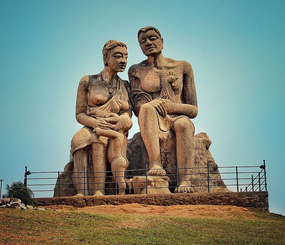
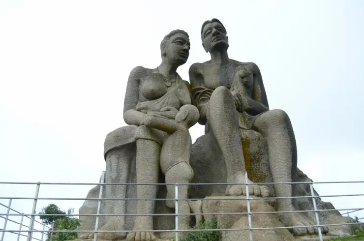
The seated concrete group of a Kuravan, a Kurathi and their child on the open mound at Ramakkalmedu, sculpted by C. B. Jinan and put up in 2005, inside DTPC Idukki’s ticketed viewpoint compound. It commemorates Kuravanmala and Kurathimala, the two hills the Idukki arch dam is wedged between — 30 km away in a straight line, 44 km by road.

Roampedia is commission-free — own or know a stay, eatery, guide or shop near Aamai Para? List it and it appears here once verified.

Add a nearby business
Before you go

Aamai Para — at a glance

DifficultyEasy on foot, once the jeep has done the climb
Duration2 to 3 hours; half a day with Ramakkalmedu
OperatorDistrict Tourism Promotion Council, Idukki, which runs the site as Aamappara Tourism Centre. The centre on top — ജാലകം, Jaalakam, the window — was built for DTPC by Steel Industrials Kerala Limited of Thrissur, in two phases with ₹3.21 crore of Tourism Department money. The jeeps are independent operators licensed by the Motor Vehicles Department.
Timings06.00 to 19.00, published by DTPC Idukki. Those hours are the useful fact: the Ramakkalmedu Tourism Centre a mile away opens at 08.30 and shuts at 18.00, so this is the ridge's only sunrise gate and its last one open in the evening. The jeep, not the gate, decides your day.
Best timeJune to September for maximum wind; October to February for the clearest view, and April is the weakest-wind month in the measured record. DTPC's statement that summer is the right season refers to easier road and visibility conditions, not peak wind strength. The Centre for Wind Energy Technology measured a June monthly mean of 13.04 m/s against 4.96 m/s in April and an annual mean of 8.41 m/s. Monsoon wind therefore comes with the opposite trade-off—mist and a slick jeep track—while the cool dry months are the sensible all-round choice.
Entry price
Indian adult
₹25

Fees change without notice. Check the current rate at the counter.

Entry: CURRENT CHECK, 4 SEPTEMBER 2026: DTPC Idukki still publishes the centre as open 06:00–19:00 at ₹25 adults and ₹15 children, and still says a jeep is required. The jeep is separate and is the real cost — a vehicle from Ramakkalmedu including the entry ticket is reported at ₹1,600, shared between however many of you travel, with a six-passenger limit now in force. There is no published camera charge and no published parking charge. Carry cash: this is a hill counter, not a booking system.

Photography: No camera charge is published and none is reported. What matters here is light and wind rather than fees. The rock faces east over the Tamil Nadu plains, so the morning is the good direction and the 06.00 opening is what makes it possible — the famous viewpoint down the road cannot offer you that. In the evening the light comes from behind the ridge and the plains below light up rather than the rock, which is its own picture. ⚠ Two practical warnings. The wind is measured at an annual mean of 8.41 m/s and a June monthly mean of 13.04 m/s, and a drone or a light tripod on an open granite edge with a steep escarpment below is a bad idea in either. And the crawl through the rock is a hands-and-knees squeeze — put the camera away and in a bag before you go in, rather than discovering the problem halfway through.

Permit: No permit and no advance paperwork — you buy a ₹25 ticket at the counter on top and walk in. The permission that matters is the jeep's, not yours. Only taxis approved by the Motor Vehicles Department are allowed to make the off-road climb, and the sticker sits on the left of the windscreen; since the 2025 district ban and the phased restart, a route must additionally be cleared by a Route Monitoring Committee chaired by the local Sub-Collector with the RTO, police, tourism department and panchayat, and the driver must hold a special licence with three to five years of experience. That is a matter between the operator and the district. Your part is to take a jeep that has the sticker and to refuse one that does not.

Booking: Nothing is sold online. DTPC's live centre page still advertises Aamappara, its hours, ticket and required jeep, but the page does not identify the route-monitoring approval attached to the jeep service. A fresh search of DTPC, district and Motor Vehicles Department material on 4 September 2026 found no later published order naming the Ramakkalmedu–Amappara route after it was absent from the first nine routes reopened following the 2025 district-wide ban. That absence is not proof of closure; it is why the operational check matters. Phone the DTPC counter on 04868 243356 and ask specifically whether approved jeeps are running from Thovalappady today, then use a vehicle carrying the required approval sticker.

Parking: At Thovalappady junction, not at the rock. You leave the car at the junction on the Thookkupalam–Ramakkalmedu road and take a jeep from there, which is the whole design of the place: private vehicles do not go up the off-road track, and only Motor Vehicles Department-approved taxis are permitted to. There is no laid-out car park at the junction, no attendant and no published charge — it is roadside space in a hamlet. ⚠ Leave nothing visible in the car. ⚠ Do not be tempted to try the track in your own vehicle. It is red earth on a gradient, it is what the CJ 550 jeeps are used for, and it is slick enough when wet that the Malayalam account of the drive says plainly that vehicles slip on it.

Wildlife: This is open grass and granite rather than forest, and the wildlife is what lives on a windy ridge. The most striking record is a Shaheen falcon photographed at Ramakkalmedu and published on Wikimedia Commons in 2016 — a cliff-nesting resident peregrine that hunts along exactly this kind of escarpment edge, and the eastern drop below the rock is textbook habitat for it. The Malayalam travelogue of the jeep route records deer in the scrub on the way up, small standing pools of water in the folds, and wild ixora and wild citrus growing in patches of darker green. ✅ The plant to notice is തൈലപ്പുല്ല്, the aromatic oil grass that covers these slopes: snap a stem and the smell carries across the hill, which is the detail the Manorama writer chose to record above all the others. ⚠ Nothing here is dangerous and nothing needs to be fed. The wind farm four kilometres north-west is a reminder that this is a working landscape, not a reserve.

Getting here

How to reach Aamai Para

  • ✈︎ By air Cochin International Airport is 125.6 km and roughly two and a half hours, west through Nedumkandam and down the high range. Madurai Airport is 147.1 km and about the same time or a little more, out across the border through Cumbum and Theni on much faster and much flatter roads. ⚠ The straight-line distances are misleading in both directions — Madurai is 94 km away as the crow flies and Cochin 100 km, and the reason the Tamil Nadu side is not the quicker option despite the better roads is the escarpment: you have to go round it. If you are landing at Madurai, the Cumbum–Kombai approach up the ghat is the interesting drive; if you are landing at Cochin, come through Nedumkandam.
  • 🚆︎ By train There is no railway in Idukki district, so every option is a long way and most of them are in Tamil Nadu. On the Kerala side, Kottayam Junction is 144.5 km. On the Tamil Nadu side the nearest useful railheads are around Theni, 64.4 km, and Bodinayakanur, which is the terminus of the branch that comes up from Madurai and sits in the plain visible from the rock. ⚠ Nothing here is walkable or auto-able from a station; whichever railhead you use you are hiring a car or taking a bus for the last stretch, and the ghat climb is the slow part.
  • 🚗︎ By road Everything funnels through Nedumkandam, 13.8 km away on the Munnar–Kumily road, which is the town to navigate to first. From Nedumkandam take the Thookkupalam road and continue towards Ramakkalmedu; Thovalappady junction is 3.90 km past Thookkupalam, and that junction is where the tarmac stops being relevant. ⚠ Do not drive up the track. The last 2.25 km is unsurfaced red earth on a gradient and only Motor Vehicles Department-approved jeeps are permitted on it. ⚠ Check that they are running: this route was not among the nine reopened in the first phase after the 2025 district-wide off-road ban. Coming from Munnar it is 59.5 km and about two hours; from Thekkady and Kumily 48.0 km; from Madurai and Theni, up the Cumbum ghat.
  • 🚌︎ By bus Buses run to Nedumkandam from Kumily, Munnar, Kattappana and Kottayam, and there is local service on the Thookkupalam–Ramakkalmedu road, which is a signed MDR carrying regular traffic. Getting to Thovalappady junction by bus is realistic; getting up the last 2.25 km is not, because that stretch has no bus and never will. ⚠ Plan the return before you go up. The centre closes at 19.00, the track down is unlit, and rural services on this road finish long before that — if you have stayed for the evening light you want a jeep or a car waiting, not a timetable.
Getting back

If you are travelling by bus or ferry, check the return service with the operator before setting out. Leave time to reach the stop or jetty after your visit.

Ask at the bus stand for the time of the last service back, not the next one. If you miss it, an auto or app cab is the fallback — agree the fare before you get in.

Do

Things to do

  • Crawl through the rock. Two big mouths open at the foot of the largest boulder and a passage joins them; you go in by one and out of the other, on your hands and knees, with steel handrails at several points and steel guards underneath. It is the reason most people come.
  • Look back at the tortoise from the track. The shape only works from a distance — Kerala Tourism's own line is that the structure resembles a tortoise and hence the name — so the moment to see it is on the way up, which is why the jeep drivers stop and point.
  • Stand on the eastern lip and feel what the state measured. The Centre for Wind Energy Technology recorded an annual mean of 8.41 m/s here and noted that the maximum wind pressure is felt right where the ridge ends in the steep eastern escarpment. That is this edge.
  • Find the flight view point. Kerala Tourism says the viewpoints scattered around the rock each carry their own local name, and that this is the best of them for a bird's-eye view over the villages in the valley. All of them are fenced.
  • Pick out Ramakkal, 1.26 km east, and decide what it looks like. Malayalam Manorama's writer settled on a gorilla's head, with the smaller stones below arranged like soldiers. From Ramakkalmedu itself you cannot see it side-on at all.
  • Come at six in the morning. This is the only gate on the ridge open at that hour, the rock faces east over the plains, and the Ramakkalmedu centre a mile away does not open until half past eight.
  • Snap a stem of തൈലപ്പുല്ല്, the oil grass that covers these slopes, and smell it. It is the detail the one published travelogue of this hill chose to record above everything else.
  • Count the turbines on the far ridge. The Pushpakandam and Kuruvikanam wind farm about four kilometres north-west is described locally as Kerala's second, with NEG Micon machines feeding the state electricity board.
  • Sit on one of the benches with a black tea and do nothing. Before the ₹3.21 crore centre was finished a single stall on the granite selling കട്ടൻചായ was the entire hospitality offer here, and it was enough for the writer who described it.
  • Then go round to the rest of the ridge — the Kuravan and Kurathi statue, 1.47 km away but 5.77 km by the Thovalappady road, and the Ramakkalmedu viewpoint beyond it. Three separate places within two kilometres, and each is a different subject.
Plan

Good to know

  • Search for it in Malayalam. ആമപ്പാറ finds it instantly and so does the Tamil ஆமைப்பாறை; “Aamai Para” in English returns nothing at all from the open geocoder.
  • Telephone the DTPC counter on 04868 243356 before you drive, and ask about the jeeps rather than about the centre.
  • Trust the six kilometres, not your map app's two. The jeeps go down to Thovalappady and back up the track; the ridge route is not a road anybody drives.
  • Leave the car at Thovalappady junction. Private vehicles are not permitted up the track and the surface is not one to experiment on.
  • Check the sticker. Only Motor Vehicles Department-approved taxis may make the climb and it sits on the left of the windscreen.
  • Six passengers is the legal maximum per jeep now, so a group of eight is two vehicles and two fares, not one.
  • The fare is per vehicle. A jeep from Ramakkalmedu with the entry ticket included is reported at ₹1,600, which divides well among six and badly among two.
  • Carry cash. There is a counter on a hilltop, not a card machine.
  • Come at opening. Six in the morning is the ridge's best hour and this is the only gate open for it.
  • If you want the sunset instead, this gate closes at 19.00 and the descent is unlit — leave with the light.
  • Do the sequence in the right order: Aamai Para first at six, Ramakkalmedu afterwards when its centre opens at half past eight.
  • Wear shoes you can crawl in and trousers you do not mind. The passage is a hands-and-knees squeeze between boulders.
  • Put the camera in a bag before you enter the passage, not halfway along it.
  • Go through the rock one at a time and agree who goes first. Only one person fits, and passing is impossible.
  • If enclosed spaces are not for you, say so at the entrance and take the viewpoints instead. Nobody is going to think less of you and the view is most of the reason to be here.
  • Hold on to hats and phones. A June monthly mean of 13.04 m/s is 47 km/h of steady wind on open rock.
  • Do not go to the edge for a photograph. The eastern side is a steep escarpment and it is precisely where the wind is strongest.
  • Time it for June to August if the wind is the point, and avoid April, which the state's own measurements single out as the calm month.
  • Watch the weather rather than the calendar in the cold months. Mist on this ridge makes the track risky and there is nothing to see from the top when it is in.
  • If it has rained, expect the descent to take longer than the climb. Wet red earth is what the jeeps slide on.
  • Bring a windproof layer even in warm weather. It is 1,060 m and exposed on every side.
  • Look east and work out where the border is. It runs 25 m from the rock, and the fields you are looking at are in Theni district.
  • Ask the driver about the rice. The path up this ridge was a smuggling route for head-loaded sacks from the Tamil plains long before it was a jeep track.
Facilities

On site

  • A ticket counter at the top, run by DTPC Idukki as Aamappara Tourism Centre, open 06.00 to 19.00 at ₹25 for adults and ₹15 for children.
  • A toilet block, built as part of the ₹3.21 crore Jaalakam eco-tourism project by Steel Industrials Kerala Limited for the state Tourism Department.
  • Walkways and benches, so that you can sit and look at the valley rather than stand on uneven granite — that was explicitly what the benches were built for.
  • A watch tower. It stood unopened for a while — the April 2023 travelogue found it closed with no facilities ready at all — and appears in the completed project list of March 2024.
  • Protective fencing round the viewpoints and steel fencing round the hills, which Malayalam Manorama reported in September 2022 had already increased visitor numbers noticeably before the rest of the project was finished.
  • Lighting, electrical and plumbing work, all part of the completed second phase. ⚠ The track down is not lit, only the site.
  • A small tea stall on the rock selling black tea, which predates the whole project and is the thing every account of the place mentions.
  • Steel handrails inside the passage under the boulder and steel guards fitted below it, so that nobody drops through the crevice.
  • ⚠ No fuel, no ATM and no shop on the ridge. Nedumkandam, 13.8 km away, is where those are. Food and stays are down at Ramakkalmedu and along the Thookkupalam road.
Stay safe

Safety

  • The passage under the boulder is a one-person crawl on hands and knees with a drop beside it. Steel handrails and steel guards have been fitted, but it is a gap between rocks and not a walkway — anyone uneasy in enclosed spaces should stay outside.
  • Only one person fits, and there is no passing place. Go through in single file, agree the order before anyone enters, and do not send a child in ahead of an adult.
  • The wind is measured, not rhetorical: an annual mean of 8.41 m/s and a June monthly mean of 13.04 m/s, which is 47 km/h of steady wind on bare granite. Keep away from the edges and keep hold of loose objects.
  • The eastern side ends in a steep escarpment and that is exactly where the state's own survey says the wind pressure is greatest. Fencing has been installed at the viewpoints; use the fenced ones.
  • The track is unsurfaced red earth on a gradient and it is slippery when wet — the published account of the drive says vehicles slip on it. Descending after rain takes longer than climbing did.
  • Mist sits on this ridge in the cold months and during the monsoon, and the Malayalam travel press warns directly that the journey up is dangerous at those times. There is no lighting on the track.
  • Take only a jeep with the Motor Vehicles Department sticker on the windscreen. Since the 2025 district ban, approved routes, approved drivers, a six-passenger limit and breathalyser testing are all conditions of operating, and a vehicle outside that system is outside it for a reason.
  • Bare granite is slick when damp and the surfaces here are climbed on. The one detailed account of the site ends its description with the plain advice to take care when getting up on the rock.
  • You are 25 m from a state border, so expect your phone to hop between Kerala and Tamil Nadu networks and possibly to roam. Do not depend on a live data connection to navigate off the ridge.
  • The gate shuts at 19.00 and there is nothing on the track after dark. If you have stayed for the evening light, have your transport waiting rather than hoping for it.
Getting around Aamai ParaNot wheelchair accessible
Terrain
Steep
From the entrance
You do not walk in and you cannot drive in. The made road ends at Thovalappady junction on the Thookkupalam–Ramakkalmedu road, and the last 2.25 km is unsurfaced red earth climbing to about 1,060 m, crossed in an open four-wheel-drive jeep — only taxis approved by the Motor Vehicles Department are permitted on it, and the surface is slippery enough when wet that the one published account of the drive says vehicles slide on it. From the jeep drop the site itself is short and largely made: DTPC’s eco-tourism project built walkways, lighting, benches and a toilet block, and Kerala Tourism records that the viewpoints around the rock are fitted with protective fencing. The rock is the exception. Kerala Tourism describes getting to it as hopping over a set of huge boulders and squeezing yourself through a jumble of rocks, the approach path is wide enough for barely one person, and the passage beneath the boulder is a hands-and-knees crawl with steel handrails and steel guards below.
Step-free access
Not accessible, and the barrier is the journey rather than the destination. Reaching the site at all means 2.25 km in an open off-road jeep over unsurfaced red earth on a gradient, which is a rough ride by design and cannot be adapted or shortened; there is no alternative vehicle access and private cars are not permitted on the track. ✅ What is better than it sounds is the ground on top. The ₹3.21 crore Jaalakam project built walkways, benches, lighting and a toilet block, and the viewpoints are fenced, so a visitor who arrives at the counter is on made ground rather than open hillside and the valley, the plains and the wind are all available from a bench. ⚠ The rock itself is not. The path to it takes one person at a time and the passage under the boulder is a crawl on hands and knees with a drop beside it — there is no ramp, no rail-guided route and no way round. ⚠ There is no published accessible toilet, and no lift or transfer assistance at the jeep stand.
Prams
A pram is not workable. The 2.25 km approach is an open jeep over unsurfaced track and there is nowhere to secure a pram in one; on top, the made walkways would take a pram between the counter and the nearer viewpoints, but the rock, the one-person path and the crawl are all closed to it. A carrier rather than a pram is the answer for a small child, and the crawl under the boulder is not a place to take one at all. ⚠ Note also that six passengers is now the legal limit in a jeep and children count.
  • The passage under the rock fits one person at a time and there is no passing place. Agree the order before anyone goes in, and do not send a child ahead of an adult.
  • It is a crawl on hands and knees between boulders with a drop beside it. Steel handrails and steel guards have been fitted, but this is a gap in the rock and not a walkway — anyone uneasy in confined spaces should stay at the fenced viewpoints outside.
  • The wind is measured rather than described: the state’s own survey recorded an annual mean of 8.41 m/s here and a June monthly mean of 13.04 m/s, which is about 47 km/h of steady wind on open granite.
  • The eastern side ends in a steep escarpment, and the same survey notes that the maximum wind pressure is felt exactly where the ridge drops away like that. Use the fenced viewpoints and stay off the open edge.
  • The track is red earth on a gradient and slides when wet; the descent after rain takes longer than the climb did. There is no lighting on it and the gate closes at 19.00.
  • Mist sits on this ridge through the monsoon and in the cold months, and the Malayalam travel press warns plainly that the journey up is dangerous when it does.
  • Only take a jeep carrying the Motor Vehicles Department sticker, which is on the left of the windscreen. Since the 2025 district-wide ban and the phased restart, approved routes, approved drivers, a six-passenger limit and breathalyser testing are conditions of operating.
  • Bare granite is slick when damp and people climb on it. The one detailed published account of the site ends by advising care when getting up on the rock.
  • You are 25 m from the Tamil Nadu border, so phones hop between two states’ networks and may roam. Do not rely on a live data connection to get off the ridge.

Checked 25 August 2026 against source 1source 2source 3source 4source 5source 6. Conditions change and surfaces vary with weather — if step-free access is essential, confirm with the site before you travel.

Nearby

What’s near Aamai Para

heritageKuravan Kurathi statue

The seated concrete group of a Kuravan, a Kurathi and their child on the open mound at Ramakkalmedu, sculpted by C. B. Jinan and put up in 2005, inside DTPC Idukki’s ticketed viewpoint compound. It commemorates Kuravanmala and Kurathimala, the two hills the Idukki arch dam is wedged between — 30 km away in a straight line, 44 km by road.

5.8 km · 12 min drive
viewpointRamakkalmedu viewpoint

Open ridge viewpoint above the Tamil Nadu plains near Nedumkandam, useful for sunset, wind-farm and high-range road planning.

5.8 km · 12 min drive
viewpointRamakkalmedu

Windy Idukki ridge and viewpoint area above the Tamil Nadu plains, often planned with wind farms and Nedumkandam-side routes.

5.6 km · 11 min drive
viewpointChathurangapara Viewpoint

A wind-turbine ridge in Chathurangappara, Udumbanchola taluk, with views towards Theni’s cultivated plains; reached from the Munnar–Kumily road, with an exposed final hill approach.

24.6 km · 41 min drive
viewpointChellarkovil Viewpoint

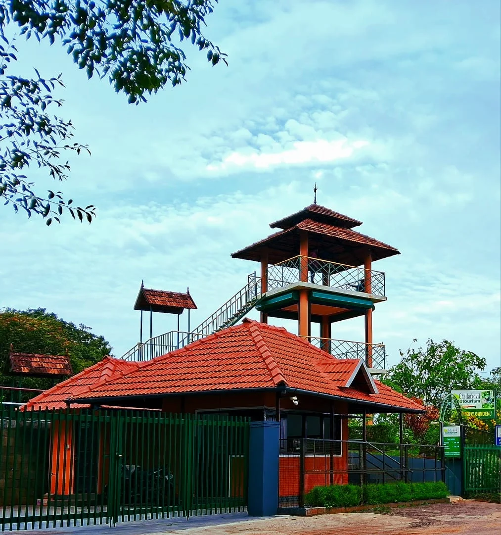
The Kerala Forest Department ecotourism centre at Chellarkovil, with a watchtower, botanical and butterfly gardens and views towards the Tamil Nadu plains. Private resort viewpoints and waterfall approaches are separate visits.

25.3 km · 32 min drive
viewpointAnchuruli

The Anchuruli reservoir-side landscape near Kattappana, where the Erattayar diversion tunnel discharges towards Idukki reservoir. Plan an exterior viewpoint visit; the water tunnel is working infrastructure.

29.8 km · 43 min drive
wildlifeMathikettan Shola National Park

Mathikettan Shola protects a remnant of native Cardamom Hills forest in Idukki. Visits are arranged through the Forest Department, with distinct Pethotty and Choondal approaches; a reservoir viewpoint is not a park-entry permit.

37.2 km · 56 min drive
viewpointPandikuzhi

Thekkady-side valley and stream landscape on the Kerala-Tamil Nadu edge.

32.9 km · 43 min drive
damAnayirankal Dam

Anayirankal is a KSEB earth-and-rockfill dam and reservoir in the Panniyar hydel system near Chinnakanal and Santhanpara. The map identifies the published hydel visitor-centre marker; boating is not currently assured.

39.9 km · 57 min drive
viewpointKalvari Mount

Reservoir-view hill point near Idukki and Cheruthoni, useful for scenic drives, photos and central high-range itineraries.

33.3 km · 45 min drive
viewpointKolukkumalai

High tea-estate sunrise viewpoint reached by jeep from the Munnar side.

50.4 km · 79 min drive
trekMangaladevi Temple trek

Seasonal forest trek from Thekkady to the ancient hilltop Mangaladevi Kannaki Temple near the Kerala-Tamil Nadu border, opened by the forest department mainly around Chithra Pournami.

43.0 km · 59 min drive

All 4 places to visit in Ramakkalmedu →

Walking and driving times are real routed distances, except the few marked “straight line”, which are direct-line estimates and will read short. Fare figures are estimates from Kerala’s notified auto/taxi tariff and exclude waiting and night charges. Routing: © openrouteservice.org by HeiGIT | Map data © OpenStreetMap contributors

On the map

Where Aamai Para is

Good to know

Aamai Para — frequently asked

When is the best time to visit Aamai Para?

June to September if you have come for the wind, October to February for the clearest view, and April is the month to avoid. This is one of the few places in Kerala where that advice rests on measurements rather than impressions: the Centre for Wind Energy Technology ran a mast 750 metres east of this rock for the state's renewable energy agency from January 1992 to December 1995 and recorded a maximum monthly mean of 13.04 metres a second in June against a minimum of 4.96 in April, with an annual mean of 8.41. Every month except April fell between 6.94 and 14.5 metres a second. So June to August gives you nearly three times the wind April does — but it is also when the mist sits on the ridge, which the Malayalam travel press warns makes the track genuinely risky. October to February is the compromise: strong wind, clear air and the Tamil plains visible to Kombai and Cumbum. Whenever you come, early morning and late evening beat the middle of the day, and the opening hours here allow both.

What are the entry fee and timings at Aamai Para?

₹25 for an adult and ₹15 for a child, and the centre is open from 06.00 to 19.00. Both figures are published by the District Tourism Promotion Council, Idukki, which lists this as Aamappara Tourism Centre among its operating centres. Those hours are worth noticing: DTPC runs the Ramakkalmedu Tourism Centre a mile away from 08.30 to 18.00, so Aamai Para opens two and a half hours earlier and closes an hour later than the famous viewpoint — it is the only place on this ridge you can legitimately watch the sun come up from, and the last one open in the evening. The jeep is separate and is the real cost: a vehicle from Ramakkalmedu including the entry ticket is reported at ₹1,600. The DTPC counter number is 04868 243356.

How do I reach Aamai Para?

Get to Thovalappady junction on the Thookkupalam–Ramakkalmedu road and take a jeep from there. That is Kerala Tourism's own instruction and it is still correct. Measured by road on 25 August 2026: Thookkupalam to Thovalappady 3.90 km, which matches the 4 km every source publishes, and Thovalappady up to the rock 2.25 km of unsurfaced track. From the Ramakkalmedu viewpoint, going the way people actually go — down to Thovalappady and back up — it is 5.78 km, which is why every source says six kilometres. ⚠ A routing app will offer you 2.17 km over the ridge instead; that is not the way the jeeps go. Further afield: Nedumkandam 13.8 km, Cumbum 25.3 km across the border, Thekkady and Kumily 48.0 km, Munnar 59.5 km, Theni 64.4 km, Cochin airport 125.6 km, Kottayam Junction 144.5 km, Madurai airport 147.1 km. ⚠ Check that the jeeps are running before you set out — see the question about the ban below.

How much time do I need for Aamai Para?

Two to three hours from Thovalappady junction, or half a day if you take in Ramakkalmedu as well. The jeep leg is 2.25 km each way, about a quarter of an hour up and longer down if the red earth is wet. On top, allow an hour: the walkways, the several fenced viewpoints — Kerala Tourism says each has its own local name — and the crawl through the rock, which takes as long as it takes because only one person fits at a time. Add the 5.78 km round to the Ramakkalmedu viewpoint and the Kuravan–Kurathi statue and it is a comfortable half day. If you want the sunrise, come here first: this centre opens at six and Ramakkalmedu's does not open until half past eight.

What else is near Aamai Para?

Nearly everything worth seeing on this ridge is within two kilometres, but the roads make it further than it looks. Routed on 25 August 2026: Ramakkal, the rock the whole place is named after, 0.97 km; the Ramakkalmedu settlement 1.59 km; the Kuravan and Kurathi statue 1.47 km direct or 5.77 km by the Thovalappady road; the Ramakkalmedu viewpoint and hornbill watch tower 2.17 km direct or 5.78 km by the road the jeeps use; Thovalappady junction 2.25 km. The Pushpakandam and Kuruvikanam wind farms are about four kilometres north-west. Further out: Nedumkandam 13.8 km, Chathurangapara viewpoint 24.6 km, Chellarkovil 25.3 km, Anchuruli 29.8 km, Thekkady and the Periyar reserve 48.0 km, Kolukkumalai 50.4 km, Munnar 59.5 km. Across the border, Cumbum is 25.3 km and Kombai 31.1 km by road although only 6.7 km away in a straight line, because the escarpment has to be gone round.

What should I know before visiting Aamai Para?

Five things. The jeeps may not be running — off-road safaris were banned district-wide in Idukki in 2025 and this route was not among the nine reopened in the first phase, so telephone 04868 243356 before you drive. The published distance of six kilometres from Ramakkalmedu is correct and your map app's two kilometres is not, because the way in is via Thovalappady. The passage under the rock is a one-person crawl on hands and knees, so anyone who dislikes enclosed spaces should plan to stay outside. The wind is real: the state's own measurements give a June monthly mean of 47 km/h on an open rock with a steep drop on the eastern side. And if you are searching for the place at all, search ആമപ്പാറ — the English name returns nothing.

Can you still get to Aamai Para by jeep?

Ask before you go, and do not assume. In 2025 the Idukki district administration banned all off-road jeep safaris in the district after a run of accidents, exempting only Kolukkumala because it cannot be reached any other way. Around 103 jeeps work the Ramakkalmedu–Amappara run alone and Amappara was named among the destinations affected. Safaris resumed on 16 July 2025 in phases under the Kerala Adventure Tourism Promotion Society, with each route inspected and cleared by a Route Monitoring Committee headed by the local Sub-Collector and supported by the RTO, police, tourism department and panchayat, a limit of six passengers per jeep, breathalyser tests before departure and drivers holding special licences with three to five years' experience. Nine routes were published for the first phase — none of them this one — and we have found no published report of Ramakkalmedu–Amappara being added since. Meanwhile DTPC continues to list the tourism centre at the top as open. Telephone the DTPC counter on 04868 243356 and ask specifically about the jeep, not about the centre.

What is the crawl through the rock actually like?

Two large openings sit at the foot of the biggest boulder and a passage joins them, so you go in by one and come out of the other. The approach to it is a footpath wide enough for one person. Inside you cannot walk: Malayalam Manorama's account, the most detailed anyone has published, says you have to squirm through the way soldiers crawl under barbed wire, sliding, sitting and lying by turns. Steel handrails have been fitted at several points and steel guards underneath so that nobody drops down through the crevice. The interior is roughly big enough for two people to shelter in, and some in the valley say a thief called Kodali Paramu did exactly that during the rice-smuggling years. It is called the punarjani gap locally, after the rebirth tunnel at Thiruvilwamala. ⚠ It is a genuine squeeze between boulders with a drop beside it, not a walkway — if enclosed spaces are not for you, the viewpoints outside are most of the reason to come anyway.

Is Aamai Para in Kerala or in Tamil Nadu?

Kerala, by twenty-five metres — and it is the only feature on this ridge that clearly is. The state boundary follows the crest here and passes 25 m east of the rock; the geocoder places the point in Thovalappady, Chottupara, Udumbanchola, Idukki, Kerala 685552. Every other named feature at Ramakkalmedu falls on the other side of that line on the same map: the Kuravan and Kurathi statue, the viewpoint, the hornbill tower and Ramakkal itself all return Uthamapalayam, Theni, Tamil Nadu, as does the settlement node that carries the Malayalam name രാമക്കൽമേട്. Kerala Tourism and Wikipedia both describe Ramakkalmedu as an Idukki hill station, so the boundary as mapped and the destination as described do not entirely agree. The Government of Kerala's own wind survey put it plainly in 2005: the border line “divides the ridge equally and it confines the utilization of lands for wind power projects”.

How windy is Ramakkalmedu really?

Windier than almost anywhere in India, and much less constant than everyone says. The Centre for Wind Energy Technology measured it for the state's renewable energy agency on a mast 750 m east of this rock, logging from January 1992 to December 1995 at ten and twenty metres. The annual mean at twenty metres was 8.41 metres a second — about 30 km/h — which the agency called one of the highest annual mean wind speeds observed in the country, with an annual mean wind power density of 546 W/m². The maximum monthly mean was 13.04 m/s in June, roughly 47 km/h; the minimum was 4.96 m/s in April, roughly 18 km/h. 🔴 The same page of that report also says “the wind speed is almost constant throughout the year”, which its own figures contradict, and that sentence is almost certainly the origin of the constant-35-km/h claim repeated across the travel web. The report is more useful where it is specific: the wind falls off as you go west, and the maximum pressure is felt right at the points where the ridge ends in the steep eastern escarpment — which is where this rock is.

Read before you go

Aamai Para guides, stories & itineraries

Stories & history of Aamai Para

Written about Aamai Para itself — its history, its legends and the arguments about them.

Around Ramakkalmedu

These guides explore Ramakkalmedu and the surrounding area. Choose a visit that fits your interests, allowing separately for travel between stops.

Kerala-wide guides & itineraries

Route-level itineraries and practical guides for the rest of Kerala.

See all 152 Idukki guides & stories →

Image credits

Photographs: Emmanuel P.Loui (CC BY-SA 4.0), Jithin cp 99 (CC BY-SA 4.0), Mprabaharan. Uploaded by Mprabaharan at en.wikipedia (Public domain), Jaseem Hamza (CC BY 3.0), MatthewsM2 (CC BY-SA 4.0), Balachand (CC BY-SA 3.0), Suresh Krishnan (CC BY-SA 4.0), Vssekm at English Wikipedia (CC BY-SA 3.0), Mprabaharan (Public domain), Edukeralam (CC BY-SA 4.0), Sibyperiyar (CC BY-SA 3.0), Sibil k p (CC0), Edukeralam, Navaneeth Krishnan S (CC BY-SA 3.0), Aml jhn (CC BY-SA 3.0), Arshad.ka5 (CC BY-SA 4.0), Hari880 (CC BY-SA 4.0), Ullas G Kalappura (CC BY-SA 4.0), Editzz by me (CC BY-SA 4.0), Augustus Binu : flickr (CC BY-SA 3.0), Sajith Erattupetta (CC BY 4.0), Drajay1976 (CC BY-SA 3.0), Sajetpa at Malayalam Wikipedia (CC BY-SA 3.0), Hrishikesh.kb (talk) (CC BY-SA 4.0), Rojypala at Malayalam Wikipedia (CC BY-SA 3.0), Rojypala at ml.wikipedia (CC BY-SA 3.0). Wikimedia Commons.