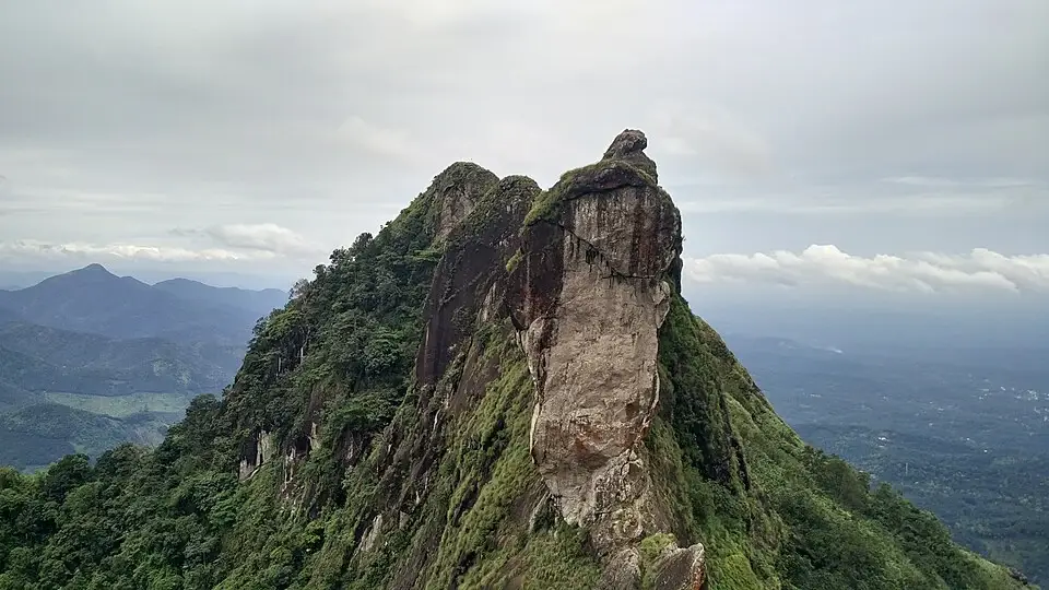
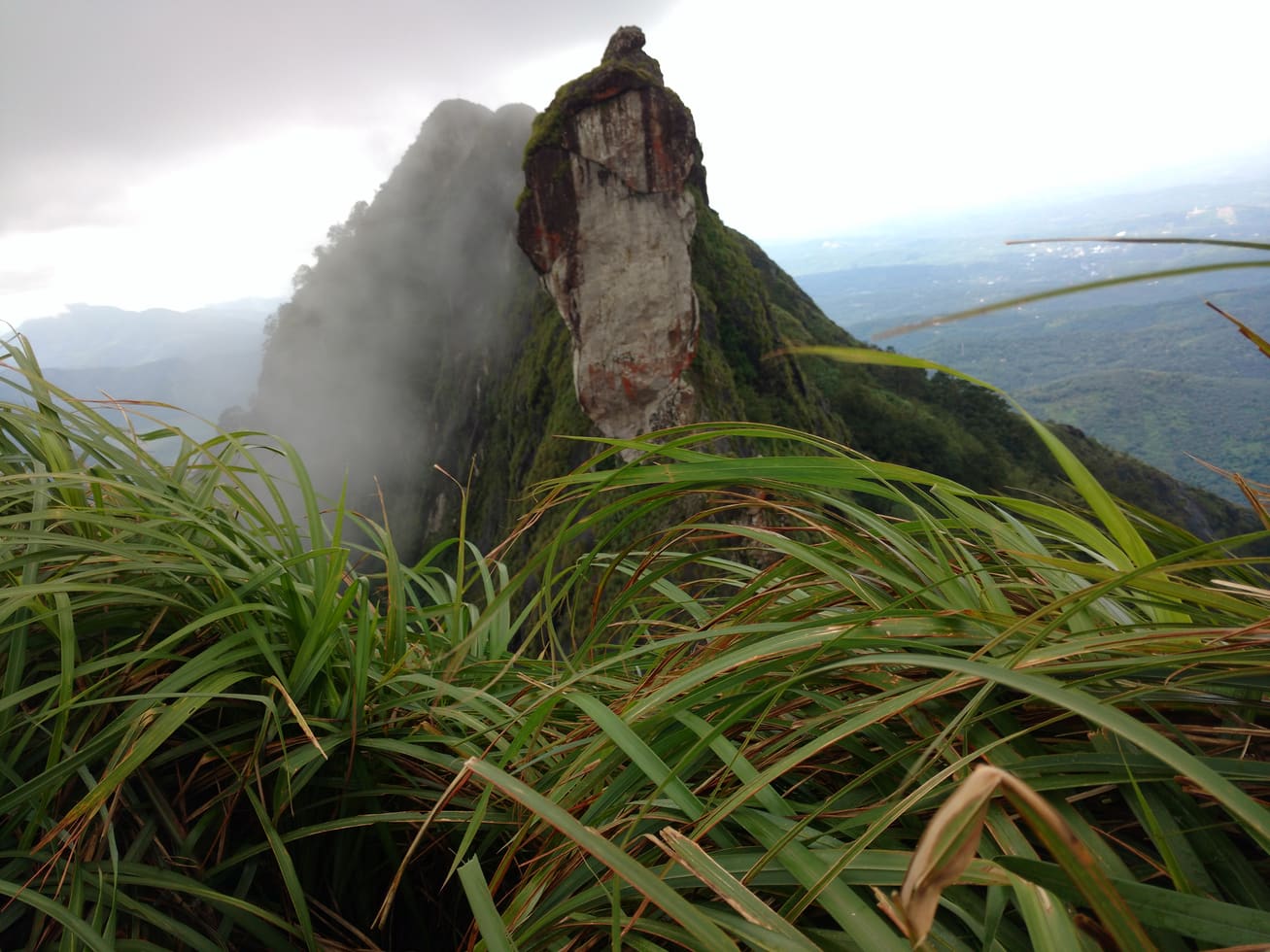
The most recognisable part of Illikkal Kallu is a pale, nearly vertical rock face under a darker cap. Grass climbs the adjoining slope, while the ground drops sharply away on either side. Seen from the visitor area, the formation has the presence of a tower without being a building.
The story of Illikkal Kallu trek
Walking changes how the tower enters the view. The approach turns through the hillside, so foreground grass, the shoulder of a slope and the rock itself do not stay aligned. A narrow view can make the pinnacle seem detached; a wider one shows the steep ridge carrying it. That changing relationship is one reason to spend time on the approach rather than treating the entire visit as a single camera stop.
The rock face carries broad differences in colour and texture. Pale exposed stone occupies its front, darker streaks descend from the upper edge and vegetation catches in places that hold enough material for growth. These are features a visitor can observe from a permitted position. They do not require touching the face or approaching its foot, and a distant photograph cannot establish a safe climbing line.
DTPC places the formation on Illickal Mala and describes the neighbouring shapes through the names Kuda Kallu and Koonan Kallu. The names compare rock with an umbrella and a hunched form. They give the skyline an accessible vocabulary, although individual shapes can look quite different as the viewing angle changes. Ask for a local identification before assigning every visible projection a name.
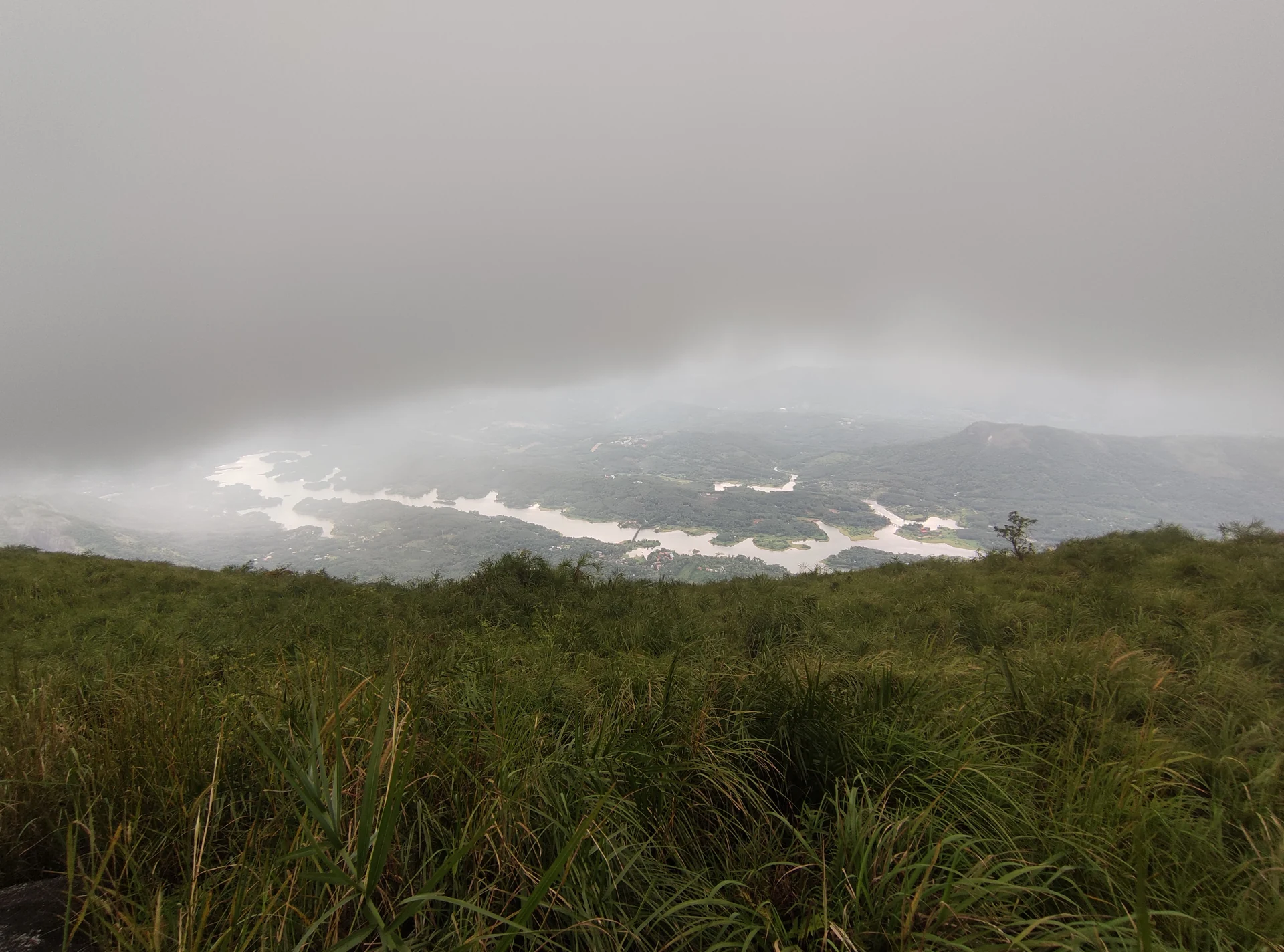
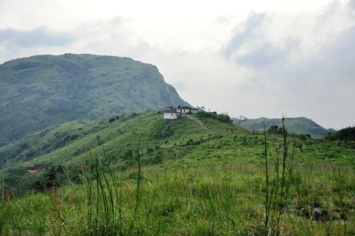
Beyond the rock, the view opens into a landscape with many smaller folds. Wooded slopes, scattered clearings and distant settlement patterns become easier to distinguish when the air is clear. The district account connects the valleys with tributaries of the Meenachil. A view of that catchment is not a close inspection of a single named river channel; leave distant silver lines unnamed unless they can actually be identified.
Cloud can change the scale of the scene. When the valley disappears, the tower becomes the main visible object, its lower slope dissolving into white. That photograph can be striking, but the same cloud also reduces the information available to a walker. If the route or the safe edge is no longer clear, the appropriate response is to shorten the visit rather than search for a more exposed angle.
The approach has a transport function as well as a scenic one. The authority describes both a short jeep ride and a hike along the winding path. Pedestrians should therefore settle the current arrangement at the entrance and remain alert to the way vehicles use the road. A place where everyone pauses to admire the same view may still need to remain clear for turning or passing.
A good visit finishes with the group comfortably back at the entrance. Descending a steep approach can put more demand on balance than climbing it, particularly after rain. Keep a little time for that stage instead of using the whole visitor window above. The final view can be remembered just as well from secure ground as from a hurried stop on the way down.
Illikkal’s connection with the Meenachil becomes more precise in the Erattupetta Block Panchayat watershed plan. The document identifies the Vadakkanaar as coming from Illikkal Kallu and describes its meeting with the Meenachil in the Panachikappara watershed. This gives the hill a relationship with the country travelled through on the approach. Water from the high ground belongs to a network of tributaries and confluences, eventually joining the river that organises much of the lower landscape.
The watershed account places the confluence near Angalamman Kovil and uses rivers, roads and local landmarks to describe boundaries around Erattupetta and Poonjaar. For a visitor, it offers a useful change of scale: the dramatic rock is part of a catchment connected with inhabited towns below. Enjoy the view with that larger pattern in mind. The document explains the drainage connection; it is not a walking map for following a stream downhill from the viewpoint.
A distant panorama can flatten this folded country. Slopes that overlap in the view may lie on opposite sides of a valley, and two nearby-looking points can require a road journey back around the hill. This matters when combining Illikkal with another highland stop. Use the actual approach roads for the itinerary and reserve the viewpoint for observing the terrain. A short gap in a photograph is a poor measure of how one inhabited valley connects with the next.
The entrance, the approach and the rock offer three different decisions for a group. At the entrance, decide who is comfortable with the agreed walking extent and who needs assistance with the climb. On the approach, maintain a pace that leaves everyone able to descend. At the viewing area, choose a secure place from which the rock can be appreciated without further scrambling. Dividing the visit in this way is useful for a family whose members have very different levels of balance and endurance.
A jeep-assisted visit still benefits from the same separation. The vehicle handles an agreed road section; it cannot make every part of the viewing ground equally easy to cross. Before getting in, establish where it stops, where the return begins and whether a person can remain at that point comfortably while others walk a little farther. This makes the choice about the actual visit rather than about an imprecise label such as easy trek. Someone who needs continuous wheelchair access should have the specific route agreed before travelling.
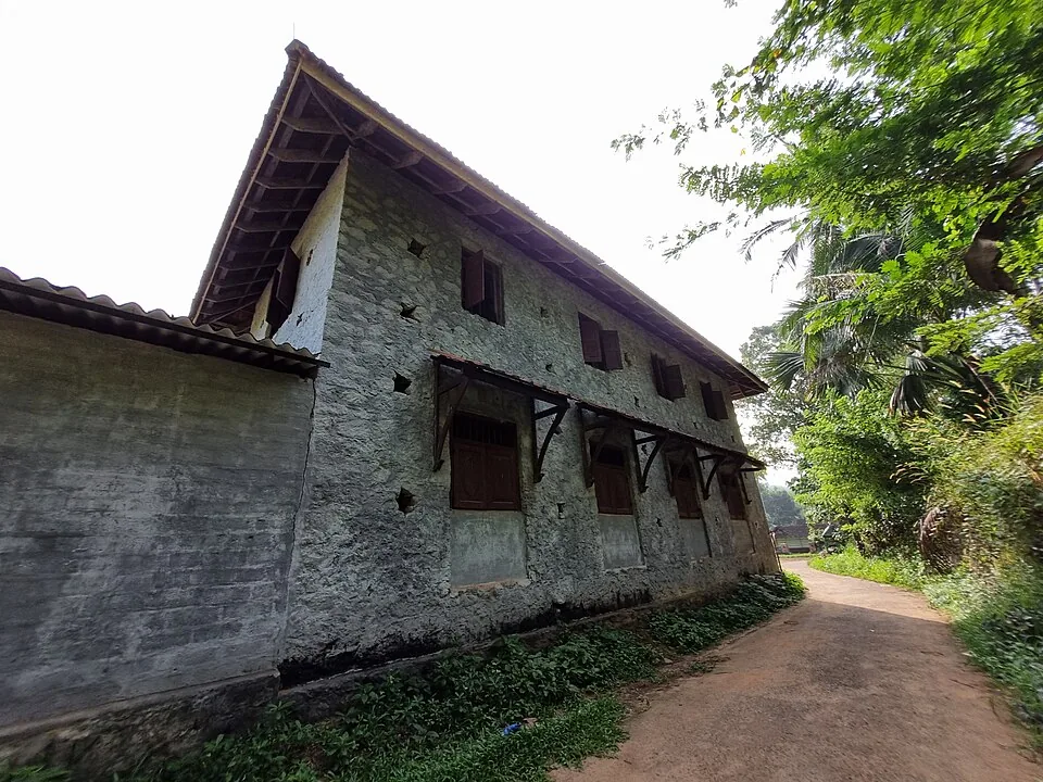
The photographed approach sign at Adukkam is a reminder that local road directions often carry a spelling different from the booking page. Keep Illikkal Kallu, Illickal Kallu and the sign’s Illikkakallu attached to the same destination when discussing transport. Share the entrance marker as well as the name. That combination is especially helpful when a driver is collecting the group after visiting another hill, because a remembered photograph of the rock does not identify a vehicle waiting area.
For photography, the rock and its surroundings reward separate frames. One can show the full tower and ridge; another can retain the grass through which it is seen; a third can look out across the lower country. These are different subjects available from an appropriate viewing position. A longer lens or a careful composition can change the emphasis without moving towards the drop. The older visitor photographs in the gallery document the scene at the time they were taken, while the present barriers and staff instructions determine where a camera may be carried today.
Illikkal and Ilaveezhapoonchira have different visual centres. Here the steep rock face dominates the immediate view, with the valley providing scale behind it. At Ilaveezhapoonchira, the enclosing hills and open ground create a broader landscape experience. Choose between them by the kind of visit the group wants, or give each its own approach and walking allowance if visiting both. They should remain two separately planned stops, even when a local itinerary sells them together as one highland excursion.
An onward stop in Erattupetta also brings the hill’s drainage story back into the journey. The town is a practical transport reference in the visitor guide and part of the river geography described in the watershed plan. Travelling back down therefore connects the elevated view with a working settlement rather than simply ending the scenery. Keep the descent unhurried enough to make the return arrangement comfortably; the hill does not become a better visit because the day contains the maximum possible number of viewpoints.