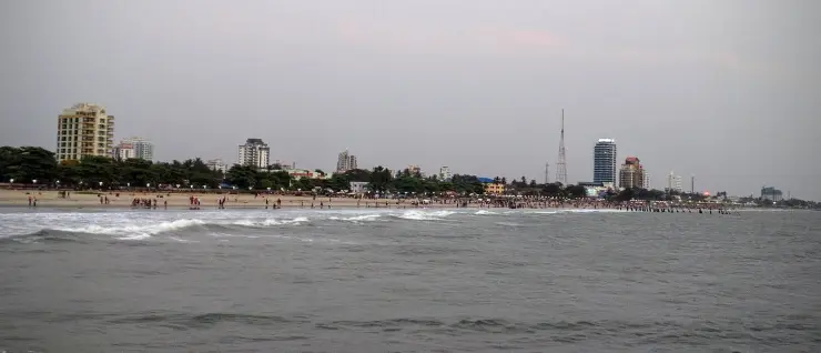
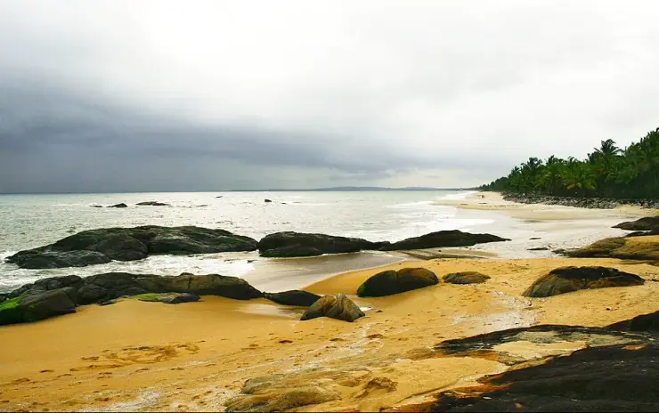
Kappad is a beach that everybody has heard of attached to a village that almost nobody writes about. The village is Kappad, or Kappakadavu, one of twenty wards in Chemancheri grama panchayat, in Koyilandy taluk of Kozhikode district — 16.76 square kilometres of coconut garden, paddy hollow, fishing hamlet and highway frontage running back from the Arabian Sea to the Atholi and Thalakkulathur boundaries inland. About 16 kilometres separate it from Kozhikode city, and rather less than that separates it from the Korapuzha, the river that for centuries divided North Malabar from South. The panchayat counted 31,326 people at the 2001 census and the revenue village of Chemancheri 34,819 at the 2011 one; the two figures cover different ground, so they are not a contradiction. This record is about that place — the wards, the boats, the halt on the railway and the memorial nobody photographs.
The first thing to get straight is that Kappad is not a resort strip with a village attached. It is a working panchayat, and the strand is one edge of it. Chemancheri grama panchayat covers 16.76 square kilometres and is divided into twenty wards: Chemancheri, Kanjilassery, Chemancheri East, Tuvakkod, Kolakkat, Pookkat, Pookkat East, Vettilapara, Vengalam, Thiruvangoor, Korappuzha, Vengalam West, Kannankadavu, Cheenicheri, Vikas Nagar, Kappat North, Kappat, Pookkat West, Tuvvapara and Kattilipeetika. It is bounded by Chengottukavu and Atholi to the north, Thalakkulathur and Elathur to the south, Atholi and Thalakkulathur to the east, and the sea to the west. Two of those twenty wards are the beach everyone comes for. The other eighteen are the part of Kappad that has never been written up, and they are where the place actually lives.
Read that ward list slowly and it turns into an archive. Kannankadavu and Kappakadavu both end in kadavu, the Malayalam word for a landing or crossing place on water — the name tells you what people did there long before anyone in Lisbon had heard of the coast. Cheenicheri, transliterated elsewhere as Chinnachery, is the Chinese settlement; the historian M. G. S. Narayanan lists it in Kozhikodinte Katha (2001, p. 41) alongside Chinakkotta and Chinthavalappu at Calicut as the surviving place-name evidence of the China trade. What that trade was, and why Chinese junks wintered on this stretch of coast at all, belongs to Koyilandy up the road and is told there. Here the point is smaller and stranger: an entire medieval commercial connection survives in this village as one ward name on a panchayat list.
Others carry plants rather than people. Dr Liji K of Nehru Arts and Science College, in a 2023 study of Koyilandy place names, reports the scholarly view that Vengalam — the ward and the junction on the Kozhikode road — takes its name from the venkana tree, a species so common in the tract that it named the place; she puts Ayinikkadu in the same family, from the ayini or anjili, and adds the practical footnote that anjili timber is what boats were built from, so the tree names and the harbour names belong to one economy. This is not folklore. It is the ordinary way a Malabar coastal parish gets labelled, and it is more informative about Kappad before 1498 than any of the plaques.
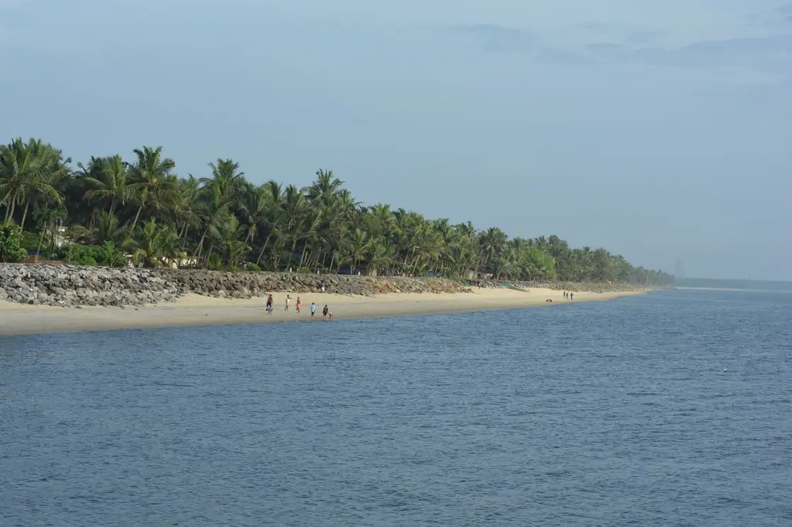
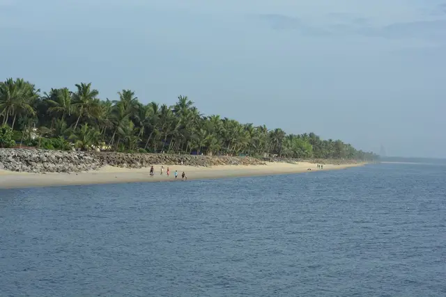
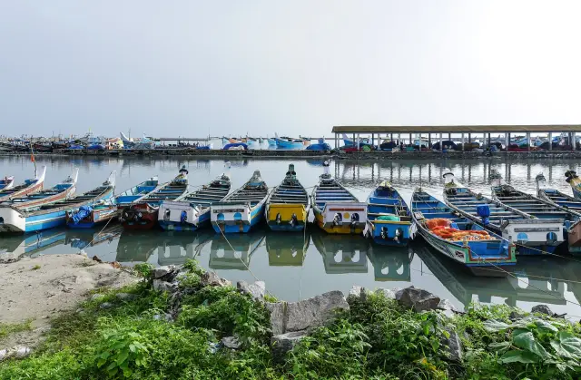
The fishing is not decoration. Go to the northern end of the strand, past the rocky headland, on any ordinary morning and you will find fifteen or twenty wooden canoes drawn up in a loose line on the dry sand — blue, yellow, green, some tarpaulined over, some with rolled nets and coir stacked beside them — with men working around the hulls and the palms of Chemancheri closing off the beach behind. A Commons photograph taken from the headland in May 2017 shows exactly that scene, with the coast running away south towards Kozhikode and the low reef breaking the water offshore. Nothing about it is arranged for visitors, and it is the honest reason to walk this end rather than the memorial end.
Inland, the village turns on Thiruvangoor. This is where National Highway 66 passes, where the buses actually stop, and where most people who say they are going to Kappad get down and take the last three kilometres west. Thiruvangoor carries the area’s higher secondary school and the Sree Narasimha Parthasarathy temple, a Vishnu shrine in which the deity is worshipped in two forms; the postal address puts it at Chemancheri, Thiruvangoor, Kozhikode 673318. The beach is 673304. Two postcodes inside one panchayat is a fair summary of how spread out this place is.
There is also a railway station in the village, and almost nobody tells you so. Chemancheri (station code CMC, Southern Railway, Palakkad division) sits on the Shoranur–Mangalore line at 11.4055°N, 75.7194°E — a little over two kilometres north-east of the beach centre, and comfortably walkable. Guidebooks and the English Wikipedia article on Kappad both send visitors to Koyilandy station, about ten kilometres away. That is good advice only if you need an express; Chemancheri is a passenger halt and few fast trains stop, but for anyone arriving on a local it is by a wide margin the nearest platform to the sand.
About a kilometre inland from the shore, at roughly 11.398°N, 75.7255°E, stands the monument the village put up for itself. It is a cast torch with a stylised white flame and a dove alighting on it, on a moulded dark plinth, and the Malayalam plaque beneath reads: Quit India Struggle Memorial, Chemancheri — Dedication: to the freedom fighters of Chemancheri, the known and those who were not known. Below that, the authority and the date: the Quit India Struggle Golden Jubilee Celebration Committee, 19 August 1992. It names nobody. We looked for what specifically happened at Chemancheri in 1942 and could not find it in any published source, English or Malayalam; the memorial appears to have been raised on the movement’s fiftieth anniversary by a local committee to mark participation rather than a single incident. It is worth two minutes of anyone’s day, and it is the exact opposite of the pillar down on the sand: that one names an event and no people, this one names people and no event.
The panchayat’s oldest formal shrine is at Kanjilassery, the ward at the inland end. The Kanjilassery Maha Siva Temple is a west-facing Siva temple counted among the traditional 108 Siva temples of Kerala, with Mahavishnu also worshipped there; local tradition attributes the installation of the idol to Parasurama and links the site to the sage Kasyapa, and holds that it was built at the same time as the temples at Kasi, Kanchipuram and Kanjirangad. Maha Sivaratri and Ashtamirohini are the observances that fill it. Those traditions are traditions, with no inscription or gazetteer behind them, and we print them as such.
One name from this village travelled further than the village did. The Kathakali master known as Chemancheri Kunhiraman Nair (26 June 1916 – 15 March 2021) carried the place as his professional prefix for eighty years of performing, and the English Wikipedia article on Chemancheri claims him as the village’s own. His biography does not quite agree: it places his birth, and his death at 104, at Cheliya, a separate village nearer Koyilandy, where he founded the Cheliya Kathakali Vidyalayam in 1983. He had already founded the Bharateeya Natya Kalalayam at Kannur in 1945, took the Kerala Sangeetha Nataka Akademi Award in 1979 and its Fellowship in 1999, and was given the Padma Shri in 2017. We record the disagreement rather than resolve it: the name is Chemancheri’s, the birthplace on the record is Cheliya’s.
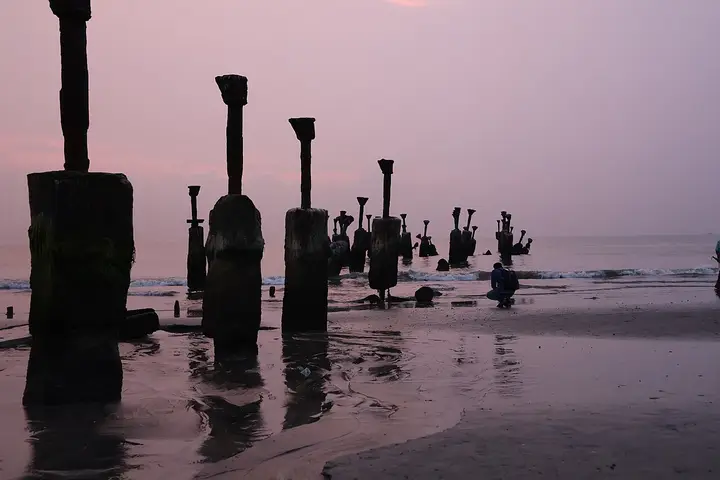
Finally, the thing the village worries about that the beach brochures do not mention. This is an eroding coast. Kerala’s draft coastal zone management plan for Kozhikode describes sea cliffs and rocky beaches at Quilandi, Elathur and Kappad, four groynes hold what sand remains along the southern half of the strand, and the harbour road running north from Kappad towards Koyilandy has given way to coastal erosion within the last few years. The 1939 pillar on the beach exists because the sea took the marker that stood before it. Nothing here is guaranteed to be in the same place in fifty years, and the people who live with that are the ones in the eighteen wards away from the sand.
Legend & myth
The legend that belongs to Kappad is not on the beach at all. It is seven miles south, in the water of the Korapuzha, and it is the reason a sixteen-kilometre drive from Kozhikode to this village was, within living memory of the people who taught the people now alive, a journey a woman of this coast could not lawfully make in reverse.
The rule is set out plainly in the standard colonial ethnography. Edgar Thurston and K. Rangachari, in Castes and Tribes of Southern India (1909), write of the Nayars: “The Nayars of North Malabar are held to be superior all along the line, clan for clan, to those of South Malabar, which is divided from the north by the river Korapuzha, seven miles north of Calicut, so that a woman of North Malabar would not unite herself to a man of her own clan name of South Malabar. A Nayar woman of North Malabar cannot pass northward beyond the frontier; she cannot pass the hills to the eastward; and she cannot cross the Korapuzha to the south. It is tabu.” Kappad lies on the northern bank of that line. Kozhikode lies on the southern one.
Two things in the same passage are usually dropped when the custom is retold, and both matter. The first is that it ran in both directions — “The women of South Malabar are similarly confined by custom, breach of which involves forfeiture of caste.” This was not a rule about one region’s women being kept in; it was a mutual enclosure, and the punishment on either side was loss of caste, which in a matrilineal household meant the boycott of the whole family, not merely the individual. The second is that there was an exception, and it was an exception of rank: “Women of the relatively inferior Akattu Charna clan are not under quite the same restrictions as regards residence as are those of most of the other clans” — which is why, Thurston notes, Malayalis obliged to live away from Malabar increasingly chose wives from that clan. The taboo bent first where status was lowest.
Where did it come from? Three explanations circulate and they do not agree. The mythological one comes from the Kerala Mahatmyam and puts it on Parasurama, who is said to have created three classes of women — of Asura, Gandharva and Deva origin — and assigned each its ground, forbidding them to mix. The political one, which is the version told in the country between the Korapuzha and Koyilandy, is that the boundary hardened out of the long rivalry between the Zamorin of Calicut and the Kolathiri of North Malabar; one strand of it holds that women of North Malabar were once detained at Calicut and married to Nair servants of the palace, and that the Akathu Charna Nayars are their descendants — which, if you believe it, explains why that clan alone was exempt. The economic one is the least romantic and probably the most operative: under marumakkathayam, property descended in the female line, and a woman who married across the frontier took a share of a taravad’s land with her. Preventing the crossing kept the land at home.
Here is the correction we owe the story. The line was not originally a river. The prohibition began as a prohibition on entering the Zamorin’s territory, and was later paraphrased into a prohibition on crossing the Korapuzha, the southern boundary of Kolathunad. Those two are not the same line, and Kappad is the proof. At its height the Zamorin’s country ran from Kollam to Kollam — from Panthalayani, in what became Kurumbranad taluk, all the way south to Quilon — and Panthalayani is north of the Korapuzha, up the coast from this village. So a woman standing on Kappad’s sand was, by the river rule, safely in North Malabar, and by the kingdom rule already inside the very territory the taboo was invented to keep her out of. The custom survived by forgetting the difference.
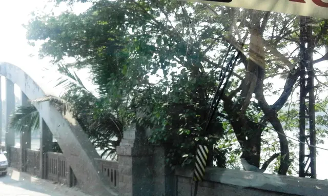
It ended, as these things do, quietly and unevenly. The Malabar Marriage Commission of 1891 recorded the practice while collecting evidence on Nair marriage; late-nineteenth-century challenges to it by figures such as the sub-judge Kuvukal Kelu Nayar and his son Kunhi Raman Nayar failed at the time; and Praveena Kodoth’s work on early twentieth-century Malabar finds that by the 1920s women were crossing the river without serious social consequence. What killed it was not a judgment but employment — government service, colleges and the Madras Presidency, which required people to live wherever the post was. Today the Korapuzha bridge on NH 66, 480 metres long on thirteen spans and completed in 1940, is the longest bridge in Kozhikode district and carries several thousand people a day across a line that once cost a caste.
Two smaller legends need refusing while we are here, because both are told at Kappad and both are wrong. The first is the folk etymology that Kappakadavu means the ship landing — kappal, ship, plus kadavu, landing place — and is therefore named for Vasco da Gama’s fleet. It cannot be. The Portuguese chroniclers of that very voyage already wrote the place down as Capua, Capucad, Capocate and Capogatto, which is to say the name was on the coast and in local use before any Portuguese ship could have given it; William Logan’s identification of those forms with Kappad has stood since the Malabar Manual. A kadavu is simply a landing or crossing place on water, of which this coast has dozens, and Kannankadavu in the next ward is one of them. The name is older than the story attached to it.
The second is subtler and is a refusal of an absence rather than of a claim. The temple on the rock at the north end of the beach — its name, and the “over 800 years” that tourism copy prints for it — belongs to the beach’s own record and is dealt with there. What we can add from this side is what we searched for and did not find: in Malayalam, ഒരുപൊട്ടുംകാവ്, കാപ്പാട് ക്ഷേത്രം, ഐതിഹ്യം and ഭഗവതി, across ml.wikipedia, the Aithihyamala and Malayalam devotional and news sources, we found no origin legend for it at all — no swayambhu story, no arrival myth, no festival narrative. That is not the same as saying none exists; village kavu traditions are frequently oral and unpublished, and this coast has certainly not been fully written down. It means only that if you are told a legend of that shrine at Kappad, you are hearing something we could not find in print, and it is worth writing down.
More about Kappad
History
Administratively, Kappad has always been a piece of somewhere larger. Revenue records list thirty-six villages in Koyilandy taluk, Chemanchery among them, alongside Pantalayani, Viyyur, Mudadi, Thikkoti and Payyoli; earlier the tract fell within Pantalayani amsom and Kovalkandy desom in Kurumbranad taluk. The panchayat itself belongs to Panthalayani block. None of these units was ever called Kappad. The beach lent its name to the bus stop and eventually to the district’s tourism map, but the administrative name of this place, for as long as there have been records, is Chemancheri.
The medieval position of the village was that of a coastal hamlet on a contested frontier. The Korapuzha, a 40-kilometre river draining 624 square kilometres and reaching the sea at Elathur, marked the conventional divide between North and South Malabar; the Zamorin’s expansion pushed his authority north past it, taking in Panthalayani Kollam. Kappad sat between the two — a stretch of rock, sand and fishing hamlet on the seaward edge of that overlap, with the working port five kilometres north and the great market fifteen kilometres south.
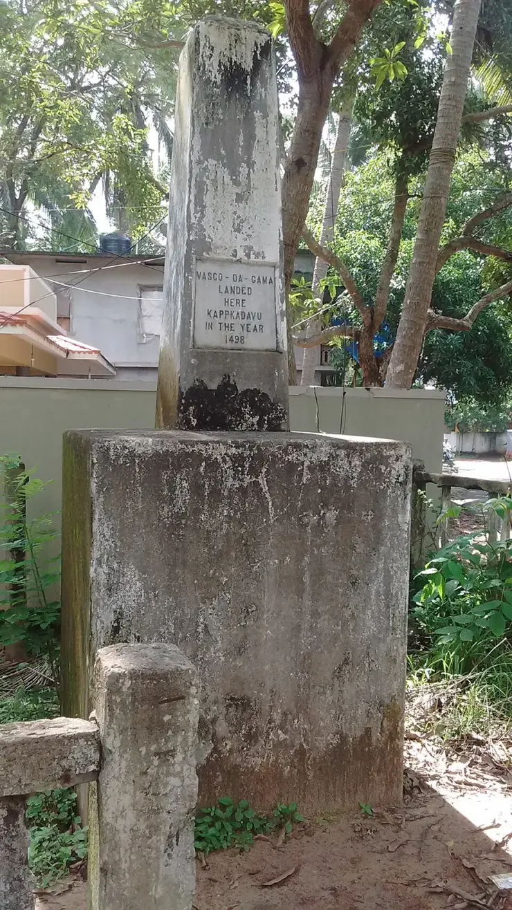
The event of 20 May 1498 happened offshore here, and it is not this record’s subject: the fleet’s anchorage, the eight days that followed, the move north to Panthalayani Kollam and the pillar that commemorates it are set out in full on the Kappad Beach page and on the Koyilandy page. What is worth saying at village level is how little it changed the village. No Portuguese settlement was founded here, no fort was raised, and no padrao has ever been excavated from this sand. Chemancheri went on being a fishing and coconut parish, and its own recorded history for the next four centuries is agrarian, not maritime.
The colonial period left three durable things in the ground. The railway came through on what is now the Shoranur–Mangalore line, giving the village its own halt at Chemancheri. The Conolly Canal, cut between 1848 and 1850 under Henry Valentine Conolly, Collector of Malabar, ran 11.4 kilometres from the Korapuzha south to the Kallai river, tying this stretch of coast into the inland freight route to Kallayi port. And in 1940 the Korapuzha road bridge was completed — 480 metres, thirteen spans, still the longest in the district — which finally made the run into Calicut an unremarkable journey rather than a ferry crossing.
The freedom struggle reached Chemancheri as it reached the rest of Malabar, and the village’s own account of it is the torch and dove memorial raised on 19 August 1992 by a golden-jubilee committee, dedicated to the freedom fighters of Chemancheri, known and unknown. Koyilandy taluk’s best-documented episode of the period, the Keezhariyur bomb case of 1942, belongs further north; whether Chemancheri men were part of it we could not establish. The memorial’s own wording suggests its makers could not fully establish it either, and chose to say so.
The modern chapter is a tourism chapter, and it is recent. A Rs 1.5 crore beautification of the beach was launched in 2007; a far larger Blue Flag rebuild followed in 2019–20, and Kappad was named on 11 October 2020 among India’s first eight Blue Flag beaches, raising its flag on 29 December 2020 ahead of the other seven. The details of that programme sit on the beach record. Its effect on the village is the part usually left out: a panchayat with a 2001 literacy rate of 91.9 per cent, whose economy was fishing, coconut and remittance, acquired a nationally certified visitor attraction in two of its twenty wards, and is now managing the traffic, the parking and the eroding harbour road that came with it.
Why visit
It is the rare Kerala beach village where you can walk from a working fishing fleet to a mainline railway halt to a 1992 freedom memorial inside an hour.
The northern end of the strand, past the headland, is where the canoes are drawn up and the nets are mended, and it is nothing like the memorial end.
Chemancheri station is a little over two kilometres from the sand, which makes Kappad one of the few Malabar beaches you can genuinely reach on foot from a train.
The Quit India Smarakam a kilometre inland is unsignposted, unvisited and carries one of the more honest inscriptions in Kerala.
Kanjilassery Maha Siva Temple, at the inland edge of the same panchayat, is counted among Kerala’s traditional 108 Siva shrines and sees almost no visitors.
You are standing on the northern bank of the Korapuzha line — the old boundary between North and South Malabar — which is a better story than most beaches have.