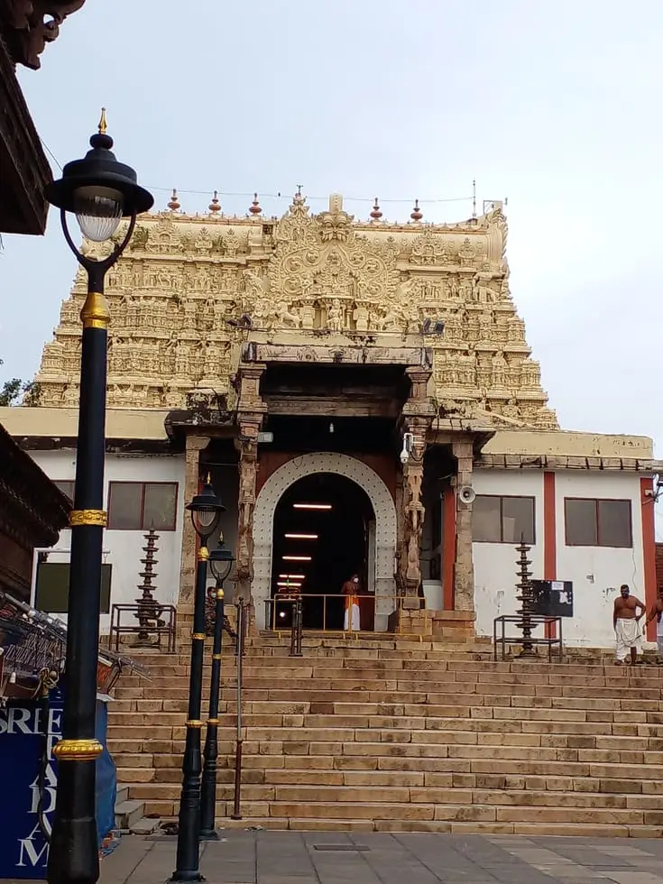
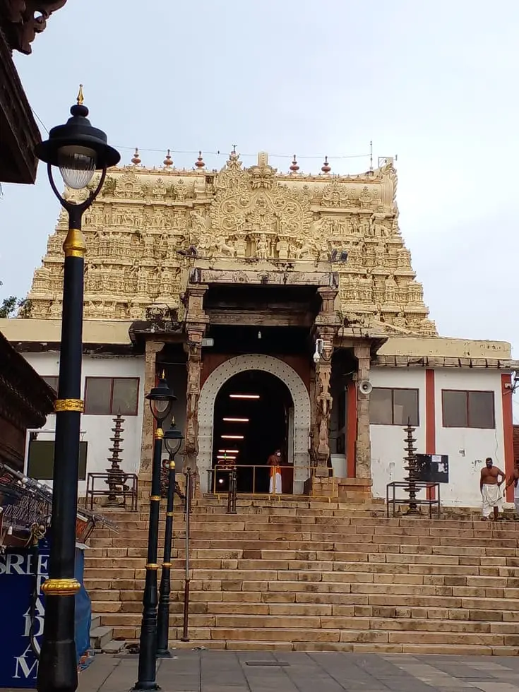
Thiruvananthapuram is the only Indian state capital that was once, in law, the property of a god. On 3 January 1750 Marthanda Varma made over the kingdom of Travancore to Padmanabhaswamy and ruled thereafter as Padmanabhadasa, the deity’s servant — and every Travancore sovereign after him governed on the same terms. The city you walk through is what that arrangement built: a temple at the dead centre of a walled quarter, a two-kilometre bazaar laid out to feed it, a palace beside it, and then, ring by ring, the apparatus of a small state that decided institutions were the point — a public library in 1829, an English school in 1834, an astronomical observatory in 1837, a general hospital in 1839, a museum and a zoo in the 1850s. It has since added a rocket range and India’s first technology park, and both of those are on the same thread.
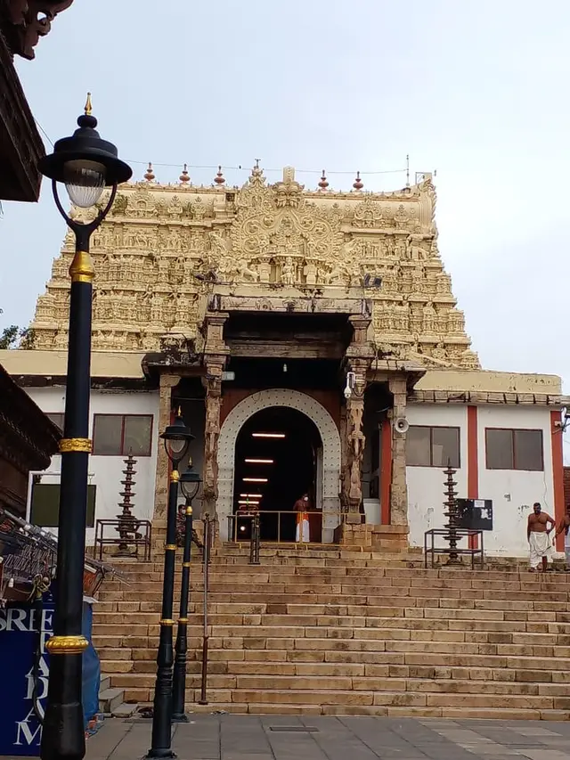
Start with the shape, because the shape is the argument. Almost every old Kerala town grew along a river, a backwater or a trade road. Thiruvananthapuram grew in rings around a shrine, inside a wall, on ground chosen for a temple rather than for a harbour or a ford. The Sree Padmanabhaswamy temple sits at the centre; the fort ran round it on all four sides; the palace quarter, the tank, the ceremonial routes and the market street were laid against it. Everything that has happened to the city since — the Secretariat, the university, the airport, the rocket range, the software park — has happened outside that ring and has arranged itself around it. Nowhere else in Kerala can you read a state’s constitution off its street plan.
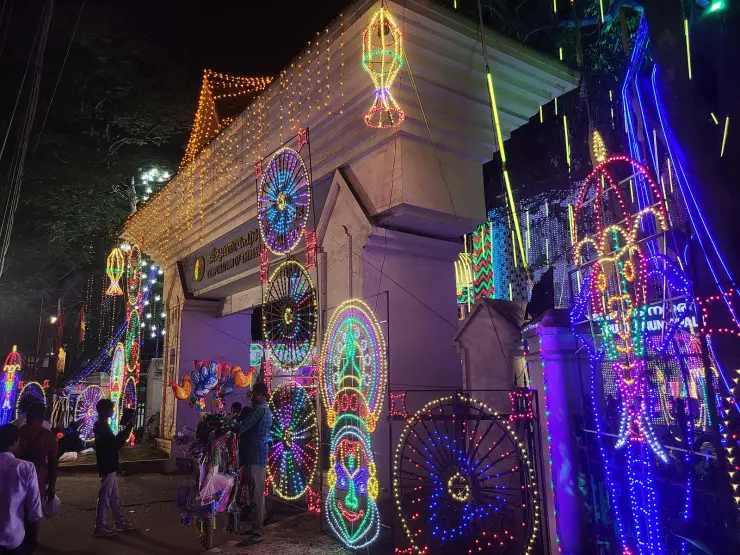
The wall is still there, and most visitors miss it because they are looking for a fort and it is not one. East Fort — Kizhakkekotta, the eastern gate — is now the busiest bus and shopping node in the city, and the fortification survives as fragments: a long run of massive dressed stone blocks beside the road, protected as a monument, and a pair of gateways. The white classical gate with the pediment and the colonnaded pavilion is the one every photograph shows. Behind it, on the road that cuts through the line of the wall, stands a red brick Gothic-revival gatehouse with twin crenellated towers, the Travancore conch set in white on its parapet and the year picked out beside it in numerals a metre high: 18 91. It is a Victorian insertion into a much older enclosure, and it dates itself, which is more than most of the buildings around here do.
Running east from that gate is Chalai. It is a straight two kilometres of bazaar from Killipalam to East Fort, and it is the oldest continuously working commercial street in the city — established at the end of the eighteenth century by Raja Kesavadas, Dewan of Travancore, as the central supply point for the kingdom. Kesavadas is better known for what he did on the other coast, where he opened the port of Alappuzha in 1762, and this is the same instinct applied to a capital: put the goods where the government is. The Killi and the Karamana rivers brought produce in. The street still does what it was built to do — vegetables, hardware, textiles, spices, gold — and at Onam more than ten thousand kilograms of flowers pass through it for the floor-designs. Most shops keep roughly nine in the morning to eight at night and close on Sunday; the crowd is heaviest in the last two hours.
It became the capital late. Travancore’s seat was at Padmanabhapuram, forty-odd kilometres south in what is now Tamil Nadu, and the administration moved north to Thiruvananthapuram in 1795, under Karthika Thirunal Rama Varma, the Dharma Raja. That is a generation and a half after the dedication of 1750 — the god had the kingdom before the government had the city — and it explains a peculiarity of the place: the ritual centre is genuinely old, and the administrative city around it is not. Almost everything that looks historic here, outside the temple compound and the fort, was built between about 1830 and 1900.
That seventy years is the interesting part, and it is not a story about architecture. Under Swathi Thirunal Rama Varma, who ruled from 1829 to 1846, a state with a population smaller than a modern Indian city built a public library in 1829, the Raja’s Free School in 1834 — the first government English school, which survives as University College at Palayam — and an astronomical observatory in 1836–37. A general hospital followed in 1839. The observatory was not decorative: the maharaja’s cousin, Raja Rama Varma of Mavelikara, was a working astronomer and a member of the British and Canadian astronomical societies, and he wrote to the Resident proposing it. John Caldecott, who had been running a private observatory at Alappuzha, was appointed royal astronomer; Lieutenant W. H. Horsley of the Madras Engineers designed the building; it went up on the highest ground in the city, opposite the palace. Caldecott began meteorological readings in July 1837 and a Travancore Almanac appeared in 1838.
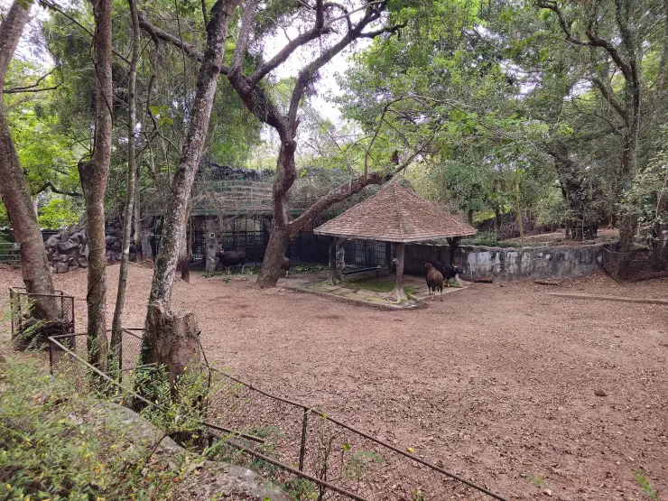
The programme did not stop with him. The museum institution was founded in 1855 and opened in 1857, the zoo followed in 1859, and the whole walled compound on the northern high ground became the city’s second centre — the Napier building, the art gallery, the botanical grounds and the animal collection all have their own records on this site and their own arguments about dates. What matters at the scale of the city is the pattern: for most of the nineteenth century Travancore spent on institutions the way other princely states spent on palaces, and the result is a capital that reads as a campus.
The most consequential thing that ever happened in this city happened in a fishing village at its northern edge. Thumba sits close to the Earth’s magnetic equator, which makes it an exceptional place from which to fire instruments into the ionosphere, and in 1962 it was chosen as India’s rocket range. The land — some six hundred acres of it — was a working coastal parish. The Bishop of Trivandrum, Rev. Peter Bernard Pereira, agreed to give it up, and gave up more than land: the prayer hall of St Mary Magdalene church became laboratory and workshop space, and the bishop’s own room became Vikram Sarabhai’s office. The first rockets were assembled in the former St Louis High School, which now holds a space museum. On 21 November 1963 a two-stage Nike-Apache, American-built, went up from Thumba; it was India’s first launch. TERLS was formally dedicated to the United Nations by Indira Gandhi on 2 February 1968, and after Sarabhai’s death on 30 December 1971 the Thumba establishments were renamed the Vikram Sarabhai Space Centre. None of it is open to casual visitors, and that is the point to make plainly rather than to leave people to discover at a gate.
The fourth layer is software. Technopark was conceived by the Government of Kerala in March 1990 as India’s first technology park, its foundation stone was laid on 31 March 1991, it opened for business in 1994 and was formally dedicated to the nation by Prime Minister P. V. Narasimha Rao in November 1995. It grew building by building — Park Centre, Pamba and Periyar first, Nila in 1997, Thejaswini in 2007 — and it is now the largest single source of employment in the state, with hundreds of companies and a workforce in the tens of thousands. Seen from the air it is not a business district at all: office blocks scattered through heavy tree canopy on the ridges north of the city, which is roughly how the nineteenth-century museum quarter was laid out too.
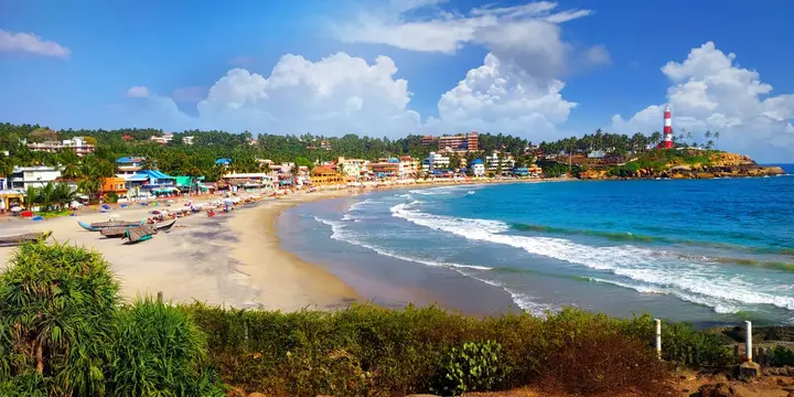
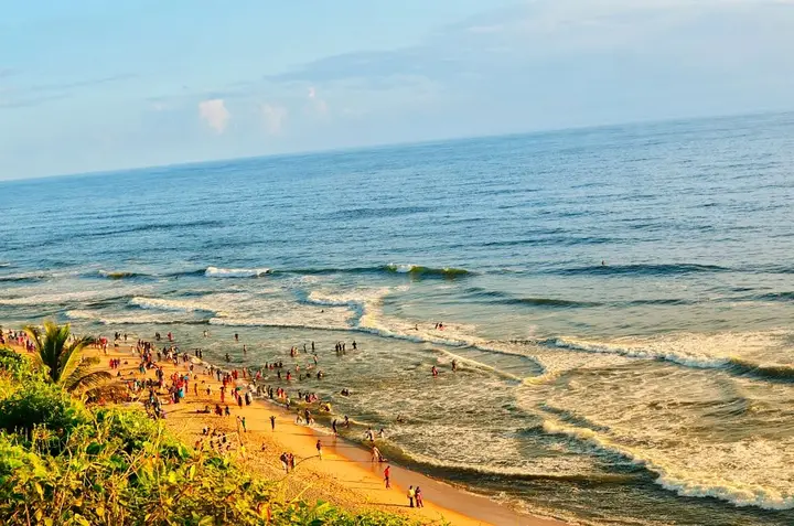
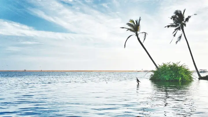
Walking it, the city divides into three easy days without much planning. The fort quarter — temple, palace, the wall, Pazhavangadi, Chalai — is one compact morning on foot, and the only part of the city where you can genuinely stay off buses. The museum quarter on the northern high ground is a second, and it is uphill from the centre. The coast at Shanghumugham and Veli, and the backwater behind it, is a third. Everything else — Neyyar, Ponmudi, Varkala, Kovalam — is a day trip, and the bus and rail hub for all of it is a single intersection at Thampanoor, where Thiruvananthapuram Central station faces the central bus station across the road.
Legend & myth
The name first, and then a refusal. Thiruvananthapuram is Thiru-Anantha-puram, the sacred city of Anantha — the thousand-hooded serpent on which Vishnu reclines — and the city is named for its deity rather than the other way round. The legend of how the god came to be here, the sage who wanted a vision, the child who defiled the worship and fled into the forest, the form so vast it had to be shrunk before human eyes could hold it, belongs to the Padmanabhaswamy temple and is told properly on that record. It is one of the finest origin stories in South India and we are not going to tell it twice. What belongs to the city rather than to the temple is the consequence: an entire capital took its name from a posture of sleep.
Underneath Chalai there may be a university, and this is the city’s genuine unsolved question. Kanthalloor Sala was a celebrated centre of learning under the Ay rulers — sometimes called a southern Nalanda — where Vedanta, tarka, vyakarana, Mimamsa, priestly practice and weapons training were all taught, and where even Lokayata, the materialist school, was on the syllabus. The historian T. Gopinatha Rao and others identified it with Valiyasala and the Chala quarter of modern Thiruvananthapuram, citing ninth-century references to a Kanthalloor Salai Mahadeva. K. V. Subramanya Iyer placed it seven miles off, near Neyyattinkara. Others have argued for Chendamangalam, or for somewhere near Vizhinjam. Nobody has settled it.
What is not in doubt is that the Cholas kept attacking it. Rajaraja Chola I recorded around 988 CE that he had done something to Kanthalloor Sala described by the verb kalamaruthu; Rajendra Chola I took both Kanthalloor and Vizhinjam around 1019 CE and renamed the port Rajendra Chola Pattanam; Kulothunga attacked it later still. Even the verb is contested — kalamaruthu has been read as destroying ships, as cutting off the students’ food supply, and as defeating the scholars in debate, which are three rather different events. Read the Chala bazaar with that in the back of your mind and the street changes character: it may be running over the site of an academy that a Tamil emperor thought worth boasting about twice.
The dedication of 1750 attracts a story that the record does not support. It is often told as expiation — that Marthanda Varma, having destroyed the Ettuveettil Pillamar and executed a great many of their families in the course of forcing his succession after 1729, gave the kingdom away to be rid of the blood on it. That reading is popular, it is old, and it may even be partly true, but it is not what the sources set out. The act itself is precisely dated: 3 January 1750, the fifth of Makaram in the year 925 of the Kollam era. The purposes given for it are political — to detach sovereign authority from ordinary civil dispute, to formalise a new distribution of power, and to bind a fractured society under a single emerging authority. A ruler who has just broken the aristocracy and needs the settlement to hold has an excellent secular reason to make rebellion into sacrilege. Both readings can be held at once; only one of them is documented.
Three different years circulate for the move of the capital, and travel writing picks whichever it met first. Malayalam Wikipedia’s city article gives 1745. The article on Raja Kesavadas says Chalai thrived after the capital shifted in 1786. English Wikipedia’s articles on the city, on Padmanabhapuram Palace and on Travancore all give 1795, and the last of those names the ruler: Karthika Thirunal Rama Varma, the Dharma Raja. We print 1795 because it is the best-attested and because three independent articles agree on it, and we say the others exist rather than pretending the question is clean. Part of the confusion is probably real history: a court does not move in an afternoon, and the sovereign, the treasury and the offices need not have arrived in the same year.
Now the coincidence, which is the best fact about this city and is almost never told. The observatory of 1837 was sited here partly because the magnetic equator at that time passed through Thiruvananthapuram, and its second director, John Allan Broun, was interested enough in the Earth’s field to plant a second station on the peak of Agasthyamalai and to publish the Thiruvananthapuram Magnetic Observations in 1874. One hundred and twenty-six years after Caldecott’s appointment, Thumba was selected as India’s rocket range for exactly the same property — proximity to the magnetic equator, which is where the equatorial electrojet runs and where ionospheric physics is best measured. The same invisible line chose this coast twice, for a maharaja’s telescope and for a national space programme, and neither choice had anything to do with the harbour, the climate or the politics.
Thumba itself is named after a flower, and the flower is the one Kerala cannot do without. Thumba is Leucas aspera, a small white-flowered herb of the mint family that comes up through the monsoon on waste ground and paddy bunds, and it is the flower at the centre of the Onam pookkalam — a garland or a floor-design without thumba was traditionally reckoned incomplete. India’s first rocket therefore went up from a village named after a weed that flowers for the harvest festival. We can find no legend attached to the village itself; Malayalam Wikipedia has an article on the plant and its uses in Ayurveda, and a short one on the settlement, and no ഐതിഹ്യം for either. That absence is worth stating: this was a small Latin Catholic fishing parish, and its recorded story starts in 1962.
Two things about Thumba get told wrong. The first is that India’s space programme began in a church. It began beside one: the prayer hall of St Mary Magdalene was used as workshop and laboratory space and the bishop’s room became Sarabhai’s office, but the rockets themselves were put together in the former St Louis High School, and it is that building, not the church, which now houses the space museum. The second is the bishop’s part in it, which is usually flattened into a sentence about a church being handed over. Rev. Peter Bernard Pereira persuaded a coastal parish to give up around six hundred acres of the ground it lived on, with the Belgian priest Vincent Victor Dereere and the district collector Madhavan Nair; the fishing families moved. That is a heavier thing than a building.
One superlative to leave at the door. Technopark is routinely described as the largest IT park in Asia, and English Wikipedia’s own article manages both that claim and the more modest “largest in India” within a few paragraphs of each other. The defensible statements are that it was India’s first technology park, conceived in 1990, and that it is the largest single employer in Kerala. Neither needs a continental league table, and nobody has published the arithmetic that would settle one.
More about Thiruvananthapuram city
History
Long before Travancore, this coast belonged to the Ay chieftains, and the learning centre of Kanthalloor Sala — which several historians place at Valiyasala and Chala inside the modern city, though the identification is disputed — was attacked by Rajaraja Chola I around 988 CE and taken with Vizhinjam by Rajendra Chola I around 1019 CE. Foreign traders knew the place under names that have not survived: Rótorá to the Portuguese, Uttere to the Dutch, and Trivandrum to the English, which stuck until the city was officially renamed in 1991.
The decisive act is dated. On 3 January 1750 — 5 Makaram 925 of the Kollam era — Marthanda Varma dedicated the kingdom of Travancore to Sree Padmanabhaswamy and thereafter ruled as Padmanabhadasa, the deity’s servant. Every subsequent Travancore sovereign held the state on the same footing. The temple’s own account of that act, and of the treasure it accumulated, is on the temple record; what concerns the city is that its central shrine was for two centuries the legal proprietor of the state around it.
The administrative capital moved from Padmanabhapuram to Thiruvananthapuram in 1795, under Karthika Thirunal Rama Varma, the Dharma Raja. His Dewan, Raja Kesavadas (1745–1799), laid out the Chalai bazaar at the end of the eighteenth century as the kingdom’s central supply market — the same official who had opened the port at Alappuzha in 1762. The fortified quarter around the temple, with its four sides and its eastern gate at Kizhakkekotta, defined the city’s core; a long section of its wall survives beside the road as a protected monument, and a brick gatehouse carrying the date 1891 stands where a later road was cut through the line.
The nineteenth century made it an institutional city. A library was founded in 1829 under Swathi Thirunal, opened to the public in 1898 and rehoused in 1900 in the Gothic building raised by Sree Moolam Thirunal for Queen Victoria’s Diamond Jubilee; the Raja’s Free School of 1834 became H. H. The Maharaja’s College in 1866 and University College in 1942; the observatory was established in 1836–37 with John Caldecott as royal astronomer and Lieutenant W. H. Horsley as its architect; the general hospital followed in 1839. The museum institution was founded in 1855 and opened in 1857, and the zoo in 1859. The original observatory was later demolished to make room for a water tank and rebuilt nearby, which is the building open to visitors today.
On 12 November 1936, on the eve of his twenty-fourth birthday, Maharaja Chithira Thirunal Balarama Varma issued the Temple Entry Proclamation from this city, opening Travancore’s state-controlled temples to communities previously excluded — the first such measure in any princely state or in British India. Gandhi wrote to him that he had “in reality become a ‘Mahatma’ … by your proclamation at this young age.” It is the last great act of the arrangement begun in 1750, and it was made possible by it: a sovereign who governed as the deity’s servant could reorder the deity’s temples by proclamation.
The modern city was made by three arrivals. The railway terminus at Thampanoor was inaugurated on 4 November 1931, with the central bus station opposite it. The airport, Kerala’s first, was established in 1932 and upgraded to international status on 1 January 1991. And the space programme came to Thumba in 1962, launching India’s first rocket on 21 November 1963 and becoming the Vikram Sarabhai Space Centre after Sarabhai’s death in 1971. Technopark, conceived in 1990 and dedicated in November 1995, added the fourth. The Corporation of Thiruvananthapuram now covers about 215 square kilometres, and the city’s literacy rate, at around 93.7 per cent, runs far above the national figure — the long tail of a state that started building schools in 1834.
Why visit
It is the only Indian state capital whose street plan is a constitutional document — a temple at the centre, a fort around it, and every later institution arranged outside the ring.
The fort quarter is genuinely walkable: temple, palace, the surviving wall, the Pazhavangadi shrine and two kilometres of working bazaar, all within one compact morning and no bus.
Chalai is a market that has been supplying a capital since the 1790s and has never been converted into anything for visitors — go at seven in the evening and it is entirely itself.
The observatory on the high ground, the library of 1829 and University College at Palayam are the physical remains of a small state that spent on institutions rather than palaces.
Thumba, fifteen kilometres north, is where India’s space programme began in 1963 in a fishing parish that gave up its land — and it is named after the flower without which an Onam pookkalam is incomplete.
Almost everything in southern Kerala is a day trip from the same intersection at Thampanoor: Kovalam, Varkala, Ponmudi, Neyyar and the Agasthyamala foothills.