Places to Visit in Ponmudi

Southern Western Ghats viewpoint and short-hike area.

Ponmudi
Practical guide

Plan Ponmudi

Who's going?Tailor Ponmudi to your trip
DistrictThiruvananthapuram
RoleHill base
Time neededA half to full day from…
Places to visit5Listed businesses4
What to expect

Highlights

  • Kalakkayam Waterfalls — A forest-edge cascade on the Mankayam river near Palode whose safe approach depends on rainfall, local guidance and current access controls.
  • Ponmudi — A small hill station and viewpoint drive in the southern Western Ghats.
  • Agasthyakoodam trek — Permit-only forest trek to a sacred Western Ghats peak, usually opened seasonally by the forest department.
  • Peppara trek — Forest Department trekking in the Peppara Wildlife Sanctuary on the Ponmudi–Vithura side, through the Karamana-river catchment and Agasthyamala foothills.
  • Ponmudi trek — Hill trekking around Ponmudi (“Golden Peak”, about 1,100 m) and the Kallar / Golden Valley trails, a cooler high-range walk near Thiruvananthapuram.
  • Peppara Dam — A reservoir on the Karamana river at the edge of the Peppara Wildlife Sanctuary near Ponmudi, with forest and elephant habitat.
Getting there

How to visit

  • Nearest airport: Trivandrum (TRV), in-district
  • Rail gateway: Thiruvananthapuram Central (TVC)
Timing

Best time to visit Ponmudi

October to March offers the coolest, clearest weather. Avoid the June–September south-west monsoon when the hairpin road turns slippery, mist blocks views and leeches are common on forest trails; roads can occasionally close after heavy rain.

Weather in PonmudiSeasonal guide

Live forecast loads in your browser.

Today at Ponmudi
Sunrise6:11 am
Sunset6:20 pm
Golden hour best light5:20 pm–6:20 pm
Blue hour after sunset6:20 pm–6:45 pm
Sun sets toward compass bearingW · 272°
Moon tonight🌓 First quarter · 56%
South-west monsoon. June to September is the south-west monsoon in Kerala. Expect heavy showers, mostly in bursts rather than all day — carry rain cover, allow extra time for getting around, and note that ferries and open-air sites are the first things affected.

Sun and moon are calculated for this location and shown in IST. Photography windows are the hour around sunrise and sunset; the sunset bearing is degrees clockwise from true north. Moon phase is accurate to about half a day.

The story

The story of Ponmudi

Ponmudi — the name means ‘golden peak’ or ‘golden crown’ in Malayalam — is a misty little hill station roughly 1,100 metres up in the Western Ghats, about an hour and a half northeast of Thiruvananthapuram. Reached by a slim ghat road that coils through 22 hairpin bends, it is a place of tea-clad slopes, grassy meadows, cool clean air and the clear Kallar stream, all wrapped in the great Agasthyamala forests that spill over the hill’s edges.

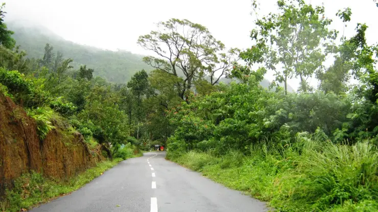
The drive is half the pleasure. From the plains you climb through Vithura and cross the Kallar, and then the road begins to fold back on itself — 22 numbered hairpin bends stitched into the hillside, each one lifting you a little higher into cooler air. Rubber and forest give way to tea gardens and the world seems to tilt; on a clear morning the valley falls away below in soft blue folds, and on a misty one the bends simply vanish into cloud a few metres ahead. It is a slow, deliberate ascent — better savoured than hurried — and the narrow single-lane stretches reward an unhurried driver.

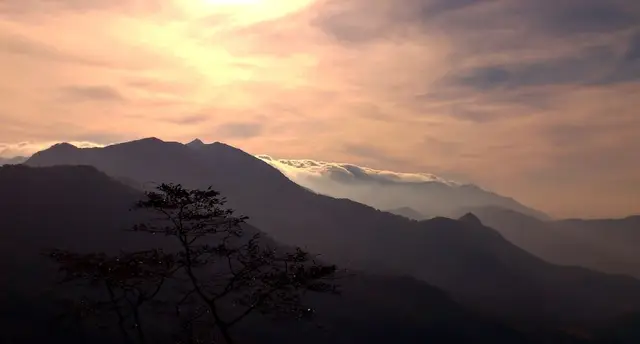
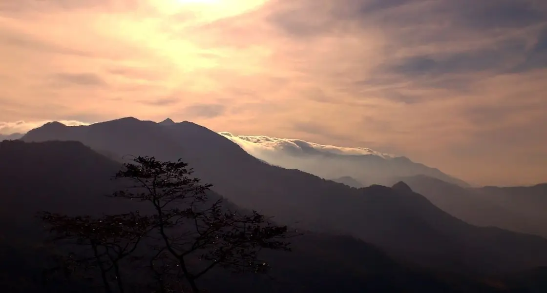
At the top the light changes. Mist drifts in and out through the day, thickening in the late afternoon until the tea slopes seem to float, then lifting to reveal ridge upon ridge of the Ghats marching south towards Agasthyamala. It is this play of low sun on damp green — the way the hills catch a gold-tinged glow at dawn and dusk — that is said to have earned Ponmudi its ‘golden crown’ of a name. The manicured tea bushes climb the shoulders of the hill in neat contour lines, and among them narrow paths lead the curious out onto grassy shelves with long views over the plains.

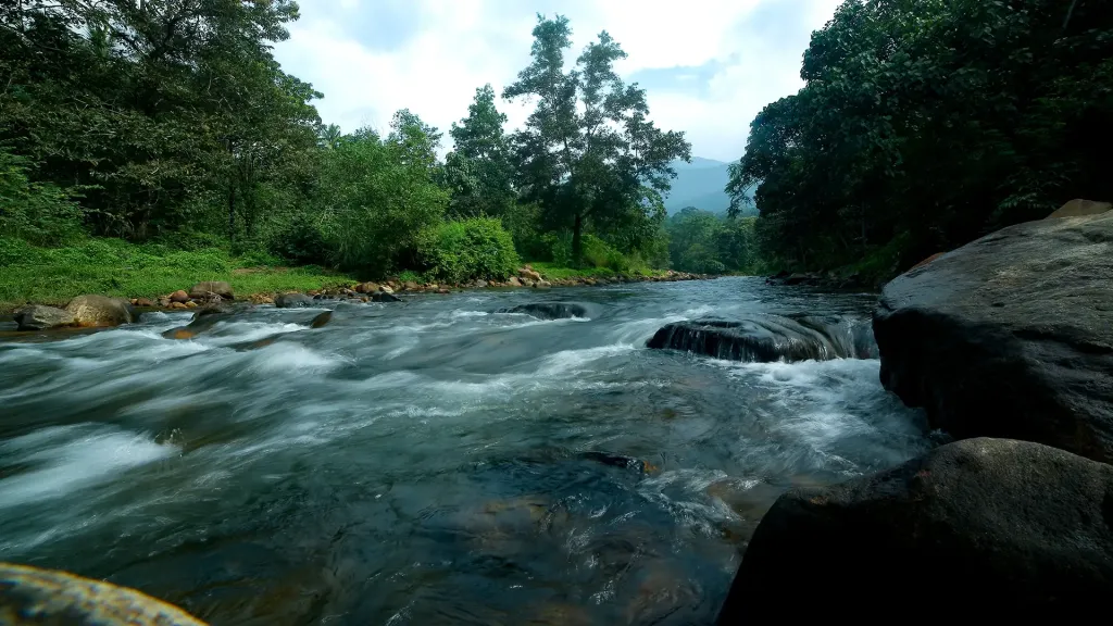
Below the peak lies Golden Valley, strung along the banks of the Kallar. Here the river runs clear and shallow over golden-brown sand and smooth boulders, cold with the memory of the high forest it was born in. Visitors wade in the shallows, picnic among the rocks and listen to the water braid its way downhill; it is one of Ponmudi’s most-loved corners, a green pocket at the foot of the climb where the stream and the forest meet. The Kallar itself rises high on Agasthyakoodam, at 1,868 m the great peak of southern Kerala, and carries that mountain’s chill down through the hills.

Above the tea, the hilltop opens into rolling meadows and short walking trails. Signposted routes lead through eco-tourism country towards viewpoints and, for the properly permitted and guided, deeper into the reserve; gentler strolls simply thread the grasslands to a ridge where the whole southern sweep of the Ghats lays itself out. This is walking country rather than adrenaline country — a place for a slow ramble, a flask of tea and a long look at the horizon.

The forests here are alive in a quiet way. Herds of deer are often seen grazing the slopes in the cool of the morning, and the surrounding Agasthyamala country shelters a rich cast of Western Ghats birds, butterflies and wildflowers. Because Ponmudi sits at the fringe of a protected biosphere, much of that wildness presses right up to the road and the tea gardens, and part of the pleasure is how close the untamed hill feels to the little cluster of cottages and viewpoints at the top.

Above all Ponmudi is calm and cool. Where the plains around Thiruvananthapuram swelter, the hilltop stays fresh and often cloud-wrapped, a small, unhurried retreat rather than a busy resort town. Days here are for wandering the tea slopes, dipping toes in the Kallar, watching the mist come and go and letting the temperature — and the pace — drop. It is best treated as a slow, weather-led escape: a place that rewards patience, warm layers and a willingness to let the hill set the mood.

Legend & myth

The name is where this page has been repeating the tourist-brochure answer as though it were the only one. Ponmudi is Malayalam for golden peak or golden crown — pon is gold, mudi is a peak or crest — and that much is not in dispute. What is presented everywhere as settled, here included, is the explanation: that the hill is named for the gilded light that washes the slopes at sunrise and sunset. It is a pleasant account and it may well be right. It is not the only one, and it is not the local one.

The Kani, who are indigenous to these hills and whose settlements lie through this forest, give a different origin. In their telling the gods who guard the mountains hid their gold in the crest of the hills, and it is that buried gold, not the evening light, that the name records. Set beside the sunrise explanation, this is the older kind of story — an account of what the mountain contains rather than of how it looks to somebody arriving from the plains — and it is conspicuously absent from almost every published description of Ponmudi, including, until now, ours.

It is worth being clear about what we are and are not claiming. We are not asserting that the Kani account is the true etymology and the light one false; neither is documented in a way that would settle it, and pon and mudi are ordinary enough words that both readings are available to anyone. What is correctable is the confidence. Presenting the sunrise-glow story as the origin, full stop, is the error — it quietly promotes a visitor’s impression over the account held by the people who have lived on this hill longest.

That pattern is worth noticing because it runs through the naming of this whole landscape. Kallar below is stone river, flatly descriptive. Meenmutty upstream is the point where fish are stopped, equally flat. Golden Valley on the Kallar takes its name from the sand in its bed rather than from Ponmudi above it, which is the assumption most people make. These hills mostly name themselves after what is physically there, which is part of why a legend about hidden gold in the crest stands out rather than blending in.

One further correction while we are on Ponmudi’s reputation. The hill is routinely described as a colonial creation, a British hill station in the manner of Munnar or Ooty. Its development as a highland retreat within reach of the Travancore capital is real, but the framing flattens the fact that this is Agasthyamala country — forest with a very long association with the Agastya traditions, and with the Kani living in it — long before anyone laid out a tea slope or a road with twenty-two bends in it. The hill station is a recent layer on the hill, not the beginning of it, and the Kani account of the name is a useful reminder of which layer came first and which one the guidebooks chose to describe when they quietly settled on the sunrise story as the only one worth telling.

More about Ponmudi

History

Ponmudi’s modern story is a colonial-era one. Sitting at a cool 1,100 metres within easy reach of the Travancore capital, the hill was developed as a highland retreat — a place for the region’s rulers and, later, British administrators to escape the heat of the plains, in the same tradition that produced hill stations across the Ghats. That legacy of Ponmudi as a summer refuge still shapes how it is used today.

The name is descriptive and old. ‘Ponmudi’ is Malayalam for ‘golden peak’ or ‘golden crown’ — ‘pon’ meaning gold and ‘mudi’ a peak or crown. Why gold is less settled than most accounts allow: the usual explanation is the warm, gilded light that washes the hills at sunrise and sunset, while the Kani, indigenous to these hills, hold that the gods guarding the mountains hid their gold in the crest. Both readings are available and neither is documented well enough to close the question — see the myths section.

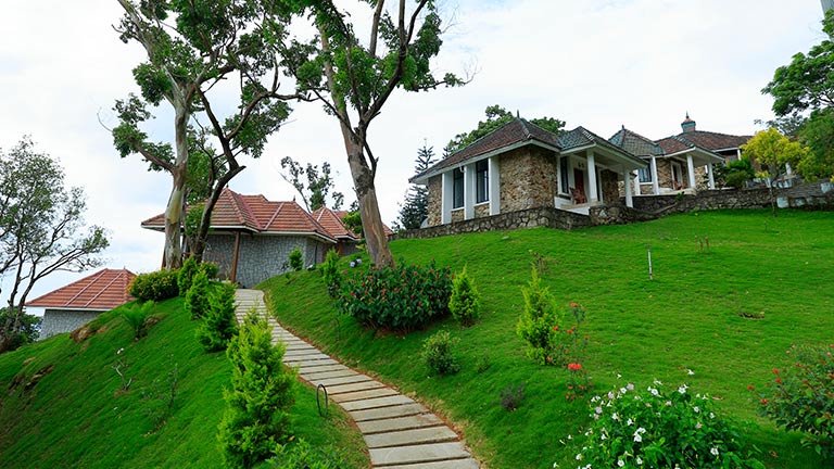
In the tourism era the hilltop was opened up with cottages, a guest house and viewpoint infrastructure, with the Kerala Tourism Development Corporation (KTDC) associated with accommodation and facilities on the peak. This development turned a quiet Travancore-era retreat into an accessible day-trip and overnight destination for travellers based in Thiruvananthapuram.

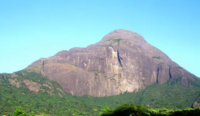
Geographically and ecologically, Ponmudi belongs to the Agasthyamala country. It lies on the northern approaches to Agasthyakoodam, at 1,868 m the highest summit in the far south and the source of the Kallar river, within the wider Agasthyamala Biosphere Reserve — a UNESCO-recognised biosphere celebrated for its exceptional Western Ghats biodiversity and its long association with the sage-linked traditions of the Agastya hills.

That protected status matters for visitors. Because Ponmudi sits at the edge of a sensitive reserve, access to the deeper forest and to the Agasthyakoodam trek is controlled — trails inside the reserve require permits and authorised guides, and the ghat road up to the hill station itself operates within posted daytime entry timings. It is wise to check current timings, permit rules and road conditions before setting out.

Why visit

The famous climb — 22 hairpin bends winding up through rubber, forest and tea to the 1,100-metre peak, one of Kerala’s most memorable mountain drives.

Golden Valley on the Kallar, a green riverside pocket of clear water, golden sand and smooth boulders, perfect for a paddle and a picnic.

Cool, mist-wrapped tea slopes and grassy meadows with long, layered views over the Western Ghats — an easy escape from the heat of the Trivandrum plains.

Gentle walking and eco-tourism trails to viewpoints, with deer often grazing the hillsides in the early morning.

The Agasthyamala setting — Ponmudi is the accessible gateway to a UNESCO biosphere and the northern approaches to Agasthyakoodam, the dominant summit of the far south.

An unhurried, uncommercial mood — a small, calm hill retreat rather than a crowded resort, well suited to a slow overnight or a leisurely day trip.
Before you go

Ponmudi — at a glance

HoursGenerally open daily from around 8:00 am, with last entry up the ghat road in the afternoon (commonly cited between 4:00 and 5:00 pm) and visitors expected to descend by early evening. Early morning is best for clear views before the cloud builds.

Entry: Nominal Kerala Forest Department charges collected at the Kallar check-post — commonly around ₹20 per Indian adult and ₹10 per child, with higher rates (about ₹200 / ₹150) for foreign visitors; parking roughly ₹10 for two-wheelers/autos up to ₹50 for buses; still-camera fee around ₹25 and video-camera around ₹150. Guided treks (e.g. Varayadumotta) are separately ticketed and may need forest-department booking. Fees change with season and regulation.

Photography: Golden hour at sunrise and sunset gives the meadows their signature warm glow; mist and low cloud make for moody wide shots but can grey out distant views, so shoot early. A still-camera fee may apply at the check-post; carry a lens cloth for the damp air.

Getting here

How to reach Ponmudi

  • ✈︎ By air Trivandrum International Airport is the nearest airport, roughly 60–65 km away, with the last stretch a slow ghat climb.
  • 🚆︎ By train Thiruvananthapuram Central is the nearest major railhead, around 60 km away; continue by road via Vithura and Kallar.
  • 🚗︎ By road About 53–61 km / 2 to 2.5 hours northeast of Thiruvananthapuram via Vithura and Kallar, then up the 22 hairpin bends to the peak.
  • 🚌︎ By bus Limited KSRTC buses run from Thiruvananthapuram towards Vithura and on up to Ponmudi, but services are sparse; a car or taxi is far easier and lets you keep to the daytime road timings.
Getting back

Check your return bus or ferry with the operator before setting out. Leave time to reach the stop or jetty after your visit, and arrange a return vehicle in advance for a remote outing.

Ask at the jetty or the stand for the time of the last service back, not the next one. If you miss it, an auto or a taxi is the fallback — agree the fare before you get in.

Do

Things to do in Ponmudi

  • Drive (or ride) the 22 hairpin bends and stop at the summit viewpoints and Echo Point
  • Walk down into the Golden Valley for sweeping hill vistas
  • Paddle and picnic beside the clear, pebble-bedded Kallar river
  • Visit the deer park near the summit resort area
  • Trek towards Varayadumotta peak for high grassland views and a chance of Nilgiri tahr
  • Birdwatch across the tea meadows and forest edges of Peppara Wildlife Sanctuary
  • Detour to the Kallar / Meenmutty waterfalls area en route
Getting around Ponmudi

If you need step-free access, contact the site before travelling. Ask about a level entrance, steps along the route, the nearest drop-off point, seating and accessible toilets.

Practical things near Ponmudi

These services are listed within about 1.2 km of Ponmudi. Walking distances follow mapped routes; access and opening hours can change. Other services may be closer but are not included here.

In the district

Where Ponmudi sits in Thiruvananthapuram district

District HQThiruvananthapuram
LandscapeState capital — coast & low hills

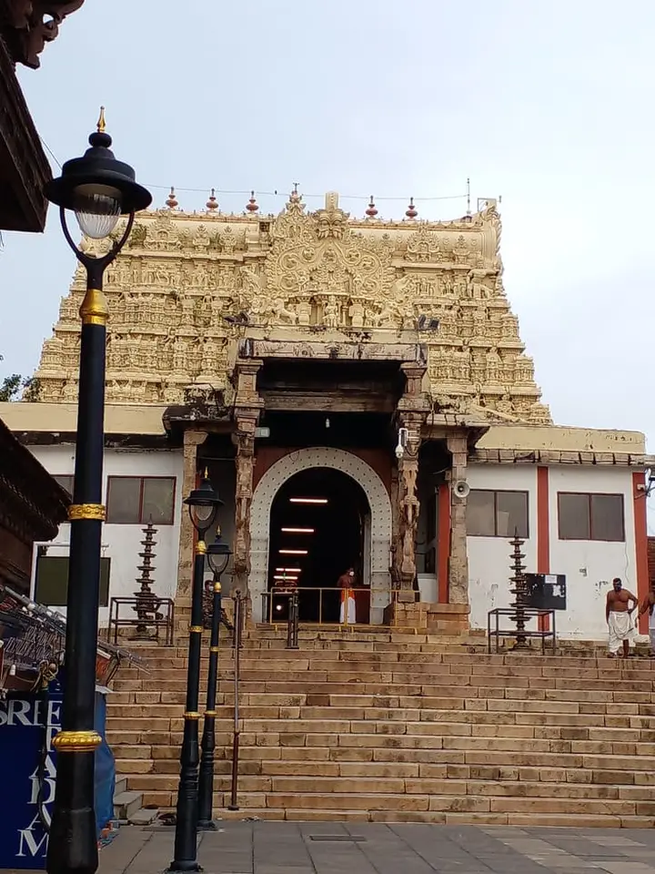
Thiruvananthapuram district is known for: The capital, Kovalam beaches and the Padmanabhaswamy Temple.

Kovalam BeachPadmanabhaswamy TempleNapier Museum
Stay · eat · do · rent · see · shop

Places in Ponmudi

Every verified place in Ponmudi — filter by what you’re after.

Ponmudi Kallar Meenmutty Trek Support — Waterfall walk and trekking support in Ponmudi
Top pick Verified
Waterfall walk and trekking support · Ponmudi
Ponmudi Kallar Meenmutty Trek Support

Kallar’s Meenmutty outing follows a forest approach to the waterfall below Ponmudi. Arrange entry and guidance through the visitor service, separately from the hilltop drive.

Directions Commission-freeView details
River County Resort Kallar Ponmudi — Resort in Ponmudi
Top pick Verified
Resort · Ponmudi
River County Resort Kallar Ponmudi

River County Resort is a Kallar-side accommodation option on the Ponmudi route. Check its current booking contact and rooms; the hilltop viewpoint is a separate uphill journey.

Directions Commission-freeView details
Kallar Meenmutty Kerala Tourism — Visitor information in Ponmudi
Top pick Verified
Visitor information · Ponmudi
Kallar Meenmutty Kerala Tourism

Kallar and Meenmutty offer a riverside and waterfall outing below Ponmudi. Use the designated approach, follow weather restrictions and keep out of fast-moving or high water.

DirectionsView guide
Golden Peak KTDC Ponmudi — KTDC hill resort in Ponmudi
Top pick Verified
KTDC hill resort · Ponmudi
Golden Peak KTDC Ponmudi

Golden Peak is KTDC’s hill accommodation at Ponmudi. Compare the room and meal package, allowing time for the winding approach and separately managed viewpoint visit.

Directions Commission-freeView details
Ponmudi Hills Kerala Tourism — Visitor information in Ponmudi
Verified
Visitor information · Ponmudi
Ponmudi Hills Kerala Tourism

Ponmudi’s ascent leads towards hill scenery above the Kallar valley. Plan a daylight drive and an open visitor session; rain or poor visibility can change the outing.

DirectionsView guide
G
Golden Peak KTDC Restaurant
Where to eat
Top pick Verified
KTDC resort restaurant · Ponmudi
Golden Peak KTDC Restaurant

Restaurant at KTDC Golden Peak for travellers staying on or visiting the Ponmudi hill route. Ponmudi, KTDC resort restaurant, eat.

Directions Commission-freeView details

Book with the place itself. India’s cyber-crime coordination centre warned in April 2025 that convincing copies of hotel and pilgrimage booking sites are being pushed through sponsored search and social ads, taking payment for rooms the property never hears about. Every listing here links to the business’s own contact details and its own Google or Bing profile — we take no commission and sit in nobody’s payment path. If a booking page reached you through an ad, check the address bar against the property’s own site before you pay. Fraud can be reported on cybercrime.gov.in or on 1930.

Official eco & forest programmes

Forest stays, camping and treks around Ponmudi

Official/public-sector eco offerings mapped to this town base. Always confirm current availability, tariff, permits and reporting time before travelling.

Agasthyakoodam, Ponmudi
trekwildlife

Agasthyakoodam / Agasthyarkoodam seasonal trek

Permit-controlled trek to one of the southern Western Ghats’ most important peaks and sacred forest landscapes.

AgasthyakoodamSeasonal multi-stage trek
Official source →
Varayadumotta, Ponmudi
trekviewpointwildlife

Varayadumotta trek

Grassland and ridge trek in the Ponmudi landscape, usually handled as a controlled forest trek.

Varayadumotta
Official source →
Peppara Wildlife Sanctuary, Ponmudi
wildlifetrekboating

Peppara Wildlife Sanctuary eco visit

Forest and reservoir landscape in the southern Western Ghats, listed by Kerala Tourism as an ecotourism destination.

Peppara Wildlife Sanctuary
Official source →
For hotels, homestays and local businesses

Get listed in Ponmudi for free

Roampedia is commission-free. Travellers discover your business, book directly and contact you through official details. Basic listings are free, while Gold and Platinum package upgrades can be requested from the owner dashboard after approval.

List your business — free
Read before you go

Ponmudi guides, stories & itineraries

We have not published a story about Ponmudi itself yet. These cover Thiruvananthapuram, the district it sits in, and travel in Kerala generally.

Around Ponmudi

These are written about individual places you can reach from Ponmudi, rather than about the town as a whole.

Kerala-wide guides & itineraries

Route-level itineraries and practical guides for the rest of the state.

See all 129 Thiruvananthapuram guides & stories →

Map

Where things are in Ponmudi

FAQ

Ponmudi travel FAQs

How long does the drive up take, and what is the road like?

Roughly an hour and a half from Thiruvananthapuram to the top, with the last stretch climbing through 22 hairpin bends on a narrow ghat road. It is a good road but a slim one, with blind corners and buses coming down it; if anyone in the car is prone to motion sickness, the bends are where it will happen. The ghat road also runs to posted daytime entry timings, so check them before setting out rather than arriving at a closed gate.

What is there actually to do at the top?

Less than most people expect, and that is rather the point. There are tea slopes to wander, grassy shelves with long views south towards Agasthyakoodam, and mist that comes and goes through the day. It is a slow, weather-led place rather than a resort town with an itinerary — best treated as somewhere to spend a few unhurried hours with warm layers, not as a checklist of attractions to work through.

What does the name Ponmudi mean, and why gold?

Ponmudi is Malayalam for golden peak or golden crown — pon is gold, mudi is a peak or crest. Why gold is the interesting part, and it is less settled than most sources suggest. The usual explanation is the gilded light on the slopes at sunrise and sunset. The Kani, who are indigenous to these hills, hold instead that the gods guarding the mountains hid their gold in the crest. Neither is documented well enough to settle it, and presenting the light story as the sole origin — as almost every description does — quietly favours a visitor’s impression over the local account.

Is Ponmudi a British hill station?

Only in its most recent layer. It was developed as a highland retreat within reach of the Travancore capital, in the same tradition that produced hill stations across the Ghats, and that history is real. But this is Agasthyamala country, with a long association with the Agastya traditions and with Kani settlements through the forest, long before any tea slope or ghat road existed. The hill station sits on top of a much older place.

How far is Ponmudi from Thiruvananthapuram and how long does it take?

Ponmudi lies roughly 53–61 km northeast of Thiruvananthapuram, generally around a 2 to 2.5 hour drive via Vithura and Kallar, followed by the climb up the 22 hairpin bends.

What is the best time to visit Ponmudi?

October to March is the pick, when the hills are cool, misty and pleasant. The monsoon (roughly June to September) brings heavy rain, leeches and slippery bends, so drive with extra care and check road conditions.

Are there entry timings for the ghat road up to Ponmudi?

Yes. The hill road uses posted daytime entry and exit times and is not a route for an after-dark arrival. Read the check-post notice before ascending and leave enough margin for the last permitted descent.

Is the road difficult to drive?

The final ascent is a narrow ghat road of 22 tight hairpin bends, often single-lane in places and prone to mist. It is manageable in a normal car with a careful, unhurried driver, but nervous drivers may prefer to hire a local taxi. Avoid rushing and use the horn on blind bends.

What is there to do in Ponmudi?

The main draws are the drive itself, wandering the tea slopes and meadows, riverside time at Golden Valley on the Kallar, easy walks to viewpoints, and watching mist, deer and long Ghats views. Deeper forest trails and the Agasthyakoodam trek require permits and authorised guides.

Can I trek to Agasthyakoodam from Ponmudi?

Agasthyakoodam — not Kerala’s second-highest peak, despite the claim being near-universal, but the dominant summit of the far south — lies within the protected Agasthyamala Biosphere Reserve and is reached via a seasonal, permit-controlled trek that needs advance booking, a photo ID and an authorised guide. It is a serious multi-hour forest trek rather than a casual walk from the hill station — check the current season, permit rules and start point locally.

What are the best places to visit in Ponmudi?

Top places to visit in Ponmudi include Ponmudi viewpoint, Golden Valley, Kallar Meenmutty Falls, Agasthyakoodam trek, Kalakkayam Waterfalls — each has a full guide with how to reach it and what to see nearby on this page.

How do I reach Ponmudi?

The nearest airport to Ponmudi is Trivandrum (TRV), in-district. The rail gateway is Thiruvananthapuram Central (TVC).

Photographs: Shishirdasika (CC BY-SA 4.0), Libperry (CC BY-SA 4.0), Sujithshivam511 (CC BY-SA 4.0), Jithu Antony (CC BY-SA 4.0). Wikimedia Commons.

Image credits