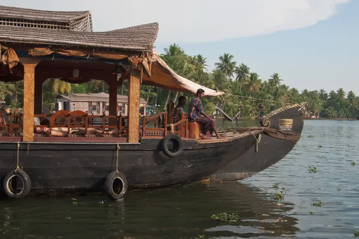
Places to Visit in Kuttanad

Low-lying paddy and canal region for slow village travel.

Kuttanad
Practical guide

Plan Kuttanad

Who's going?Tailor Kuttanad to your trip
DistrictAlappuzha
RoleBackwater village base
Time neededA half-day minimum to get past the…
Places to visit5Listed businesses5
What to expect

Highlights

  • Chavara Bhavan — The Kainakary birthplace memorial of Saint Kuriakose Elias Chavara, approached through the backwater landscape and maintained as a Christian pilgrimage site.
  • Kuttanad — Low-lying paddy and canal region known as Kerala’s rice bowl.
  • Pathiramanal Island — Small Vembanad Lake island known for birdwatching.
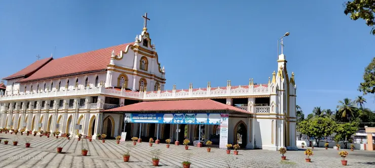
  • Champakulam — Kuttanad village on the Pamba known for the Champakulam Moolam snake-boat race and Kalloorkad St Mary’s Basilica.
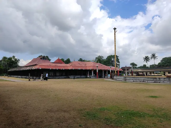
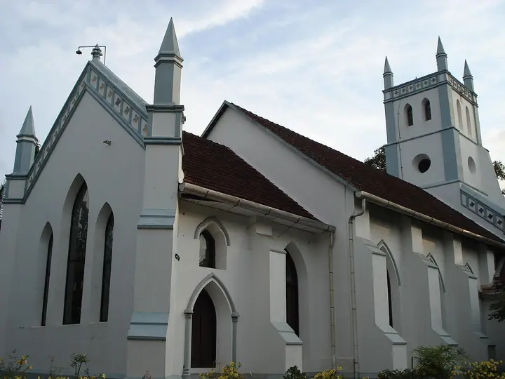
  • Edathua Church — St George Forane Church at Edathua in Kuttanad, known for its large annual pilgrimage feast.
  • R Block Kuttanad — Iconic below-sea-level reclaimed farmland at Kainakary, ringed by bunds with the canal water sitting higher than the paddy fields.
Getting there

How to visit

  • Nearest airport: Cochin (COK), ~86 km
  • Rail gateway: Alappuzha (coastal line)
Timing

Best time to visit Kuttanad

December to February, and this is derivable rather than a matter of taste: the puncha paddy crop is in the ground from about November and harvested by February, so that is when the fields are green and sitting visibly below the canal line. In October the polders are dewatered and bare. From June to August they are deliberately under water. The cool dry months are also the most comfortable for being on open water all day.

Weather in KuttanadSeasonal guide

Live forecast loads in your browser.

Today at Kuttanad
Sunrise6:14 am
Sunset6:23 pm
Golden hour best light5:23 pm–6:23 pm
Blue hour after sunset6:23 pm–6:48 pm
Sun sets toward compass bearingW · 272°
Moon tonight🌓 First quarter · 52%
South-west monsoon. June to September is the south-west monsoon in Kerala. Expect heavy showers, mostly in bursts rather than all day — carry rain cover, allow extra time for getting around, and note that ferries and open-air sites are the first things affected.

Sun and moon are calculated for this location and shown in IST. Photography windows are the hour around sunrise and sunset; the sunset bearing is degrees clockwise from true north. Moon phase is accurate to about half a day.

The story

The story of Kuttanad

Kuttanad is the only farmland in India where the year begins by emptying the field: 874 square kilometres of polder and canal across three districts, much of it one to two metres below the sea, where rice is grown in basins that have to be pumped dry before anything can be sown.

Kuttanad is not a village or a viewpoint. It is a region — 874 square kilometres of it, spread across ten taluks in three districts, Alappuzha holding roughly 57 per cent, Kottayam 30 and Pathanamthitta 13. Together that is about two and a half per cent of Kerala. Around 490 square kilometres of it lies one to two metres below mean sea level, and that part is mostly rice.

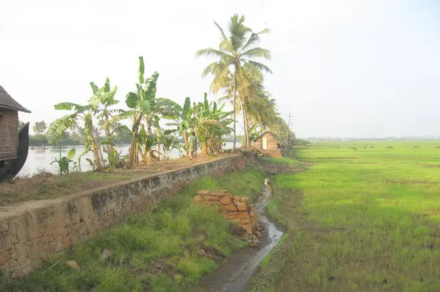
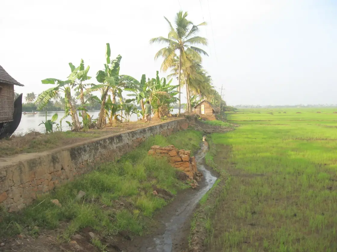
The thing to understand before anything else is the geometry, and one photograph on this page shows it better than any paragraph can: a stone-faced bund with canal water behind it, a boat floating at roughly the height of your eye, and on the other side of the wall a field of green paddy lying well below that waterline. The water is up. The crop is down. Everything else here follows from that.

What it means in practice is that farming begins with drainage rather than irrigation. A padasekharam — a block of fields ringed by its own bund and farmed as one unit by many owners — is a basin. Before it can be sown it has to be dewatered, which begins about a month ahead of sowing and is done by pumps housed in a small building on the bund called an engine thara, one to a padasekharam. Only when the basin is dry does the crop go in. When the harvest is off, the shutters are opened and the monsoon takes the field back.

The Kerala State Planning Board's 2019 report on post-flood Kuttanad — the document that settles most of the arguments on this page — is blunt about the scale of the human system involved. Around 95 per cent of holdings here are small or marginal. Between one and a half and two lakh people depend on this landscape directly or indirectly. Paddy covers roughly 37,000 hectares a year, and the split tells its own story: about 26,000 hectares of the main puncha crop and only about 11,000 of a second crop, because the limiting factor is not soil or sunlight but how long it takes to get the water out and how long you dare leave it out.

The FAO recognised the whole arrangement in 2013 as a Globally Important Agricultural Heritage System, under the name “Kuttanad Below Sea Level Farming System, India”. Read the citation and you notice it is not a landscape award. FAO describes a mosaic of three things working together — wetlands for paddy and fish, garden lands for food crops, and open water for inland fishing and shells. What is being protected is a method, not a view.

🛑 One claim you will meet everywhere and should not repeat: that Kuttanad is the only place in the world where farming is done below sea level. It is not, and the correction comes from Kerala's own government. The Planning Board's report calls Kuttanad “one of the few regions in India” where this happens, and then names the counter-example itself, observing that the system has many similarities with the Dutch polder system — which is also a recognised FAO heritage system. One of the few places in the world is a big enough claim, and it is true.

For a visitor, the practical consequence of all this is that Kuttanad has a season in a way most landscapes do not, and you can derive it from the crop calendar rather than from a tourism page. The puncha crop is in the ground from about November and harvested by February. In October the polders are dewatered and bare. From June to August they are under water. If you want the Kuttanad of the photographs — the impossible green field below the canal — come between December and February. The two best polder photographs we could find of this region were taken on 24 December and 5 December, which is not a coincidence.

The AC Road, running roughly 24 km from Alappuzha to Changanassery, is the one drive that crosses the polders and gives you the geometry from a car window. The alternative, and the better one, is the State Water Transport ferry network out of Alappuzha, which still serves Kainakari, Nedumudi, Champakulam, Kavalam, Pulinkunnu and Mankombu as ordinary public transport rather than as a cruise.

Legend & myth

We should be straight with you at the start of this section: Kuttanad, as a region, does not appear to carry folklore of its own, and we are not going to manufacture any. What it has instead is a contested early history that reads like legend, a great deal of living tradition that belongs to particular villages rather than to the region, and one modern story about a night's work with earth and baskets. We will give you all three, labelled.

The oldest layer is Sangam-era and it is genuinely uncertain. The Chera ruler Uthiyan Cheralathan is associated with a capital at Kuzhumur in Kuttanad, with a queen named Veliyan Nallini; the tradition continues that he was defeated by Karikala Chola at the Battle of Venni and that the capital was burned. ⚠ We flag this rather than assert it: the sentence carrying the Battle of Venni is marked as needing a citation on the encyclopedia that prints it, and so is the widely repeated etymology deriving Kuttanad from the land of the Kuttuva tribe. Treat all of it as contested early history — interesting, and not settled.

The second layer is the one people actually mean when they talk about Kuttanad's traditions, and the honest thing to say is that it is not Kuttanad's. The Nehru Trophy belongs to Punnamada; the Moolam race and the Moolakazhcha — the temple delegation that must light a lamp at a named Christian household before the boats may run — belong to Champakulam; the snake-saint devotion, with its votive gold snakes and roosters, belongs to Edathua; the Ramsar wetland and the midnight-sands legend belong to Pathiramanal. These are living traditions of specific villages, and rolling them up into “Kuttanad folklore” would flatten exactly what makes each of them worth a page.

The third layer is a story from 1972, and it is the closest thing this region has to a founding myth of its own — with the difference that it is about a piece of infrastructure and it may well be true. The Thanneermukkom bund, built to keep salt water out of the paddy, was constructed in phases: the first completed in 1965, the second in 1975, and the third never. With the project stalled and the money gone, the account goes, one night in 1972 a large group of farmers went out and filled the gap between the north and south sections themselves, with earth. And the earth embankment between the two halves of the bund is still there.

🔑 That story is worth handling carefully, because it is the kind that gets better each time it is told. It rests on a single secondary source, and we present it as what farmers here say rather than as engineering record. But it is corroborated in an oblique and rather satisfying way: the Planning Board's own 2019 report states flatly that the third phase of the bund remained incomplete. The official document does not mention the farmers. It does confirm the gap they are said to have filled.

If you want the mythic register in Kuttanad, in other words, you will not find it in a legend about a god. You will find it in a landscape where every field is a decision that has to be renewed annually — where the water is above the crop, the pump is the difference between a harvest and a lake, and the most-told local story is about a community that got tired of waiting for the state and moved the earth itself.

More about Kuttanad

History

The modern shape of Kuttanad was drawn up in 1953-54, when the Travancore government produced a detailed development plan for the region. It had three main components, and the fate of each is the history of Kuttanad since: a spillway at Thottappally to let floodwater out to the sea, a bund at Thanneermukkom to keep salt water out of the paddy, and a road-cum-canal between Alappuzha and Changanassery to carry both traffic and drainage.

🔴 The dates are worth getting right, because the travel web does not. Taking them from the Kerala State Planning Board's 2019 report rather than from aggregators: the Thottappally spillway was completed in 1958; the first phase of the Thanneermukkom bund in 1965 and the second in 1975, with the third never finished; and the AC Road was completed by the 1990s. ⚠ Competing figures exist and we record rather than hide them — Thottappally is given as 1955 in some accounts against the Planning Board's 1958, and Thanneermukkom is sometimes described as constructed in 1974 and functional from 1976, which does not fit the phased account. Where they conflict we prefer the Planning Board.

Two precursors deserve a line. In 1937 Travancore appointed two Italian engineers, who proposed a floodway near Aryad; the Thottappally channel that was eventually built was proposed later by a PWD executive engineer, I. C. Chacko. The idea of draining Kuttanad by cutting a hole to the sea is therefore about ninety years old, and the version that got built was the local engineer's rather than the imported consultants'.

The AC Road is the component that reveals the most, because of what was left out of it. It was designed as a road and a canal — the canal to drain floodwater from Upper Kuttanad into Vembanad. What was built by the 1990s was the road. The Planning Board's criticism is unusually direct for a government document: the AC Road, it says, was not supposed to be a road alone, and as built it cuts across multiple natural waterways and obstructs the drainage it was meant to supplement. The canal remains incomplete to this day.

The bund at Thanneermukkom did what it was built to do and presented a bill nobody had costed. The official accounting, again from the Planning Board, includes a 33 per cent decline in the lake's bird population, blocked fish migration, the spread of water hyacinth, and rising rodent and mosquito populations. Without tidal flushing, the lake stopped clearing itself: Alappuzha town's sewage alone contributes some 64,237 kg of biochemical oxygen demand per day to a water body that no longer has a mechanism for carrying it away. ⚠ The unfinished-construction story of the barrage itself belongs to our Thanneermukkom page, and the reclamation history of the individual polders to R Block; this page deliberately does not retell either.

There has also been repair, and it is worth recording because good news from Kuttanad is rare. After the 2008 package, channels were cut between the C and D blocks and between the Rani and Chithira polders. The result was measurable: 764 hectares came back into cultivation in 2014, for the first time since 1992, and the Rani-Chithira polders produced 1,402.49 metric tonnes of puncha paddy in 2016-17.

Then came August 2018. The Planning Board's assessment is that the flood was a once-in-a-hundred-years event, or a one per cent probability — which is a specific and sobering way of putting it, given that Kuttanad floods on two, five, ten, twenty-five, fifty and hundred-year intervals as a matter of course. Most of the engine tharas, the pump houses on which the entire dewatering system depends, were destroyed. The Board recommended a package of ₹2,447.66 crore; the precedent it cited was ₹2,139.8 crore in 2008.

The report ends on a question rather than a prescription, and it is the right one for a reader to leave with: whether the answer to a hydraulic problem is more hydraulics. Every fix in Kuttanad's modern history — spillway, bund, road, channel, pump — has solved the problem it was designed for and created another that had to be engineered around. The Board's own recommendations include cutting padasekharams down from around 600 acres to about 250, so that basins can be dewatered faster, and replacing the old pumps with low-head, high-discharge vertical axial-flow propeller sets. Which is to say: more hydraulics.

Why visit

To see the one thing that photographs cannot quite convince you of until you are standing on the bund: a canal at the level of your chest and a rice field below your feet, with a wall between them.

For the season, which is derivable and worth planning around. The puncha crop is in the ground from November and harvested by February, the polders are bare in October and under water from June to August. December to February is the green Kuttanad.

To take the AC Road, the 24 km between Alappuzha and Changanassery — the one drive that crosses the polders, and a road that was supposed to be a canal as well.

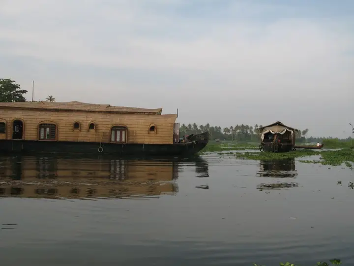
To use the State Water Transport ferries out of Alappuzha to Kainakari, Nedumudi, Champakulam, Kavalam, Pulinkunnu and Mankombu — ordinary public transport through the polders, at a fraction of a houseboat charter and with the people who live here aboard.

For the engine thara: a small building on a bund housing the pumps that make the whole system possible, one per padasekharam, and a vernacular building type most people walk past without noticing. Most were destroyed in 2018.

To understand a landscape that FAO protects as a system rather than a scene — three soil zones, one crop calendar and a pump, recognised in 2013 as a Globally Important Agricultural Heritage System.
Before you go

Kuttanad — at a glance

HoursNo opening hours — Kuttanad is a lived-in region of farmland, canals and villages, not a site with a gate. The State Water Transport ferries run to a published timetable; confirm departures at the Alappuzha jetty on the day, as services change with the season and the water.

Entry: None. There is nothing to buy a ticket for. Costs here are transport: the State Water Transport ferries are ordinary cheap public boats, while shikara hire and houseboat charter are priced privately and vary widely by season.

Getting here

How to reach Kuttanad

Kuttanad spans ten taluks in three districts, so there is no single arrival point. The road spine is the AC Road, roughly 24 km from Alappuzha to Changanassery, which is the one drive that crosses the polders. By water, State Water Transport ferries from Alappuzha serve Kainakari, Nedumudi, Champakulam, Kavalam, Pulinkunnu and Mankombu. Kainakary is about 30 minutes from Alappuzha by ferry, and roughly 3 hours from Kumarakom or Changanassery, 8 hours from Kollam. Rail: Alappuzha (ALLP) and Changanassery (CGY). Air: Cochin International, about 82 km.

Getting back

Check your return bus or ferry with the operator before setting out. Leave time to reach the stop or jetty after your visit, and arrange a return vehicle in advance for a remote outing.

Ask at the jetty or the stand for the time of the last service back, not the next one. If you miss it, an auto or a taxi is the fallback — agree the fare before you get in.

Do

Things to do in Kuttanad

  • Stand on a bund and look both ways — canal water on one side, paddy below your feet on the other.
  • Drive the AC Road, the 24 km Alappuzha–Changanassery crossing of the polders.
  • Take a State Water Transport ferry to Kainakari, Nedumudi, Kavalam, Pulinkunnu or Mankombu.
  • Find an engine thara on a bund — the pump house that empties a whole padasekharam.
  • Come in December or January for green paddy; in October the same fields are bare.
  • Pair it with Champakulam's basilica and boat-building lineage, a short hop by water.
  • Look for the shell deposits and lime economy of the kayal lands, the old lake floor.
Getting around Kuttanad

If you need step-free access, contact the site before travelling. Ask about a level entrance, steps along the route, the nearest drop-off point, seating and accessible toilets.

Practical things near Kuttanad
What the cash actually costs
  • Withdrawing from a bank that is not your own is free for a set number of times a month, then costs up to ₹23 plus GST — about ₹27 a withdrawal. This is not one of the RBI’s six metro centres, so the allowance here is the higher one: at least five free other-bank withdrawals a month, and at least five at your own bank.
  • That free allowance belongs to Indian bank accounts. On a card issued abroad your own bank’s international withdrawal and exchange charges apply instead. If the machine offers to bill you in your home currency, choose rupees — the conversion rate on that offer is set by the machine, not by your bank.
  • Choose a well-lit ATM, preferably at a bank branch. Shield your PIN, avoid help from strangers and use your bank’s support number if a withdrawal fails or the machine retains your card.

Charge cap and free-transaction limits: Reserve Bank of India, in force since 1 May 2025.

These services are listed within about 1.2 km of Kuttanad. Walking distances follow mapped routes; access and opening hours can change. Other services may be closer but are not included here.

Nearby bases

Where to go from Kuttanad

Alappuzha town, Alappuzha townHouseboat base
Town / base

Alappuzha town

Canals, beach, lighthouse and main houseboat departure point.

Alappuzha BeachAlappuzha LighthouseFinishing PointCanal walks
Open Alappuzha town guide →
Mararikulam, MararikulamBeach base
Town / base

Mararikulam

Quiet beach belt north of Alappuzha town.

Marari BeachFishing villagesArthunkal Church
Open Mararikulam guide →
Ambalappuzha, AmbalappuzhaTemple base
Town / base

Ambalappuzha

Historic Krishna temple town south of Alappuzha.

Ambalappuzha Sree Krishna TempleKarumadikuttanPunnapra beach belt
Open Ambalappuzha guide →
Haripad and Mannarasala, Haripad and MannarasalaTemple base
Town / base

Haripad and Mannarasala

Serpent shrine and temple circuit in south Alappuzha.

Mannarasala TempleHaripad templesKayamkulam lake side
Open Haripad and Mannarasala guide →
Cherthala, CherthalaCoastal taluk-town base
Town / base

Cherthala

Taluk town on NH-66 between Alappuzha and Kochi — the Karthyayani temple at its centre, the Cherthala Pooram and its padayanis, and the lagoon-and-coast country north of Alappuzha.

Cherthala Karthyayani TempleKakkathuruthu
Open Cherthala guide →
Chengannur, ChengannurPampa-side temple base
Town / base

Chengannur

Rail and pilgrim town on the Pampa in eastern Alappuzha, carrying two crowds. It starts the Pancha Pandava circuit of five Divya Desams, and it is the railhead most Sabarimala pilgrims arrive at.

Chengannur Mahadeva TempleThrichittatt Maha Vishnu TempleChakkulathukavu Bhagavathy Temple
Open Chengannur guide →
Mavelikkara, MavelikkaraOnattukara temple town
Town / base

Mavelikkara

Market and temple town on the Achankovil in eastern Alappuzha — Kandiyoor’s 823 AD epigraph, the Buddha at Buddha Junction, and the Onattukara country of Chettikulangara’s kettukazhcha.

Kandiyoor Sree Mahadeva Temple
Open Mavelikkara guide →
In the district

Where Kuttanad sits in Alappuzha district

Nearest airportCochin (COK), ~86 km
Rail gatewayAlappuzha (coastal line)
District HQAlappuzha
LandscapeBackwaters & coastal Kuttanad

Alappuzha district is known for: The Alleppey backwaters, houseboats and the Nehru Trophy Boat Race.

Houseboat cruisesAlleppey Beach & pierKuttanad — farming below sea level
Stay · eat · do · rent · see · shop

Places in Kuttanad

Every verified place in Kuttanad — filter by what you’re after.

3 places to stay in Kuttanad

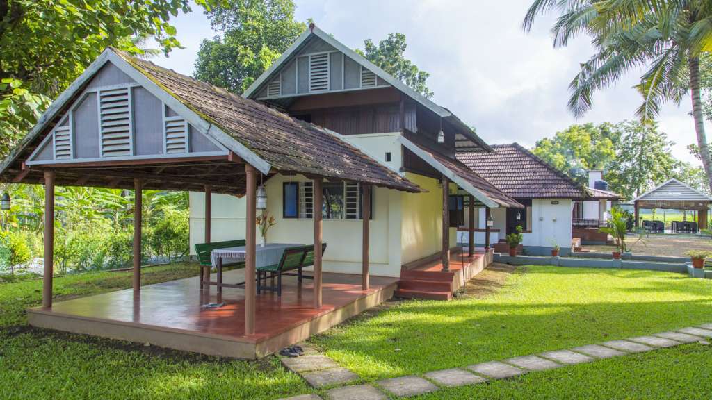
Kayaloram Homestay Kuttanad — Kerala Tourism-listed homestay in Kuttanad
Top pick Verified
Kerala Tourism-listed homestay · Kuttanad
Kayaloram Homestay Kuttanad

Kerala Tourism-listed homestay option for Kuttanad backwater stays. Kuttanad, Kerala Tourism-listed homestay, stay.

Directions Commission-freeView details
Kurialacherry House Manapra Kuttanad — Kerala Tourism-listed homestay in Kuttanad
Top pick Verified
Kerala Tourism-listed homestay · Kuttanad
Kurialacherry House Manapra Kuttanad

Kerala Tourism-listed Manapra homestay for Kuttanad village and backwater stays. Kuttanad, Kerala Tourism-listed homestay, stay.

Directions Commission-freeView details
Maliampurackal Homestay Kuttanad — Kerala Tourism-listed homestay in Kuttanad
Top pick Verified
Kerala Tourism-listed homestay · Kuttanad
Maliampurackal Homestay Kuttanad

Kerala Tourism-listed Kuttanad homestay at Maliampurackal House, Punnakunnam. Kuttanad, Homestay, Punnakunnam.

Directions Commission-freeView details

Book with the place itself. India’s cyber-crime coordination centre warned in April 2025 that convincing copies of hotel and pilgrimage booking sites are being pushed through sponsored search and social ads, taking payment for rooms the property never hears about. Every listing here links to the business’s own contact details and its own Google or Bing profile — we take no commission and sit in nobody’s payment path. If a booking page reached you through an ad, check the address bar against the property’s own site before you pay. Fraud can be reported on cybercrime.gov.in or on 1930.

Places to visit

The places themselves, around Kuttanad

The best tourist places to visit in Kuttanad — temples, viewpoints, lakes, heritage and nature, each with a full guide, how to reach it and what to see nearby.

For hotels, homestays and local businesses

Get listed in Kuttanad for free

Roampedia is commission-free. Travellers discover your business, book directly and contact you through official details. Basic listings are free, while Gold and Platinum package upgrades can be requested from the owner dashboard after approval.

List your business — free
Read before you go

Kuttanad guides, stories & itineraries

Around Kuttanad

The town itself and the places around it — each written about one subject rather than as a general guide.

The boat, and the family that owns the drawing
Story
The boat, and the family that owns the drawing

Thirty metres of anjili wood, six to eight months of work, and a shape that has been in one family since about 1614.

6 min read · Read →
How a Roman soldier became a snake saint in Kuttanad
Story
How a Roman soldier became a snake saint in Kuttanad

St George kills a dragon. Kuttanad has no dragons and a great many cobras, and its people work all day in standing water. Nobody decided that the saint would become a protector against snakebite. The country decided it.

8 min read · Read →
The feast that the internet ends a week early
Story
The feast that the internet ends a week early

A correction settled by a photograph. Two people took pictures at Edathua in May 2026, and strung across the porch in both of them is the church’s own festival banner, with the dates on it in Malayalam.

7 min read · Read →
The Prime Minister who jumped into the winning boat
Story
The Prime Minister who jumped into the winning boat

Most trophies are commissioned. This one was a thank-you note. Nehru went home to Delhi, had a snake boat made in silver, signed it, and posted it back to the lake where he had misbehaved.

8 min read · Read →
Punnamada is not a lake
Story
Punnamada is not a lake

One body of water, three names, and a great deal of confusion. Punnamada is not a separate lake, is not an arm of one, and does not have its own folklore — and being straight about all three is more useful than the alternative.

7 min read · Read →
A footbridge built in the shape of a snake boat
Story
A footbridge built in the shape of a snake boat

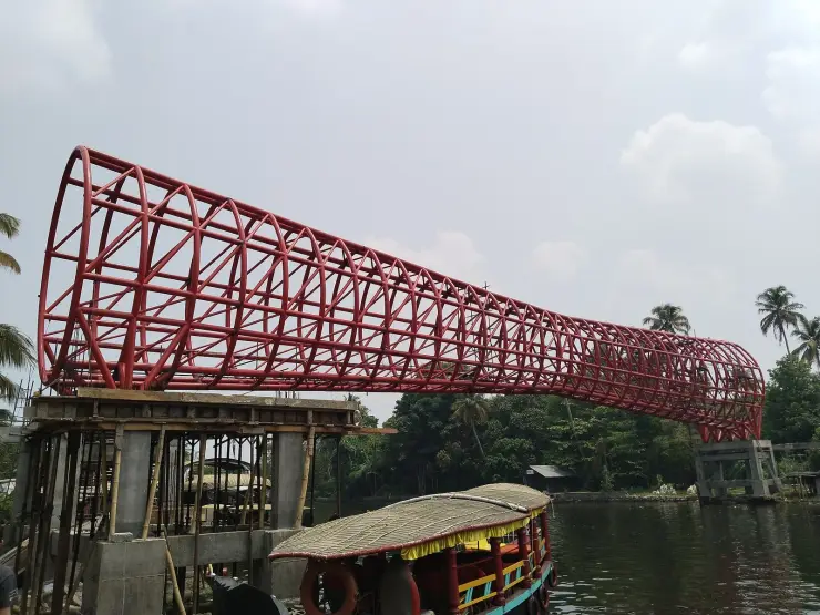
Nothing in its filename says so. You only find out by opening the photograph: the footbridge at the race start is not a bridge with decoration on it. It is a bridge in the shape of the boat.

6 min read · Read →

Kerala-wide guides & itineraries

Route-level itineraries and practical guides for the rest of the state.

See all 100 Alappuzha guides & stories →

Map

Where things are in Kuttanad

FAQ

Kuttanad travel FAQs

How far below sea level is Kuttanad?

One to two metres below mean sea level across the roughly 490 km² that is predominantly rice, and as much as 1.5 to 2.2 m in the reclaimed kayal polders — those are the Kerala State Planning Board's figures and they are the strongest available. ⚠ You will see a wide range elsewhere: an average of 2.2 m from Kerala Tourism, 0.6 m from a single research station at Kumarakom, 1.2 to 3.0 m in press reporting, and −2.7 m in an encyclopedia infobox, which is a single lowest point rather than a regional figure. Prefer the Planning Board.

Is Kuttanad the only place in the world where farming is done below sea level?

No, and the correction comes from Kerala's own government. The Planning Board's 2019 report calls Kuttanad one of the few regions in India where this is done, and then names the counter-example itself — noting the system's similarities with the Dutch polder system, which FAO also recognises as a heritage agricultural system. “One of the few places in the world” is accurate; “the only” is not.

What are the three soil zones of Kuttanad?

Karappadam, about 33,000 ha — alluvial soils along the waterways, slightly higher and moderately acidic. Kayal lands, about 13,000 ha — reclaimed lake-bed polders 1.5 to 2.2 m below sea level, roughly neutral, with vast deposits of fossil lime shells beneath the topsoil, which is physical proof they were once lake floor. And kari lands, about 9,000 ha — black peaty acidic soils at or below sea level at Vaikom, Thuravur, Ambalapuzha, Thakazhi and Purakkad. ⚠ Note that “Purakkad” is a place-qualified kari zone, not a fourth soil class; the six agro-ecological zones (Lower, Upper and North Kuttanad, Kayal lands, Vaikom Kari, Purakkad Kari) are a separate scheme layered on top of the three soils.

What is the puncha crop, and when is it grown?

Puncha is the main annual paddy crop, grown in the non-monsoon months. Before the 1960s it was the only crop Kuttanad took. Sowing is completed first in the kayal lands, Lower Kuttanad and North Kuttanad, then in the puncha area of Vaikom Kari and last in Upper Kuttanad — finished by the first week of November, or the third week in Upper Kuttanad — with dewatering beginning about a month before and harvest in February. State documents spell it “puncha”; tourism copy often writes “punja”.

Why does farming here begin by pumping water out?

Because a padasekharam — a block of fields ringed by its own bund — is a basin lying below the level of the water around it. It has to be dewatered before it can be sown, using pumps housed in an engine thara on the bund, and the shutters are opened again after harvest so the monsoon refills it. That is also why there is far more puncha (about 26,000 ha) than second crop (about 11,000 ha): the limiting factor is dewatering time, not soil.

When is the best time to visit Kuttanad?

December to February, and you can derive it from the crop calendar rather than a tourism page: the puncha crop is in the ground from about November and harvested by February, the polders are dewatered and bare in October, and they are under water from June to August. For green paddy below the canal line, come in the cool dry months.

Is there an entry fee or opening time?

No. Kuttanad is a region of working farmland, canals and villages, not a ticketed site. Costs are transport: the State Water Transport ferries from Alappuzha are cheap public boats, while shikara hire and houseboat charter are priced privately.

What are the best places to visit in Kuttanad?

Top places to visit in Kuttanad include Kuttanad canals, Paddy fields, Champakulam, Nedumudy, Chavara Bhavan — each has a full guide with how to reach it and what to see nearby on this page.

How do I reach Kuttanad?

The nearest airport to Kuttanad is Cochin (COK), ~86 km. The rail gateway is Alappuzha (coastal line).

Photographs: Sourav Niyogi (CC BY-SA 3.0), Bibindas21 (CC BY-SA 4.0), Sanu N (CC BY-SA 3.0), Achuthan K V (CC BY-SA 4.0), Henkelz (CC BY-SA 3.0), Ingo Mehling (CC BY-SA 4.0), Bennyvk (CC BY-SA 3.0). Wikimedia Commons.

Image credits