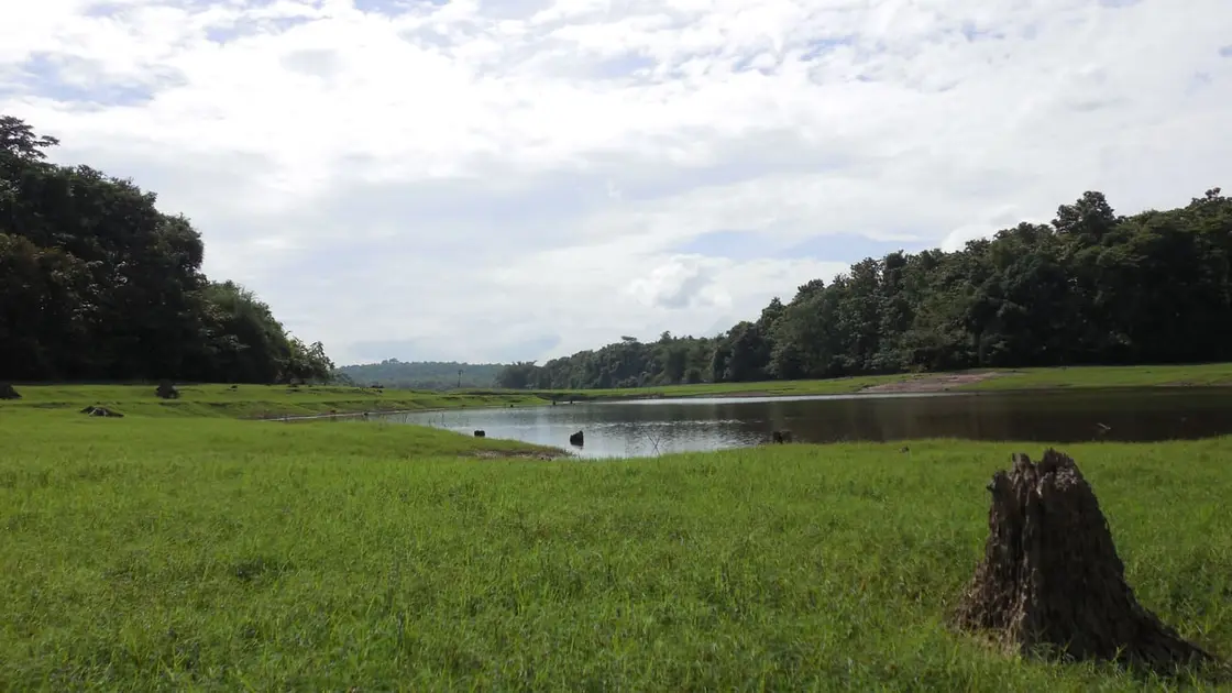
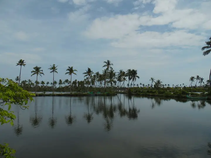
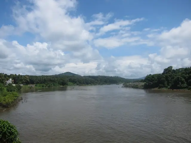
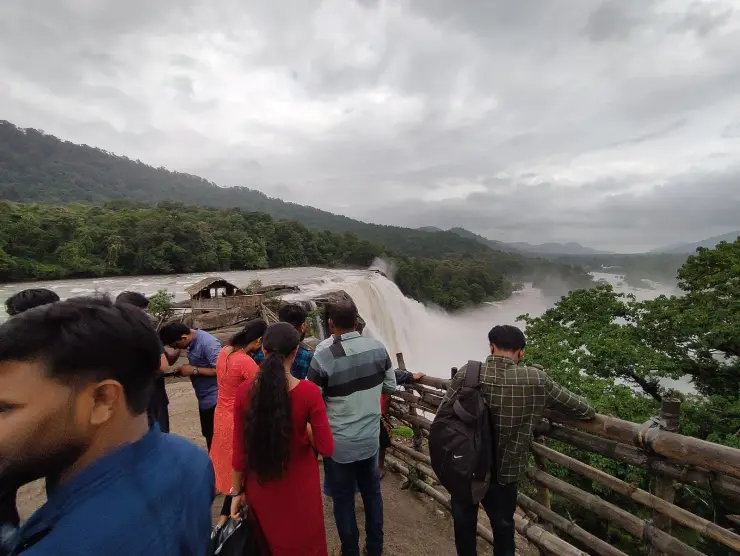
Thattekkad is a peninsula. Two arms of the Periyar close around the village before they meet in the backwater above Bhoothathankettu, which is why the place has water on both sides of it and a forest at its back. Almost everyone who arrives is here for one thing, and that thing — the Salim Ali Bird Sanctuary — has its own page on this site. The village underneath it is more interesting than its signage suggests. It is the road-head of Kuttampuzha, a panchayat that holds roughly a sixth of Ernakulam district inside its boundary, touches Tamil Nadu at its far end, and carries about forty-two people to the square kilometre in a state that averages nearly nine hundred. And the road running through it was once the only road from Kochi to Munnar, until a flood took it away in 1924 and nobody ever put it back.
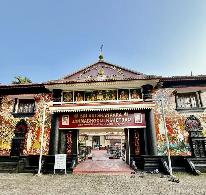
What you actually see at Thattekkad is small: a road, a concrete bridge thrown across the Bhoothathankettu backwater in 2005, a village Shiva temple under coconut and areca palms with a hill behind it, a scatter of homestays and birding lodges, a few shops, and the sanctuary gate. It reads as a place people pass through. That is exactly what it is, and it is the point — Thattekkad has been a place people pass through for a very long time, and the interesting question is where they were going.
The water first, because the water explains the village. The Periyar arrives here already large, and immediately east of the settlement it takes in the Kuttampuzha river. That tributary is itself a joining: the Vadattupara, the Pinavoorkudi and the Pooyamkutty come together upstream, and the usual reading of the name is Koottanpuzha, the conjoined river. The Periyar then splits around Thattekkad and rejoins below it in the reservoir. Four named rivers become one in about fifteen kilometres, which is why this stretch floods the way it does.
The administrative unit is Kuttampuzha gram panchayat, formed on 20 September 1969, with seventeen wards — Thattekkad, Kuttampuzha, Inchathotty, Urulanthanni, Pooyamkutty, Idamalayar, Vadattupara, Mamalakandam, Pinavoorkudi, Manikandanchal, Kuttiyachal, Thalippara, Kallelimedu, Arattuchira, Poika, Thundathil and Anakayam. Its southern boundary is the Periyar and the Idukki panchayats beyond it; its northern one runs up to Athirappilly and the Tamil Nadu line; its eastern edge is Edamalakkudy and Tamil Nadu again. An Ernakulam panchayat that borders another state is not a common thing.
Its size is genuinely disputed and we would rather say so than pick. The Malayalam Wikipedia and the local-government listings give 543.07 square kilometres; the English Wikipedia article gives 448.05 while also saying the panchayat holds 17.7 per cent of Ernakulam district — a share that works out at about 543, not 448, so its own two figures disagree with each other. Kerala Tourism’s destination page says over 650. What all three agree on is the shape of the fact: this is one of the largest panchayats in Kerala by area and one of the emptiest by people, with roughly 23,000 residents at the 2001 count and about 24,800 at 2011.
About one person in six here belongs to a Scheduled Tribe — the 2011 figure is 17.2 per cent — which makes Kuttampuzha, after Wayanad, one of the most substantially adivasi parts of Kerala. The Muthuvan and the Mannan are the communities most often named, along with Ulladan, Malayan, Malayarayan and Urali households, living in settlements scattered through the forest wards well east of where the tar ends. They are not a visitor attraction and should not be treated as one; what they are is the reason the interior of this panchayat is inhabited at all.
East of the village the road thins. At Pooyamkutty it crosses the river on a chappath, a low causeway on stumpy piers with the water running a foot or two below the deck — and in the monsoon, over it. That is the honest condition of the road here, and it is worth planning around: the eastern leg of Kuttampuzha is a dry-season proposition, roughly November to March, and in July it can simply be shut by the river.
Take the water seriously. On the evening of 20 February 2007 a boat returning from the bird sanctuary went down at the Ovunkal jetty, a kilometre from the sanctuary, and eighteen people died. The boat was not licensed. Boating on this reach is a legitimate thing to do and the authorised operators at the Bhoothathankettu jetty run it properly, but the rule that came out of 2007 is simple and worth keeping: licensed boat, life jacket on, stay seated, and do not get on anything that is filling up past its marked capacity because the light is going.
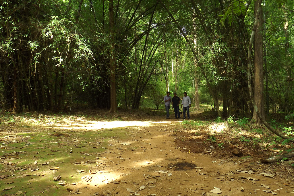
The other thing to take seriously is that this is a working forest edge with elephants in it. Crop raiding and the occasional fatal encounter are real here, and the sensible precautions are the ordinary ones — do not drive the forest roads after dark, do not walk out to the river at night, and follow whatever the Forest Department or your host tells you about which tracks are currently in use by animals. Wildlife has also given the place a reputation problem, which is dealt with further down this page.
Use Thattekkad as a base rather than a stop. The sanctuary wants a dawn start and the barrage downstream wants a morning, so a single afternoon covers neither. Within a short drive there is the Inchathotty suspension footbridge about ten kilometres away, often described as the longest hanging bridge in Kerala at roughly 183 metres and a metre and a bit wide; Kuttampuzha village itself; and the Idamalayar reservoir road. Provision at Kothamangalam, seventeen kilometres back — that is the last town of any size, and services east of Thattekkad are sparse by design.
Legend & myth
Start with a refusal, because the temptation here is enormous. The best legend on this river is the one about the demons who tried to dam the Periyar, were tricked by a rooster crowing before dawn, and abandoned the boulders where they lie — the story that gives Bhoothathankettu, the demons’ dam, its name. It is a genuinely good story and it is not Thattekkad’s. It belongs a few kilometres downstream and we tell it in full on our Bhoothathankettu page. What Thattekkad has instead is quieter, and most of it is about vanishing.
The village’s own tradition is that it used to be a town. Malayalam accounts of Thattekkad hold that this was Thattaiyur, an inhabited settlement in the time of the ancient Chera power, and that it was ended not by war but by water: repeated floods, and the Periyar changing its course, until the population was gone entirely and the site simply grew over. Centuries of that produced Thattaikkad, and then Thattekkad. We present this as tradition rather than as archaeology — we have found no excavation report behind it — but note what the tradition is actually saying. It is a folk memory of a river that moves, told in a place where the river demonstrably does.
That gives the name two readings and it is worth having both. The plain one, which we use on our sanctuary page, takes thattu for flat or level and kaadu for forest: flat forest, which is a fair description of the low ground here. The village one derives it from the lost Thattaiyur. Neither is provable from where we sit, and the pair of them together tells you more than either alone — one account remembers a landscape, the other remembers a settlement that the landscape ate.
The living mythology of this panchayat is not in the village at all; it is up the road, with the communities of the Kuttampuzha forests, and it has its centre of gravity in Madurai rather than in Kerala. The Muthuvan take their name, by their own account, from muthuku — the back. When they came over the Ghats they carried their children and everything they owned on their backs rather than on their heads, and they still do; a second and more resonant version has it that what they carried up on their backs was the image of Madurai Meenakshi herself, the deity of the royal house they had followed out of the plains. Both versions are recorded in the Malayalam ethnographic literature, and the community still sends people to the Meenakshi temple festival at Madurai — a devotional line drawn straight across the mountains they walked.
Muthuvan marriage carries its own small mythology of the forest. The households settle the match and fix the day; then the bride goes up into the trees with her friends and hides, and the groom and his companions have to find her. When they do, the party comes back down, she is garlanded, betel is exchanged, and the marriage is completed by the groom pushing into her hair a comb he has made himself — the workmanship of that comb being taken as the measure of the man, and the rule being that she wears it for the rest of her life. Before all that, unmarried boys and girls sleep not at home but in separate chavadis, dormitories run by the eldest among them; on the eve of a wedding you are expected to say goodbye to your chavadi in song.
The Mannan, the other community named across these forests, are the only group in Kerala who still have a king. Their tradition ties them to the Pandya house of Madurai, their deity is Madurai Meenakshi again, and their raja’s seat is at Kovilmala near Kattappana — which is in Idukki, not here, and we say so plainly because the temptation to relocate a good fact is how errors get made. In the settlements themselves worship is domestic and local: a built enclosure for Muthiyamma and the hill gods, who are understood to be ancestors who came down from the sky, with a moopan or kanikkaran speaking for each hamlet.
Two Mannan beliefs are worth setting down here specifically, because of where we are standing. Roll the wax of the rock bee into a ball, drop it into a fire burning hard, and the heaviest rain will stop. Tie salt into a cloth bundle and put it in water, and heavy rain will come. Divination is done with paddy grains, by a rite called kodayngi, when a child is to be named or a harvest comes in light. Rain-magic is common enough across South India; what makes it land here is the setting. This is a village whose founding story is that a flood erased the town before it, on a river that has since been barraged downstream, dammed upstream, and opened in emergency more than once. Of all the places to keep a charm for stopping rain, the Periyar valley is not an odd choice.
The last myth about Kuttampuzha is a recent one and it did real damage. Following elephant and other wildlife incidents from about 2022, sections of the Malayalam media took to describing the panchayat as a ghost village emptied by fear. The panchayat president, Kanthi Vellakayyan, has publicly disputed it, and so have residents: the families who moved — put at somewhere between forty and seventy-nine over five years — largely moved within Kuttampuzha itself rather than out of it, and they moved for the ordinary combination of services, work and schooling as much as for animals. The village is inhabited and functioning. The reporting hurt land values and local prospects, which is a reminder that a story does not have to be old to be a legend, and that the modern ones are usually the more expensive.
More about Thattekkad
History
The single most consequential fact about Thattekkad is one that no longer exists. The first road from Kochi to Munnar ran through here — Kochi to Thattekkad, then Pooyamkutty, then Mankulam and up. Everything the High Range produced, spices included, came down that way to Kochi, and the stretch was known as the rajapatha, the royal road. It ended in 1924. The great flood of that year — the flood of ’99 in the Malayalam calendar, which remains the benchmark disaster of modern Kerala — brought Karinthiri hill down across the royal road and destroyed it, and the Pooyamkutty–Mankulam section went with the water. The British-built railway and ropeway serving Munnar were wrecked in the same event. The High Range’s trade link to Kochi was cut in a single season.
The replacement went in somewhere else, and that is why Thattekkad is quiet. The Regent Maharani Sethu Lakshmi Bayi ordered a new road from Aluva to Munnar and a new crossing of the Periyar; the road was inaugurated in March 1931. The Neriamangalam Bridge, begun in 1924 and opened on 2 March 1935 by Sri Chithira Thirunal Balarama Varma, carried it — 214 metres long, 4.9 metres wide, built in surkhi and granite, described as the first Class A arch bridge in Asia, and still standing after the floods of 1961 and 2018. From 1935 the Thattekkad route was simply left alone.
Consider what that did. A road through a forest is the beginning of the end of that forest; no road means no clearing, no depots and no settlement. Thattekkad’s low riverine forest was left to itself from 1924, and nine years later Salim Ali walked into it and called what he found the richest bird habitat in peninsular India. The sanctuary story is on its own page. The part that belongs here is the accident behind it: this forest survived because a hill fell on the road.
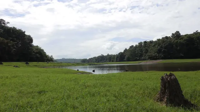
The engineering came back later and from both directions. Downstream, the Bhoothathankettu barrage — headworks of the Periyar Valley Irrigation Project, begun in 1956 — raised the water that now surrounds the village. Upstream, the Idamalayar dam on the Periyar tributary of the same name was completed in 1985: a gravity dam 102.8 metres high and 373 metres long, impounding about 1.09 cubic kilometres and driving 75 megawatts through two turbines, with its shutters opened in the floods of August 2018. The bird sanctuary was notified in 1983. The Thattekkad bridge over the reservoir followed in 2005, and with it came proposals to rebuild the old Kochi–Munnar road through the village.
One scheme that never arrived defines the interior more than any that did. From 1981 the Kerala State Electricity Board pursued a hydroelectric project at Pindimedu on the Pooyamkutty, about eight kilometres inside the forest — a scheme costed at around ₹250 crore and designed for 1,000 megawatts, on the scale of Idukki. It was fought as another Silent Valley. A Kerala Forest Research Institute assessment concluded that once the value of the forest to be submerged was counted, the cost-benefit ratio turned negative. A cut-down 210-megawatt version was pushed again around 2001 under Chief Minister A. K. Antony and was abandoned on environmental and financial grounds. The forest east of Pooyamkutty is standing because that argument was won.
The village’s modern history has one dark date in it. On 20 February 2007, at about 6.30 in the evening, a tourist boat returning from the bird sanctuary capsized at the Ovunkal jetty on the Periyar, a kilometre from the sanctuary and on the Ernakulam–Idukki border. Thirty-seven people were aboard. Eighteen died — fifteen students, two teachers and one employee of a private school in Angamaly, on a school excursion. Accounts of the cause conflicted from the start: an early reading held that the hull had been holed and taken water, while the then DGP, Raman Srivastava, said the following day that the boat had simply overturned. What was not in doubt afterwards was that it had been operating unlicensed. Justice M. M. Pareed Pillay’s inquiry produced around eighty-six recommendations on inland water transport, including making swimming a subject in schools; the owner-operator, P. M. Raju, was convicted and sentenced to five years and a fine of ₹1 lakh, reduced to two years in 2021.
Why visit
It is a peninsula in the Periyar, with two arms of the river closing around the village and a forest at its back.
The road through it was the original Kochi–Munnar route, abandoned after the 1924 flood — and the forest here survived because of that.
It is the road-head of Kuttampuzha, among Kerala’s largest panchayats by area and emptiest by population, with about forty-two people to the square kilometre.
Two nationally known sites sit within a few kilometres — the Salim Ali Bird Sanctuary and the Bhoothathankettu barrage — and both want a whole morning, so the village is the practical base for either.
The Inchathotty suspension footbridge, at roughly 183 metres often called Kerala’s longest, is about ten kilometres away.
It is the western doorway to a genuinely large adivasi landscape — Muthuvan and Mannan settlements, evergreen forest and the Tamil Nadu border — that begins where the tar thins at Pooyamkutty.