Ramakkalmedu viewpoint

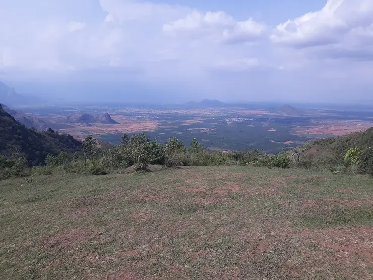
The Ramakkalmedu viewpoint is the lip of a Western Ghats escarpment about a thousand metres above the Cumbum valley, and what you look out at from it is another state. It sits inside a gated compound run by the District Tourism Promotion Council, Idukki, which charges ₹25 and opens the gate from 08:30 to 18:00. The same ticket buys a hornbill-shaped watchtower, a canteen, a children’s playground, a camel ride and the Kuravan and Kurathi statue that row 12 of this guide is about, 137 metres away. What it does not buy is either end of the day: the sun is up here from about six in the morning and does not set until after the counter has closed, every day of the year.

Ramakkalmedu viewpoint, Ramakkalmedu
Practical guide

Plan Ramakkalmedu viewpoint

Who's going?Tailor Ramakkalmedu viewpoint to your trip
Typeviewpoint
AreaRamakkalmedu
DistrictIdukki
Best timeSeptember to May, excluding the heavy…
Time neededOne to two hours inside the compound
Entry₹25
Places to visit4Listed businesses12

The place is named for a rock, and the rock is neither the statue nor this railing. Ramakkal — രാമക്കൽ in Malayalam, ராமக்கல் in Tamil — is a crag 756 metres north, a peak at 1,063 metres with a flagstaff on the crest, and it stands outside the compound and outside the ticket. Two legends attach to it and Malayalam Wikipedia carries both: Rama’s foot pressed here in the Treta Yuga while he searched for Sita, and, on the same ridge, the കല്ലുമ്മേൽ കല്ല് that Bhimasena is said to have used to pound betel for Draupadi. Medu is simply high ground, added later to a name the mountain already had. The climb to it is 700 metres from beside the Sree Rama and Durgga Devi Temple, free and unstaffed.

And the ridge is a working border rather than a scenic one. Eight Tamil Nadu towns are named on this view by Kerala Tourism and English Wikipedia between them, and every one of them is two to four times further by road than it is in a straight line, because nothing crosses the escarpment here. Around the compound, on private land at Pushpakandam and Kuruvikanam, stands the second wind farm ever built in Kerala — about 14.25 MW of NEG MICON turbines feeding the state electricity board — on a ridge whose wind is published three different ways and never below thirty kilometres an hour.

The story

Why a hill named after a rock is visited for a view of somewhere else — and why the two hours it is famous for both fall outside the hours you are allowed to be there.

The story of Ramakkalmedu viewpoint

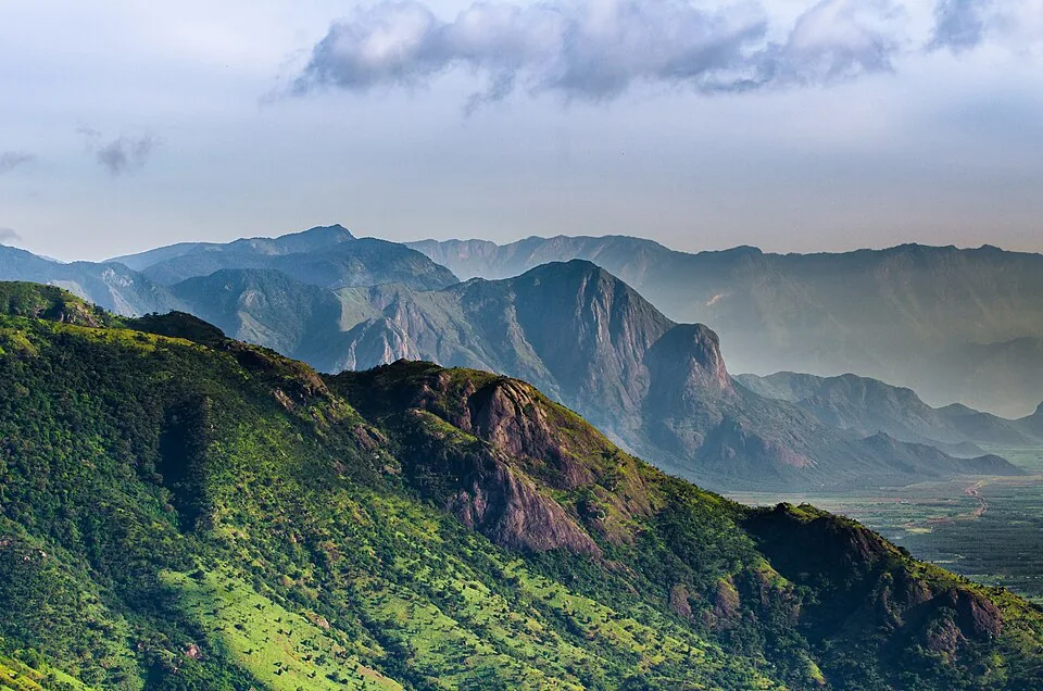
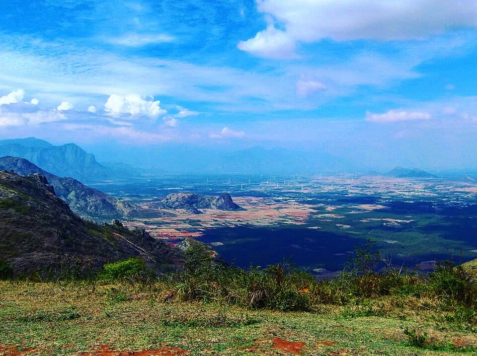
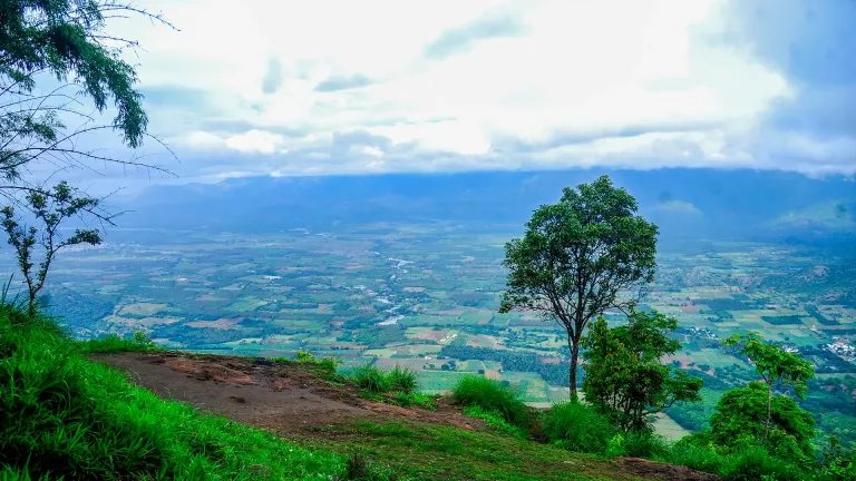
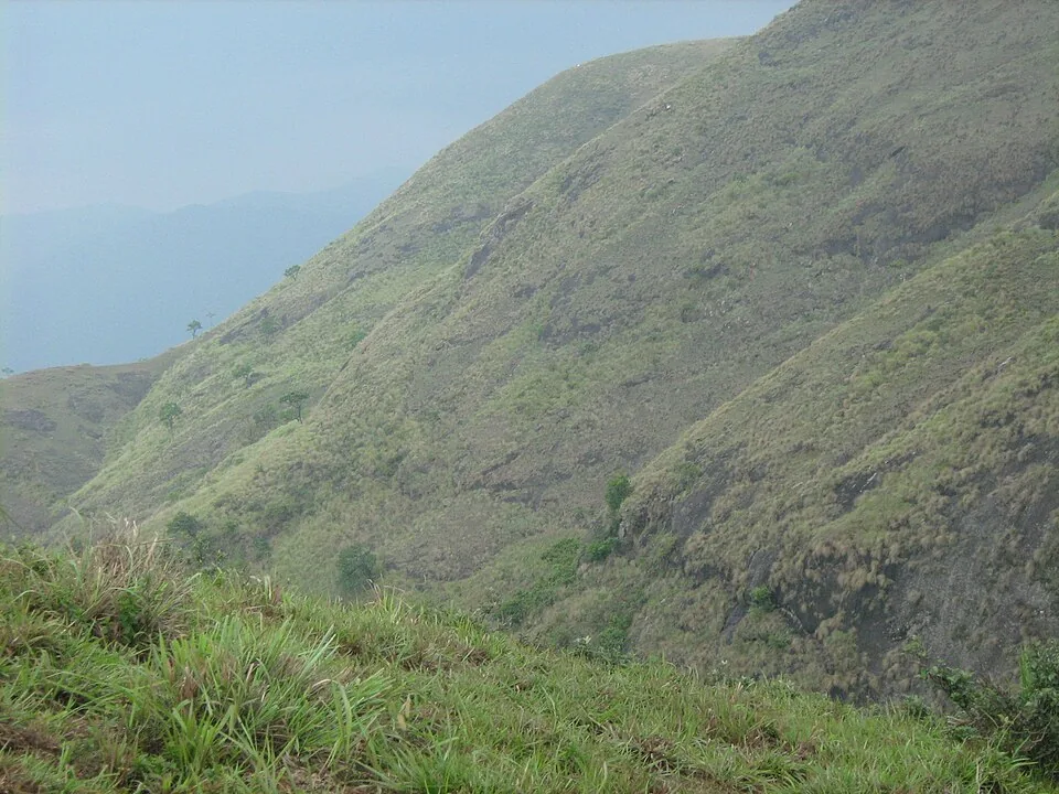
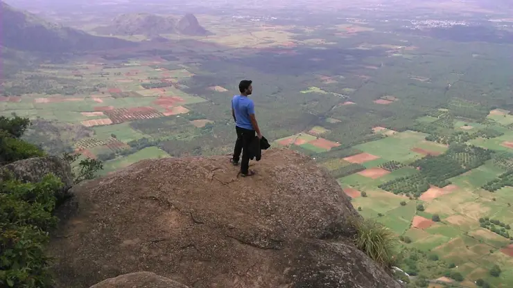
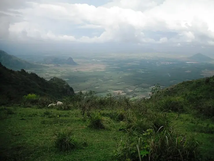
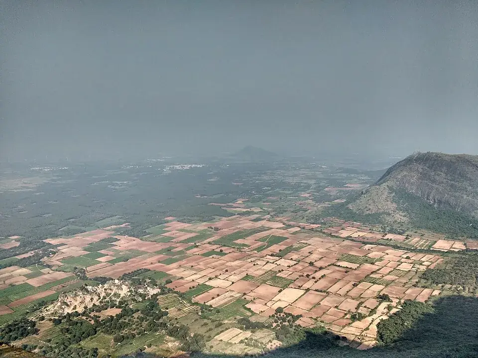
Start with what is under you, because the arithmetic of this view is the thing nobody prints. Kerala Tourism and English Wikipedia between them name eight places on the plain below — Adivaram, Cumbum, Theni, Kombai, Thevaram, Uthamapalayam, Bodinayakanur and Vaiga — and from the railing they are a grid of coloured fields with the Cumbum valley running away to the south-east. Cumbum is 8.8 kilometres from this point in a straight line. By road it is 24.2, and takes twenty-six minutes. Uthamapalayam, the Tamil Nadu taluk that OpenStreetMap believes this viewpoint actually stands in, is 8.9 kilometres away and 33.3 by road. Bodinayakanur, the nearest railway station to Ramakkalmedu as the crow flies, is 25.2 kilometres away and 59.2 by road, a little over an hour. Nothing crosses this crest. You are looking down at a country that is closer to you than the nearest petrol pump and further away than Kattappana.

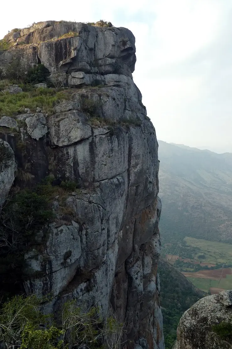
Then look north, because the place is named for something you cannot see from the railing. Ramakkal — രാമക്കൽ in Malayalam and ராமக்கல் in Tamil — is a crag 756 metres from this viewpoint, mapped by OpenStreetMap as a peak at 1,063 metres with a bare-rock outcrop drawn round it and a flagstaff on the crest. Medu is simply high ground: Malayalam for an elevated place, added to a name the mountain already had. The mountain was Ramakkal first. That is why the rock, and not the statue and not this railing, is what the whole hill is called after.

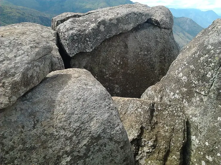
The name has two stories and only one of them is famous. Malayalam Wikipedia carries both. In the first, in the Treta Yuga, Sri Rama came down on this upland while searching for Sita, and it was from here that he chose Rameswaram for the Sethu bridge; the place is named for where his feet pressed the rock. English Wikipedia adds a version in which Lakshmana is with him, and a local reading of the name as “land of Rama’s stone” or “land where Rama set his holy foot”. In the second story the object is different and so is the epic. On top lies the കല്ലുമ്മേൽ കല്ല്, the stone upon stone, which Bhimasena is said to have used to pound betel for Draupadi while the Pandavas were in forest exile. One hilltop, two epics, and the Mahabharata one almost never gets repeated in English.

Getting to the rock is a separate outing from a separate place. The climb starts beside the Sree Rama and Durgga Devi Temple on the hill road — Malayalam Wikipedia records that temple as standing here, and local descriptions put it at the threshold of the mountain path, where people take a blessing before going up. The path is published locally as 700 metres, about thirty minutes up and fifteen down, and the last part of it is bare rock rather than made ground. There is no railing, no staff and no ticket. Kerala Tourism’s own advice for this hill, written in its newsletter, is the same advice in different words: “leave your vehicle in the valley and set out on your foot. Trek with the gushing breeze.”

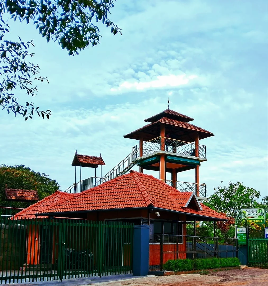
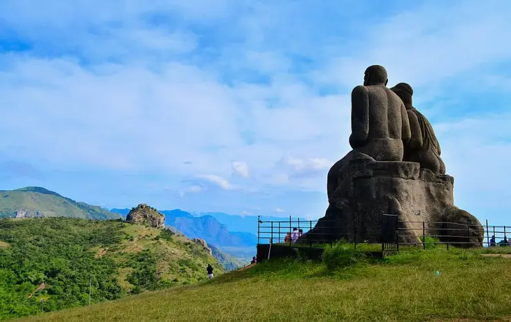
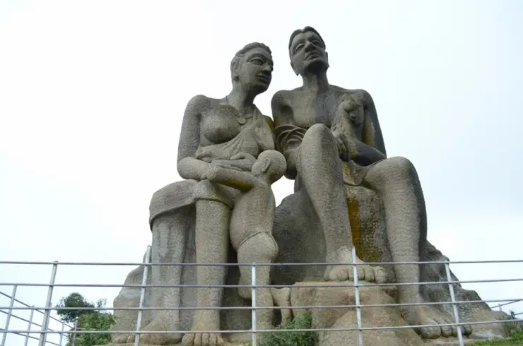
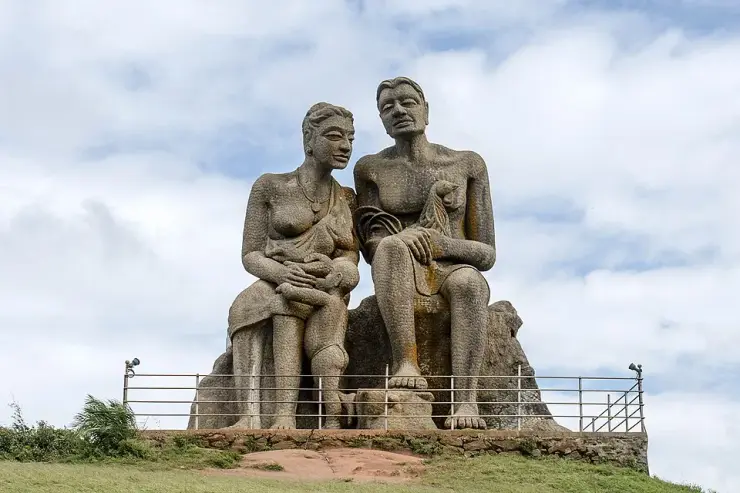
The compound is much younger than any of this. Malayalam Wikipedia records the Idukki District Tourism Promotion Council opening its tourism centre at Ramakkalmedu on 23 February 2011, with K. K. Jayachandran MLA both inaugurating it and laying the foundation stone for an Energy Park costed at ₹75 lakh. A restaurant, a water supply scheme and comfort stations were finished by then; a clock room, a rest centre and tent accommodation were still to come. Fifteen years on the enclosure holds a ticket counter, a canteen mapped as a food court, a cafe, concrete benches, a children’s playground with a posted maximum age of sixteen, a camel ride, a hornbill-shaped watchtower and the Kuravan and Kurathi statue that row 12 of this guide is about, 137 metres from the viewpoint.

Around it, on private land at Pushpakandam and Kuruvikanam, stands the second wind farm ever built in Kerala. English Wikipedia puts it at roughly 14.25 MW of NEG MICON machines feeding the Kerala State Electricity Board, and notes that for an upland described as one of Asia’s largest wind-blown areas the generating potential is still largely untapped. The wind itself is measured three different ways and the three do not agree. A Centre for Wind Energy Technology mast up here gives an annual mean of 8.41 metres per second, which is 30.3 km/h. Malayalam Wikipedia says the average is 32.5 km/h and that gusts sometimes reach 100. English Wikipedia says approximately 35 km/h, year-round, regardless of season or time of day. A mast mean and a visitor’s impression are different quantities and all three are describing the same experience, which is that nothing loose stays where you put it.

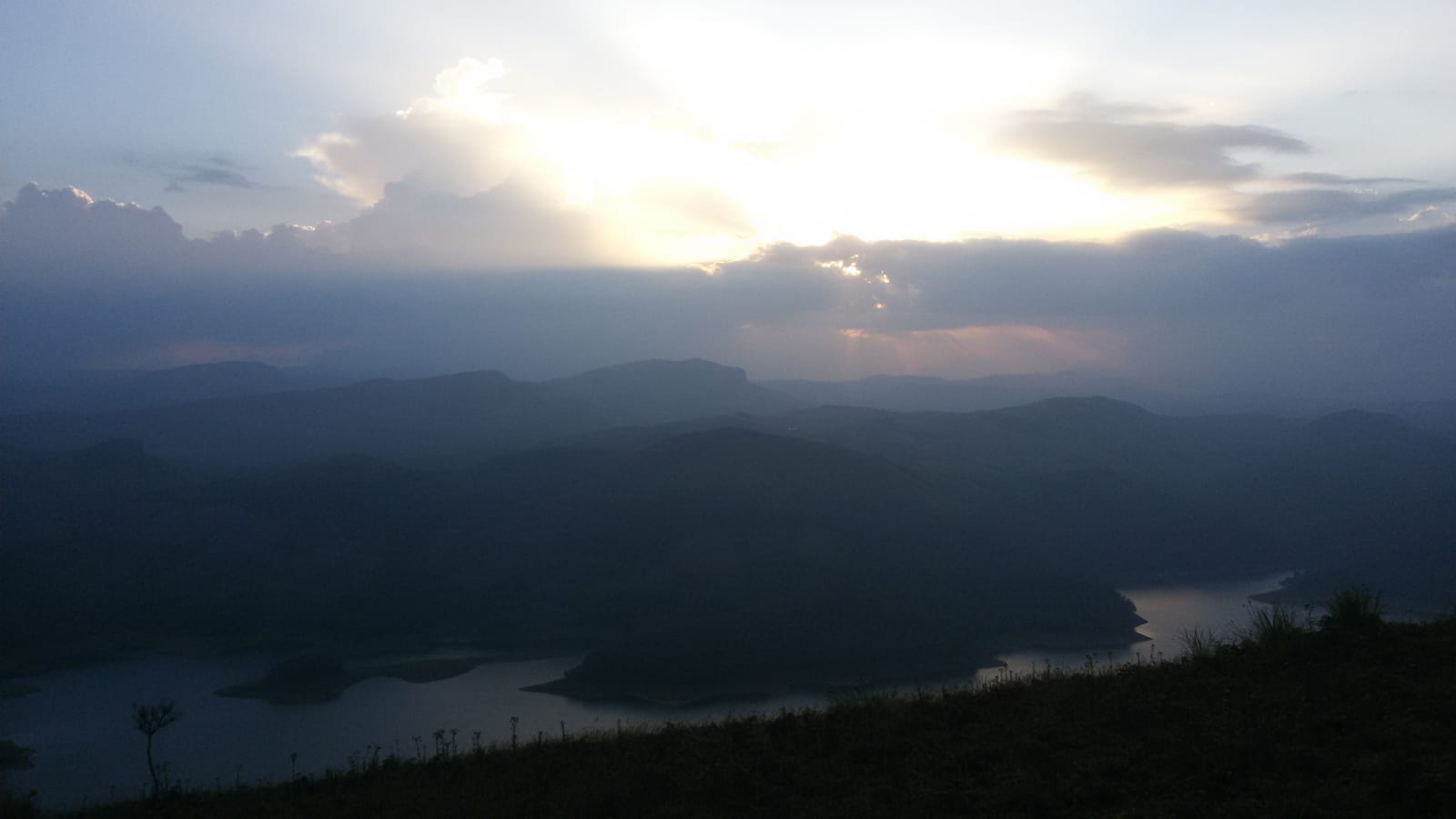
And then there is the finding that changes how you plan the day, which is that the two moments this viewpoint is recommended for are both outside its opening hours. DTPC publishes 08:30 to 18:00, every day. Computed for this pin and cross-checked against an independent ephemeris to within two minutes, the sun rises here between 06:00 on 21 June and 06:38 on 1 January, and sets between 18:06 on 21 December and 18:44 on 21 June. There is no day in the year when the gate is open and the sun is below the horizon. English Wikipedia is right that “the view is striking at dusk when all these towns in Tamil Nadu are lit up”, and a local tourism site is right to tell you to stay until dusk — but neither can be done from inside this compound. The Aamappara centre 5.8 kilometres away by the Thovalappady road keeps 06:00 to 19:00 and can.

One more thing sits below the crest and almost nothing on the Malayalam-language internet mentions it. Kerala Tourism’s newsletter describes Thirumalairayar Perumal Kovil, four kilometres down the mount on the Kerala–Tamil Nadu border, reached by “a meandering path less travelled by”, where “people from both Tamilnadu and Kerala offer prayers” and from which Ramakkalmedu towers high on one side. A local tourism site describes what may be the same descent as a two-kilometre steep route to a Perumal Jagannadha Temple at the foot of the mountain. The official figure is four kilometres and this page leads with it; whether the two are describing one path and one temple is not settled by anything published.

Legend & myth

The Ramayana account, from Malayalam Wikipedia’s own article on Ramakkalmedu: in the Treta Yuga, while searching for Sita, Sri Rama descended on this upland on his way towards Lanka, and it was from here that Rameswaram was chosen for the building of the Sethu bridge. Because Rama’s feet pressed here, the place took his name. English Wikipedia carries a variant in which he is accompanied by Lakshmana, and glosses the name as “Land of Rama’s Stone” or “Land where Rama set his holy foot”.

The Mahabharata account, from the same article and far less often repeated: on top of the ridge lies the കല്ലുമ്മേൽ കല്ല്, literally the stone upon stone, and the story attached to it is that Bhimasena used it to pound betel for Draupadi during the Pandavas’ years in the forest. It is a domestic image — a kitchen implement the size of a boulder — and it belongs to a different epic from the one the place is named after.

Both stories are about the same physical object: a rock on the high ground. Ramakkal is a crag at 1,063 metres with a sheer face on the valley side, 756 metres north of the modern viewpoint, and the Sree Rama and Durgga Devi Temple stands at the foot of the path up to it. The legends are not decoration on a viewpoint; they are why there is a temple at the bottom of the climb.
Read the full history of Ramakkalmedu viewpoint 334 more words

History

23 February 2011 — the District Tourism Promotion Council, Idukki, opens its tourism centre at Ramakkalmedu. K. K. Jayachandran MLA inaugurates it and lays the foundation stone for an Energy Park in the same ceremony. A restaurant, a water supply scheme and comfort stations are recorded as already complete; the ₹75 lakh Energy Park is to add a clock room, a rest centre, a restaurant and tent accommodation. Malayalam Wikipedia is the source for all of it.

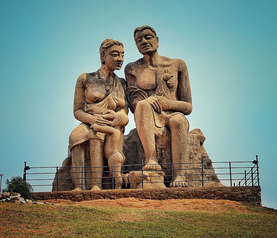
2005 — the Kuravan and Kurathi statue is erected on the mound 137 metres from the viewpoint, sculpted by C. B. Jinan. Row 12 of this guide covers it, including the fact that it has three figures and not the two that most descriptions count.

Wind power comes to the ridge in stages: the villages of Pushpakandam and Kuruvikanam host what English Wikipedia records as the second wind energy farm installation in Kerala, on private holdings, with a current capacity of about 14.25 MW using NEG MICON turbines and the electricity going to the Kerala State Electricity Board.

March 2015 — Kerala Tourism publishes its own article on Ramakkalmedu, calling it one of the most windy places in Asia, putting it 36 km north of Kumily, telling visitors to leave the vehicle in the valley and walk, and naming Thirumalairayar Perumal Kovil four kilometres down the mount.

By 2015 English Wikipedia records more than 100,000 visitors a year and notes that little had been done to improve basic facilities, with the state announcing plans for buses and other measures. The circuit it names — Tortoise Rock, Kuravan Hills, Rama Rock, Wind Mills Viewpoint, Soolapara Hill and Hyderamala Hills — still describes what is up here, and the last two of those six appear nowhere else on this site.

6 May 2023 — the viewpoint first appears in the map history with an indicated outlook to the north-northeast. 11 May 2026 — Ramakkal’s map record is updated with its 1,063 m elevation and names in Malayalam and Tamil.

What to expect

Highlights

  • The plain, and the arithmetic of it. Eight towns are named on the view and the nearest of them is a twenty-six-minute drive round the ghat. This is the clearest example in the Idukki high range of a place where a straight line and a road bear almost no relation to each other.
  • Ramakkal itself, 756 m north — the rock the place is named for, at 1,063 m, with a flagstaff on the crest and a sheer face on the valley side. It is outside the ticketed compound and the climb to it starts somewhere else entirely.
  • The 700-metre climb. It begins beside the Sree Rama and Durgga Devi Temple on the hill road, and is published locally as about thirty minutes up and fifteen down. Malayalam Wikipedia confirms the temple; Kerala Tourism’s own advice for this hill is to “leave your vehicle in the valley and set out on your foot”.
  • Two name legends, both published in Malayalam and only one of them widely repeated in English. Rama’s foot is the famous one. The കല്ലുമ്മേൽ കല്ല് — Bhima’s betel stone, from the Mahabharata rather than the Ramayana — is the other, and it is on top of this ridge.
  • The hornbill tower, 131 m from the viewpoint: the highest made platform in the compound and the frame the dusk descriptions are written from.
  • The wind. Three independent figures — a government mast’s annual mean of 8.41 m/s, Malayalam Wikipedia’s 32.5 km/h average with gusts to 100, English Wikipedia’s roughly 35 km/h year-round — and they are all describing the same thing, which is that you cannot put a hat down here.
  • The gate’s hours against the sky. DTPC opens at 08:30 and closes at 18:00. Sunrise on this ridge is between 06:00 and 06:38 and sunset between 18:06 and 18:44, every day of the year. The two moments this viewpoint is recommended for both fall outside the hours you can be here.
  • A second temple nobody writes about. Kerala Tourism’s own newsletter describes Thirumalairayar Perumal Kovil, 4 km down the mount on the state border, reached by “a meandering path less travelled by”, where “people from both Tamilnadu and Kerala offer prayers”.
Getting there

How to visit

  • Come to the Ramakkalmedu Tourism Centre gate on the Thookkupalam–Ramakkalmedu road. DTPC Idukki publishes 08:30 to 18:00 daily, ₹25 for adults and ₹15 for children and senior citizens, with ₹300 for video and ₹1,200 for an album. The unit in charge is on +91 99479 91444 and the counter for this ridge is 04868 243356. Booking is offline only, so carry cash.
  • Measured with OSRM from this pin on 26 August 2026: Thookkupalam 8.3 km, Nedumkandam 14.3 km, Kattappana 23.3 km, Chellarkovil 23.9 km, Puliyanmala 31.9 km, the Idukki arch dam 44.3 km, Kumily 48.9 km, Thekkady 50.2 km and Munnar 60.3 km. DTPC gives Nedumkandam bus stand as “about 12.4 km”; both Wikipedias say 15 km. All three are describing the same drive.
  • Do not build the day around sunrise or sunset at this gate. Take Aamai Para first — its centre opens at 06:00 and closes at 19:00, and it is 5.8 km away by the Thovalappady road — then come here from half past eight, and be moving down before the counter shuts.
  • The climb to Ramakkal is a separate outing from a separate parking place. Leave the vehicle at the Sree Rama and Durgga Devi Temple on the ridge road; the rock is free, unstaffed and unrailed, and the last part of it is bare rock rather than path.
  • If you want the plain sharp rather than hazy, come in the first two hours after opening. Every published photograph taken from this escarpment later in the day shows the Cumbum valley under haze.
  • Make it a ridge day rather than a stop. Aamai Para, this viewpoint, the Kuravan and Kurathi statue 137 metres away and Ramakkal are four different things within two kilometres of each other, and the roads between them add up to about twelve.

Distance by road

  • Kochi107 km
  • Madurai172 km
  • Thiruvananthapuram226 km
  • Coimbatore252 km
  • Kozhikode276 km

Road km to Idukki; ghat roads and traffic vary — allow extra.

Timing

Best time

September to May, excluding the heavy monsoon; Malayalam Wikipedia names exactly that window for Ramakkalmedu. Everything this viewpoint exists for is below the ridge, and in the south-west monsoon the cloud comes over the top and sits there, sometimes for days — a viewpoint inside a cloud is a car park with a railing. Within the day, the first two hours after the 08:30 opening give the clearest plain, because haze builds over the Cumbum valley as the ground heats. Late afternoon gives the best light on the fields and on the escarpment face. What you cannot have from inside this gate is either end of the day: the sun is up between 06:00 and 06:38 all year and sets between 18:06 and 18:44, and the counter is open 08:30 to 18:00. If sunrise or the lit Tamil Nadu towns at dusk is what you have driven for, the neighbouring Aamappara centre keeps 06:00 to 19:00 and this one does not.

Weather in Ramakkalmedu viewpointSeasonal guide

Live forecast loads in your browser.

Today at Ramakkalmedu viewpoint
Sunrise6:11 am
Sunset6:20 pm
Golden hour best light5:20 pm–6:20 pm
Blue hour after sunset6:20 pm–6:45 pm
Sun sets toward compass bearingW · 272°
Moon tonight🌓 First quarter · 56%
South-west monsoon. June to September brings heavy rain to Kerala. Trails, falls and ghat roads can be slippery, swollen or closed at short notice, and forest departments sometimes suspend access. Check locally on the day before you travel.

Check the official alert before you travel. Kerala’s beaches, waterfalls and trekking routes close at short notice during heavy rain, and district alert levels change day to day. We do not publish an alert level of our own — read it from the state authority: Kerala State Disaster Management Authority, or the district control room on 1077.

Sun and moon are calculated for this location and shown in IST. Photography windows are the hour around sunrise and sunset; the sunset bearing is degrees clockwise from true north. Moon phase is accurate to about half a day.

Visitor notes

  • 🔴 You cannot see sunrise or sunset from inside this compound, and almost every page recommending it for both fails to say so. DTPC publishes 08:30 to 18:00. Computed for this pin and cross-checked against an independent ephemeris to within two minutes, sunrise falls between 06:00 on 21 June and 06:38 on 1 January, and sunset between 18:06 on 21 December and 18:44 on 21 June. On no day of the year is the sun below the horizon while this gate is open.
  • ⚠ The elevation is contested and this page does not pick a winner. Wikidata and both Wikipedias publish 981.07 m for Ramakkalmedu; English Wikipedia’s own Geography section says 3,500 ft, which is 1,067 m; Malayalam Wikipedia says 1,100 m. OpenStreetMap tags Ramakkal itself at 1,063 m. They are not all measuring the same point and none of them says which point it is measuring.
  • ⚠ The wind figures disagree and all of them are honest. The Centre for Wind Energy Technology’s mast on this ridge gives an annual mean of 8.41 m/s, which is 30.3 km/h. Malayalam Wikipedia says the average is 32.5 km/h and that it sometimes reaches 100. English Wikipedia says approximately 35 km/h year-round, regardless of season or time of day. A mast mean and a visitor’s impression are different quantities; both are printed here.
  • ⚠ The distance down to the border temple is given two ways. Kerala Tourism’s newsletter places Thirumalairayar Perumal Kovil “4 km down the mount”. A local tourism site describes a “Temple Route Trek” of 2 km, steeply down, to a Perumal Jagannadha Temple at the foot. The official figure is the one this page leads with, and the two may not be measuring the same path or even the same building.
  • 🔴 The mapped state boundary places this viewpoint on the Tamil Nadu side of the ridge, returning Uthamapalayam, Theni as its address. Kerala Tourism, DTPC Idukki and Wikidata nevertheless present Ramakkalmedu as an Idukki destination. For travel, use the attraction coordinates and follow DTPC access information rather than relying on the state name returned by a map.
  • ⚠ The ticket shops on this compound are mapped as KTDC and the tariff is published by DTPC. OpenStreetMap records two ticket points named “KTDC Entrance Pass” and “KTDC Entrance Ticket”; the fees, the hours and the phone numbers on this page all come from the District Tourism Promotion Council, Idukki, which is a different body. We have used the operator that publishes the rates.
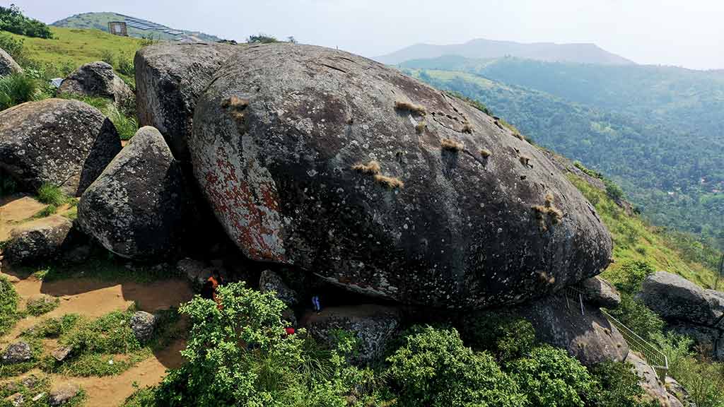
  • ⚠ A widely circulated photograph filed as Ramakkalmedu is not this viewpoint. File:Ramakkalmedu 1.jpg on Wikimedia Commons — visitors standing on a rounded boulder above a sea of cloud — is described by its uploader as “ramakkalmedu viewpoint”, but the rock in it has the head and shell of Aamai Para, the tortoise rock row 11 of this guide is about. It is not in this page’s gallery.
  • 🔴 Two frames of Ramakkalmedu wildlife are excluded for a burned-in watermark. Both shield-tail snake photographs on Wikimedia Commons carry “SHOT ON MI A3 / BROTHERS RAMAKKALM” across the bottom of the frame and a 2020/9/12 07:46 timestamp. The observation is cited in this page’s safety notes because it is genuinely useful; the pictures are not published.
  • ✅ The rock is free and the view is not. Ramakkal stands outside the DTPC enclosure and costs nothing; the viewpoint, the hornbill tower and the Kuravan and Kurathi statue are all inside the ₹25 ticket. If the legend is what brought you, you do not need the gate at all.
  • ⚠ There is no guided anything. DTPC publishes no guide, no timed slot and no online booking for this centre or for the Ramakkal climb. Anything sold as a booked Ramakkalmedu experience is reselling access that is bought at a counter for ₹25.
Safety

Good to know

  • The grass runs to the lip of the escarpment and there is no railing beyond the compound edge. The drop that makes the view is around a thousand metres onto the Tamil Nadu plain. Do not step out for a photograph.
  • This is the windiest ridge in Kerala and the wind is not a breeze. A government mast here records a June monthly mean of 13.04 m/s — 47 km/h of steady wind on open grass with nothing to hold on to. Hats, phone cases, spectacles and light bags all go over.
  • Ramakkal is a climb, not a walk. The published thirty minutes assumes you are steady on bare rock. There is no railing, no staff and no lighting on it, and it is outside the ticketed compound.
  • The red earth and short grass are slick after rain, and the paved path stops before the open ground does. Most falls up here happen on the last few metres.
  • The gate shuts at 18:00 and the road down is unlit two-lane hill road. Be moving before the counter closes rather than after it.
  • Mist can close the ridge in minutes in the cold months, and the same cloud is on the descending road. This is not a place to improvise a night drive.
  • Snakes use the tarmac on this ridge — a shield-tail snake was photographed on it at 07:46 on 12 September 2020. Watch where you put your feet in long grass, particularly on the way to Ramakkal.
  • Phones hop between Kerala and Tamil Nadu networks up here because the border runs west of the compound. That can mean roaming charges and it can mean live navigation dropping out on the descent.
  • There is no published accessible toilet at this centre and the block that exists is 405 m from the viewpoint. Plan for that distance rather than discovering it.
  • The camel ride and the children’s playground are inside the same ticket but are not covered by anything on this page. Satisfy yourself about them on the ground.
Stay · eat · do · rent · see · shop

Stays, food & things to do near Ramakkalmedu viewpoint

Verified hotels, homestays, restaurants, experiences, sights, shops and rentals around Ramakkalmedu viewpoint — commission-free, with direct contact. Filter by what you need.

2 things to do near Ramakkalmedu viewpoint

Paadi Holidays Airport Shuttle and Local Tours — Airport in Ramakkalmedu
Top pick Verified
Airport · Ramakkalmedu
Paadi Holidays Airport Shuttle and Local Tours

Airport in Ramakkalmedu. Paadi Holidays, Ramakkalmedu, Anniyar Thozhu, Idukki, Kerala 685515 · Airport shuttle, Local tours, Jeep safari support.

Directions Commission-freeView details
Ramakkalmedu Amappara Jeep Safari — Jeep safari operator in Ramakkalmedu
Verified
Jeep safari operator · Ramakkalmedu
Ramakkalmedu Amappara Jeep Safari

Amappara-side jeep safari contact for Ramakkalmedu viewpoints and hill-route activity planning. Do, Jeep safari operator, Ramakkalmedu Amappara Jeep Safari.

Directions Commission-freeView details

Book with the place itself. India’s cyber-crime coordination centre warned in April 2025 that convincing copies of hotel and pilgrimage booking sites are being pushed through sponsored search and social ads, taking payment for rooms the property never hears about. Every listing here links to the business’s own contact details and its own Google or Bing profile — we take no commission and sit in nobody’s payment path. If a booking page reached you through an ad, check the address bar against the property’s own site before you pay. Fraud can be reported on cybercrime.gov.in or on 1930.

Ranked guides

Top experiences around Ramakkalmedu

3 more places around Ramakkalmedu. Open a guide to plan the visit and onward journey.

viewpointRamakkalmedu

2.9 km · 4 min drive

Windy Idukki ridge and viewpoint area above the Tamil Nadu plains, often planned with wind farms and Nedumkandam-side routes.

heritageKuravan Kurathi statue

140 m · 2 min walk

The seated concrete group of a Kuravan, a Kurathi and their child on the open mound at Ramakkalmedu, sculpted by C. B. Jinan and put up in 2005, inside DTPC Idukki’s ticketed viewpoint compound. It commemorates Kuravanmala and Kurathimala, the two hills the Idukki arch dam is wedged between — 30 km away in a straight line, 44 km by road.

viewpointAamai Para

5.8 km · 12 min drive

Tortoise-shaped rock outcrop above Thovalappady on the Kerala–Tamil Nadu border ridge, reached by jeep track from the Thookkupalam–Ramakkalmedu road, with a two-mouthed passage under the rock and DTPC’s Jaalakam eco-tourism centre on top.

Roampedia is commission-free — own or know a stay, eatery, guide or shop near Ramakkalmedu viewpoint? List it and it appears here once verified.

Add a nearby business
Before you go

Ramakkalmedu viewpoint — at a glance

Duration1 to 2 hours; add an hour for the Ramakkal climb
OperatorDistrict Tourism Promotion Council, Idukki, which has run this centre since 23 February 2011 — Malayalam Wikipedia records K. K. Jayachandran MLA opening it and laying the foundation stone for the Energy Park the same day, with a restaurant, a water supply scheme and comfort stations already finished and ₹75 lakh budgeted for the park.
Timings08:30 to 18:00 daily, published by DTPC Idukki. Read those hours against the sky: the sun is up here between 06:00 and 06:38 all year and sets between 18:06 and 18:44, so this gate opens two hours after sunrise and shuts before sunset on every day of the year.
Best timeSeptember to May, excluding the heavy monsoon — the window Malayalam Wikipedia names for Ramakkalmedu. The reason is visibility, not comfort: everything this viewpoint is for lies below the ridge, and in the south-west monsoon the cloud sits on top of it. Late afternoon gives the best light on the plains.
Entry price
Indian adult
₹25

Fees change without notice. Check the current rate at the counter.

Entry: ₹25 adults, ₹15 children, ₹15 senior citizens, published by DTPC Idukki on its own destination page, with ₹300 for video and ₹1,200 for an album. The same ticket covers the viewpoint, the hornbill tower, the Kuravan and Kurathi statue 137 m away and the rest of the compound. Ramakkal itself is outside it and free. Carry cash; DTPC states only offline booking.

Photography: No published still-camera charge; DTPC publishes ₹300 for video and ₹1,200 for an album, which are compound-wide rates rather than per-object ones. The practical constraint is not the tariff but the wind — this is the windiest ridge in Kerala, and a tripod on the open grass above the escarpment is not a stable tripod. Nothing here is a restricted subject: the wind farm, the plains and the rock are all photographed openly and published on Wikimedia Commons under free licences.

Booking: Nothing to book. DTPC publishes no online booking for any centre on this ridge and its own page says offline only, so the ticket is bought at the counter on the day. The unit in charge is on +91 99479 91444 and the DTPC counter for this ridge is 04868 243356 — worth a call in the monsoon, when cloud can sit on the ridge for days and the view this page is about is simply not there. Nobody sells a timed slot, a sunrise ticket or a guided walk to Ramakkal, and any site offering one is reselling something DTPC does not publish.

Parking: The surfaced, paving-stone parking area inside the compound is about 282 m from the viewpoint, with a flight of steps between it and the gate. DTPC publishes no parking charge. For Ramakkal, park separately by the Sree Rama and Durgga Devi Temple on the ridge road and walk from there.

Getting here

How to reach Ramakkalmedu viewpoint

  • ✈︎ By air Cochin International Airport, published by DTPC as “about 123 km”; measured by road it is 126 km and a little over two hours. Madurai is nearer for anyone arriving on the Tamil Nadu side, but the road still has to go round the ridge rather than over it.
  • 🚆︎ By train DTPC publishes Kottayam as the railhead, “about 119 km”; measured by road it is 145 km and about two and a half hours. 🔑 The nearest station in a straight line is Bodinayakanur, 25 km away — and 59 km by road, because nothing crosses this ridge. You can see the country it stands in from the viewpoint and you cannot get to it in under an hour.
  • 🚗︎ By road The Thookkupalam–Ramakkalmedu road, an asphalted two-lane MDR, is the approach from every direction, and it runs past the compound gate. Measured with OSRM from this pin on 26 August 2026: Thookkupalam 8.3 km, Nedumkandam 14.3 km, Kattappana 23.3 km, Chellarkovil 23.9 km, Puliyanmala 31.9 km, Idukki arch dam 44.3 km, Kumily 48.9 km, Thekkady 50.2 km, Munnar 60.3 km. Aamai Para is 5.8 km by the Thovalappady road and the Kuravan and Kurathi statue is a 137 m walk inside the same compound.
  • 🚌︎ By bus Nedumkandam is the bus town, 14.3 km by our measurement and “about 12.4 km” by DTPC's; Malayalam and English Wikipedia both say 15 km. Kerala RTC works the Thekkady–Munnar corridor through Nedumkandam, and the last leg up the ridge is a jeep or a taxi. No published service sets down at the gate.
Getting back

If you are travelling by bus or ferry, check the return service with the operator before setting out. Leave time to reach the stop or jetty after your visit.

Ask at the bus stand for the time of the last service back, not the next one. If you miss it, an auto or app cab is the fallback — agree the fare before you get in.

Do

Things to do

  • Stand at the viewpoint itself and read the plain. OpenStreetMap records this point with a bearing of 22 degrees. Kerala Tourism and English Wikipedia between them name what is down there: Adivaram, Cumbum, Theni, Kombai, Thevaram, Uthamapalayam, Bodinayakanur and Vaiga, with the Cumbum valley running away south-east.
  • Work out how far away those towns actually are. Cumbum is 8.8 km from here in a straight line and 24.2 km by road. Uthamapalayam — the taluk OpenStreetMap thinks this viewpoint is in — is 8.9 km away and 33.3 km by road. Bodinayakanur is 25.2 km and 59.2 km. The ridge does not let you down.
  • Climb Ramakkal. The rock the whole place is named for is 756 m north of this viewpoint, mapped as a peak at 1,063 m and corroborated by a bare-rock outcrop drawn round it. The climb starts beside the Sree Rama and Durgga Devi Temple on the hill road and is published locally as 700 m, about thirty minutes up and fifteen down.
  • Go up the hornbill tower. It is mapped 131 m from the viewpoint, tagged as an attraction needing no reservation, and it is the highest made platform inside the compound — the frame from which the local description of dusk over the plains is written.
  • Look for the wind farm rather than at it. The turbines belong to Pushpakandam and Kuruvikanam, on private holdings, and English Wikipedia puts the installed capacity at about 14.25 MW of NEG MICON machines feeding the Kerala State Electricity Board. It was the second wind farm site in Kerala.
  • Sit down in the wind for ten minutes. Two three-seat concrete benches are mapped inside the compound. Government measurement from a mast on this ridge gives an annual mean of 8.41 m/s; Malayalam Wikipedia says the average is 32.5 km/h and gusts reach 100; English Wikipedia says about 35 km/h year-round. All three describe the same experience.
  • Take the 137 m walk to the Kuravan and Kurathi statue, which is inside this ticket and is the other reason people come up. Row 12 of this guide covers it, including the fact that it has three figures and not two.
  • Find the temple below. Kerala Tourism's own newsletter describes Thirumalairayar Perumal Kovil, 4 km down the mount on the Kerala–Tamil Nadu border, reached by “a meandering path less travelled by”, where “people from both Tamilnadu and Kerala offer prayers”. Nothing else on this site mentions it.
  • Look at what lives here. The ecosystem English Wikipedia describes is grassland–shola laced with sporadic bamboo, and photographers have published a giant wood spider, a Nephila orb-weaver's web loaded with dew and an unidentified katydid, all shot at Ramakkalmedu.
  • Eat at the DTPC canteen inside the compound — mapped as a food court, with a separate cafe near the gate. It is the only catering up here; the alternative is Nedumkandam, fourteen kilometres down.
  • Let children use the playground, mapped inside the compound with a posted maximum age of 16 and included in the same ticket.
  • Do the ridge properly across a day. Aamai Para opens at 06:00, this gate at 08:30. Take the tortoise rock first for the early light, come here in the afternoon, and be moving before the counter shuts at 18:00.
Plan

Good to know

  • Do not plan a sunrise here. The gate opens at 08:30 and the sun is up between 06:00 and 06:38 every day of the year. Aamai Para's centre, 5.8 km away by road, opens at 06:00 and is the ridge's sunrise site.
  • Do not plan a sunset here either. Sunset falls between 18:06 and 18:44 and the counter closes at 18:00. The dusk view over the lit Tamil Nadu towns that gets recommended everywhere happens after this gate is shut.
  • Carry cash. DTPC publishes offline booking only, and there is no ticket portal for any centre on this ridge.
  • Hold on to everything loose. Hats, phone cases, spectacles, hoods, maps and light bags all go over the escarpment from this ridge, and the wind here is measured in the double figures of metres per second in June.
  • Bring a windproof layer even in April. Wind at 8 m/s across an exposed grass ridge at a thousand metres takes the warmth out of you far faster than the temperature suggests.
  • Wear shoes with a grip if you intend to climb Ramakkal. The last part of that climb is bare rock, and the same red earth that makes the compound photogenic is slick after rain.
  • Check the sky before driving up in the monsoon. Cloud sits on this ridge for days at a time and there is nothing to see from a viewpoint inside a cloud. The DTPC counter, 04868 243356, is the number to ask on.
  • Fill the tank at Nedumkandam. The last fourteen kilometres are a hill road with no fuel on them.
  • Expect your phone to change state. The border runs west of this compound and handsets hop between Kerala and Tamil Nadu networks, which can mean roaming and can mean navigation dropping out.
  • Do not rely on a map app for the drive to Aamai Para. Left to itself a routing engine sends a car up the jeep track and reports about two kilometres; the road people actually use goes down to Thovalappady and back up, and is 5.8 km.
  • Bring sun cover as well as wind cover. This is an open grass ridge with no shade between the gate and the escarpment.
  • If you want the plain at its clearest, come in the first two hours after the gate opens. Haze builds over the Cumbum valley through the day, as the published photographs from this viewpoint show.
  • Do not count on the toilet being close. The block mapped in the compound is 405 m from the viewpoint.
  • Take the walk round rather than the single photograph. The viewpoint, the hornbill tower and the statue give three different angles over the same plain within 140 m of each other.
  • Small children need holding on the grass above the escarpment, not at the rail. The drop that matters is beyond the compound edge.
  • Ramakkal is outside the ticket. If the rock is what you came for you do not need to pay at this gate at all — but the viewpoint, the tower and the statue are all inside it.
  • Allow for the descent. The road down is unlit two-lane hill road and mist comes over it in the cold months.
  • Do not expect a guide. Nothing published by DTPC offers one for this centre or for the Ramakkal climb.
  • Buy the video ticket before you start filming if you are going to. It is a published rate, ₹300, and the counter is at the gate.
  • Bring binoculars if you have them. Picking Cumbum, Theni and Bodinayakanur out of the grid of fields is the whole activity here and the naked eye flattens it.
  • Time the ridge as a whole rather than as three stops. Aamai Para at six, this compound from half past eight, and you are down before the light goes.
  • Do not park on the ridge road for the Ramakkal climb where the shoulder is soft. The temple is the marked place to leave a vehicle.
  • If the compound is full, the light is usually better an hour later. Coach parties cluster in the middle of the day.
  • Take your litter down with you. There is no waste collection published for the ridge outside the compound.
Facilities

On site

  • Ticket counter at the gate; DTPC publishes the rates.
  • DTPC canteen, mapped as a food court, 196 m from the viewpoint, plus a separate cafe near the gate tagged as having no internet access.
  • Public toilet block, mapped 405 m from the viewpoint at the western end of the compound.
  • Surfaced parking on paving stones, mapped 282 m away, with a flight of steps between it and the compound.
  • Hornbill tower, 131 m away — an attraction needing no reservation and tagged wheelchair=no.
  • Two three-seat concrete benches with backrests, about 150 m from the viewpoint.
  • Children's playground inside the compound with a posted maximum age of 16.
  • A camel ride, mapped 122 m from the viewpoint and stating no reservation. Not ours and not described here.
  • A named footpath to the point itself — “View point Path” — running the last 53 m.
  • A lighting mast inside the compound, which is why the statue is floodlit after the gate has shut.
  • A gate on the compound boundary tagged for foot and bicycle access.
  • The Sree Rama and Durgga Devi Temple on the ridge road outside the compound, which is where the Ramakkal climb begins.
  • No fuel, no pharmacy, no ATM and no bank on the ridge. Nedumkandam, 14.3 km down, is the nearest of each.
Stay safe

Safety

  • This is the edge of an escarpment on the windiest ridge in Kerala. Government measurement from a mast here gives an annual mean of 8.41 m/s and a June monthly mean of 13.04 m/s — 47 km/h of steady wind on open grass. Loose objects go over.
  • Do not step past the compound edge for a photograph. What makes the view is a drop of roughly a thousand metres onto the Tamil Nadu plain, and the grass runs right up to it.
  • The gate shuts at 18:00 and the road down is unlit. Be moving before the counter closes, not after.
  • Mist can close the ridge in minutes in the cold months, and the same cloud is on the descending road.
  • The red earth and short grass are slick after rain, and the paved path stops before the open ground does.
  • Ramakkal is a rock climb at the end, not a walk. The published thirty minutes is for people who are steady on bare rock; there is no railing and no staff.
  • You are close enough to the Tamil Nadu border for phones to hop networks. Do not depend on live navigation to get back down.
  • There is no published accessible toilet here and the block that exists is 405 m from the point.
  • Snakes use the roads on this ridge — a shield-tail snake was photographed on the tarmac at Ramakkalmedu at 07:46 on 12 September 2020. Watch where you put your feet in long grass.
  • The camel ride and the playground are inside the compound but are not covered by anything on this page. Satisfy yourself about them on the ground.
Getting around Ramakkalmedu viewpointPartly wheelchair accessible
Terrain
Some steps
Steps
One descending flight separates the parking area from the compound; no reliable step count is published. There are no steps between the gate and the viewpoint itself. The hornbill tower, 131 m from the point, has its own stair and is marked as inaccessible to wheelchairs.
From the entrance
You drive to the gate and walk in. The Thookkupalam–Ramakkalmedu road reaches the compound, where a surfaced parking area stands about 282 m from the viewpoint. Paving-stone paths cross the enclosure and continue to within 53 m of the railing. One descending flight of steps separates the parking area from the compound; the final stretch is short-cropped grass over compacted red earth rather than a made surface.
Step-free access
✅ Partly, and among the better high-range viewpoints in Idukki — but the qualification is real. The road reaches the compound, the parking is surfaced, and the paths through the enclosure are paving stones rather than earth, so the Kuravan and Kurathi statue and most of the compound are a genuine visit. Two things are not accessible: the flight of steps between the parking and the gate, where no adjacent ramp is documented, and the hornbill tower. The last few metres to the railing are unpaved grass. Ramakkal, 756 m north, is a rock climb outside this ticket and is not accessible. DTPC publishes no accessible route or accessible toilet for this centre, so contact the council before a mobility-dependent visit.
Prams
✅ A pram works for most of the compound, which is unusual on this ridge — surfaced parking, paved paths and a level walk to within a few metres of both the viewpoint and the statue. Expect to lift it down the mapped steps between the parking and the gate, and expect the last stretch of grass to be hard going after rain. The playground inside the compound posts a maximum age of 16.

Ticket counter at the gate; DTPC publishes ₹25 adults, ₹15 children and senior citizens, offline booking only.DTPC canteen, mapped as a food court, 196 m from the viewpoint, and a separate cafe near the gate.Public toilet block 405 m from the viewpoint at the western end of the compound. No accessible toilet is published.Surfaced parking on paving stones 282 m away, with a flight of steps between it and the compound.Two three-seat concrete benches with backrests inside the enclosure.Children’s playground with a posted maximum age of 16, included in the same ticket.Hornbill tower 131 m from the point — an attraction needing no reservation but not accessible to wheelchairs.A lighting mast inside the compound; the statue is floodlit after the gate has shut.No fuel, pharmacy, ATM or bank on the ridge. Nedumkandam, 14.3 km down, is the nearest of each.

  • The grass runs to the lip of the escarpment and there is no railing beyond the compound edge. Do not step past it for a photograph.
  • The wind is the hazard here rather than the height. A government mast on this ridge measured an annual mean of 8.41 m/s and a June monthly mean of 13.04 m/s — about 47 km/h of steady wind on open grass. Hats, spectacles, phone cases and light bags go over.
  • The mapped steps between the parking and the gate have no mapped ramp beside them. Anyone who cannot take a flight of steps should be set down at the gate rather than at the parking area.
  • The last few metres to the point are unpaved grass over compacted red earth and are slippery when wet; the paving stops before the view does.
  • The gate shuts at 18:00 and the hill road down is unlit. Leave with the light rather than after it.
  • Mist closes this ridge in minutes in the cold months, on the ground here and on the descending road alike.
  • There is no published accessible toilet and the block that exists is 405 m from the viewpoint.
  • Ramakkal is outside this compound and outside this ticket: 700 m of path from the Sree Rama and Durgga Devi Temple, unrailed, unstaffed and finishing on bare rock.
  • Snakes use the tarmac on this ridge — a shield-tail snake was photographed on it at 07:46 on 12 September 2020. Watch where you put your feet in long grass.
  • Mobile phones roam between Kerala’s and Tamil Nadu’s networks up here. Do not depend on a live data connection for the descent.

Checked 26 August 2026 against source 1source 2source 3. Conditions change and surfaces vary with weather — if step-free access is essential, confirm with the site before you travel.

If you need help at Ramakkalmedu viewpoint
112All emergencies (police · fire · medical)The single number to call in any emergency (ERSS).

Emergency numbers are verified against official government and state tourism sources. 112 works anywhere in India.

Nearby

What’s near Ramakkalmedu viewpoint

heritageKuravan Kurathi statue

The seated concrete group of a Kuravan, a Kurathi and their child on the open mound at Ramakkalmedu, sculpted by C. B. Jinan and put up in 2005, inside DTPC Idukki’s ticketed viewpoint compound. It commemorates Kuravanmala and Kurathimala, the two hills the Idukki arch dam is wedged between — 30 km away in a straight line, 44 km by road.

140 m · 2 min walk
viewpointRamakkalmedu

Windy Idukki ridge and viewpoint area above the Tamil Nadu plains, often planned with wind farms and Nedumkandam-side routes.

2.9 km · 4 min drive
viewpointAamai Para

Tortoise-shaped rock outcrop above Thovalappady on the Kerala–Tamil Nadu border ridge, reached by jeep track from the Thookkupalam–Ramakkalmedu road, with a two-mouthed passage under the rock and DTPC’s Jaalakam eco-tourism centre on top.

5.8 km · 12 min drive
viewpointChathurangapara Viewpoint

A wind-turbine ridge in Chathurangappara, Udumbanchola taluk, with views towards Theni’s cultivated plains; reached from the Munnar–Kumily road, with an exposed final hill approach.

25.4 km · 39 min drive
viewpointChellarkovil Viewpoint

The Kerala Forest Department ecotourism centre at Chellarkovil, with a watchtower, botanical and butterfly gardens and views towards the Tamil Nadu plains. Private resort viewpoints and waterfall approaches are separate visits.

24.9 km · 29 min drive
viewpointAnchuruli

The Anchuruli reservoir-side landscape near Kattappana, where the Erattayar diversion tunnel discharges towards Idukki reservoir. Plan an exterior viewpoint visit; the water tunnel is working infrastructure.

30.6 km · 40 min drive
wildlifeMathikettan Shola National Park

Mathikettan Shola protects a remnant of native Cardamom Hills forest in Idukki. Visits are arranged through the Forest Department, with distinct Pethotty and Choondal approaches; a reservoir viewpoint is not a park-entry permit.

38.0 km · 54 min drive
viewpointPandikuzhi

Thekkady-side valley and stream landscape on the Kerala-Tamil Nadu edge.

32.5 km · 40 min drive
damAnayirankal Dam

Anayirankal is a KSEB earth-and-rockfill dam and reservoir in the Panniyar hydel system near Chinnakanal and Santhanpara. The map identifies the published hydel visitor-centre marker; boating is not currently assured.

40.7 km · 55 min drive
viewpointKalvari Mount

Reservoir-view hill point near Idukki and Cheruthoni, useful for scenic drives, photos and central high-range itineraries.

34.2 km · 43 min drive
trekMangaladevi Temple trek

Seasonal forest trek from Thekkady to the ancient hilltop Mangaladevi Kannaki Temple near the Kerala-Tamil Nadu border, opened by the forest department mainly around Chithra Pournami.

42.7 km · 57 min drive
wildlifeThekkady / Periyar

The Thekkady visitor gateway to Periyar Tiger Reserve, with Kumily as the road, bus and stay base; plan the Anavachal arrival, lake outing or guided forest programme as distinct stages.

52.6 km · 53 min drive

All 4 places to visit in Ramakkalmedu →

Walking and driving times are real routed distances, except the few marked “straight line”, which are direct-line estimates and will read short. Fare figures are estimates from Kerala’s notified auto/taxi tariff and exclude waiting and night charges. Routing: © openrouteservice.org by HeiGIT | Map data © OpenStreetMap contributors

On the map

Where Ramakkalmedu viewpoint is

Good to know

Ramakkalmedu viewpoint — frequently asked

Which rock is Ramakkalmedu named after?

Ramakkal — രാമക്കൽ in Malayalam, ராமக்கல் in Tamil — a crag 756 metres north of the modern viewpoint, mapped as a peak at 1,063 metres. Medu simply means high ground and was added later. The rock is outside the DTPC compound and free to visit; the climb to it is a separate 700 metres from beside the Sree Rama and Durgga Devi Temple on the hill road.

Can you watch the sunrise or the sunset from Ramakkalmedu viewpoint?

Not from inside the gate. DTPC publishes 08:30 to 18:00 daily. Computed for this pin and cross-checked against an independent ephemeris, sunrise here falls between 06:00 and 06:38 and sunset between 18:06 and 18:44, on every day of the year — so the counter opens about two hours after first light and shuts before the sun goes down. The neighbouring Aamappara centre, 5.8 km away by the Thovalappady road, is open 06:00 to 19:00 and is the ridge's site for both.

Which Tamil Nadu towns can you see from Ramakkalmedu?

Kerala Tourism and English Wikipedia between them name Adivaram, Cumbum, Theni, Kombai, Thevaram, Uthamapalayam, Bodinayakanur and Vaiga, with the Cumbum valley running away to the south-east. They are much further off than they look: Cumbum is 8.8 km in a straight line and 24.2 km by road, Uthamapalayam 8.9 km and 33.3 km, Bodinayakanur 25.2 km and 59.2 km. Nothing crosses this crest.

How windy is Ramakkalmedu really?

Three published figures, none of them wrong. A Centre for Wind Energy Technology mast on this ridge records an annual mean of 8.41 m/s — 30.3 km/h — and a June monthly mean of 13.04 m/s. Malayalam Wikipedia gives an average of 32.5 km/h with gusts sometimes reaching 100. English Wikipedia says approximately 35 km/h year-round, regardless of season or time of day. On the ground the practical consequence is the same in all three: hats, phone cases and light bags go over the escarpment.

Is there a temple at Ramakkalmedu?

Two are published, at opposite ends of the hill. The Sree Rama and Durgga Devi Temple stands on the ridge road at the foot of the 700-metre path up to Ramakkal, and Malayalam Wikipedia records it as being here. Four kilometres down the mount, on the Kerala–Tamil Nadu border, Kerala Tourism's own newsletter describes Thirumalairayar Perumal Kovil, reached by “a meandering path less travelled by”, where “people from both Tamilnadu and Kerala offer prayers”. Neither is inside the DTPC compound.

When is the best time to visit Ramakkalmedu viewpoint?

September to May, excluding the heavy monsoon; Malayalam Wikipedia names exactly that window for Ramakkalmedu. Everything this viewpoint exists for is below the ridge, and in the south-west monsoon the cloud comes over the top and sits there, sometimes for days — a viewpoint inside a cloud is a car park with a railing. Within the day, the first two hours after the 08:30 opening give the clearest plain, because haze builds over the Cumbum valley as the ground heats. Late afternoon gives the best light on the fields and on the escarpment face. What you cannot have from inside this gate is either end of the day: the sun is up between 06:00 and 06:38 all year and sets between 18:06 and 18:44, and the counter is open 08:30 to 18:00. If sunrise or the lit Tamil Nadu towns at dusk is what you have driven for, the neighbouring Aamappara centre keeps 06:00 to 19:00 and this one does not.

What are the entry fee and timings at Ramakkalmedu viewpoint?

Entry: ₹25 adults, ₹15 children, ₹15 senior citizens, published by DTPC Idukki on its own destination page, with ₹300 for video and ₹1,200 for an album. The same ticket covers the viewpoint, the hornbill tower, the Kuravan and Kurathi statue 137 m away and the rest of the compound. Ramakkal itself is outside it and free. Carry cash; DTPC states only offline booking. Timings: 08:30 to 18:00 daily, published by DTPC Idukki. Read those hours against the sky: the sun is up here between 06:00 and 06:38 all year and sets between 18:06 and 18:44, so this gate opens two hours after sunrise and shuts before sunset on every day of the year. The rupee figure quoted is the Indian adult rate.

How do I reach Ramakkalmedu viewpoint?

Come to the Ramakkalmedu Tourism Centre gate on the Thookkupalam–Ramakkalmedu road. DTPC Idukki publishes 08:30 to 18:00 daily, ₹25 for adults and ₹15 for children and senior citizens, with ₹300 for video and ₹1,200 for an album. The unit in charge is on +91 99479 91444 and the counter for this ridge is 04868 243356. Booking is offline only, so carry cash. Measured with OSRM from this pin on 26 August 2026: Thookkupalam 8.3 km, Nedumkandam 14.3 km, Kattappana 23.3 km, Chellarkovil 23.9 km, Puliyanmala 31.9 km, the Idukki arch dam 44.3 km, Kumily 48.9 km, Thekkady 50.2 km and Munnar 60.3 km. DTPC gives Nedumkandam bus stand as “about 12.4 km”; both Wikipedias say 15 km. All three are describing the same drive. Do not build the day around sunrise or sunset at this gate. Take Aamai Para first — its centre opens at 06:00 and closes at 19:00, and it is 5.8 km away by the Thovalappady road — then come here from half past eight, and be moving down before the counter shuts. The climb to Ramakkal is a separate outing from a separate parking place. Leave the vehicle at the Sree Rama and Durgga Devi Temple on the ridge road; the rock is free, unstaffed and unrailed, and the last part of it is bare rock rather than path. If you want the plain sharp rather than hazy, come in the first two hours after opening. Every published photograph taken from this escarpment later in the day shows the Cumbum valley under haze. Make it a ridge day rather than a stop. Aamai Para, this viewpoint, the Kuravan and Kurathi statue 137 metres away and Ramakkal are four different things within two kilometres of each other, and the roads between them add up to about twelve.

How much time do I need for Ramakkalmedu viewpoint?

One to two hours inside the compound; add an hour for Ramakkal. The viewpoint itself takes ten minutes and the rest of the time goes on the walk between it, the hornbill tower 131 m away and the Kuravan and Kurathi statue 137 m away — three different angles on the same plain — plus however long it takes to pick Cumbum, Theni and Bodinayakanur out of the grid of fields, which is the actual activity here and is slower than it sounds. The climb to Ramakkal is a separate 700 m from a separate parking place, published locally as thirty minutes up and fifteen down, so budget an hour with the walk to and from the temple. Half a day covers this compound and Aamai Para together, 5.8 km apart by the Thovalappady road, and that is the sensible shape of a ridge day: the tortoise rock from six, this gate from half past eight, and down before the light goes.

What else is near Ramakkalmedu viewpoint?

Nearby you can pair Kuravan Kurathi statue (140 m), Ramakkalmedu (2.9 km), Aamai Para (5.8 km), Chathurangapara Viewpoint (25.4 km).

What should I know before visiting Ramakkalmedu viewpoint?

The grass runs to the lip of the escarpment and there is no railing beyond the compound edge. The drop that makes the view is around a thousand metres onto the Tamil Nadu plain. Do not step out for a photograph. This is the windiest ridge in Kerala and the wind is not a breeze. A government mast here records a June monthly mean of 13.04 m/s — 47 km/h of steady wind on open grass with nothing to hold on to. Hats, phone cases, spectacles and light bags all go over. Ramakkal is a climb, not a walk. The published thirty minutes assumes you are steady on bare rock. There is no railing, no staff and no lighting on it, and it is outside the ticketed compound. The red earth and short grass are slick after rain, and the paved path stops before the open ground does. Most falls up here happen on the last few metres. The gate shuts at 18:00 and the road down is unlit two-lane hill road. Be moving before the counter closes rather than after it. Mist can close the ridge in minutes in the cold months, and the same cloud is on the descending road. This is not a place to improvise a night drive. Snakes use the tarmac on this ridge — a shield-tail snake was photographed on it at 07:46 on 12 September 2020. Watch where you put your feet in long grass, particularly on the way to Ramakkal. Phones hop between Kerala and Tamil Nadu networks up here because the border runs west of the compound. That can mean roaming charges and it can mean live navigation dropping out on the descent. There is no published accessible toilet at this centre and the block that exists is 405 m from the viewpoint. Plan for that distance rather than discovering it. The camel ride and the children’s playground are inside the same ticket but are not covered by anything on this page. Satisfy yourself about them on the ground.

Read before you go

Ramakkalmedu viewpoint guides, stories & itineraries

Stories & history of Ramakkalmedu viewpoint

Written about Ramakkalmedu viewpoint itself — its history, its legends and the arguments about them.

Around Ramakkalmedu

These guides explore Ramakkalmedu and the surrounding area. Choose a visit that fits your interests, allowing separately for travel between stops.

Kerala-wide guides & itineraries

Route-level itineraries and practical guides for the rest of Kerala.

See all 152 Idukki guides & stories →

Image credits

Photographs: \prinz\ (CC BY-SA 4.0), Kondephy (CC BY-SA 4.0), Sibyperiyar (CC BY-SA 3.0), Dvellakat at Malayalam Wikipedia (CC BY-SA 3.0), Edukeralam, Navaneeth Krishnan (CC BY-SA 3.0), Jaseem Hamza (CC BY 3.0), Dr. Ajay B. (CC BY-SA 3.0), Dr. Ajay B. MD (CC BY-SA 3.0). Wikimedia Commons.