Padinjarekara Beach

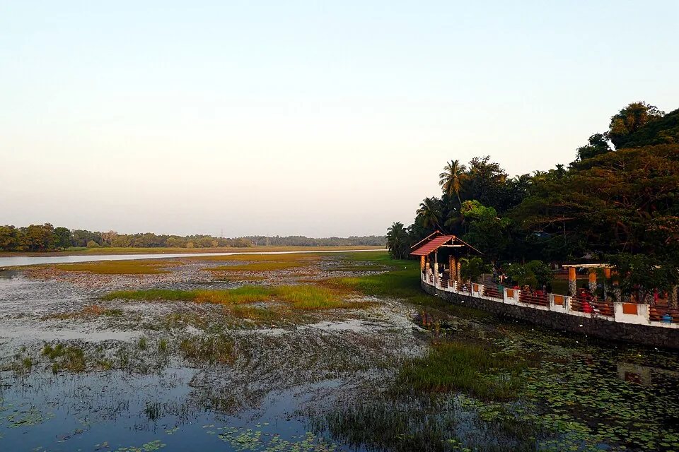
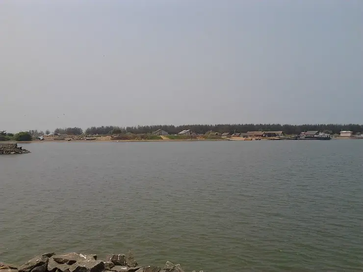
Padinjarekara Beach is the seaward face of the Padinjarekkara sandspit — a tongue of sand a little over a kilometre long with the open Arabian Sea on one side and still river water on the other. A belt of casuarina runs the length of it between the sand and the water behind, and a government park sits behind the trees where the road from the north finally stops.

Padinjarekara Beach, Ponnani
Practical guide

Plan Padinjarekara Beach

Who's going?Tailor Padinjarekara Beach to your trip
Typebeach
AreaPonnani
DistrictMalappuram
Best timeSeptember to March, in the early morning…
Time neededTwo to three hours for the beach, the…
Places to visit3Listed businesses6

Despite the address, it is not in Ponnani. The spit belongs to Purathur grama panchayat in Tirur taluk; Ponnani town is across the water on the far bank. Tirur is the practical base and the nearer station, and the beach is reached down Tipu Sultan Road, which runs about 6.2 kilometres from Koottayi and ends here.

The story

Sand is not usually the point of a place. Here it is the whole of it. Padinjarekkara is a bank of sand a little over a kilometre long, thrown up between a river and the sea and held there by trees somebody planted — open surf down one side, still water down the other, and a road that comes six kilometres down the coast and simply stops. On a Sunday evening it is one of the busiest pieces of coast in Malappuram, and almost nobody on it has come from Ponnani, whose lights are visible across the water.

The story of Padinjarekara Beach

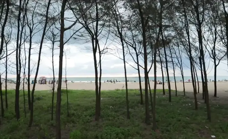
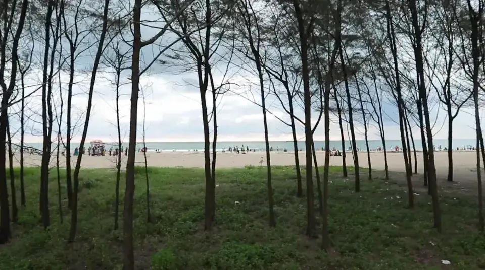
Start with the trees, because they are the reason the beach is usable. A continuous belt of casuarina runs the length of the spit between the sand and the water behind it — thin grey trunks set close, a high thin canopy, and bare ground and grass underneath. Casuarina is not a Kerala tree. It is an Australian coastal species planted along this coast for shelter: it holds loose sand, it takes salt wind, and it grows fast enough to be worth putting in. What it makes is shade with a breeze through it, which on a west-facing beach at four in the afternoon is the difference between an hour outdoors and ten minutes. The district tourism council calls them pine trees and Kerala Tourism calls them casuarina; they are the same trees, and the whistling sound people describe is the wind through their needles.

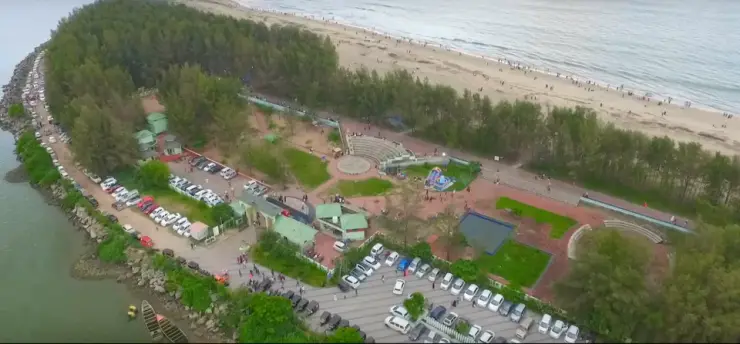
Behind the trees is the park. It is a government one — mapped as such, operated as such — and it is the reason families come rather than just couples at sunset. The tourism authorities list an amenity centre, an amphitheatre, eco-shops and a children’s play area beside the beach. What none of them list is a time or a price for any of it, and no other authority publishes one either. It behaves as public open ground with buildings on it rather than as an attraction with a gate.

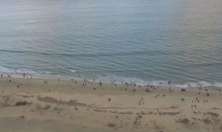
The sand itself is wide, pale and flat, and it shelves into a direct shore break. Aerial photographs of a weekend evening show the crowd strung out in a thin line along the waterline for hundreds of metres with the whole upper beach empty behind them — which is exactly how an open, unpatrolled surf beach gets used when the water is interesting and nobody is going far into it. There is no rock, no cove and no headland; it is a straight edge of the Arabian Sea, and the light goes down into it without anything in the way. That is the sunset people drive out for.

The name is a description, not a title. പടിഞ്ഞാറേക്കര breaks into padinjaru, west, and kara, the shore or the land — the western shore, which is what this is from anywhere in Purathur. It is a common enough construction in Malayalam that other Padinjarekkaras exist elsewhere in Kerala and are nothing to do with this one, which is worth knowing if you are searching for the place rather than standing on it.

The wind is the other thing that organises the beach, and it explains two of the things on it. This is a west-facing shore with an onshore sea breeze that gets up through the afternoon: it is what makes the belt of casuarina audible — the whistling the trees are named for is air going through those fine branchlets — and it is what makes a wide flat beach with a steady onshore breeze close to an ideal place to launch a powered parachute. The same wind that makes the shade pleasant is the reason there is an engine overhead at weekends.

The year divides sharply. The district tourism council recommends September to March, early morning or evening, and that is the honest window: through those months the sea is workable, the evenings are long and the belt fills up. March to May is hot on open sand and the visit is an evening one or nothing. From roughly June to September the south-west monsoon comes in from directly ahead — the beach faces into it — and the surf stands up. That is the half of the year in which almost everything here except the trees and the road stops being a reason to come.

Look at the trees closely, because they are not what they appear to be. Casuarina equisetifolia has no needles and no pine in it. What hangs off the branches in fine grey-green threads are jointed photosynthetic branchlets, and the real leaves are the rings of minute scale-like teeth at each joint, so small you have to hold one to see them. Underground it does something more unusual still: it carries root nodules full of Frankia, a filamentous soil bacterium, and fixes its own nitrogen out of the air. That is why it will start on bare salt sand where very little else germinates, and why a belt of it can be established on a spit in a few years rather than a generation. It is Australian and South-East Asian by origin and has been on the Indian coast for over a century, under a shelf of names — Australian pine, whistling pine, she-oak, beefwood.

Whether belts like this one are good for a shore is an argument that is still running. After 26 December 2004 they became policy: a study by Finn Danielsen and colleagues in Science that October found that settlements behind mangrove and tree cover had been measurably less damaged by the tsunami than open ones, and casuarina — cheap, fast, salt-tolerant — became the tree of choice for the bio-shields that followed. Tamil Nadu’s forest department alone put in 4,850 hectares of bio-shield and 2,250 hectares of mangrove from 2005 at a cost of ₹21.4 crore. Ecologists pushed back hard, and the objections are specific: a single-species plantation lets almost nothing grow underneath it and displaces the low dune plants, Spinifex among them, that actually hold sand; belts were put in as evenly spaced rows that water runs straight between instead of staggered ranks that break it; and some were planted beside the village rather than between the village and the sea, which funnels wind and surge rather than absorbing it.

None of that is settled, and none of it is written on a board here. It simply means that the shade a family sits in on a Sunday evening at Padinjarekkara is also a piece of contested coastal engineering, and that the belt is doing at least two jobs — one of them the one everybody notices, which is making a hot west-facing beach pleasant at five in the afternoon.

What a visit actually looks like is this. You drive to the end of the road and park where it stops. The park is immediately there, and most families do not go much past it, because the shade is there and the sand beyond it is wide, bright and hot. Towards five the belt fills up, stalls appear along the edge of the sand, and people drift down to the waterline in a long thin line that runs for several hundred metres. Almost nobody goes far into the water. At sunset the whole line turns to face the same direction, and about ten minutes after it, everybody starts the drive back up the coast.

The other beach on this road is worth knowing about, because it is going somewhere. Koottayi, five to seven kilometres north at the top of Tipu Sultan Road, is in Mangalam panchayat rather than Purathur, is locally called Kashmir Beach, and is being worked up for Blue Flag certification — a first phase of about ₹1 crore covering parking, toilets, seating, coffee shops and marked entry points, with the district collector overseeing it and the Tirur sub-collector as nodal officer. If it comes through it would be Kerala’s third, after Kappad and Chal. Padinjarekkara has the park and the flight; the next beach up the same road is going for the certificate.

And then, at weekends, there is an engine overhead. Since March 2019 the District Tourism Promotion Council has run paramotoring flights off this beach — a powered parachute, a pilot, a passenger seat and about ten minutes in the air over the sand, the trees and the water. It costs three thousand rupees and it runs on Saturdays and Sundays. It is the only thing here you pay for, the only thing with a published price, and the only thing that turns a stretch of coast into an outing somebody plans a month ahead.

Read the full history of Padinjarekara Beach 486 more words

History

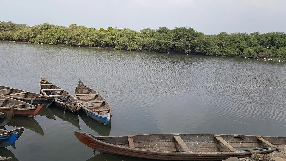
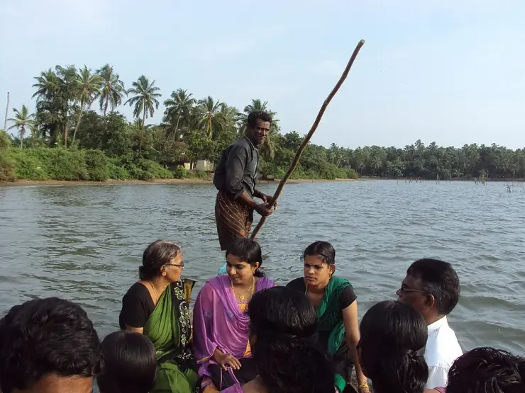
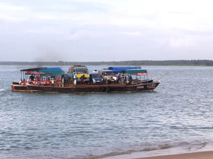
The spit has always been a crossing rather than a destination. The water behind it is the tail of the Tirur Puzha, and the settlements on it — Murikkumad among them — are islands reached by boat. A photograph from 2013 shows a country boat being punted across from Murikkumad to Gomukham on the Padinjarekkara side, loaded to the gunwales with ordinary passengers: an old woman, three women in saris, a dozen heads. That is what the water here was for.

The place it belongs to is Purathur, a grama panchayat of 19.15 square kilometres and 31,915 people at the 2011 census, in Tirur taluk. Padinjarekkara is its southernmost tip — the point where the panchayat, and the taluk, and the district’s coast all run out into the sea at once. Everything else about the panchayat is behind the beach: the islands, the river reaches, the schools, the bus stand, and the road that connects them all to Tirur.

The tourism version is recent and it is a district government project. The paramotoring was launched on 17 March 2019 by the District Tourism Promotion Council; Malayala Manorama, reporting on Purathur in January 2024, called the DTPC beach project at Padinjarekkara a considerable success — and in the same piece recorded that the block panchayat’s pleasure cruises from here had stopped, and that no authorised boat service was running to the islands and river reaches behind the spit, in a panchayat the paper described as the most suitable place in the district for water tourism.

That gap has not closed. Kerala Tourism’s destination page and the district council’s own page both still list water scooters, speed boats and idle cruises among the things to do here. Nobody publishes an operator, a landing, a timing or a fare for any of them.

Why visit

For the hour before sunset under the casuarina, which is the single best thing about the place and costs nothing.

For a beach that is genuinely local: a district park, families out of Tirur and Purathur, and no resort strip anywhere near it.

For the flight, if the weekend suits — ten minutes over a sandspit is a rare thing to be able to buy in Kerala.

For the geography, which is unusual and legible from the ground: sea on one hand, river on the other, and a strip of sand you can walk across in a couple of minutes.

For a road that ends. There are not many places in Kerala where the tarmac simply stops at the sea and everybody has to turn round, and it changes the feel of the place — nobody here is passing through.

For the trees themselves, if you like knowing what you are sitting under: an Australian species that makes its own nitrogen, has no leaves worth the name, and is the subject of a live argument about whether belts like this protect a shore or wreck it.
What to expect

Highlights

  • A working stretch of open coast rather than a resort beach: sand, surf, a casuarina plantation and a sunset people travel for.
  • A government park behind the sand, and a weekend paramotor flight that is the only thing here anybody charges for.
Getting there

How to visit

  • Come from Tirur, not from Ponnani: the station is 18.7 km away by road, about 22 minutes, and the road runs straight down the spit to the beach.
  • Aim for late afternoon. The sunset is what the place is known for, and the casuarina shade makes the hour before it comfortable.
  • If paramotoring is the reason for the trip, come on a Saturday or a Sunday and contact the District Tourism Promotion Council in advance — nothing about the flights is bookable online.
  • Settle under the casuarina rather than on the open sand. The belt is where the shade and the moving air are, and it is where the stalls appear in the late afternoon.

Distance by road

  • Kozhikode49 km
  • Coimbatore133 km
  • Kochi168 km
  • Mysuru192 km
  • Mangaluru277 km

Road km to Malappuram; ghat roads and traffic vary — allow extra.

Timing

Best time

September to March, in the early morning or the evening, is what the district tourism council recommends. Through the south-west monsoon, roughly June to September, the surf here stands up and the sea is not for going into.

Weather in Padinjarekara BeachSeasonal guide

Live forecast loads in your browser.

Today at Padinjarekara Beach
Sunrise6:16 am
Sunset6:25 pm
Golden hour best light5:25 pm–6:25 pm
Blue hour after sunset6:25 pm–6:50 pm
Sun sets toward compass bearingW · 272°
Moon tonight🌓 First quarter · 53%
South-west monsoon. June to September is monsoon season: the sea gets rough, swimming is often unsafe and boat services can be suspended. Follow lifeguard and local warnings, and expect changeable conditions.

Check the official alert before you travel. Kerala’s beaches, waterfalls and trekking routes close at short notice during heavy rain, and district alert levels change day to day. We do not publish an alert level of our own — read it from the state authority: Kerala State Disaster Management Authority, or the district control room on 1077.

Sun and moon are calculated for this location and shown in IST. Photography windows are the hour around sunrise and sunset; the sunset bearing is degrees clockwise from true north. Moon phase is accurate to about half a day.

Visitor notes

  • Nothing here runs to a published timetable or a published price, the park included.
  • The official pages also list water scooters, speed boats and cruises. Local reporting in January 2024 recorded that the block panchayat's pleasure trips from Padinjarekkara had stopped and that no authorised boat service was running to the islands behind the spit. Treat boating as something to confirm on the day rather than to plan around.
  • This is public open coast. There is no ticket office, no gate and nobody to ask.
  • Eat before you come or after you leave. No permanent food outlet on the spit appears on any map or published list; what there is arrives with the stalls in the afternoon and goes home with them.
Safety

Good to know

  • Open surf on an unpatrolled beach. No lifeguard, flag system or rescue equipment is recorded here by any authority.
  • The sand shelves and the shore break is direct. Families with small children are better on the tree side of the sand than at the waterline.
  • The southern end of the spit runs out at the river mouth, where the channel, the current and the fishing fleet all are. That end is not a place to swim.
Stay · eat · do · rent · see · shop

Stays, food & things to do near Padinjarekara Beach

Verified hotels, homestays, restaurants, experiences, sights, shops and rentals around Padinjarekara Beach — commission-free, with direct contact. Filter by what you need.

2 things to do near Padinjarekara Beach

Ponnani Responsible Tourism Kerala Tourism — Responsible tourism in Ponnani
Verified
Responsible tourism · Ponnani
Ponnani Responsible Tourism Kerala Tourism

Kerala Tourism Responsible Tourism source for Ponnani village, heritage and coast experiences. Ponnani, Responsible Tourism, Malabar cuisine.

Directions Commission-freeView details
P
Ponnani Malabar Kerala Tourism
Things to do
Top pick Verified
Coastal heritage · Ponnani
Ponnani Malabar Kerala Tourism

Kerala Tourism Malabar source for Ponnani estuary, coast, fishing and heritage context. Public destination information · Ponnani, Bharathapuzha, Malabar coast.

Directions Commission-freeView details

Book with the place itself. India’s cyber-crime coordination centre warned in April 2025 that convincing copies of hotel and pilgrimage booking sites are being pushed through sponsored search and social ads, taking payment for rooms the property never hears about. Every listing here links to the business’s own contact details and its own Google or Bing profile — we take no commission and sit in nobody’s payment path. If a booking page reached you through an ad, check the address bar against the property’s own site before you pay. Fraud can be reported on cybercrime.gov.in or on 1930.

Ranked

More ways to explore Ponnani

Find food, accommodation and activities across Ponnani. Browse the guides for places to eat, stay and explore along your route.

Across the whole of Ponnani

Ranked guides

Top experiences around Ponnani

4 more places around Ponnani. Open a guide to plan the visit and onward journey.

heritagePonnani

1.6 km · 20 min walk

Historic coastal town known for mosque traditions and Bharathapuzha estuary.

mosquePonnani Juma Masjid

3.4 km · 19 min drive

The great Juma Masjid of Ponnani, a centuries-old centre of Islamic learning on the Malabar coast, long called the “Mecca of Malabar”.

backwaterBharathapuzha estuary

440 m · 5 min walk

The mouth of the Bharathapuzha (Nila), Kerala’s second-longest river — which reaches the sea here together with the Tirur Puzha, between Ponnani on the south bank and Padinjarekkara on the north.

backwaterBiyyam Kayal

6.2 km · ~16 min by auto

A calm coconut-fringed backwater and park near Ponnani, with boating and kayaking — a quieter, lesser-known alternative to the Alappuzha backwaters.

Roampedia is commission-free — own or know a stay, eatery, guide or shop near Padinjarekara Beach? List it and it appears here once verified.

Add a nearby business
Before you go

Padinjarekara Beach — at a glance

TimingsOpen coast, so there is nothing to open or close. No authority publishes hours for the park or any of the buildings in it. The flights are a weekend operation — Saturdays and Sundays — and the district tourism council is the only contact for them.

Entry: The beach, the casuarina belt and the park behind them are public and free; there is no ticket window and no gate. One thing here is priced, and it is the only thing anybody publishes a price for: the paramotoring flight run by the District Tourism Promotion Council, given by Kerala Tourism as ₹3,000 for about ten minutes in the air. Water scooters, speed boats and cruises appear on the official pages with no operator and no rate attached to any of them.

Photography: The two frames the place gives you are the sunset over open water and the casuarina belt shot from behind the trunks towards the sand. Aerial views exist because of the paramotoring, and that is the only way to get one.

Parking: Vehicles park at the end of Tipu Sultan Road, beside the government park and immediately behind the sand. No charge is published, and no operator or authority publishes a capacity — on a Sunday evening in the dry season the road end is the busiest it gets all week.

Getting here

How to reach Padinjarekara Beach

  • ✈︎ By air Calicut International Airport at Karipur is the nearest, 47.8 km by road and about 52 minutes. The district tourism council gives it as roughly 50 km, and Kerala Tourism as about 55 km to Karipur — which is the same airport under its other name.
  • 🚆︎ By train Tirur is the nearest station: 18.7 km by road, about 22 minutes, and the road runs the length of the spit. Kuttippuram is the other railhead, 23.9 km and about 28 minutes. The two official pages name different stations — Kerala Tourism says Tirur at about 20 km, the district council says Kuttippuram at about 24 km — and both figures are close to the measured ones. Tirur is the nearer of the two by roughly five kilometres.
  • 🚗︎ By road From the north, down Tipu Sultan Road from Koottayi — about 6.2 km of it, and it ends at the beach. From Tirur town the drive is 18.2 km and about 21 minutes.
  • 🚌︎ By bus Purathur has the nearest bus stand. It is about 1.5 km away in a straight line and 11.8 km by road, roughly 17 minutes, because the road has to go round the Tirur Puzha behind the spit.
  • ⛴︎ By boat Country boats have always worked the water behind the spit — the islands of the Tirur Puzha, Murikkumad among them, are reached that way. There is no published scheduled service to the beach and no ticketed operator; reporting in January 2024 recorded that the pleasure trips run from here previously had stopped.
Getting back

If you are travelling by bus or ferry, check the return service with the operator before setting out. Leave time to reach the stop or jetty after your visit.

Ask at the jetty or stand for the time of the last service back, not the next one. If you miss it, an auto or app cab is the fallback — agree the fare before you get in.

Do

Things to do

  • Sit out the hour before sunset under the casuarina belt, which is the thing the beach is best at.
  • Walk the width of the spit — open surf on one side, still water on the other, and only a couple of minutes between them.
  • Fly. The District Tourism Promotion Council’s paramotoring runs at weekends and gives about ten minutes over the sand and the water.
  • Take the children to the park behind the trees.
  • Stay for the light going down into open sea — there is no headland and nothing in the way of it.
  • Look at a casuarina properly while you are sitting under one: the fine grey-green threads are jointed branchlets, and the real leaves are the rings of tiny scale teeth at each joint.
  • Drive the coast road on from Padinjarekkara up to Koottayi if you have the afternoon — 6.2 km of it, with the sea on one side the whole way.
Plan

Good to know

  • Come from Tirur, not from Ponnani. Ponnani is on the far bank and is a ferry or a long way round.
  • Arrange the return before you set off. No app-cab operator lists Tirur as a service city, so the dependable arrangement is a taxi or auto from the rank at Tirur railway station, booked as a round trip — this is a sunset beach at the end of an unlit road with no last-mile service on the spit.
  • Late afternoon into sunset is the visit. Middle of the day on open sand with a west-facing aspect is not.
  • Carry cash. Nothing here is a card transaction and the priced activity is a weekend one.
  • If the paramotoring is the reason for the trip, ring the district tourism council first — there is no online booking and no published schedule beyond Saturdays and Sundays.
  • A Tirur address on a stay or a listing can still mean this beach; a Ponnani address means the other bank.
  • Settle under the trees rather than on the open sand. The belt is where the shade and the breeze are; the sand between it and the water is wide, bright and unshaded.
  • Agree the return trip with your driver before you leave Tirur. The road ends here, nothing on the spit is lit, and there is no last-mile transport.
  • Koottayi, at the top of the same road, is a different beach in a different panchayat. If a listing says Koottayi, it is five to seven kilometres north of this one.
Facilities

On site

  • Vehicles come right to the end of the road, which finishes at the beach, and everything is within a couple of hundred metres of where the car stops.
  • Carry water, and expect to buy food in Tirur or Purathur rather than here.
Getting around Padinjarekara BeachPartly wheelchair accessible
Terrain
Mostly flat
From the entrance
Vehicles reach the beach directly: Tipu Sultan Road comes down the spit from the north and stops at the government park behind the sand, so the drop-off is at the beach rather than a walk from it. From the park through the casuarina belt to the top of the sand is short and level, on bare ground and grass under the trees. From there to the water is loose dry sand, unsurfaced and unedged, and the beach is wide — the walk across the open sand is the longest part of the approach and the hardest underfoot.
Step-free access
The park and the tree belt are the accessible part, and they are also the good part: the road end, the ground under the casuarina and the amenity buildings are level, and the sea is in view from them. The sand is not accessible. It is soft, wide and unedged, and there is no boardwalk, no matting and no beach wheelchair recorded anywhere here. No accessible toilet at the park is recorded in any published source.
Prams
A pram is fine on the road end and under the trees, where most families settle anyway. It will not cross the open sand to the waterline — take a carrier if the water is the point.

Parking at the end of Tipu Sultan Road, immediately behind the sand. No charge is published.A government park with an amenity centre, an amphitheatre, eco-shops and a children’s play area, all listed by Kerala Tourism and the district tourism council. Neither publishes hours or charges.No accessible toilet at the park is recorded in any published source, and no ramp, boardwalk, matting or beach wheelchair is recorded anywhere on the sand.No toilet, drinking water or food outlet on the spit appears on any map or published list. Stalls set up along the edge of the trees in the late afternoon; nothing here is permanent.No ticket window anywhere on the beach.

  • This is open Arabian Sea with a direct shore break, and nothing about it is patrolled.
  • The upper beach is wide and unshaded once you leave the casuarina. The shade is behind you, not at the water.
  • In the south-west monsoon, roughly June to September, the surf here builds and the sea is not for entering.
  • The spit narrows to its southern tip at the river mouth, where the channel and the fishing traffic are. That end is not a swimming beach.
  • The road ends here, and nothing on the spit is lit. The return leg is the same six kilometres back up the coast.

Checked 31 August 2026 against source 1source 2source 3. Conditions change and surfaces vary with weather — if step-free access is essential, confirm with the site before you travel.

If you need help at Padinjarekara Beach
112All emergencies (police · fire · medical)The single number to call in any emergency (ERSS).

Emergency numbers are verified against official government and state tourism sources. 112 works anywhere in India.

Nearby

What’s near Padinjarekara Beach

backwaterBharathapuzha estuary

The mouth of the Bharathapuzha (Nila), Kerala’s second-longest river — which reaches the sea here together with the Tirur Puzha, between Ponnani on the south bank and Padinjarekkara on the north.

440 m · 5 min walk
heritagePonnani

Historic coastal town known for mosque traditions and Bharathapuzha estuary.

1.6 km · 20 min walk · straight line
mosquePonnani Juma Masjid

The great Juma Masjid of Ponnani, a centuries-old centre of Islamic learning on the Malabar coast, long called the “Mecca of Malabar”.

3.4 km · 19 min drive
backwaterBiyyam Kayal

A calm coconut-fringed backwater and park near Ponnani, with boating and kayaking — a quieter, lesser-known alternative to the Alappuzha backwaters.

6.2 km · ~16 min by auto · straight line
templeTriprangode Maha Shiva Temple

A west-facing Shiva temple south of Tirur, nine shrines inside six acres, built around the moment Shiva came out of the linga to stop Death taking the boy Markandeya.

8.2 km · ~14 min by cab · straight line
templeAlathiyur Hanuman Temple

The Alathiyur Perumthrikkovil near Tirur, where the sanctum holds Sri Rama alone and the Hanuman carved outside it — leaning, caught in the act of listening to his orders — is the figure the crowds come for.

9.5 km · ~16 min by cab · straight line
heritageThunchath Ezhuthachan Malayalam University

The state university at Vakkad, four kilometres west of Thunchan Parambu, founded in 2012 to teach the humanities and social sciences through Malayalam rather than English.

10.3 km · ~17 min by cab · straight line
templeTrikkandiyoor Mahadeva Temple

One of the hundred and eight Shiva temples of Kerala, a kilometre from Thunchan Parambu — an apsidal ninth-century shrine that opens at half past two in the morning because the god here was installed at dusk.

12.7 km · ~21 min by cab · straight line
heritageThunchan Parambu

At Tirur, the ground of Thunchath Ezhuthachan, the “father of the Malayalam language” — a working literary institution with a museum, a manuscript library and the Vidyarambham first-letters tradition at Vijayadashami.

13.0 km · ~22 min by cab · straight line
templeThirunavaya Nava Mukunda Temple

An ancient Vishnu temple on the Bharathapuzha at Thirunavaya, near the historic Mamankam fair-ground and a major venue for ancestral (bali/shraddha) rites.

13.6 km · ~23 min by cab · straight line
heritageWagon Tragedy Memorial

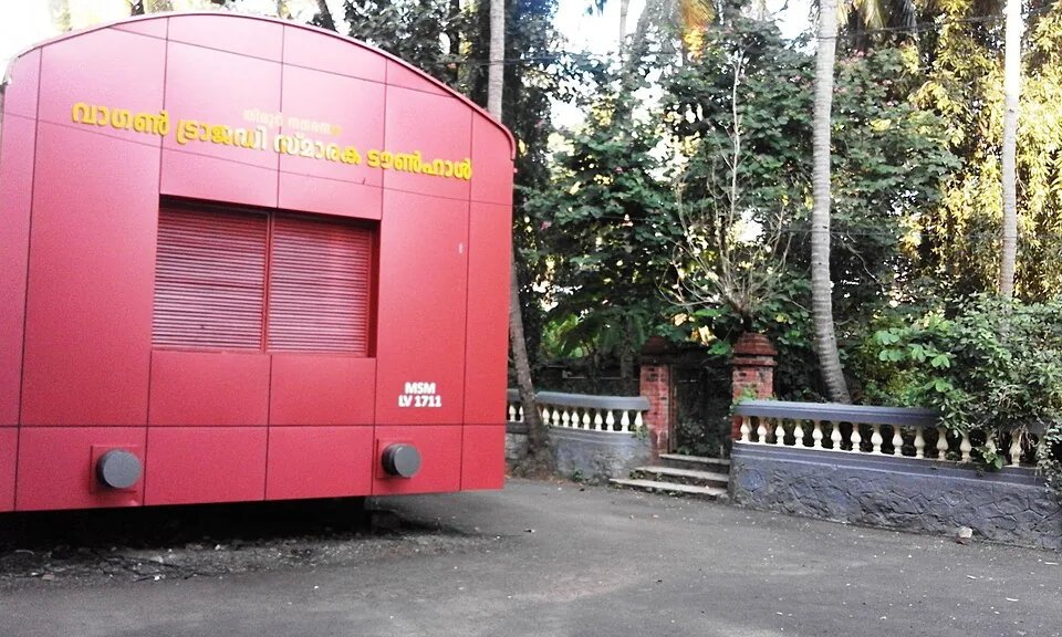
Tirur's town hall, built as a full-size railway goods wagon in signal red and lettered MSM LV 1711 — the memorial to the hundred prisoners shut into wagon 1711 at the station down the road on 19 November 1921.

13.7 km · ~23 min by cab · straight line
templeKadampuzha Devi Temple

A revered Devi temple near Vettichira with no idol — the goddess is worshipped in a natural rock fissure; devotees offer the poomoodal and muri-pooja. Founded by legend of Adi Shankara.

22.3 km · ~37 min by cab · straight line

All 3 places to visit in Ponnani →

Walking and driving times are real routed distances, except the few marked “straight line”, which are direct-line estimates and will read short. Fare figures are estimates from Kerala’s notified auto/taxi tariff and exclude waiting and night charges. Routing: © openrouteservice.org by HeiGIT | Map data © OpenStreetMap contributors

On the map

Where Padinjarekara Beach is

Good to know

Padinjarekara Beach — frequently asked

Is Padinjarekara Beach in Ponnani?

No. The beach is on the Padinjarekkara spit, which is in Purathur grama panchayat, Tirur taluk. Ponnani town is across the water on the other bank. Kerala Tourism’s own destination page files it under Ponnani while describing it as opposite the Ponnani port — both halves are true, and they are on opposite banks.

What does the paramotoring cost at Padinjarekara Beach?

Kerala Tourism gives it as ₹3,000 for a ten-minute flight, operated by the District Tourism Promotion Council on Saturdays and Sundays. There is no online booking; the council’s Malappuram office is the contact.

Can you go boating at Padinjarekara Beach?

The official pages list water scooters, speed boats and cruises, but no operator, landing, timing or fare is published for any of them, and reporting in January 2024 recorded that the pleasure trips run here previously had stopped. Ask on the day rather than travelling for the boats.

What are the trees behind the beach?

Casuarina, planted as a shelter belt along the spit between the sand and the river water. The district tourism council refers to them as pine; they are the same trees, and they are what makes the beach comfortable in the afternoon.

Is it safe to swim at Padinjarekara Beach?

Treat it as an unpatrolled open-sea beach. No lifeguard, flag system or rescue equipment here is recorded by any authority, the shore break is direct, and the southern tip of the spit runs out at the river mouth where the channel and the fishing traffic are. Through the south-west monsoon, roughly June to September, the surf builds and the sea is not for entering at all.

Is there anything for children at Padinjarekara Beach?

Yes — a children’s play area in the government park behind the beach, alongside the amphitheatre and the eco-shops. The shade under the casuarina is the practical place for a family to settle; the open sand between the trees and the water is wide and hot.

How long should I allow for Padinjarekara Beach?

Two to three hours covers the park, the trees and the sunset, which is what most people come for. Allow longer on a weekend if you intend to fly.

Where can I eat at Padinjarekara Beach?

Nothing permanent. No food outlet on the spit appears on any map or published list; stalls set up along the edge of the casuarina in the late afternoon and go when the crowd does. Tirur, twenty minutes back up the road, is where the meal is.

Does the paramotoring run in the monsoon?

Wind and weather govern it and nobody publishes a monsoon schedule. Through the south-west monsoon, roughly June to September, assume nothing flies and ring the district tourism council before travelling.

Is Koottayi Beach the same as Padinjarekara Beach?

No. Koottayi is a separate beach five to seven kilometres north, at the far end of the same Tipu Sultan Road, and it is in Mangalam panchayat rather than Purathur. Some travel listings treat the two as one place; they are not.

Is the park at Padinjarekara Beach open at fixed times?

No authority publishes opening hours or charges for the park or for any of the buildings in it. Treat it as public open ground.

When is the best time to visit Padinjarekara Beach?

September to March, in the early morning or the evening, is what the district tourism council recommends. Through the south-west monsoon, roughly June to September, the surf here stands up and the sea is not for going into.

What are the entry fee and timings at Padinjarekara Beach?

Entry: The beach, the casuarina belt and the park behind them are public and free; there is no ticket window and no gate. One thing here is priced, and it is the only thing anybody publishes a price for: the paramotoring flight run by the District Tourism Promotion Council, given by Kerala Tourism as ₹3,000 for about ten minutes in the air. Water scooters, speed boats and cruises appear on the official pages with no operator and no rate attached to any of them. Timings: Open coast, so there is nothing to open or close. No authority publishes hours for the park or any of the buildings in it. The flights are a weekend operation — Saturdays and Sundays — and the district tourism council is the only contact for them.

How do I reach Padinjarekara Beach?

Come from Tirur, not from Ponnani: the station is 18.7 km away by road, about 22 minutes, and the road runs straight down the spit to the beach. Aim for late afternoon. The sunset is what the place is known for, and the casuarina shade makes the hour before it comfortable. If paramotoring is the reason for the trip, come on a Saturday or a Sunday and contact the District Tourism Promotion Council in advance — nothing about the flights is bookable online. Settle under the casuarina rather than on the open sand. The belt is where the shade and the moving air are, and it is where the stalls appear in the late afternoon.

How much time do I need for Padinjarekara Beach?

Two to three hours for the beach, the trees and the sunset; longer if you are flying.

What else is near Padinjarekara Beach?

Nearby you can pair Bharathapuzha estuary (440 m), Ponnani (1.6 km), Ponnani Juma Masjid (3.4 km), Biyyam Kayal (6.2 km).

What should I know before visiting Padinjarekara Beach?

Open surf on an unpatrolled beach. No lifeguard, flag system or rescue equipment is recorded here by any authority. The sand shelves and the shore break is direct. Families with small children are better on the tree side of the sand than at the waterline. The southern end of the spit runs out at the river mouth, where the channel, the current and the fishing fleet all are. That end is not a place to swim.

Image credits

Photographs: Kambliyil (CC BY-SA 4.0), Dhruvaraj S from India (CC BY 2.0), Anish nellickal (CC BY-SA 4.0). Wikimedia Commons.