What to expect
Highlights
- Sea views and sunset at Paravur Pozhikkara
- Nearby seafood, cafes or beach walks where available
- Easy pairing with local stays and short day trips
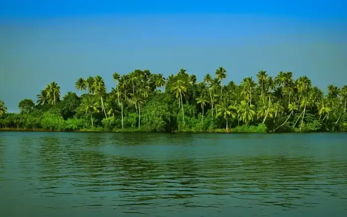
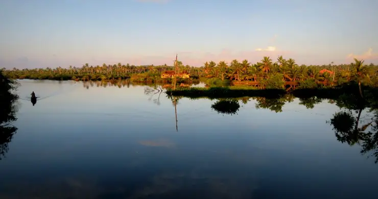
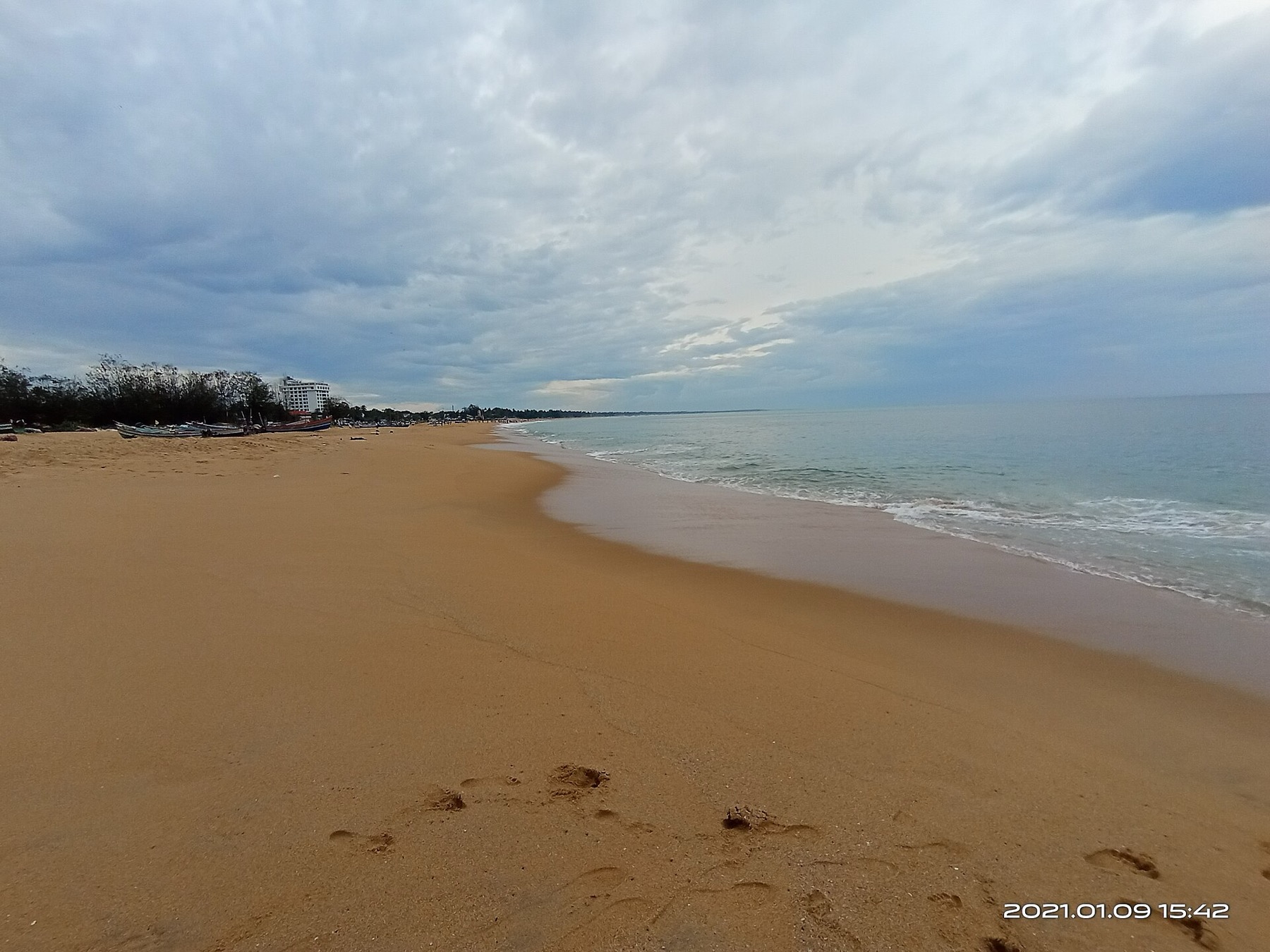
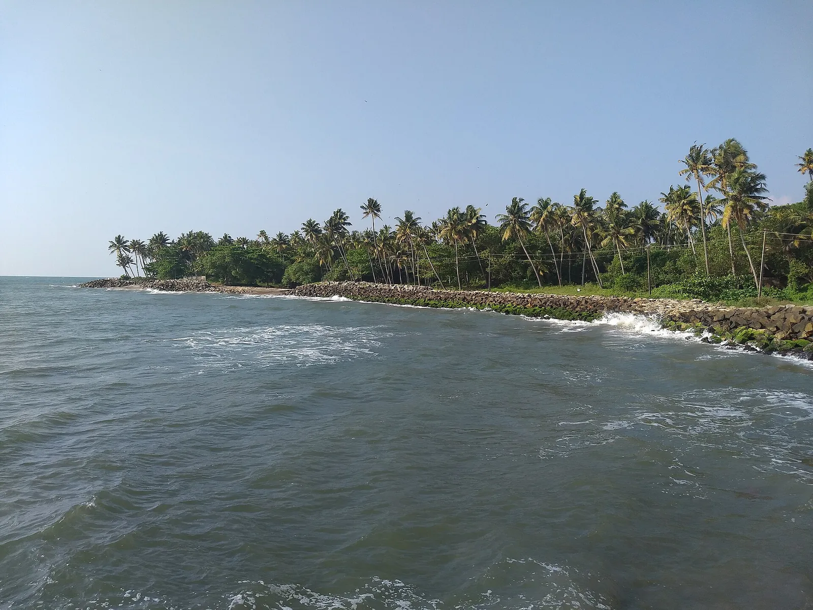
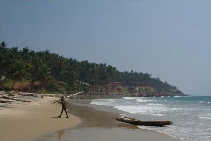
The estuary and beach at Paravur south-east of Kollam, where the Paravur backwaters meet the sea across a sandbar — a quiet spot known for its regulator bridge, the TS Canal and calm backwater-and-sea scenery.
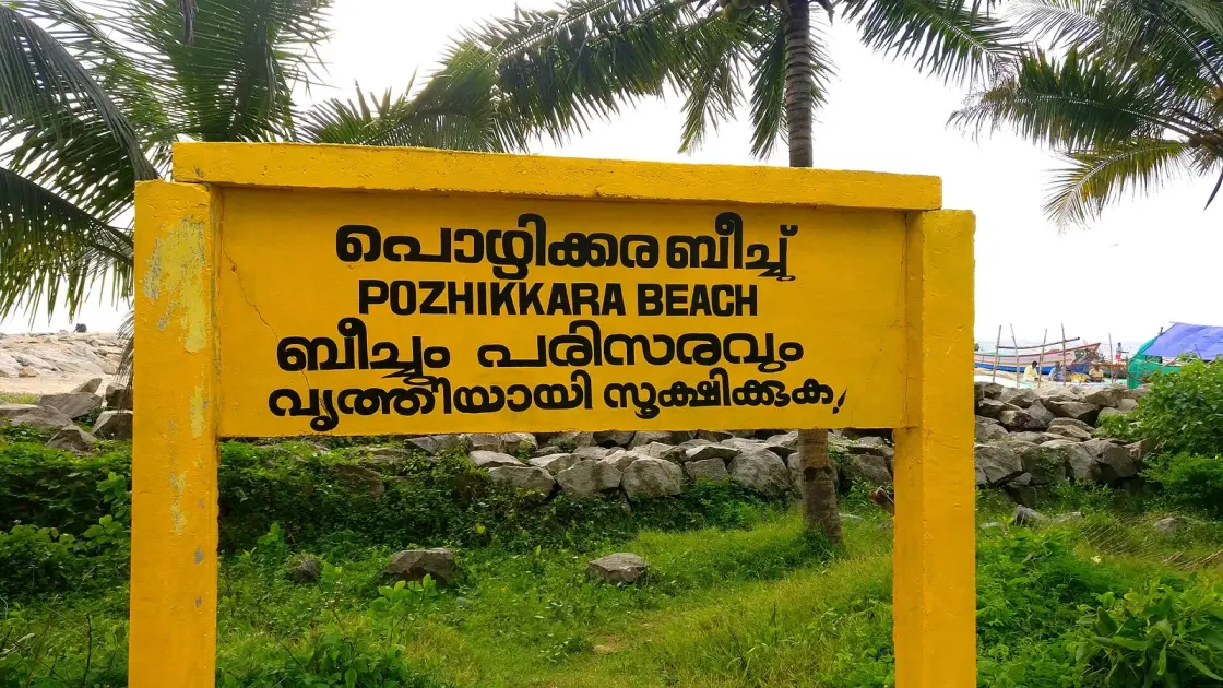
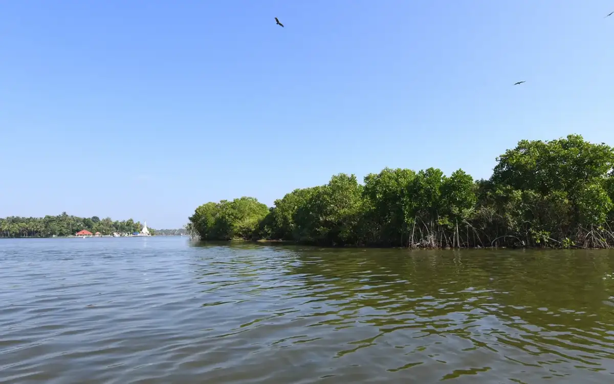
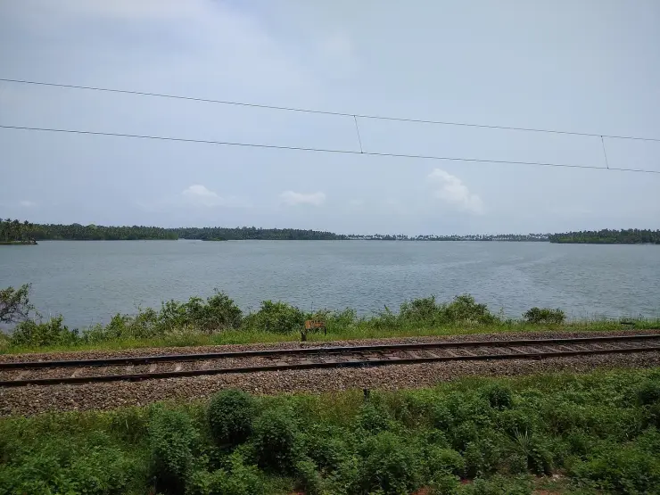
A sandbar where the Paravur backwater breaks through to the sea, south of Kollam. On one side still green water and coconut palms; on the other, open surf. The two are separated by a strip of sand you can stand on — and by a regulator bridge that decides when they meet.
Pozhikkara means the place of the pozhi — the mouth or breach where a backwater cuts through the coastal sand ridge to reach the sea. That is exactly what this is: the Paravur backwater, running parallel behind the coast, finally finding the Arabian Sea across a bar of sand south of Kollam.
The appeal is the juxtaposition, and it is immediate. Stand on the bar and there is calm brackish water behind you and open ocean in front, sometimes only a few dozen metres apart, with entirely different colours, sounds and temperatures. Very few places let you hold both in one glance.
The regulator bridge is the piece of infrastructure that makes the place legible. A regulator controls when and how much the backwater and the sea exchange — critical for keeping salt out of the freshwater system behind, and for managing the bar. It is not scenic, but it is the reason the estuary behaves as it does, and worth understanding rather than walking past.
This is also a point on the TS Canal — the Thiruvananthapuram–Shoranur inland waterway — which runs behind the coast here and links this stretch into the historic network of canals and lagoons that once carried most of the traffic in Travancore. The canal is quieter now than it was, but it is still there and still used.
Practically: come at sunset, expect no facilities, and treat the water with care. This is an estuary mouth, which means currents, a shifting sandbar and a shelving beach — not a swimming beach, whatever it looks like on a calm evening.
The birdlife is better than the modest setting suggests. Estuary mouths concentrate feeding — waders working the bar at low water, terns over the breach, egrets in the backwater shallows behind — and because nobody comes here for birds, nothing is disturbed. Early morning and late afternoon are the productive hours, and a pair of binoculars turns a fifteen-minute stop into an hour.
It also makes a natural pairing with Kollam town. Paravur is south of the city, so the honest way to fit it in is on the road towards Varkala and Thiruvananthapuram rather than as a dedicated trip out and back. Half an hour here on the way south, timed for the light, is the right size of commitment for what it is.
The fishing is small-scale and local — country craft, cast nets, people working the backwater side rather than the surf. It is a quiet counterpoint to the industrial scale of Neendakara at the other end of the same lake system, and seeing both in one day tells you a good deal about how differently the Kerala coast makes its living.
Start with the largest misreading, which is that any of this is nature taking its course. The sandbar visitors photograph, and the way the mouth behaves, are the result of about thirty years of engineering — and by most accounts the engineering has not worked.
For centuries the estuary ran as a seasonal valve. It opened in the monsoon, flushed nutrient-rich sediment seaward, and closed again on its own; that cycle is what made the mangrove fringe a fish nursery and supported both sea fishermen and inland fishermen. Then it was replaced, in three steps that the sources date separately and do not entirely agree on. A tidal regulator was built into the spillway bridge in 1957, explicitly to control salt-water intrusion into Paravur Lake. A spillway followed in 1968 — constructed, in the words of Peter Pradeep of the Help Foundation quoted in the Deccan Chronicle, “in the name of Ithikkara paddy field development”. And in 1986 the natural estuary itself was closed with granite boulders.
The objection raised by the river-network organisation SANDRP is geometric and easy to picture. The spillway sits about five hundred metres from the natural mouth and runs north–south, while the Ithikkara river arrives from the east and runs straight west. Their verdict on it is blunt: the construction “is purely unscientific”. Add to that the fact that the regulator shutters have reportedly been broken since 2013 — so sand enters on every high tide and fresh water drains away — and you have the situation described in the reporting: depth near the estuary that once exceeded fifteen feet, now largely filled in.
One comparison carries the whole argument. The river’s runoff historically took three to four weeks to reach the sea. It now takes around forty-eight hours. The consequences named in the sources are floods in the rains and drought in summer, salt pushing up the river at high tide, water loss in the Kappil and Nadayara lakes, and a district drinking-water shortage. The ending is the part worth carrying away: in August 2018 the district administration cut a new outlet by hand, parallel to the original estuary — reopening in an emergency the mouth that had been sealed with boulders thirty-two years earlier. ⚠ These accounts are advocacy and press rather than government record; the state wetland brief and the Paravoor development plan would settle it and neither was reachable.
A smaller thing, and a good illustration of how honours travel. A 2018 Central Marine Fisheries Research Institute litter study put a beach on this stretch among India’s sixteen cleanest and top in Kerala. Wikipedia and Onmanorama attach that ranking to Pozhikkara. But the district’s own tourism council attaches it to neighbouring Thanni Beach, on a page it titles “Thanni Beach (Pozhikkara)” — and Thanni is a different beach, 3.2 km north along the same coastal road. We are not able to say which of them CMFRI actually surveyed, so we are not going to tell you this beach is one of India’s cleanest. Somebody on this stretch of sand is; the district and the encyclopaedia disagree about who.
The last correction is the one that matters most, and it is about safety rather than scenery. This is not an undiscovered beach — it is surveyed, ranked, and actively promoted by the district tourism council. What it is not is serviced. There are no lifeguards, no changing rooms and no toilets. On 14 February 2026 three teenagers were swept away by the current in the estuary behind the Pozhikkara Devi Temple; one was rescued by the Fire and Rescue Services and the police, and the bodies of the other two, both sixteen, were recovered the following afternoon with the assistance of the Coast Guard. The reporting is explicit that the estuary is considered highly dangerous and that residents typically avoid swimming there. That is the sentence to hold on to: local people do not swim where the listings suggest you swim. Come for the sunset and the geography. Do not come to swim.
The most common misreading here is that the pozhi is a permanent geographical feature like a river mouth. It is not, or not reliably. Sandbars at backwater mouths along this coast open, close, migrate and are cut open — sometimes naturally by monsoon flood, sometimes deliberately to relieve flooding behind. What you see on the day is a snapshot of a system that moves.
That is also the answer to visitors who arrive expecting a dramatic river-meets-sea confluence and find a modest breach, or none. The scale of the opening depends on season, on recent rain and on management. Photographs circulate showing a wide, spectacular mouth; those are one condition among several, not the standing state.
A second confusion is with Kappil, further south towards Varkala, where a similar backwater-and-sea juxtaposition is more heavily photographed and more visited. The two get conflated in listings. They are different places on the same coastal system, doing the same thing, and Paravur Pozhikkara is the quieter of the two.
There is no old legend attached to this spot that we have been able to source, and we are not going to supply one. What is genuinely interesting here is physical rather than mythological — a coastal system whose behaviour is visible, and a piece of colonial-era water engineering still doing its job.
Paravur Pozhikkara lies south of Kollam, where the Paravur backwater — running behind the coastal sand ridge — breaks through to the Arabian Sea across a sandbar.
The term pozhi refers to precisely this kind of breach between a backwater and the sea, a recurring feature of the Kerala coast where lagoons run parallel behind a barrier of sand.
A regulator bridge controls the exchange between the backwater and the sea, managing salinity intrusion into the freshwater system behind and the condition of the bar.
The location sits on the Thiruvananthapuram–Shoranur (TS) Canal, part of the historic inland waterway network that once carried the bulk of Travancore's goods traffic behind the coastline.
Sandbars of this kind are dynamic — opening, closing and migrating with monsoon flood and with deliberate management — so the configuration of the mouth changes through the year.
The spit has been a named and recorded place for a very long time. Local history writing records a Pozhikara sasanam — a twelfth-century inscription in vattezhuthu, the old round script, cut on a stone slab at the Pozhikkara Sivakshetram, where a Devi temple stands today (recorded locally; we have not been able to check it against a published epigraphical corpus). Independent literary evidence comes from the Unnineeli Sandesam, the classical Malayalam messenger-poem written more than six hundred years ago, which names the temples of Paravur. Messenger-poems work by listing places along a real journey, so being named in one means the place sat on a route people actually travelled.
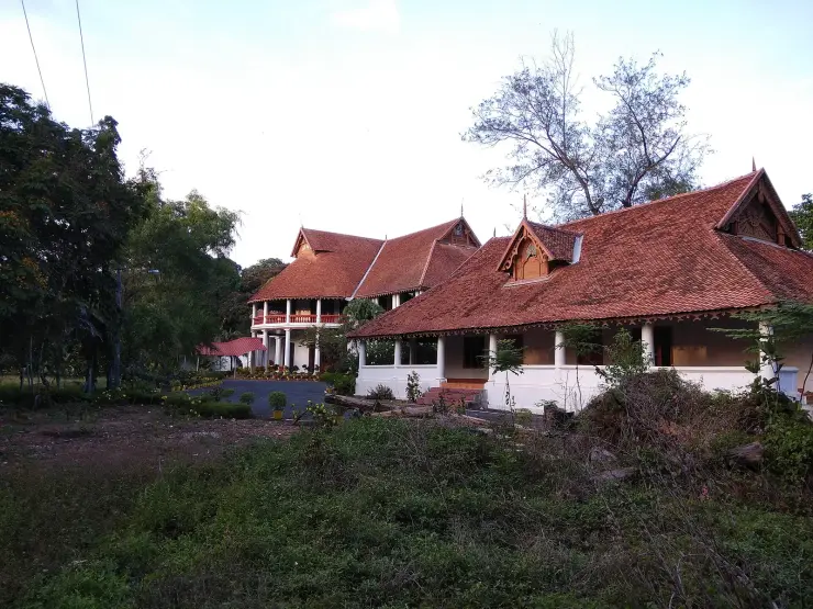
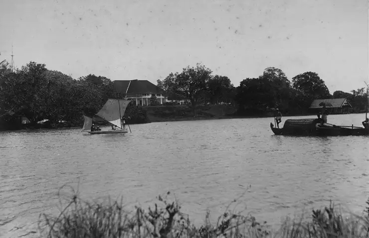
It was also, before independence, an administrative headquarters, and remnants of an old fort and a police station are reported here. Pozhikara Palace survives in the least glamorous and most telling way possible — as a Kerala PWD rest house. The names themselves are about water: Pozhikkara is pozhi plus kara, the place of the breach, and Paravur is locally derived from paravii, the sea, plus oor, a settlement, worn down from Paravayoor.
The modern history of access is short and startling. The Kollam–Paravur Coastal Road runs 14.1 km from Chinnakada to Paravur along the strip between the backwater and the sea, and it is maintained by the Kerala Harbour Engineering Department rather than the highways department. In December 2015 the department completed the renovation of the Pozhikara–Thanni section, and on 8 July 2016 bus services resumed after a gap of twenty-four years. That is the real reason this place reads as remote when the map says it is twelve kilometres from a district headquarters: not that nobody had discovered it, but that from about 1992 until 2016 you could not get a bus to it.
Calm backwater and open sea within a few dozen metres of each other, separated by a strip of sand you can stand on.
Sunset here, with the light on both the still water and the surf, is among the better free evenings near Kollam.
It is a legible piece of coastal geography — you can see how a pozhi works, and how it is managed.
It sits on the historic TS Canal, linking it to the inland waterway network behind the whole coast.
It is much quieter than the comparable and more photographed spot at Kappil further south.
Road km to Kollam; ghat roads and traffic vary — allow extra.
November to February for dry weather; avoid rough-sea days during monsoon warnings.
Live forecast loads in your browser.
Sun and moon are calculated for this location and shown in IST. Photography windows are the hour around sunrise and sunset; the sunset bearing is degrees clockwise from true north. Moon phase is accurate to about half a day.
Browse listed stays, food, activities, sights, shops and rentals around Paravur Pozhikkara. Check each listing’s locality and contact the business directly for current arrangements.
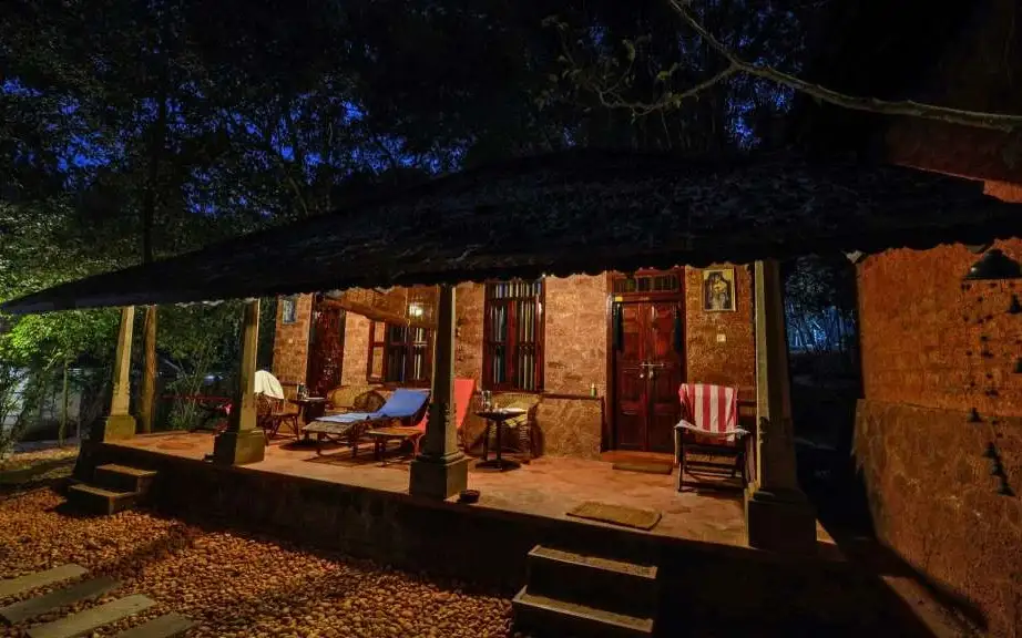
Kerala Tourism-classified Ayurveda centre on the banks of Ashtamudi Lake at Ashtamudi, on the backwater edge of Kollam. It runs residential Ayurveda and Panchakarma programmes in rustic laterite cottages beside the water, focused on treatment stays rather than casual spa visits.
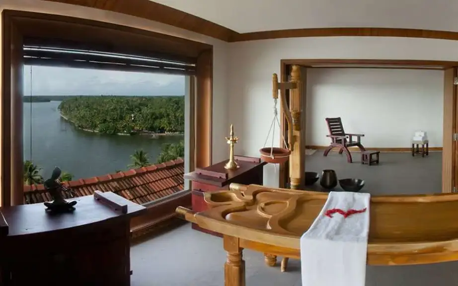
Kerala Tourism Green Leaf-classified Ayurveda and spa centre at The Leela Ashtamudi (Raviz), Thevally, overlooking Ashtamudi Lake in Kollam. Its therapy rooms offer classical Kerala Ayurveda treatments and rejuvenation packages with backwater views, run to the Green Leaf standard rather than as a generic hotel spa.
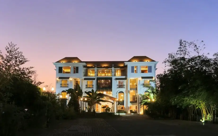
Kerala Tourism Ayur Diamond-classified Ayurveda resort at Thangassery near the Kollam lighthouse, on the seafront edge of Kollam town. It offers doctor-supervised classical Ayurveda and Panchakarma treatments alongside resort rooms, run by the D-Fort group as a dedicated wellness retreat.
Kollam Taxi Services arranges city, airport and district journeys. Request a total covering stops, waiting and return when combining lake-side stays with city sights.
DTPC Kollam online-ticketing source for Sambranikodi boating in the Ashtamudi backwaters. Book via DTPC · Sambranikodi, Ashtamudi, DTPC Kollam.
DTPC Kollam is the official first check for Ashtamudi backwater cruise packages, houseboat options, current tariffs and Kollam lake logistics. Check DTPC tariffs · Ashtamudi, DTPC Kollam, Houseboats.
Kollam Dream Houseboat offers houseboat and shikara trips from Kollam, with a published departure point on Link Road near the KSRTC bus stand. Its programme includes short backwater outings, overnight stays and longer journeys towards Alappuzha, Kumarakom and Kochi.
Book with the place itself. India’s cyber-crime coordination centre warned in April 2025 that convincing copies of hotel and pilgrimage booking sites are being pushed through sponsored search and social ads, taking payment for rooms the property never hears about. Use the contact and source details on each profile to confirm the exact business and booking channel. A directory entry or map pin alone does not establish an operator’s identity or current availability. Roampedia takes no commission and does not collect booking payments. If a booking page reached you through an ad, check the address bar against the property’s own site before you pay. Fraud can be reported on cybercrime.gov.in or on 1930.
Find food, accommodation and activities across Kollam town. Browse the guides for places to eat, stay and explore along your route.
13 more places around Kollam town. Open a guide to plan the visit and onward journey.
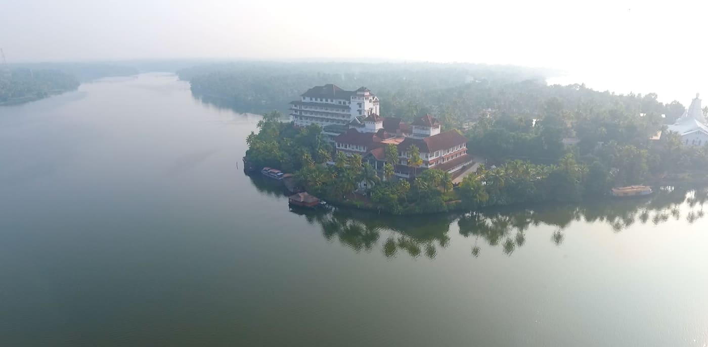
28.5 km · 35 min drive
Large palm-fringed backwater system and houseboat base around Kollam.
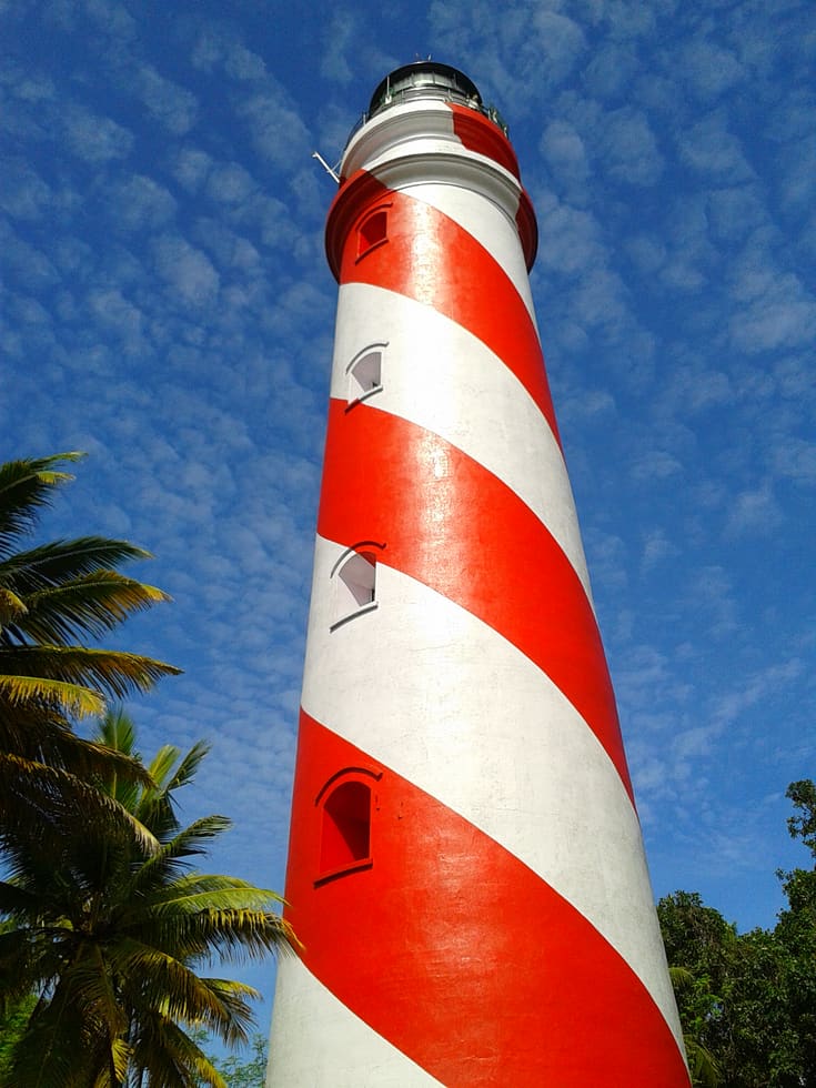
13.9 km · 18 min drive
Thangassery Lighthouse raises Kollam’s sea view above a historic coastal neighbourhood. The red-and-white tower is a working navigation landmark with a separate visitor session.
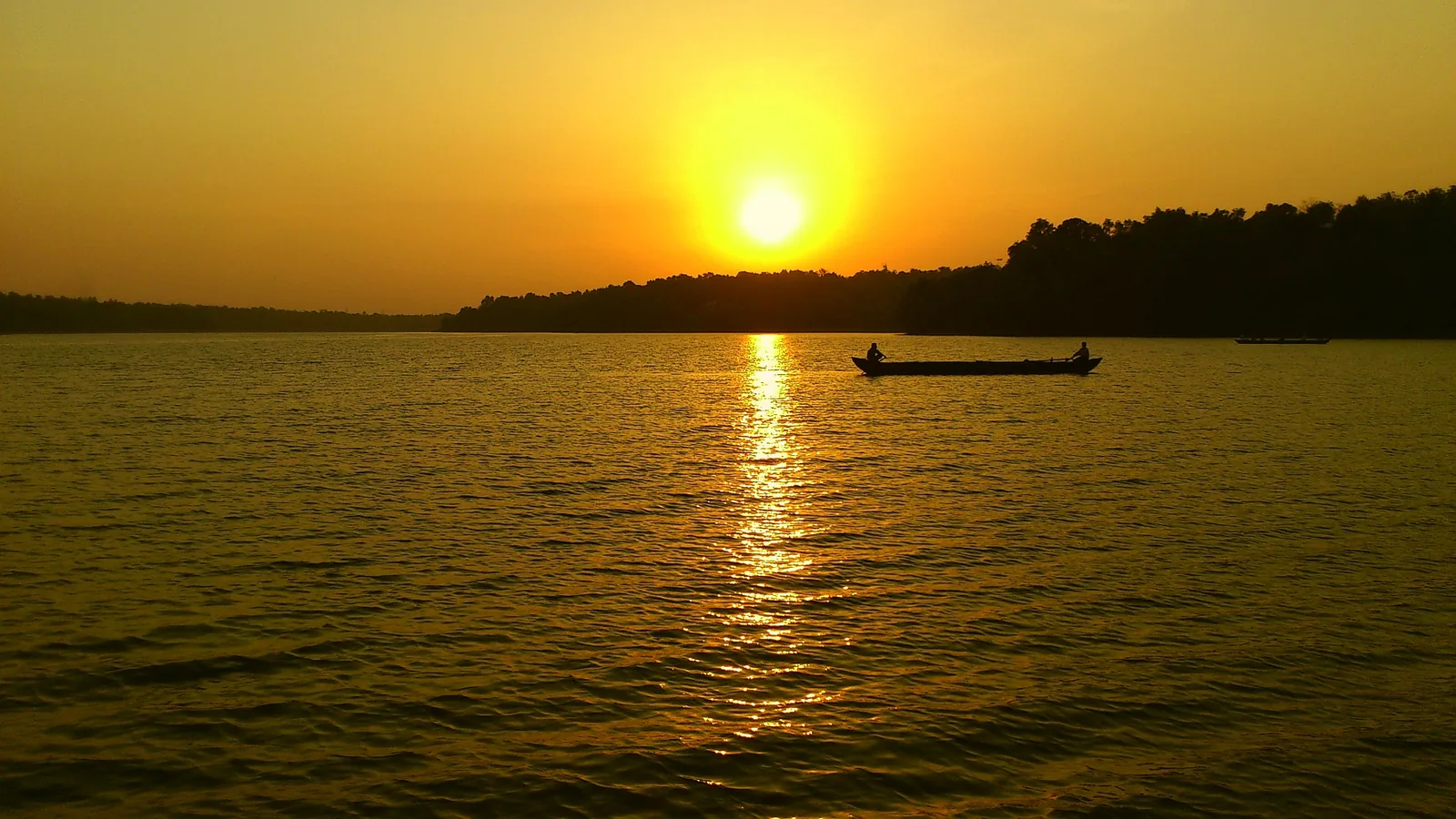
Kerala’s largest freshwater lake, a Ramsar wetland ringed by hills and a Sastha temple, north of Kollam.
11.0 km · 14 min drive
The city’s Mahatma Gandhi beach and park on the Arabian Sea, a popular evening spot near Kollam town.
16.1 km · 20 min drive
A quiet, curved bay beach west of Kollam town, calmer than the city beach and good for a relaxed evening.
14.7 km · 18 min drive
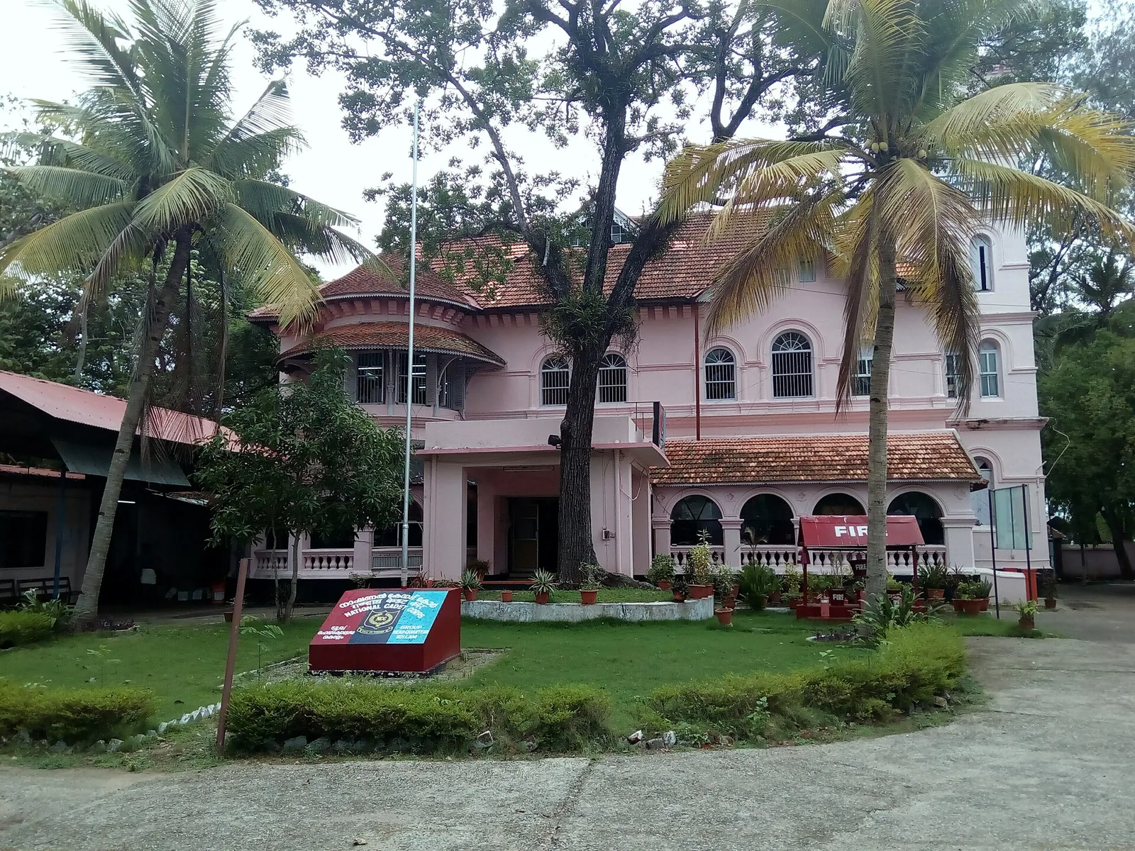
A Travancore royal residence on the Ashtamudi shore in Kollam, built to be arrived at by boat and now a working NCC establishment — viewed from outside or from the water.
12.4 km · straight line
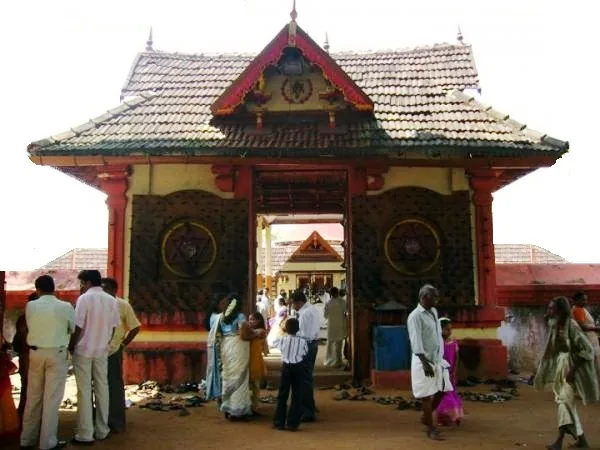
Anandavalleeswaram is an active Shiva temple in Kollam, with an Anandavally shrine and a ten-day annual festival in March or April. Ritual processions and cultural performances bring another dimension to the temple visit. Follow its worship session, admission and photography rules.
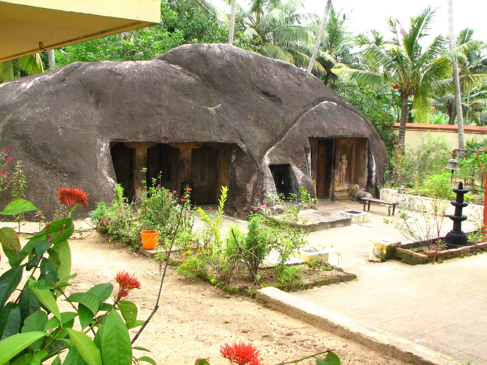
A monolithic rock-cut cave temple near Anchal/Kadakkal in south Kollam, carved with a Shiva shrine.
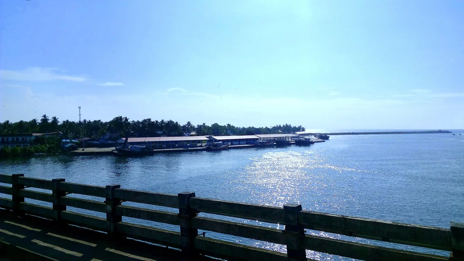
21.2 km · 27 min drive
By most accounts Kerala’s largest fishing harbour, at the mouth of Ashtamudi Lake about 9 km from Kollam town, and where Indian fishing was mechanised; two bridges cross the confluence and the early-morning auction is the sight to catch.
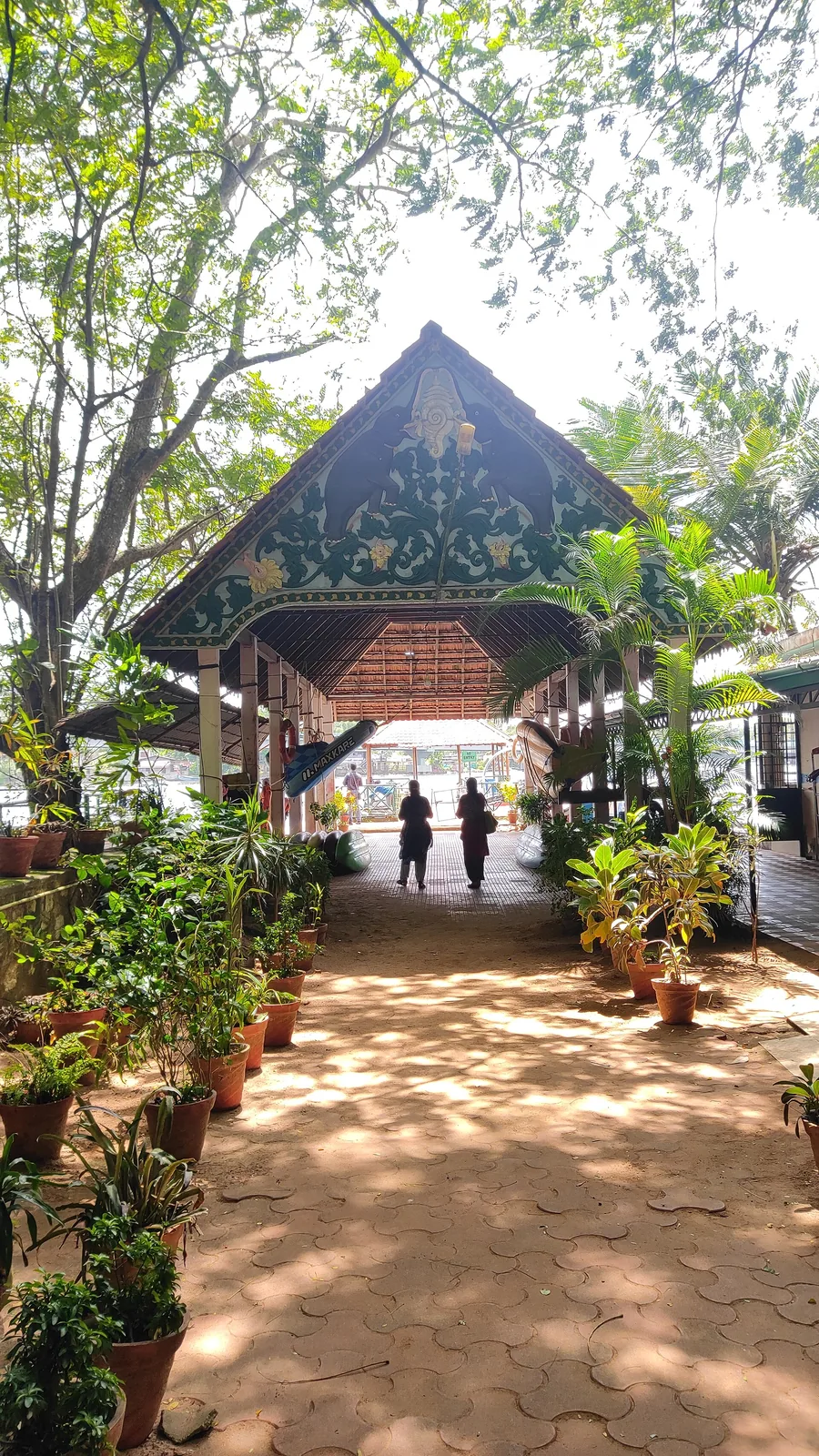
11.8 km · straight line
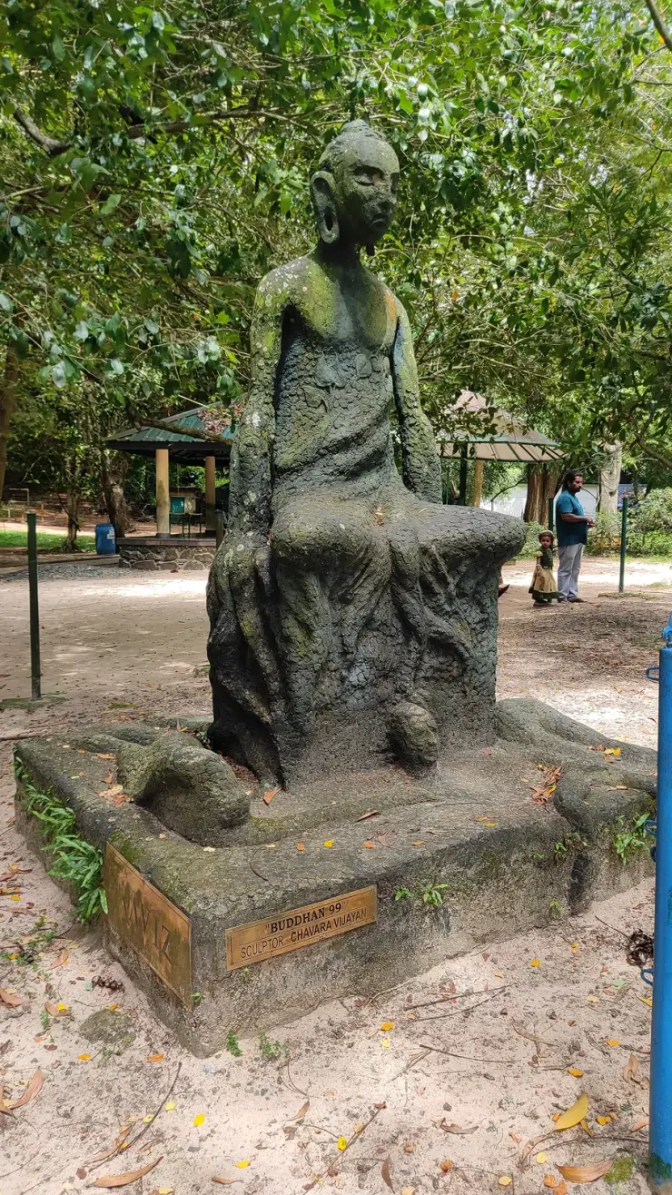
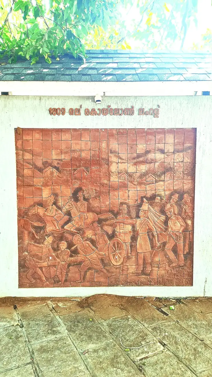
Forty-eight acres of municipal park on the Ashtamudi shore in the middle of Kollam, run by the DTPC — boating and kayaking off a painted jetty, ziplines and rope courses, a heritage walkway of terracotta reliefs, contemporary sculpture left behind by a 2012 festival, and a mangrove wetland with a state biodiversity heritage tag.
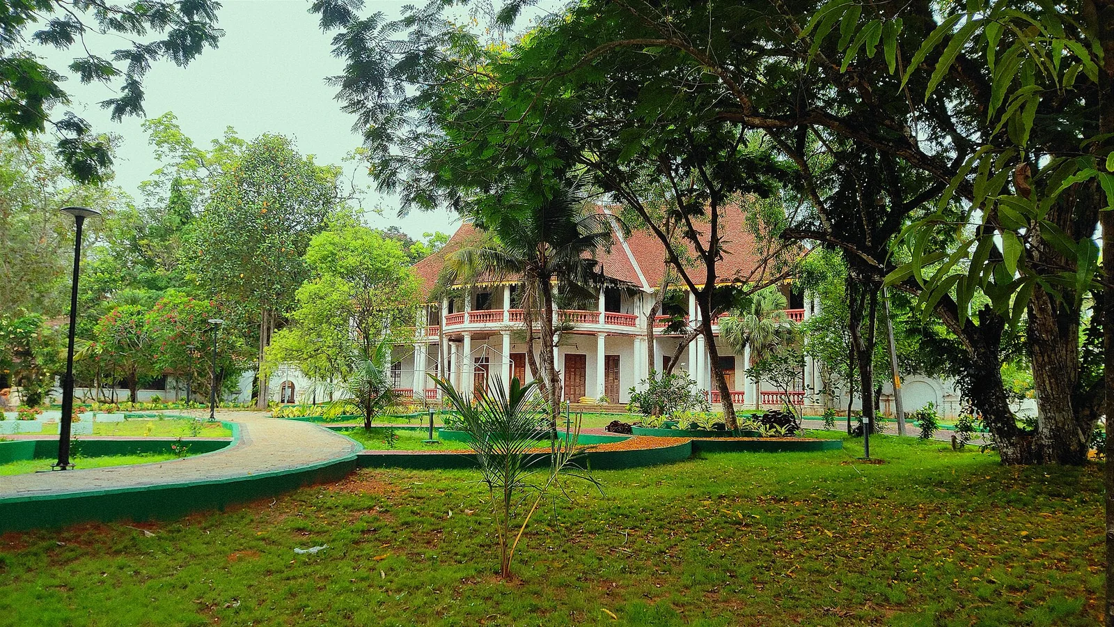
11.8 km · straight line
The former British Residency at Asramam survives as a government guest house beside Kollam’s backwater landscape. Its architecture is the attraction, with access governed by its working use.
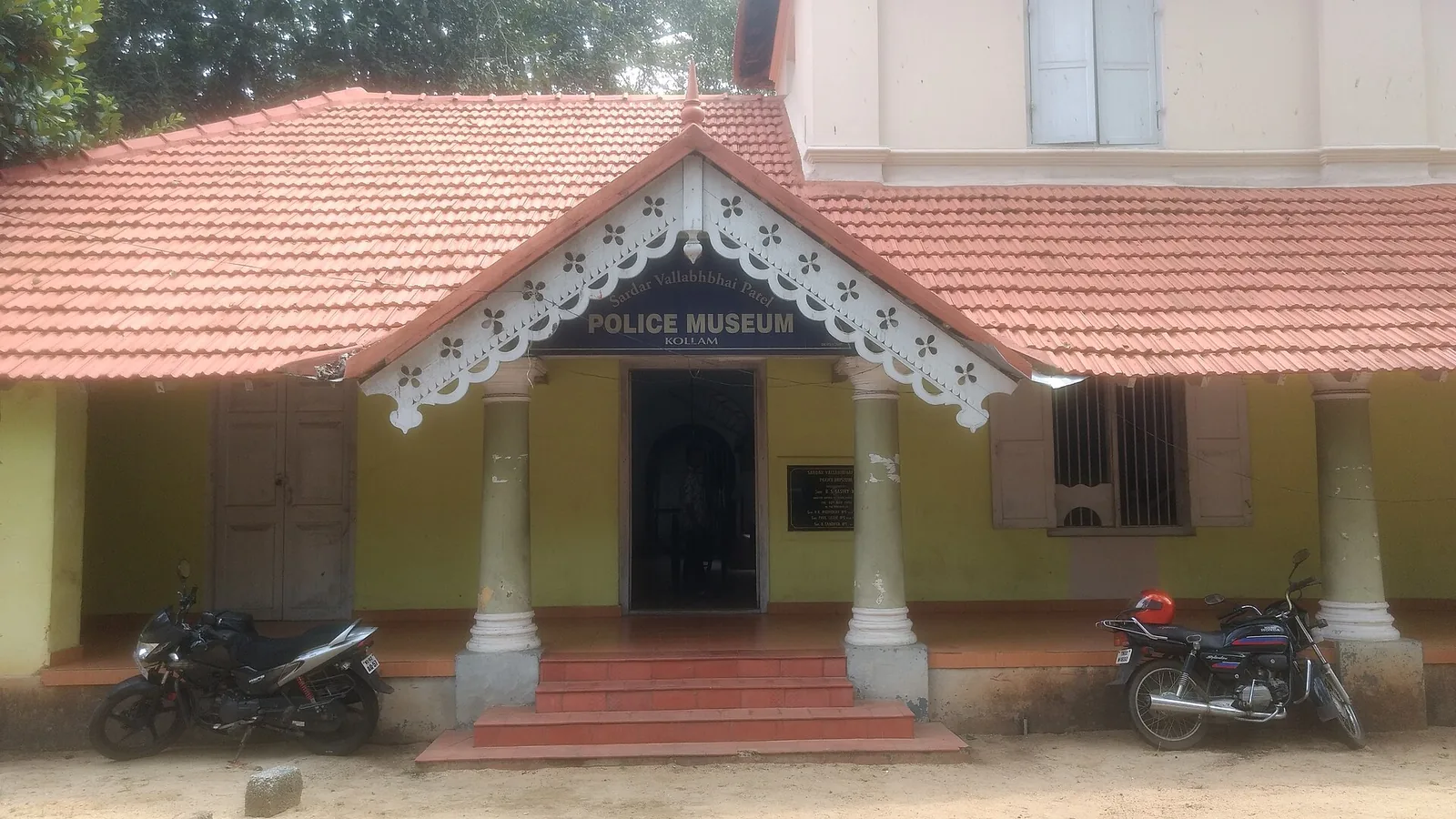
10.1 km · straight line
Kollam’s Sardar Vallabhbhai Patel Police Museum introduces the history of policing through arms, equipment and investigation displays. It offers an indoor history stop during a city outing. Check the museum’s session before choosing your day, and leave time to read the displays.
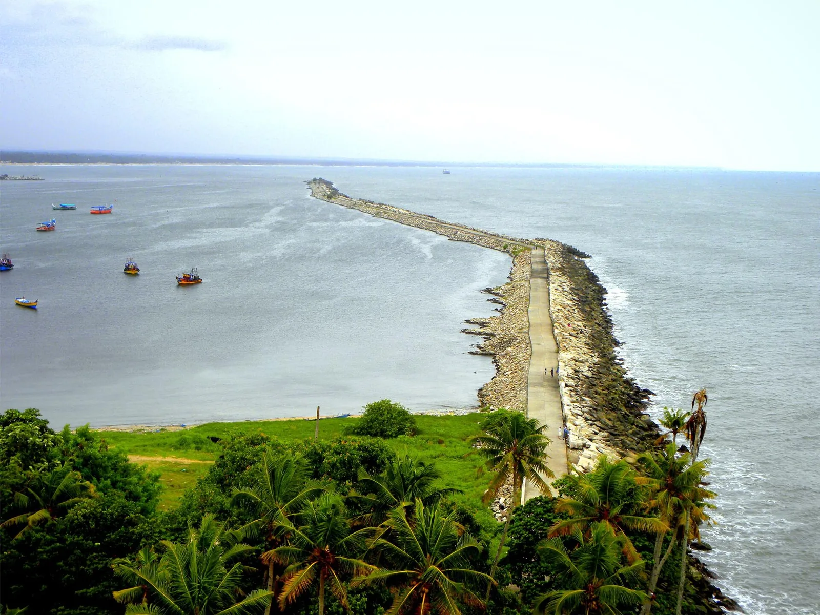
10.3 km · straight line
The working wharf and breakwater at Thangassery, conventionally founded in AD 825 — the event the Malayalam calendar counts from. A short cargo quay and a long public breakwater walk, above a seabed that has produced Tang and Song coins and Lower Palaeolithic tools.
Roampedia is commission-free — own or know a stay, eatery, guide or shop near Paravur Pozhikkara? Submit public business details for review.
Add a nearby businessEntry: Free to walk; no ticket, and no services of any kind — no lifeguard, no changing rooms, no toilets, no documented parking.
Roughly 12 km south of Kollam town and about 2.5 km west of Paravur, on the Kollam–Paravur Coastal Road. Paravur station (PVU) on the Kollam–Thiruvananthapuram line is 2.1 km east, and Paravur bus stand about the same. ⚠ Published distances vary widely — the district tourism council sends visitors to Kollam station instead; Paravur station is nearer and better advice.
If you are travelling by bus or ferry, check the return service with the operator before setting out. Leave time to reach the stop or jetty after your visit.
Ask at the bus stand for the time of the last service back, not the next one. If you miss it, an auto or app cab is the fallback — agree the fare before you get in.
If you need step-free access, contact the site before travelling. Ask about a level entrance, steps along the route, the nearest drop-off point, seating and accessible toilets.
These services are listed within about 1.2 km of Paravur Pozhikkara. Walking distances follow mapped routes; access and opening hours can change. Other services may be closer but are not included here.
Published emergency and visitor-assistance contacts. For an immediate emergency, call 112. Shared Kerala contact sources checked 4 October 2026; publication does not establish a tested live response.
Kollam’s Sardar Vallabhbhai Patel Police Museum introduces the history of policing through arms, equipment and investigation displays. It offers an indoor history stop during a city outing. Check the museum’s session before choosing your day, and leave time to read the displays.
10.1 km · straight lineThe working wharf and breakwater at Thangassery, conventionally founded in AD 825 — the event the Malayalam calendar counts from. A short cargo quay and a long public breakwater walk, above a seabed that has produced Tang and Song coins and Lower Palaeolithic tools.
10.3 km · straight lineThe city’s Mahatma Gandhi beach and park on the Arabian Sea, a popular evening spot near Kollam town.
11.0 km · 14 min driveForty-eight acres of municipal park on the Ashtamudi shore in the middle of Kollam, run by the DTPC — boating and kayaking off a painted jetty, ziplines and rope courses, a heritage walkway of terracotta reliefs, contemporary sculpture left behind by a 2012 festival, and a mangrove wetland with a state biodiversity heritage tag.
11.8 km · straight lineThe former British Residency at Asramam survives as a government guest house beside Kollam’s backwater landscape. Its architecture is the attraction, with access governed by its working use.
11.8 km · straight lineAnandavalleeswaram is an active Shiva temple in Kollam, with an Anandavally shrine and a ten-day annual festival in March or April. Ritual processions and cultural performances bring another dimension to the temple visit. Follow its worship session, admission and photography rules.
12.4 km · straight lineThangassery Lighthouse raises Kollam’s sea view above a historic coastal neighbourhood. The red-and-white tower is a working navigation landmark with a separate visitor session.
13.9 km · 18 min driveA Travancore royal residence on the Ashtamudi shore in Kollam, built to be arrived at by boat and now a working NCC establishment — viewed from outside or from the water.
14.7 km · 18 min driveA quiet, curved bay beach west of Kollam town, calmer than the city beach and good for a relaxed evening.
16.1 km · 20 min drive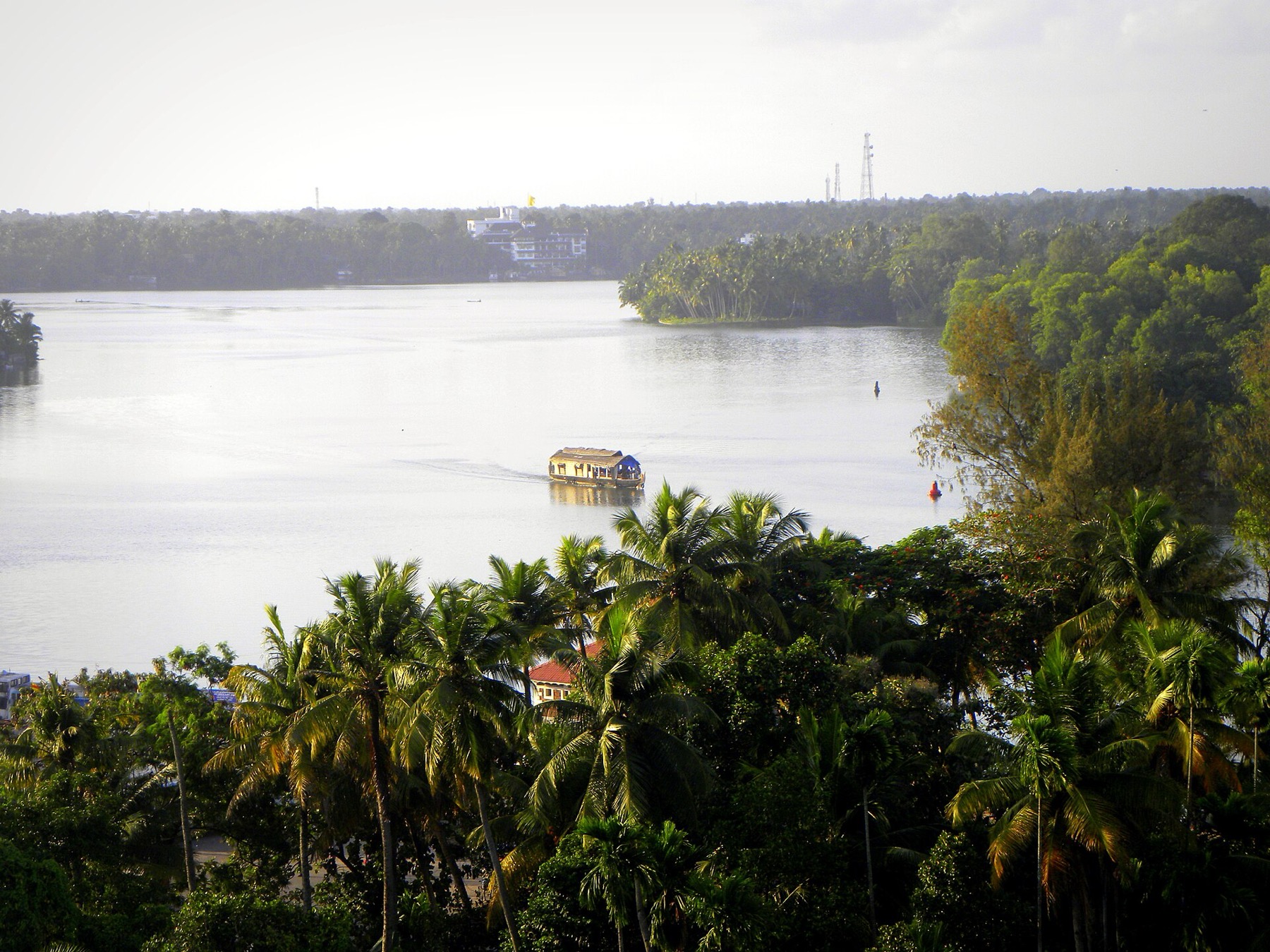
The open-water outlooks on the Munroe Island and Perumon side of Ashtamudi, where the lake widens out — the wide views the canal trips themselves do not give you.
16.4 km · straight lineBy most accounts Kerala’s largest fishing harbour, at the mouth of Ashtamudi Lake about 9 km from Kollam town, and where Indian fishing was mechanised; two bridges cross the confluence and the early-morning auction is the sight to catch.
21.2 km · 27 min driveLarge palm-fringed backwater system and houseboat base around Kollam.
28.5 km · 35 min driveRoad and walking figures are route estimates, with travel times dependent on access, traffic and conditions. Figures marked “straight line” show direct separation and do not describe a road or walking route. Fare estimates use Kerala’s 26 April 2022 auto/taxi notification and exclude waiting, night and applicable one-way surcharges. Confirm the current meter or operator quote before travelling. Routing: © openrouteservice.org by HeiGIT | Map data © OpenStreetMap contributors
Nearby toilets, pharmacies, ATMs, seating and vets are community-mapped and may be incomplete or out of date. Map data © OpenStreetMap contributors | Walking times © openrouteservice.org by HeiGIT
Pozhi is the breach or mouth where a backwater cuts through the coastal sand ridge to reach the sea; pozhikkara is the place of it. It describes exactly what is happening here — the Paravur backwater finding the Arabian Sea across a sandbar.
No. This is an estuary mouth with currents, a shifting sandbar and a shelving beach, and it is not a swimming beach however calm it looks on the evening you visit. There are no lifeguards and no facilities.
Not necessarily. Sandbars at backwater mouths open, close and migrate with the monsoon and with deliberate management to relieve flooding behind. The dramatic wide-mouth photographs that circulate show one condition among several, not the permanent state.
It controls the exchange between the backwater and the sea — keeping salt water out of the freshwater system behind and managing the condition of the bar. It is the reason the estuary behaves as it does, and worth a look even though it is not scenic.
No, though they get conflated in listings. Kappil is further south towards Varkala and does the same thing — backwater beside sea — but is more visited and much more photographed. Paravur Pozhikkara is the quieter of the two.
The Thiruvananthapuram–Shoranur canal, part of the historic inland waterway network running behind the Kerala coast that once carried the bulk of Travancore's goods traffic. It passes through here and is still in use, though far quieter than it once was.
More than the modest setting suggests. Estuary mouths concentrate feeding — waders on the bar at low water, terns over the breach, egrets in the backwater shallows behind — and since nobody comes here for birds, nothing is disturbed. Early morning and late afternoon are the productive hours.
Half an hour, timed for the light, is the right size of commitment. It works best as a stop on the road south towards Varkala and Thiruvananthapuram rather than as a dedicated trip out from Kollam and back.
None to speak of. No lifeguards, no changing facilities, no reliable food. Bring what you need and treat it as an unserviced stretch of coast, which is what it is and part of why it stays quiet.
November to February for dry weather; avoid rough-sea days during monsoon warnings.
Entry: Free to walk; no ticket, and no services of any kind — no lifeguard, no changing rooms, no toilets, no documented parking. Timings: Daytime; late afternoon is best.
Base yourself in Kollam town or a nearby town in Kollam, then confirm the last-mile route locally before leaving. Arrive before sunset if you want photos and a calmer walk; beach roads can slow down in the evening. If the visit depends on forest, temple, boat, ferry, weather or seasonal access, check the official/local rule on the day before travel.
1 to 3 hours, longer if staying for food or sunset.
Nearby you can pair Sardar Vallabhbhai Patel Police Museum (10.1 km, approximate straight-line separation), Port of Kollam (10.3 km, approximate straight-line separation), Kollam Beach (11.0 km, route estimate), Asramam Adventure Park (11.8 km, approximate straight-line separation).
Do not swim during rough-sea warnings. Avoid isolated stretches after dark unless with a trusted local/operator.
Written about Paravur Pozhikkara itself — its history, its legends and the arguments about them.
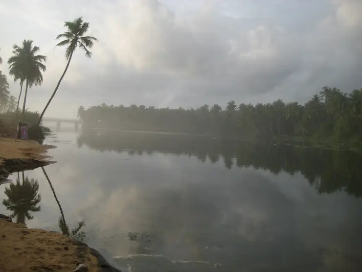
These guides explore Kollam town and the surrounding area. Choose a visit that fits your interests, allowing separately for travel between stops.
Route-level itineraries and practical guides for the rest of Kerala.
Photographs: Arunvrparavur (CC BY-SA 4.0), Tuderna (CC BY 3.0), Sree kumar chaethas (CC BY-SA 4.0), Navaneeth Krishnan S (CC BY-SA 3.0). Wikimedia Commons.