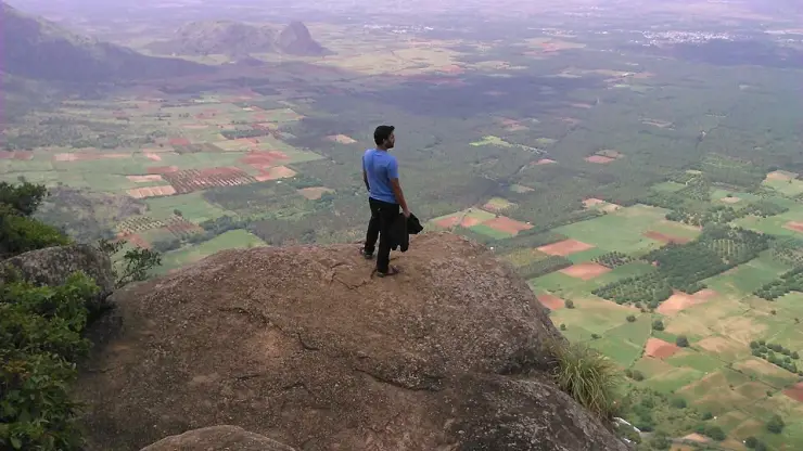
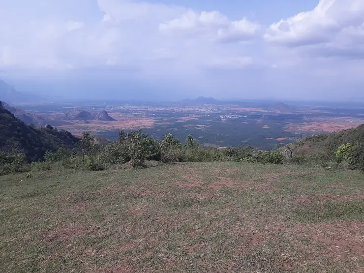
Kuravan Kurathi statue

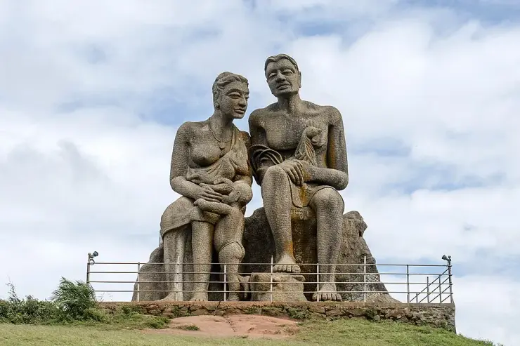
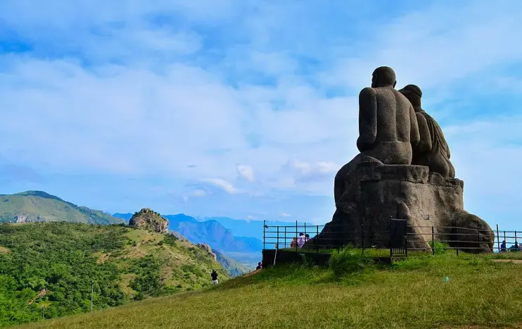
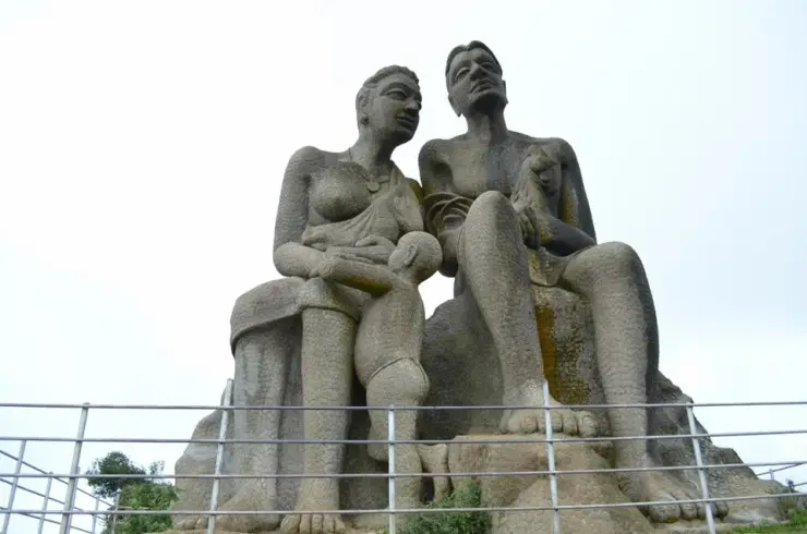
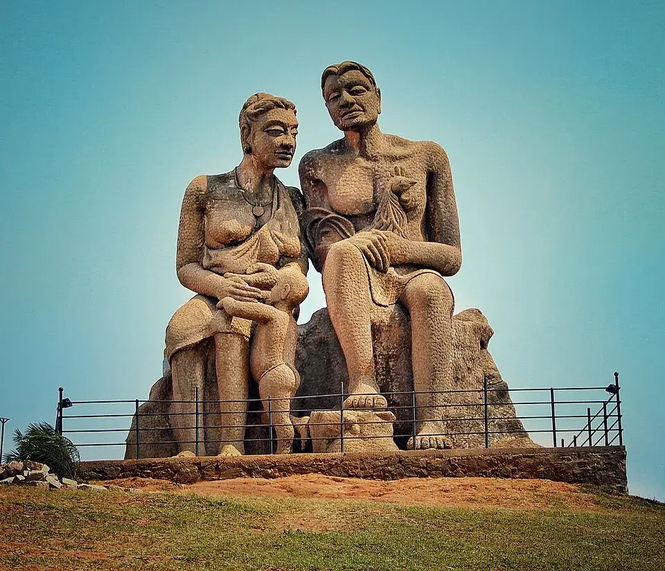
The Kuravan and Kurathi statue is a seated concrete group on a bare grass mound at Ramakkalmedu, and the first thing to say about it is that it is not a twin statue. DTPC Idukki, which sells the ticket, calls it “the twin statues of the Kuruvan and Kuruvatti couple”. Kerala Tourism, in its own newsletter, describes “two huge statues of a ‘kuravan’ and a ‘kurathi’ and their child (people with tribal background) looking down nonchalantly at the visitors”. Open any clear photograph of it and Kerala Tourism is the one that is right: there are three figures. Kuravan sits on the right with a bird cupped against his chest, Kurathi sits on the left, and a child stands between her knees with her hands folded across him. The whole group is finished in a scaled, chiselled texture that runs over the bodies, the rock they lean on and the plinth alike.

Kuravan Kurathi statue, Ramakkalmedu
Practical guide

Plan Kuravan Kurathi statue

Who's going?Tailor Kuravan Kurathi statue to your trip
Typeheritage
AreaRamakkalmedu
DistrictIdukki
Best timeSeptember to May, and not the monsoon
Time neededForty minutes to an hour and a half
Entry₹25
Places to visit4Listed businesses12

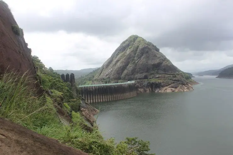
It was sculpted by C. B. Jinan and put up in 2005 — the attribution is carried by Malayalam Wikipedia, which captions its photograph of the group simply “കുറവനും കുറത്തിയും, ജിനന്റെ ശില്പം”, Kuravan and Kurathi, Jinan’s sculpture, and independently by the photographer of one of the best frames of it on Wikimedia Commons, whose own description reads “A sculpture by Jinan @ Ramakkalmedu”. DTPC Idukki adds, in its own words, that the group “has the distinction of being the highest such statue in Kerala”. What it commemorates is not here at all. Kuravan and Kurathi are the names of two granite hills 30 kilometres west in a straight line and 44 by road, and the Idukki arch dam — Kerala’s largest, a concrete double-curvature parabolic thin arch across the Periyar — is wedged in the gorge between them. The district is named after that gorge: ഇടുക്ക്, idukku, the narrow place.

And the ground it stands on is disputed by the maps. Ask OpenStreetMap’s boundaries what state this statue is in and the answer is Tamil Nadu — Theni district, Uthamapalayam taluk — because the state line runs 84 metres to the west of it. That same boundary way is an edge of a Kerala gram panchayat ward, admin level 10, that is itself named Ramakkalmedu. So Kerala’s own ward called Ramakkalmedu stops 84 metres short of the statue that everyone photographs when they come to Ramakkalmedu. Kerala Tourism, DTPC Idukki and Wikidata all file it in Idukki, and so does this page.

The story

Three figures in scaled concrete on a bare grass mound, looking east over Tamil Nadu — a Kuravan with a bird held against his chest, a Kurathi beside him, and a child standing between her knees. Almost every page written about them, including the one belonging to the council that sells the ticket, calls this a twin statue. It has three figures, and Kerala Tourism is the only official body that says so. What they commemorate is thirty kilometres away: Kuravanmala and Kurathimala, the two granite hills the Idukki arch dam is wedged between, and which gave a whole district its name.

The story of Kuravan Kurathi statue

Begin with the count, because it is the one thing about this sculpture that can be settled by looking. The District Tourism Promotion Council of Idukki runs the compound the statue stands in, and on its own destination page it writes that “it is the twin statues of the Kuruvan and Kuruvatti couple that is the main attraction here at Ramakkalmedu.” Twin. Commercial travel pages have repeated that word for twenty years. Kerala Tourism's newsletter of March 2015 describes the same object differently: “On the open meadows of the mount stand two huge statues of a ‘kuravan’ and a ‘kurathi’ and their child (people with tribal background) looking down nonchalantly at the visitors.” We opened nine photographs of the group on Wikimedia Commons at full resolution, taken from four different angles by six different photographers across more than a decade, and in every single one there is a child: standing on the plinth between Kurathi's knees, head at her forearm, one knee bent, her hands folded across him. Kerala Tourism is right. The department that owns the gate has miscounted its own main attraction.

Once you are looking properly, the rest of the detail arrives. Kuravan sits on the right, one forearm across his raised knee, and in his other hand — folded in against his chest, easy to miss and invisible in most published photographs — is a bird. A fowl, wings tucked, head up. There is something coiled at his hip that reads as a basket or a rolled mat. Kurathi sits on the left with a pendant on a cord at her throat and an ornament at her ear. Both figures lean back against a sculpted boulder that is part of the same casting, and both are barefoot with the soles of their feet turned out towards you at the front of the plinth. And the whole thing — skin, cloth, the rock behind them, the base — is worked in an overlapping scaled texture, thousands of small facets, so that at any distance the group reads as one piece of stone rather than as figures placed on it. That texture is the reason to walk around it instead of photographing it from the path.

It was made by C. B. Jinan and put up in 2005. That sentence is repeated on every commercial travel page about Ramakkalmedu, and English Wikipedia carries it too — but English Wikipedia's only citation for it is one of those commercial pages, so on its own it is a single source wearing an encyclopaedia's clothes. The corroboration is in Malayalam and it is independent. Malayalam Wikipedia's article on രാമക്കൽമേട് carries a photograph of the group in its gallery captioned “കുറവനും കുറത്തിയും, ജിനന്റെ ശില്പം” — Kuravan and Kurathi, Jinan's sculpture. And on Wikimedia Commons, the photographer of one of the finest frames of it wrote his own description years ago as “A sculpture by Jinan @ Ramakkalmedu”. Three unconnected sources for the sculptor. The year 2005 still rests only on the commercial ones, and this page says so rather than borrowing their confidence.

What nobody publishes is how big it is. Forty feet is the figure in circulation and it is everywhere. DTPC Idukki, asked the same question by its own web page, answers only that the group “has the distinction of being the highest such statue in Kerala” — a superlative with no number attached. Kerala Tourism gives no height at all. Neither does Malayalam Wikipedia, which says only that the statues were “built a few years ago”. We are not going to convert a photograph into a measurement: what can honestly be said is that in the frames taken before the guard rail went up, adults stand at the level of Kuravan's ankle with the soles of his feet at about their head height, and that is consistent with a seated figure of that order. The number is left where it is, unattributed and uncertain.

Now the thing the statue is actually about, which is not at Ramakkalmedu and never has been. Kuravan and Kurathi are the names of two granite hills thirty kilometres west of this mound in a straight line — forty-four by the road, about fifty minutes if the ghat is clear. Between them the Periyar runs through a gorge so narrow that Malayalam has a word for it, ഇടുക്ക്, idukku, the tight place, and that word is where the district of Idukki got its name. Wedged into that gorge is the Idukki arch dam. KSEB's own board at the site, headed “Salient Features of Idukki Dam”, gives the type as concrete double curvature parabolic thin arch, the river as the Periyar, the length at the top as 365.76 m and the height from deepest foundation as 169.16 m — printed beside its equivalent, 555.00 ft. It is one of the highest arch dams in Asia and the largest in India of its kind, and the statue on this ridge is a monument to the two hills that hold it up.

There is a person inside that story, and Kerala Tourism named him in its own newsletter in August 2020. Chemban Kolumban — Karuvellayan Chemban Kolumban in full — was the headman of the Oorali, and he lived at Narikkad in Chembacherry, about five kilometres from where the dam now stands. In 1932, according to Malayalam Wikipedia citing Manorama and Mathrubhumi, the superintendent of the Malankara Rubber Estate, W. J. John, went hunting in the Idukki forests and took Kolumban along as his guide. Somewhere on that walk Kolumban showed him the Periyar tearing through the gap between Kuravanmala and Kurathimala. John worked out that a dam there would give power and irrigation, studied it with his engineer brother, and submitted a report to the Travancore government. Everything that followed — the Canadian aid, the consultancy of Surveyor, Nenniger and Chenevert, the three dams at Idukki, Cheruthoni and Kulamavu, the commissioning by Indira Gandhi on 12 February 1976 — followed from that. Kerala Tourism quotes the Secretary of DTPC Idukki putting it in one sentence: “He was the one who showed the hills of Kuravan and Kurathi, thereby being instrumental in the setting up of the Idukki Dam.”

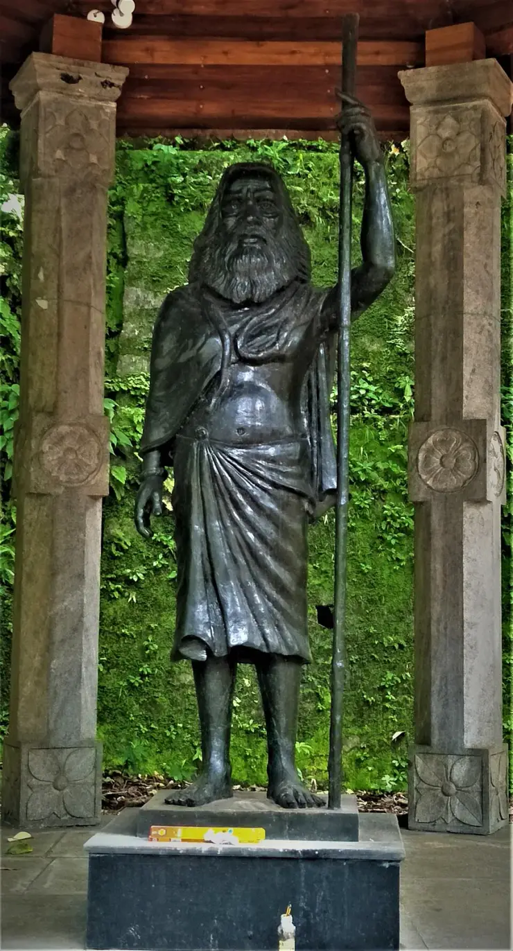
Kolumban did not see it finished. He died on 21 June 1970, aged 112, six years before the project was commissioned, and was cremated at Vellappara facing the two dams. He had been a guest of honour when the Canadian government took over the construction work and was honoured at the major ceremonies of the first phase. A statue of him went up beside the dam in 1976, by the sculptor Kunnuvila Murali; the same sculptor made the memorial at his samadhi at Vellappara, begun in 2015 and opened to the public in 2020 by the Kerala Department of Archaeology, a twelve-foot figure unveiled by two state ministers. The Kerala Forest Department's boat on the Idukki reservoir is called Kolumban. He is the reason there is a dam between those hills, and the sculpture on this ridge is, at one remove, about him too.

The mapped state boundary creates an awkward result: the statue’s returned address is Uthamapalayam, Theni, Tamil Nadu, and the line runs 83.9 metres west of the plinth. The viewpoint, hornbill tower and Ramakkal rock fall on the same side; Aamai Para is the only named feature shown on the Kerala side. Kerala Tourism and DTPC Idukki nevertheless administer and present the visitor destination as part of Idukki, so use the attraction pin rather than the map’s state label when planning the visit.

The administrative boundary is stranger than the destination label suggests. The mapped state line is also the eastern edge of Ramakkalmedu Ward 5 in Karunapuram grama panchayat, Udumbanchola taluk, Idukki. The statue stands eighty-four metres outside that ward, while the coordinate published by Wikidata and English Wikipedia, 9°47′59″N 77°14′14″E, sits 430 metres inside it and more than a kilometre from the visitor mound. For practical travel, follow the attraction pin and DTPC guidance rather than the ward name alone.

The encyclopaedias also disagree. English Wikipedia and Wikidata use one coordinate; Malayalam Wikipedia gives 9°48′41″N, 77°14′38″E, about 1.3 km away and on the Tamil Nadu side of the mapped state line despite labelling it Kerala. None of this changes the practical destination: Kerala Tourism, DTPC Idukki and the Government of Kerala’s tourism system all present Ramakkalmedu and its statue as an Idukki attraction. Follow the attraction pin rather than an encyclopaedia coordinate.

One last thing about the ridge as a working border, because it explains a practical inconvenience. The nearest railway station to this statue, measured in a straight line, is Bodinayakanur — twenty-five kilometres away, down in the plain you are looking at, in Tamil Nadu. By road it is fifty-nine kilometres and over an hour, because nothing crosses the ridge here and you have to go the long way round. DTPC publishes Kottayam, a hundred and nineteen kilometres by its reckoning and a hundred and forty-four by ours, as the railhead for this centre. Both statements are true at once. The view from the mound is of a plain you can see and cannot easily reach, and that is as good a summary of this border as any sentence on the page.

Legend & myth

The oldest layer is a marriage. Malayalam Wikipedia's article on കുറത്തി records the belief plainly: “ഒരിക്കൽ പാർവ്വതീ പരമേശ്വരന്മാർ കുറത്തിയായും കുറവനായും ജനനമെടുത്തു” — once, Parvati and Parameswara were born as Kurathi and Kuravan. That is the frame the whole thing sits in. Kurathi is not only a woman of the Kuravar in this telling; she is worshipped as a deity in her own right, alongside hill-gods such as Muthappan, Pottan and Gulikan, and she walks into Kerala's ritual theatre as a character — in Theyyam as Kurathi Amma, in Padayani, and in the Porattu Nadakam and Kurathiyattam folk plays, where Kuravan and Kurathi come to the Thrissur Pooram, are separated in the crush, and are looked for until they are found.

The story attached to the hills is the one that gives this statue its meaning, and Malayalam Wikipedia states it in a single sentence under the heading of place names: “കുറവൻ - കുറത്തി മലകളെ തമ്മിൽ ബന്ധിപ്പിച്ചു പണിത കമാന അണക്കെട്ടാണ് ഇടുക്കി ഡാം” — the Idukki Dam is the arch dam built joining the Kuravan and Kurathi hills. Two hills named for a man and a woman of the Kuravar, standing on either side of a gorge, with a wall built between them. It does not need much elaboration to see why somebody put a sculpture of the couple on a ridge thirty kilometres away and pointed them out over the plains. The article on Idukki district makes the same connection from the other direction: the largest arch dam in India is built in the ഇടുക്ക്, the narrow place, between the hills called Kuravan and Kurathi, and the district takes its name from that gap.

Popular retellings go further and turn the hills into the couple themselves — two lovers who came up into these mountains and were turned to stone where they stood, so that the dam is built between their bodies. That version circulates on travel pages and in conversation on the ridge, but it does not appear in Kerala Tourism's account or either Wikipedia article, and no cited Malayalam publication establishes it as a local ഐതിഹ്യം. Treat it as a story people tell, not as documented history.

There is a competing reading of who Kuravan and Kurathi were, and it is cast in concrete at the other end of Kerala. At Asramam in Kollam stands a different sculpture of the same pair, red-painted, standing rather than seated, made by Guru Prasad Ayyappan at a ten-day Kerala Lalithakala Akademi and State Tourism Department camp called അഷ്ടശില്പ in 2020. Its plaque does not tell a myth at all. It reads: “Kuravan and Kurathi are the representatives of the Blacks in India. In Sanga period Kuravan and Kurathi were poets and scholars and were very rich. But they were victimised to genocide by feudal rulers for land and Culture. The Kuravan and Kurathi Hills are the right example of the feudal cruelty… In this sense it is a historical Sculpture as well.” That is one sculptor's statement on his own plinth rather than a scholarly finding, and it is quoted here as that. But it is a reminder that the two figures on this ridge are read by some people as a memorial and not as decoration.

The ridge itself has legends, and they belong to the rock rather than to the statue. Sri Rama is said to have come down here searching for Sita and to have chosen Rameswaram for the causeway from this spot, and the place is named for the stone his feet touched; another story attaches to the ‘kallummel kallu’, the stone upon stone, which Bhimasena is said to have used to pound betel for Draupadi during the Pandavas' exile. Both are properly Ramakkal's rather than the statue's, and row 13 of this guide takes them up where they belong. They are noted here only so that nobody reads the sculpture as being about them: it is not. It is about two hills and a dam.

Before publishing any of this we searched in Malayalam, because an English-language blank measures search coverage rather than the world — കുറവനും കുറത്തിയും, കുറത്തി, ഐതിഹ്യം, രാമക്കൽമേട്, ഇടുക്കി അണക്കെട്ട് കുറവൻ. What came back was the Parvati–Parameswara birth, the Theyyam and folk-theatre traditions, the hills-and-dam place-name note, the Chemban Kolumban history and Malayalam Wikipedia's own caption naming Jinan as the sculptor. What did not come back was any temple, festival, offering or shrine associated with the statue itself, which is unsurprising for a public sculpture put up in 2005 and is reported here as the result of a search rather than as a claim about what the people on this ridge believe.
Read the full history of Kuravan Kurathi statue 529 more words

History

1932. W. J. John, superintendent of the Malankara Rubber Estate, hunts in the Idukki forests with Chemban Kolumban, the Oorali headman from Narikkad in Chembacherry, as his guide. Kolumban shows him the Periyar running through the gorge between Kuravanmala and Kurathimala. John and his engineer brother study the site and submit a report to the Travancore government. ⚠ Kerala Tourism's own 2020 newsletter dates this to 1922 rather than 1932 and hedges it — “Legend has it that back in 1922, Kolumban joined a team headed by the Malankara Estate superintendent during a hunting trip in Idukki.” Ten years apart, official body against Malayalam press, and the official body is the one saying “legend has it”. Both dates are printed.

21 June 1970. Chemban Kolumban dies at the age of 112, before the project he made possible is commissioned. He is cremated at Vellappara, facing the Idukki and Cheruthoni dams.

12 February 1976. The Idukki hydroelectric project is commissioned by Prime Minister Indira Gandhi. It was completed with aid from the Government of Canada, with M/s Surveyor, Nenniger and Chenevert as technical consultants, and comprises three dams — the Idukki arch dam, the Cheruthoni dam and the Kulamavu dam. In the same year a statue of Kolumban, by the sculptor Kunnuvila Murali, is put up beside the dam.

2005. The Kuravan and Kurathi group is sculpted by C. B. Jinan and erected on the ridge at Ramakkalmedu. ⚠ The year comes to English readers only through commercial travel pages; the sculptor is independently corroborated by Malayalam Wikipedia's own caption and by a Wikimedia Commons photographer's description of his own frame.

23 February 2011. Idukki's District Tourism Promotion Council opens its tourism centre at Ramakkalmedu, and the foundation stone for an Energy Park on the same site is laid, both inaugurated by K. K. Jayachandran MLA. Malayalam Wikipedia records what had been completed by then — a restaurant, a water supply scheme and comfort stations — and puts the Energy Park's construction cost at ₹75 lakh, with a cloak room, a rest centre, a restaurant and tent accommodation planned. The compound the statue now stands in is that project.

2015. Kerala Tourism's newsletter of March 2015 publishes the description that this page relies on for the count of figures, and English Wikipedia records that Ramakkalmedu was already drawing more than a hundred thousand visitors a year while basic facilities remained undeveloped.

2015–2020. The Kerala Department of Archaeology builds a memorial at Kolumban's samadhi at Vellappara, near Cheruthoni, by the same sculptor who made the 1976 statue. The twelve-foot figure is unveiled and the memorial opened to the public in August 2020 by the Minister for Ports, Museums, Archaeology and Archives and the Minister for Power.

Some time between the mid-2010s and now, undated. A steel guard rail goes up around the plinth, with floodlights on posts. Wikimedia Commons photographs from earlier show visitors standing on the statue's feet and leaning against its ankles with no rail present at all; current frames show the rail, the lights and a lighting mast twenty-two metres away. No published account dates or explains the installation, so the photographs provide the only chronology used here.

What to expect

Highlights

  • Three figures, not two. Kuravan holds a bird — a fowl, folded against his chest with one hand over it. Kurathi wears a pendant on a cord and an ear ornament, and a child stands against her, held. Every source that calls this a “twin statue” has counted the adults and stopped.
  • The texture. The entire group — skin, cloth, the boulder behind them, the plinth — is worked in an overlapping scaled pattern, so that from a distance the figures read as carved out of the same rock they are sitting on. It is the thing photographs flatten and the reason it is worth walking round.
  • A monument to somewhere else. The hills the statue is named for are 30 km away and hold up a dam. This is the only large public sculpture in Kerala that commemorates a piece of hydroelectric engineering by portraying the people the two hills are named after.
  • The scale. Photographs taken before the guard rail went up show adults standing at the level of Kuravan’s ankle, with the soles of his feet at head height. The figure of 40 ft circulates widely; no official body publishes a height, and this page does not invent one.
  • It sits inside a paid compound, and that is worth knowing before you arrive. DTPC’s ticket counter, canteen, benches, a children’s playground, a floodlight mast, a “Hornbill tower” 29 m away and a camel ride 106 m away are all part of the same enclosure. This is a visitor attraction, not an open hillside with a statue on it.
  • The guard rail is new. Older photographs on Wikimedia Commons show visitors leaning on the feet and standing on the plinth; the current frames show a steel railing round the whole base and floodlights on posts. You look at it now rather than climb it.
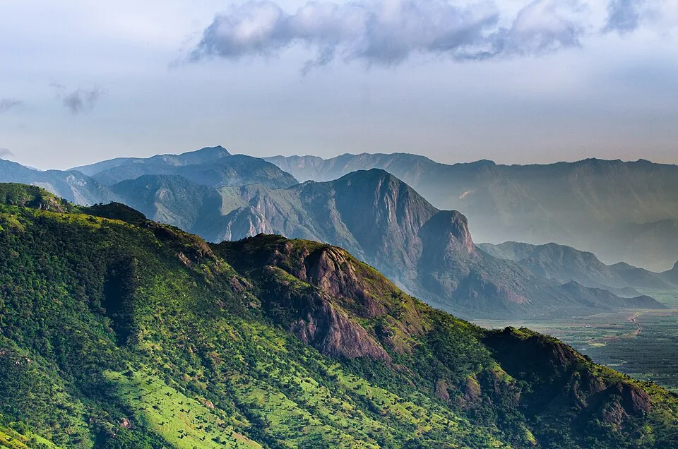
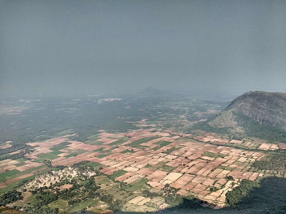
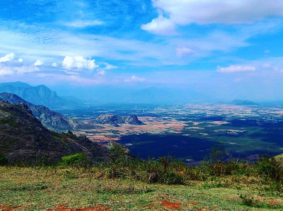
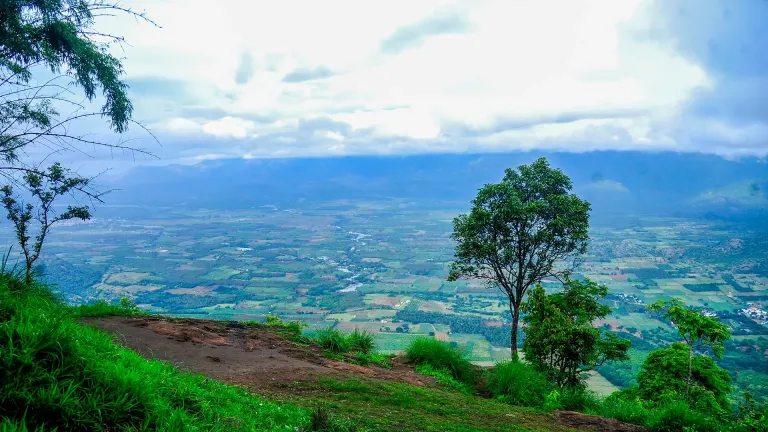
  • The plains behind it. The statue faces out over Tamil Nadu, and the towns you are looking at — Cumbum, Bodinayakanur, Uthamapalayam, Theni — are named by Kerala Tourism on its own page about a Kerala viewpoint.
  • The nearest railway station as the crow flies is in another state and takes an hour to reach. Bodinayakanur is 25 km away in a straight line and 59 km by road, because nothing crosses the ridge here.
Getting there

How to visit

  • Come to the Ramakkalmedu Tourism Centre gate. DTPC Idukki runs the compound the statue stands in and publishes its hours as 08:30 to 18:00, every day, with adults at ₹25, children at ₹15 and senior citizens at ₹15. There are two further published rates that most visitors never see quoted: ₹300 for video and ₹1,200 for an album. The unit in charge is reachable on +91 99479 91444, and the DTPC counter number for this ridge is 04868 243356.
  • The last stretch is the Thookkupalam–Ramakkalmedu road, an asphalted two-lane MDR that runs 300 m below the statue, and then a paved footpath. OSM maps the path immediately beside the plinth with a paving-stone surface, and there is a surfaced parking area 185 m off. This is one of the very few high-range viewpoints in Idukki where you walk to the thing on made ground.
  • From Nedumkandam it is 13.8 km by road as we measure it; DTPC publishes “about 12.4 km” to the bus stand. From Thookkupalam it is 6.9 km, from Kattappana 23.1 km, from Puliyanmala 20.7 km — DTPC describes the centre as “17 km from Puliyanmala” by the Thekkady route — and from Kumily 49.4 km. Munnar is 60.3 km and takes over an hour.
  • If you are coming for sunrise, this is not the gate. DTPC opens Ramakkalmedu at 08:30. Its Aamappara centre, 5.8 km away by the road the jeeps use, opens at 06:00 and closes at 19:00, so the ridge’s early light and its last hour both belong to the neighbouring site rather than to this one. Row 11 of this guide covers that centre in full.
  • Pair it with the dam it is about, if you have the day. The Idukki arch dam is 44.3 km and about 51 minutes by road, and the Kolumban memorial at Vellappara — the man who showed the gorge to the engineers — is beside it. That drive turns a photo stop into the actual story.
  • Carry cash. This is a hill counter with printed rates, not an online booking system, and there is no published portal for tickets to any DTPC centre on this ridge.

Distance by road

  • Kochi107 km
  • Madurai172 km
  • Thiruvananthapuram226 km
  • Coimbatore252 km
  • Kozhikode276 km

Road km to Idukki; ghat roads and traffic vary — allow extra.

Timing

Best time

September to May, and not the monsoon; the Malayalam Wikipedia article on Ramakkalmedu recommends exactly that window, excluding the heavy rains, and the reason is visibility rather than comfort. The whole point of the mound the statue stands on is that the Tamil Nadu plain is laid out below it, and in the south-west monsoon the cloud comes over the ridge and sits on it. Late afternoon is the light: the group faces east over the plains, so the sun is behind you in the evening and full on the faces. The towns below light up after dusk, and Kerala Tourism singles that out — “the view is striking at dusk when all these towns in Tamil Nadu are lit up” — but note that the gate shuts at 18:00, which in this latitude is close to sunset for much of the year and before it for the rest. If dusk over the plains is what you came for, the neighbouring Aamappara centre is open until 19:00 and this one is not.

Weather in Kuravan Kurathi statueSeasonal guide

Live forecast loads in your browser.

Today at Kuravan Kurathi statue
Sunrise6:11 am
Sunset6:20 pm
Golden hour best light5:20 pm–6:20 pm
Blue hour after sunset6:20 pm–6:45 pm
Sun sets toward compass bearingW · 272°
Moon tonight🌓 First quarter · 53%
South-west monsoon. June to September is the south-west monsoon in Kerala. Expect heavy showers, mostly in bursts rather than all day — carry rain cover, allow extra time for getting around, and note that ferries and open-air sites are the first things affected.

Sun and moon are calculated for this location and shown in IST. Photography windows are the hour around sunrise and sunset; the sunset bearing is degrees clockwise from true north. Moon phase is accurate to about half a day.

Visitor notes

  • 🔑 The official count is wrong on most pages and right on one. DTPC Idukki, the operator, calls this “the twin statues of the Kuruvan and Kuruvatti couple”. Kerala Tourism’s newsletter of March 2015 describes “two huge statues of a ‘kuravan’ and a ‘kurathi’ and their child”. There are three figures. We checked nine Commons photographs at full resolution before writing that sentence, including frames taken from four different angles, and the child is unmistakable in all of them.
  • 🔴 No official body publishes a height for this statue. “40 ft” is quoted by commercial travel sites and is repeated everywhere; DTPC says only that it is “the highest such statue in Kerala”, without a number, and Kerala Tourism gives none. We are not printing a measurement we cannot source, and we are not deriving one from a photograph.
  • ⚠ The sculptor and the year are better sourced than they look, but not by the state. C. B. Jinan and 2005 come to English readers through commercial travel pages, and English Wikipedia’s only citation for the sentence is one of them. The independent corroboration is Malayalam: ml.wikipedia captions the group “ജിനന്റെ ശില്പം”, Jinan’s sculpture, and a Commons photographer describes his own frame as “A sculpture by Jinan @ Ramakkalmedu”. Three sources for the sculptor; the year 2005 still rests on the commercial ones alone.
  • 🔴 OpenStreetMap places this statue in Tamil Nadu. Its returned address is “Kuravan and Kurathi Statue, View point Path, Ramakkalmedu, Uthamapalayam, Theni, Tamil Nadu”, and the mapped state boundary runs 83.9 m west of the plinth. The viewpoint, hornbill tower and Ramakkal rock fall on the same side of that line; Aamai Para is the only named Ramakkalmedu feature shown on the Kerala side. Kerala Tourism and DTPC nevertheless administer and present the destination as part of Idukki.
  • 🔴 The elevation is contested three ways and nobody is obviously wrong. Wikidata and both Wikipedias publish 981.07 m for Ramakkalmedu. English Wikipedia’s own Geography section, in the same article as that infobox, says the place “stands tall in the western ghats at a height of 3,500 ft” — 1,067 m. The Malayalam article says 1,100 m. NASA’s SRTM elevation model reads 1,012 m at the statue and 910 m at the coordinate Wikidata publishes. These are not all measuring the same point, which is most of the explanation, and none of them says which point it is measuring.
  • 🔴 Kerala’s power utility and Kerala’s tourism department disagree about the dam by 25 centimetres. KSEB’s own board at the dam, headed “Salient Features of Idukki Dam”, gives the height from deepest foundation as 169.16 m — which is exactly 555.00 ft, printed beside it. Kerala Tourism’s newsletter says “At 168.91 m, it is one of the highest arch dams in Asia.” The operator’s figure converts to a round number of feet and the tourism department’s does not, which is a clue rather than a proof. Both are printed here.
  • ⚠ A different Kuravan and Kurathi sculpture exists and it is easy to mistake for this one. At Asramam in Kollam there is a red-painted standing pair on a black plinth, made by Guru Prasad Ayyappan at a Kerala Lalithakala Akademi and State Tourism Department ten-day camp called അഷ്ടശില്പ in 2020. Its plaque offers a completely different reading of who Kuravan and Kurathi were — “representatives of the Blacks in India”, poets and scholars in the Sangam period who “were victimised to genocide by feudal rulers for land and Culture”, with “The Kuravan and Kurathi Hills” named on the plaque as “the right example of the feudal cruelty”. We opened its photograph, established it is a different work in a different district, and left it out of this page’s gallery.
  • ✅ The path to the statue is paved. OpenStreetMap records the footpath running past the plinth with a paving-stone surface and the parking area 185 m away likewise, and the mound is low and grassed. Among Idukki’s famous viewpoints — which mostly involve jeep tracks, boulders or a climb — this is the one you can reach on made ground.
  • ⚠ You are buying into a compound, not walking up to a monument. Inside the same ticket are DTPC’s canteen, benches, a children’s playground with a posted maximum age of 16, a floodlight mast, a structure mapped as the “Hornbill tower” 29 m from the statue and tagged wheelchair=no, and a camel ride 106 m off. If you were expecting an empty ridge with a sculpture on it, this is not that, and the neighbouring Aamappara site is closer to it.
  • ⚠ There are two historic photographs of Kolumban on Wikimedia Commons — one showing him with visiting Canadian and KSEB engineers at the dam site, one with the Canadian government’s Fred Willows — and neither is used on this page. Both are uploaded with “source=Unknown” and “author=Unknown” and then tagged CC BY-SA 4.0, a licence the uploader cannot grant for work they do not own. They are named here because they exist and because somebody should re-license them properly, not because we are relying on them.
Safety

Good to know

  • There is a steel guard rail around the plinth now and it is there for a reason. Older photographs show visitors standing on the feet and leaning against the ankles; the current arrangement is to look rather than to climb. Do not lift a child over the rail for a photograph.
  • The statue stands on an open, exposed mound on the windiest ridge in Kerala. Government measurements from a mast on this ridge record an annual mean of 8.41 m/s and a June monthly mean of 13.04 m/s — that second figure is 47 km/h of steady wind, on a bare grass hill with nothing to hold. Hats, phone cases, spectacles and loose bags all go over the edge from here.
  • The mound is short-cropped grass over compacted red earth, and it is slick after rain. The made footpath is paved; the last few metres of the mound around the plinth are not, and that is where people slip.
  • The gate shuts at 18:00 and the road down is a two-lane hill road with no lighting. If you have driven up for the evening light, be moving before the counter closes rather than after it.
  • Mist. In the cold months cloud comes over the ridge and can reduce the view to nothing in minutes, and the same cloud is on the descending road. This is not a place to be improvising a night drive.
  • The compound includes a camel ride and a children’s playground with a posted upper age of 16. Neither is run by us and neither is covered by anything on this page; satisfy yourself about them on the ground.
  • You are 84 m from the Tamil Nadu border. Mobile phones on this mound hop between two states’ networks, which can mean roaming charges and can mean a data connection that comes and goes. Do not depend on live navigation to get back down.
  • There is no published accessible toilet at this centre and the toilet block OSM records is 285 m from the statue. Plan for that distance rather than discovering it.
  • The bird under Kuravan’s hand and the child against Kurathi are at height and the group is floodlit after dark, but the gate is shut before dark. Nobody should be on the mound at night.
  • If you are visiting on a windy day with a small child, hold on to them on the mound rather than at the rail. The drop the wind matters for is the escarpment beyond the compound, not the plinth.
Stay · eat · do · rent · see · shop

Stays, food & things to do near Kuravan Kurathi statue

Verified hotels, homestays, restaurants, experiences, sights, shops and rentals around Kuravan Kurathi statue — commission-free, with direct contact. Filter by what you need.

2 places to eat near Kuravan Kurathi statue

Paadi Holidays Restaurant Ramakkalmedu — In-house resort restaurant in Ramakkalmedu
Top pick Verified
In-house resort restaurant · Ramakkalmedu
Paadi Holidays Restaurant Ramakkalmedu

In-house resort restaurant in Ramakkalmedu. Paadi Holidays, Ramakkalmedu, Anniyar Thozhu, Idukki, Kerala 685515 · Restaurant, Resort dining, Ramakkalmedu food.

Directions Commission-freeView details
M
Menorah Rooms and Restaurant Ramakkalmedu
Where to eat
Verified
Rooms and restaurant · Ramakkalmedu
Menorah Rooms and Restaurant Ramakkalmedu

Ramakkalmedu rooms-and-restaurant contact for food, fresh-up stops and local hill activities. Ramakkalmedu, eat, Rooms and restaurant.

Directions Commission-freeView details

Book with the place itself. India’s cyber-crime coordination centre warned in April 2025 that convincing copies of hotel and pilgrimage booking sites are being pushed through sponsored search and social ads, taking payment for rooms the property never hears about. Every listing here links to the business’s own contact details and its own Google or Bing profile — we take no commission and sit in nobody’s payment path. If a booking page reached you through an ad, check the address bar against the property’s own site before you pay. Fraud can be reported on cybercrime.gov.in or on 1930.

Ranked guides

Top experiences around Ramakkalmedu

3 more places around Ramakkalmedu. Open a guide to plan the visit and onward journey.

viewpointRamakkalmedu

2.9 km · 4 min drive

Windy Idukki ridge and viewpoint area above the Tamil Nadu plains, often planned with wind farms and Nedumkandam-side routes.

viewpointRamakkalmedu viewpoint

140 m · 2 min walk

Open ridge viewpoint above the Tamil Nadu plains near Nedumkandam, useful for sunset, wind-farm and high-range road planning.

viewpointAamai Para

5.8 km · 12 min drive

Tortoise-shaped rock outcrop above Thovalappady on the Kerala–Tamil Nadu border ridge, reached by jeep track from the Thookkupalam–Ramakkalmedu road, with a two-mouthed passage under the rock and DTPC’s Jaalakam eco-tourism centre on top.

Roampedia is commission-free — own or know a stay, eatery, guide or shop near Kuravan Kurathi statue? List it and it appears here once verified.

Add a nearby business
Before you go

Kuravan Kurathi statue — at a glance

Duration40 minutes to 1.5 hours; a half day with Aamai Para
OperatorDistrict Tourism Promotion Council, Idukki, which runs the compound as the Ramakkalmedu Tourism Centre. The unit in charge is on +91 99479 91444 and the DTPC counter number for this ridge is 04868 243356. The centre and its Energy Park were inaugurated on 23 February 2011 by K. K. Jayachandran MLA; the statue itself predates them by six years.
Timings08:30 to 18:00, every day, published by DTPC Idukki. Note what that excludes: this gate opens two hours after the neighbouring Aamappara centre and shuts an hour before it. The dusk view over the lit Tamil Nadu towns that Kerala Tourism recommends happens after this counter has closed.
Best timeSeptember to May, excluding the heavy monsoon — the window Malayalam Wikipedia recommends for Ramakkalmedu. The reason is the view rather than the weather: this mound exists to look east over the Tamil Nadu plain, and in the south-west monsoon the cloud comes over the ridge and stands on it. Late afternoon is the light.
Entry price
Indian adult
₹25

Government monuments, museums and forest reserves in India often charge foreign visitors more. We have not verified whether this site does — ask at the counter.

Fees change without notice. Check the current rate at the counter.

Entry: ₹25 adults, ₹15 children, ₹15 senior citizens; published by DTPC Idukki on its own destination page. Two further rates are printed there and are rarely quoted anywhere else: ₹300 for video and ₹1,200 for an album. There is no published still-camera charge and no published parking charge. Carry cash — there is no online ticketing for any DTPC centre on this ridge.

Photography: No published still-camera charge. DTPC does publish ₹300 for video and ₹1,200 for an album, which are the only camera-related figures on its own page for this centre. The statue faces east: it is backlit in the morning and lit on the faces in the late afternoon, and the scaled texture that is the point of the sculpture only shows in raking light. A wide lens from the north-west corner of the mound gets the group with the plains behind it; the bird under Kuravan's hand and the child at Kurathi's knee need a walk round to the left of the plinth and are missing from almost every published photograph.

Booking: Nothing to book and nowhere to book it. DTPC publishes no online ticketing for the Ramakkalmedu centre and there is no advance reservation for entry — you drive up, pay at the counter and walk in. The one thing worth doing by telephone in advance is checking the gate is open on the day, on +91 99479 91444 or 04868 243356, because this is a hill centre on a road that closes in bad weather and the district has closed viewpoints on this ridge before at short notice. Ask about the road as well as the gate. If you want the sunrise or the dusk view, do not ring this number at all: those hours belong to the Aamappara centre 5.8 km away by road, which runs 06:00 to 19:00, and no amount of asking will open this one earlier.

Parking: There is a surfaced parking area mapped 185 m from the statue, and the last approach is a paved footpath — OpenStreetMap records the path immediately beside the plinth with a paving-stone surface. No parking charge is published by DTPC. The road in is the Thookkupalam–Ramakkalmedu MDR, a two-lane asphalt hill road that runs about 300 m below the statue.

Getting here

How to reach Kuravan Kurathi statue

  • ✈︎ By air Cochin International Airport, published by DTPC as “about 123 km”; measured by road it is 120 km and a little over two hours. Madurai is the nearer airport for anyone arriving from the Tamil Nadu side, but the road still has to go round the ridge rather than over it.
  • 🚆︎ By train DTPC publishes Kottayam as the railhead, “about 119 km”. Measured by road it is 144 km and about two and a half hours, and no route we could reproduce gives 119. 🔑 The nearest station in a straight line is Bodinayakanur in Theni district, Tamil Nadu — 25 km away, and 59 km by road, because nothing crosses the ridge here. Theni Junction is 33.7 km straight and 64 km by road. Kottayam remains the sensible Kerala arrival.
  • 🚗︎ By road The Thookkupalam–Ramakkalmedu road, an asphalted two-lane MDR, is the approach from every direction, and the last stretch to the compound is paved. Measured with OSRM from the pin: Thookkupalam 6.9 km, Nedumkandam 13.8 km, Puliyanmala 20.7 km, Kattappana 23.1 km, Chellarkovil 15.0 km, Kumily 49.4 km, Thekkady 49.9 km, Munnar 60.3 km, the Idukki arch dam 44.3 km. ⚠ DTPC publishes “about 12.4 km” to Nedumkandam bus stand and describes the centre as “17 km from Puliyanmala”; Malayalam and English Wikipedia both say 15 km from Nedumkandam. Our routed figures sit between the published ones.
  • 🚌︎ By bus Nedumkandam is the bus town for this ridge — DTPC names its bus stand as the road reference for the centre, about 12.4 km by its reckoning and 13.8 km by ours. Kerala RTC works the Thekkady–Munnar corridor through Nedumkandam and Puliyanmala; there is no published service that sets down at the compound gate, so the last leg is a taxi or an auto from Nedumkandam or Thookkupalam.
Getting back

If you are travelling by bus or ferry, check the return service with the operator before setting out. Leave time to reach the stop or jetty after your visit.

Ask at the bus stand for the time of the last service back, not the next one. If you miss it, an auto or app cab is the fallback — agree the fare before you get in.

Do

Things to do

  • Count the figures. There are three, and almost every published description says two. Kuravan on the right, Kurathi on the left, and a child standing between her knees with her hands folded across him. It takes ten seconds and it is the one thing about this statue that most visitors leave without noticing.
  • Walk round the plinth. The bird cupped against Kuravan's chest — a fowl, wings folded, head up — is invisible from the path everybody photographs from, and so is the coiled basket or mat at his hip. The group was made to be walked around and is almost always seen from one spot.
  • Look at the surface from a metre away. The whole casting is worked in an overlapping scaled texture — skin, cloth, the boulder behind them and the plinth all in the same facets — which is why the figures read as carved out of the rock they lean on. Photographs flatten it completely.
  • Find the hills it is about. Kuravanmala and Kurathimala are 30 km west in a straight line, and the statue faces the wrong way to see them. Standing on the mound with your back to the plains and working out which direction the dam is in is a better introduction to the sculpture than any caption on it.
  • Pick out the towns below. Kerala Tourism names them on its own page: Cumbum, Theni, Kombai, Thevaram, Uthamapalayam, Bodinayakanur and Vaiga. From the mound they are a grid of fields and roads with the Cumbum valley running away south-east.
  • Take the viewpoint 137 m north. OpenStreetMap records it with a bearing of 22 degrees, which is where it is pointed — a slightly different angle over the plains from the one the statue gives you, and less crowded.
  • Sit on the benches and let the wind do its work. Two three-seat concrete benches sit about 30 m from the plinth. This is the windiest ridge in Kerala, with a government-measured annual mean of 8.41 m/s, and sitting still in it for ten minutes is a large part of why people drive up.
  • Have something at the DTPC canteen, 59 m from the statue and mapped as a food court. It is the only catering inside the compound and the alternative is Nedumkandam, fourteen kilometres away.
  • Let children use the playground. It is mapped inside the compound with a posted maximum age of 16 and it is included in the same ticket, which matters if you have driven a long way for a sculpture that a child will look at for ninety seconds.
  • Walk to the Hornbill tower, 29 m away, and decide for yourself. It is tagged as an attraction with no reservation needed and wheelchair access explicitly marked as no. There is also a camel ride 106 m off. Neither is ours and neither is described here beyond saying they are inside the same gate.
  • Do the ridge properly and add Aamai Para. It is 1.5 km away in a straight line but 5.8 km by road — the jeeps go down to Thovalappady and back up, because the ridge route is not a way anybody drives — and it opens at 06:00 and closes at 19:00 when this gate does neither, and it is the only named Ramakkalmedu feature shown on the Kerala side of the mapped state line. Row 11 of this guide covers it in full.
  • If you have the day, drive to the dam. The Idukki arch dam is 44.3 km and about fifty minutes west, and the Kolumban memorial at Vellappara is beside it. Seeing the gorge the statue commemorates turns a photo stop into the story it is actually telling.
Plan

Good to know

  • Carry cash. ₹25 an adult, ₹15 a child, ₹15 a senior citizen, and there is no online ticketing for this or any DTPC centre on the ridge.
  • Come in the afternoon if you want the sculpture, not the morning. The group faces east and is backlit until midday; the faces and the scaled texture only work in late light.
  • Do not come here for sunrise. The gate opens at 08:30. The Aamappara centre, 5.8 km away by road, opens at 06:00 and is the ridge's only early gate.
  • Do not plan on dusk either. Kerala Tourism recommends the view when the Tamil Nadu towns light up; this counter shuts at 18:00, which is at or before sunset for most of the year.
  • A windproof layer beats a warm one. The measured annual mean here is 8.41 m/s and June averages 13.04 m/s — steady wind rather than cold is what makes the mound uncomfortable.
  • Secure your hat, your spectacles and your phone before you step onto the mound. Things go over the edge from here and they do not come back.
  • A wide lens is the useful one. The group is large, the mound is small, and there is no way to back off far enough for a normal lens to take in the statue and the plains together.
  • Walk to the left of the plinth for the child and the bird. From the standard photographing spot both are hidden, which is why they are missing from nearly every image of this statue online.
  • Take the paved path rather than cutting across the grass. The mound is short-cropped grass on compacted red earth and it is slick after rain; the made path goes almost to the plinth.
  • Do not climb on it. There is a steel guard rail round the base now, and photographs from before it went up are not a guide to what is allowed today.
  • Allow for the toilet block being 285 m away. It is inside the compound but it is not next to the statue, and there is no published accessible toilet here.
  • Ring ahead in bad weather on +91 99479 91444 or 04868 243356, and ask about the road as well as the gate.
  • Fuel up at Nedumkandam. There is no fuel on the ridge and the nearest reliable pumps are fourteen kilometres back.
  • Expect your phone to hop networks. You are 84 m from the Tamil Nadu border and handsets roam between two states' operators up here.
  • Do not rely on live navigation for the descent. Coverage comes and goes and the road is unlit.
  • If the cloud is down, go anyway but go early in the window. Mist clears and returns on this ridge within minutes rather than hours.
  • Budget 40 minutes if the statue is all you want and 90 if you intend to walk round it, take the viewpoint and sit in the wind.
  • Combine with Aamai Para in one half day. They are 1.5 km apart in a straight line and 5.8 km by road, and the sensible order is Aamappara first, because it opens earlier.
  • If you want to see what the statue is about, put the Idukki arch dam in the same trip — 44 km west, about 50 minutes.
  • Do not search for the statue by map pin alone. Reverse geocoders return “Uthamapalayam, Theni, Tamil Nadu” for it, which will look wrong on your phone and is not.
  • Small children need holding on the mound rather than at the rail. The wind is the hazard, not the plinth.
  • The camel ride and the playground are inside the same ticket. If you have children, that changes how long the stop is worth planning for.
  • Bring water. The canteen is the only source inside the gate and it keeps the centre's hours, not yours.
  • If a jeep operator offers to take you on from here to Aamai Para, check the Motor Vehicles Department sticker and read row 11 first — that route's status after the 2025 district ban is not settled.
Facilities

On site

  • Ticket counter at the gate, run by DTPC Idukki — ₹25 adults, ₹15 children and ₹15 senior citizens, payable in cash. Two ticket points are shown inside the compound, but DTPC’s published record is the authority for the operator and rates.
  • DTPC canteen, 59 m from the statue, mapped as a food court. The only catering inside the gate.
  • A café is mapped 139 m away with internet access explicitly tagged as none.
  • Two three-seat concrete benches with backrests, about 30 m from the plinth, and more seating around the compound.
  • Paved footpaths. The path beside the plinth is recorded with a paving-stone surface, which makes this one of the few high-range viewpoints in Idukki you reach on made ground.
  • Surfaced parking 185 m from the statue, with no published charge.
  • Public toilets, 285 m from the statue, mapped as a unisex public toilet building. No accessible toilet is published.
  • A children's playground inside the compound with a posted maximum age of 16.
  • Floodlighting — a lighting mast stands 22 m from the statue and there are lights on posts around the plinth, although the gate closes at 18:00 and nobody is on the mound after dark.
  • A steel guard rail around the base of the statue.
  • Two further paid attractions inside the same gate: a structure mapped as the Hornbill tower 29 m away, tagged as needing no reservation and wheelchair access no, and a camel ride 106 m off.
  • A signed viewpoint 137 m north, mapped with a bearing of 22 degrees.
  • ⚠ No fuel, no ATM and no pharmacy on the ridge. Nedumkandam, 13.8 km away, is the nearest town for all three.
Stay safe

Safety

  • There is a steel guard rail around the plinth and the statue is not to be climbed. Photographs on Wikimedia Commons from before the rail was installed show visitors standing on the feet; that is not a guide to what is permitted now, and lifting a child over the rail for a photograph is the specific thing not to do.
  • This is the windiest ridge in Kerala and the mound is completely exposed. A government mast on this ridge measured an annual mean of 8.41 m/s and a June monthly mean of 13.04 m/s — 47 km/h of steady wind on open grass. Hats, spectacles, phone cases and loose bags all leave from here.
  • The mound is short grass over compacted red earth and it is slippery when wet. The paved path runs almost to the plinth; the last few metres of grass are where people go down.
  • The gate closes at 18:00 and the hill road down has no lighting. If you have come for the evening light, be moving before the counter shuts rather than after it.
  • Mist can close the view in minutes in the cold months, and the same cloud is on the descending road. This is not a place to improvise a night drive.
  • You are 84 m from the Tamil Nadu border. Phones roam between two states' networks up here, which means both unexpected charges and a data connection you should not depend on for navigation.
  • The toilet block is 285 m from the statue and there is no published accessible toilet at this centre. Plan the distance rather than discover it.
  • The compound includes a camel ride and a children's playground, neither of them run by us and neither covered by anything on this page. Satisfy yourself about both on the ground.
  • Small children need holding on the mound. The hazard is the wind on open ground rather than the plinth itself, and the escarpment is beyond the compound rather than inside it.
  • There is no fuel, no ATM and no pharmacy on this ridge, and Nedumkandam is 13.8 km back. Arrive with a full tank and whatever medication you need.
Getting around Kuravan Kurathi statuePartly wheelchair accessible
Terrain
Mostly flat
From the entrance
You drive to the gate and walk. The Thookkupalam–Ramakkalmedu road is an asphalted two-lane MDR that runs about 300 m below the statue, and a surfaced parking area stands 185 m from the plinth. A paving-stone footpath continues past the statue. That is the whole approach — no jeep, no track, no boulders. Among the well-known viewpoints on this ridge it is the exception: Aamai Para needs 2.25 km of unsurfaced red earth in an off-road jeep, and Ramakkal needs a climb. The last stretch here is a short rise onto a low grass mound, and the made path goes almost all the way to the base. What the paving does not cover is the final few metres of mound around the plinth, which are short-cropped grass over compacted red earth and are slick after rain.
Step-free access
✅ Partly, and better than most of Idukki. The road comes to the compound, the parking is surfaced, and the path from it towards the statue is paved rather than beaten earth — a wheelchair user can be brought to within a short distance of the plinth on made ground, which is not true of any other famous feature on this ridge. The benches, the canteen 59 m away and the open view east over the Tamil Nadu plain are all reachable from the paved path, and the view is the larger part of why people come. ⚠ The last few metres onto the mound are unpaved grass on a slight rise and will need help or will need to be skipped; the statue reads perfectly well from the paved level and the loss is a change of angle rather than the sight itself. ⚠ The nearest mapped toilet block is about 285 m from the statue and is not published as accessible — plan that distance before you arrive rather than after. ⚠ The Hornbill tower inside the same compound is marked as inaccessible to wheelchairs. ⚠ DTPC does not publish details of assistance, transfers or a wheelchair-accessible route for this centre; the assessment above is based on mapped surfaces and photographs, and it is worth ringing +91 99479 91444 to ask.
Prams
✅ A pram works here, which is unusual for this ridge. Surfaced parking, a paved path and a short level walk mean a pram can be pushed from the car to within a few metres of the statue, and the compound has benches, a canteen and a children’s playground with a posted upper age of 16 — so this is a workable stop with a small child in a way that Aamai Para, which needs an open jeep over 2.25 km of unsurfaced track, simply is not. ⚠ The final rise onto the grass mound is not paved and a pram will need lifting or leaving. ⚠ The real caution is the wind rather than the ground: this is the windiest measured ridge in Kerala, a June monthly mean of 13.04 m/s is 47 km/h of steady wind, and a pram canopy on an open mound behaves like a sail. Fold the hood down and keep a hand on it.
  • The statue is railed and is not climbed. A steel guard rail now runs round the base; photographs on Wikimedia Commons taken before it went up show visitors standing on the feet and leaning against the ankles, and they are not a guide to what is allowed today. Do not lift a child over the rail for a photograph.
  • The wind is the hazard on this site, not the height. The mound is fully exposed, a government mast on this ridge measured an annual mean of 8.41 m/s, and hats, spectacles, hoods and phone cases all leave from here. Secure everything before you step up.
  • The last few metres of mound are unpaved grass over compacted red earth and are slippery when wet. The paved path is the safe route and it goes almost to the plinth.
  • The gate shuts at 18:00 and the hill road down is unlit. Leave with the light, not after it.
  • Mist closes this ridge in minutes in the cold months, on the mound and on the descending road alike.
  • There is no published accessible toilet and the toilet block is 285 m away.
  • The compound contains a camel ride and a playground that are not ours and are not described here; satisfy yourself about both on the ground.
  • Mobile phones roam between Kerala’s and Tamil Nadu’s networks 84 m from the state border. Do not depend on a live data connection for the descent.

Checked 26 August 2026 against source 1source 2source 3. Conditions change and surfaces vary with weather — if step-free access is essential, confirm with the site before you travel.

If you need help at Kuravan Kurathi statue
112All emergencies (police · fire · medical)The single number to call in any emergency (ERSS).

Emergency numbers are verified against official government and state tourism sources. 112 works anywhere in India.

Nearby

What’s near Kuravan Kurathi statue

viewpointRamakkalmedu viewpoint

Open ridge viewpoint above the Tamil Nadu plains near Nedumkandam, useful for sunset, wind-farm and high-range road planning.

140 m · 2 min walk
viewpointRamakkalmedu

Windy Idukki ridge and viewpoint area above the Tamil Nadu plains, often planned with wind farms and Nedumkandam-side routes.

2.9 km · 4 min drive
viewpointAamai Para

Tortoise-shaped rock outcrop above Thovalappady on the Kerala–Tamil Nadu border ridge, reached by jeep track from the Thookkupalam–Ramakkalmedu road, with a two-mouthed passage under the rock and DTPC’s Jaalakam eco-tourism centre on top.

5.8 km · 12 min drive
viewpointChathurangapara Viewpoint

A wind-turbine ridge in Chathurangappara, Udumbanchola taluk, with views towards Theni’s cultivated plains; reached from the Munnar–Kumily road, with an exposed final hill approach.

25.4 km · 39 min drive
viewpointChellarkovil Viewpoint

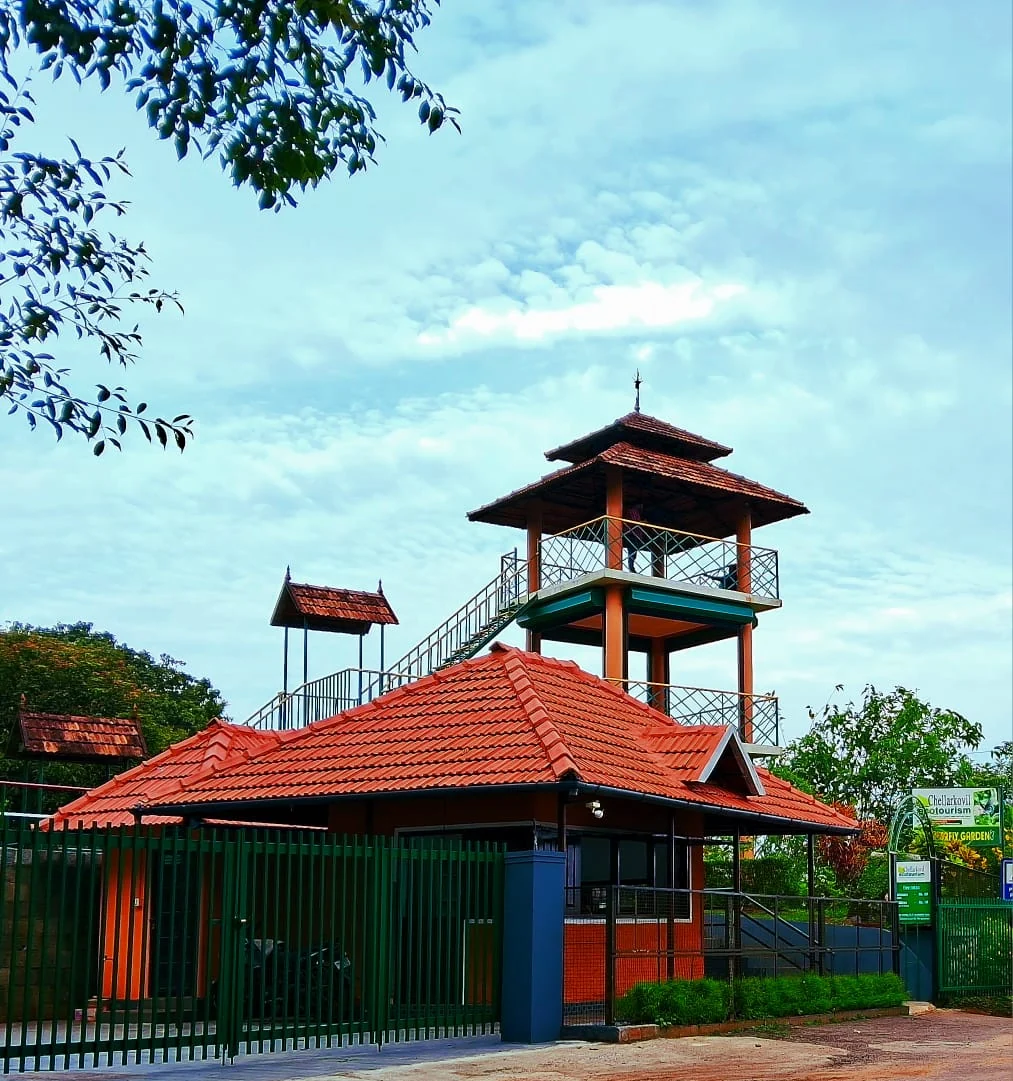
The Kerala Forest Department ecotourism centre at Chellarkovil, with a watchtower, botanical and butterfly gardens and views towards the Tamil Nadu plains. Private resort viewpoints and waterfall approaches are separate visits.

24.9 km · 29 min drive
viewpointAnchuruli

The Anchuruli reservoir-side landscape near Kattappana, where the Erattayar diversion tunnel discharges towards Idukki reservoir. Plan an exterior viewpoint visit; the water tunnel is working infrastructure.

30.6 km · 40 min drive
viewpointPandikuzhi

Thekkady-side valley and stream landscape on the Kerala-Tamil Nadu edge.

32.5 km · 40 min drive
wildlifeMathikettan Shola National Park

Mathikettan Shola protects a remnant of native Cardamom Hills forest in Idukki. Visits are arranged through the Forest Department, with distinct Pethotty and Choondal approaches; a reservoir viewpoint is not a park-entry permit.

38.0 km · 54 min drive
damAnayirankal Dam

Anayirankal is a KSEB earth-and-rockfill dam and reservoir in the Panniyar hydel system near Chinnakanal and Santhanpara. The map identifies the published hydel visitor-centre marker; boating is not currently assured.

40.7 km · 55 min drive
viewpointKalvari Mount

Reservoir-view hill point near Idukki and Cheruthoni, useful for scenic drives, photos and central high-range itineraries.

34.2 km · 43 min drive
trekMangaladevi Temple trek

Seasonal forest trek from Thekkady to the ancient hilltop Mangaladevi Kannaki Temple near the Kerala-Tamil Nadu border, opened by the forest department mainly around Chithra Pournami.

42.6 km · 57 min drive
wildlifeThekkady / Periyar

The Thekkady visitor gateway to Periyar Tiger Reserve, with Kumily as the road, bus and stay base; plan the Anavachal arrival, lake outing or guided forest programme as distinct stages.

52.6 km · 53 min drive

All 4 places to visit in Ramakkalmedu →

Walking and driving times are real routed distances, except the few marked “straight line”, which are direct-line estimates and will read short. Fare figures are estimates from Kerala’s notified auto/taxi tariff and exclude waiting and night charges. Routing: © openrouteservice.org by HeiGIT | Map data © OpenStreetMap contributors

On the map

Where Kuravan Kurathi statue is

Good to know

Kuravan Kurathi statue — frequently asked

Is the Kuravan and Kurathi statue really a twin statue?

No. There are three figures, not two — Kuravan, Kurathi, and a child standing between Kurathi's knees. DTPC Idukki, which runs the site, calls it “the twin statues of the Kuruvan and Kuruvatti couple”, and almost every travel page repeats that. Kerala Tourism's own newsletter gets it right: “two huge statues of a ‘kuravan’ and a ‘kurathi’ and their child”. Photographs of the group from four different angles all show the child clearly. Look at the left-hand figure's lap.

Who made the Kuravan and Kurathi statue and when?

The sculptor is C. B. Jinan, and the year usually given is 2005. The sculptor is well corroborated: Malayalam Wikipedia captions its photograph of the group “ജിനന്റെ ശില്പം”, Jinan's sculpture, and a Wikimedia Commons photographer describes his own frame as “A sculpture by Jinan @ Ramakkalmedu”. The year 2005 comes only through commercial travel pages; no Kerala government source we could find publishes it, and none publishes a height either. “40 ft” circulates widely and is not officially sourced.

What do Kuravan and Kurathi have to do with the Idukki dam?

They are the names of the two granite hills the dam is built between — Kuravanmala and Kurathimala — thirty kilometres west of the statue in a straight line and forty-four by road. The Periyar runs through the gorge between them, and the Malayalam word for that narrow gap, ഇടുക്ക്, gives Idukki district its name. Kerala Tourism quotes DTPC Idukki's Secretary on the man who pointed the gorge out: Chemban Kolumban, an Oorali headman, “was the one who showed the hills of Kuravan and Kurathi”. He died in 1970 aged 112, six years before the dam was commissioned.

Why does the map say the Kuravan and Kurathi statue is in Tamil Nadu?

Because OpenStreetMap's state boundary runs 84 metres west of the plinth, so a reverse geocode returns Uthamapalayam, Theni, Tamil Nadu. The same is true of the Ramakkalmedu viewpoint, the hornbill tower and Ramakkal itself. Kerala Tourism, DTPC Idukki and Wikidata all file the statue in Idukki, Kerala, and that is correct for every practical purpose. The oddity worth knowing is that the very boundary that excludes the statue is also the edge of a Kerala gram panchayat ward — admin level 10, ward 5 of Karunapuram — whose name is Ramakkalmedu.

When is the best time to visit Kuravan Kurathi statue?

September to May, and not the monsoon; the Malayalam Wikipedia article on Ramakkalmedu recommends exactly that window, excluding the heavy rains, and the reason is visibility rather than comfort. The whole point of the mound the statue stands on is that the Tamil Nadu plain is laid out below it, and in the south-west monsoon the cloud comes over the ridge and sits on it. Late afternoon is the light: the group faces east over the plains, so the sun is behind you in the evening and full on the faces. The towns below light up after dusk, and Kerala Tourism singles that out — “the view is striking at dusk when all these towns in Tamil Nadu are lit up” — but note that the gate shuts at 18:00, which in this latitude is close to sunset for much of the year and before it for the rest. If dusk over the plains is what you came for, the neighbouring Aamappara centre is open until 19:00 and this one is not.

What are the entry fee and timings at Kuravan Kurathi statue?

Entry: ₹25 adults, ₹15 children, ₹15 senior citizens; published by DTPC Idukki on its own destination page. Two further rates are printed there and are rarely quoted anywhere else: ₹300 for video and ₹1,200 for an album. There is no published still-camera charge and no published parking charge. Carry cash — there is no online ticketing for any DTPC centre on this ridge. Timings: 08:30 to 18:00, every day, published by DTPC Idukki. Note what that excludes: this gate opens two hours after the neighbouring Aamappara centre and shuts an hour before it. The dusk view over the lit Tamil Nadu towns that Kerala Tourism recommends happens after this counter has closed. The rupee figure quoted is the Indian adult rate. Government monuments, museums and forest reserves in India often charge foreign visitors more, and we have not verified whether this site does.

How do I reach Kuravan Kurathi statue?

Come to the Ramakkalmedu Tourism Centre gate. DTPC Idukki runs the compound the statue stands in and publishes its hours as 08:30 to 18:00, every day, with adults at ₹25, children at ₹15 and senior citizens at ₹15. There are two further published rates that most visitors never see quoted: ₹300 for video and ₹1,200 for an album. The unit in charge is reachable on +91 99479 91444, and the DTPC counter number for this ridge is 04868 243356. The last stretch is the Thookkupalam–Ramakkalmedu road, an asphalted two-lane MDR that runs 300 m below the statue, and then a paved footpath. OSM maps the path immediately beside the plinth with a paving-stone surface, and there is a surfaced parking area 185 m off. This is one of the very few high-range viewpoints in Idukki where you walk to the thing on made ground. From Nedumkandam it is 13.8 km by road as we measure it; DTPC publishes “about 12.4 km” to the bus stand. From Thookkupalam it is 6.9 km, from Kattappana 23.1 km, from Puliyanmala 20.7 km — DTPC describes the centre as “17 km from Puliyanmala” by the Thekkady route — and from Kumily 49.4 km. Munnar is 60.3 km and takes over an hour. If you are coming for sunrise, this is not the gate. DTPC opens Ramakkalmedu at 08:30. Its Aamappara centre, 5.8 km away by the road the jeeps use, opens at 06:00 and closes at 19:00, so the ridge’s early light and its last hour both belong to the neighbouring site rather than to this one. Row 11 of this guide covers that centre in full. Pair it with the dam it is about, if you have the day. The Idukki arch dam is 44.3 km and about 51 minutes by road, and the Kolumban memorial at Vellappara — the man who showed the gorge to the engineers — is beside it. That drive turns a photo stop into the actual story. Carry cash. This is a hill counter with printed rates, not an online booking system, and there is no published portal for tickets to any DTPC centre on this ridge.

How much time do I need for Kuravan Kurathi statue?

Forty minutes to an hour and a half; the walk from the gate is short and level. The statue itself takes ten minutes to look at and twenty to walk around properly, which is the part most people skip — the scaled texture and the bird under Kuravan’s hand are not visible from the single spot everybody photographs from. Add the viewpoint 137 m away, the Hornbill tower, the canteen and the time it takes to work out which of the towns below is which, and an hour is comfortable. Half a day covers this and Aamai Para together, 1.5 km apart in a straight line but 5.8 km by road, and that is the sensible way to plan the ridge. A full day gets you the statue in the morning and the Idukki arch dam it commemorates in the afternoon, 44 km west.

What else is near Kuravan Kurathi statue?

Nearby you can pair Ramakkalmedu viewpoint (140 m), Ramakkalmedu (2.9 km), Aamai Para (5.8 km), Chathurangapara Viewpoint (25.4 km).

What should I know before visiting Kuravan Kurathi statue?

There is a steel guard rail around the plinth now and it is there for a reason. Older photographs show visitors standing on the feet and leaning against the ankles; the current arrangement is to look rather than to climb. Do not lift a child over the rail for a photograph. The statue stands on an open, exposed mound on the windiest ridge in Kerala. Government measurements from a mast on this ridge record an annual mean of 8.41 m/s and a June monthly mean of 13.04 m/s — that second figure is 47 km/h of steady wind, on a bare grass hill with nothing to hold. Hats, phone cases, spectacles and loose bags all go over the edge from here. The mound is short-cropped grass over compacted red earth, and it is slick after rain. The made footpath is paved; the last few metres of the mound around the plinth are not, and that is where people slip. The gate shuts at 18:00 and the road down is a two-lane hill road with no lighting. If you have driven up for the evening light, be moving before the counter closes rather than after it. Mist. In the cold months cloud comes over the ridge and can reduce the view to nothing in minutes, and the same cloud is on the descending road. This is not a place to be improvising a night drive. The compound includes a camel ride and a children’s playground with a posted upper age of 16. Neither is run by us and neither is covered by anything on this page; satisfy yourself about them on the ground. You are 84 m from the Tamil Nadu border. Mobile phones on this mound hop between two states’ networks, which can mean roaming charges and can mean a data connection that comes and goes. Do not depend on live navigation to get back down. There is no published accessible toilet at this centre and the toilet block OSM records is 285 m from the statue. Plan for that distance rather than discovering it. The bird under Kuravan’s hand and the child against Kurathi are at height and the group is floodlit after dark, but the gate is shut before dark. Nobody should be on the mound at night. If you are visiting on a windy day with a small child, hold on to them on the mound rather than at the rail. The drop the wind matters for is the escarpment beyond the compound, not the plinth.

Read before you go

Kuravan Kurathi statue guides, stories & itineraries

Stories & history of Kuravan Kurathi statue

Written about Kuravan Kurathi statue itself — its history, its legends and the arguments about them.

Around Ramakkalmedu

These guides explore Ramakkalmedu and the surrounding area. Choose a visit that fits your interests, allowing separately for travel between stops.

Kerala-wide guides & itineraries

Route-level itineraries and practical guides for the rest of Kerala.

See all 152 Idukki guides & stories →

Image credits

Photographs: JVN5871 (CC BY-SA 4.0), Balachand (CC BY-SA 3.0), Arshad.ka5 (CC BY-SA 4.0), Tonynirappathu (CC BY-SA 3.0), Vimal Joseph (CC BY-SA 2.0), Jaseem Hamza (CC BY 3.0), Edukeralam, Navaneeth Krishnan S (CC BY-SA 3.0), rojypala (CC BY 2.0), \prinz\ (CC BY-SA 4.0), Mprabaharan (Public domain), Sajith Erattupetta (CC BY 4.0), Hatesens (CC BY-SA 4.0), Athulvis (CC BY-SA 4.0), This Photo was taken by Timothy A. Gonsalves. Feel free to use my photos, but please mention me as the author. I would much appreciate if you send me an email [email protected] or write on my talk page, for my information. Please contact me before commercial use. Please do not upload an edited image here without consulting me. I would like to make corrections only at my own source to ensure that the changes improve the image and are preserved.Otherwise you may upload an edited image with a new name. Please use one of the templates derivative or extract. (CC BY-SA 4.0), കാക്കര (CC BY-SA 3.0), Drbijith (CC BY-SA 4.0), Karthikwiki93 (CC BY-SA 4.0), KSEB (CC BY-SA 2.5 in), Aml jhn (CC BY-SA 3.0), Hoshosh (CC BY-SA 3.0), Jayeshj at Malayalam Wikipedia (CC BY-SA 3.0), George Abraham Maniyambra (CC BY-SA 4.0), തങ്കച്ചൻ നെല്ലിക്കുന്നേൽ (CC BY-SA 4.0), Vijayanrajapuram (CC BY-SA 4.0), Vaikoovery (CC BY 3.0), Mullookkaaran (CC BY-SA 3.0), Vijayakumarblathur (CC BY-SA 3.0), Vishnu Rema Jayaram (CC BY-SA 4.0), Ravanan Kannur (CC BY-SA 3.0). Wikimedia Commons.