Hosdurg Fort

Hosdurg Fort is the surviving fortification on a low hill at Hosdurg in Kanhangad, Kasaragod district. Also known as Kanhangad Fort or Puthiya Kotta, it preserves a compact group of laterite walls, a prominent bastion and a broad ramp within the modern town. The visit is best approached as a close look at the remaining structure and its urban setting. It is separate from the larger Bekal Fort and from the nearby Nithyananda Ashram, whose caves belong to a different part of the locality’s story.

Hosdurg Fort, Hosdurg, Kanhangad
Practical guide

Plan Hosdurg Fort

Who's going?Tailor Hosdurg Fort to your trip
Typeheritage
AreaHosdurg, Kanhangad
DistrictKasaragod
Best timeChoose daylight and a dry-weather spell…
Time neededAllow approximately 30–60 minutes to…
EntryFree
Places to visit4Listed businesses6
The story

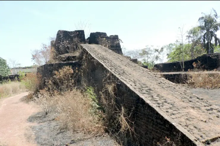
Hosdurg’s surviving fort is a study in mass and approach. A broad ramp leads towards a raised bastion, while the curved walls hold their shape above the lower ground. Around them, Kanhangad continues its everyday life. The fort’s interest lies in that meeting of old defensive construction and the modern town.

The story of Hosdurg Fort

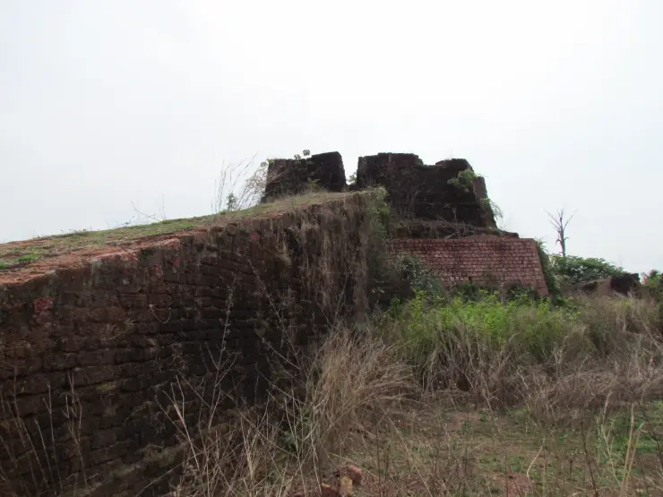
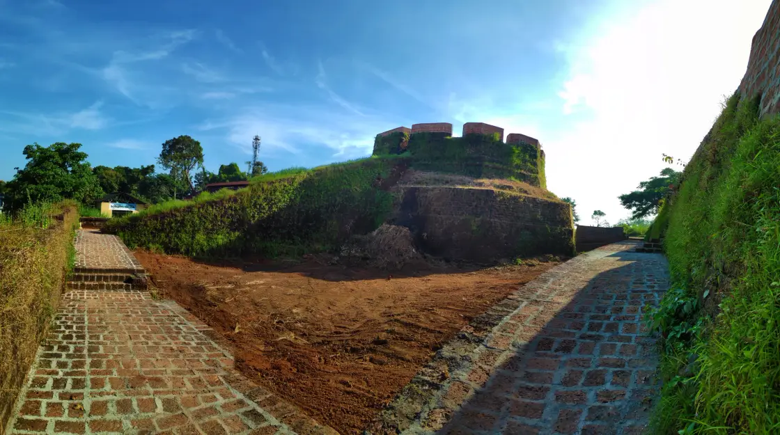
The most distinctive view begins below the bastion. Its lower mass spreads out before the upper wall rises above it, giving the structure a stepped profile. Red-toned blocks along the top contrast with darker, vegetation-covered surfaces below. The form is easier to understand when the whole rise is visible than from a close view of one wall alone.

The ramp supplies a different geometry. It runs towards the raised structure in a straight, broad line, connecting lower ground with the upper level. In older photographs, individual stones and weathered edges are exposed; in greener views, grass partly conceals them. These changes affect the visitor’s view and footing without changing the ramp’s role in the overall composition.

Hosdurg belongs to the fort-building history associated with the Ikkeri or Keladi Nayakas. Kasaragod district administration names Somashekara Nayak as its builder, while Kerala Tourism places the fort within the period of Nayaka expansion into northern Kerala. The surviving structure gives that regional history a physical presence in Kanhangad.

The name offers another entry into the story. Kerala Tourism translates Hosdurg as new fort, and the government’s monument lists use Puthiya Kotta. A visitor can encounter both names on the way here. They refer to the same historic site rather than two forts that need to be added separately to an itinerary.

The fort is now part of a town setting. Buildings and roads appear close to the surviving walls, and a sign beside one approach directs people to the Hosdurg crematorium. This proximity calls for a different visiting manner from a large enclosed monument park. Photography and stopping places must leave local activity undisturbed.

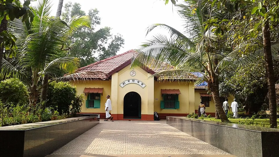
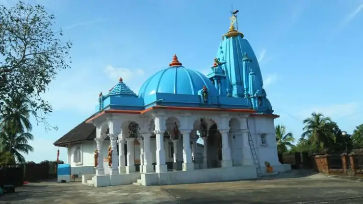
The nearby religious institutions add layers to the locality without becoming interchangeable with the fort. Kerala Tourism identifies the Poonkavanam Karpooreswara Temple to the southwest and associates it with the Nayakas. Nithyananda Ashram belongs to a separate spiritual history. Its presence should not cause the fort’s masonry to be described as an ashram building or every cave to be presented as a military tunnel.

A comparison with Bekal can be useful if it stays specific. The region contains several Nayaka-associated forts, and Kerala Tourism notes similarities in bastions and elevated observation structures. Hosdurg, however, is experienced through a smaller surviving group within Kanhangad. Bekal has its own sea-edge setting and visitor circuit.

Look at the joints and surfaces as well as the outline. Some blocks are plainly visible, while others are hidden by moss or vegetation. Light can reveal the curve of a wall or flatten it into a dark shape. Moving to a different safe position on the established approach can explain more than climbing onto an uncertain edge.

The value of a short Hosdurg visit is therefore concentrated. One can understand a ramp, a bastion, a name and a surviving piece of regional history in relation to the town around it. There is no need to invent a complete palace interior or a long tunnel route to make those remains worth attention.

The regional names in Hosdurg’s history describe a dynasty operating across a wider area than modern Kerala. Ikkeri, Keladi and Bednur appear in accounts of the Nayakas and their centres of rule. Kerala Tourism places the fort’s construction after the region’s earlier control by Kolathiri chiefs and associates the expansion with Sivappa and Somasekhara Nayaka. Reading the names together is more useful than treating each spelling as evidence for a different builder of the same bastion.

The fort’s low hillock also deserves attention. It gives the surviving structure an elevated position within the town, while the rounded bastion concentrates the visual mass at the edge. The ramp connects that upper level with the approach below. From a safe position at the base, one can read how height and projection work together without needing to climb onto the outer wall to appreciate the site’s former defensive character.

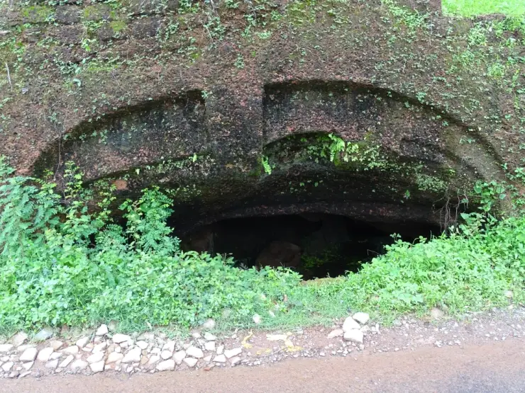
Kerala Tourism’s architectural account identifies wall walkways and caves cut into lateritic formations below the southwestern bastion. These are descriptions of features in the fort’s historical landscape. The caves associated with nearby Nithyananda Ashram have their own institutional identity and devotional use. A visitor interested in both should arrange two distinct stops, using the authorised approach to each rather than looking for a continuous underground route between them.

The town setting is visible in photographs made from different sides. A broad view from below includes modern buildings beyond the masonry, while a closer image concentrates on stone courses, grass and the top of the bastion. Together they explain why Hosdurg can be both a historical monument and a familiar local landmark. Leave room for residents and people using the neighbouring facilities, particularly where an approach road serves more than the fort.

The railway photograph in the gallery belongs to that present-day town context. It shows Kanhangad’s platforms and tracks, the rail gateway from which a separate road transfer reaches the fort. It does not depict a station inside the historical enclosure. For a short stop between trains, establish the return pickup and the actual departure before beginning the visit; the fort’s compact surviving form makes a focused inspection possible, but the station connection still needs its own time.

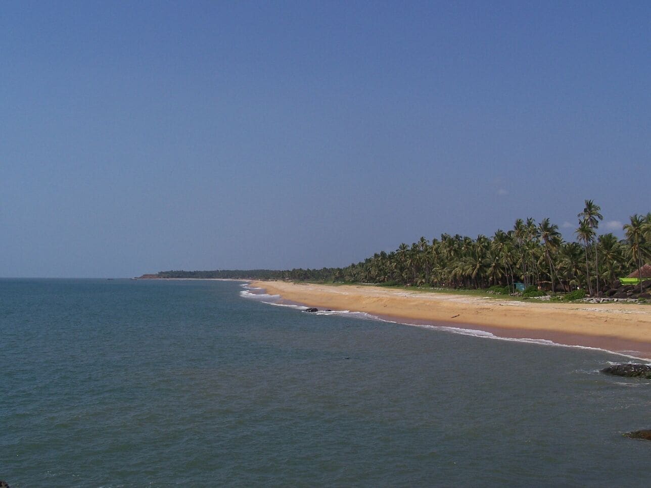
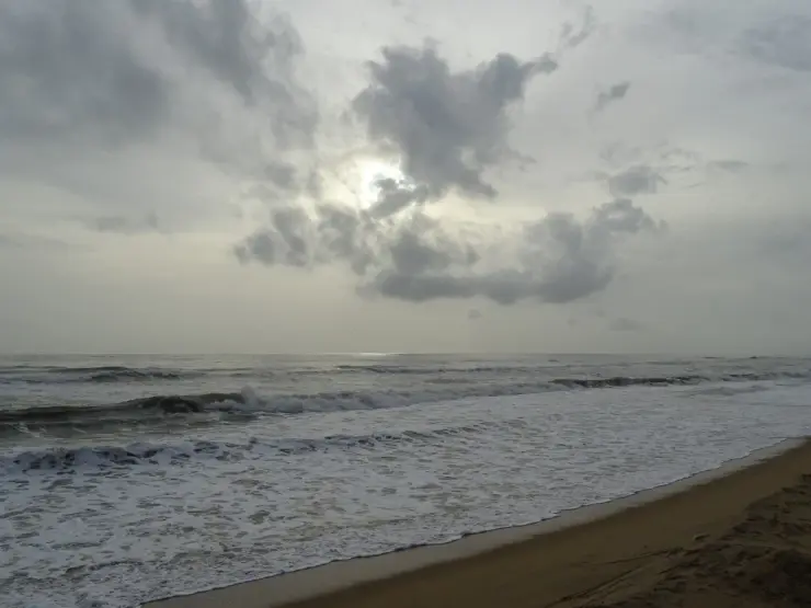
A visit to Hosdurg can be paired with its coastal counterpart in Kanhangad without repeating the same experience. At the fort, the main subjects are the rise of the ramp, the curve of the bastion and the relationship of old masonry to the modern town. At the beach, the subjects are the open shore and fishing activity. Travel between their named approaches by road, and let each place retain its own geography rather than assuming that the fort’s historical coastal role puts its gate directly on the sand.

For someone who prefers to remain on lower ground, the frontal view is especially informative. The spreading base, upper red-toned blocks and changing vegetation can be seen together. A companion exploring farther along an open path should agree to return to that same landward meeting point. The interest of the fort lies in understanding the surviving structure, so a visit does not have to depend on gaining the highest available position.

Puthiya Kotta also appears in the Department of Archaeology's monument list reproduced in Kerala's Economic Review. The entry names Hosdurg in Kasaragod, connecting the local place-name to the state's record of protected heritage. This is a different kind of recognition from a tourism description of an impressive bastion. It treats the surviving fabric as historical evidence whose value continues even where a building is incomplete or a visitor route is modest.

That perspective changes how weathered masonry is viewed. An irregular edge can preserve the shape of an earlier wall; a joint can show how separate blocks meet; a change of level can clarify the relationship between the ramp and the raised structure. These details are easier to study from a stable position than while trying to balance on the wall itself. Leave loose stones and vegetation management to the responsible authority, rather than tidying a small area to make a photograph look more complete.

The Revenue Department's Hosdurg village account places the fort beside the town's administrative life. It identifies the village headquarters around Puthiyakotta and notes nearby government offices and a school. The old fort name therefore remains part of an everyday civic address, not only a label on a historical attraction. This makes the approach more intelligible: roads serving local offices and residents also bring a visitor towards the monument, and those uses continue during sightseeing.

A useful way to finish the visit is to hold the two scales together. From farther back, the rounded mass makes a recognisable landmark within Kanhangad. From the admitted approach, individual blocks and the broad ramp explain how that mass is constructed. The town beyond it shows the continued use of the locality, while the protected remains preserve an earlier layer. Hosdurg does not need a reconstructed court scene or an invented tunnel adventure to make that relationship visible; its surviving form and present setting already provide the substance of the visit.
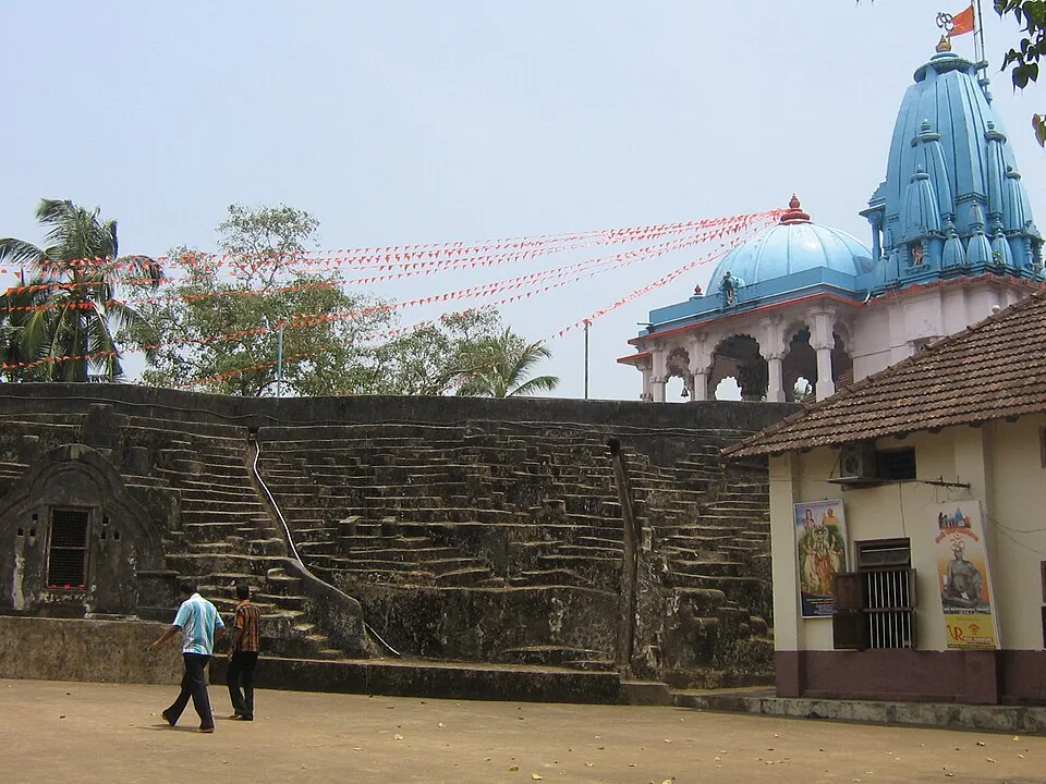
Read the full history of Hosdurg Fort 175 more words

History

Kasaragod district administration attributes the fort to Somashekara Nayak of the Ikkeri dynasty. Kerala Tourism similarly places it among the forts associated with the Nayakas in northern Kerala.

The state tourism account connects its construction with the period when the Bednur Nayakas extended control into territory previously associated with the Kolathiri chieftains. The page follows that regional context without assigning an unsupported exact construction year.

Hosdurg is also called Kanhangad Fort. Puthiya Kotta is the name used in Kerala’s official protected-monument listings, linking the surviving site to the locality’s new-fort name.

The neighbouring Karpooreswara Temple is identified by Kerala Tourism as another Nayaka-associated structure. Nithyananda Ashram is a separate later institution whose caves should be understood through the ashram’s own history.

Why visit

Read a rounded bastion and broad ramp at a compact historic site in Kanhangad.

Connect the name Hosdurg with the surviving fort that helps explain it.

See how a historic fortification remains embedded in a modern town.

Add a focused heritage stop to a Kanhangad visit while keeping the nearby temple and ashram distinct.

What to expect

Highlights

  • The rounded bastion rises in substantial tiers, with battlement-like projections along its upper edge. Begin with the view from lower ground to understand its form.
  • The broad ramp provides a strong visual line towards the raised structure. Compare its exposed stonework with the curved mass of the bastion without assuming every upper surface is open for walking.
  • The fort survives among present-day roads, buildings and community uses. Its relationship with the town is as revealing as the surviving walls.
  • The names Hosdurg and Puthiya Kotta both point to the idea of a new fort, helping explain the overlapping names used for the place.
  • The nearby Karpooreswara Temple and Nithyananda Ashram offer separate cultural stops, each requiring its own approach and respectful visit.
Getting there

How to visit

  • Ask for Hosdurg Fort or Puthiya Kotta in Kanhangad. Include the fort in the destination, since Hosdurg also names the wider administrative locality.
  • Arrive at the established street-side approach and first look at the structure from lower ground. This gives a useful view even if the upper ramp is unsuitable for your group.
  • Follow the open approach indicated on site. Do not use an overgrown section or a wall edge simply because it appears in an older photograph.
  • Spend time comparing the ramp, curved bastion and adjoining wall fragments. Notice how vegetation and repairs affect which masonry surfaces are visible.
  • Keep clear of the neighbouring crematorium approach and other community access. The modern uses around the fort are not empty space for visitor parking or photography.
  • If adding the ashram or temple, travel to the institution’s own entrance and follow its rules. Return to Kanhangad for the meal and onward bus or rail connection.

Distance by road

  • Mangaluru53 km
  • Kozhikode181 km
  • Mysuru226 km
  • Coimbatore356 km
  • Kochi358 km

Road km to Kasaragod; ghat roads and traffic vary — allow extra.

Timing

Best time

Choose daylight and a dry-weather spell that allows the approach and stone surfaces to be assessed clearly. Morning or later afternoon can give more comfortable light on the exposed masonry. After rain, moss, grass and wet stone may make an inclined surface unsuitable even when the fort can still be viewed from below.

Weather in Hosdurg FortSeasonal guide

Live forecast loads in your browser.

Today at Hosdurg Fort
Sunrise6:19 am
Sunset6:13 pm
Golden hour best light5:13 pm–6:13 pm
Blue hour after sunset6:13 pm–6:38 pm
Sun sets toward compass bearingW · 262°
Moon tonight🌒 Waxing crescent · 7%

Sun and moon are calculated for this location and shown in IST. Photography windows are the hour around sunrise and sunset; the sunset bearing is degrees clockwise from true north. Moon phase is accurate to about half a day.

Visitor notes

  • Puthiya Kotta is the name used in Kerala’s protected-monument listings for Hosdurg. The fort should be treated as historic fabric, including loose or weathered parts that appear less substantial.
  • The ashram’s cave complex is not a promise of unrestricted tunnels through the fort. Keep the two visits distinct.
  • The present setting includes active local buildings and a crematorium direction sign visible beside the approach. Give residents and those using community facilities priority.
Safety

Good to know

  • Stay on the open, established approach and keep away from unguarded wall edges or crumbling masonry.
  • Do not pull at plants growing from the walls or remove loose stones; both actions can damage the historic fabric or dislodge material.
  • Avoid the ramp if it is wet, heavily overgrown or closed. A lower-ground view is a valid visit.
  • Do not enter openings, caves or enclosed spaces unless the responsible institution explicitly admits visitors there.
Stay · eat · do · rent · see · shop

Stays, food & things to do near Hosdurg Fort

Browse listed stays, food, activities, sights, shops and rentals around Hosdurg Fort. Check each listing’s locality and contact the business directly for current arrangements.

2 things to do near Hosdurg Fort

Bus station · Kanhangad
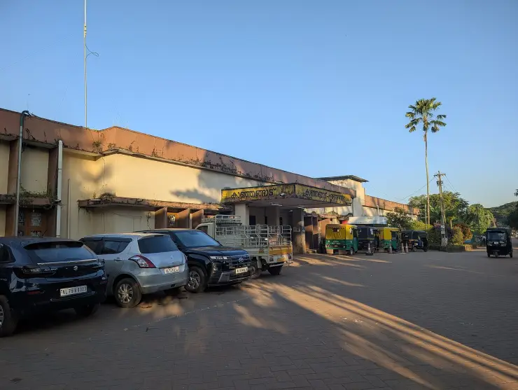
KSRTC Kanhangad Depot

Kanhangad's own state bus depot, run by an Assistant Transport Officer. Office of the Assistant Transport Officer, KSRTC Kanhangad, Kasaragod, Kerala 671531.

Directions Commission-freeView details
Railway station · Kanhangad
Kanhangad Railway Station (KZE)

Station code KZE, on the Shoranur-Mangalore line, opened in 1910 and the usual railhead for Bekal. Railway Station Road, Kanhangad, Kasaragod, Kerala.

Directions Commission-freeView details

Book with the place itself. India’s cyber-crime coordination centre warned in April 2025 that convincing copies of hotel and pilgrimage booking sites are being pushed through sponsored search and social ads, taking payment for rooms the property never hears about. Use the contact and source details on each profile to confirm the exact business and booking channel. A directory entry or map pin alone does not establish an operator’s identity or current availability. Roampedia takes no commission and does not collect booking payments. If a booking page reached you through an ad, check the address bar against the property’s own site before you pay. Fraud can be reported on cybercrime.gov.in or on 1930.

Options

More ways to explore Kanhangad

The fort stands within the Hosdurg part of Kanhangad. Nithyananda Ashram and Karpooreswara Temple are separate neighbouring institutions.

Across the whole of Kanhangad

Nearby guides

Top experiences around Hosdurg Fort

4 separate places to consider after Hosdurg Fort. Open each guide before deciding: their access, hours and return arrangements are independent.

heritageNithyanandashram

The hillside cave complex at Hosdurg where Bhagawan Nityananda cut meditation chambers by hand out of a single mass of laterite — 43 by the ashram’s own account — with the Nithyananda Temple built above them in 1963. Mobile phones are prohibited in the caves.

beachKanhangad beach

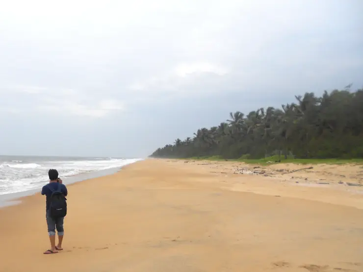
Kanhangad Beach is the Hosdurg coastal frontage of Kanhangad in Kasaragod district, with a broad sandy shore and an established fish-landing setting. It is a beach visit from Kanhangad town, distinct from Hosdurg Fort, the town’s ashrams and the separately named beaches at Ajanur, Ozhinhavalappu and Thaikadappuram. Use the named beach approach rather than a generic Kanhangad map result. The shore’s working character is central to the visit: leave boats, nets and landing passages clear while enjoying the sea-facing sand.

heritageAnandashram

A tranquil spiritual retreat at Kanhangad founded in 1931 by Swami Ramdas (Papa) and Mother Krishnabai, set in quiet wooded grounds; open to visitors of every faith under its motto of “universal love and service”.

heritageNileshwar

The cultural capital of Kasaragod — a Theyyam and folk-arts town on the Nileshwaram backwaters, with kovilakams, kavus and a lively ritual-arts season.

Roampedia is commission-free — own or know a stay, eatery, guide or shop near Hosdurg Fort? Submit public business details for review.

Add a nearby business
Before you go

Hosdurg Fort — at a glance

Entry: DTPC Kasaragod lists no entry fee.

Parking: No dedicated public parking capacity is established in the destination guidance. Use a lawful street-side or locally directed space that leaves residential, institutional and crematorium access clear.

Getting here

How to reach Hosdurg Fort

  • ✈︎ By air Kannur International Airport is about 91 km away in DTPC Kasaragod’s destination guidance. Arrange the onward road journey to Kanhangad and the specific Hosdurg Fort approach.
  • 🚆︎ By train Kanhangad railway station is about 2.7 km away in DTPC’s visitor account. Complete the journey by local road transport to the fort approach.
  • 🚗︎ By road Travel to Kanhangad and specify Hosdurg Fort or Puthiya Kotta for the final local approach. Hosdurg is also an administrative locality, so the fort name matters when arranging the drop-off.
  • 🚌︎ By bus DTPC places Kanhangad bus stand about 1.9 km from the fort. Use a local road connection for the final stretch rather than assuming a through bus enters the monument area.
Getting back

Return to the agreed fort approach for pickup and continue into Kanhangad for bus, rail or a meal. Do not use the crematorium approach as a waiting area.

Do

Things to do

  • Observe the rounded bastion from lower ground.
  • Compare the ramp’s straight approach with the curved walls.
  • Photograph visible masonry and vegetation without stepping onto fragile edges.
  • Read the fort in relation to the modern Hosdurg locality.
  • Make a separate respectful visit to the nearby temple or ashram if their access arrangements suit the day.
Facilities

On site

  • Kanhangad is the town base for meals, onward transport and accommodation.
  • The fort visit concerns surviving outdoor structures; an on-site museum, food counter and public toilet provision are not established by the checked visitor descriptions.
  • Nearby religious institutions have their own facilities and rules; their presence does not make those facilities part of a public fort visit.
Getting around Hosdurg Fort
From the entrance
Fort junction off Nithyananda Asram Road
Step-free access
Expect inclined and potentially uneven stone surfaces around the surviving ramp. A verified step-free route to the upper structure is not available. Establish the exact lower-ground viewing position and vehicle approach before arranging a visit for someone with limited mobility.

Checked 7 September 2026 against source 1source 2. Conditions change and surfaces vary with weather — if step-free access is essential, confirm with the site before you travel.

Practical things near Hosdurg Fort
What the cash actually costs
  • For savings accounts covered by the RBI allowance, other-bank ATM transactions are free up to a monthly limit; after that, a transaction may cost up to ₹23 plus applicable taxes. This is not one of the RBI’s six metro centres, so the allowance here is the higher one: at least five free other-bank transactions (cash and noncash combined) a month.
  • Own-bank ATMs provide at least five free cash transactions a month and free noncash transactions. Basic Savings Bank Deposit Accounts follow separate rules. On a card issued abroad your own bank’s international withdrawal and exchange charges apply instead. If the machine offers to bill you in your home currency, choose rupees — the conversion rate on that offer is set by the machine, not by your bank.
  • Choose a well-lit ATM, preferably at a bank branch. Shield your PIN, avoid help from strangers and use your bank’s support number if a withdrawal fails or the machine retains your card.

Charge cap and free-transaction limits: Reserve Bank of India, ATM FAQ updated 4 July 2025; checked 4 October 2026.

These services are listed within about 1.2 km of Hosdurg Fort. Walking distances follow mapped routes; access and opening hours can change. Other services may be closer but are not included here.

Eat nearby

What to eat in Kanhangad

Keep the meal in Kanhangad’s town plan. Hosdurg Fort is a compact outdoor heritage stop rather than a dining compound, and neighbouring religious institutions should not be assumed to provide visitor meals.

Explore food in Kanhangad →
01

A Kanhangad town meal

A restaurant near the next bus, rail or accommodation stop avoids unnecessary returns through the fort approach.

02

Tea between town stops

Choose a shop on the agreed onward route, keeping institutional entrances and narrow local roads clear.

03

Dinner after a coastal outing

If combining the fort with Kanhangad’s beach, arrange the meal at an actual town restaurant or booked property rather than relying on the sand for dining.

Nearby

What’s near Hosdurg Fort

heritageNithyanandashram

The hillside cave complex at Hosdurg where Bhagawan Nityananda cut meditation chambers by hand out of a single mass of laterite — 43 by the ashram’s own account — with the Nithyananda Temple built above them in 1963. Mobile phones are prohibited in the caves.

beachKanhangad beach

Kanhangad Beach is the Hosdurg coastal frontage of Kanhangad in Kasaragod district, with a broad sandy shore and an established fish-landing setting. It is a beach visit from Kanhangad town, distinct from Hosdurg Fort, the town’s ashrams and the separately named beaches at Ajanur, Ozhinhavalappu and Thaikadappuram. Use the named beach approach rather than a generic Kanhangad map result. The shore’s working character is central to the visit: leave boats, nets and landing passages clear while enjoying the sea-facing sand.

heritageAnandashram

A tranquil spiritual retreat at Kanhangad founded in 1931 by Swami Ramdas (Papa) and Mother Krishnabai, set in quiet wooded grounds; open to visitors of every faith under its motto of “universal love and service”.

heritageNileshwar

The cultural capital of Kasaragod — a Theyyam and folk-arts town on the Nileshwaram backwaters, with kovilakams, kavus and a lively ritual-arts season.

beachBekal Beach

The beach stretch below Bekal Fort, with a landscaped park — famously the setting of the song “Uyire” from the film Bombay.

heritageBekal Fort

Kerala’s largest fort (~40 acres), a keyhole-shaped laterite bastion jutting into the Arabian Sea, built around 1650 by the Keladi Nayakas; its observation tower once mounted cannons.

backwaterValiyaparamba Backwaters

An inhabited coastal backwater landscape in southern Kasaragod, with fishing shores, coconut groves and island settlements. The map uses the Valiyaparamba village jetty as a shoreline orientation base.

heritageChandragiri Fort

A 17th-century hilltop fort above the Chandragiri river built by the Keladi Nayakas, with sweeping views of the river mouth and the Arabian Sea — good at sunset.

mosqueMalik Deenar Mosque

The Malik Ibn Dinar Juma Masjid in Thalankara, Kasaragod — by tradition among the oldest mosques in India, linked to the earliest arrival of Islam on the Malabar coast.

mosqueNellikunnu Mosque

The Nellikunnu Muhyaddin Juma Masjid, a Sunni Friday mosque and dargah near the Kasaragod town beach that houses the tomb of Saint Thangal Uppapa; a local pilgrimage centre whose annual Nercha draws large crowds.

templeMadhur Temple

The Madhur Sree Madanantheshwara-Siddhivinayaka temple on the Madhuvahini river — a Shiva temple better known for its beloved “Bodajja” Ganapathi and a Tipu Sultan sword-mark on its well.

hill stationRanipuram

A grassland-and-shola hill topping out at 1,049 m, the “Ooty of Kerala”, with easy treks and montane forest on the Western Ghats edge.

4 detailed place guides in Kanhangad →

Nearby toilets, pharmacies, ATMs, seating and vets are community-mapped and may be incomplete or out of date. Map data © OpenStreetMap contributors | Walking times © openrouteservice.org by HeiGIT

On the map

Where Hosdurg Fort is

Good to know

Hosdurg Fort — frequently asked

Are Hosdurg Fort, Kanhangad Fort and Puthiya Kotta the same place?

Yes. Hosdurg Fort is also called Kanhangad Fort, and Kerala’s protected-monument listings use Puthiya Kotta for the site.

Who built Hosdurg Fort?

Kasaragod district administration attributes it to Somashekara Nayak of the Ikkeri dynasty. Kerala Tourism places it within the region’s Nayaka fort-building history.

What does the name Hosdurg mean?

Kerala Tourism explains it as new fort. Puthiya Kotta expresses the same idea in Malayalam and is another name used for the monument.

Is Hosdurg Fort the same as Bekal Fort?

No. Hosdurg is in Kanhangad and has its own surviving ramp and bastion. Bekal is a separate, larger coastal fort farther north.

Does fort entry include the Nithyananda Ashram caves?

No combined admission arrangement is established. The ashram is a separate institution; use its own entrance and follow its visiting rules.

Is there an entry fee for Hosdurg Fort?

DTPC Kasaragod lists no entry fee. The page does not establish a separate published daily opening schedule, so plan a daylight visit and follow the access directions on site.

Which railway station should I use?

Kanhangad railway station is the local rail gateway. DTPC places it about 2.7 km from the fort; arrange the final road connection to the fort approach.

Can someone with limited mobility visit Hosdurg Fort?

The principal remains can be viewed from lower ground, but the exact drop-off and surface should be checked for the visitor’s needs. The upper ramp is inclined and may be uneven or slippery; a continuous wheelchair-accessible route is not verified.

Read before you go

Hosdurg Fort guides, stories & itineraries

Stories & history of Hosdurg Fort

Written about Hosdurg Fort itself — its history, its legends and the arguments about them.

Around Kanhangad

These reads cover nearby destinations, each with its own arrival point and visit arrangements.

Kerala-wide guides & itineraries

Route-level itineraries and practical guides for the rest of Kerala.

See all 29 Kasaragod guides & stories →