What to expect
Highlights
- Boat or canoe routes around R Block Kuttanad
- Village life, canals and lake/river scenery
- Good fit for homestays and local food stops
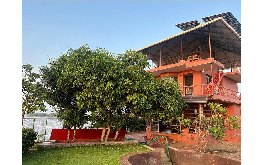
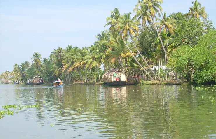
Iconic below-sea-level reclaimed farmland at Kainakary, ringed by bunds with the canal water sitting higher than the paddy fields.
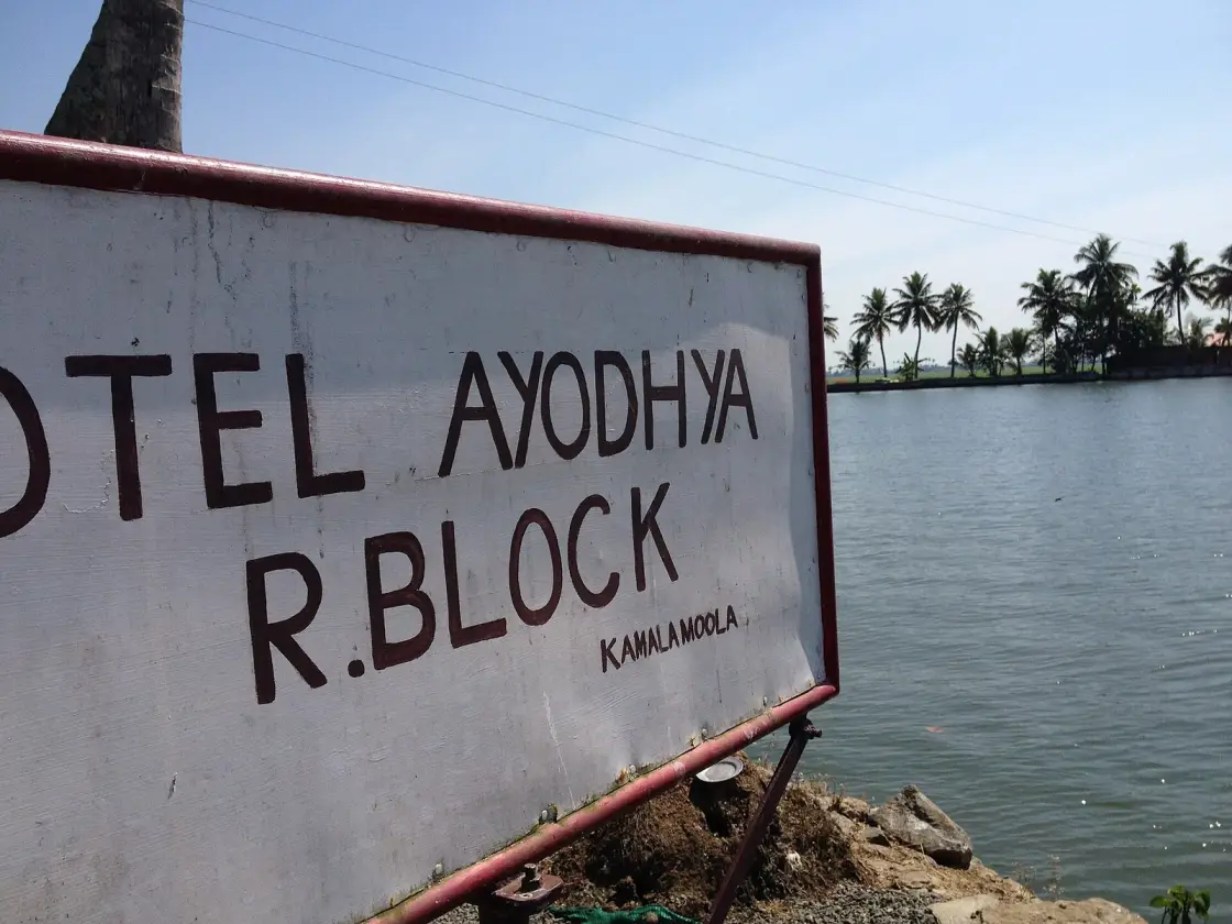
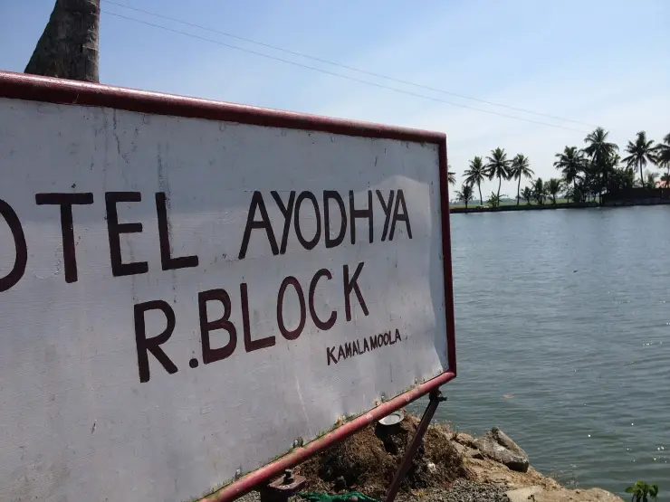
R Block is a letter on a survey map that eight families turned into ground. It is a kayal padasekharam — a polder reclaimed from the bed of Vembanad Lake, ringed by a continuous outer bund, lying permanently below the level of the water outside it and kept dry only by pumping. It is in Kainakari panchayat, in Kuttanad taluk, and it can be reached only by boat. Tourist boats stop at Kamalamoola on its western bund, where a hand-painted board for the Hotel Ayodhya reads R.BLOCK in letters a foot high. What almost nobody stopping there is told is that the four blocks sold as a single destination — Q, S, T and R — were made by two different families two decades apart, and that the state took all of them back.
Start with what a padasekharam actually is, because the word is doing a lot of work. The Kerala State Planning Board describes it as a single group consisting of an outer bund and a series of small canals that take water into the individual paddy fields, with the outer bund serving the function of flood protection. Water enters through a sluice gate in that bund and moves to the fields through distributing canals and field canals. Everything inside depends on the wall, and the wall is the machine.
The bunds were not always concrete. Traditionally they were clay dug from the canal beds and stabilised with bamboo and coconut trunks, and the planning board is blunt about how that went: there was a high risk of the bunds being breached, and these bunds were indeed breached frequently. From the 1950s the state moved to permanent bunds with a top width of three metres, and the modern form is the pile-and-slab bund — concrete piles driven into the lake bed with slabs spanning between them. The planning board's own photograph of completed pile-and-slab outer bunds is captioned Kainakari North, which is this parish.
Then the water has to be got out again. Dewatering is done, in the board's words, using the old petti and para mechanism or motor pumps, and the pumping station has its own name as a building type: the engine thara, or motor thara, essentially a platform built to carry the dewatering gear. The petti and para is a wooden scoop-wheel arrangement — the successor to the foot-driven chakram and the ancestor of everything with an engine in it.
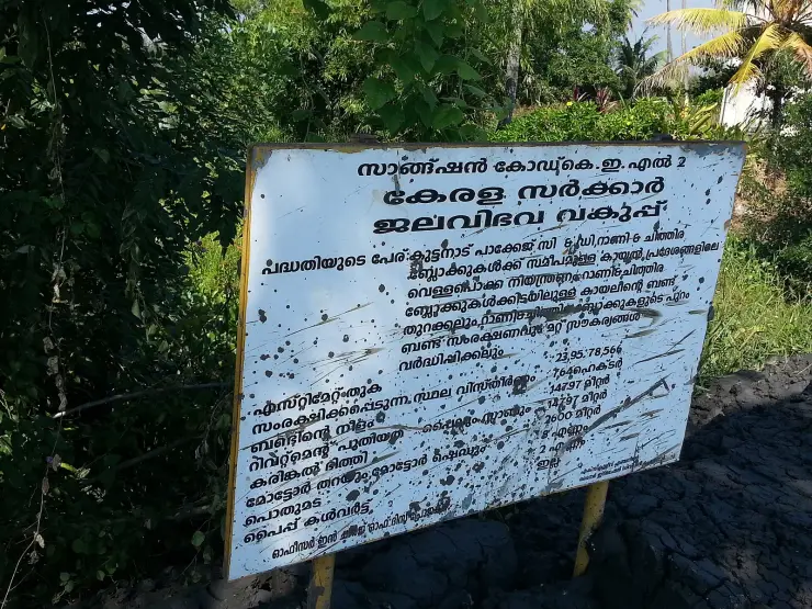
That sequence sounds like history until you read the project board standing at R Block itself. It carries the sanction code K.E.L. 2, it belongs to the Kerala Water Resources Department, and it covers flood-control work in the kayal areas near the Rani and Chithira blocks under the Kuttanad Package. Its line items are worth reading as a bill of materials: estimate ₹23,95,78,566; area protected 764 hectares; bund length 14,797 metres; new revetment 14,797 metres; granite wall 2,600 metres; motor platforms and sheds, 8 nos.; and — on a state contract in the 2010s — petti and para, 2 nos.
That 764 hectares is not a round number chosen for a signboard. The planning board records that from 2014, for the first time since 1992, paddy cultivation could be restarted in about 764 hectares of kayal land in the Rani and Chithira blocks, which produced 1,402.49 metric tonnes of puncha paddy in 2016–17. The board on the bund and the figure in the report are the same piece of work.
The failure mode here is worth knowing too, because it is not what you would guess. The only breach recorded in the pile-and-slab kayal bunds happened west of D Block, at Puthanarayiram, on 26 November 2016 during the vrischika veliyettam — about fifty metres of bund gone. The cause was traced to a kundarikuzhi: a pit some eighty metres deep dug in the field to trap fish while it was being dewatered, over which the bund had been built. The water did not beat the engineering. The engineering was built on top of something somebody had dug and not recorded.
One more thing about the machine, because it explains why the state keeps coming back to these bunds. A padasekharam is only as strong as its weakest metre of wall, and the bigger the block, the more metres there are to fail and the more owners have to agree before any of it is repaired. The planning board has recommended shrinking padasekharams from around 600 acres to about 250 for exactly that reason — smaller units are easier to maintain, easier to dewater and easier to get a decision out of. R Block, at some 1,400 acres, is more than twice the size the board now thinks is sensible. It was built at a moment when the constraint was capital, and it is maintained in one where the constraint is coordination.
As for who lives here — nobody lives on R Block, exactly, because it is a field. People live on the bunds and in the villages around them. Kainakari panchayat, with its two revenue villages of Kainakary North and South, had 23,696 people in 5,689 households at the 2011 Census, and its own description of itself is that vast paddy lands make up the major part of the village and these paddy lands are below sea water level. ⚠ There is no population figure for R Block itself and we do not print one.
There is no folklore attached to R Block, and the reason is unusually clear: the place is younger than most people's grandparents. It was made in about 1920 and 1921, out of open lake, by named men with a bank balance and a kerosene engine, on a lot number assigned by a colonial survey. Legends do not attach themselves to a survey lot within a century, and none has attached itself here.
That is a different kind of blank from the ones we usually report. At an old grove or tank, an absence of recorded lore almost always means our search has failed. Here the absence is structural: there was nothing at this coordinate to have a story about, because there was no ground. Everything R Block is, somebody built, and recently enough that the receipts survive.
🚫 We are also refusing a specific temptation. Twelve kilometres north-west, Pathiramanal has a fine legend about a sage raising an island out of Vembanad overnight — an origin story about land appearing where there had been only water, which is very nearly a description of what happened here. Floating that story onto R Block would be easy, and it would be a fabrication. It belongs to that island, it is told there, and it stays there.
What R Block has instead is anecdote — stories attached to named people in printed sources, which is a different category from myth and is labelled as such here rather than dressed up.
The first is the Ponnada Vaakkaal grant, which survives in the account of the consortium's partners and is the sort of detail that only exists because somebody wrote a name down. The second is the one everybody in Kuttanad tells about the reclaimers: that the local people told them plainly they were mad, that rice would not grow in a lake, and that they should stop. In the flattened version this is a story about visionaries and doubters, which is how it is usually retold. Read more carefully it is a story about risk, and the doubters had a case — the bunds of that era breached frequently, the rice price collapsed in the 1920s and reclamation stopped dead for two decades until wartime food policy revived it.
The third is the pond. Joseph Murickan, who made the neighbouring Q, S and T blocks from 1940, is said to have dug a ten-acre freshwater pond because the people working his fields had nothing but salt water to drink. It is a good story and a revealing one, and it points at the thing tourism finds hardest to say about this landscape: the fields were made by capital and worked by labour, and the labour did not own the water it drank any more than it owned the ground it stood on.
There is a fourth, and it is the one we find hardest to place. The tourist boats that stop at Kamalamoola tie up beside a hand-painted hotel sign, and the water they float on is Rani — Murickan's block, named for a queen of Travancore. The bund they photograph is R Block, made by other people, twenty years earlier. And the fields on both sides belong, since 1975, to one thousand five hundred and eighty farmers who were given them. Three claims on the same view, none of them wrong, and no single story that holds all three together. If R Block ever does acquire folklore, that is most likely where it will come from.
That is the honest shape of R Block's mythology. No gods, no sages, no origin legend. A survey letter, eight surnames, a monsoon that could take everything back, and an argument about who the land belonged to that was eventually settled by the state taking it. Those are not myths, and this page does not pretend they are.
The Madras government banned further kayal reclamation in 1903 and lifted the ban in 1913, having approved a scheme in 1912 that notified some 19,500 acres of Vembanad for reclamation in blocks, each named with a letter of the English alphabet. That is where the R comes from — a lot on a map. ⚠ Why that particular letter, and what if anything it stood for, is not recorded anywhere we can find, and we are not going to invent an explanation.
R Block belongs to the third of the new-reclamation periods that ran from about 1914 to 1920. Wikipedia's Kuttanad article, sourced to the FAO's GIAHS proposal, records that R Block Kayal covering 1,400 acres was reclaimed by the joint efforts of eight families led by Pallithanam Luca Matthai, then a member of the Sree Moolam Popular Assembly. His named partners were Vachaparampil Mathen, Pazhayaparmpil Chacko, Ettuparayil Xavier, Pattassery P. P. Mathai, Kaarikkuzhi Ponnada Vaakkaal Mathulla Mappila, Meledom, Paruthickal and Kandakudy. A secondary source dates the work to 1921, so we give it as about 1920–21.
⚠ Two figures need care. The reclaimed extent is given as 1,400 acres, while the block as mapped today encloses closer to 1,600 — those are not the same measurement, and the page says 1,400 acres reclaimed and notes the mapped extent is larger. And R Block is repeatedly credited to Joseph Murickan, the Kayal Rajavu. It was not his. Murickan made Q, S and T, from 1940 — two decades later — and the conflation is everywhere online because all four blocks are marketed as a single destination.
Reclamation stopped when the rice price collapsed in the 1920s and did not resume until the early 1940s, when the Grow More Food campaign and electric motors revived it and the last tracts were made. Murickan's blocks were named Chithira, Rani and Marthandam, after the Travancore royal house. ⚠ Their acreages are given as 900/652/600 in some sources and 716/674/568 in others; we print the disagreement rather than choose. He also built Chithira Church, described as the first Christian shrine in Kuttanad.
The land did not stay in private hands. There was an agitation in 1954, an acquisition in 1972, and in 1975 some 1,600 acres were distributed to 1,580 farmers. Whether the reclaimers should be remembered as builders or as landlords is a live argument in Kerala rather than a settled one — it broke out publicly in 2011 over a schoolbook — and this page reports it as an argument. In 2008 the Kuttanad Package brought state money back to the same bunds, which is what the K.E.L. 2 board on the bund records.
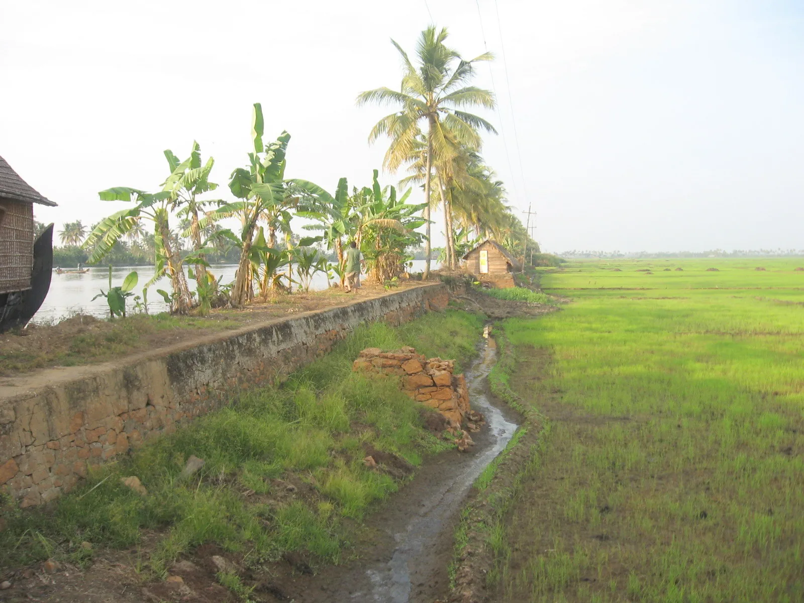
Because it is the clearest place in Kerala to see what a polder actually is: a wall, a pump, and a crop growing below the level of the water on the other side of the wall.
For the arithmetic nobody says out loud. The lake outside is permanently higher than the field inside, and the only thing between them is maintenance.
Because the boat is the only way in, and the approach across open kayal to a bund line on the horizon is the point of the trip.
For the K.E.L. 2 project board at the bund, which is a better history lesson than most museums manage — including a state contract in the 2010s ordering petti and para, 2 nos.
To see the distinction nobody else draws: Q, S and T are Murickan's, from 1940; R is Pallithanam Luca Matthai's eight-family consortium, from about 1920. Two families, two decades, one boat stop.
For the crop calendar. Green paddy runs roughly December to February, the polder stands bare around October, and it is under water from June to August — three completely different places at one coordinate.
Road km to Alappuzha; ghat roads and traffic vary — allow extra.
October to March is best for comfortable boat trips; monsoon is greener but weather can disrupt plans.
Live forecast loads in your browser.
Sun and moon are calculated for this location and shown in IST. Photography windows are the hour around sunrise and sunset; the sunset bearing is degrees clockwise from true north. Moon phase is accurate to about half a day.
Browse listed stays, food, activities, sights, shops and rentals around R Block Kuttanad. Check each listing’s locality and contact the business directly for current arrangements.
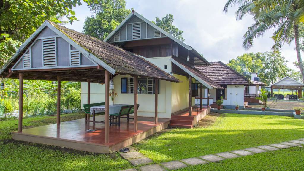
Kayaloram Homestay is in Karumady, Ambalappuzha, on the southern Kuttanad side of Alappuzha. Compare this location with a town stay before booking. Ask the host about the road approach, room arrangement and meals; the published record does not establish a private waterfront or included boat trip.
A Manapra homestay near Champakulam whose property description highlights rooms converted from an antique granary and verandas facing the Pamba River. Compare the exact room photographs before booking. Ask about the approach with luggage, steps, meals and whether your assigned room has the described river view.
A Punnakunnam homestay facing the Pamba River, with the Pulincunnoo church opposite in its property description. This is a village and river setting for a Kuttanad stay. Ask whether arrival is by road or boat, where luggage is unloaded and which meals are available.
A Kandankary homestay beside the Kuttanad waterways. Kerala Tourism lists boat arrangements on request; ask what is available for your dates.
A Nedumudy homestay for travellers planning time around Kuttanad’s river villages. Confirm the room, route and booking terms directly.
Sunny Days is a Champakulam homestay on the Pampa River side of Kuttanad. Kerala Tourism lists its Chakkalayil address and a Gold House approval valid to 23 April 2027, while the exterior photograph dates to 2018. Ask the host for the exact room, river view, road or boat arrival, meals, available activities, complete rate and cancellation terms.
Green Palace Health Resort is in Kanjippadom, in Alappuzha’s Kuttanad area. An older operator-submitted listing describes a waterside setting with abundant greenery and says televisions were deliberately omitted from the cottages to encourage guests to spend more time outdoors.
Riverbliss Holiday Home is described by the operator as a Pamba River waterfront stay in Thalavady, Kuttanadu. Its listing mentions homemade Kuttanadu-style cuisine and shikkara cruises along the Pamba–Manimala river route towards Vembanadu Lake.
GG Farm House Homestay is a two-room riverside stay at Onnamkara, Mankombu, in the Kuttanad region. The operator describes views of the river and surrounding paddy fields, with rooftop and riverside dining as part of the property's setting.
Book with the place itself. India’s cyber-crime coordination centre warned in April 2025 that convincing copies of hotel and pilgrimage booking sites are being pushed through sponsored search and social ads, taking payment for rooms the property never hears about. Use the contact and source details on each profile to confirm the exact business and booking channel. A directory entry or map pin alone does not establish an operator’s identity or current availability. Roampedia takes no commission and does not collect booking payments. If a booking page reached you through an ad, check the address bar against the property’s own site before you pay. Fraud can be reported on cybercrime.gov.in or on 1930.
Find food, accommodation and activities across Kuttanad. Browse the guides for places to eat, stay and explore along your route.
5 more places around Kuttanad. Open a guide to plan the visit and onward journey.
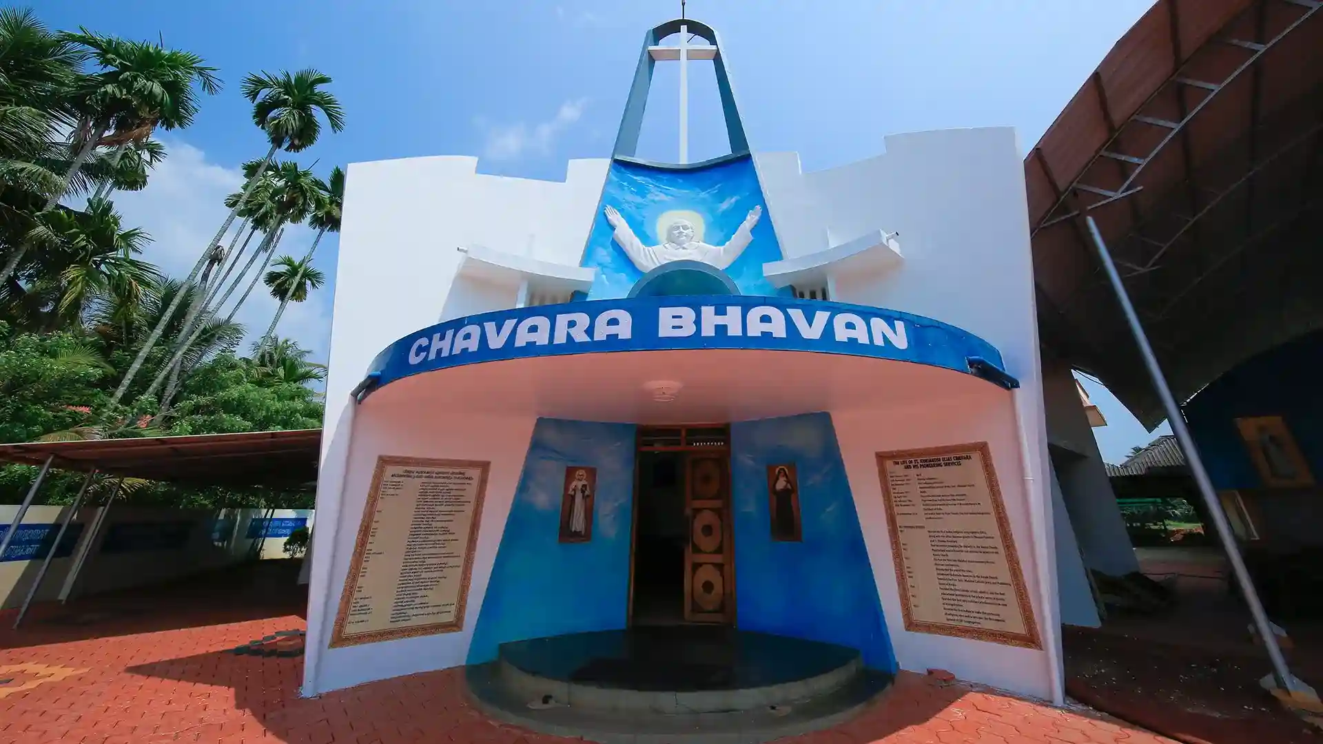
Chavara Bhavan in Kainakary preserves the birthplace and ancestral home of Saint Kuriakose Elias Chavara as a pilgrimage site and museum.
5.5 km · straight line
Low-lying paddy and canal region known as Kerala’s rice bowl.
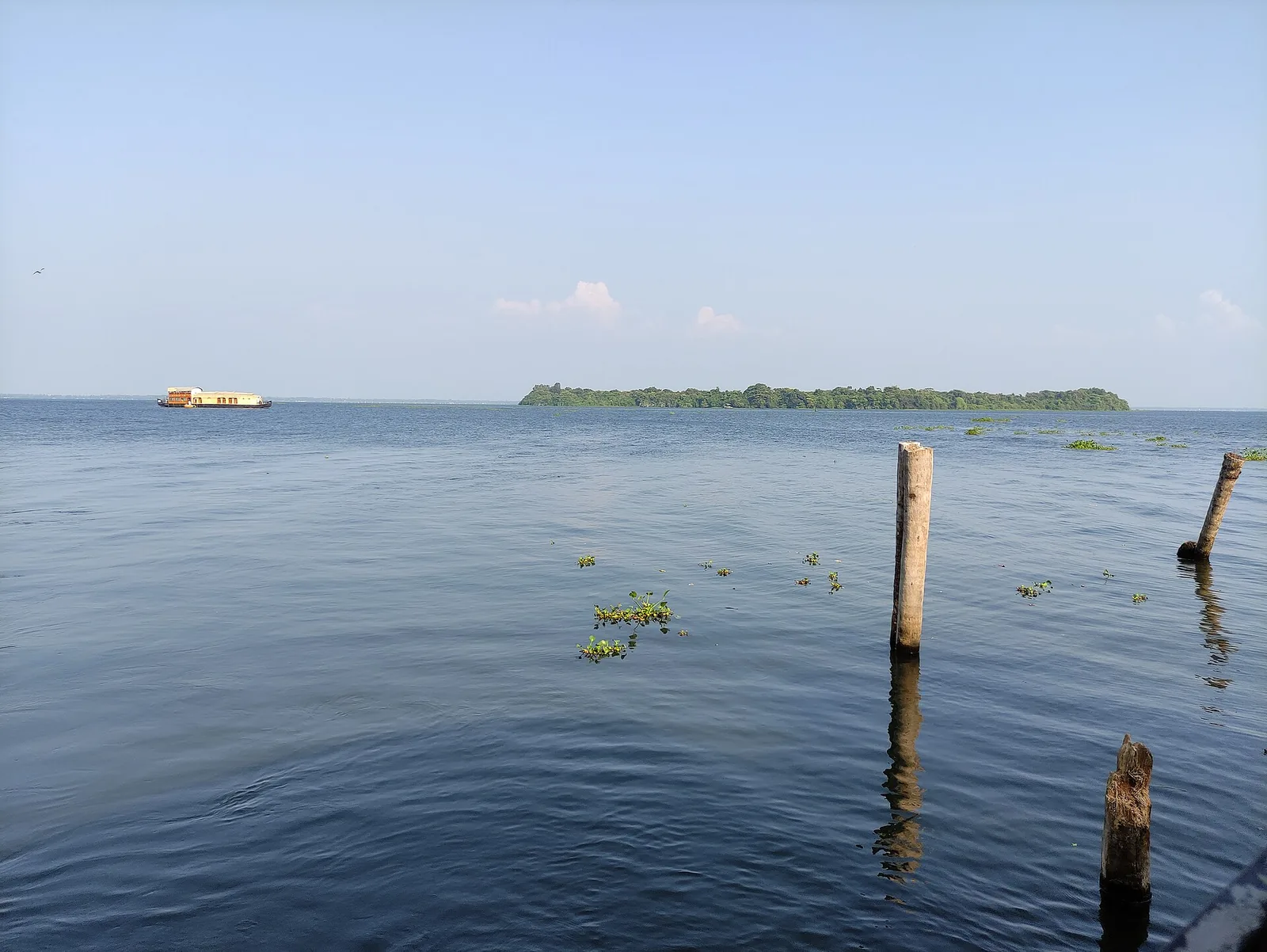
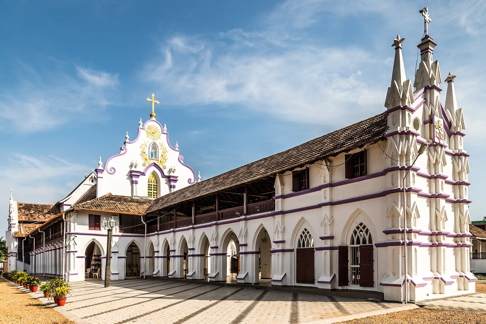
7.2 km · straight line
Kuttanad village on the Pamba known for the Champakulam Moolam snake-boat race and Kalloorkad St Mary’s Basilica.
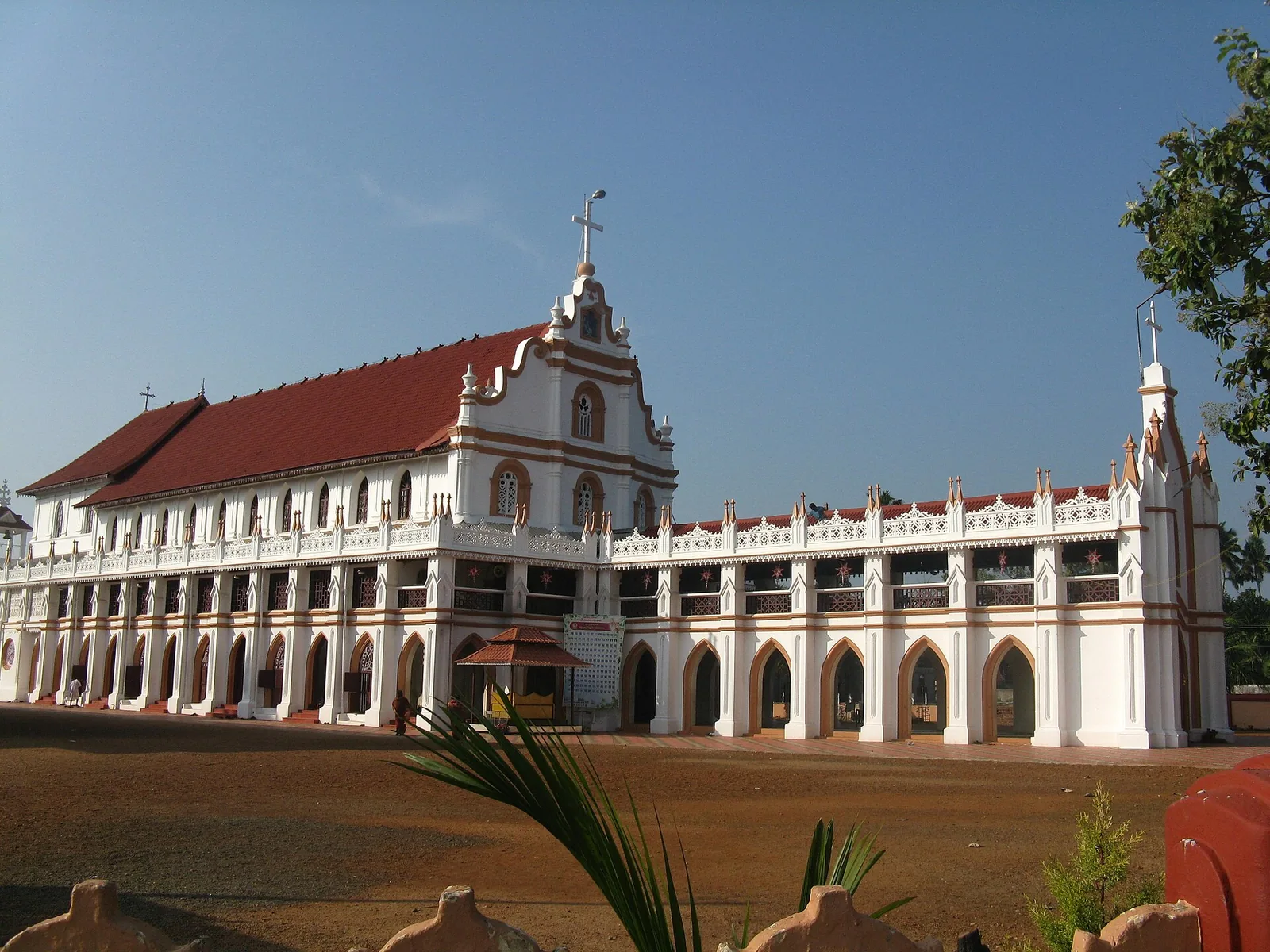
St George Forane Church at Edathua in Kuttanad, known for its large annual pilgrimage feast.
Roampedia is commission-free — own or know a stay, eatery, guide or shop near R Block Kuttanad? Submit public business details for review.
Add a nearby businessEntry: Nothing to pay. R Block is a padasekharam, not a ticketed site; the whole cost of a visit is the boat.
Dress code: Nothing formal. Bunds are narrow, uneven and often muddy, so wear shoes you do not mind ruining, and take sun cover — there is no shade on a polder.
Festivals: No festivals of its own. The wider Kuttanad calendar peaks with the Onam-season snake-boat races, and the Champakulam Moolam race is the district's oldest.
Photography: Wide, flat and hard-lit in the middle of the day; early morning and late afternoon are far better. ⚠ Please remember whose ground this is — the bunds are working infrastructure and people live and farm along them, so ask before photographing anyone or entering a field.
If you are travelling by bus or ferry, check the return service with the operator before setting out. Leave time to reach the stop or jetty after your visit.
Ask at the bus stand for the time of the last service back, not the next one. If you miss it, an auto or app cab is the fallback — agree the fare before you get in.
If you need step-free access, contact the site before travelling. Ask about a level entrance, steps along the route, the nearest drop-off point, seating and accessible toilets.
These services are listed within about 1.2 km of R Block Kuttanad. Walking distances follow mapped routes; access and opening hours can change. Other services may be closer but are not included here.
Published emergency and visitor-assistance contacts. For an immediate emergency, call 112. Shared Kerala contact sources checked 4 October 2026; publication does not establish a tested live response.
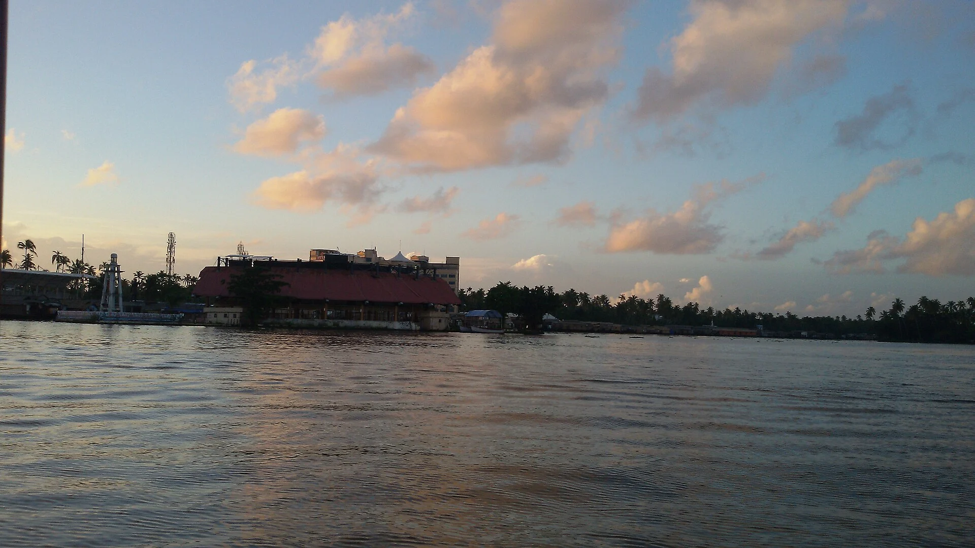
Finishing-point lake of the Nehru Trophy Boat Race and the main houseboat cruising water off Alappuzha.
5.0 km · straight line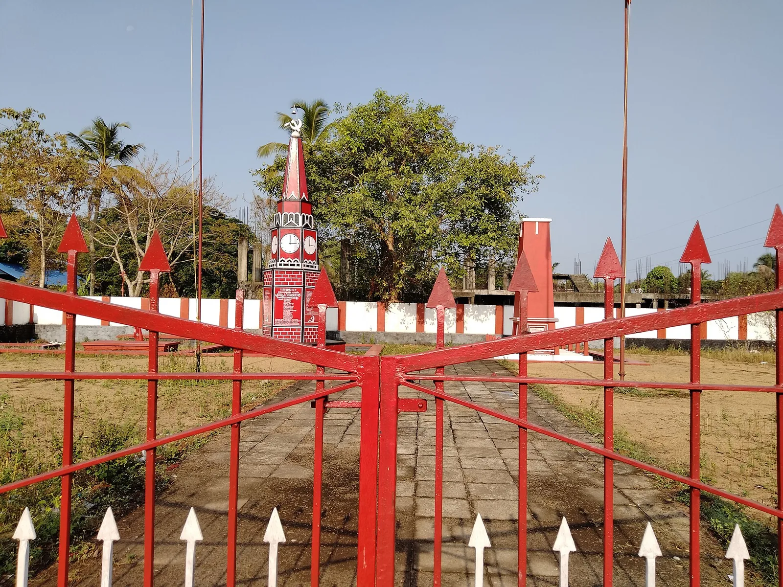
Martyrs’ memorial (Rakthasakshi Mandapam) to the 1946 Punnapra–Vayalar uprising, on the coastal belt north of Punnapra on the Alappuzha side.
5.1 km · straight lineLow-lying paddy and canal region known as Kerala’s rice bowl.
5.5 km · straight line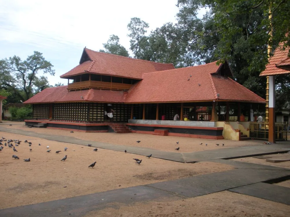
Central Alappuzha town temple (Mullakkal Rajarajeswari) famous for the annual Mullackal Chirappu festival.
5.6 km · straight line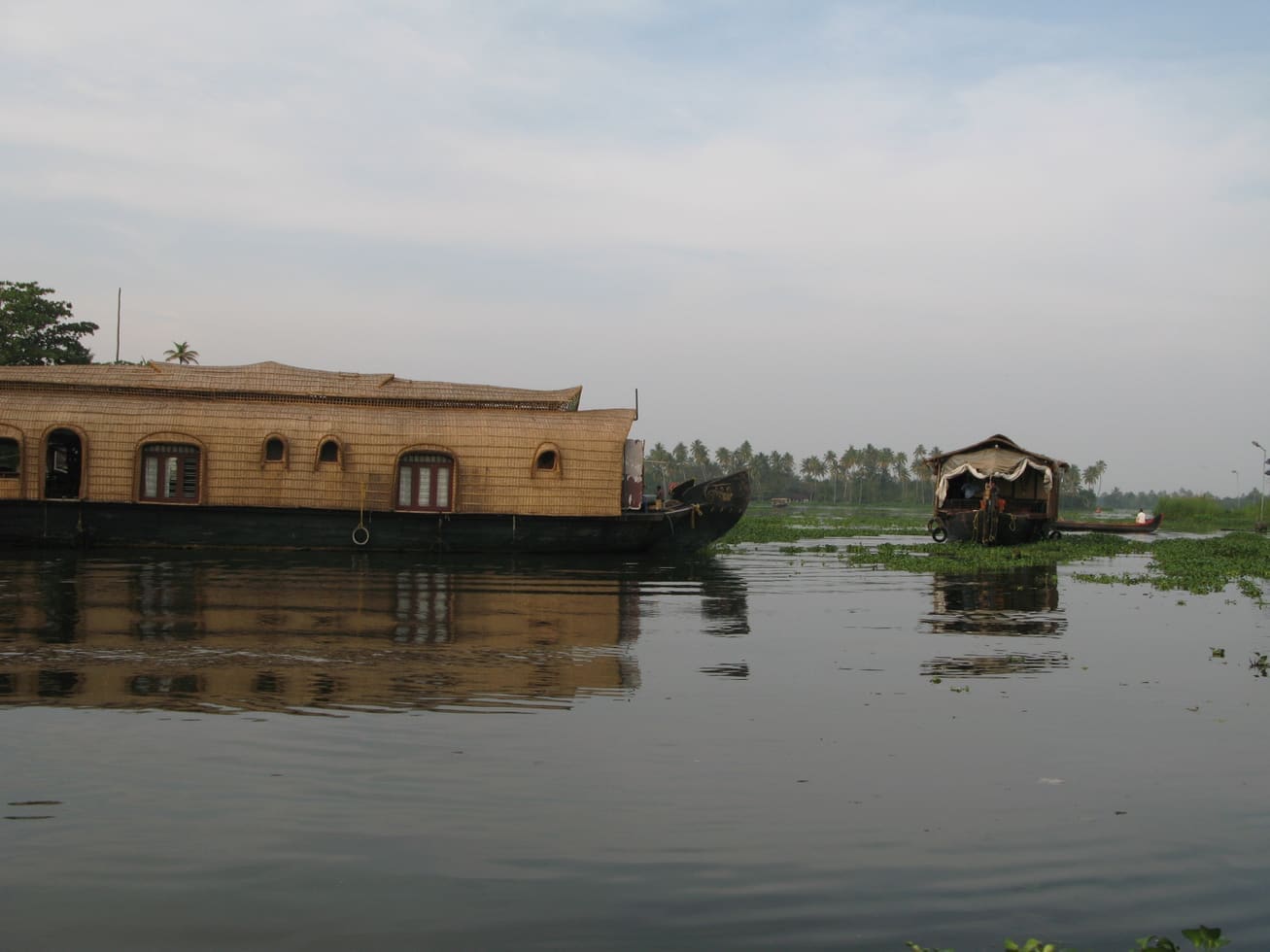
Backwater and houseboat hub with canals, beach, lighthouse and Finishing Point jetty.
6.0 km · straight line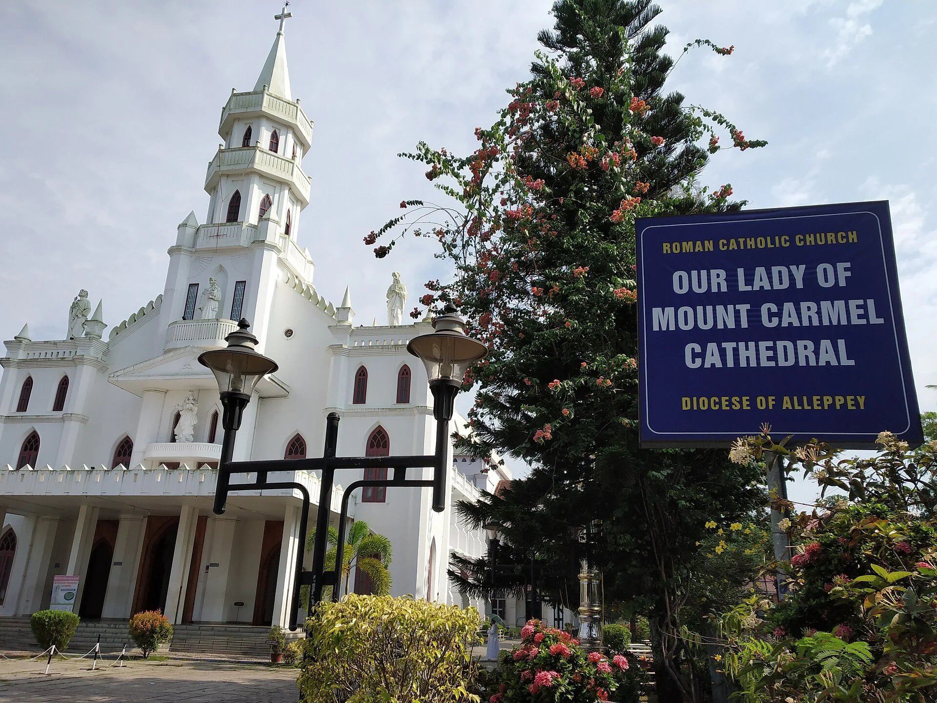
Landmark 19th-century cathedral of the Alappuzha diocese near the town centre.
6.8 km · straight line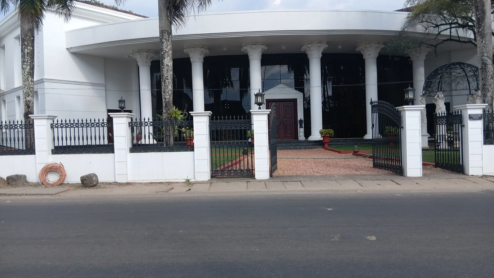
Private memorial museum in Thathampally with a large collection of paintings, ivory, crystal and antiques.
7.0 km · straight lineKuttanad village on the Pamba known for the Champakulam Moolam snake-boat race and Kalloorkad St Mary’s Basilica.
7.2 km · straight line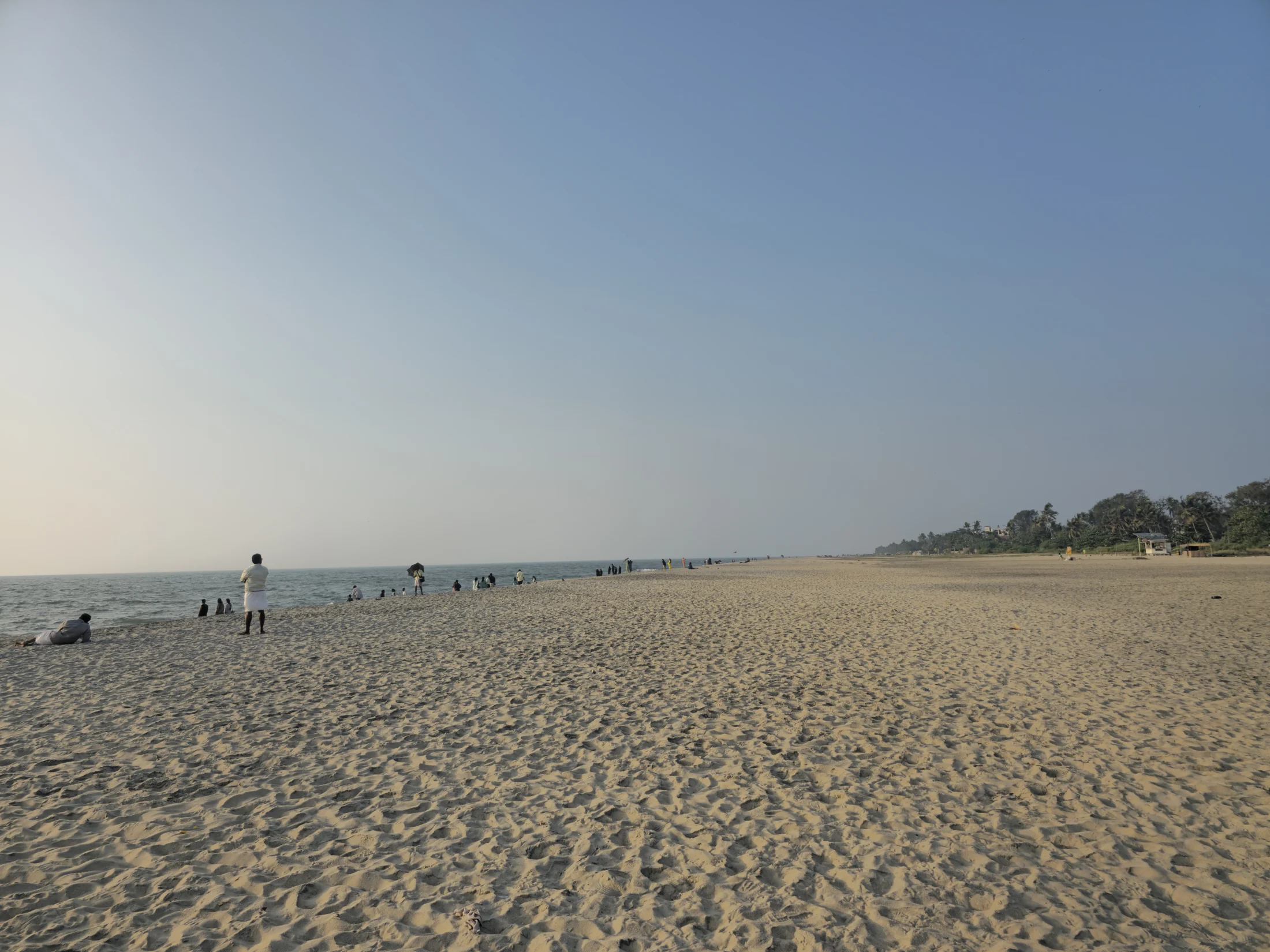
Pair Alappuzha’s broad town beach and old pier remains with the red-and-white lighthouse on C.C.S.B. Road, commissioned in 1862 and still maintained as a navigational light.
7.5 km · straight line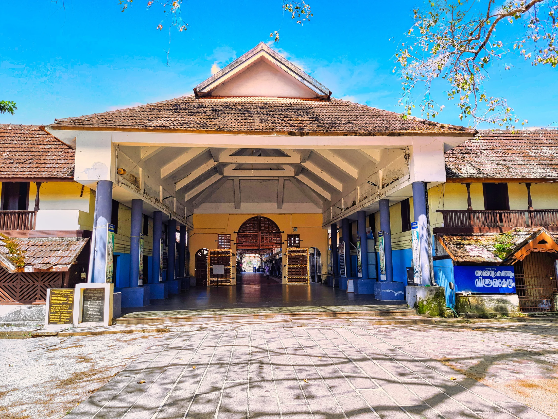
Ambalappuzha Sree Krishna Temple is an active temple in Ambalappuzha town, south of Alappuzha, administered by the Travancore Devaswom Board. Krishna is worshipped here as Parthasarathy, Arjuna’s charioteer. The temple combines a broad tank, tiled courtyards and painted ritual spaces with two enduring cultural associations: Palpayasam offered to the deity, and Kunchan Nambiar’s creation of Thullal. A visit works best when darshan, the permitted exterior spaces and any offering collection are planned around the temple’s morning or evening opening.
9.4 km · straight line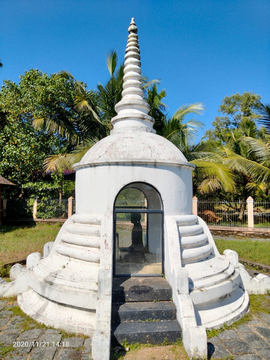
Ancient black-granite Buddha statue at Karumadi near Ambalappuzha, a relic of Kerala’s Buddhist past.
9.6 km · straight line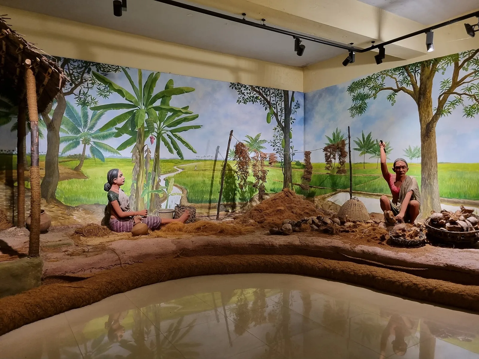
Museum on Kerala’s coir (coconut-fibre) heritage — the craft Alappuzha built its trade on.
12.3 km · straight lineNearby toilets, pharmacies, ATMs, seating and vets are community-mapped and may be incomplete or out of date. Map data © OpenStreetMap contributors | Walking times © openrouteservice.org by HeiGIT
An eight-family consortium led by Pallithanam Luca Matthai, a member of the Sree Moolam Popular Assembly, in about 1920–21, covering some 1,400 acres. ⚠ It is very widely credited to Joseph Murickan, the Kayal Rajavu — that is wrong. Murickan made the neighbouring Q, S and T blocks from 1940, two decades later.
Nothing that anyone has recorded. The 1912 scheme notified around 19,500 acres of Vembanad for reclamation in blocks each named with a letter of the English alphabet, so R is simply a lot number on a survey map. We have not found any source explaining the choice, and we have not invented one.
No, and this is worth stating because Kerala Tourism's own page for the Q/S/T/R kayal describes “Dutch dikes”. We can find no evidence that Dutch engineers were involved. The state planning board says only that the system has many similarities with the Dutch polder system — a comparison, not a history.
By boat only; there is no road to the polder. Tourist and houseboat routes out of Alappuzha stop at Kamalamoola on the western bund. There is no entry fee and no ticket — this is working farmland, not a site — so the cost of a visit is the cost of the boat.
No. Rani is one of the blocks Joseph Murickan reclaimed from 1940, alongside Chithira and Marthandam. R Block is a separate and earlier polder, made about two decades before, by a different group of people. They are adjacent, and they are routinely confused.
It depends what you want to see. Green standing paddy runs roughly December to February; the polder is bare and dewatered around October; and from June to August it is under water. The same coordinate looks like three different landscapes across one year.
October to March is best for comfortable boat trips; monsoon is greener but weather can disrupt plans.
Entry: Nothing to pay. R Block is a padasekharam, not a ticketed site; the whole cost of a visit is the boat. Timings: No gates and no opening hours — this is working farmland reached across open water. In practice you are limited to daylight and to your boatman's schedule, and there is nothing to see after dark.
Base yourself in Kuttanad or a nearby town in Alappuzha, then confirm the last-mile route locally before leaving. Plan boat timings first, then arrange road transfer around the departure point. If the visit depends on forest, temple, boat, ferry, weather or seasonal access, check the official/local rule on the day before travel.
2 hours to a full day; overnight if using a houseboat area.
Nearby you can pair Punnamada Lake (5.0 km, approximate straight-line separation), Punnapra Vayalar Memorial (5.1 km, approximate straight-line separation), Kuttanad (5.5 km, approximate straight-line separation), Mullakkal Temple (5.6 km, approximate straight-line separation).
Use operators with life jackets and clear weather judgement. Avoid overloaded boats.
Written about R Block Kuttanad itself — its history, its legends and the arguments about them.
These guides explore Kuttanad and the surrounding area. Choose a visit that fits your interests, allowing separately for travel between stops.


Route-level itineraries and practical guides for the rest of Kerala.
Photographs: Subhashish Panigrahi (CC BY-SA 3.0), Arunravi.signs (CC BY-SA 3.0), Sanu N (CC BY-SA 3.0). Wikimedia Commons.