Athirappilly Falls

Athirappilly Falls is geographically a Thrissur district waterfall, but many Kochi travellers search it as an Ernakulam/Kochi day trip. This page should therefore frame it honestly as a cross-district day trip from the Kochi side, not as an Ernakulam-local waterfall.

Athirappilly Falls, Thattekkad
Practical guide

Plan Athirappilly Falls

Who's going?Tailor Athirappilly Falls to your trip
Typewaterfall
Nearest baseThattekkad
Best timePost-monsoon and winter are best for flow and access balance
Time neededFull day from Kochi/Ernakulam
EntryAround ₹50 (Indian) / ₹200–250 (foreigner)
Nearest town/baseThattekkad
DistrictErnakulam
Place typewaterfall
Time neededFull day from Kochi/Ernakulam.

Athirappilly Falls is geographically a Thrissur district waterfall, but many Kochi travellers search it as an Ernakulam/Kochi day trip. This page should therefore frame it honestly as a cross-district day trip from the Kochi side, not as an Ernakulam-local waterfall.

For exact district planning, use the Thrissur Athirappilly guide; from Ernakulam, the key is choosing a reliable driver/operator, starting early and not underestimating weekend traffic or forest-road rules.

The story

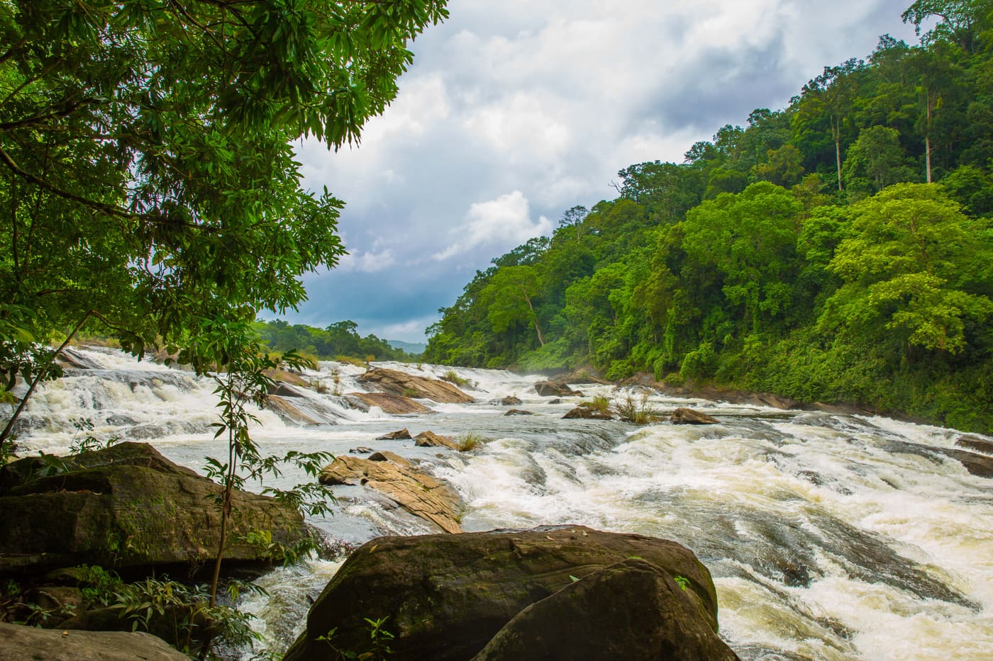
Kerala’s largest waterfall drops about 24 metres in a single broad curtain, and in a good monsoon it spreads to nearly a hundred metres wide — loud enough that you hear it from the car park before you see anything at all. Athirappilly is the state’s most photographed waterfall and the backdrop to a shelf of Indian films, but the thing that actually makes it rare is not the drop. It is the forest the river runs through: the last substantial stretch of low-elevation riverine rainforest in Kerala, and one of the very few places in the Western Ghats where all four of peninsular India’s hornbill species still live together.

The story of Athirappilly Falls

There are two Athirappillys and it is worth knowing which one you are visiting. From the upper viewpoint you look along the lip of the fall as the Chalakudy river gathers itself and goes over — wide, brown after rain, and astonishingly loud. Then there is the path down, a steep stepped descent of ten or fifteen minutes through wet rock and tree roots to the pool at the base, where you stand in the spray and look back up at the whole face. Most visitors do the top and leave. The walk down is the visit.

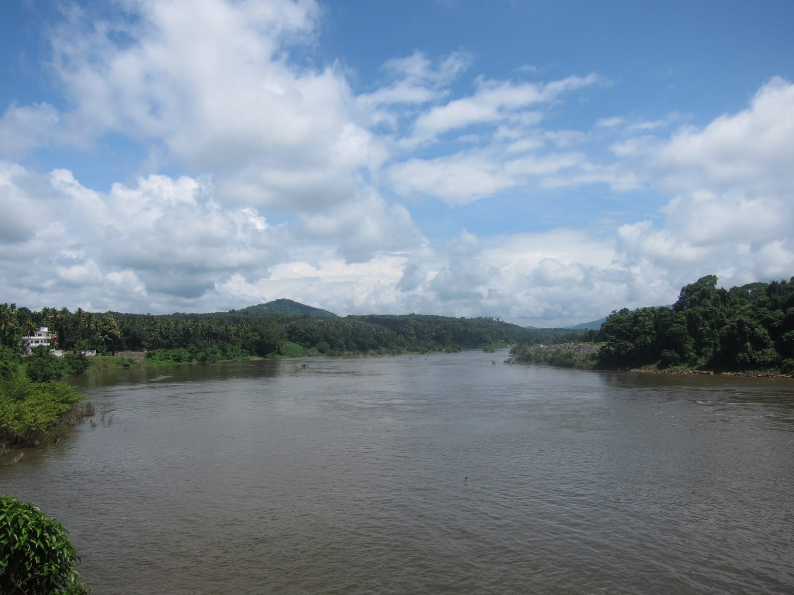
The river here is the Chalakudy, which runs about 145 kilometres from the high Western Ghats to the sea. Athirappilly sits low — around 180 metres above sea level — and that low elevation is the whole ecological point. Rainforest at this height has been almost entirely cleared across the Ghats for plantation and settlement, so the riverine forest along this stretch is a remnant rather than a sample.

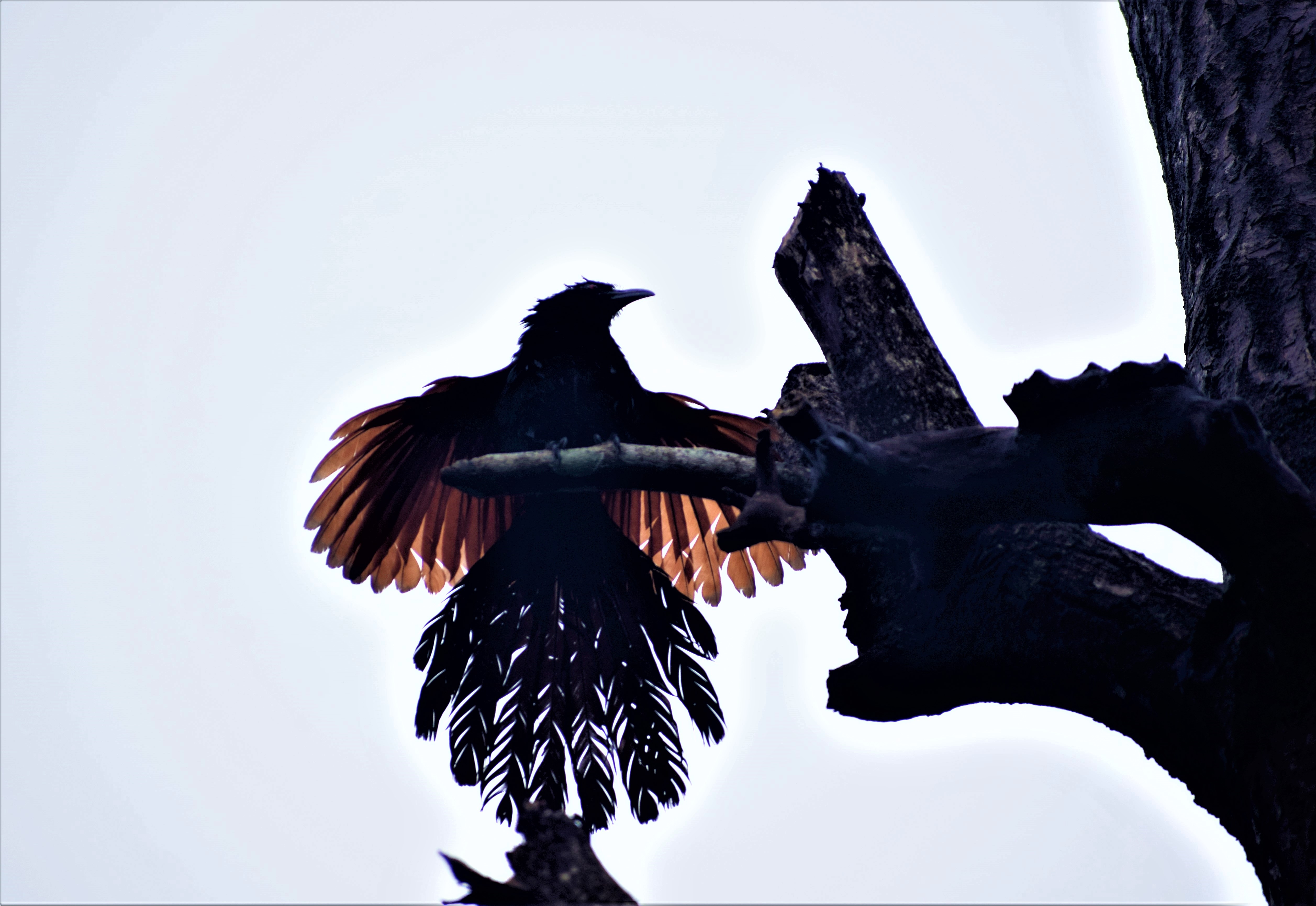
That remnant is why birdwatchers come. All four hornbill species of peninsular India — the Great Hornbill, the Malabar Pied, the Malabar Grey and the Indian Grey — are found in this belt, which is close to unique. Great Hornbills need big old trees with cavities large enough to seal a female inside for the nesting season, and big old trees at low elevation are exactly what the rest of the Ghats has lost.

The falls are also, frankly, a film set. Sequences from Baahubali were shot here, along with Punjabi House, Raavan/Raavanan, Guru and a long list of Malayalam and Tamil productions. If the place looks familiar before you have ever been, that is why. It also explains the crowds: this is not a secret, and on a holiday weekend in season the upper viewpoint is busy.

One practical note that catches people out: Athirappilly and Vazhachal, five kilometres upstream, are normally sold as a single ticket for the same day. Treat them as one visit rather than two, and do Vazhachal second — it is flatter, quieter, and the better place to actually look at the river.

The other thing that catches people out is the water itself. People drown here. The rocks above the fall are smooth, the current is stronger than it looks, and the level can rise fast when the catchment upstream gets rain that has not reached you yet. The barriers and the whistles are not decoration.

Legend & myth

The name is usually explained locally as coming from the Malayalam for the sound or the shape of the water on the rock, and you will hear several confident versions from several confident guides. We have not found a source that settles the etymology, so we are not going to pick the prettiest one.

You will also very often hear Athirappilly called “the Niagara of India”. It is a tour-brochure line rather than a fact, and it does the place no favours: Niagara is fifty times wider and carries an incomparably larger volume. Athirappilly is worth seeing for what it actually is — the biggest waterfall in Kerala, set in the state’s last low-elevation riverine rainforest — and that is a better reason to go than a borrowed comparison.

The modern legend is more of a problem than the old one. A great many visitors arrive expecting the waterfall from the Baahubali films — the colossal cliff the hero climbs, several hundred metres of it. Sequences for those films were shot in this landscape, and that part is true. The giant fall is not: it is a computer-generated construction, scaled far beyond anything on the Chalakudy river. People who come looking for it stand in front of one of the finest waterfalls in southern India and feel short-changed by a visual effect. Athirappilly's genuine film history is long enough without it — Punjabi House, Guru, Raavan and Raavanan and a shelf of Malayalam and Tamil productions have used this river.

A correction to our own wording, before the dangerous one. This page has described Athirappilly as dropping in a single broad curtain. That is how it photographs in full monsoon, when the volume is high enough to close the gaps, and it is not what the fall actually is. Athirappilly is a segmented waterfall — the standard descriptions give it four distinct drops — and outside the peak flow you can see the river separate on the rock into channels that fall at different rates onto different ledges. That is worth knowing before you arrive in February and wonder why it does not look like the postcard. It has not shrunk. You are seeing its structure, which the monsoon hides.

The published measurements are a small mess and it is better to say so than to pick one. The figure repeated almost everywhere is about 24 to 25 metres, or 80 to 82 feet, and that is the number to travel with. But the same widely-copied data block that gives a 25-metre total also lists a longest single drop of 51 metres, which cannot both be true, and puts the site's elevation at 120 metres above sea level where other sources say closer to 180. We flag this rather than quietly choosing, because a waterfall that has been photographed a hundred million times still does not have an agreed set of dimensions, and that is a more useful thing to know about tourist data than any one of the numbers.

The third misconception is the most dangerous and the most local: that the falls are safe in the dry season because the water is low. They are not. The rock above the lip is smooth and polished, the current runs faster than it looks from the bank, and the level can rise sharply when rain falls in the catchment upstream, out of sight of anyone standing here. People have died at this fall. The barriers and the whistles are the least interesting true thing on this page and the one most worth obeying.

Read the full history of Athirappilly Falls 648 more words

History

The Chalakudy river already carries six dams along its course. The defining modern story of Athirappilly is the long fight over a seventh.

The Kerala State Electricity Board’s proposed 163-megawatt Athirappilly hydroelectric project would have dammed the river just upstream of the falls. Opponents — ecologists, river campaigners and, decisively, the indigenous communities living in the affected forest — argued that it would reduce the falls to a regulated trickle outside release hours and cut through the low-elevation riparian forest that the hornbills depend on.

The project area is the territory of the Kadar, along with Malaya, Mala Malasar and Mannan communities. Kadar village assemblies — gramasabhas — formally passed resolutions against the project. That mattered legally as well as morally: the Vazhachal Kadar hold community forest rights over this stretch under the Forest Rights Act, which makes their assemblies’ consent a statutory question rather than a courtesy.

The proposal was revived as recently as 2020, drawing a fresh round of opposition. The Kerala government subsequently abandoned the 163-MW project in the face of sustained protest from environmental and tribal organisations. Campaigners generally treat that as a reprieve rather than a settlement, since the proposal has been shelved and revived more than once across two decades.

The timeline is longer than most accounts suggest, and having it in order explains why campaigners here say “shelved”, never “settled”. The Kerala State Electricity Board proposed the 163-MW scheme in 1994. Environmental clearance was granted in 2005. The Kerala High Court quashed that clearance in 2006 and ordered a fresh public hearing. In 2011 the Union Environment Minister rejected the project outright on environmental grounds. It was revived again in 2020, and abandoned again after sustained opposition. That is roughly three decades, two formal rejections and at least three revivals, over one stretch of river.

The other half of the story is a legal fact rather than a campaign. In 2014, eight years after the Forest Rights Act, nine tribal settlements in and around the Vazhachal forest division became the first community in Kerala to receive Community Forest Resource rights, over an area on the order of 400 square kilometres. The Kadar are classified a Particularly Vulnerable Tribal Group. What the CFR title does is convert their gramasabha resolutions from moral objections into statutory ones: projects proposed inside that area — the Athirappilly scheme, and the separate Anakkayam proposal — run into a village assembly with a legal standing to refuse them.

One person is inseparable from that outcome. Geetha Vazhachal is the first woman to become moopathi, or chieftain, of the Kadar at Vazhachal. An anganwadi teacher who began teaching at seventeen and set up a library for the settlement's children, she led her community through the process of securing those forest rights and through the opposition to the dam, working with environmentalists and through legal and government channels rather than around them. She received the P.V. Thampy Memorial Endowment Award in 2016.

So when you stand at the bottom of the fall, you are looking at something that exists in its present form because a specific set of people fought for it, repeatedly, and most recently won.

Why visit

Because it is the largest waterfall in Kerala and, unlike most big waterfalls, you can walk down and stand at the foot of it.

Because the forest is rarer than the fall: the last substantial low-elevation riverine rainforest in the state, and one of the few places where all four peninsular hornbill species occur together.

Because Athirappilly and Vazhachal come on one ticket and make a genuinely complementary pair — the drama here, the wide quiet river five kilometres up.

Because it is an easy day from Kochi, and the drive up through the Chalakudy valley is a large part of the pleasure.

And because the river you are looking at was very nearly a reservoir. Knowing that changes what you see.

What to expect

Highlights

  • Major Chalakudy river waterfall usually visited as a long day trip from Kochi.
  • Pairs with Vazhachal, Charpa and Athirappilly forest-belt stops when access allows.
  • Inventory priority for verified Kochi drivers, day-trip operators and responsible family stops.
Getting there

How to visit

  • Treat it as a Kochi-to-Thrissur day trip and start early.
  • Check same-day waterfall/forest access and road condition before confirming the itinerary.
  • Use the Thrissur/Athirappilly route page for local stays and exact waterfall-base planning.

Distance by road

  • Kozhikode175 km
  • Coimbatore190 km
  • Thiruvananthapuram206 km
  • Madurai278 km
  • Mysuru348 km

Road km to Ernakulam; ghat roads and traffic vary — allow extra.

Timing

Best time

Post-monsoon and winter are best for flow and access balance. Monsoon is dramatic but closures and slippery paths are more likely.

Weather in Athirappilly FallsSeasonal guide

Live forecast loads in your browser.

Today at Athirappilly Falls
Sunrise6:14 am
Sunset6:43 pm
Golden hour best light5:43 pm–6:43 pm
Blue hour after sunset6:43 pm–7:08 pm
Sun sets toward compass bearingWNW · 285°
Moon tonight🌒 Waxing crescent · 1%
South-west monsoon. June to September brings heavy rain to Kerala. Trails, falls and ghat roads can be slippery, swollen or closed at short notice, and forest departments sometimes suspend access. Check locally on the day before you travel.

Check the official alert before you travel. Kerala’s beaches, waterfalls and trekking routes close at short notice during heavy rain, and district alert levels change day to day. We do not publish an alert level of our own — read it from the state authority: Kerala State Disaster Management Authority, or the district control room on 1077.

Sun and moon are calculated for this location and shown in IST. Photography windows are the hour around sunrise and sunset; the sunset bearing is degrees clockwise from true north. Moon phase is accurate to about half a day.

Visitor notes

  • This is a cross-district listing; avoid telling users it is in Ernakulam district.
  • Driver reliability and return timing matter more than cheap fare.
  • Food/rest stops should be verified for families.
Safety

Good to know

  • Respect waterfall barriers and forest instructions.
  • Avoid wet rocks, restricted pools and late forest-road driving.
  • Do not push the route during heavy rain or official warnings.
Official eco & forest programmes

Forest stays, camping and guided activities linked to Athirappilly Falls

These are official or public-sector eco offerings that match this place, town or forest destination. Confirm availability, permits, tariffs and reporting times with the official operator before travel.

Bhoothathankettu, Athirappilly Falls
boatingtrekviewpoint

Bhoothathankettu eco visit

Dam, forest and river landscape east of Kochi, listed by Kerala Tourism as an ecotourism destination and programme.

Kerala Forest Department / local tourism authorities
Official source →
Paniyeli Poru, Athirappilly Falls
wildlifeviewpoint

Paniyeli Poru forest river visit

Rocky Periyar river landscape and forest-edge destination that needs careful seasonal safety checks.

Kerala Forest Department / local tourism authorities
Official source →
Thattekkad Bird Sanctuary, Athirappilly Falls
birdingwildlifetrek

Thattekkad Bird Sanctuary birding

One of Kerala’s key birding landscapes on the Periyar river, east of Kochi.

Kerala Forest Department
Official source →
Stay · eat · do · rent · see · shop

Stays, food & things to do near Athirappilly Falls

Verified hotels, homestays, restaurants, experiences, sights, shops and rentals around Athirappilly Falls — commission-free, with direct contact. Filter by what you need.

1 thing to do near Athirappilly Falls

Thattekkad Birding Guide Walk — Birding walk in Thattekkad
Top pick Verified
Birding walk · Thattekkad
Thattekkad Birding Guide Walk

Thattekkad Birding Guide Walk is a sourced birding walk record for the thattekkad guide. Thattekkad Bird Sanctuary, Ernakulam district, Kerala · Contact direct / check current rules · thattekkad, do, Birding walk.

Commission-freeView details

Book with the place itself. India’s cyber-crime coordination centre warned in April 2025 that convincing copies of hotel and pilgrimage booking sites are being pushed through sponsored search and social ads, taking payment for rooms the property never hears about. Every listing here links to the business’s own contact details and its own Google or Bing profile — we take no commission and sit in nobody’s payment path. If a booking page reached you through an ad, check the address bar against the property’s own site before you pay. Fraud can be reported on cybercrime.gov.in or on 1930.

Roampedia is commission-free — own or know a stay, eatery, guide or shop near Athirappilly Falls? List it and it appears here once verified.

Add a nearby business
Before you go

Athirappilly Falls — at a glance

TimingsAround 8:00am–5:30pm daily (Forest Department; weather-dependent)

Entry: Around ₹50 (Indian) / ₹200–250 (foreigner); children reduced. One ticket covers Athirappilly + Vazhachal the same day. Parking & camera extra.

Getting here

How to reach Athirappilly Falls

~63–70 km from Kochi via Chalakudy (NH544, then SH21).

Getting back

Work out your return before you settle in for the sunset. Services on this coast thin out sharply in the evening, and Athirappilly Falls is easier to reach than to leave. We do not publish departure times: there is no official live feed we are permitted to republish, and a wrong time here would strand you. Check the operator directly on the day.

Ask at the jetty or stand for the time of the last service back, not the next one. If you miss it, an auto or app cab is the fallback — agree the fare before you get in.

Go early — the falls are busiest midday and forest checkpoints close to traffic around 6:30pm. Don’t enter the water near the top; rocks are slippery and currents strong.

Getting around Athirappilly FallsPartly wheelchair accessible
Terrain
Some steps
From the entrance
About 500 m of paved pathway from the gate to the top viewpoint.
Step-free access
The paved path to the TOP viewpoint is wheelchair-friendly. The path down to the base is steep and is NOT usable by wheelchair.
  • The descent to the base is steep — those with heart or breathing conditions are advised to avoid it.

Checked 4 August 2026 against source 1. Conditions change and surfaces vary with weather — if step-free access is essential, confirm with the site before you travel.

Practical things near Athirappilly Falls

Mapped within about 1.2 km of Athirappilly Falls, with real walking routes rather than straight-line distances. Community-mapped data: opening hours are shown only where they are recorded, and this is not a complete list — something unmapped may well be closer. Please confirm on the ground.

If you need help at Athirappilly Falls
112All emergencies (police · fire · medical)The single number to call in any emergency (ERSS).

Emergency numbers are verified against official government and state tourism sources. 112 works anywhere in India.

Nearby

What’s near Athirappilly Falls

waterfallVazhachal Falls 10.0 km · 26 min drive
trekPaniyeli Poru 33.0 km · 66 min drive
churchMalayattoor Church 13.0 km · ~22 min by cab
backwaterEzhattumugham 32.5 km · 52 min drive
templeKarthyayani Devi Temple 17.8 km · ~30 min by cab
templeSree Krishna Temple 18.7 km · ~31 min by cab
backwaterPeriyar river 19.5 km · ~33 min by cab
templeThrikkariyoor Temple 40.9 km · 69 min drive
wildlifeThattekkad Bird Sanctuary 54.3 km · 82 min drive
churchKadamattom Church 35.0 km · ~58 min by cab

All 7 places to visit in Thattekkad →

Walking and driving times are real routed distances, not straight lines. Fare figures are estimates from Kerala’s notified auto/taxi tariff and exclude waiting and night charges. Routing: © openrouteservice.org by HeiGIT | Map data © OpenStreetMap contributors

Nearby toilets, pharmacies, ATMs, seating and vets are community-mapped and may be incomplete or out of date. Map data © OpenStreetMap contributors | Walking times © openrouteservice.org by HeiGIT

On the map

Where Athirappilly Falls is

Good to know

Athirappilly Falls — frequently asked

How high is Athirappilly, and is it really “the Niagara of India”?

It drops around 24 metres (about 80 feet) and spreads to roughly 100 metres wide in full monsoon flow, making it the largest waterfall in Kerala. The Niagara comparison is a tour-brochure line, not a useful one — Niagara is vastly wider and carries far more water. Go for what Athirappilly actually is.

Can you go down to the bottom of the falls?

Yes, and it is the best part. A steep stepped path takes about 10 to 15 minutes each way down to the base, where you get the full face of the fall and a lot of spray. It is slippery in and after rain — proper footwear matters, and it is hard going if you have knee trouble.

Is the ticket shared with Vazhachal?

Normally yes — one ticket typically covers both Athirappilly and Vazhachal on the same day, with camera and parking charged separately. Rates change, so confirm at the counter.

When is the best time to go?

For sheer volume, during and just after the monsoon. For comfort, safety and the walk down, the drier post-monsoon and winter months. In peak monsoon the descent to the base is sometimes closed on safety grounds.

Is it safe to swim or get onto the rocks above the fall?

No. People have died here. The rock above the lip is smooth, the current is faster than it appears, and the level can rise quickly when rain falls in the catchment upstream. Stay behind the barriers and take the guards seriously.

What wildlife might I actually see?

This belt holds all four peninsular Indian hornbill species — Great, Malabar Pied, Malabar Grey and Indian Grey. Sightings are luck rather than a guarantee, and early morning away from the main viewpoint gives the best chance. The forest also supports elephants, so follow posted warnings.

Was a dam going to be built here?

Yes — a proposed 163-MW hydroelectric project would have been the seventh dam on the Chalakudy, immediately upstream. It was opposed for years by ecologists and by the Kadar and other indigenous communities, whose village assemblies passed resolutions against it, and the Kerala government ultimately abandoned it. It had been revived before, so campaigners treat it as shelved rather than closed.

Which films were shot at Athirappilly?

Sequences from Baahubali were filmed here, along with Punjabi House, Raavan/Raavanan, Guru and many other Malayalam and Tamil productions — which is a good part of why it feels familiar and why it gets busy. The location has been used since the 1970s, and Dil Se filmed here in 1998.

Is Athirappilly one drop or several?

Several. It is a segmented waterfall, usually described as having four distinct drops, with an overall height of about 24 to 25 metres. In full monsoon the volume closes the gaps and it reads as one broad curtain, which is how it is almost always photographed. In the drier months you can see the river separate on the rock and fall in channels — that is its actual structure, not a diminished version of it.

Who are the Kadar, and what are their rights here?

The Kadar are the indigenous community of this forest, classified as a Particularly Vulnerable Tribal Group. In 2014, nine tribal settlements in and around the Vazhachal forest division became the first community in Kerala to receive Community Forest Resource rights under the Forest Rights Act, over an area on the order of 400 sq km. That gives their village assemblies a statutory say over projects proposed inside it, which is why their resolutions against the dam carried legal weight rather than only moral weight.

How long has the dam been fought over?

About three decades. The Kerala State Electricity Board proposed the 163-MW scheme in 1994; environmental clearance came in 2005; the Kerala High Court quashed it in 2006; the Union Environment Minister rejected the project in 2011; it was revived in 2020 and abandoned again after sustained opposition. Campaigners describe it as shelved rather than settled, and the record supports them.

When is the best time to visit Athirappilly Falls?

Post-monsoon and winter are best for flow and access balance. Monsoon is dramatic but closures and slippery paths are more likely.

What are the entry fee and timings at Athirappilly Falls?

Entry: Around ₹50 (Indian) / ₹200–250 (foreigner); children reduced. One ticket covers Athirappilly + Vazhachal the same day. Parking & camera extra.. Timings: Around 8:00am–5:30pm daily (Forest Department; weather-dependent). Fees and timings are indicative — confirm on site before you travel.

How do I reach Athirappilly Falls?

Treat it as a Kochi-to-Thrissur day trip and start early. Check same-day waterfall/forest access and road condition before confirming the itinerary. Use the Thrissur/Athirappilly route page for local stays and exact waterfall-base planning.

How much time do I need for Athirappilly Falls?

Full day from Kochi/Ernakulam.

What else is near Athirappilly Falls?

Nearby you can pair Vazhachal Falls (3.0 km), Paniyeli Poru (12.8 km), Malayattoor Church (13.0 km), Ezhattumugham (14.9 km).

What should I know before visiting Athirappilly Falls?

Respect waterfall barriers and forest instructions. Avoid wet rocks, restricted pools and late forest-road driving. Do not push the route during heavy rain or official warnings.

Read before you go

Athirappilly Falls guides, stories & itineraries

Stories & history of Athirappilly Falls

Written about Athirappilly Falls itself — its history, its legends and the arguments about them.

Around Thattekkad

Athirappilly Falls sits in Thattekkad, so these cover the streets, buildings and harbour you will walk through to reach it.

Kerala-wide guides & itineraries

See all 171 Ernakulam guides & stories →

Image credits