Peermade

Peermade is a working highland settlement on the Kottayam–Kumily road, with tea slopes, shaded lanes and neighbouring Kuttikkanam around it. Begin in the town centre and plan one permitted landscape or heritage stop; there is no single Peermade gate, viewpoint or all-inclusive entry ticket.

Peermade, Idukki and Cheruthoni
Practical guide

Plan Peermade

Who's going?Tailor Peermade to your trip
Typehill station
AreaIdukki and Cheruthoni
DistrictIdukki
Best timeOctober to February often suits a longer…
Time neededAllow a half day for the town and one…
Places to visit12Listed businesses17

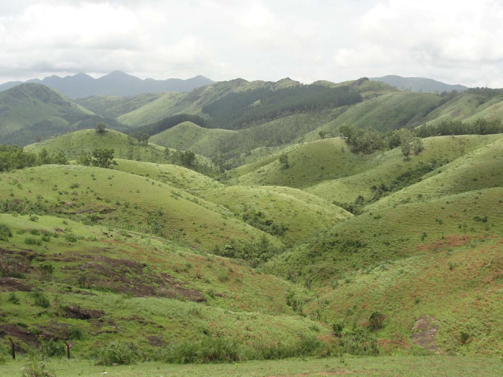
The appeal lies in the relationship between the road and the hills. Tea fields, older bridges, streams, schools and small commercial frontages occupy the same terrain, so a visit can reveal how a plantation district works rather than reducing it to a distant green panorama.

The story

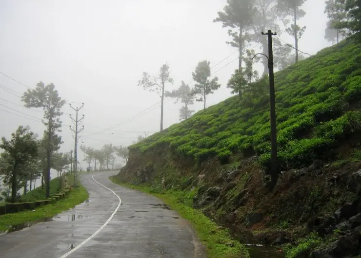
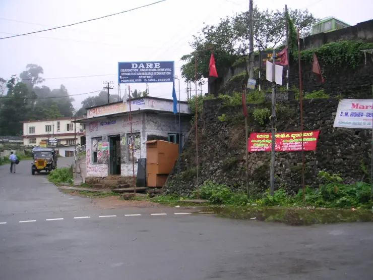
Peermade is easiest to recognise in the details beside the road: a tea hedge bending around a slope, a shaded picking lane, a bridge over a rocky stream and buildings set above retaining walls. The landscape is inhabited and worked. Its quiet moments happen within that everyday movement, not beyond it.

The story of Peermade

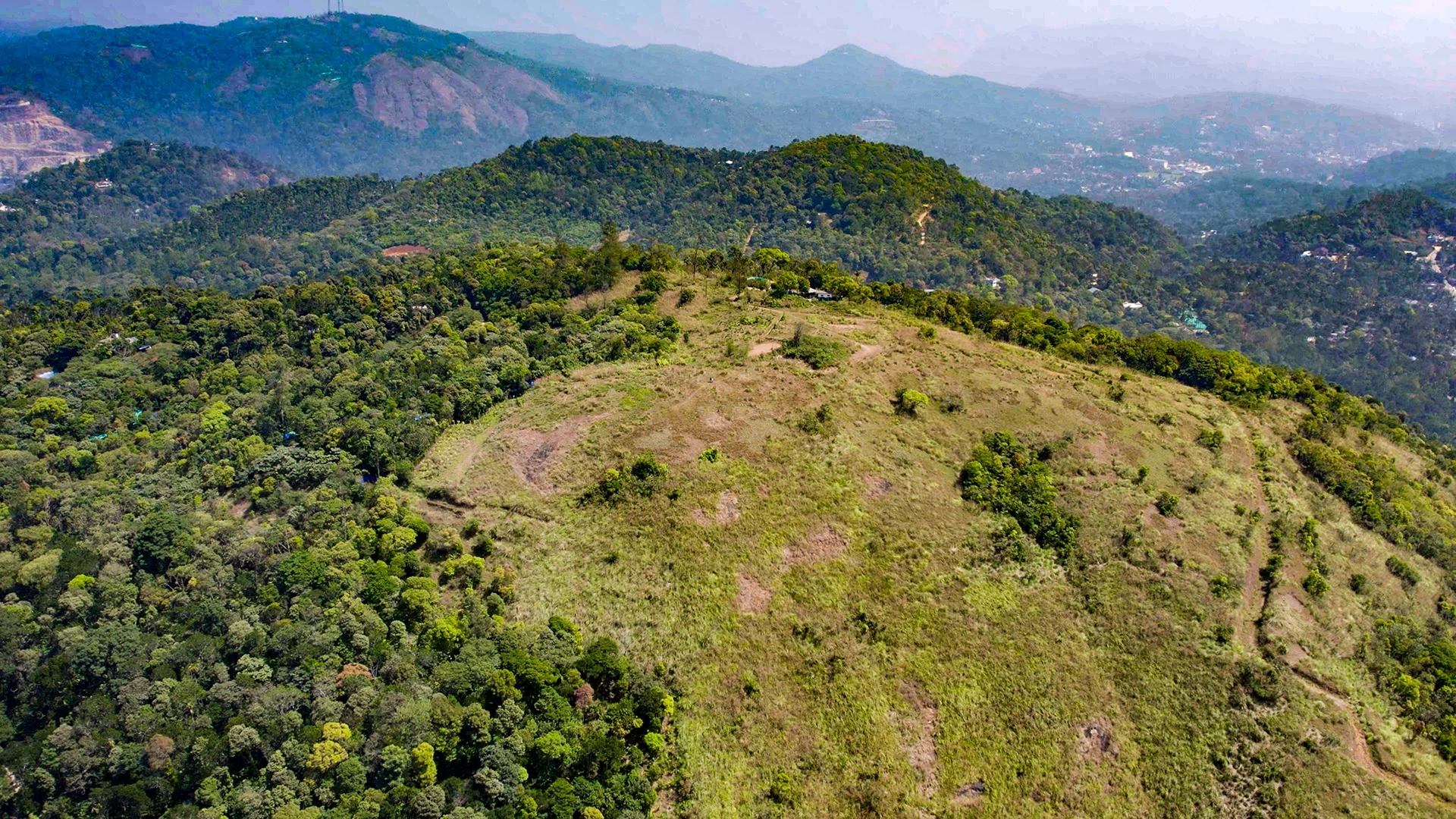
Peermade is a settlement and a surrounding highland landscape in Idukki district. Peerumedu and Peermede are common alternate spellings; Peermade taluk is the larger administrative area. The map here uses the town centre as a practical visitor base. It does not identify a summit, an estate gate or an entrance to a formally enclosed hill station. That distinction matters when a search result makes several widely spaced places appear to be one attraction.

The Kottayam–Kumily road gives the town its travel role. From the lower country, the journey climbs through the Mundakkayam side towards Kuttikkanam and Peermade, continuing towards the plantation settlements and Kumily beyond. Peermade is therefore both somewhere to stop and somewhere people pass through for work, education and trade. The shops and transport activity are part of the place rather than an interruption to its scenery.

Kerala Tourism describes the destination at about 915 metres above sea level. Treat that as a broad settlement elevation, not an exact measurement for every room, road bend or nearby hill. The surrounding terrain rises and falls, and Kuttikkanam and other neighbouring sites have their own elevations. Cooler air, moving cloud and wet slopes can be part of a visit without promising a uniform temperature across the whole district.

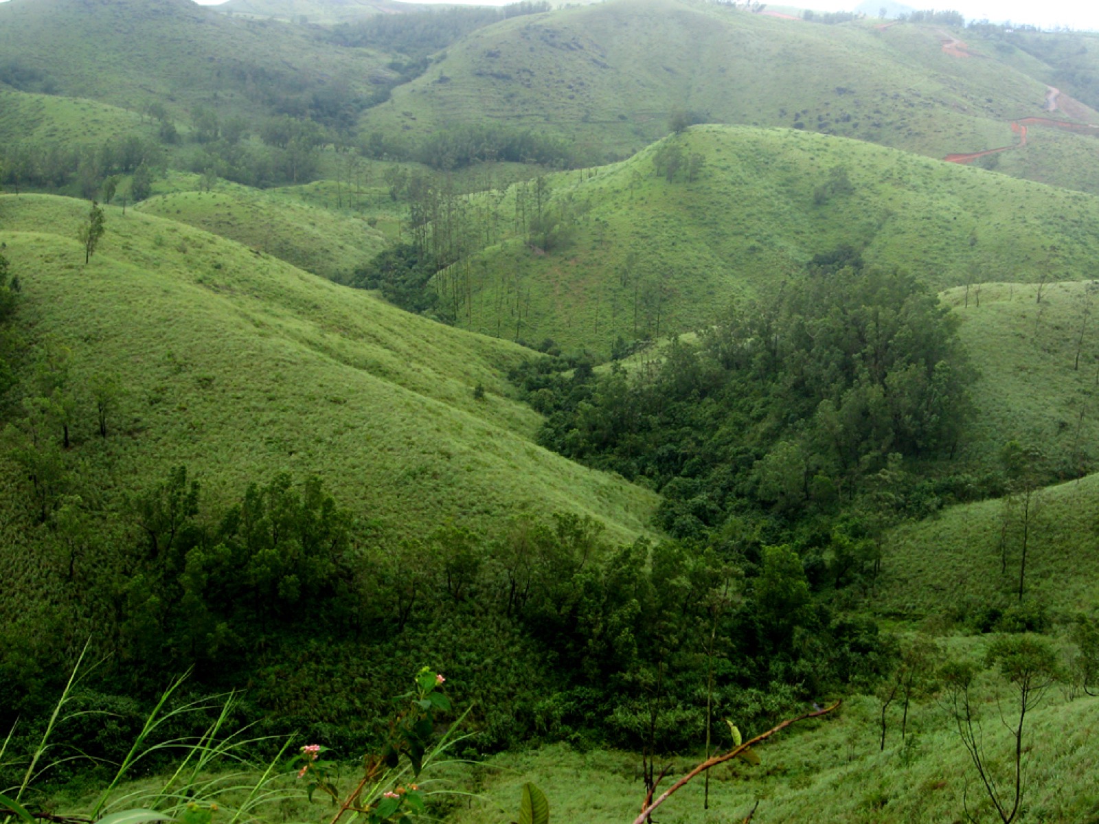
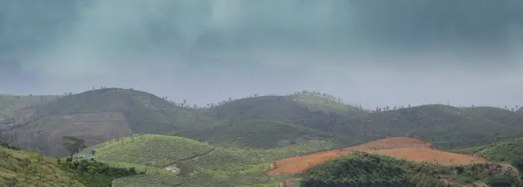
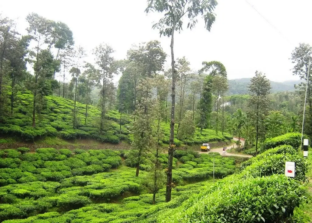
The tea landscape is visibly organised. Low bushes make continuous picking surfaces, taller trees interrupt the rows, and narrow lanes connect sections to larger roads. Looking at those lanes changes the interpretation of a tea view: the slope is not just a pattern of green curves, but a crop that must be reached, maintained and collected. A worker or leaf vehicle has priority on an estate route, even when a visitor has permission to walk there.

Not every green hillside is tea. Tree cover, scrub, gardens and other cultivated ground sit beside the more recognisable clipped fields. A useful visit pays attention to the boundaries and transitions rather than naming every distant patch from a moving vehicle. The tea hedge is identifiable close up through its maintained height and rows; a shaded wooded slope requires more care before calling it a particular spice plantation.

Water also divides the landscape into smaller places. Streams pass under roads, disappear behind vegetation and reappear around rocks. Older and newer bridges around Peermade make those crossings visible. From a public crossing, the relationship between a stream, masonry support and road deck can be read without entering the channel. After rain, the same rocky bed can carry much stronger flow than an old photograph suggests.

The town’s buildings often sit above or below road level, held by banks and retaining walls. That vertical arrangement is part of walking here. A café that appears adjacent on a map may require steps; a room above the road may have a steep final approach; a public-office address may be easy to reach by vehicle but awkward with luggage. Choose the actual entrance and gradient rather than assuming a town-centre pin means a level pedestrian district.

Kuttikkanam is close enough to be a natural companion to Peermade, but it remains a separate settlement with its own junctions, institutions and accommodation. Kerala Tourism places it about 3 km from Peermade in its regional brochure. The number is useful for understanding their proximity, not as a universal doorstep distance. A driver still needs to know which town and which property is intended.

Peeru Hills is another distinct name in the local landscape. Tourism sources associate it with Peer Mohammed, as they do the settlement’s name. A town-centre visit does not itself bring a traveller to the associated hillside or memorial. If that is the purpose of the day, use the named site and establish its current access; do not follow an assumed path from a broad Peermade marker.

The nearby royal-residence story also needs precise boundaries. Kerala Tourism describes a Peermade summer palace associated with Travancore and separately identifies Ammachikkottaram as private property. These buildings are not a single public palace campus. An old account of a caretaker showing visitors around is historical visitor information, not assurance that a door is open today. The buildings can inform an understanding of the plateau without promising an unarranged interior visit.

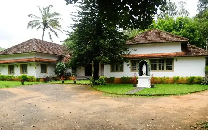
Pallikkunnu’s St George’s CSI Church provides a more specific institutional landmark in the plantation belt. Kerala Tourism dates the church to 1867 and connects it with Henry Baker Junior. That is a reason to understand the area’s nineteenth-century history, while remembering that it is an active church with its own worship and visiting arrangements. It should not become a generic decorative chapel in a Peermade photo itinerary.

Peermade differs from Thekkady in the purpose of a visit. A Thekkady plan often centres on a booked Periyar Tiger Reserve activity and its reporting time. A Peermade plan can centre on the settlement, plantation landscape and an individually arranged heritage stop. Being on a route towards Kumily does not put the town inside the reserve or include a forest programme in an overnight stay.

It also differs from an itinerary built around Vagamon’s named viewpoints, meadows and activities. Peermade is more readily read through its transport corridor and working cultivation. A traveller looking for a particular adventure activity should book the actual operator and destination instead of expecting every Idukki hill town to offer the same list. The distinction makes a shorter, more coherent visit possible.

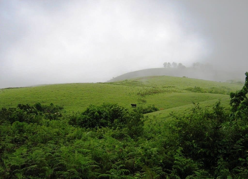
Mist is both a visual condition and a transport constraint. It can soften a distant slope while leaving the nearby tea hedge sharply visible; a few minutes later it may remove the far view entirely. A sensible visit then shifts its attention towards the settlement or an indoor stop, rather than driving from bend to bend in pursuit of a vanished panorama. The landscape is still present, but the day’s scale has changed.

Legend & myth

The name Peerumedu is traditionally connected with Peer Mohammed, a Sufi figure remembered in the local landscape and in Kerala Tourism’s account. His association with traders and Travancore royalty is part of that received history. The place-name story should be presented as an association preserved locally, without inventing a documented date of arrival or claiming that a picturesque anecdote proves the origin of every nearby name.

Read the full history of Peermade 412 more words

History

Kerala Tourism’s history of Peermede describes a nineteenth-century shift towards plantation agriculture, naming Henry Baker Junior among the figures associated with coffee cultivation and the later development of tea. The broad agricultural change is well established in the destination’s history. Specific “first estate” claims, family genealogies and precise experimental acreages should not be treated as settled merely because they recur in travel summaries.

Roads and crossings belong to that plantation history. Moving a harvested crop, supplies and people requires dependable access between slopes and the lower towns. The older bridge structures photographed at Peermade are tangible reminders of successive transport arrangements. A visible inscription or an individual bridge’s documented construction record is needed before assigning it a date; weathered masonry alone cannot supply one.

The existence of a plantation landscape should not be narrated as the discovery of empty land. Estate work depended on labour and on communities whose lives extended beyond the names of owners and missionaries. For a present-day visitor, workers’ lanes, housing and collection routes are parts of a living economy. They deserve the same privacy and respect as residential and working spaces elsewhere.

The district administration continues to list Peermade as a taluk and revenue centre. That contemporary civic role helps explain why the town has offices, schools and regular movement beyond tourism. The regional name on an official address may refer to the larger taluk; it should not be used to locate every institution at the same town-centre point.

The plantation-era church at Pallikkunnu and the Travancore summer-residence accounts show that the plateau accumulated several kinds of institution. Religious work, cultivation, administration and seasonal residence left different traces. A history-led outing is strongest when it chooses one trace to examine properly, with permission where needed, instead of treating every old-looking building as an open heritage attraction.

Why visit

To see a highland town as a place of work and movement: tea slopes, road crossings and civic life make Peermade more than a viewpoint between larger destinations.

To spend time with a plantation landscape at close range through a permitted estate visit, observing the difference between a scenic hillside and the access network that supports a crop.

To build a modest heritage circuit around a specifically identified church, bridge or royal-residence site, with each location’s current access understood before arrival.

To break the journey between the Kottayam side and Kumily with an overnight stay that allows time for changing light and weather instead of relying on one brief roadside view.
What to expect

Highlights

  • A real settlement on the high-range transport corridor, useful for understanding the journey between the Kottayam side and Kumily.
  • Tea hedges, shade trees, estate access lanes and stream crossings: a landscape shaped by cultivation and movement.
  • Local memory of Peer Mohammed alongside documented plantation-era institutions, with separate nearby heritage sites that need their own access arrangements.
Getting there

How to visit

  • Use Peermade town centre as the arrival base and identify the actual address of the stay or heritage stop before turning off the highway. Peerumedu and Peermede are alternate spellings of this settlement.
  • Choose a small circuit around the town and one nearby destination instead of assuming the whole Peermade taluk can be explored on foot from a single pin.
  • For an estate walk, arrange access with the named property. Public-road tea views do not grant entry to picking lanes, factories or workers’ residential areas.

Distance by road

  • Kochi107 km
  • Madurai172 km
  • Thiruvananthapuram226 km
  • Coimbatore252 km
  • Kozhikode276 km

Road km to Idukki; ghat roads and traffic vary — allow extra.

Timing

Best time

October to February often suits a longer outdoor visit; a clear interval matters more than a fixed season for ridge views. Monsoon weather can obscure the landscape and slow the road, while warmer months still vary with cloud and elevation.

Weather in PeermadeSeasonal guide

Live forecast loads in your browser.

Today at Peermade
Sunrise6:11 am
Sunset6:14 pm
Golden hour best light5:14 pm–6:14 pm
Blue hour after sunset6:14 pm–6:39 pm
Sun sets toward compass bearingW · 267°
Moon tonight🌖 Waning gibbous · 88%
South-west monsoon. June to September brings heavy rain to Kerala. Trails, falls and ghat roads can be slippery, swollen or closed at short notice, and forest departments sometimes suspend access. Check locally on the day before you travel.

Check the official alert before you travel. Kerala’s beaches, waterfalls and trekking routes close at short notice during heavy rain, and district alert levels change day to day. We do not publish an alert level of our own — read it from the state authority: Kerala State Disaster Management Authority, or the district control room on 1077.

Sun and moon are calculated for this location and shown in IST. Photography windows are the hour around sunrise and sunset; the sunset bearing is degrees clockwise from true north. Moon phase is accurate to about half a day.

Visitor notes

  • Peermade town, Peermade taluk and the wider plantation destination cover different areas. A property using the regional name may be some distance from the town-centre anchor.
  • Kuttikkanam is a neighbouring settlement, not another name for the same town centre. Keep the two addresses distinct for buses, rooms and pickups.
  • A heritage building’s place in tourism history does not establish current public entry. Private palaces, estates and religious institutions need their own permission.
Safety

Good to know

  • Do not step into the carriageway to photograph tea fields. On bends, a narrow verge and mist can remove the margin a walker expects.
  • Avoid descending to rocky stream beds after rain; a view from an existing public crossing does not make the water below a bathing site.
Official eco & forest programmes

Experiences around Peermade

These are official or public-sector eco offerings that match this place, town or forest destination. Confirm availability, permits, tariffs and reporting times with the official operator before travel.

Idukki Wildlife Sanctuary, Peermade
wildlifeboatingviewpoint

Idukki Wildlife Sanctuary eco visit

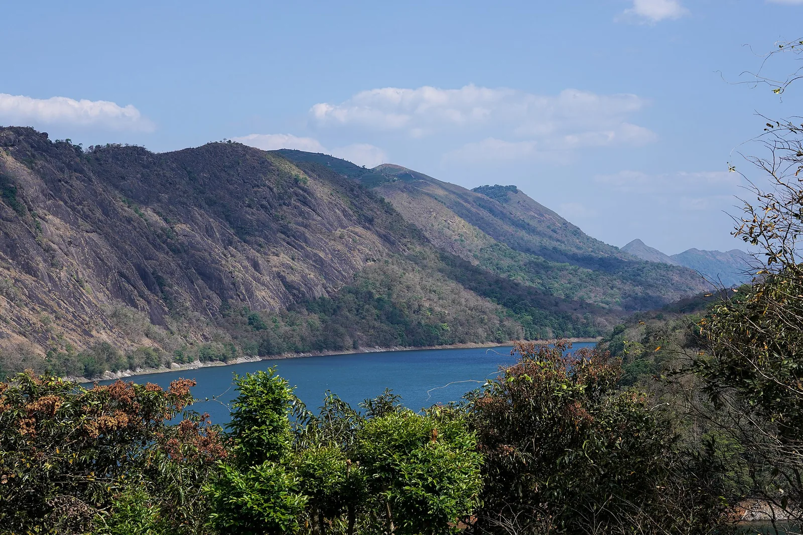
Forest and reservoir wildlife sanctuary around the Idukki-Cheruthoni dam landscape.

Kerala Forest Department
Official source →
Kalvari Mount, Peermade
viewpointtrek

Kalvari Mount ecotourism viewpoint

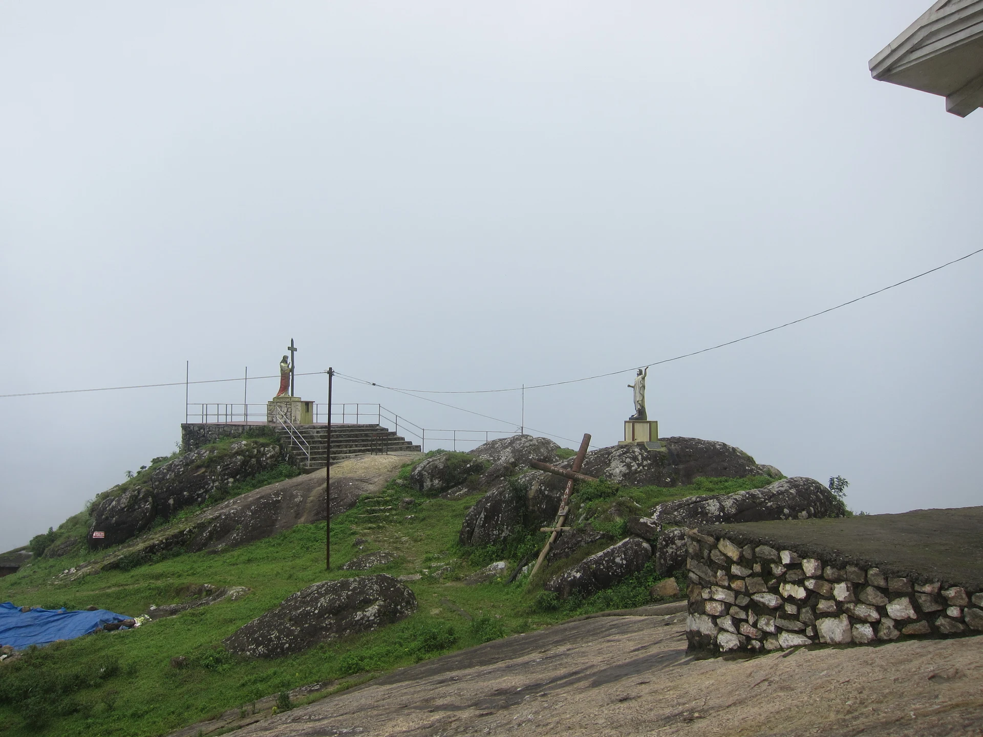
Idukki reservoir viewpoint and pilgrimage hill, connected with Kerala Forest Ecotourism listings.

Kerala Forest Department / local tourism authorities
Official source →
Stay · eat · do · rent · see · shop

Stays, food & things to do near Peermade

Verified hotels, homestays, restaurants, experiences, sights, shops and rentals around Peermade — commission-free, with direct contact. Filter by what you need.

1 thing to do near Peermade

Sahyadri Ayurvedic Centre Peermade — Ayurveda and wellness centre in Idukki and CheruthoniPhoto: Kerala Tourism
Top pick
Ayurveda and wellness centre · Idukki and Cheruthoni
Sahyadri Ayurvedic Centre Peermade
6.8 km · 10 min drive~₹100–130 by auto

Kerala Tourism destination record for Peermade Ayurveda, Panchakarma, herbal medicine, yoga and wellness stays.

Directions Commission-freeView details

Book with the place itself. India’s cyber-crime coordination centre warned in April 2025 that convincing copies of hotel and pilgrimage booking sites are being pushed through sponsored search and social ads, taking payment for rooms the property never hears about. Every listing here links to the business’s own contact details and its own Google or Bing profile — we take no commission and sit in nobody’s payment path. If a booking page reached you through an ad, check the address bar against the property’s own site before you pay. Fraud can be reported on cybercrime.gov.in or on 1930.

Ranked

More ways to explore Idukki and Cheruthoni

This collection spans the wider Idukki highlands. Peermade, Kulamavu and the Neriamangalam–Adimali waterfall corridor are separate bases; select a stay or onward stop by its actual road location.

Nearest to Peermade, on foot

Walking routes start at Peermade. Check the route and access before setting out, especially where a road, gate or waterway separates the stops.

Across the whole of Idukki and Cheruthoni

Ranked guides

Top experiences around Peermade

4 separate places to consider after Peermade. Open each guide before deciding: their access, hours and return arrangements are independent.

hill stationKuttikkanam

4.0 km · 4 min drive

Peermade-side hill-station and adventure-tourism area, useful for tea estates, pine roads and central high-range routing.

viewpointParunthumpara

7.4 km · 9 min drive

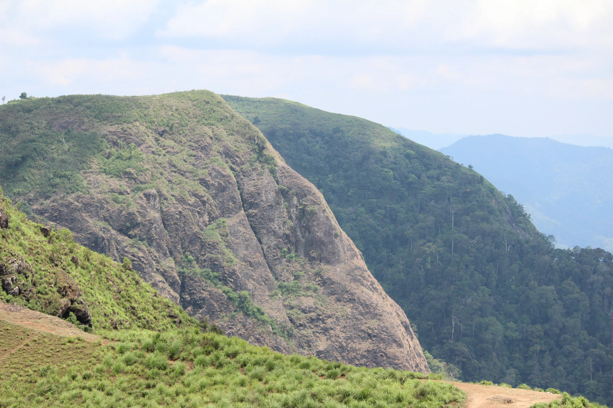
A rock-and-grass viewpoint near Peermade on the Pambanar side of Idukki, overlooking steep wooded ravines; known as Eagle Rock and for the profile-like Tagore Rock formation.

viewpointPanchalimedu

14.2 km · 15 min drive

Meadow and hill-viewpoint landscape near the Peermade/Kuttikkanam side of Idukki.

viewpointPine forest

11.8 km · ~20 min by cab

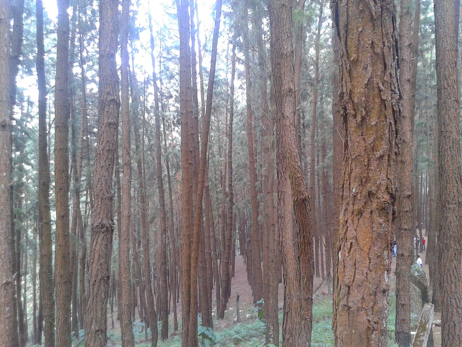
A 61.40-hectare plantation of Caribbean pine on the Kolahalamedu shoulder above Vagamon — planted in rows by the Kerala Forest Department’s research wing on land that was not legally forest at all until March 2021, and run today as a ticketed ecotourism centre with a counter, a car park and a made path. Every travel site calls it a British-era forest; the state’s own record calls it the Kolahalamedu Pine Plantation.

Roampedia is commission-free — own or know a stay, eatery, guide or shop near Peermade? List it and it appears here once verified.

Add a nearby business
Before you go

Peermade — at a glance

TimingsThere is no common opening schedule for a town and its surrounding landscape. Plan outdoor movement in daylight and use the individual institution’s hours for a church, estate, museum or other arranged visit
Best timeA clearer period from October to February often suits outdoor plans. Monsoon cloud, runoff and wet approaches can shorten a circuit; warm-season conditions vary with the particular slope and elevation. Use a current forecast for the journey.

Entry: Peermade is a settlement, with no single destination admission ticket. Private estates, organised visits and individual attractions set their own terms

Photography: Public-road landscape photographs are possible only from a safe standing place clear of traffic. Obtain permission inside estates and religious or residential properties, and ask before photographing workers closely. A factory tour may have its own camera restrictions.

Parking: Use the town or property’s designated vehicle space and keep bus stopping areas, bridges and estate entrances clear. A tea view beside a bend is not a parking bay. At a stay above or below the road, establish whether the vehicle reaches the entrance or luggage must be carried along a slope.

Getting here

How to reach Peermade

  • ✈︎ By air Cochin International Airport is the usual gateway for a western approach. Madurai can be relevant when the itinerary comes through Tamil Nadu and Kumily. Compare the whole journey to the actual Peermade address, rather than choosing an airport from a straight-line radius.
  • 🚆︎ By train Kottayam is the practical rail gateway from the Kerala side, followed by road through Mundakkayam and the ghat approach. There is no railway station in Peermade. Tourism publications give differing broad distances, so use the actual station-to-stay route rather than a fixed transfer time.
  • 🚗︎ By road Approach along the Kottayam–Kumily corridor through Mundakkayam and Kuttikkanam from the west, or from the Kumily side through the plantation belt. The map anchors Peermade town centre on the highway. Use a property’s exact entrance for the final turn rather than a taluk-wide address.
  • 🚌︎ By bus Peermade lies on the main road corridor towards Kumily. Choose a service that actually stops in Peermade and confirm the stop before boarding; express services may have a different stopping pattern. Kuttikkanam is a separate stop. For an estate away from the highway, arrange onward transport and return.
Getting around

Getting around Peermade

Use the highway town centre as the transport anchor, then arrange a vehicle or a property-led walk for a named estate or heritage stop. Peermade’s slopes and spread make an unspecific town walk a poor substitute for an agreed route and return.

Getting back

For a stay or estate away from the highway, arrange transport back to the main road with the host. Confirm whether the onward bus boards at Peermade or Kuttikkanam, and keep any Kumily or Kottayam connection tied to that specific stop.

Do

Things to do

  • Take a short, carefully chosen town walk to notice how buildings, retaining walls and crossings follow the slope, using safe pedestrian space.
  • Arrange a named-estate walk to observe tea rows, shade and collection access without entering working land uninvited.
  • Choose one nearby heritage institution for a focused visit, rather than assuming all old buildings are open for sightseeing.
  • Look at the stream-and-road relationship from an existing public crossing; leave the rocky channel undisturbed.
Included

What’s included

  • A town-centre orientation to Peermade as a high-range settlement rather than a single gated attraction.
  • Public-road views of plantation slopes, older road alignments and the terrain around the settlement from safe stopping places.
  • One separately arranged estate, heritage or landscape stop whose owner or operator has confirmed access.
Plan

Good to know

  • Pin the exact stay or institution as well as Peermade town centre; regional addresses can cover a broad part of the taluk.
  • Ask a property to define the walk it actually permits, including the start, finish and return, before entering an estate road.
  • Keep Kuttikkanam, Thekkady and Vagamon as separate itinerary stops with their own travel time rather than folding them into a short Peermade circuit.
Facilities

On site

  • The town provides the practical base for road transport, meals and everyday services. Confirm the actual stop or property needed rather than relying on the broad destination label.
  • Estates and heritage institutions have separate visitor arrangements; a commercial stay may arrange an experience but cannot grant access to neighbouring land.
  • Kuttikkanam and other nearby settlements offer additional services, each with its own address and road approach. They should not be represented as facilities at one Peermade attraction.
Stay safe

Safety

  • Do not walk along blind highway bends when mist removes visibility or vehicles leave no clear pedestrian margin.
  • Keep out of stream channels and small cascades after rain, even if an older photograph shows low water.
  • Avoid private estate tracks and unmarked hillside shortcuts; arrange a specific route and return with the host when walking beyond public access.
Getting around Peermade
From the entrance
The pin identifies Peermade town centre as the base for a distributed highland settlement. The final approach varies with the chosen hotel, estate visit or public-road stop.
Step-free access
Book access at the actual property: parking-to-door gradient, steps, room level and bathroom arrangement matter more than the broad Peermade destination name. A town-centre pin cannot certify access across the surrounding slopes.
  • Estate lanes and private historical properties need their own access arrangements.
  • Mist can reduce visibility on the road and make an unfamiliar return route harder to follow.

Checked 5 September 2026 against source 1source 2. Conditions change and surfaces vary with weather — if step-free access is essential, confirm with the site before you travel.

Practical things near Peermade

These services are listed within about 1.2 km of Peermade. Walking distances follow mapped routes; access and opening hours can change. Other services may be closer but are not included here.

Eat nearby

What to eat in Idukki and Cheruthoni

Peermade is a settlement, so food belongs in the town plan rather than at one attraction gate. Choose a town restaurant, bakery or your booked property and confirm meal times when staying away from the highway.

Explore food in Idukki and Cheruthoni →
01

High-range tea stop

A town tea shop suits the road journey and the plantation setting; stop where the vehicle can leave the Kottayam–Kumily carriageway completely.

02

Kerala meal

Use an established Peermade or Kuttikkanam restaurant for a full meal, keeping the two settlements distinct when arranging a pickup.

03

At an estate stay

Confirm breakfast, dinner and any packed meal directly with the property, because an isolated estate address may not have walkable evening alternatives.

Nearby

What’s near Peermade

hill stationKuttikkanam

Peermade-side hill-station and adventure-tourism area, useful for tea estates, pine roads and central high-range routing.

4.0 km · 4 min drive
viewpointParunthumpara

A rock-and-grass viewpoint near Peermade on the Pambanar side of Idukki, overlooking steep wooded ravines; known as Eagle Rock and for the profile-like Tagore Rock formation.

7.4 km · 9 min drive
viewpointPine forest

A 61.40-hectare plantation of Caribbean pine on the Kolahalamedu shoulder above Vagamon — planted in rows by the Kerala Forest Department’s research wing on land that was not legally forest at all until March 2021, and run today as a ticketed ecotourism centre with a counter, a car park and a made path. Every travel site calls it a British-era forest; the state’s own record calls it the Kolahalamedu Pine Plantation.

11.8 km · ~20 min by cab · straight line
viewpointParagliding viewpoints

The Kolahalamedu ridge above Vagamon — grass hills the state names as one of only two accredited paragliding sites in Kerala, and the launch ground for a carnival its own website has not updated since 2015. What you come for is the open meadow ridge and the valley it drops into; whether anyone is flying on the day is a question for a licensed operator, not a website.

13.0 km · ~22 min by cab · straight line
hill stationVagamon meadows

Open meadow landscape forming the classic Vagamon sightseeing circuit.

13.1 km · ~22 min by cab · straight line
mosqueThangalpara

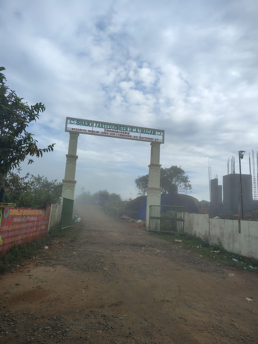
A working Muslim pilgrimage centre on a bare granite dome above Vagamon, on the Kottayam side of the district line. It calls itself the Shaikh Fareedudheen (R.A) Maqam, and the life set out at its gate — the saint’s father, mother, teachers and date of death — is that of Fariduddin Ganjshakar, Baba Farid, whose dargah is at Pakpattan in the Punjab. Kerala Tourism calls this rock his grave; the shrine says maqam, which is the smaller and more careful word.

13.5 km · ~23 min by cab · straight line
viewpointPanchalimedu

Meadow and hill-viewpoint landscape near the Peermade/Kuttikkanam side of Idukki.

14.2 km · 15 min drive
hill stationVagamon

Rolling meadows, pine patches and viewpoints on the Idukki/Kottayam highland edge.

16.2 km · ~27 min by cab · straight line
hill stationMurikkady

Murikkady, also mapped as Murickady, is a plantation settlement near Kumily in Idukki. Use the village as an orientation base and a separately confirmed estate entrance for a spice or plantation visit.

16.4 km · ~27 min by cab · straight line
trekVagavanam Windy Walk trek

The Forest Department’s guided walk on the grass tops at the southern end of the Idukki Wildlife Sanctuary, about ten kilometres by road from Vagamon — some seven kilometres on foot up jeep track and open ridge, with the Idukki reservoir catchment below you. The state will not sell it to fewer than six people, and it will not take more than seven.

16.6 km · ~28 min by cab · straight line
A
Ayyappancoil Hanging Bridge
Place
heritageAyyappancoil Hanging Bridge

The long pedestrian suspension bridge above the Idukki reservoir at Ayyappancoil, valued for water and hill views as well as the crossing itself.

16.6 km · ~28 min by cab · straight line
churchKurisumala

The pilgrim hill above Vagamon — a bare rock dome climbed by a 1.2 km path lined with the Stations of the Cross to St Thomas Church on the summit, and, 818 m away and lower down, the separate Cistercian monastery of Kurisumala Ashram, founded in 1958. Most descriptions run the two together; they are different places with different approaches and different people in charge.

16.7 km · ~28 min by cab · straight line

All 12 places to visit in Idukki and Cheruthoni →

Walking and driving times are real routed distances, except the few marked “straight line”, which are direct-line estimates and will read short. Fare figures are estimates from Kerala’s notified auto/taxi tariff and exclude waiting and night charges. Routing: © openrouteservice.org by HeiGIT | Map data © OpenStreetMap contributors

Nearby toilets, pharmacies, ATMs, seating and vets are community-mapped and may be incomplete or out of date. Map data © OpenStreetMap contributors | Walking times © openrouteservice.org by HeiGIT

On the map

Where Peermade is

Good to know

Peermade — frequently asked

Are Peermade, Peermede and Peerumedu the same place?

They are alternate spellings used for this Idukki settlement and destination. Peermade taluk is a larger administrative area. When booking a room or arranging transport, use the actual street, estate or institution as well as the regional name.

Where should I start a Peermade visit?

The map marks the town-centre settlement node as a visitor base. Start there for orientation or a prearranged pickup, then travel to the specific estate or heritage stop. It is not a ticket office, a summit or a guarantee that every nearby attraction is walkable.

Can I walk into any tea estate around Peermade?

No. Tea fields, picking lanes and factories are working property. Arrange a walk with the named estate or host and understand the permitted area. A view from a public road does not grant access beyond the boundary.

Is Kuttikkanam another name for Peermade?

No. It is a neighbouring settlement often included in the same highland trip. Keep the two names separate when selecting a bus stop or accommodation. A regional hotel description may use both, but its actual entrance will be in one specific location.

Does a Peermade stay include a Periyar forest visit?

No. Reserve programmes around Thekkady have their own booking and reporting arrangements. Peermade is a separate highland settlement on the wider journey. Leave enough road time for a booked reserve activity rather than treating the two places as one campus.

Are the old palaces open for casual visits?

Do not assume so. The royal residences are separately identified properties, and Kerala Tourism explicitly describes Ammachikkottaram as private. Establish current access with the relevant property before planning an interior visit; an old caretaker account is not an opening schedule.

Is Peermade worth visiting when the hills are misty?

A settlement or heritage visit can still work if road conditions are safe. Focus on a specific indoor or nearby stop instead of chasing distant views. If the purpose is entirely panoramic photography, keep the plan flexible because visibility can change quickly.

Can I explore the whole area without a vehicle?

The town centre can provide a starting point, but estates and heritage sites are spread across slopes and neighbouring settlements. Public transport can cover the main corridor; a prearranged local vehicle is more practical for a small circuit with several separate entrances. Do not assume continuous pavement between them.

How do I reach Peermade?

Use Peermade town centre as the first meeting point, then the exact address of your stay or arranged estate visit. Kuttikkanam and a property marketed as Thekkady are not interchangeable pickup locations.

How much time do I need for Peermade?

Choose a short town-and-road stop or an overnight plantation-country stay according to the onward journey. A reserved activity in Thekkady requires its own travel and reporting allowance.

What should I know before visiting Peermade?

This is a settlement spread across highland roads, not a gated attraction. Estate lanes, homes and private historical properties require their own access arrangements.

When is the best time to visit Peermade?

October to February often suits a longer outdoor visit; a clear interval matters more than a fixed season for ridge views. Monsoon weather can obscure the landscape and slow the road, while warmer months still vary with cloud and elevation.

What are the entry fee and timings at Peermade?

Entry: Peermade is a settlement, with no single destination admission ticket. Private estates, organised visits and individual attractions set their own terms. Timings: There is no common opening schedule for a town and its surrounding landscape. Plan outdoor movement in daylight and use the individual institution’s hours for a church, estate, museum or other arranged visit.

What else is near Peermade?

Nearby you can pair Kuttikkanam (4.0 km), Parunthumpara (7.4 km), Pine forest (11.8 km), Paragliding viewpoints (13.0 km).

Read before you go

Peermade guides, stories & itineraries

Stories & history of Peermade

Written about Peermade itself — its history, its legends and the arguments about them.

Around Idukki and Cheruthoni

These reads cover nearby destinations, each with its own arrival point and visit arrangements.

Kerala-wide guides & itineraries

Route-level itineraries and practical guides for the rest of Kerala.

See all 153 Idukki guides & stories →