Arippara Waterfalls

A ticketed rock-shelf cascade on the Iruvanjipuzha in Kodanchery panchayat, famous for bathing and dangerous for it — the hazard is a field of scoured potholes in the riverbed, not the drop.

Arippara Waterfalls, Thusharagiri
Practical guide

Plan Arippara Waterfalls

Who's going?Tailor Arippara Waterfalls to your trip
Typewaterfall
Nearest baseThusharagiri
Best timePost-monsoon is usually strongest
Time needed1 to 3 hours
Entry₹10
Nearest town/baseThusharagiri
DistrictKozhikode
Place typewaterfall
Time needed1 to 3 hours.

A ticketed rock-shelf cascade on the Iruvanjipuzha in Kodanchery panchayat, famous for bathing and dangerous for it — the hazard is a field of scoured potholes in the riverbed, not the drop.

Arippara Waterfalls belongs under Thusharagiri, one of the practical travel bases in Kozhikode district. Use Thusharagiri for stays, food, local transport and operators, then plan this place as a focused stop rather than an isolated pin.

The story

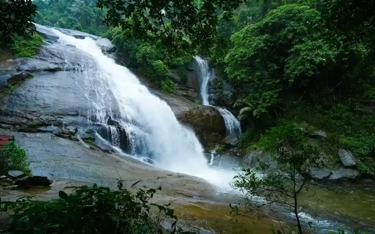
Arippara is a rock-shelf cascade on the Iruvanjipuzha in Kodanchery panchayat, about 45 kilometres east of Kozhikode, run as a ticketed site by DTPC Kozhikode with iron handrails, an information centre and lifeguards on station. It is beautiful, it is cheap, and it kills people. At least twenty-seven have drowned here in twenty-three years, and the reason is not the waterfall — it is the floor. The riverbed is a field of scoured potholes, circular hollows drilled into the gneiss by pebbles spinning in eddies, and a hole three metres deep looks exactly like a hollow thirty centimetres deep when you are standing above it. Kerala Tourism's own page and the district tourism body describe natural pools perfect for swimming. We will not repeat that phrase.

The story of Arippara Waterfalls

Read the local place names before you read the tourism copy, because the local names are a hazard vocabulary. Vattakkuzhi means round pit. Shwasakkuzhi means, literally, breath pit. Neelakkayathadaakam is the blue-deep pool. Tourism copy repackages these as eight levels of a scenic waterfall. They are the names of specific dangerous features, given by people who knew what happened in them.

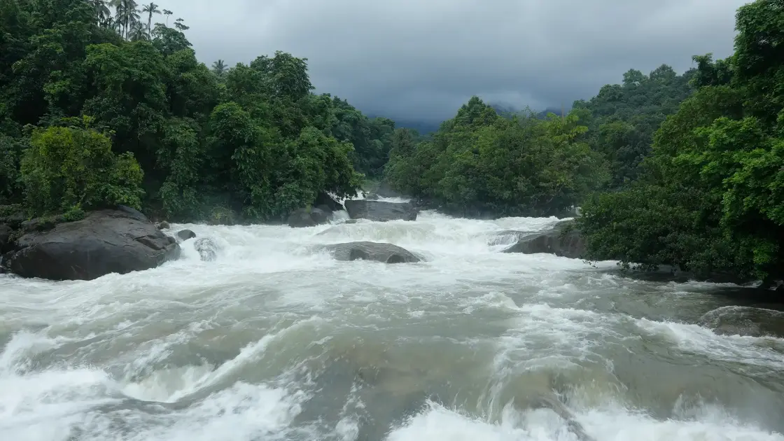
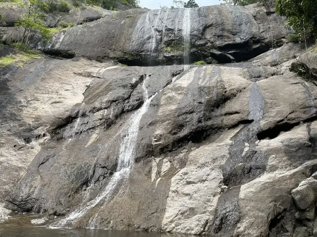
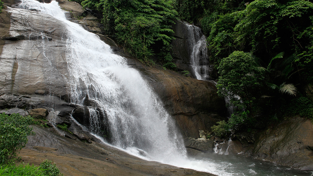
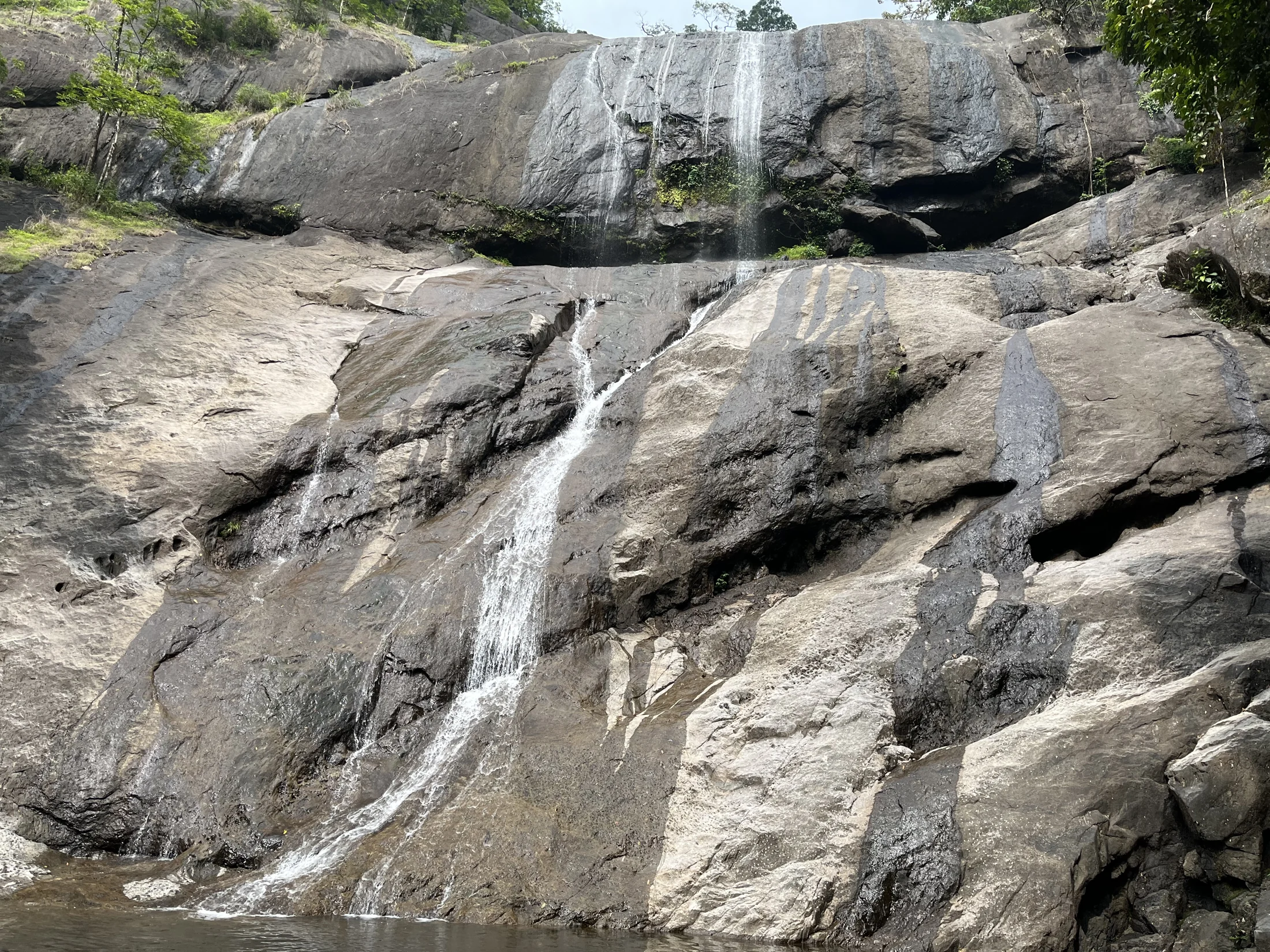
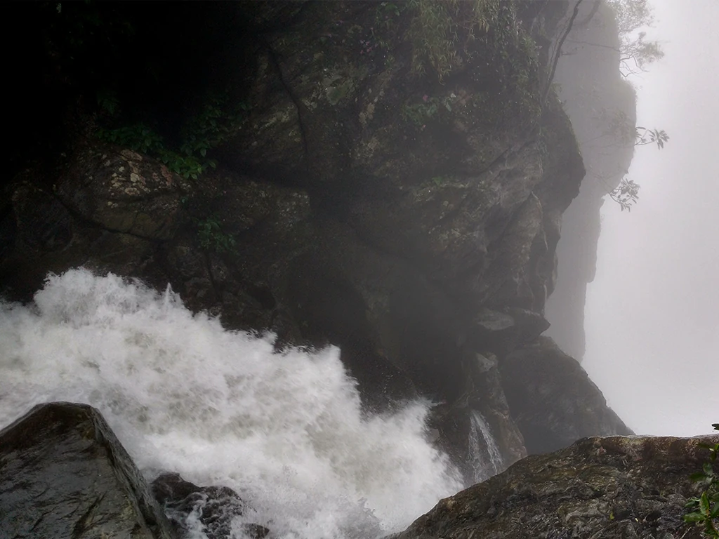
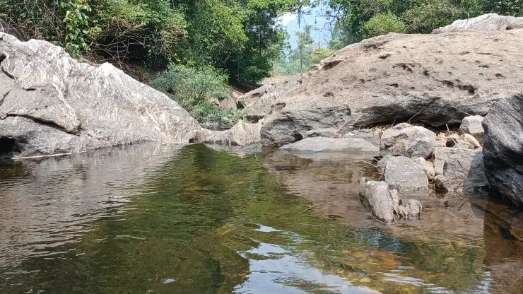
The geology is a pothole field, and Wikimedia Commons itself files photographs of this site under fluvial erosion. Where a river runs over a resistant rock shelf, pebbles caught in eddies grind circular and lobed hollows into the bed. At Arippara they range from plate-sized to body-sized, and in low water they hold standing pools while the shelf around them is dry and walkable. Three things follow from that, and all three are visible in ordinary photographs of the place.

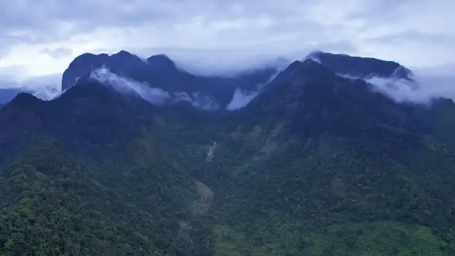
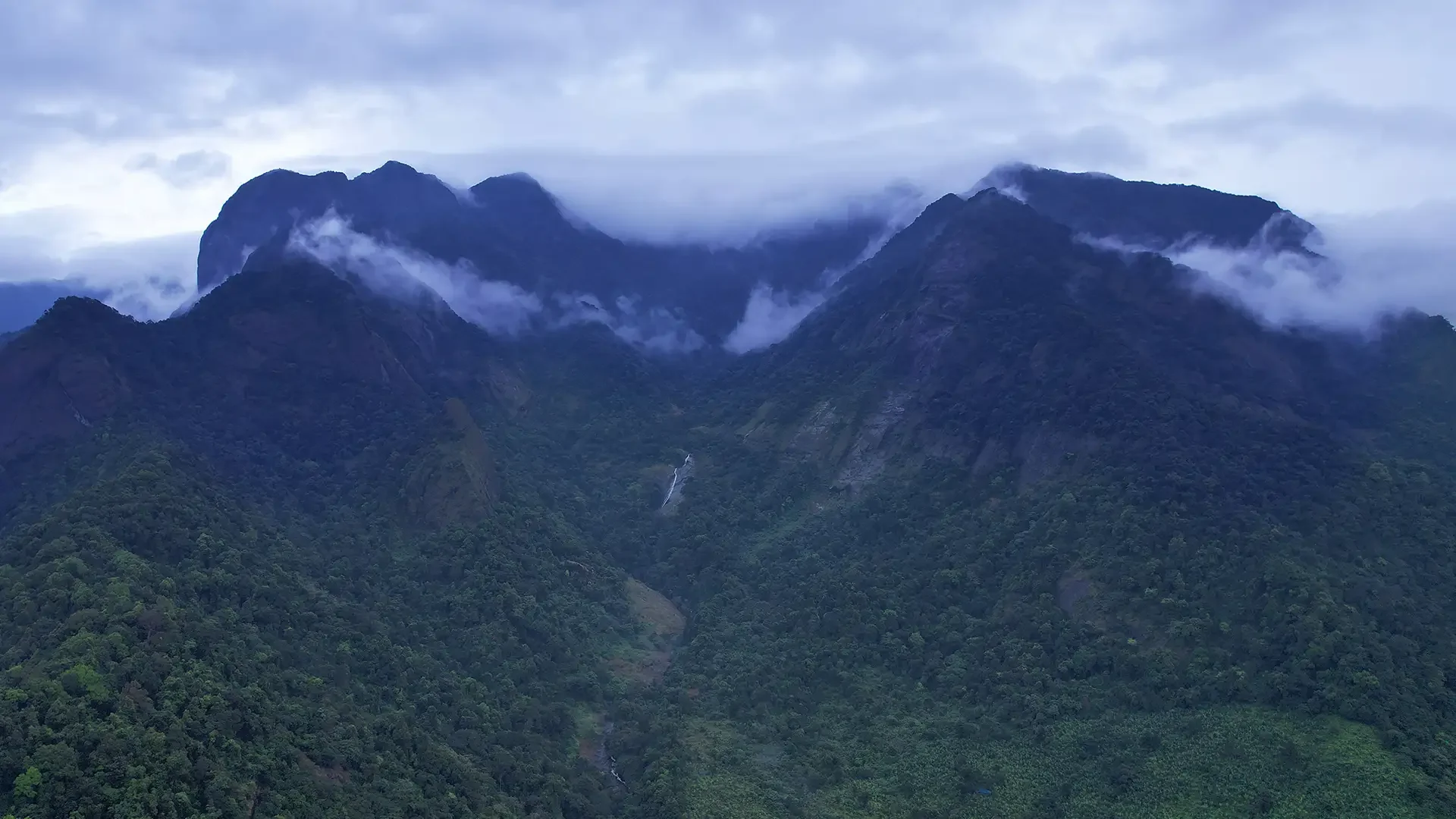
The first is the pothole itself. There is no rim cue and no gradient — the water simply changes colour, and a three-metre shaft reads the same as a thirty-centimetre puddle. The second is the chute: the flow funnels into slots barely a metre wide, and wet gneiss has roughly the friction of wet glass. The third is the flash rise. This river's catchment head is Vellarimala at 1,544 metres, and rain falling up there is invisible from the shelf.

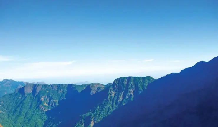
That third mechanism deserves a paragraph of its own now. In August 2024 the Chooralmala and Mundakkai landslides moved some 86,000 square metres of ground and carried debris eight kilometres downstream. Vellarimala is the same mountain — the Iruvanjipuzha's own source massif. A catchment that has recently lost that much of its slope is not a catchment to be casual about downstream.

The fatality record should be given carefully, because the numbers in circulation are inflated by being pooled. A figure of about fifty deaths in twenty years is widely quoted; it covers Arippara, Pathankayam and the wider Iruvanji together. The Arippara-specific figure, reported by Madhyamam in April 2023, is twenty-seven drowned in twenty-three years. A separate uncited account gives nineteen since DTPC took the site over, with one body never recovered.

Three deaths can be dated, and we name nobody. On 1 March 2022, an eighteen-year-old from Vadakara, at about three in the afternoon. On 12 September 2025, a twenty-five-year-old who entered outside permitted hours without permission, recovered by a lifeguard. And on 15 April 2023, at about half past three in the afternoon, two schoolboys aged fifteen and thirteen, from a party of fourteen drawn from three families. Three relatives who went in after them were pulled out alive by the site's own lifeguards.

Hold on to the date of that third one, because it is the single most important fact on this page. The fifteenth of April is deep dry season. It was mid-afternoon, inside opening hours, with lifeguards on duty and close enough to save three other people. The dry-season advice that this page and every other page gives is about flood risk. It says nothing whatever about pothole risk, and a page that implies come in the dry months and you will be fine is repeating the exact assumption under which two children died.

The honest version is narrower and less comfortable. The dry season is when the falls are approachable at all. The potholes are lethal in every season. Stay off the wet rock and out of the water, whatever the month, and note that reporting from April 2026 describes a summer-holiday visitor surge — peak crowding falling in the same month as the 2023 deaths.

There is a local view on this that tourism writing tends to leave out. Residents of Thiruvambady and Kodenchery have run a social-media campaign asking visitors to stay away from the Iruvanji bathing spots, at least until the start of summer — the exact inverse of the tourism advice. The same reporting notes that the authorities attribute most drownings to tourists not following guidelines. Both halves belong on the page, and neither should be laundered into the other.

What Arippara's protection actually is, is a shift rather than a fence. Lifeguards are on station until half past five. The river does not close at half past five, and in practice nor does access.

Legend & myth

The most dangerous sentence written about Arippara is that it is best in the monsoon. Kerala Tourism says June to September. The district tourism body says the same. So does most of the travel web. In the monsoon this river rises fast off a 1,544-metre catchment you cannot see, over rock with the friction of wet glass, into slots a metre wide. Our window is November to May, and the reason is flood risk — with the pothole caveat above attached to it permanently.

The second is the swimming. Kerala Tourism's page describes natural pools perfect for swimming, and the district tourism body lists natural swimming pools under Facilities. This is a site with a documented drowning toll in the twenties, a stationed lifeguard service, and a bed full of hollows you cannot judge the depth of from above. We do not reproduce that phrase in any form.

The third correction is administrative and it is nearly universal. Arippara is not in Thiruvambadi panchayat. It is in Kodanchery gram panchayat, ward 8, Koduvally block, Thamarassery taluk. Thiruvambadi here is the assembly constituency, and the Thiruvambadi panchayat's own area centres about five kilometres away. Thiruvambady is simply the nearest town.

The fourth is the river. English Wikipedia and the district administration both describe the waterfall as being on a tributary of the Iruvanjippuzha. It is on the Iruvanjipuzha main stem. The confusion with Thusharagiri is understandable and constant — Thusharagiri is on the Chalippuzha, which is a tributary of this river, and the two sites are routinely swapped in listings.

The fifth is that we will not print dimensions for this waterfall. A height of fifty metres, four drops, a flow of twenty-five cubic metres a second and a width of three metres all circulate from one uncited infobox — on a page whose coordinates are about forty-five kilometres wrong, landing near Nilambur. If the coordinate on a page is that wrong, its numbers have not been checked either.

The sixth is a claim we will make no assertion about in either direction. The name Arippara is sometimes glossed as rock of rice. No authority is cited for it anywhere we looked. It is a gloss, not an etymology.

The seventh is a numbers correction that matters because it cuts the other way. You will read that nearly fifty people have died at Arippara. That figure comes from reporting that pools three separate sites across the wider Iruvanji over twenty years, and using it here overstates one place while quietly erasing the others. The Arippara-specific count, from reporting dated April 2023, is twenty-seven in twenty-three years. That is quite bad enough to be going on with, and it has the advantage of being about this river shelf rather than about a region.

An eighth, briefly, for anyone navigating: at least one major travel site files Arippara under Wayanad, and another under Kalpetta. It is in Kozhikode district, on the Kozhikode side of the ghats, and the drive is east from Kozhikode city rather than up into Wayanad.

And the ninth is that Arippara has been banned or closed. It has not. We searched for a ban, a closure order and an order number and found none. It is open and ticketed, at ten rupees for an adult and five for a child, nine in the morning until five in the afternoon, with lifeguards to half past five. What is true statewide is that waterfall sites close under red and orange rain alerts, and that is the restriction to plan around.

Read the full history of Arippara Waterfalls 847 more words

History

The largest recent change at Arippara is one that neither Wikipedia had caught at the time of writing: there is a hydroelectric power station here, and it has been running since 2021.

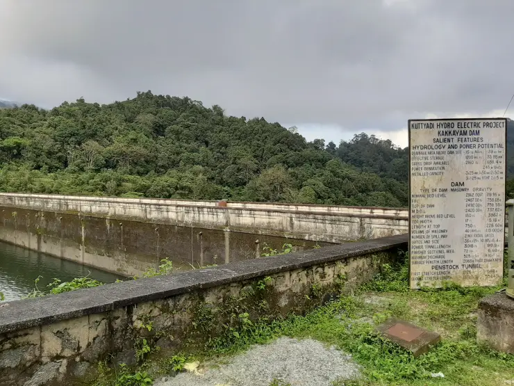
The Arippara Small Hydroelectric Project is a 4.5-megawatt run-of-the-river scheme — a weir and a diversion, with no reservoir. It was commissioned on 13 October 2021 and inaugurated in early November by the Chief Minister. It cost about ₹52 crore and generates in the region of thirteen to fourteen million units a year. It is held on a thirty-year build-own-operate-transfer lease under the Kerala Small Hydro Power Policy, as an independent power producer selling to the state electricity board.

The owner is the part that makes it a story. It is not the electricity board. It is Cochin International Airport Limited — the company that made Kochi the world's first fully solar-powered airport in 2015. Its managing director described Arippara as the airport's biggest step since going solar. An airport company owns a waterfall.

Both Wikipedias still describe the project as being in proposal stages, five years after it was commissioned. Anyone writing this page from the encyclopaedias would have got it wrong in the same direction, and confidently.

The geometry matters for understanding what you are looking at. The intake weir sits about 500 to 600 metres upstream of the falls; the powerhouse is about 110 metres downstream. The falls are inside the bypassed reach — the stretch between the abstraction point and the return.

And here the finding cuts the opposite way to the obvious inference, which is why it is worth setting out carefully. CIAL's own site states that the plant runs from June to November only. Abstraction therefore happens when the river is in spate and nobody should be in it. In our November-to-May window the plant is largely idle, and the water a visitor sees is essentially the natural flow. The dry-season trickle at Arippara is the seasonal hydrograph, not the power station, and this page will not imply that CIAL turned the falls off. What is documented is a water-quality effect: in April 2026 a check-dam cleaning upstream sent muddy water past the falls.

On safety, the same care applies. The hazard here is upstream rainfall, not plant operation — a run-of-river weir has no storage to release, and there is no evidence of any plant-caused surge. The project was delayed by the 2018 and 2019 floods, the pandemic and litigation; the existence of the litigation is sourced, and nothing about its subject, court or petitioner is, so we say nothing more about it. Local apprehension that the falls would disappear is recorded in Malayalam sources as a fear rather than an outcome, and no action council, protest or named campaign turned up.

Arippara is not an isolated intervention on this river either: the same Iruvanjipuzha system already carries the Chembukadavu and Urumi small-hydro weirs.

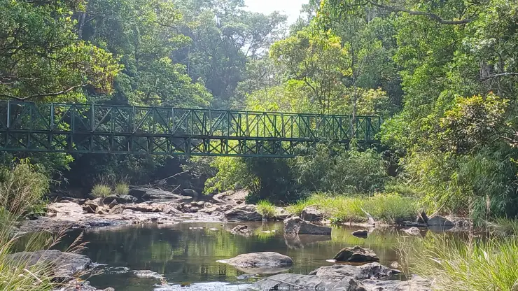
There is one genuinely cheerful thing to add. A suspension bridge now spans the river at the falls — mapped, built, and listed among the attractions in April 2026 reporting, though Malayalam Wikipedia still describes it as merely approved. For a place whose central instruction is to stay out of the water, a way to be safely over the river is the best facility it could have been given.

And every summer the reach immediately upstream becomes something else entirely. The Malabar River Festival, run by the Kerala Adventure Tourism Promotion Society with DTPC Kozhikode and the district panchayat, held its twelfth edition from 30 July to 2 August 2026 on the Chalippuzha and the Iruvanjipuzha — the largest kayaking event in Asia and the only whitewater championship in South India, with titles awarded as Rapid Raja and Rapid Rani. The course starts at Pulikkayam near Kodenchery, within about three kilometres of the falls. The elite paddlers and the drowning victims are on the same reach of the same river. Arippara is a place to watch water that other people, trained and equipped, ride.

Why visit

It is a genuinely striking piece of river geology — a wide rock shelf drilled with scour potholes, with the water funnelling through slots in it — and it is ten rupees to walk in.

The suspension bridge across the river at the falls is the best way to see the whole shelf without setting foot on wet rock.

It is close and easy: about 45 km and under an hour from Kozhikode, a kilometre off the Hill Highway, with a staffed site, a ticket counter and toilets.

November to May is when the shelf is exposed and the site is approachable at all — and the same months are when the potholes are most tempting and most dangerous.

In late July and early August, the reach immediately upstream hosts the Malabar River Festival, the biggest kayaking event in Asia.

It is one of the few places where you can see what a run-of-river hydro scheme actually looks like: the weir is 500 metres upstream, the powerhouse 110 metres downstream, and the falls sit in the bypassed reach between them.

What to expect

Highlights

  • Waterfall viewpoint at Arippara Waterfalls
  • Forest-edge scenery
  • Short walks, food stops or nearby viewpoints where available
Getting there

How to visit

  • Base yourself in Thusharagiri or a nearby town in Kozhikode, then confirm the last-mile route locally before leaving.
  • Visit early and check whether the falls are open; waterfall access can close quickly in heavy rain.
  • If the visit depends on forest, temple, boat, ferry, weather or seasonal access, check the official/local rule on the day before travel.

Distance by road

  • Coimbatore180 km
  • Kochi182 km
  • Mysuru209 km
  • Mangaluru233 km
  • Bengaluru349 km

Road km to Kozhikode; ghat roads and traffic vary — allow extra.

Timing

Best time

Post-monsoon is usually strongest; dry months are easier for access but water volume may be lower.

Weather in Arippara WaterfallsSeasonal guide

Live forecast loads in your browser.

Today at Arippara Waterfalls
Sunrise6:15 am
Sunset6:45 pm
Golden hour best light5:45 pm–6:45 pm
Blue hour after sunset6:45 pm–7:10 pm
Sun sets toward compass bearingWNW · 284°
Moon tonight🌒 Waxing crescent · 9%
South-west monsoon. June to September brings heavy rain to Kerala. Trails, falls and ghat roads can be slippery, swollen or closed at short notice, and forest departments sometimes suspend access. Check locally on the day before you travel.

Check the official alert before you travel. Kerala’s beaches, waterfalls and trekking routes close at short notice during heavy rain, and district alert levels change day to day. We do not publish an alert level of our own — read it from the state authority: Kerala State Disaster Management Authority, or the district control room on 1077.

Sun and moon are calculated for this location and shown in IST. Photography windows are the hour around sunrise and sunset; the sunset bearing is degrees clockwise from true north. Moon phase is accurate to about half a day.

Visitor notes

  • Wear footwear with grip; rocks can be slippery.
  • Carry a dry bag for phone and documents.
Safety

Good to know

  • Do not enter restricted pools or climb wet rocks.
  • Flash-flood risk rises during heavy rain.
Official eco & forest programmes

Forest stays, camping and guided activities linked to Arippara Waterfalls

These are official or public-sector eco offerings that match this place, town or forest destination. Confirm availability, permits, tariffs and reporting times with the official operator before travel.

Thusharagiri Waterfalls, Arippara Waterfalls
waterfalltrekwildlife

Thusharagiri waterfalls and trek

Foothill waterfall and trekking destination east of Kozhikode, listed in Kerala Tourism’s ecotourism inventory.

Kerala Forest Department / local tourism authorities
Official source →
Vellarimala, Arippara Waterfalls
trekcampingwildlife

Vellarimala trek

Western Ghats trek landscape linked with the Thusharagiri/Vellarimala side of Kozhikode; access depends on forest permissions.

Kerala Forest Department
Official source →
Stay · eat · do · rent · see · shop

Stays, food & things to do near Arippara Waterfalls

Verified hotels, homestays, restaurants, experiences, sights, shops and rentals around Arippara Waterfalls — commission-free, with direct contact. Filter by what you need.

Thusharagiri Waterfall Forest Ecotourism — Official forest ecotourism source in Thusharagiri
Verified
Official forest ecotourism source · Thusharagiri
Thusharagiri Waterfall Forest Ecotourism

Kerala Forest Ecotourism source for Thusharagiri Waterfall, useful for current access and booking checks.

Commission-freeView details
Rain Country Resorts Thusharagiri — Kerala Tourism-listed resort in Thusharagiri
Verified
Kerala Tourism-listed resort · Thusharagiri
Rain Country Resorts Thusharagiri

Kerala Tourism-listed resort near Thusharagiri for waterfall and forest-edge stays. Contact direct / check current rules · Rain, Kerala Tourism-listed resort, thusharagiri.

Commission-freeView details
Golden Glades Anakkampoyil — Homestay in Thusharagiri
Verified
Homestay · Thusharagiri
Golden Glades Anakkampoyil

Kerala Tourism-listed homestay at Anakkampoyil near Thusharagiri. Contact direct · Golden Glades, Anakkampoyil, Thusharagiri stay.

Commission-freeView details
Thusharagiri Waterfalls Kerala Tourism — Waterfall and trek in Thusharagiri
Verified
Waterfall and trek · Thusharagiri
Thusharagiri Waterfalls Kerala Tourism

Kerala Tourism official source for Thusharagiri Waterfalls and DTPC contact. Check current access rules · Thusharagiri, Waterfalls, Kodenchery.

Commission-freeView details
K
Koodathai Homestay
Place to stay
Top pick
Hotel · Thusharagiri
Koodathai Homestay

Three-bedroom riverside retreat with river access for bathing and campfires. Sits ten minutes from Thamarassery town, gateway to Thusharagiri waterfalls.

Commission-freeView details
R
River Valley Resort
Place to stay
Top pick
Hotel · Thusharagiri
River Valley Resort

Individual cottages with private decks perched in tropical Western Ghats rainforest. Set on the Iruvanjipuzha river near Thusharagiri and Vellarimala.

Commission-freeView details
K
Karimb Resorts
Place to stay
Top pick
Hotel · Thusharagiri
Karimb Resorts

Hilltop cottages with an infinity pool and 320-degree valley views in the Western Ghats. Set below the Vellarimala hills in the Thamarassery ghat foothills.

Commission-freeView details
T
Tusharagiri Waterfalls Food Stop
Where to eat
Top pick Verified
Waterfall food stop · Thusharagiri
Tusharagiri Waterfalls Food Stop

Tusharagiri Waterfalls Food Stop is a sourced waterfall food stop record for the thusharagiri guide.

Commission-freeView details
T
Thusharagiri Homestays Booking Helpline
Place to stay
Top pick Verified
Local homestay directory support · Thusharagiri
Thusharagiri Homestays Booking Helpline

Local Thusharagiri homestay and resort directory helpline for travellers comparing waterfall-side stays.

Commission-freeView details

Book with the place itself. India’s cyber-crime coordination centre warned in April 2025 that convincing copies of hotel and pilgrimage booking sites are being pushed through sponsored search and social ads, taking payment for rooms the property never hears about. Every listing here links to the business’s own contact details and its own Google or Bing profile — we take no commission and sit in nobody’s payment path. If a booking page reached you through an ad, check the address bar against the property’s own site before you pay. Fraud can be reported on cybercrime.gov.in or on 1930.

Roampedia is commission-free — own or know a stay, eatery, guide or shop near Arippara Waterfalls? List it and it appears here once verified.

Add a nearby business
Before you go

Arippara Waterfalls — at a glance

Timings09:00 to 17:00 daily, with lifeguards on station until 17:30, per the operator's mapped hours and September 2025 reporting. The district tourism body's own page still shows 10:00–17:00, which appears to be stale (indicative — confirm locally). ⚠ Note what those hours actually protect: the river does not close at 17:30 and, in practice, nor does access. A death in September 2025 involved someone entering outside permitted hours without permission.
Best timeNovember to May. ⚠ AND READ THE NEXT SENTENCE BEFORE ACTING ON THAT. Kerala Tourism and the district tourism body both recommend the monsoon, June to September, which is when this river rises fastest off an invisible 1,544 m catchment — that advice is actively dangerous and we do not repeat it. But the dry season is safer only against FLOODING. The two schoolboys who drowned here did so on 15 April, mid-afternoon, in deep dry season, inside opening hours, with lifeguards on duty. Waterfall sites across Kerala close under red and orange rain alerts.
Entry price
Indian adult
₹10

Fees change without notice — treat this as indicative and confirm at the counter.

Entry: ₹10 adult / ₹5 child, from DTPC Kozhikode, which operates the site — observed 15 August 2026. A ₹25 camera pass is reported by one private directory and is not confirmed by the operator. There is NO forest permit here and this is not reserve forest, which readers routinely confuse with nearby Thusharagiri (indicative — confirm locally).

Dress code: None, but wear shoes with real grip and treat every wet rock as if it were wet glass — that is roughly the friction of wet gneiss.

Festivals: The Malabar River Festival, run by the Kerala Adventure Tourism Promotion Society with DTPC Kozhikode and the district panchayat, ran its 12th edition from 30 July to 2 August 2026 on the Chalippuzha and the Iruvanjipuzha, with the course starting at Pulikkayam near Kodenchery, within about 3 km of the falls. It is the largest kayaking event in Asia and the only whitewater championship in South India (indicative — confirm dates locally).

Photography: No restriction reported by the operator. A ₹25 camera pass appears in one private directory only.

Getting here

How to reach Arippara Waterfalls

  • ✈︎ By air Calicut International Airport at Karipur, 46–49 km (indicative — confirm distance and transfer time locally).
  • 🚆︎ By train Kozhikode (Calicut) railway station, 46–47 km (indicative — confirm locally).
  • 🚗︎ By road East from Kozhikode via Kunnamangalam, Mukkam and Thiruvambady, then the Anakkampoyil road; the site is about 1 km off the Hill Highway (indicative — confirm the exact route locally).
  • 🚌︎ By bus The nearest bus stand is Anakkampoyil, about 5.2 km away, with services from Kozhikode via Mukkam and Thiruvambady; the last stretch needs an auto or a lift (indicative — confirm current routes locally).
Getting back

Work out your return before you settle in for the sunset. Services on this coast thin out sharply in the evening, and Arippara Waterfalls is easier to reach than to leave. We do not publish departure times: there is no official live feed we are permitted to republish, and a wrong time here would strand you. Check the operator directly on the day.

Ask at the jetty or stand for the time of the last service back, not the next one. If you miss it, an auto or app cab is the fallback — agree the fare before you get in.

Do

Things to do

  • Walk the suspension bridge over the river at the falls — mapped, built and open, and the best way to see the whole shelf without setting foot on wet rock.
  • Look at the potholes properly rather than through them: circular and lobed hollows ground into the bed by pebbles spinning in eddies, plate-sized to body-sized, holding water when the shelf around them is dry.
  • Learn the local names, because they are a hazard vocabulary rather than a scenic one — Vattakkuzhi, round pit; Shwasakkuzhi, literally breath pit; Neelakkayathadaakam, the blue-deep pool.
  • Trace the run-of-river hydro scheme on the ground: the intake weir is 500–600 m upstream and the powerhouse about 110 m downstream, so the falls lie in the bypassed reach between them.
  • Come in late July or early August for the Malabar River Festival on the reach just upstream, and watch trained paddlers ride the water nobody should swim in.

🔴 DO NOT SWIM, IN ANY SEASON. At least 27 people have drowned at Arippara in 23 years. The hazard is the riverbed, not the drop: scour potholes where a three-metre shaft looks identical to a thirty-centimetre puddle from above, chutes barely a metre wide, and flash rises off a 1,544 m catchment you cannot see from the shelf — a catchment that lost 86,000 m² of slope in the 2024 Chooralmala–Mundakkai landslides. Kerala Tourism's own page calls these natural pools perfect for swimming and the district tourism body lists natural swimming pools under Facilities; we do not repeat either. Note also that residents of Thiruvambady and Kodenchery have campaigned asking visitors to stay away from the Iruvanji bathing spots, while the authorities attribute most drownings to visitors not following guidelines. Both of those are worth knowing.

Getting around Arippara Waterfalls

We have not assessed physical access at this place yet. Across India, step-free routes, handrails and accessible toilets are the exception rather than the rule, and pavements are often interrupted — if step-free access matters to you, contact the site or a local operator before committing to the trip.

If you need help at Arippara Waterfalls
112All emergencies (police · fire · medical)The single number to call in any emergency (ERSS).

Emergency numbers are verified against official government and state tourism sources. 112 works anywhere in India.

Nearby

What’s near Arippara Waterfalls

waterfallTusharagiri Waterfalls 3.9 km · ~10 min by auto
damKakkayam Dam 18.3 km · ~30 min by cab
wildlifeMalabar Wildlife Sanctuary 19.0 km · ~32 min by cab
activityKariyathumpara 19.8 km · ~33 min by cab
damPeruvannamuzhi Dam 30.0 km · ~50 min by cab
wildlifeSarovaram Bio Park 33.4 km · ~56 min by cab
museumPazhassi Raja Museum 33.4 km · ~56 min by cab
templeThali Temple 35.3 km · ~59 min by cab
heritageMananchira Square 35.5 km · ~59 min by cab
heritageSM Street / Mittayi Theruvu 36.0 km · ~60 min by cab
beachKappad Beach 36.3 km · ~61 min by cab

All 4 places to visit in Thusharagiri →

On the map

Where Arippara Waterfalls is

Good to know

Arippara Waterfalls — frequently asked

Is it safe to swim at Arippara?

No, and this is not a formality. At least 27 people have drowned here in 23 years. The hazard is the riverbed: a field of scoured potholes where a three-metre shaft looks identical to a thirty-centimetre puddle from above, plus chutes a metre wide over rock with the friction of wet glass. Kerala Tourism's own page calls these natural pools perfect for swimming. Do not treat that as advice.

Is the dry season safe, then?

It is safER in one respect only — no flash flooding — and that distinction has cost lives. On 15 April 2023, deep in the dry season, mid-afternoon, inside opening hours and with lifeguards on duty, two schoolboys aged 15 and 13 drowned here; three relatives who went in after them were pulled out alive. The potholes are lethal in every season.

What does it cost and when is it open?

₹10 for an adult and ₹5 for a child, per DTPC Kozhikode, which operates the site. Open 09:00 to 17:00 daily, with lifeguards on station until 17:30. A ₹25 camera pass is reported by one private directory. There is no forest permit and this is not reserve forest — a point readers often confuse with Thusharagiri.

Which panchayat is it in?

Kodanchery gram panchayat, ward 8, Koduvally block, Thamarassery taluk. Almost every listing says Thiruvambadi panchayat, which is wrong — Thiruvambadi is the assembly constituency here, and Thiruvambady is the nearest town.

How far is it from Kozhikode and from Thiruvambady?

About 44.6 km from Kozhikode city, roughly 51 minutes by road. From Thiruvambady town the routing engines give about 9 km; every published source says 15 km, copied between them, and we cannot reproduce it. The nearest bus stand is Anakkampoyil, 5.2 km away.

Is there a hydroelectric project here?

Yes — built and running, not proposed. The 4.5 MW Arippara Small Hydroelectric Project, owned by Cochin International Airport Ltd rather than by the state electricity board, was commissioned on 13 October 2021. Both Wikipedias still describe it as being in proposal stages. Its intake weir is about 500 m upstream and its powerhouse about 110 m downstream, so the falls lie in the bypassed reach.

Has the power station reduced the flow at the falls?

Not in the season you are likely to visit. CIAL's own site says the plant runs June to November only, so during the November-to-May window it is largely idle and the flow is essentially natural. The dry-season trickle is the seasonal hydrograph, not the plant. What is documented is a water-quality effect: an upstream check-dam cleaning in April 2026 sent muddy water past the falls.

How high is the waterfall?

We are not printing a height. The figures in circulation — 50 metres, four drops, 25 cubic metres a second — all come from a single uncited infobox on a page whose coordinates are about 45 km wrong. Nobody appears to have measured it.

When is the best time to visit Arippara Waterfalls?

Post-monsoon is usually strongest; dry months are easier for access but water volume may be lower.

What are the entry fee and timings at Arippara Waterfalls?

Entry: ₹10 adult / ₹5 child, from DTPC Kozhikode, which operates the site — observed 15 August 2026. A ₹25 camera pass is reported by one private directory and is not confirmed by the operator. There is NO forest permit here and this is not reserve forest, which readers routinely confuse with nearby Thusharagiri (indicative — confirm locally).. Timings: 09:00 to 17:00 daily, with lifeguards on station until 17:30, per the operator's mapped hours and September 2025 reporting. The district tourism body's own page still shows 10:00–17:00, which appears to be stale (indicative — confirm locally). ⚠ Note what those hours actually protect: the river does not close at 17:30 and, in practice, nor does access. A death in September 2025 involved someone entering outside permitted hours without permission.. The rupee figure quoted is the Indian adult rate. Fees and timings are indicative — confirm on site before you travel.

How do I reach Arippara Waterfalls?

Base yourself in Thusharagiri or a nearby town in Kozhikode, then confirm the last-mile route locally before leaving. Visit early and check whether the falls are open; waterfall access can close quickly in heavy rain. If the visit depends on forest, temple, boat, ferry, weather or seasonal access, check the official/local rule on the day before travel.

How much time do I need for Arippara Waterfalls?

1 to 3 hours.

What else is near Arippara Waterfalls?

Nearby you can pair Tusharagiri Waterfalls (3.9 km), Kakkayam Dam (18.3 km), Malabar Wildlife Sanctuary (19.0 km), Kariyathumpara (19.8 km).

What should I know before visiting Arippara Waterfalls?

Do not enter restricted pools or climb wet rocks. Flash-flood risk rises during heavy rain.

Image credits
  • Arippara Waterfalls:Dvellakat · CC BY-SA 4.0