Kulamavu Dam

Kulamavu Dam holds the southern side of the Idukki reservoir beside the Thodupuzha–Puliyanmala road. The KSEB structure, surrounding water and Kulamavu settlement are related but different places: plan a hydel-tourism visit and a permitted reservoir view, with the infrastructure rules understood before arrival.

Kulamavu Dam, Idukki and Cheruthoni
Practical guide

Plan Kulamavu Dam

Who's going?Tailor Kulamavu Dam to your trip
Typedam
AreaIdukki and Cheruthoni
DistrictIdukki
Best timeClear daylight after sustained heavy…
Time neededAllow about 45–90 minutes for the…
Places to visit12Listed businesses17

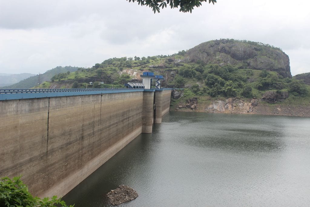
The most useful way to see Kulamavu is as one part of a larger water-and-power system. Its gravity wall works with Idukki Arch Dam and Cheruthoni Dam to retain one reservoir; the electricity is generated downstream at the underground station in Moolamattom.

The story

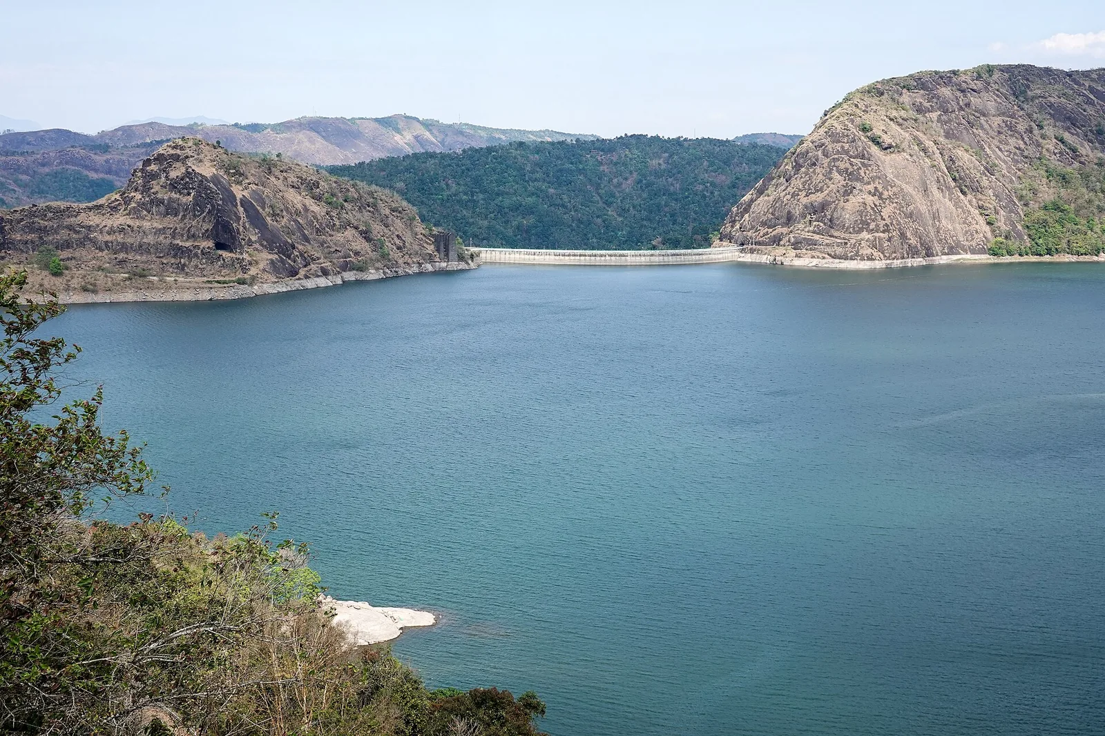
A single wall can be difficult to understand when the water disappears around several wooded headlands. At Kulamavu, the long gravity dam closes one side of a reservoir much larger than the view beside the road. The bare margins, distant ridges and water held high above Moolamattom are parts of an operating landscape, not the boundaries of a small ornamental lake.

The story of Kulamavu Dam

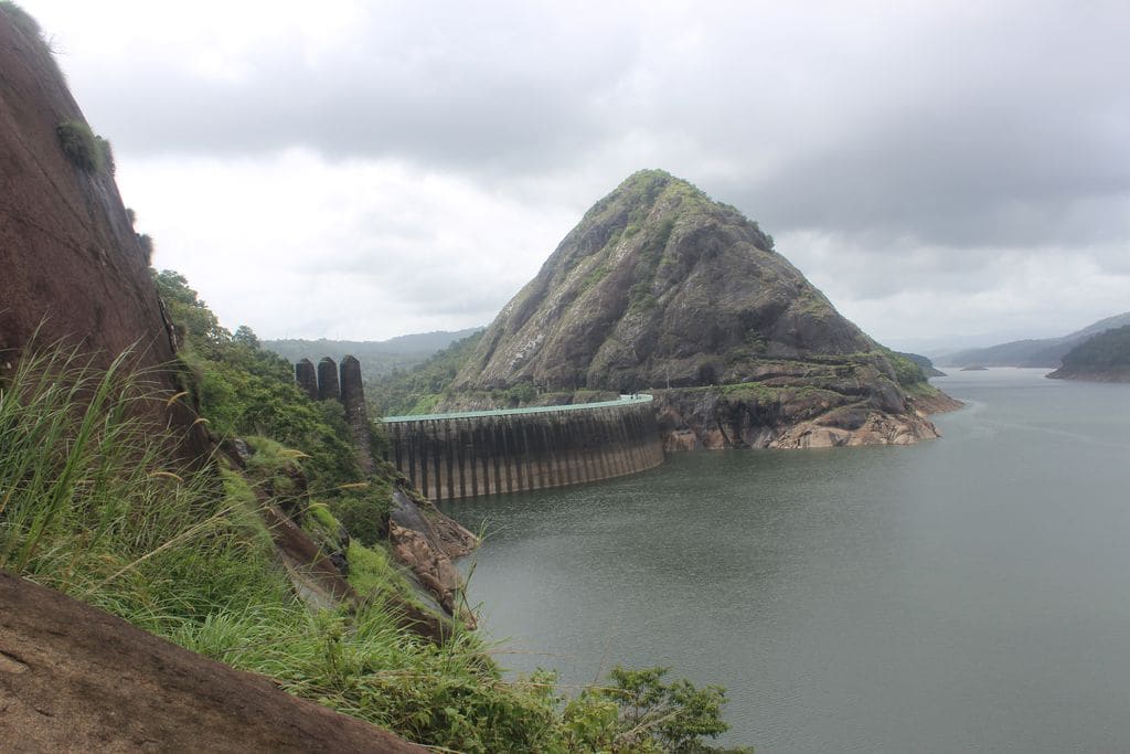
Kulamavu is one of three dams associated with the Idukki Hydroelectric Project. The other two are Idukki Arch Dam and Cheruthoni Dam. Together they retain the same large reservoir across a complicated highland basin. A photograph taken at Kulamavu therefore shows part of the Idukki storage system even when the famous arch dam is nowhere in the frame. The three names describe different structures, not three interchangeable entrances to a single sightseeing enclosure.

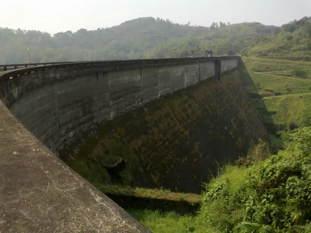
KSEB identifies the local watercourse as Kilivallithodu; its tourism operator uses the spelling Kilivillithode and describes it as a tributary of the Periyar. The structural difference is equally clear in the operator’s engineering account: Kulamavu is a gravity dam with concrete above and masonry below. The published dimensions are 100 metres in height and 385.06 metres in length. These describe the dam, not the visible height above the road or the length of an authorised visitor walk.

A gravity dam resists water pressure principally through the weight of its structure. That is why the downstream face appears as a massive, sloping body rather than the thin-looking sweep associated with the Idukki arch. The distinction gives Kulamavu an engineering story of its own. Visitors do not need access to restricted areas to appreciate that difference; historic photographs and a permitted exterior view can make the forms legible.

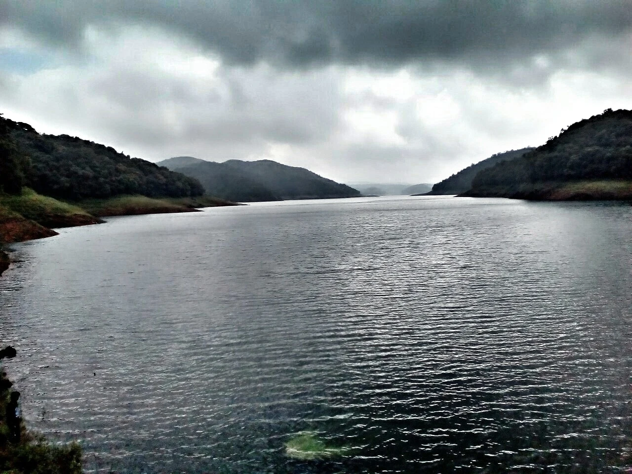
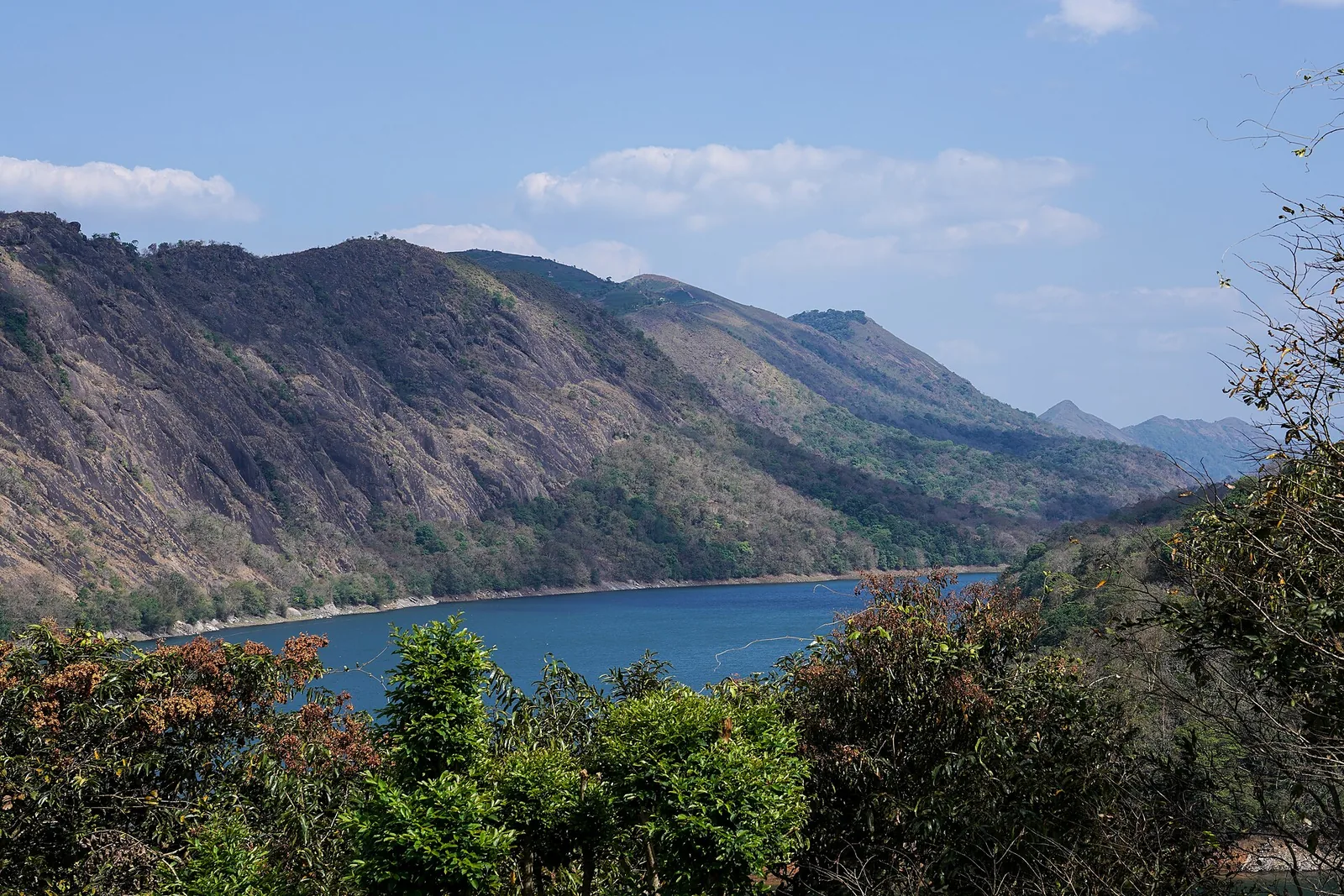
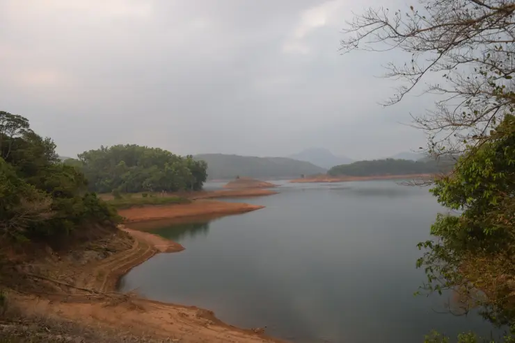
The reservoir’s operating surface is a better subject than a promise of permanent deep-blue water. When the level falls, brown banks emerge beneath the tree line, headlands extend and some shallow connections can narrow. When storage rises, those same margins disappear. The vegetation line and waterline need not coincide. Looking for the strip between them helps explain why photographs from different months can seem to show different lakes.

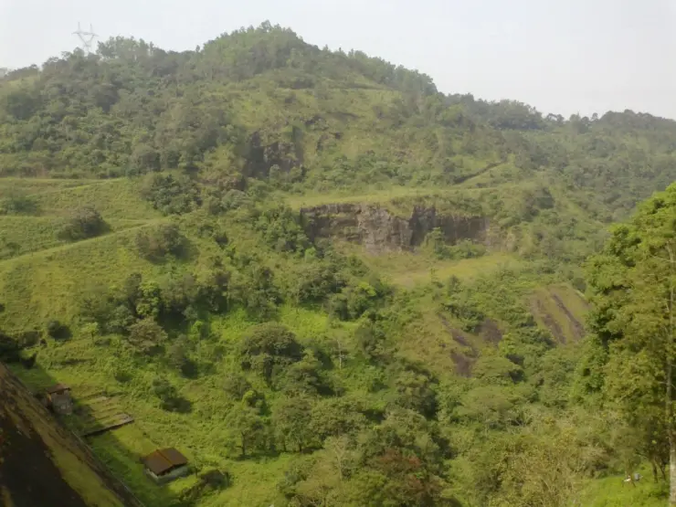
Branching inlets follow the land’s original contours. A ridge becomes a peninsula, a lower saddle can separate one arm from another, and wooded slopes continue beyond the visible water. This is why a lakeside road view cannot show the whole reservoir at once. The landscape is best read in layers: near bank, inlet, opposite slope and successive hills, with the dam only one engineered boundary among natural ridges.

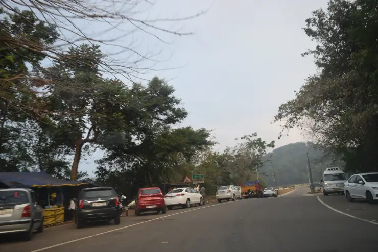
The route beside the dam is also a working transport corridor. The Thodupuzha–Puliyanmala road carries people between lower settlements and the high ranges. Its proximity makes Kulamavu easy to notice from a vehicle, but it also creates a temptation to stop wherever water appears. The view must be secondary to keeping the carriageway clear. The operator explicitly distinguishes a tourism visit from informal parking around the dam.

The township name can cause another misunderstanding. A room advertised in Kulamavu may lie along a reservoir arm or a road outside the immediate dam area. That location can be attractive in its own right, but it does not confer private access to the KSEB structure. Likewise, a meal or a view at a commercial property should not be described as part of the hydel-tourism ticket unless the operator explicitly includes it.

Water stored at this elevation is useful because of the height difference to the generating station. The project sends water through a power tunnel and pressure system towards Moolamattom, where turbines drive generators underground. The visitor beside Kulamavu sees storage and landscape, while the principal power-producing machinery is elsewhere. Looking for a public turbine hall at the foot of this dam misunderstands the layout of the project.

The distinction between an intake, a dam wall and a powerhouse is practical as well as technical. An intake admits water into the conveyance system; the dam retains it; the powerhouse converts its energy. These components have different operational hazards and access controls. A tourism-centre entry does not turn them into a continuous public walking route, and a marked service road should not be followed simply because it leads towards the water.

KSEB’s project description gives six generating units of 130 MW each at Moolamattom, for an installed capacity of 780 MW. Installed capacity is the rating of the station, not a statement that it generates that amount continuously. Water availability, demand and equipment operation affect actual output. Kulamavu’s quiet reservoir surface is therefore connected to a changing electrical system rather than a machine running at one fixed level for visitors.

The water continues to matter after generation. KSEB describes the tailrace discharge entering the Thodupuzha River and contributing to irrigation and further generation at Malankara. This downstream relationship makes a wider journey through Moolamattom and the Thodupuzha side more understandable. Those are separate destinations, however, and the hydrological connection should not be converted into a claim of a public trail following the entire route.

Photography needs particular care here because many widely circulated images are older than the current tourism notice. They can document the dam’s form or a past reservoir level, but they do not establish present permission to take the same frame. The operator’s current restriction at the dam governs the visit. A useful guide can show a historic exterior while being clear that the camera may need to stay put away on the ground.
Read the full history of Kulamavu Dam 298 more words

History

The Idukki project was dedicated on 12 February 1976. KSEB’s unit history records three generating units commissioned during 1976 and the remaining three in 1985–86. These stages belong to the hydroelectric project as a whole. They should not be confused with a single completion date for every dam, tunnel, road and visitor facility in the scheme.

KSEB records Canadian assistance and technical consultancy by Surveyor, Nenniger and Chenevert for the Idukki project. That partnership belongs to the engineering history of the system. At Kulamavu, the visible result is one of the retaining structures that made the shared reservoir possible, rather than a separate power project bearing only the township’s name.

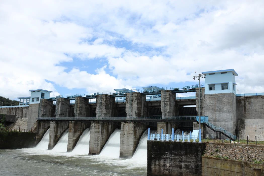
Among the three retaining dams, KSEB identifies Cheruthoni as the one with radial spillway gates. This is a crucial distinction when news or photographs show water releases from the Idukki reservoir. A Cheruthoni gate-opening photograph is not a photograph of Kulamavu, and a visitor should not travel here expecting the same spectacle at this gravity wall.

The current hydel-tourism article is dated 7 February 2026 and describes a named visitor programme at Kulamavu. Tourism is a later use around an operating asset, with its own reporting arrangements. It does not replace the dam’s purpose or remove the restrictions that come with storing water and conveying it towards a major generating station.

Why visit

To understand the less familiar gravity-dam side of the Idukki project, complementing the better-known arch and spillway structures without treating them as the same attraction.

To read a working reservoir’s changing shoreline: exposed banks, inlets and wooded headlands explain water storage more clearly than a single broad scenic photograph.

To connect a high-range road journey with the system that sends water down to Moolamattom. The view becomes more meaningful when storage, conveyance and generation are kept distinct.

What to expect

Highlights

  • A substantial gravity dam whose upper portion is concrete and lower portion masonry, distinct from the curved Idukki arch dam.
  • A reservoir landscape of branching inlets, wooded slopes and exposed drawdown banks, changing with stored water rather than remaining at one photographic level.
  • A road-side view into the Idukki hydel system, with a current named tourism-centre programme and clear limits around the working dam.
Getting there

How to visit

  • Approach from Thodupuzha through the Moolamattom–Arakkulam side, or follow the high-range road from Cheruthoni towards Kulamavu. Use Kulamavu Hydel Tourism Center as the institution for the visit.
  • The map marks the southwest road approach to the dam, not a parking bay or the reservoir centre. Follow the operator’s instructions for reporting and the areas currently open.
  • Separate the reservoir stop from any plan to visit Idukki Arch Dam, Cheruthoni or Moolamattom. Their entrances and permissions are not covered merely by arriving at Kulamavu.

Distance by road

  • Kochi107 km
  • Madurai172 km
  • Thiruvananthapuram226 km
  • Coimbatore252 km
  • Kozhikode276 km

Road km to Idukki; ghat roads and traffic vary — allow extra.

Timing

Best time

Clear daylight after sustained heavy rain has eased is best for understanding the hill-and-water landscape. Reservoir level depends on rainfall and operation; fuller water and clear skies do not necessarily occur together.

Weather in Kulamavu DamSeasonal guide

Live forecast loads in your browser.

Today at Kulamavu Dam
Sunrise6:11 am
Sunset6:08 pm
Golden hour best light5:08 pm–6:08 pm
Blue hour after sunset6:08 pm–6:33 pm
Sun sets toward compass bearingW · 263°
Moon tonight🌑 New moon · 0%
Retreating monsoon. October and November still see spells of rain from the retreating monsoon, though it is usually lighter than mid-year. Conditions are generally good but worth checking.

Sun and moon are calculated for this location and shown in IST. Photography windows are the hour around sunrise and sunset; the sunset bearing is degrees clockwise from true north. Moon phase is accurate to about half a day.

Visitor notes

  • Kulamavu’s tourism entry is not a ticket to inspect galleries, equipment, intake works or the underground powerhouse. Stay within the access actually offered that day.
  • Drawdown can expose large brown margins and small islands. Those surfaces are part of a working reservoir and should not be treated as newly opened walking routes.
  • A Kulamavu address may identify the township, a lakeside property or the dam approach. Use the institution’s full name when arranging a visit or a pickup.
Safety

Good to know

  • Stay outside fenced infrastructure and away from the reservoir edge. Water depth, soft margins and operational changes cannot be judged from a calm surface.
  • Keep the approach road clear and follow current operator directions. Do not stop a vehicle on the dam to photograph the view.
Official eco & forest programmes

Experiences around Kulamavu Dam

These are official or public-sector eco offerings that match this place, town or forest destination. Confirm availability, permits, tariffs and reporting times with the official operator before travel.

Idukki Wildlife Sanctuary, Kulamavu Dam
wildlifeboatingviewpoint

Idukki Wildlife Sanctuary eco visit

Forest and reservoir wildlife sanctuary around the Idukki-Cheruthoni dam landscape.

Kerala Forest Department
Official source →
Kalvari Mount, Kulamavu Dam
viewpointtrek

Kalvari Mount ecotourism viewpoint

Idukki reservoir viewpoint and pilgrimage hill, connected with Kerala Forest Ecotourism listings.

Kerala Forest Department / local tourism authorities
Official source →
Stay · eat · do · rent · see · shop

Stays, food & things to do near Kulamavu Dam

Browse listed stays, food, activities, sights, shops and rentals around Kulamavu Dam. Check each listing’s locality and contact the business directly for current arrangements.

1 thing to do near Kulamavu Dam

Ayurveda and wellness centre · Idukki and Cheruthoni
Sahyadri Ayurvedic Centre Peermade
Est. 47.2 km · 64 min drive~₹950–1110 by taxi

Kerala Tourism destination record for Peermade Ayurveda, Panchakarma, herbal medicine, yoga and wellness stays.

Directions Commission-freeView details

Book with the place itself. India’s cyber-crime coordination centre warned in April 2025 that convincing copies of hotel and pilgrimage booking sites are being pushed through sponsored search and social ads, taking payment for rooms the property never hears about. Use the contact and source details on each profile to confirm the exact business and booking channel. A directory entry or map pin alone does not establish an operator’s identity or current availability. Roampedia takes no commission and does not collect booking payments. If a booking page reached you through an ad, check the address bar against the property’s own site before you pay. Fraud can be reported on cybercrime.gov.in or on 1930.

Options

More ways to explore Idukki and Cheruthoni

This collection spans the wider Idukki highlands. Peermade, Kulamavu and the Neriamangalam–Adimali waterfall corridor are separate bases; select a stay or onward stop by its actual road location.

Across the whole of Idukki and Cheruthoni

Nearby guides

Top experiences around Kulamavu Dam

4 separate places to consider after Kulamavu Dam. Open each guide before deciding: their access, hours and return arrangements are independent.

viewpointNadukani Viewpoint

5.9 km · 6 min drive

Ghat viewpoint on the Thodupuzha–Puliyanmala road overlooking the Idukki high range, a popular stop for valley views and cool breezes.

townPainavu

17.6 km · 16 min drive

The hill headquarters town of Idukki district near the arch dam, a quiet high-range base for Idukki–Cheruthoni dam-side sightseeing and the surrounding reservoir viewpoints.

viewpointHill View Park

21.9 km · 24 min drive

The DTPC’s eight-acre garden and viewing park on the Vellappara shoulder above the Idukki reservoir, about 350 ft above the water. It is the dependable way to see the Idukki arch dam — strung between Kuravanmala and Kurathimala, roughly 1.6 km east-north-east — because the dam crest itself is shut most of the year and this is open every day from 08:00 to 19:00.

damCheruthoni Dam

21.8 km · 24 min drive

The 138-metre concrete gravity dam a kilometre west of the Idukki arch dam, carrying the five radial gates that are the only spillway for the whole Idukki reservoir — the gates opened in a south-west monsoon for the first time on 9 August 2018.

Roampedia is commission-free — own or know a stay, eatery, guide or shop near Kulamavu Dam? Submit public business details for review.

Add a nearby business
Before you go

Kulamavu Dam — at a glance

OperatorKerala State Electricity Board; visitor programme listed by Kerala Hydel Tourism Centre.
TimingsThe operator publishes two entry slots: 09:00–13:00 and 13:30–17:30. Confirm the available slot before travelling; operational or weather restrictions can override the listing
Best timeClear weather improves the view across inlets and ridges. After heavy rain, road and operational conditions matter more than the calendar. In drier periods expect exposed reservoir margins rather than a permanently full lake.

Entry: Kerala Hydel Tourism Centre lists a ₹10 Entry Pass for Kulamavu Hydel Tourism Center. Additional services are not implied by this pass

Photography: Photography is not allowed at Kulamavu Dam under the current operator notice. Keep cameras put away in the restricted dam area and ask staff which, if any, surrounding visitor views may be photographed. Historical images on this page do not establish present-day shooting permission.

Parking: The operator explicitly says tourists cannot park near Kulamavu Dam. Arrange reporting and any permitted vehicle waiting with the tourism centre before stopping; do not treat the approach marker, a roadside photograph or another driver’s parked car as permission.

Getting here

How to reach Kulamavu Dam

  • ✈︎ By air Cochin International Airport is the practical airport gateway. Continue by road towards Thodupuzha and the Kulamavu approach, allowing for the slower high-range section. No fixed airport-to-dam driving time is promised.
  • 🚆︎ By train There is no railway station at Kulamavu. Kottayam and the Ernakulam stations are practical rail gateways, followed by a road journey through the lower towns. Choose according to the train and the rest of the itinerary; a straight-line “nearest station” does not describe the ghat-road transfer.
  • 🚗︎ By road Use the Thodupuzha–Puliyanmala high-range road through the Arakkulam side, or approach from Cheruthoni. The map marks the southwest road approach to the dam. Report through the named Kulamavu Hydel Tourism Center rather than attempting to enter an equipment or service gate.
  • 🚌︎ By bus Thodupuzha is the useful lower-town bus interchange for this approach; choose a service routed through Kulamavu and confirm its stopping point with the conductor. A bus along the high-range road is transport to the locality, not a sightseeing shuttle that waits at the dam. Arrange the return separately.
Getting around

Getting around Kulamavu Dam

Follow the hydel-tourism centre’s reporting and vehicle instructions for the controlled part of the visit. Kulamavu township, a reservoir outlook and the working dam are separate locations; do not walk between them along operational or no-parking road space unless staff directs that route.

Getting back

Keep the return vehicle at the waiting place authorised by the hydel tourism centre. If arriving by bus, establish the boarding point and a service towards your onward town; the dam approach is not a place for a vehicle to wait wherever a passenger chooses.

Do

Things to do

  • Use the permitted visitor view to distinguish the massive gravity structure from the arch-dam image associated with Idukki.
  • Look for the difference between the waterline and the wooded slope above it to understand reservoir drawdown.
  • Follow the high-range road landscape as a passenger, leaving driving and safe stopping decisions to the driver.
  • Pair the stop with a separately arranged Idukki or Moolamattom visit only after checking its own access, rather than assuming a combined infrastructure tour.
Included

What’s included

  • Entry through the visitor arrangement currently offered by Kulamavu Hydel Tourism Center within the published slot.
  • A permitted understanding of the gravity dam and reservoir landscape from the area staff opens that day.
  • Orientation to Kulamavu’s role in the wider Idukki hydel system; access to galleries, equipment and Moolamattom powerhouse is not included.
Plan

Good to know

  • Confirm the reporting point and slot before leaving Thodupuzha or Cheruthoni; the road approach is not permission to stop at an operational gate.
  • Keep phones and cameras put away where the operator prohibits photography, even when older visitor images appear online.
  • Treat any separate reservoir viewpoint as its own stop and check that the vehicle can wait legally without obstructing the high-range road.
Facilities

On site

  • The named hydel-tourism centre publishes entry booking and two visit slots. Use it for current reporting instructions.
  • Kulamavu settlement and commercial properties provide separate town services; they are not automatically included in the dam visit.
  • The published centre listing does not establish a visitor boating service, swimming area or open inspection gallery. Treat each of those as a separate permission question, not a standard dam amenity.
Stay safe

Safety

  • Do not descend exposed reservoir banks, climb parapets or enter fenced equipment areas. Calm water does not reveal depth or a stable edge.
  • Keep vehicles moving where parking is prohibited and obey staff directions immediately if access changes.
  • Abandon an optional view when fog or heavy rain reduces visibility on the approach; there is no need to create an unsafe roadside stop.
Getting around Kulamavu Dam
From the entrance
The map uses the southwest road approach to Kulamavu Dam as a named arrival reference. The operator prohibits parking near the dam; obtain the authorised visitor stopping arrangement before passengers get out.
Step-free access
A road reaching the dam does not establish a safe wheelchair drop-off or an accessible tourism route. Ask the hydel tourism centre about the available unloading position and the route from it before committing to the stop.
  • Stay within the visitor area directed by staff, clear of operational gates.
  • Exposed reservoir banks are not a maintained promenade.

Checked 5 September 2026 against source 1source 2. Conditions change and surfaces vary with weather — if step-free access is essential, confirm with the site before you travel.

Practical things near Kulamavu Dam

These services are listed within about 1.2 km of Kulamavu Dam. Walking distances follow mapped routes; access and opening hours can change. Other services may be closer but are not included here.

Eat nearby

What to eat in Idukki and Cheruthoni

Use Kulamavu township for a meal or tea break. The hydel-tourism entry listing does not establish a café inside the controlled dam visit, and an entry pass should not be read as including refreshments.

Explore food in Idukki and Cheruthoni →
01

Before reporting

Finish a full meal in Kulamavu or on the approach before the selected entry slot so food does not delay the controlled visit.

02

During the dam stop

Carry no assumption that food is sold or may be eaten inside the operational area; follow staff instructions about what can be taken through the entrance.

03

Onward break

Choose the next town according to the route towards Thodupuzha or Cheruthoni rather than making an unsafe roadside stop for a reservoir view.

Nearby

What’s near Kulamavu Dam

viewpointNadukani Viewpoint

Ghat viewpoint on the Thodupuzha–Puliyanmala road overlooking the Idukki high range, a popular stop for valley views and cool breezes.

5.9 km · 6 min drive
trekVagavanam Windy Walk trek

The Forest Department’s guided walk on the grass tops at the southern end of the Idukki Wildlife Sanctuary, about ten kilometres by road from Vagamon — some seven kilometres on foot up jeep track and open ridge, with the Idukki reservoir catchment below you. The state will not sell it to fewer than six people, and it will not take more than seven.

12.8 km · straight line
hill stationVagamon

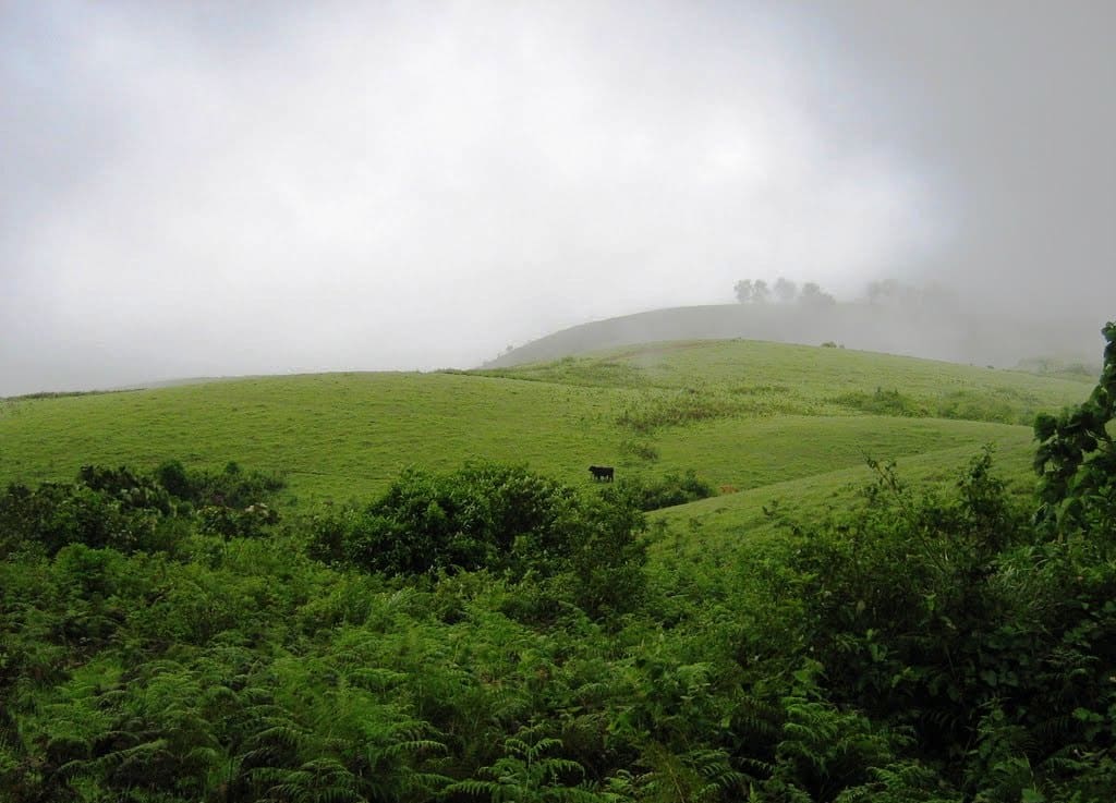
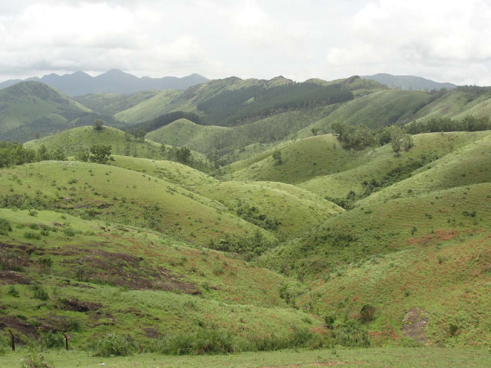
Rolling meadows, pine patches and viewpoints on the Idukki/Kottayam highland edge.

13.1 km · straight line
churchKurisumala

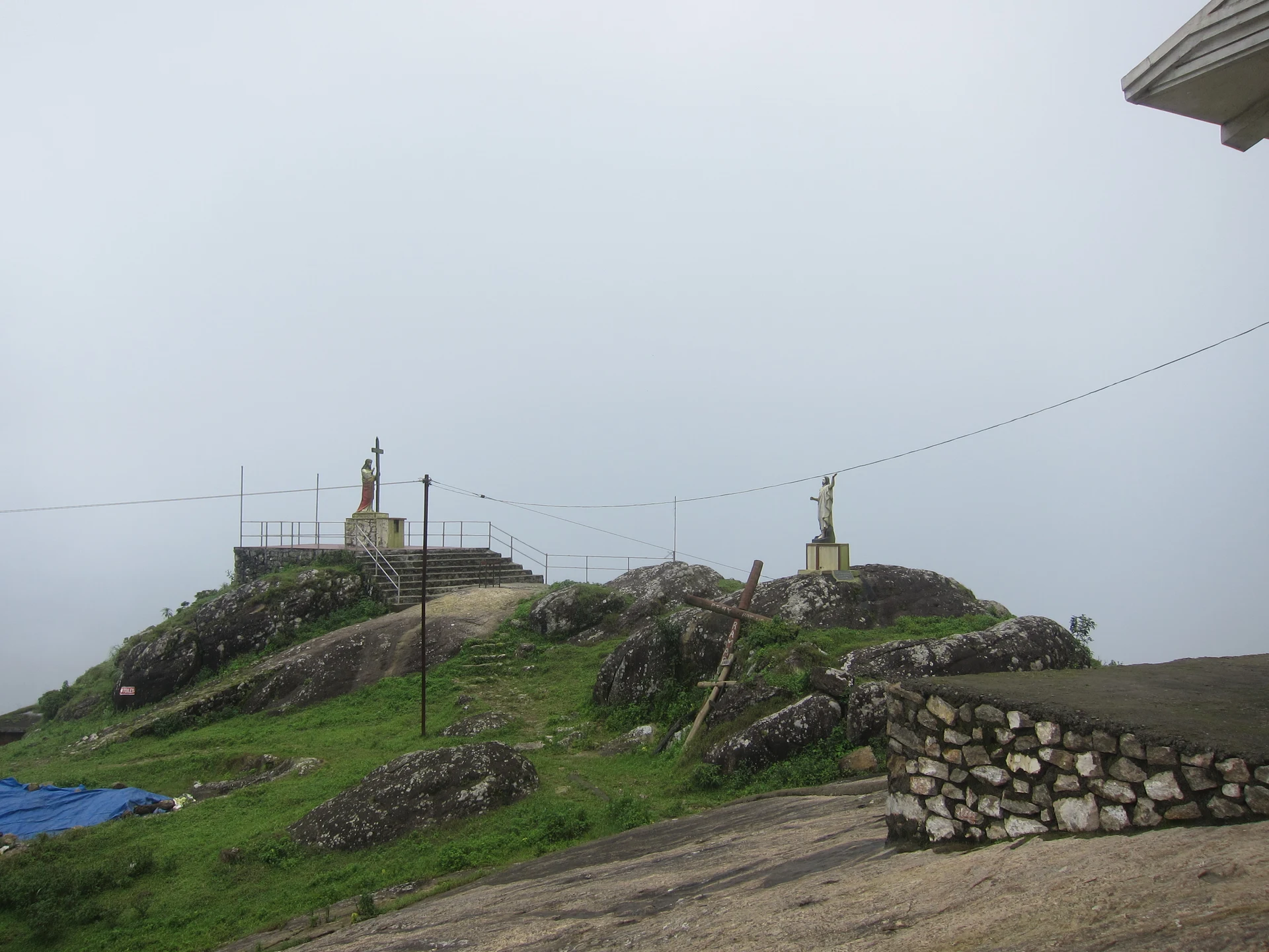
The pilgrim hill above Vagamon — a bare rock dome climbed by a 1.2 km path lined with the Stations of the Cross to St Thomas Church on the summit, and, 818 m away and lower down, the separate Cistercian monastery of Kurisumala Ashram, founded in 1958. Most descriptions run the two together; they are different places with different approaches and different people in charge.

13.9 km · straight line
hill stationVagamon meadows

Open meadow landscape forming the classic Vagamon sightseeing circuit.

15.7 km · straight line
mosqueThangalpara

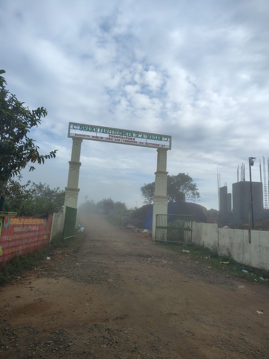
A working Muslim pilgrimage centre on a bare granite dome above Vagamon, on the Kottayam side of the district line. It calls itself the Shaikh Fareedudheen (R.A) Maqam, and the life set out at its gate — the saint’s father, mother, teachers and date of death — is that of Fariduddin Ganjshakar, Baba Farid, whose dargah is at Pakpattan in the Punjab. Kerala Tourism calls this rock his grave; the shrine says maqam, which is the smaller and more careful word.

15.9 km · straight line
townPainavu

The hill headquarters town of Idukki district near the arch dam, a quiet high-range base for Idukki–Cheruthoni dam-side sightseeing and the surrounding reservoir viewpoints.

17.6 km · 16 min drive
damCheruthoni Dam

The 138-metre concrete gravity dam a kilometre west of the Idukki arch dam, carrying the five radial gates that are the only spillway for the whole Idukki reservoir — the gates opened in a south-west monsoon for the first time on 9 August 2018.

21.8 km · 24 min drive
viewpointHill View Park

The DTPC’s eight-acre garden and viewing park on the Vellappara shoulder above the Idukki reservoir, about 350 ft above the water. It is the dependable way to see the Idukki arch dam — strung between Kuravanmala and Kurathimala, roughly 1.6 km east-north-east — because the dam crest itself is shut most of the year and this is open every day from 08:00 to 19:00.

21.9 km · 24 min drive
damIdukki Arch Dam

Major hydroelectric dam and one of Kerala’s landmark engineering sites.

25.1 km · 27 min drive
damMalankara Dam

An Irrigation Department dam and reservoir at Muttom near Thodupuzha, storing Thodupuzha River runoff and Idukki power-station tailwater for the Muvattupuzha Valley Irrigation Project; the visitor park has its own permitted areas.

29.9 km · 30 min drive
wildlifeIdukki Wildlife Sanctuary

Protected forest around the Idukki and Cheruthoni reservoirs near Painavu, with hilly evergreen woodland, elephants and boat-and-trek access arranged through the Forest Department.

38.5 km · 74 min drive

12 detailed place guides in Idukki and Cheruthoni →

Road and walking figures are route estimates, with travel times dependent on access, traffic and conditions. Figures marked “straight line” show direct separation and do not describe a road or walking route. Fare estimates use Kerala’s 26 April 2022 auto/taxi notification and exclude waiting, night and applicable one-way surcharges. Confirm the current meter or operator quote before travelling. Routing: © openrouteservice.org by HeiGIT | Map data © OpenStreetMap contributors

Nearby toilets, pharmacies, ATMs, seating and vets are community-mapped and may be incomplete or out of date. Map data © OpenStreetMap contributors | Walking times © openrouteservice.org by HeiGIT

On the map

Where Kulamavu Dam is

Good to know

Kulamavu Dam — frequently asked

Is Kulamavu Dam the same as Idukki Arch Dam?

No. Kulamavu is a gravity dam and Idukki is an arch dam. They work with Cheruthoni to retain one shared reservoir. Each structure has a different location and visitor arrangement; arriving at Kulamavu does not bring you to the arch-dam entrance.

Does the Kulamavu ticket include access inside the dam?

The published entry pass is for the hydel-tourism centre. It should not be interpreted as permission to enter inspection galleries, intake works or other restricted infrastructure. Use only the areas offered by staff for the day’s visit.

Can I visit the underground powerhouse from Kulamavu?

Moolamattom is a separate location down the hydel system. The engineering link through tunnels and pressure works is not a public route. Any organised or educational powerhouse access requires its own current KSEB arrangement.

Why do reservoir photographs show so much bare shore?

Stored water changes with inflow and operation, exposing margins below the vegetation line. Brown banks and temporary islands are normal features of drawdown. They are not designated beaches or proof that the shore is safe to walk on.

Can I watch spillway gates opening at Kulamavu?

KSEB identifies Cheruthoni as the gated spillway structure among the three Idukki reservoir dams. News images of those radial gates should not be used to promise a release spectacle at Kulamavu. Follow official notices rather than travelling towards operational activity.

Is boating part of the Kulamavu visit?

The current Kulamavu operator listing publishes an entry pass but does not establish a boat ride as part of it. Other Idukki reservoir boating centres have separate names and arrangements. Do not buy a plan on the assumption that any visible water has a public boat service.

Where does this page’s map lead?

It leads to the southwest road approach by the dam, used as an arrival landmark. It does not identify a permitted parking space or an entrance to equipment. Follow the hydel-tourism operator’s reporting directions and current road instructions on arrival.

How do I reach Kulamavu Dam?

Navigate to Kulamavu on the Thodupuzha–Puliyanmala road and follow the hydel tourism centre’s arrival instructions. The mapped southwest approach is a route reference, not permission to park beside the dam.

How much time do I need for Kulamavu Dam?

Make the length of the pause depend on the authorised visitor arrangement. A reservoir view does not include travel to the other Idukki dams or to Moolamattom’s separate powerhouse.

What should I know before visiting Kulamavu Dam?

The operator prohibits photography at the dam and parking nearby. Keep the distinction between a permitted visitor area and operational KSEB infrastructure clear throughout the stop.

When is the best time to visit Kulamavu Dam?

Clear daylight after sustained heavy rain has eased is best for understanding the hill-and-water landscape. Reservoir level depends on rainfall and operation; fuller water and clear skies do not necessarily occur together.

What are the entry fee and timings at Kulamavu Dam?

Entry: Kerala Hydel Tourism Centre lists a ₹10 Entry Pass for Kulamavu Hydel Tourism Center. Additional services are not implied by this pass. Timings: The operator publishes two entry slots: 09:00–13:00 and 13:30–17:30. Confirm the available slot before travelling; operational or weather restrictions can override the listing.

What else is near Kulamavu Dam?

Nearby you can pair Nadukani Viewpoint (5.9 km, route estimate), Vagavanam Windy Walk trek (12.8 km, approximate straight-line separation), Vagamon (13.1 km, approximate straight-line separation), Kurisumala (13.9 km, approximate straight-line separation).

Read before you go

Kulamavu Dam guides, stories & itineraries

Stories & history of Kulamavu Dam

Written about Kulamavu Dam itself — its history, its legends and the arguments about them.

Around Idukki and Cheruthoni

These reads cover nearby destinations, each with its own arrival point and visit arrangements.

Kerala-wide guides & itineraries

Route-level itineraries and practical guides for the rest of Kerala.

See all 153 Idukki guides & stories →