Idukki Arch Dam

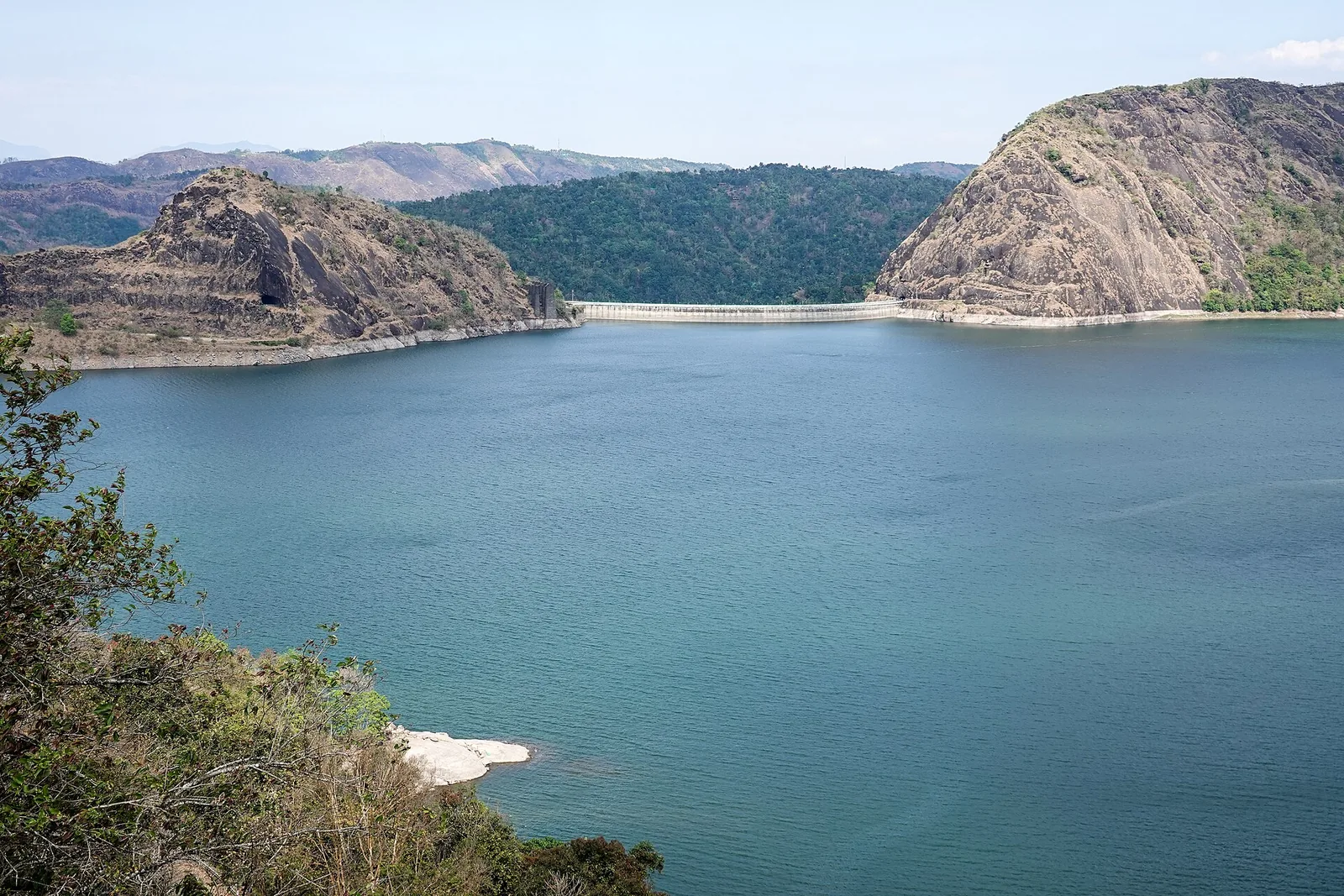
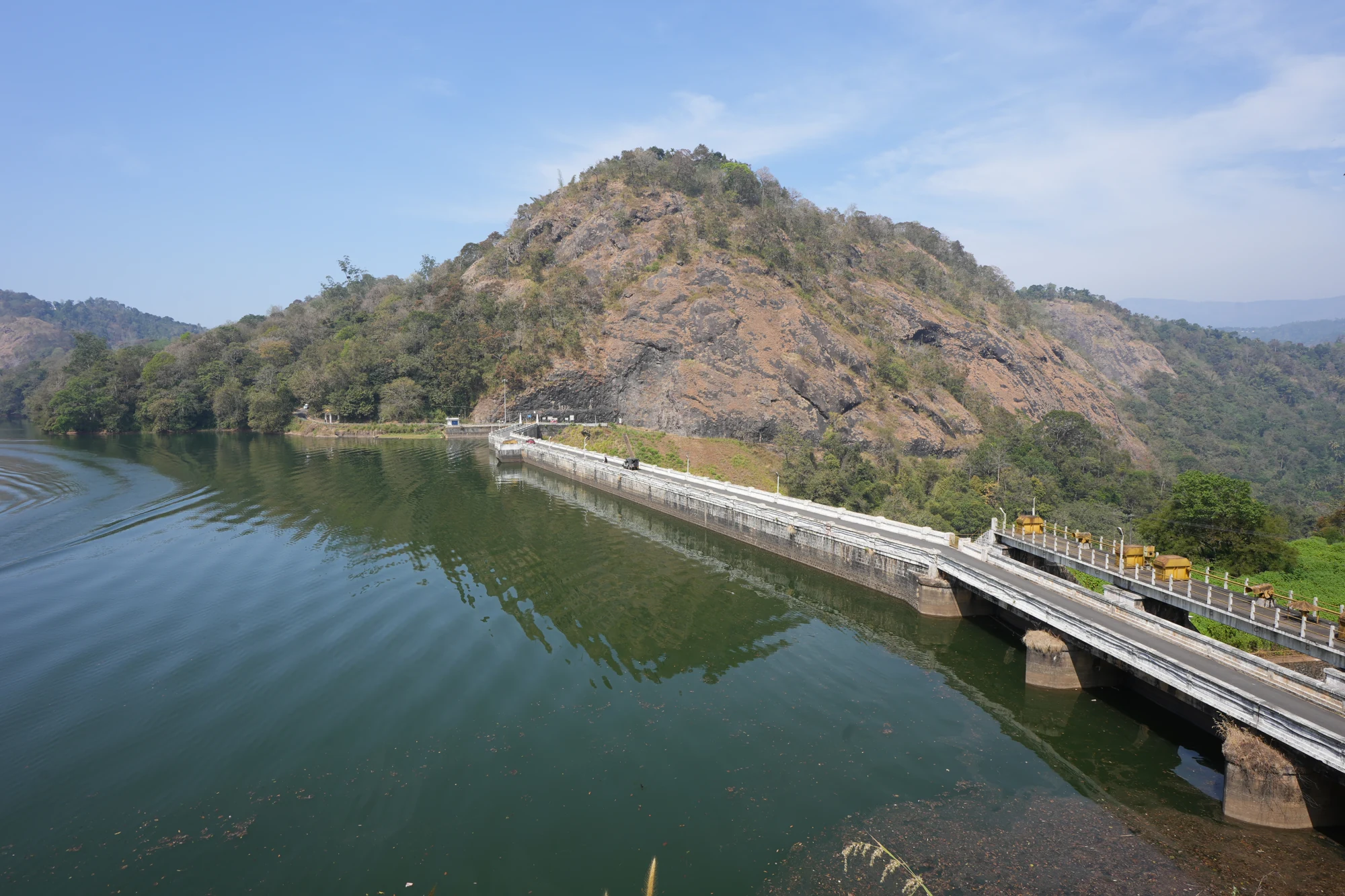
Idukki Arch Dam is Kerala's landmark hydroelectric structure, built across the Periyar between the Kuravan and Kurathi hills and forming the core of the Idukki reservoir system with Cheruthoni and Kulamavu. It is an engineering landmark as much as a viewpoint.

Idukki Arch Dam, Idukki and Cheruthoni
Practical guide

Plan Idukki Arch Dam

Who's going?Tailor Idukki Arch Dam to your trip
Typedam
AreaIdukki and Cheruthoni
DistrictIdukki
Best timeOctober to March is easiest for road…
Time needed1 to 3 hours for viewpoints
EntryVaries — see below
Places to visit12Listed businesses17

Public access around dam areas is security-controlled and can change by season, maintenance, water level and official decisions. Plan the Idukki-Cheruthoni area through currently open viewpoints and authorised visitor zones rather than assuming unrestricted dam entry.

The story

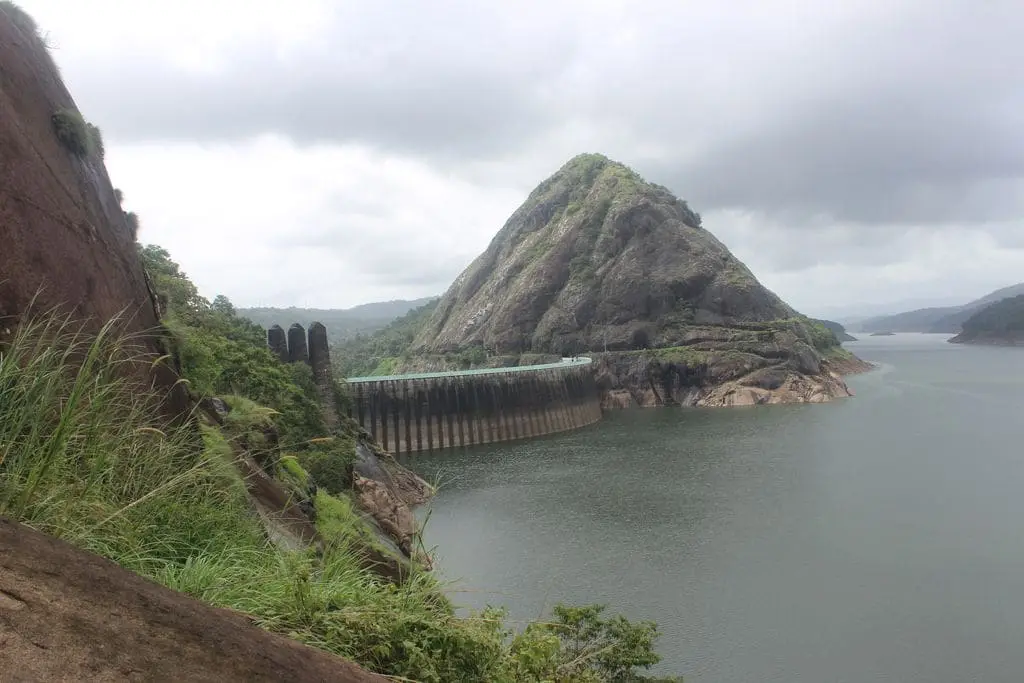
A wafer-thin wall of concrete curving 168.91 metres into the sky, wedged so tightly between two granite hills that the Periyar has nowhere to go but up — Idukki Arch Dam is one of Asia’s tallest arch dams and a place you can only see on a handful of days each year.

The story of Idukki Arch Dam

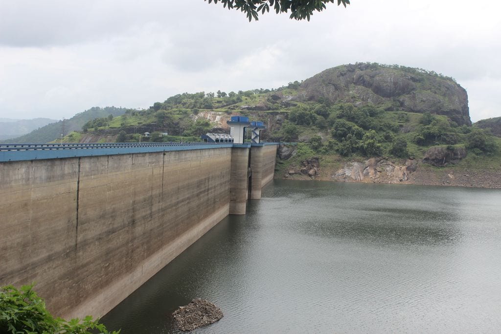
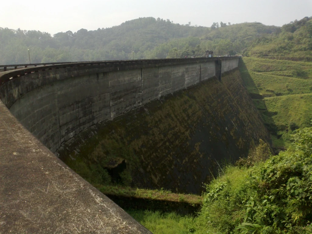
The road from Cheruthoni climbs through cardamom-scented hills, and then, quite suddenly, the forest parts and the arch appears — a pale, impossibly slender crescent of concrete strung between two dark granite shoulders of rock. Rising 168.91 metres (about 554 feet) and stretching some 365 metres across, the Idukki Arch Dam is a double-curvature parabolic thin arch dam, which is engineering-speak for a structure that curves in two directions at once, like the inside of an eggshell. It holds back the Periyar not by sheer bulk but by cleverness, transferring the colossal weight of the reservoir sideways into the living rock of the two hills that grip it.

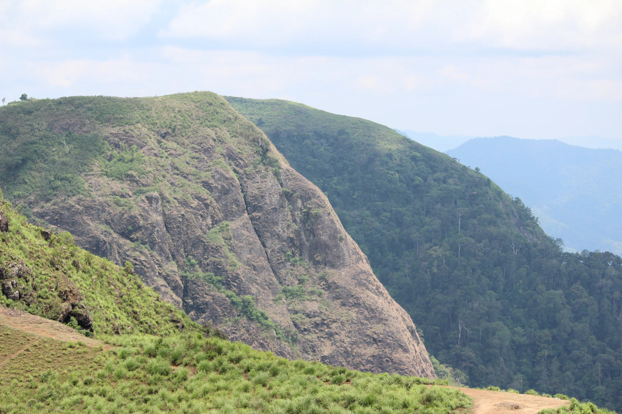
Those two hills have names, and a story. To the visitor’s eye they are simply the granite jaws of a gorge, but locally they are Kuravan and Kurathi — a tribal husband and wife turned to stone — and the dam takes its very shape from the tight natural chokepoint they form. It is precisely because the Periyar squeezes through this narrow rock throat that engineers could get away with such a thin, daring wall; a wider valley would have needed a fatter, heavier dam. Standing at the top, you look down a dizzying drop into the gorge on one side and out across a vast, still sheet of water on the other.

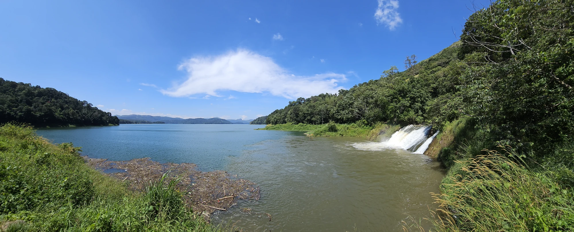
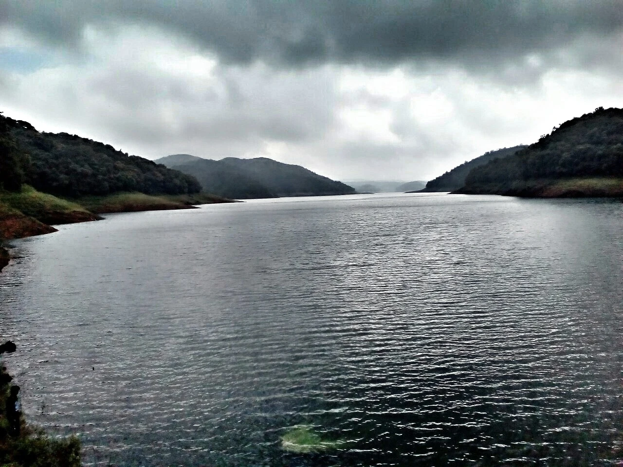
That sheet of water is one of India’s largest reservoirs, spreading over roughly 60 square kilometres and drowning entire valleys behind three linked barriers. Idukki Arch Dam does not work alone: it is the centrepiece of the Idukki Hydroelectric Project, teamed with the gated Cheruthoni Dam next door and the Kulamavu Dam a little further off, the three together sealing the high plateau into a single giant basin. From here the trapped water is not spilled but sent plunging down through a mountain to a hidden powerhouse, spinning turbines that light much of Kerala.

The engineering drama is matched by the drama of getting to see it at all. For most of the year the arch itself is off-limits — access to the dam top is restricted for security reasons, and this is not a place you can simply turn up to on a random Tuesday. The dam opens to the public only on select occasions, most famously during the Onam and Christmas holiday seasons, when crowds finally get to walk (or, these days, be driven in buggy vehicles) across the crest of one of the tallest arch dams on the continent.

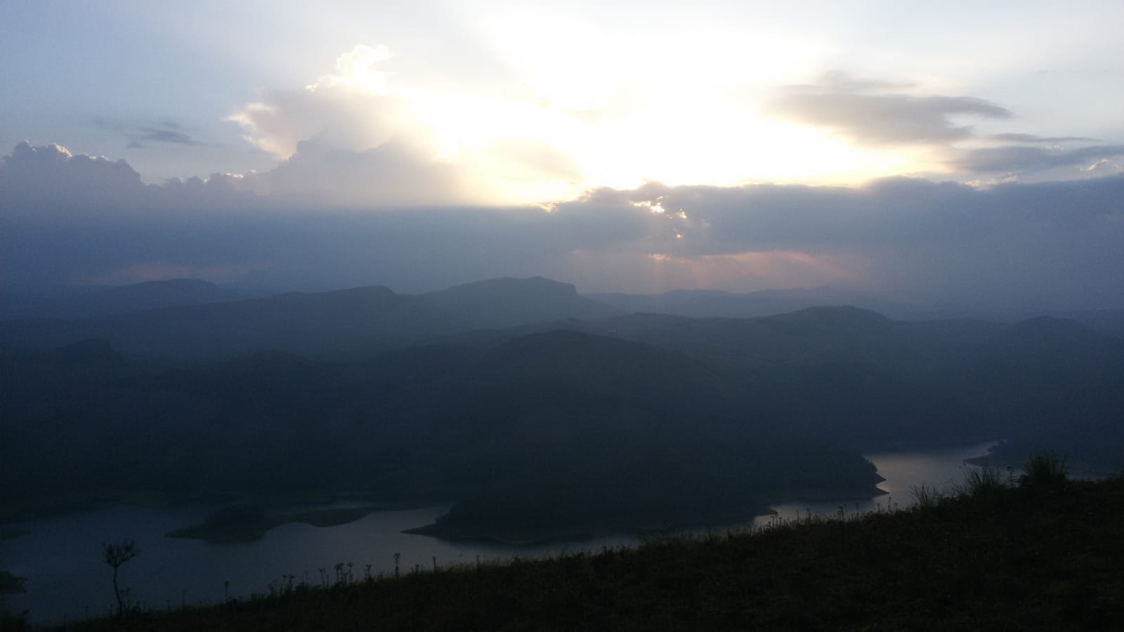
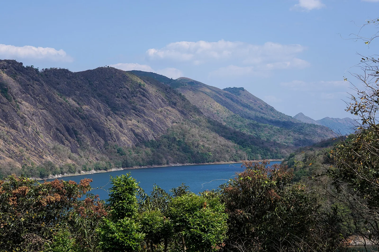
When it is open, the reward is a view that few dams in the world can offer: the thin white arc of the wall, the emerald reservoir cradled among forested ridges, mist burning off the water in the early morning, and the sheer vertical plunge into the Periyar gorge below. Boating on the reservoir and the nearby hill-view park are generally accessible more regularly than the dam top itself, so many visitors come for the water and the panoramas even when the crest is closed.

Set beside the twin settlements of Painavu and Cheruthoni — the quiet administrative heart of Idukki district — the dam is best folded into a wider high-range day: the pilgrim viewpoint of Kalvari Mount a short drive away, the Cheruthoni barrage with its dramatic gates, and the endless green corrugations of the Western Ghats rolling to the horizon. It is a monument to both nature’s geology and human nerve, and the fact that you can only catch it on chosen days somehow makes the arch feel all the more like a hidden marvel.

Legend & myth

The two hills that clasp the dam — Kuravan and Kurathi — carry a much-loved local legend, and it is worth knowing before you stand between them. As the tradition is told, Kuravan and Kurathi were a devoted tribal couple, husband and wife, who lived in these forests. One day, so the story goes, they happened to glimpse the goddess Sita bathing in the Periyar during Lord Rama’s forest exile, and for this trespass they were turned to stone. Distraught at the thought of being parted — for the couple had never in their lives been apart — they begged for mercy. Moved by their devotion, Rama is said to have blessed them so that they would remain together for all time, and set them down as the two great rock hills that now stand on either bank of the river, eternally facing one another. The gorge between them, folklore holds, is the narrow space the couple were left to share — and it is exactly in that gap that the modern arch dam was raised, so that Kuravan and Kurathi still stand together, now bound by a wall of concrete as well as by legend. (This is a traditional local legend, recounted here as folklore rather than history.)

Read the full history of Idukki Arch Dam 712 more words

History

The story of the dam begins not with engineers but with a tribesman. The narrow gorge between Kuravan and Kurathi is remembered as having been pointed out by Chemban Kolumban, a member of the local Oorali tribal community whose deep knowledge of these dense forests made him an indispensable guide. According to the widely retold account, Kolumban led the outsiders to the very spot where the Periyar squeezes between the two hills — the site that would eventually anchor the dam. The two encyclopedias disagree on when: en.wikipedia and the Idukki district administration date the hunting trip to 1922, while ml.wikipedia — in its article on the dam and in its dedicated article on Kolumban alike — puts it in 1932, the same year W. J. John submitted his report. Neither has displaced the other and we do not pick between them. A memorial to Kolumban stands near the dam today in acknowledgement of that role, though the precise details of the encounter, as with much oral history, are told in slightly varying forms.

The idea of harnessing the Periyar here is usually traced to around 1919, credited to an early survey report (often attributed to an Italian engineer named Jacob) on the power potential of the river. That first report was rejected. The proposal was carried forward in 1932, when W. J. John — superintendent of the Malankara rubber estate, working with an engineer brother — submitted a report to the then Government of Travancore on the feasibility of building a dam at Idukki for power generation. In 1935 the assembly member K. A. Narayana Pillai brought the scheme to the government’s attention again, and in 1937 two more Italian engineers, Angelo Omedayo and Clantheyo Masele, carried out a study of the site; nothing came of it either. For decades the scheme remained on paper, too vast and remote for the resources of the day, and it was only after Independence — a preliminary investigation by P. Joseph John in 1947, a Central Water Commission survey in 1956, a project report in 1961 and Planning Commission sanction in 1963 — that it moved towards reality.

Construction of the great arch finally began on 30 April 1969, undertaken with substantial Canadian assistance. The Government of Canada backed the project with loans and grants, and Canadian consulting engineers — the firm known as SNC (Surveyer, Nenniger and Chênevert, later part of SNC-Lavalin) — provided the technical expertise for the daring thin-arch design, with construction carried out by Indian contractors. The result, when it topped out, was a structure standing 168.91 metres tall, celebrated as Asia’s first arch dam and among the tallest arch dams on the continent.

The reservoir began filling in the early 1970s, and the first units of the associated power station went into trial operation on 4 October 1975. The completed Idukki Hydroelectric Project — the arch dam together with the Cheruthoni and Kulamavu dams — was formally dedicated to the nation by Prime Minister Indira Gandhi in February 1976. It remains owned and operated by the Kerala State Electricity Board.

Crucially, the arch dam does not itself house the machinery. The water it stores is carried through the mountains to the Moolamattom power station, one of India’s notable underground powerhouses, built deep inside the rock and equipped with Pelton-type turbines for a total installed capacity of around 780 MW. That hidden powerhouse, fed by the water the thin white arch holds back, has for decades been one of the largest sources of hydroelectric power in Kerala — the quiet engine behind the spectacle.

Why visit

See one of Asia’s tallest arch dams — a 168.91 m wall thin as an eggshell, curving between two granite hills.

Witness a rare, restricted marvel: the dam top opens to the public only on select days, mainly the Onam and Christmas seasons.

Take in sweeping views of a vast reservoir cradled among the forested ridges of the Western Ghats.

Feel the vertigo of the Periyar gorge plunging away beneath the crest of the arch.

Connect with living folklore — the legend of Kuravan and Kurathi, the stone couple whose hills hold up the dam.

Pair it with Cheruthoni, Painavu, boating on the reservoir and the pilgrim heights of Kalvari Mount for a full high-range day.
What to expect

Highlights

  • Double-curvature arch dam and major Kerala hydroelectric landmark.
  • Reservoir views, Cheruthoni/Idukki viewpoints, Hill View Park and high-range road loops.
  • What there is locally: drivers, family stays and food stops — the viewpoints themselves are unstaffed.
Getting there

How to visit

  • Base in Idukki, Cheruthoni, Painavu or Kattappana depending on the wider high-range itinerary.
  • Check current public access, ticketing and security rules before planning the dam as the centrepiece.
  • Pair with Hill View Park, Kalvari Mount or Cheruthoni-side viewpoints when direct dam access is restricted.

Distance by road

  • Kochi107 km
  • Madurai172 km
  • Thiruvananthapuram226 km
  • Coimbatore252 km
  • Kozhikode276 km

Road km to Idukki; ghat roads and traffic vary — allow extra.

Timing

Best time

October to March is easiest for road travel and views. Monsoon can be dramatic but access and safety advisories may change quickly.

Weather in Idukki Arch DamSeasonal guide

Live forecast loads in your browser.

Today at Idukki Arch Dam
Sunrise6:12 am
Sunset6:21 pm
Golden hour best light5:21 pm–6:21 pm
Blue hour after sunset6:21 pm–6:46 pm
Sun sets toward compass bearingW · 272°
Moon tonight🌓 First quarter · 53%
South-west monsoon. June to September brings heavy rain to Kerala. Trails, falls and ghat roads can be slippery, swollen or closed at short notice, and forest departments sometimes suspend access. Check locally on the day before you travel.

Check the official alert before you travel. Kerala’s beaches, waterfalls and trekking routes close at short notice during heavy rain, and district alert levels change day to day. We do not publish an alert level of our own — read it from the state authority: Kerala State Disaster Management Authority, or the district control room on 1077.

Sun and moon are calculated for this location and shown in IST. Photography windows are the hour around sunrise and sunset; the sunset bearing is degrees clockwise from true north. Moon phase is accurate to about half a day.

Visitor notes

  • Photography and movement can be restricted near dam/security zones.
  • Carry ID if visiting controlled areas.
  • Do not rely on old blog posts for access rules; check current official/local guidance.
Safety

Good to know

  • Follow all dam security, barrier and water-release instructions.
  • Avoid restricted tunnel, spillway and reservoir-edge areas.
  • Do not approach unsafe viewpoints during heavy rain or low visibility.
Official eco & forest programmes

Experiences around Idukki Arch Dam

These are official or public-sector eco offerings that match this place, town or forest destination. Confirm availability, permits, tariffs and reporting times with the official operator before travel.

Idukki Wildlife Sanctuary, Idukki Arch Dam
wildlifeboatingviewpoint

Idukki Wildlife Sanctuary eco visit

Forest and reservoir wildlife sanctuary around the Idukki-Cheruthoni dam landscape.

Kerala Forest Department
Official source →
Kalvari Mount, Idukki Arch Dam
viewpointtrek

Kalvari Mount ecotourism viewpoint

Idukki reservoir viewpoint and pilgrimage hill, connected with Kerala Forest Ecotourism listings.

Kerala Forest Department / local tourism authorities
Official source →
Stay · eat · do · rent · see · shop

Stays, food & things to do near Idukki Arch Dam

Verified hotels, homestays, restaurants, experiences, sights, shops and rentals around Idukki Arch Dam — commission-free, with direct contact. Filter by what you need.

3 places to eat near Idukki Arch Dam

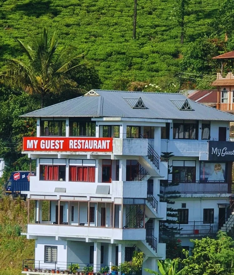
My Guest Restaurant Kuttikkanam — Kuttikkanam restaurant in Idukki and Cheruthoni
Top pick Verified
Kuttikkanam restaurant · Idukki and Cheruthoni
My Guest Restaurant Kuttikkanam
60.3 km · 61 min drive ~₹1190–1380 by taxi

Kuttikkanam restaurant in Idukki and Cheruthoni. My Guest Restaurant, NH-183, Theni By-Pass, Pambanar, Peerumade, Idukki, Kerala 685531 · Restaurant menu pricing · Kuttikkanam, Pambanar, Restaurant.

Directions Commission-freeView details
Agincourt Restaurant Kuttikkanam — Kuttikkanam restaurant in Idukki and Cheruthoni
Verified
Kuttikkanam restaurant · Idukki and Cheruthoni
Agincourt Restaurant Kuttikkanam
64.8 km · 71 min drive ~₹1270–1470 by taxi

Kuttikkanam restaurant in Idukki and Cheruthoni. Agincourt, Kuttikkanam, Peerumedu, Idukki, Kerala 685531 · Kuttikkanam, Restaurant, Peerumedu.

Directions Commission-freeView details
Igloo Heritage Restaurant Cheruthoni — Hotel restaurant in Idukki and Cheruthoni
Verified
Hotel restaurant · Idukki and Cheruthoni
Igloo Heritage Restaurant Cheruthoni
3.7 km · 6 min drive ~₹60–80 by auto

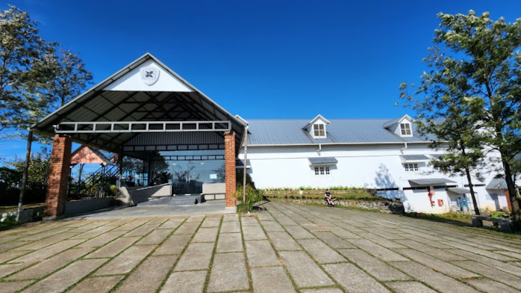
Hotel restaurant in Idukki and Cheruthoni. Igloo Heritage Resorts, Cheruthoni, Idukki district, Kerala · idukki-and-cheruthoni, eat, Hotel restaurant.

Directions Commission-freeView details

Book with the place itself. India’s cyber-crime coordination centre warned in April 2025 that convincing copies of hotel and pilgrimage booking sites are being pushed through sponsored search and social ads, taking payment for rooms the property never hears about. Every listing here links to the business’s own contact details and its own Google or Bing profile — we take no commission and sit in nobody’s payment path. If a booking page reached you through an ad, check the address bar against the property’s own site before you pay. Fraud can be reported on cybercrime.gov.in or on 1930.

Ranked

More ways to explore Idukki and Cheruthoni

Find food, accommodation and activities across Idukki and Cheruthoni. Browse the guides for places to eat, stay and explore along your route.

Nearest to Idukki Arch Dam, on foot

Walking routes start at Idukki Arch Dam. Check the route and access before setting out, especially where a road, gate or waterway separates the stops.

Across the whole of Idukki and Cheruthoni

Ranked guides

Top experiences around Idukki and Cheruthoni

20 more places around Idukki and Cheruthoni. Open a guide to plan the visit and onward journey.

A
Amrithamedu
Place
trekAmrithamedu

A Peerumedu ridge walk through plantation and high-range scenery, with access dependent on the chosen trail, land permission and current weather.

A
Ayyappancoil Hanging Bridge
Place
heritageAyyappancoil Hanging Bridge

15.4 km · ~26 min by cab

The long pedestrian suspension bridge above the Idukki reservoir at Ayyappancoil, valued for water and hill views as well as the crossing itself.

M
Madammakkulam Waterfalls
Place
waterfallMadammakkulam Waterfalls

A secluded waterfall below Kuttikkanam whose approach has depended on estate tracks and regulated jeep routes; current legal access must be established first.

damCheruthoni Dam

5.5 km · 11 min drive

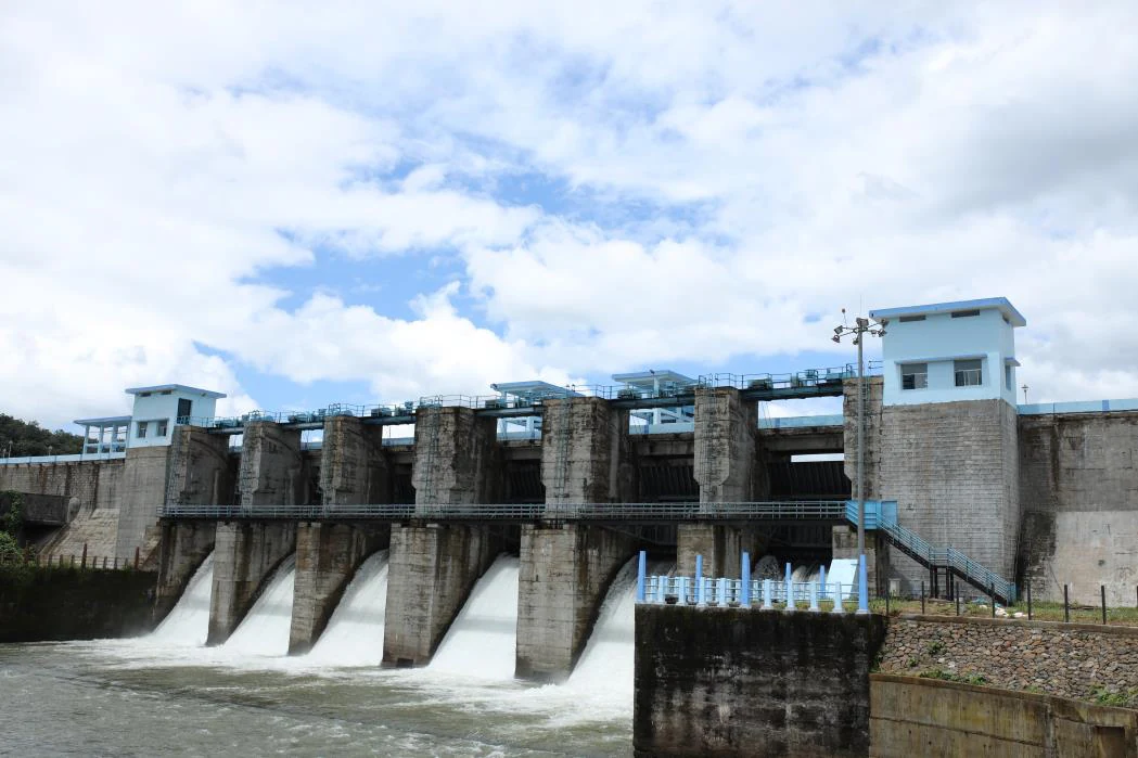
The 138-metre concrete gravity dam a kilometre west of the Idukki arch dam, carrying the five radial gates that are the only spillway for the whole Idukki reservoir — the gates opened in a south-west monsoon for the first time on 9 August 2018.

viewpointHill View Park

5.6 km · 10 min drive

The DTPC’s eight-acre garden and viewing park on the Vellappara shoulder above the Idukki reservoir, about 350 ft above the water. It is the dependable way to see the Idukki arch dam — strung between Kuravanmala and Kurathimala, roughly 1.6 km east-north-east — because the dam crest itself is shut most of the year and this is open every day from 08:00 to 19:00.

viewpointKalvari Mount

13.6 km · 19 min drive

Reservoir-view hill point near Idukki and Cheruthoni, useful for scenic drives, photos and central high-range itineraries.

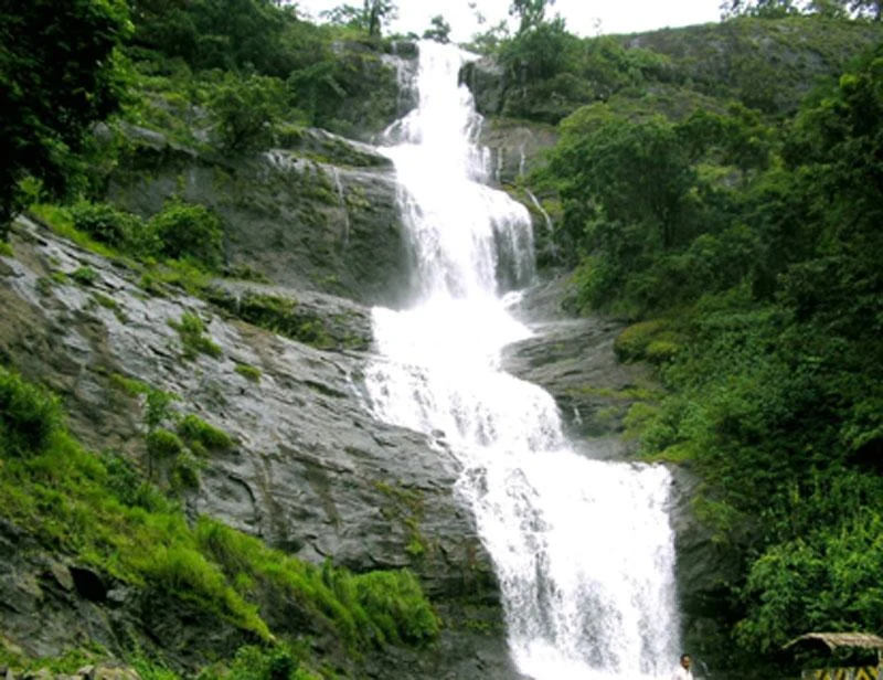
waterfallCheeyappara Waterfalls

Waterfall on the Kochi-Munnar road, commonly paired with Valara as a high-range arrival stop.

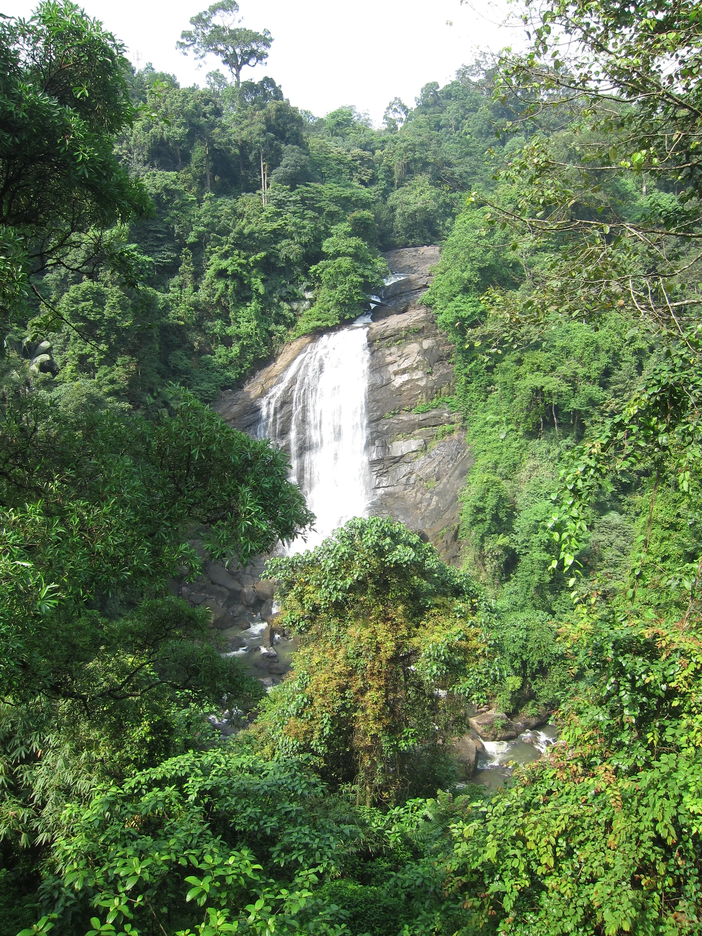
waterfallValara Waterfalls

Valara is the forest-framed Deviyar cascade beside NH85 between Neriamangalam and Adimali in Idukki. It is a separate roadside stop from Cheeyappara, with viewing from the road and no assumed access to the waterfall base.

hill stationPeermade

Peermade, also written Peerumedu or Peermede, is a plantation settlement and highland landscape on the Kottayam–Kumily road in Idukki. The map uses the town centre as a visitor base, not a single hilltop attraction.

viewpointPanchalimedu

Meadow and hill-viewpoint landscape near the Peermade/Kuttikkanam side of Idukki.

hill stationKuttikkanam

Peermade-side hill-station and adventure-tourism area, useful for tea estates, pine roads and central high-range routing.

damKulamavu Dam

25.0 km · 26 min drive

Kulamavu is KSEB’s gravity dam on Kilivallithodu and one of three dams forming the Idukki reservoir. Visit through the hydel-tourism arrangements; reservoir views do not authorise entry to restricted infrastructure.

waterfallThommankuthu Waterfalls

Seven-step cascade and eco-tourism trekking spot on the Kaliyar river near Thodupuzha, with rock pools, forest paths and a Forest Department eco-tourism trail.

damMalankara Dam

An Irrigation Department dam and reservoir at Muttom near Thodupuzha, storing Thodupuzha River runoff and Idukki power-station tailwater for the Muvattupuzha Valley Irrigation Project; the visitor park has its own permitted areas.

viewpointAnchuruli

28.4 km · 36 min drive

The Anchuruli reservoir-side landscape near Kattappana, where the Erattayar diversion tunnel discharges towards Idukki reservoir. Plan an exterior viewpoint visit; the water tunnel is working infrastructure.

wildlifeIdukki Wildlife Sanctuary

55.9 km · 80 min drive

Protected forest around the Idukki and Cheruthoni reservoirs near Painavu, with hilly evergreen woodland, elephants and boat-and-trek access arranged through the Forest Department.

damPonmudi Dam

32.6 km · 40 min drive

KSEB’s Panniyar-project dam at Konnathadi near Rajakkadu and Vellathooval in Idukki; a reservoir-and-engineering visit, distinct from Ponmudi hill station in Thiruvananthapuram.

townPainavu

7.4 km · 10 min drive

The hill headquarters town of Idukki district near the arch dam, a quiet high-range base for Idukki–Cheruthoni dam-side sightseeing and the surrounding reservoir viewpoints.

viewpointParunthumpara

A rock-and-grass viewpoint near Peermade on the Pambanar side of Idukki, overlooking steep wooded ravines; known as Eagle Rock and for the profile-like Tagore Rock formation.

viewpointNadukani Viewpoint

30.9 km · 32 min drive

Ghat viewpoint on the Thodupuzha–Puliyanmala road overlooking the Idukki high range, a popular stop for valley views and cool breezes.

Roampedia is commission-free — own or know a stay, eatery, guide or shop near Idukki Arch Dam? List it and it appears here once verified.

Add a nearby business
Before you go

Idukki Arch Dam — at a glance

Timings⚠ Access is restricted. The dam top is not open year-round — for security reasons it opens to the public only on select days, most commonly during the Onam and Christmas holiday seasons (and in some periods on Saturdays, Sundays and public holidays). On open days viewing is generally during daytime hours, roughly 10:00 a.m. to 5:30 p.m. Boating and the hill-view park nearby are usually accessible more regularly. Opening arrangements change year to year, so confirm before travelling.
Best timeSeptember to March, when the high-range weather is pleasant and the reservoir is full — and, crucially, aligned with the dam’s public-opening windows (typically the Onam season around August–September and the Christmas–New Year period). Plan your trip around the announced opening dates rather than the other way round.

Entry: Any entry or ticket charge on open days is nominal, and boating is charged separately; exact fees vary and are not consistently published.

Festivals: The dam’s best-known public openings coincide with the Onam holiday season (around August–September) and the Christmas–New Year period, when the crest is opened to visitors for a limited number of days.

Photography: Photography is heavily restricted at the dam for security reasons. On open days visitors are frequently not permitted to carry mobile phones or cameras onto the dam top, and photographing the structure is typically banned. Rules can change; check what is currently allowed on arrival.

Getting here

How to reach Idukki Arch Dam

  • ✈︎ By air The nearest airport is Cochin (Kochi) International Airport, roughly 100 km away — around a 3.5–4.5 hour drive through the hills.
  • 🚆︎ By train The nearest major railhead is Kottayam, about 105–110 km away; Ernakulam/Kochi stations are a broadly similar distance. From either, continue by road into the high ranges.
  • 🚗︎ By road Reached by road via Muvattupuzha, Thodupuzha and Cheruthoni; the final stretch winds up through cardamom-country hills to the dam site near Painavu.
  • 🚌︎ By bus Idukki is well connected by state and private buses from Kochi, Kottayam, Thodupuzha and Munnar to Cheruthoni/Painavu, from where the dam is a short local hop.
Getting back

If you are travelling by bus or ferry, check the return service with the operator before setting out. Leave time to reach the stop or jetty after your visit.

Ask at the bus stand for the time of the last service back, not the next one. If you miss it, an auto or app cab is the fallback — agree the fare before you get in.

Do

Things to do

  • Walk (or ride the buggy shuttle) across the crest of the arch on a public-opening day and take in the view down the Periyar gorge.
  • Gaze out over the huge reservoir spreading among the forested ridges of the Western Ghats.
  • Go boating on the reservoir waters, usually available more regularly than the dam top itself.
  • Spot the two granite hills — Kuravan and Kurathi — that clasp the dam, and the Kolumban memorial nearby.
  • Combine with the gated Cheruthoni Dam and the quiet twin towns of Painavu and Cheruthoni.
  • Climb to Kalvari Mount (Calvary Mount), a nearby hill-top viewpoint and pilgrimage spot, for panoramas of the reservoir.
  • Linger for sunrise or late-afternoon light, when mist rises off the water and the arch glows pale against the dark hills.
Getting around Idukki Arch Dam

If you need step-free access, contact the site before travelling. Ask about a level entrance, steps along the route, the nearest drop-off point, seating and accessible toilets.

Practical things near Idukki Arch Dam

These services are listed within about 1.2 km of Idukki Arch Dam. Walking distances follow mapped routes; access and opening hours can change. Other services may be closer but are not included here.

Nearby

What’s near Idukki Arch Dam

damCheruthoni Dam

The 138-metre concrete gravity dam a kilometre west of the Idukki arch dam, carrying the five radial gates that are the only spillway for the whole Idukki reservoir — the gates opened in a south-west monsoon for the first time on 9 August 2018.

5.5 km · 11 min drive
viewpointHill View Park

The DTPC’s eight-acre garden and viewing park on the Vellappara shoulder above the Idukki reservoir, about 350 ft above the water. It is the dependable way to see the Idukki arch dam — strung between Kuravanmala and Kurathimala, roughly 1.6 km east-north-east — because the dam crest itself is shut most of the year and this is open every day from 08:00 to 19:00.

5.6 km · 10 min drive
townPainavu

The hill headquarters town of Idukki district near the arch dam, a quiet high-range base for Idukki–Cheruthoni dam-side sightseeing and the surrounding reservoir viewpoints.

7.4 km · 10 min drive
viewpointKalvari Mount

Reservoir-view hill point near Idukki and Cheruthoni, useful for scenic drives, photos and central high-range itineraries.

13.6 km · 19 min drive
trekVagavanam Windy Walk trek

The Forest Department’s guided walk on the grass tops at the southern end of the Idukki Wildlife Sanctuary, about ten kilometres by road from Vagamon — some seven kilometres on foot up jeep track and open ridge, with the Idukki reservoir catchment below you. The state will not sell it to fewer than six people, and it will not take more than seven.

14.0 km · ~23 min by cab · straight line
A
Ayyappancoil Hanging Bridge
Place
heritageAyyappancoil Hanging Bridge

The long pedestrian suspension bridge above the Idukki reservoir at Ayyappancoil, valued for water and hill views as well as the crossing itself.

15.4 km · ~26 min by cab · straight line
hill stationVagamon

Rolling meadows, pine patches and viewpoints on the Idukki/Kottayam highland edge.

19.3 km · ~32 min by cab · straight line
damKulamavu Dam

Kulamavu is KSEB’s gravity dam on Kilivallithodu and one of three dams forming the Idukki reservoir. Visit through the hydel-tourism arrangements; reservoir views do not authorise entry to restricted infrastructure.

25.0 km · 26 min drive
viewpointAnchuruli

The Anchuruli reservoir-side landscape near Kattappana, where the Erattayar diversion tunnel discharges towards Idukki reservoir. Plan an exterior viewpoint visit; the water tunnel is working infrastructure.

28.4 km · 36 min drive
viewpointNadukani Viewpoint

Ghat viewpoint on the Thodupuzha–Puliyanmala road overlooking the Idukki high range, a popular stop for valley views and cool breezes.

30.9 km · 32 min drive
damPonmudi Dam

KSEB’s Panniyar-project dam at Konnathadi near Rajakkadu and Vellathooval in Idukki; a reservoir-and-engineering visit, distinct from Ponmudi hill station in Thiruvananthapuram.

32.6 km · 40 min drive
wildlifeIdukki Wildlife Sanctuary

Protected forest around the Idukki and Cheruthoni reservoirs near Painavu, with hilly evergreen woodland, elephants and boat-and-trek access arranged through the Forest Department.

55.9 km · 80 min drive

All 12 places to visit in Idukki and Cheruthoni →

Walking and driving times are real routed distances, except the few marked “straight line”, which are direct-line estimates and will read short. Fare figures are estimates from Kerala’s notified auto/taxi tariff and exclude waiting and night charges. Routing: © openrouteservice.org by HeiGIT | Map data © OpenStreetMap contributors

Nearby toilets, pharmacies, ATMs, seating and vets are community-mapped and may be incomplete or out of date. Map data © OpenStreetMap contributors | Walking times © openrouteservice.org by HeiGIT

On the map

Where Idukki Arch Dam is

Good to know

Idukki Arch Dam — frequently asked

Can I visit the Idukki Arch Dam any day of the year?

No. The dam top is not open year-round; for security reasons it opens only on selected announced dates, often around Onam and Christmas. Boating and Hill View Park usually operate more often. Travel specifically for dam entry only when KSEB or DTPC has published an open date.

How tall is the Idukki Arch Dam and what makes it special?

It stands 168.91 metres (about 554 feet) tall and is a double-curvature parabolic thin arch dam — celebrated as Asia’s first arch dam and among the tallest on the continent. Instead of a heavy straight wall, its slender curved shell transfers the water’s pressure sideways into the two granite hills it is wedged between.

Which river does it hold back, and where does the power come from?

It impounds the Periyar river. The dam itself generates no power directly; the stored water is carried through the mountains to the underground Moolamattom power station, which has an installed capacity of around 780 MW and is one of Kerala’s largest hydroelectric sources.

Can I take photographs at the dam?

Photography at the dam is heavily restricted for security reasons — on open days visitors are often barred from carrying mobile phones and cameras onto the dam top, and photography of the structure is typically prohibited. Rules can change, so check what is currently permitted before you go.

What is the legend of Kuravan and Kurathi?

The two hills gripping the dam are named after a tribal couple, Kuravan and Kurathi, who — as local legend tells it — were turned to stone by Lord Rama after glimpsing Sita bathing in the Periyar, then blessed to remain together forever as the two hills on either bank. The dam was later built in the narrow gap between them. It is a traditional folk legend rather than documented history.

How do I reach the Idukki Arch Dam?

It lies near Cheruthoni and Painavu in Idukki district. The nearest airport is Cochin (Kochi) International, roughly 100 km away, and the nearest major railhead is Kottayam, around 105–110 km away; the usual road approach is via Muvattupuzha, Thodupuzha and Cheruthoni.

When is the best time to visit Idukki Arch Dam?

October to March is easiest for road travel and views. Monsoon can be dramatic but access and safety advisories may change quickly.

What are the entry fee and timings at Idukki Arch Dam?

Entry: Any entry or ticket charge on open days is nominal, and boating is charged separately; exact fees vary and are not consistently published. Timings: ⚠ Access is restricted. The dam top is not open year-round — for security reasons it opens to the public only on select days, most commonly during the Onam and Christmas holiday seasons (and in some periods on Saturdays, Sundays and public holidays). On open days viewing is generally during daytime hours, roughly 10:00 a.m. to 5:30 p.m. Boating and the hill-view park nearby are usually accessible more regularly. Opening arrangements change year to year, so confirm before travelling.

How do I reach Idukki Arch Dam?

Base in Idukki, Cheruthoni, Painavu or Kattappana depending on the wider high-range itinerary. Check current public access, ticketing and security rules before planning the dam as the centrepiece. Pair with Hill View Park, Kalvari Mount or Cheruthoni-side viewpoints when direct dam access is restricted.

How much time do I need for Idukki Arch Dam?

1 to 3 hours for viewpoints; half day with nearby Idukki stops.

What else is near Idukki Arch Dam?

Nearby you can pair Cheruthoni Dam (5.5 km), Hill View Park (5.6 km), Painavu (7.4 km), Kalvari Mount (13.6 km).

What should I know before visiting Idukki Arch Dam?

Follow all dam security, barrier and water-release instructions. Avoid restricted tunnel, spillway and reservoir-edge areas. Do not approach unsafe viewpoints during heavy rain or low visibility.

Image credits

Photographs: KSEB (CC BY-SA 2.5), Athulvis (CC BY-SA 4.0), Department of Tourism, Government of Kerala (© Kerala Tourism), Alanjs (CC BY-SA 4.0). Wikimedia Commons.