What to expect
Highlights
- Reservoir and dam views at Peruvannamuzhi Dam
- Engineering landmark or garden/viewpoint stop
- Pair with nearby hill, forest or town routes
Irrigation reservoir and boating spot in the Kozhikode high ranges, with a 1977 government crocodile breeding centre on the shore.
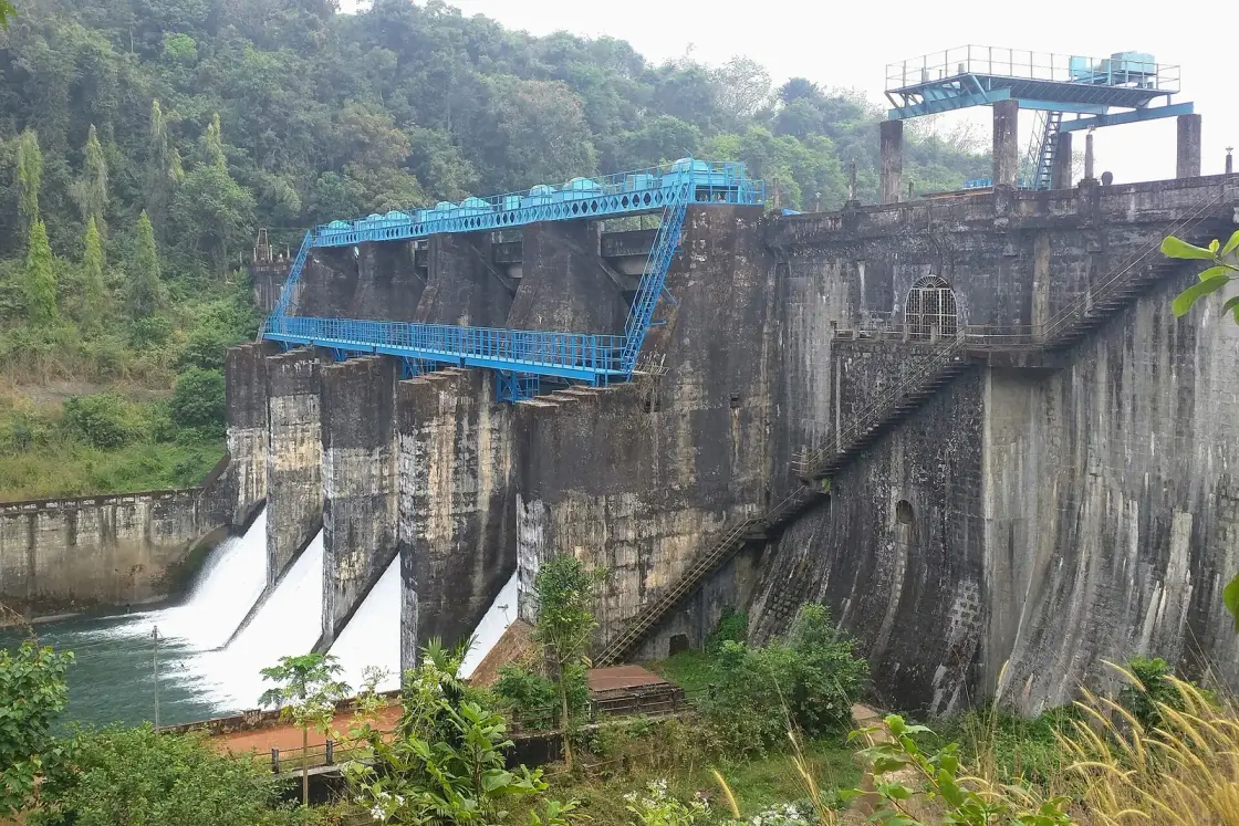
Cupped in the spice-green foothills of the Western Ghats about 60 km by road from Kozhikode — almost due north, not east, and barely 38 km as the crow flies — Peruvannamuzhi Dam is Malabar’s favourite day-outing on the water. A broad, island-dotted reservoir spreads behind a stone masonry wall; speed boats fan white wakes across the calm; a government crocodile breeding centre established in 1977 sits on the shore, and a wooded island locals call the pakshi-thuruthu, the bird island, rises out of the middle of it. Built as the storage heart of the Kuttiyadi Irrigation Project, it is a working dam wearing a holiday face — and, as it turns out, no longer doing the job it was built for.
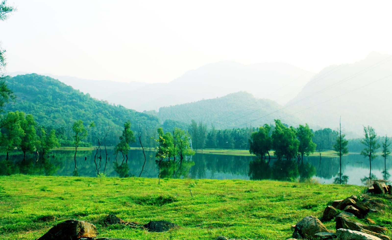
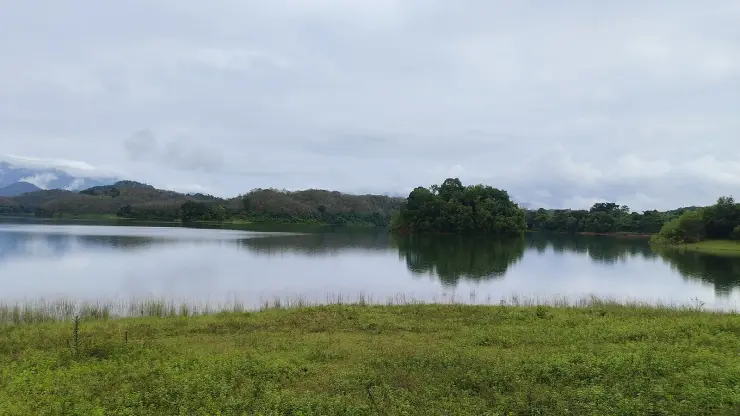
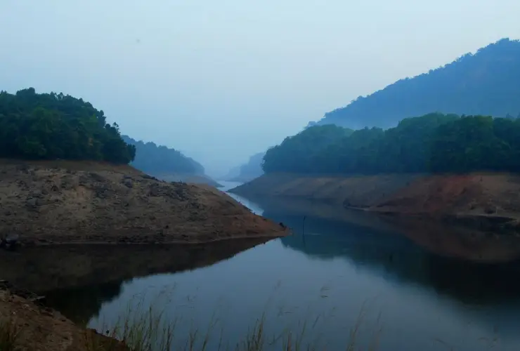
The first thing you notice at Peruvannamuzhi is the stillness of a very big sheet of water. The reservoir spreads out behind the dam wall like a flooded valley — because that is exactly what it is — its arms reaching back between wooded ridges until they vanish into blue haze. Low islands rise out of the calm, some no bigger than a clump of trees, and the whole scene sits inside a bowl of the Western Ghats. On a bright morning the water mirrors the hills so completely that it is hard to say where the forest ends and its reflection begins.
Most visitors come for the boating, and it is the right instinct. Speed boats wait at the little jetty for those who want the thrill — the sudden lurch, the spray, the ridge lines wheeling past — while slower row boats and passenger launches suit families and photographers who would rather drift (rides are ticketed separately and depend on water level and weather — confirm on the day). Out on the reservoir the temperature drops, kingfishers dart low over the surface, and the engine noise gives way, when you cut it, to birdsong rolling off the shore.
Two things get called sanctuaries here and only one of them is. The wooded island in the reservoir is known locally as the pakshi-thuruthu — literally the bird island — and cormorants and darters do dry their wings on its snags while herons work the shallows below. But there is no notified "Peruvannamuzhi Bird Sanctuary"; the protected area is the Malabar Wildlife Sanctuary, 74.2 sq km notified in 2010 across the Chakkittapara and Koorachundu villages, and its headquarters happen to be here at Peruvannamuzhi. The island is a good place to watch birds. It is not a legal designation, and we would rather tell you that than repeat the brochure.
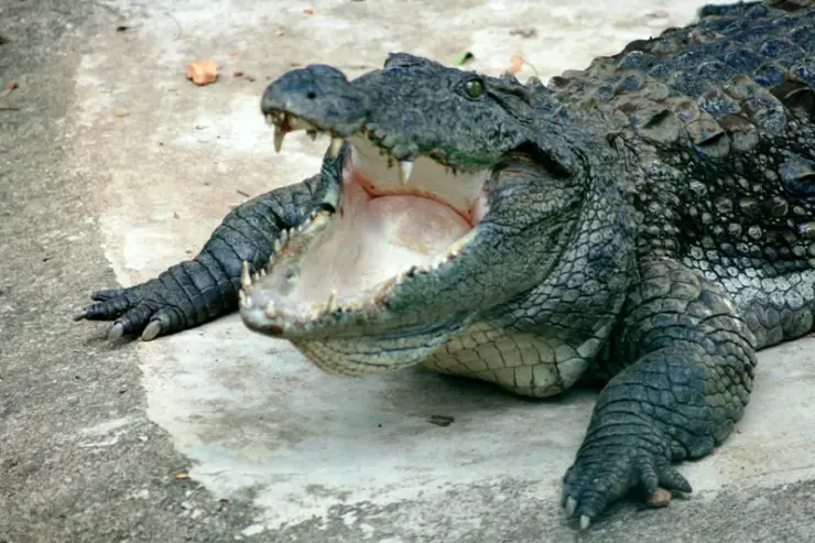
The crocodiles are the other thing worth getting right. The enclosures on the shore are a Government Crocodile Breeding Centre run by the Kerala Forest Department, and its own painted board gives the date to the day: established 7 January 1977. The word "farm" misleads badly. India's crocodile-skin trade was legal until the Wildlife (Protection) Act of 1972 closed it, and a visitor reading "crocodile farm" reasonably assumes a relic of it — but this is the opposite, one of two centres Kerala opened in 1977 to breed muggers in captivity and release them into protected areas. The board lists six animals: three male, two female, one juvenile.
One island carries a quieter weight, and an honest uncertainty. A garden on it is called the Smaraka Thottam and is described everywhere as a memorial to the region’s freedom fighters — but every source repeats one identical sentence, and none of them names a person, a year or an order. We have not been able to find who it commemorates. (The variant name "Smrithivanam" that circulates online is not attested anywhere.) Meanwhile the one memorial at Peruvannamuzhi you can actually stand and read is a white obelisk by the dam road, topped with the Ashoka lions, whose plaque commemorates not a person but a set of measurements.
Around the water, the land does the rest of the work. The catchment climbs into pepper and rubber country, and the drive in threads past smallholdings, plantation slopes and pockets of evergreen forest belonging to the wider Malabar wilderness. Peruvannamuzhi and Kakkayam are often planned together and they are on the same river — but be warned that they are not a short hop apart. There is no through road between the two reservoirs. Kakkayam is reached on an entirely separate road up from Balussery and Koorachundu, so pairing them means driving back down and round, and it makes for a long day rather than a lazy one.
What makes the place linger is how unhurried it feels. There are no crowds shouting for your attention, no strip of shops — just water, forest, a jetty, and the long green islands. Come on a weekday and you may share the reservoir with little more than a fisherman’s canoe and a wheeling raptor. It is a destination that rewards slowness: a boat ride, a walk among the birds, a packed lunch under the trees, and the road home through the spice hills as the light goes gold.
Every board at Peruvannamuzhi, every guidebook and — until this page was rewritten — our own description all say the same thing: this is an irrigation dam. That is what it was designed as, and the design was not modest. The Kerala Irrigation Department's brief specified an ayacut of 14,568.70 hectares across the Kozhikode, Koyilandy and Vadakara taluks, fed by a left-bank main canal of 40.02 kilometres and a right-bank main canal of 34.27, ten branch canals totalling 136 kilometres, and roughly 330 kilometres of distributaries and sub-distributaries, with the main canal sized for 18.38 cubic metres a second. That is a very large machine for growing rice.
In March 2017 the Centre for Water Resources Development and Management published a benchmarking study of the Kuttiyadi Irrigation Project. CWRDM is not a critic from outside: it is the Kerala government's own water research institute, and it is headquartered in Kozhikode, in the very district these canals serve. Its finding was that against a designed command and a paddy area of 14,569 hectares in the 1970s, the paddy actually growing under the canals had fallen to 1,210.59 hectares. That is a decline of about 91 per cent. Nine out of every ten hectares this dam was built to water are no longer growing the crop it was built to water.
The study also asked why, and the answers are unglamorous. Its socio-economic survey found that 87 per cent of the farmland in the command had undergone reclamation — paddy converted to coconut, rubber, arecanut, banana and house plots. Farmers who had stopped cultivating gave two reasons above all others: labour shortage, and water that did not arrive. The canals are part of that second reason. Conveyance losses were measured at 0.6 to 10 per cent on newly cement-lined reaches, but 1 to 26 per cent on unlined ones. On a bad stretch a quarter of the water can disappear before it reaches a field.
So what does the reservoir actually do now? It supplies drinking water. The Irrigation Department states that a scheme with an installed capacity of 174 million litres a day has been completed here, and that 150 million litres a day are currently being drawn to supply major parts of Kozhikode district — the Japan Bank for International Cooperation loan that people around Perambra and Balussery still call the Japan kudivella padhathi. Beyond that, water is released down the spillway and canal sluice on request for no agricultural reason at all: purely to push salinity back from the Kerala Water Authority's intake at Gulikappuzha, so that Vatakara can keep drinking.
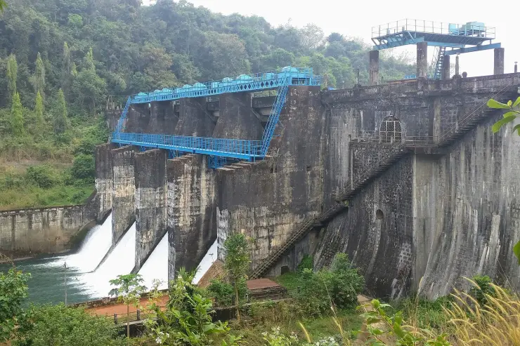
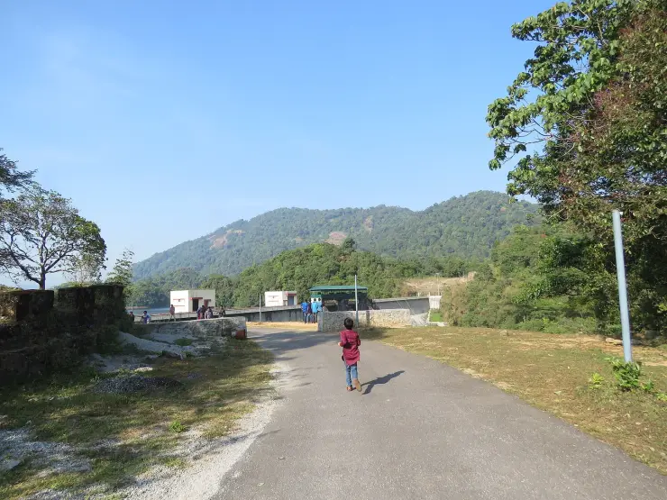
None of this is a failure, and it is worth being careful about the word. Peruvannamuzhi has been quietly repurposed. A reservoir holding 120.52 million cubic metres behind a stone masonry dam and thirteen earth dams, spread over 1,052 hectares, is now principally a municipal water tank for a city sixty kilometres away, with irrigation as the residual use and tourism as the visible one. Nobody announced the change. There was no ribbon. The canals are still there, still mapped, still on the plaque — the obelisk by the dam road still records 37.2 kilometres of left-bank canal, 37.2 of right-bank and an ayacut of 14,575 hectares, as though 1973 were still going on.
The dates are the part that lands. Construction began in 1962 and the project was not declared complete until 1993 — and by the time it was finally functioning in full swing, the countryside it had been designed to irrigate had largely stopped being paddy. It was finished and obsolete inside roughly the same decade. What saved it was thirst rather than hunger. Stand on the parapet and you are looking at a Nehruvian irrigation temple that survived by becoming plumbing, which is a stranger and better story than the one on the signboard.
Peruvannamuzhi Dam belongs to the Kuttiadi (Kuttiyadi) Irrigation Project, one of the most important irrigation schemes in the Malabar region and, historically, the principal one in Kozhikode district. The project was conceived to harness the Kuttiadi river’s upland flow — impounding the monsoon so that water could be released steadily through the dry months for farmland across the northern plains.
The build took thirty-one years. The Irrigation Department's own record is unusually candid about both the timing and the mood: the project started in 1962, was partially commissioned in 1973, and "started functioning in full swing since 1993 when it was completed". The department describes it as conceived in "the Nehruvian period when dams were considered to be temples" — which is the right frame for the scale of what was drawn. Water distribution began in 1973; the last of the works were finished twenty years after that.
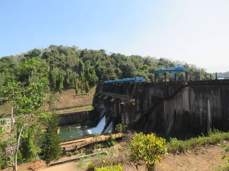
The numbers are worth having straight, because the dam publishes two sets of them. The Irrigation Department's asset register gives a main dam of stone masonry gravity construction — plus, and this is the part nobody mentions, thirteen separate earth dams plugging the low saddles around a lumpy laterite rim. Maximum height above lowest foundation 35.36 m; catchment 108.78 sq km; gross storage 120.52 million cubic metres with 113.44 million live; reservoir area at full level 1,052 hectares; an ogee spillway 48.8 m long with four radial gates of 12.2 m by 7.62 m. The design flood was calculated by Ryve's formula, a nineteenth-century Madras Presidency method, which tells you exactly which engineering tradition drew these plans.
The command area is three taluks, not three districts. The department states it plainly — this is "the only one in Kozhikode District" — and the designed ayacut of 14,568.70 hectares lies in the Kozhikode, Koyilandy and Vadakara taluks, all inside Kozhikode district. The frequent claim that the water reaches Malappuram and Kannur appears to be taluk names being read as district names. Serving it are a left-bank main canal of 40.02 km, a right-bank main canal of 34.27 km, ten branch canals totalling 136 km and some 330 km of distributaries.
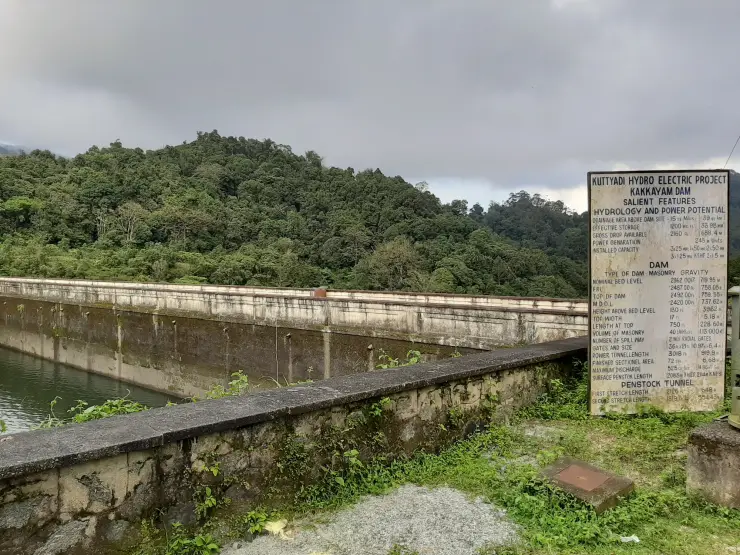
There is no power station here, and that matters for understanding the whole river. Peruvannamuzhi is an Irrigation Department asset; a 6 MW scheme has been proposed and never built. All the generation is upstream at Kakkayam, where the Kuttiyadi powerhouses take the water down a 658-metre drop before releasing it — and the tailwater then rejoins the river and flows into this reservoir. Peruvannamuzhi is the bottom of the cascade, catching what the turbines have finished with, not a contributor to them.
The visitor facilities came much later and are datable. The eco-tourism project at the dam was inaugurated on 10 August 2008; a ₹3.13 crore modernisation of the tourist centre — parking, children's park, garden renovation, cafeteria, ticket counter, entrance gate — had its works inaugurated on 3 November 2020. The crocodile breeding centre long predates both, opening on 7 January 1977, four and a half years after the Wildlife (Protection) Act. Cage fish-farming was introduced in the reservoir in 2021, a further use of the same water.
Peruvannamuzhi should not be confused with the higher Kakkayam Dam deeper in the same hills, which is tied more directly to the Kuttiadi hydroelectric works. The two sit in the same upland catchment and are often visited together, but they are distinct structures with distinct roles — Peruvannamuzhi the broad, accessible leisure-and-irrigation reservoir, Kakkayam the steeper, wilder dam-and-trekking zone above it.
The boating is the headline. Few reservoirs in north Kerala offer speed boats, row boats and launch rides on water this calm and this scenic — a genuine on-the-water experience with the Western Ghats rising on every side, suited equally to thrill-seekers and to families who just want to drift (rides ticketed separately — confirm on the day).
It is a rare three-in-one nature stop. A single boat ride reaches an island with a bird sanctuary, a crocodile and reptile farm and a small aquarium, so children and adults get birds, crocodiles and a scenic cruise in one easy, low-effort outing.
The setting is the real luxury — a large island-studded reservoir cradled by spice hills and forest, with the cool air, birdsong and mirror-still water that make Malabar’s uplands special, and none of the crowding of Kerala’s marquee hill stations.
There is quiet meaning here too. The Smrithivanam memorial garden island, laid out for the region’s freedom fighters, gives the visit a reflective note you do not expect at a boating spot and ties the landscape to Malabar’s independence-era history.
It is the perfect base for Kakkayam. Peruvannamuzhi pairs naturally with the higher Kakkayam eco-tourism and trekking zone — a calm morning on the reservoir followed by an afternoon of waterfalls, viewpoints and forest trails in the hills above.
And it is deeply local and unhurried — a working irrigation dam that Malabar families have long used as a picnic ground, so it feels authentic rather than packaged, especially on a weekday when the water is nearly your own.
Road km to Kozhikode; ghat roads and traffic vary — allow extra.
Post-monsoon and winter for scenery; monsoon access may change.
Live forecast loads in your browser.
Sun and moon are calculated for this location and shown in IST. Photography windows are the hour around sunrise and sunset; the sunset bearing is degrees clockwise from true north. Moon phase is accurate to about half a day.
These are official or public-sector eco offerings that match this place, town or forest destination. Confirm availability, permits, tariffs and reporting times with the official operator before travel.
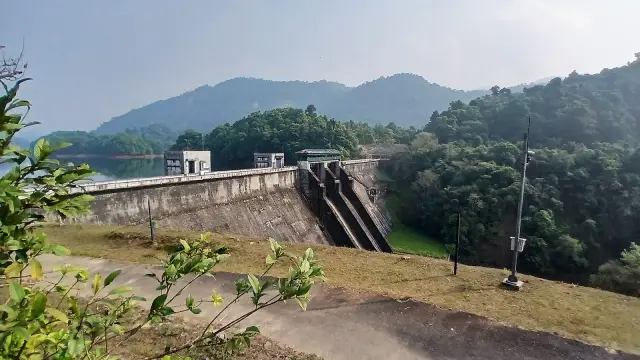
Forest Department sightseeing in the Kakkayam reservoir landscape. Ask the local counter which Urakkuzhi paths and viewpoints are admitted; reservoir boating is a separate service.
Official source →Lake and forest-edge destination in Kozhikode district, included in Kerala Tourism’s ecotourism destination list.
Official source →Hill trek/viewpoint landscape where district borders meet, listed by Kerala Tourism as an ecotourism destination.
Official source →Browse listed stays, food, activities, sights, shops and rentals around Peruvannamuzhi Dam. Check each listing’s locality and contact the business directly for current arrangements.
Restaurant and resort dining at Le Montigo near Koorachund, Thonikkadavu and the Kakkayam route. Resort restaurant.
Book with the place itself. India’s cyber-crime coordination centre warned in April 2025 that convincing copies of hotel and pilgrimage booking sites are being pushed through sponsored search and social ads, taking payment for rooms the property never hears about. Use the contact and source details on each profile to confirm the exact business and booking channel. A directory entry or map pin alone does not establish an operator’s identity or current availability. Roampedia takes no commission and does not collect booking payments. If a booking page reached you through an ad, check the address bar against the property’s own site before you pay. Fraud can be reported on cybercrime.gov.in or on 1930.
Find food, accommodation and activities across Kakkayam. Browse the guides for places to eat, stay and explore along your route.
4 more places around Kakkayam. Open a guide to plan the visit and onward journey.
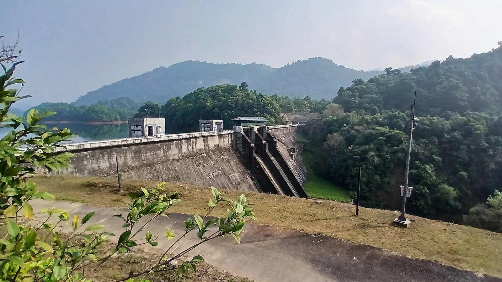
12.1 km · straight line
Reservoir and forested day-trip area in the Western Ghats foothills.
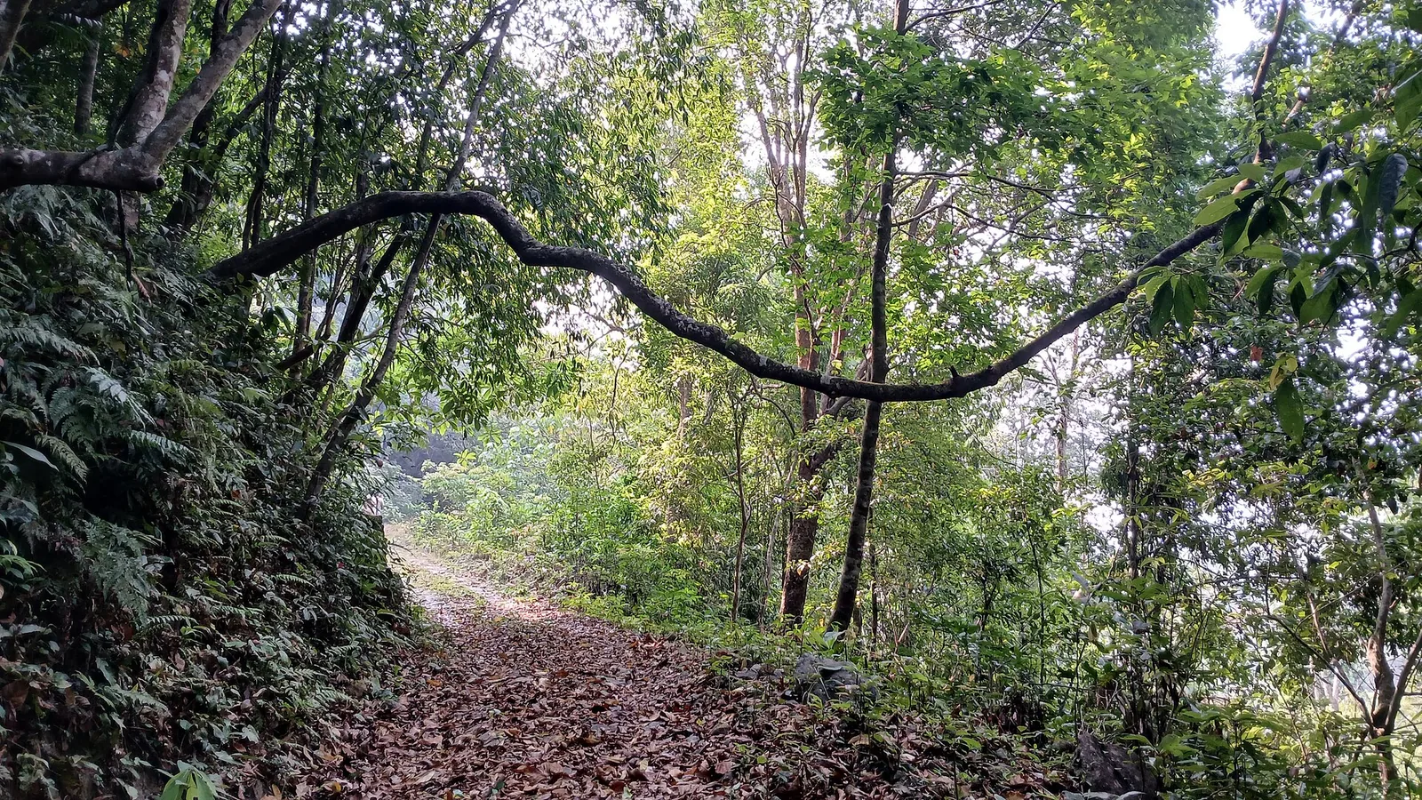
15.7 km · straight line
Kozhikode’s last evergreen forest block, notified in 2009 under section 18(1) as a declaration of intention and never finally declared — there is no gate, no permit and no wildlife programme, and you cannot go in.
10.3 km · straight line
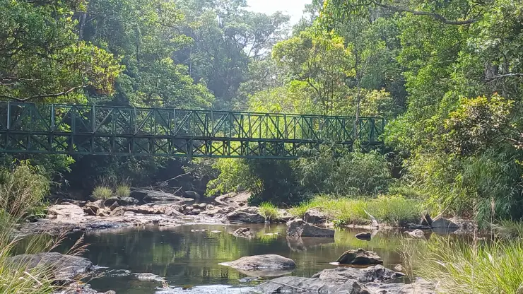
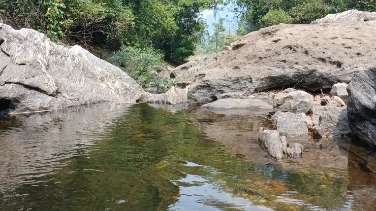
A ticketed riverside bathing and picnic centre on Irrigation Department land where the Kuttiyadi runs over a bedrock sheet into the head of the Peruvannamuzhi backwater — at 57 m, with no drop and no forest permit, but a serious drowning history.
9.4 km · straight line
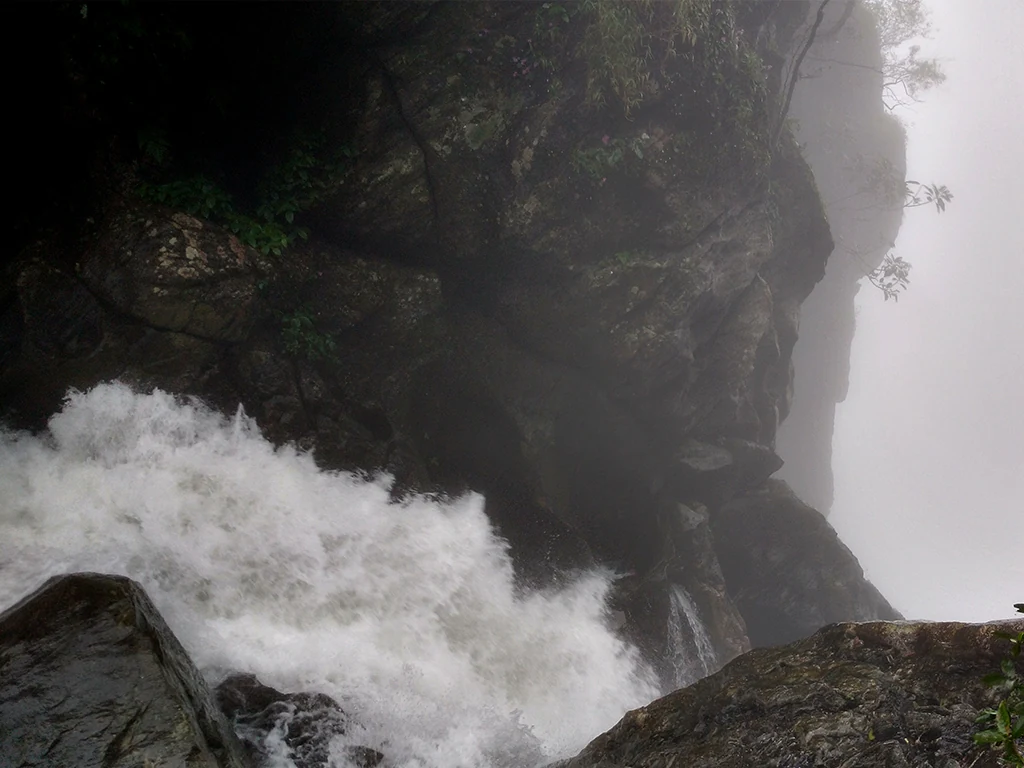
The managed forest outing towards Urakkuzhi Falls above Kakkayam, distinct from reservoir boating. Confirm the admitted route with the forest counter: recent reports describe restrictions at the waterfall viewpoint and Shankaranpuzha.
Roampedia is commission-free — own or know a stay, eatery, guide or shop near Peruvannamuzhi Dam? Submit public business details for review.
Add a nearby businessEntry: A modest entry ticket is usually charged, with separate charges for boating (speed boat, row boat or launch) and for the crocodile farm and island attractions; expect a small per-head amount plus per-ride costs.
Dress code: No formal dress code; wear comfortable clothing and good walking shoes for the jetty and island paths, and carry a hat, sunscreen and a light rain layer. Always wear the life jacket provided on boats.
Photography: Cameras and phones are welcome for the reservoir, islands and birdlife; carry a zoom lens for the bird sanctuary and secure your gear on speed-boat rides against spray (any drone or commercial-shoot permissions — confirm locally).
If you are travelling by bus or ferry, check the return service with the operator before setting out. Leave time to reach the stop or jetty after your visit.
Ask at the bus stand for the time of the last service back, not the next one. If you miss it, an auto or app cab is the fallback — agree the fare before you get in.
If you need step-free access, contact the site before travelling. Ask about a level entrance, steps along the route, the nearest drop-off point, seating and accessible toilets.
These services are listed within about 1.2 km of Peruvannamuzhi Dam. Walking distances follow mapped routes; access and opening hours can change. Other services may be closer but are not included here.
Published emergency and visitor-assistance contacts. For an immediate emergency, call 112. Shared Kerala contact sources checked 4 October 2026; publication does not establish a tested live response.
The managed forest outing towards Urakkuzhi Falls above Kakkayam, distinct from reservoir boating. Confirm the admitted route with the forest counter: recent reports describe restrictions at the waterfall viewpoint and Shankaranpuzha.
9.4 km · straight lineA ticketed riverside bathing and picnic centre on Irrigation Department land where the Kuttiyadi runs over a bedrock sheet into the head of the Peruvannamuzhi backwater — at 57 m, with no drop and no forest permit, but a serious drowning history.
10.3 km · straight lineReservoir and forested day-trip area in the Western Ghats foothills.
12.1 km · straight lineKozhikode’s last evergreen forest block, notified in 2009 under section 18(1) as a declaration of intention and never finally declared — there is no gate, no permit and no wildlife programme, and you cannot go in.
15.7 km · straight line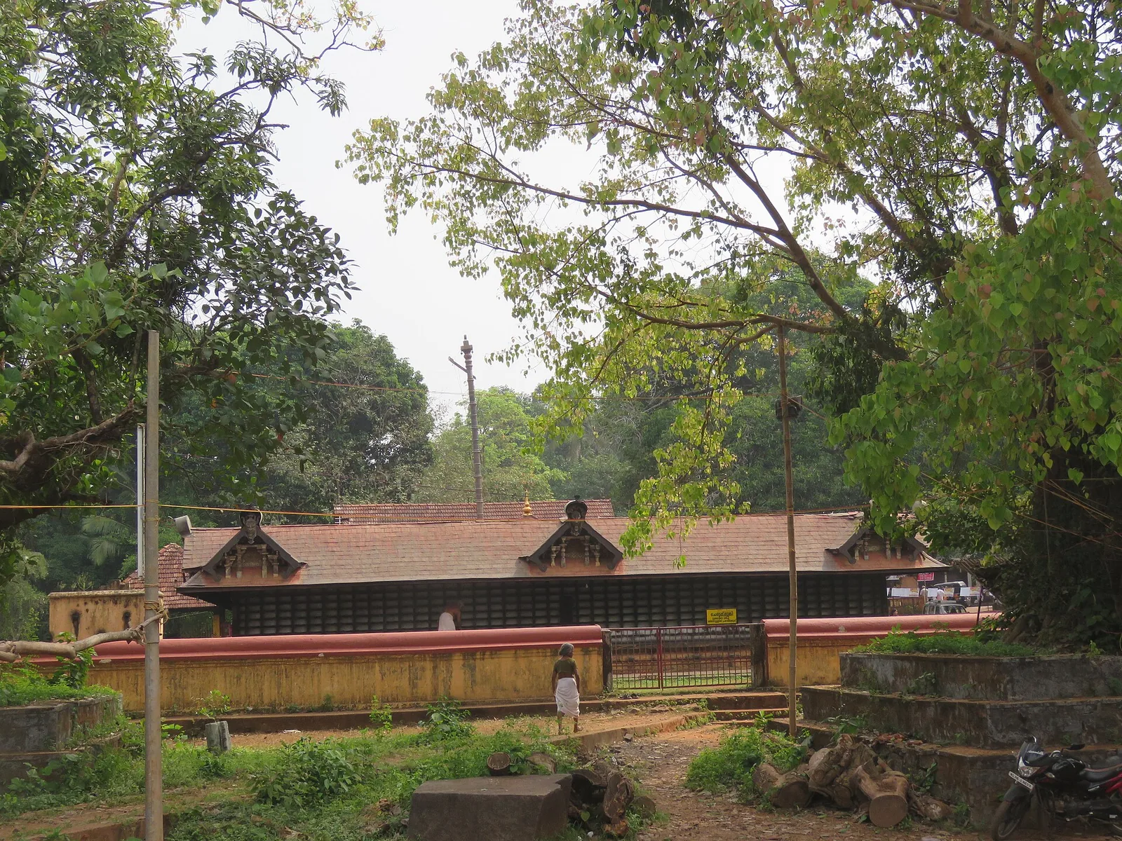
Ancient Durga/Bhagavathy temple at Vadakara, celebrated in the Vadakkan Pattukal and linked to the Kalaripayattu hero Thacholi Othenan.
22.2 km · straight line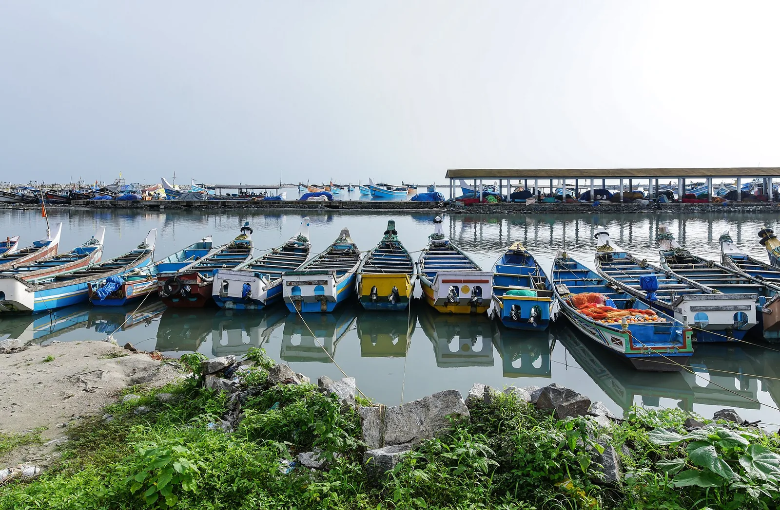
The medieval port of Panthalayani Kollam — Ibn Battuta’s Fandarayna, where Chinese junks wintered, and the anchorage where da Gama’s fleet lay 88 days in 1498. Nothing of the port survives above ground; the working fishing harbour is what you come for.
23.1 km · straight line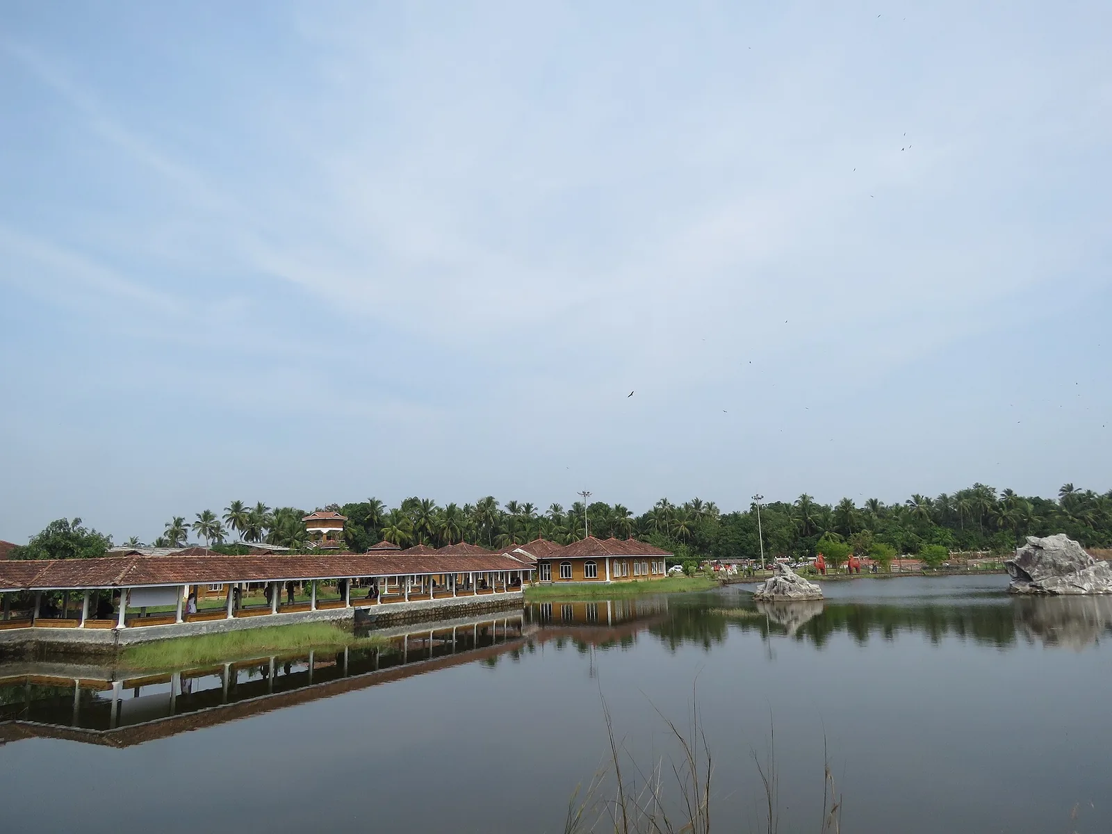
Kerala Arts & Crafts Village at Iringal near Vadakara — a riverside campus of working artisans and crafts pavilions.
23.9 km · straight line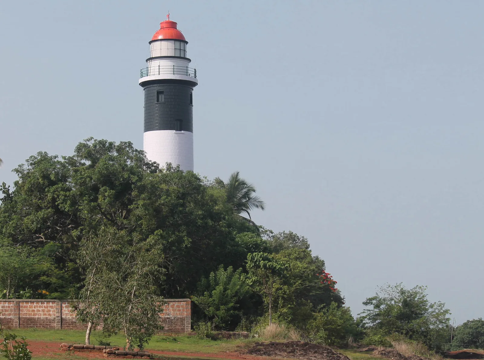
A 1909 lighthouse on the laterite headland at Kadalur Point, built to mark the submerged Sacrifice Rock eight kilometres offshore.
24.7 km · straight line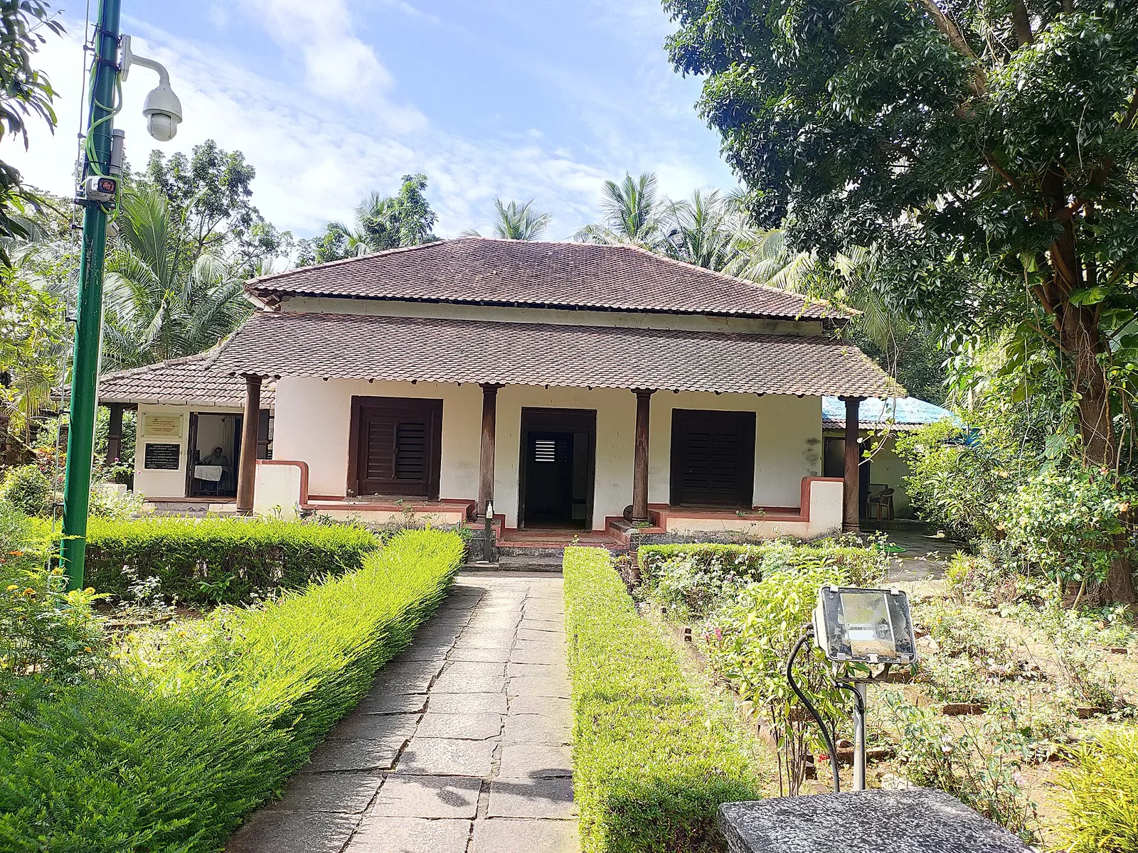
The Kerala Archaeology Department’s museum in the surviving part of the Marakkar family house at Kottakkal, Iringal — three rooms and a vestibule holding swords, stone shot and megalithic finds, with an Indian Navy obelisk in the garden. Not the fort: that was razed in 1600.
24.9 km · straight line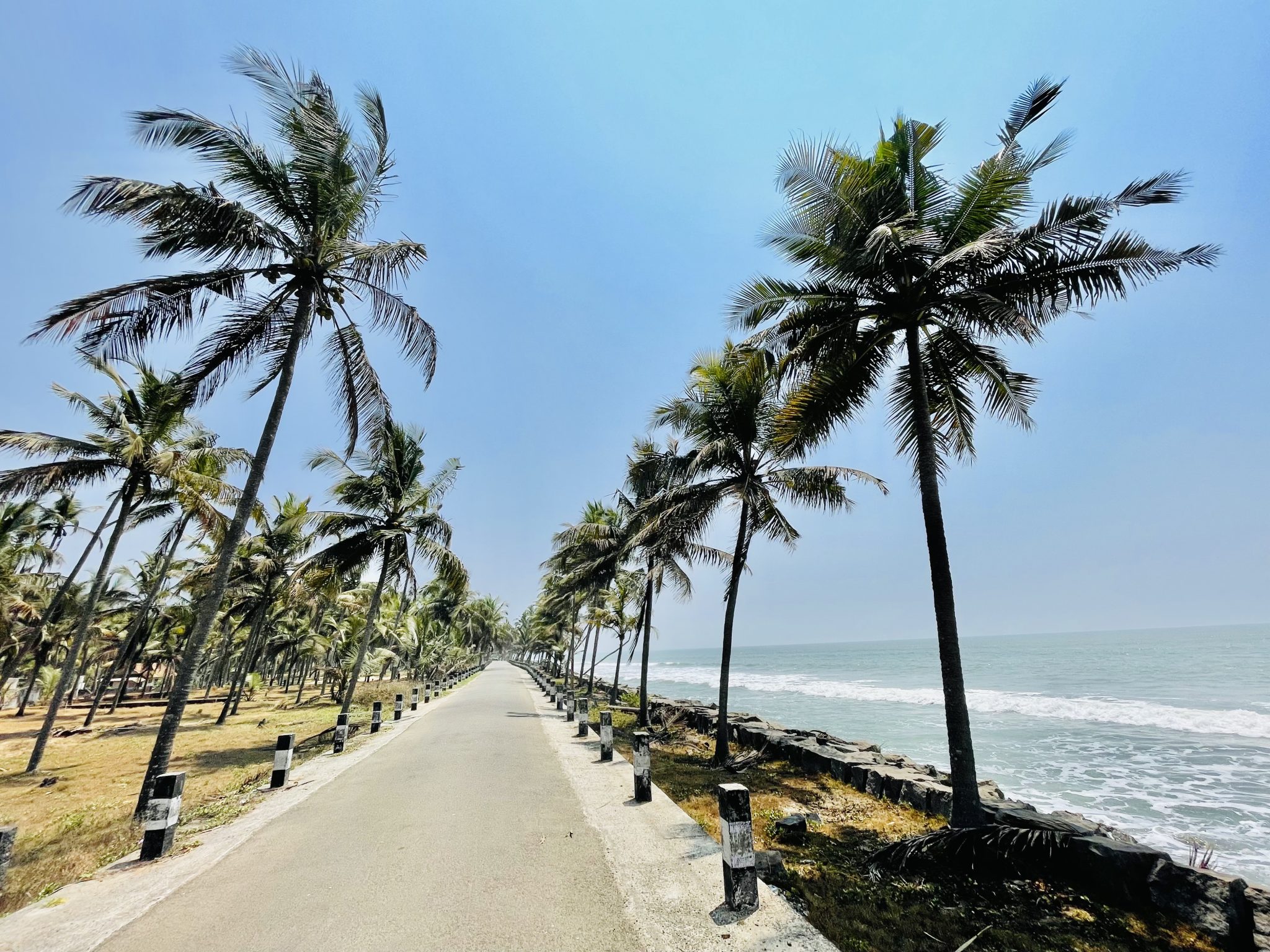
An 8 km olive ridley nesting shore at Iringal, protected since 1992 by a village committee of twelve — and now largely armoured with seawalls, with seven nesting females recorded across the four seasons to 2023.
25.3 km · straight line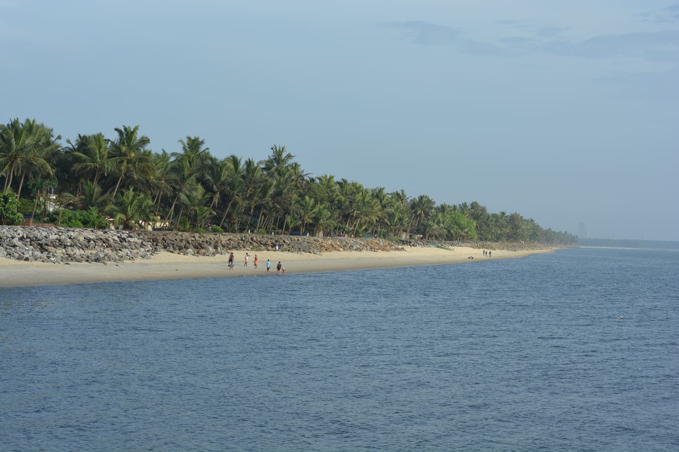
Historic beach associated with Vasco da Gama’s arrival on the Malabar coast.
26.2 km · straight line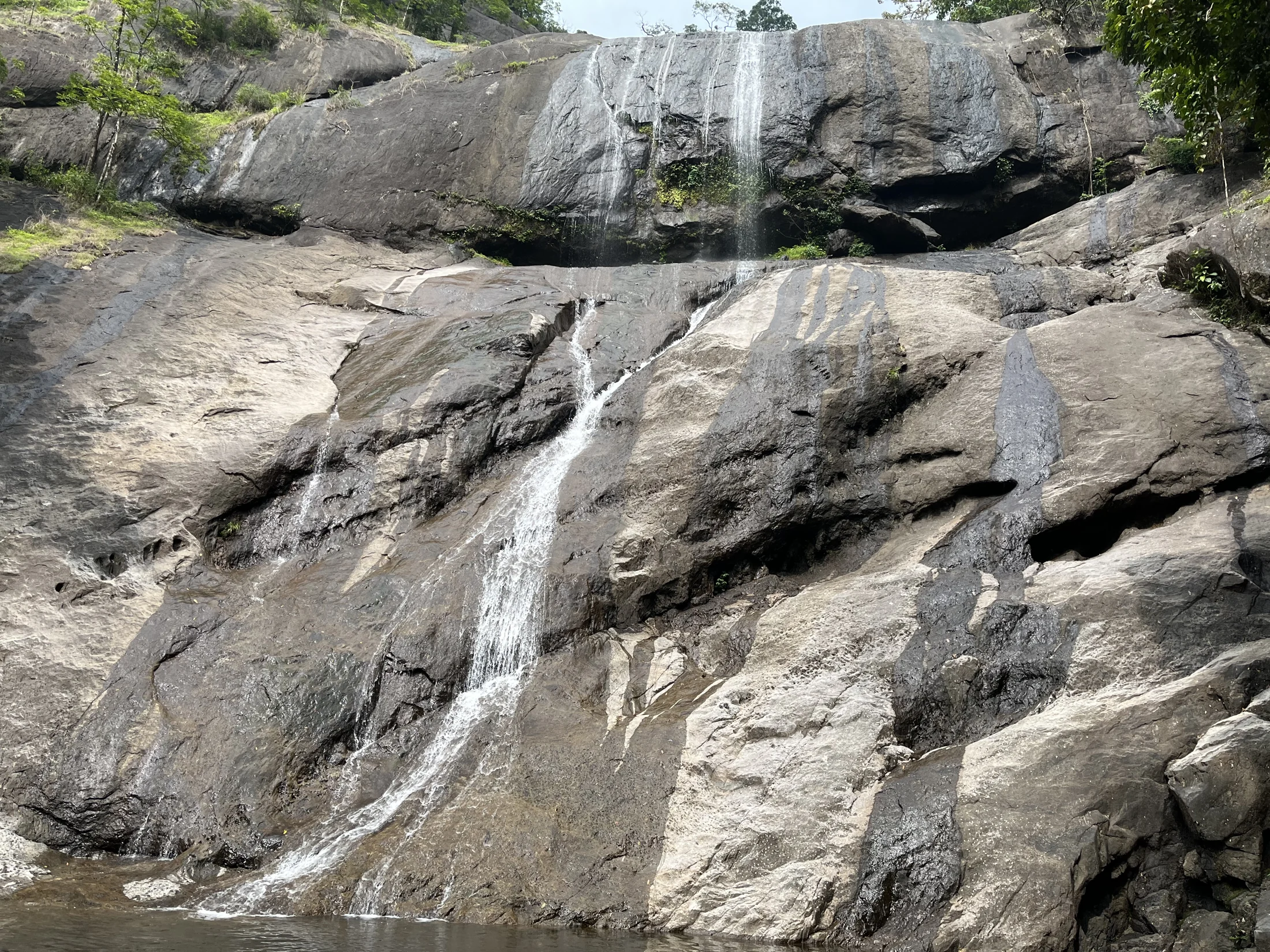
Forest Department waterfall trails near Kodencherry in Kozhikode: distinguish the ordinary waterfall entry, the Thumbithullumpara route and the separately approved Thenpara interior-forest trek.
28.5 km · straight lineNearby toilets, pharmacies, ATMs, seating and vets are community-mapped and may be incomplete or out of date. Map data © OpenStreetMap contributors | Walking times © openrouteservice.org by HeiGIT
The main draws are boating on the reservoir (speed boats, row boats and launch rides), a boat trip to an island with a bird sanctuary, a crocodile and reptile farm and a small aquarium, the Smrithivanam memorial garden island for the region’s freedom fighters, and picnicking amid forest and spice-hill scenery. Many visitors combine it with the nearby Kakkayam dam-and-trekking zone. Specific facilities open on a given day depend on water level and maintenance — confirm locally.
Boating is the signature activity but it is weather- and water-level dependent, so it can be suspended during heavy monsoon flow or maintenance. Wear the life jacket provided, follow the operator’s instructions, and supervise children closely. Speed-boat and row-boat rides are usually ticketed separately from any entry charge.
October to March is generally the most pleasant, with clear skies, comfortable temperatures and a full, calm reservoir. The monsoon months (roughly June to September) turn the surrounding hills spectacularly green but can bring heavy rain, higher water and interrupted boating. Early morning is best for birdlife and still water.
About 60 km by road, and the direction is north, not east — the dam sits at 11.5965°N, 75.8233°E against Kozhikode city's 11.2588°N, 75.7804°E, a bearing of 007° and only 37.8 km in a straight line. Go north via Balussery and Perambra, or up NH66 to Koyilandy and inland through Perambra; from the north coast it is Vatakara–Kuttiadi–Kadiyangad, with the dam 16 km from Kuttiadi. Nothing goes near Thiruvambady, which is 30 km away to the south-east. Perambra (about 13 km) is the nearest bus depot and Vatakara, to the north, is the nearest railhead.
No. It is owned and run by the Kerala Irrigation Department and there is no power station here; a 6 MW scheme has been proposed but never built. All the generation on this river is upstream — 225 MW across the Kuttiyadi powerhouses at Kakkayam, plus 3.75 MW at the tail race station and 3 MW at the Kakkayam small hydro project. Peruvannamuzhi catches that water afterwards and sends it out for irrigation and, increasingly, for drinking: about 150 million litres a day are drawn from this reservoir for Kozhikode district.
It is still there, and it is neither a zoo nor a farm in the commercial sense. Its own government signboard records that it was established on 7 January 1977 as a crocodile breeding centre run by the Kerala Forest Department — one of two set up in Kerala that year to breed mugger crocodiles in captivity and release them into protected areas after the Wildlife (Protection) Act ended the skin trade. The board lists six animals: three male, two female and one juvenile. India stopped producing captive-bred crocodiles for release in 1994, so the muggers here are what that programme left behind — and a mugger can live close to a hundred years.
Not in the legal sense. The wooded island is known locally as the pakshi-thuruthu, the bird island, and it genuinely is a good place to see cormorants, darters and herons — but no "Peruvannamuzhi Bird Sanctuary" has ever been notified. The protected area in these hills is the Malabar Wildlife Sanctuary, 74.2 sq km notified in 2010, whose headquarters happen to be at Peruvannamuzhi. You may also see an aquarium mentioned on other sites; we could find no source for one and have not repeated the claim.
They sit in the same upland catchment and are often visited together, but they are different structures. Peruvannamuzhi is the broad, accessible leisure-and-irrigation reservoir with boating and the wildlife islands, part of the Kuttiadi Irrigation Project. Kakkayam is higher and wilder — a steeper dam associated with the Kuttiadi hydroelectric works and known for trekking and waterfalls. Peruvannamuzhi is the easy family outing; Kakkayam is the adventure add-on.
Half a day (about three to four hours) covers the boating and the island wildlife comfortably; a full day lets you add Kakkayam. It is very child-friendly — the crocodile farm, aquarium and birds make it engaging for young visitors — but keep children close near the water and inside the boats, and carry your own food and water as facilities are limited.
Post-monsoon and winter for scenery; monsoon access may change.
Entry: A modest entry ticket is usually charged, with separate charges for boating (speed boat, row boat or launch) and for the crocodile farm and island attractions; expect a small per-head amount plus per-ride costs. Timings: Generally open daytime hours, commonly around 9 am to 5 pm, with the last boat rides earlier in the afternoon.
Base yourself in Kakkayam or a nearby town in Kozhikode, then confirm the last-mile route locally before leaving. Check public access status before travel; dam areas often have security rules and seasonal entry limits. If the visit depends on forest, temple, boat, ferry, weather or seasonal access, check the official/local rule on the day before travel.
1 to 2 hours.
Nearby you can pair Kakkayam trek (9.4 km, approximate straight-line separation), Kariyathumpara (10.3 km, approximate straight-line separation), Kakkayam Dam (12.1 km, approximate straight-line separation), Malabar Wildlife Sanctuary (15.7 km, approximate straight-line separation).
Do not cross barriers or restricted zones. Follow release-warning and security instructions.
Written about Peruvannamuzhi Dam itself — its history, its legends and the arguments about them.
These guides explore Kakkayam and the surrounding area. Choose a visit that fits your interests, allowing separately for travel between stops.
Route-level itineraries and practical guides for the rest of Kerala.
Photographs: Razimantv (CC BY-SA 4.0), Dhruvaraj S from India (CC BY 2.0), Kiranpjob (CC0), irvin calicut (CC BY-SA 3.0), Robykurian (CC0), Nativeplants garden (CC BY-SA 4.0). Wikimedia Commons.


